James Meehan

Last updated

James Meehan
Born 1774
Ireland
Died 21 April 1826
Macquarie Field, New South Wales, Australia
Occupation Surveying
Years active 1800 - 1822
Known for Early Australian surveyor

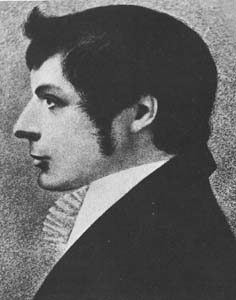
James Meehan [1] [2] (1774 – 21 April 1826) was an Irish-Australian explorer and surveyor.

Ireland Island in north-west Europe, 20th largest in world, politically divided into the Republic of Ireland and Northern Ireland (a part of the UK)

Ireland is an island in the North Atlantic. It is separated from Great Britain to its east by the North Channel, the Irish Sea, and St George's Channel. Ireland is the second-largest island of the British Isles, the third-largest in Europe, and the twentieth-largest on Earth.

Australia Country in Oceania

Australia, officially the Commonwealth of Australia, is a sovereign country comprising the mainland of the Australian continent, the island of Tasmania and numerous smaller islands. It is the largest country in Oceania and the world's sixth-largest country by total area. The neighbouring countries are Papua New Guinea, Indonesia and East Timor to the north; the Solomon Islands and Vanuatu to the north-east; and New Zealand to the south-east. The population of 25 million is highly urbanised and heavily concentrated on the eastern seaboard. Australia's capital is Canberra, and its largest city is Sydney. The country's other major metropolitan areas are Melbourne, Brisbane, Perth and Adelaide.

Surveying The technique, profession, and science of determining the positions of points and the distances and angles between them

Surveying or land surveying is the technique, profession, and science of determining the terrestrial or three-dimensional positions of points and the distances and angles between them. A land surveying professional is called a land surveyor. These points are usually on the surface of the Earth, and they are often used to establish maps and boundaries for ownership, locations, such as building corners or the surface location of subsurface features, or other purposes required by government or civil law, such as property sales.

Contents

Meehan was born in Ireland in 1774, and was one of a number of political prisoners who arrived in Australia in February 1800. Two months later he became an assistant to Charles Grimes, the surveyor-general, and went with him to explore the Hunter River in 1801. He was also with Grimes on the expedition to explore King Island and Port Phillip in the summer of 1802-3. Grimes had leave of absence from August 1803 to go to England, and during his absence for about three years, Meehan did much of his work with the title of assistant-surveyor. In October 1805 Governor King directed him to trace the course of the Nepean to the southward a little beyond Mount Taurus, and in October 1807 Meehan prepared his plan of Sydney.

Charles Grimes was an English surveyor who did some valuable work in colonial Australia. He served as Surveyor General of New South Wales and discovered the Yarra River in what is now the state of Victoria. He is perhaps best known for being the surveyor who mapped the route of the Hobart Road, Tasmania's main north-south arterial route. Much of the modern Midland Highway still follows the route that he planned.

Hunter River (New South Wales) river

The Hunter River is a major river in New South Wales, Australia. The Hunter River rises in the Liverpool Range and flows generally south and then east, reaching the Tasman Sea at Newcastle, the second largest city in New South Wales and a major harbour port. Its lower reaches form an open and trained mature wave dominated barrier estuary.

King Island (Tasmania) island between Australia and Tasmania

King Island is an island in the Bass Strait, belonging to the Australian state of Tasmania. It is the largest of three islands known as the New Year Group, and the second-largest island in Bass Strait. The island's population at the 2016 census was 1,585 people, up from 1,566 in 2011. The local government area of the island is the King Island Council.

In 1812 Governor Macquarie sent him to Tasmania with instructions to remeasure the whole of the farms granted by former governors and himself. He accompanied Hamilton Hume in some explorations in southern New South Wales in 1816, when Lake George was discovered, and in 1818 Meehan was appointed deputy surveyor-general. It was around this time that he named the settlement of Goulburn after Henry Goulburn, the Under-Secretary for War and the Colonies.

Lachlan Macquarie Scottish British army officer and New South Wales colonial administrator

Major General Lachlan Macquarie, CB was a British Army officer and colonial administrator from Scotland. Macquarie served as the fifth and last autocratic Governor of New South Wales from 1810 to 1821, and had a leading role in the social, economic and architectural development of the colony. He is considered by historians to have had a crucial influence on the transition of New South Wales from a penal colony to a free settlement and therefore to have played a major role in the shaping of Australian society in the early nineteenth century. In 1816 Macquarie gave orders that led to the Appin Massacre of Gundungurra and Dharawal people.

Tasmania island state of Australia

Tasmania is an island state of Australia. It is located 240 km (150 mi) to the south of the Australian mainland, separated by Bass Strait. The state encompasses the main island of Tasmania, the 26th-largest island in the world, and the surrounding 334 islands. The state has a population of around 526,700 as of March 2018. Just over forty percent of the population resides in the Greater Hobart precinct, which forms the metropolitan area of the state capital and largest city, Hobart.

Hamilton Hume Australian explorer

Hamilton Hume was an early explorer of the present-day Australian states of New South Wales and Victoria. In 1824, along with William Hovell, Hume participated in an expedition that first took an overland route from Sydney to Port Phillip. Along with Sturt in 1828, he was part of an expedition of the first Europeans to discover the Darling River.

He endeavoured in this year without success to find a practicable road over the Shoalhaven River so that communication might be opened up with Jervis Bay, but continuing his efforts early in 1820 he went through some very difficult country after crossing the river from the east, and then connecting with his 1818 track.

Shoalhaven River river in Australia

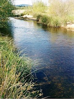
The Shoalhaven River is a perennial river that rises from the Southern Tablelands and flows into an open mature wave dominated barrier estuary near Nowra on the South Coast of New South Wales, Australia.

Jervis Bay bay in New South Wales, Australia

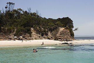
Jervis Bay is a 102-square-kilometre (39 sq mi) oceanic bay and village on the south coast of New South Wales, Australia, said to possess the whitest sand in the world.

In 1822 he resigned his position and was granted a pension of £100 a year in 1823. He died on 21 April 1826. He was a most capable and industrious official, and though he does not rank among the leading explorers, he did some very valuable work while carrying out his duties during the first 20 years of the nineteenth century.

Legacy

Northern Beaches Region in New South Wales, Australia

The Northern Beaches is an area in the northern coastal suburbs of Sydney, in the state of New South Wales, Australia, near the Pacific coast. This area extends south to the entrance of Port Jackson, west to Middle Harbour and north to the entrance of Broken Bay. The area was formerly inhabited by the Garigal or Caregal people in a region known as Guringai country.

James Meehan High School is a high school in Macquarie Fields, New South Wales, Australia. It opened in 1975 and is situated in the metropolitan south-west region of Sydney in the local government area of Campbelltown City. The address is 58 Harold Street, Macquarie Fields.

Macquarie Fields, New South Wales Suburb of Sydney, New South Wales, Australia

Macquarie Fields is a suburb of Sydney, in the state of New South Wales, Australia. Macquarie Fields is located 38 kilometres south-west of the Sydney central business district, in the local government area of the City of Campbelltown and is part of the Macarthur region.

Related Research Articles

Gregory Blaxland English explorer in Australia

Gregory Blaxland was an English pioneer farmer and explorer in Australia, noted especially for initiating and co-leading the first successful crossing of the Blue Mountains by European settlers.

John Oxley British explorer

John Joseph William Molesworth Oxley was an explorer and surveyor of Australia in the early period of British colonisation. He served as Surveyor General of New South Wales and is perhaps best known for his two expeditions into the interior of New South Wales and his discoveries of the Tweed River and the Brisbane River in what is now the state of Queensland.

William Lawson (explorer) Australian pastoralist and explorer in New South Wales

William Lawson, MLC was an English-born Australian explorer, land owner, grazier and politician who migrated to Sydney, New South Wales in 1800. Along with his close friends and colleagues Gregory Blaxland and William Wentworth, he pioneered the first successful crossing of the Blue Mountains by European settlers.

John Septimus Roe first Surveyor-General of Western Australia and explorer

John Septimus Roe was the first Surveyor-General of Western Australia. He was a renowned explorer, and a Member of Western Australia's legislative and executive councils for nearly 40 years.

D'Arcy Wentworth was born in Portadown, County Armagh, Ireland and emigrated to Australia as an assistant surgeon to the then new colony of Sydney.

William Redfern Australian doctor

William Redfern was an English-raised surgeon in early colonial Australia who was transported to New South Wales as a convict for his role in the Mutiny on the Nore.

George Evans (explorer) Australian explorer

George William Evans was a surveyor and early explorer in the Colony of New South Wales. Evans was born in Warwick, England, migrating to Australia in October 1802.

Moss Vale, New South Wales Town in New South Wales, Australia

Moss Vale is a town in the Southern Highlands of New South Wales, Australia, in the Wingecarribee Shire. At the 2016 census, it has a population of 8,579 and is sited on the Illawarra Highway, which connects to Wollongong and the Illawarra coast via Macquarie Pass.

Charles Throsby was an Australian explorer, pioneer and parliamentarian. He opened up much new land beyond the Blue Mountains for colonial settlement. He was a grazier, and became a prominent member of New South Wales society.

Marulan Town in New South Wales, Australia

Marulan is a small town in the Southern Tablelands of New South Wales, Australia in the Goulburn Mulwaree Council local government area. It is located south-west of Sydney on the Hume Highway, although it bypasses the town proper. Marulan lies on the 150th meridian east. It has a railway station on NSW TrainLink's Southern Highlands Line. Marulan was previously known as Mooroowoolen.

John Watts (military architect) architect & Postmaster-General

John Cliffe Watts was an Irish military officer and architect who designed some of the first permanent public buildings in the young British colony of New South Wales, and who also later became Postmaster General in South Australia, where he was commonly referred to as "Captain Watts".

Robert Dixon (explorer) Australian surveyor and explorer

Robert Harald Lindsay Dixon (1800–1858) was an Australian surveyor and explorer, born in Darlington, England.

Department of Lands building

The Department of Lands building is a heritage-listed state government administrative building of the Victorian Renaissance Revival architectural style located in Bridge Street in the Sydney central business district of New South Wales, Australia. The large three-storey public building was designed by Colonial Architect James Barnet and built in different stages, with Walter Liberty Vernon and William Edmund Kemp designing various components of the building. The builder was John Young.

1813 crossing of the Blue Mountains

The 1813 crossing of the Blue Mountains was the expedition led by Gregory Blaxland, William Lawson and William Charles Wentworth, which became the first successful crossing of the Blue Mountains in New South Wales by European settlers. The crossing enabled the settlers to access and use the land west of the mountains for farming, and made possible the establishment of Australia's first inland settlement at Bathurst.

European land exploration of Australia deals with the opening up of the interior of Australia to European settlement which occurred gradually throughout the colonial period, 1788–1900. A number of these explorers are very well known, such as Burke and Wills who are well known for their failed attempt to cross the interior of Australia, as well as Hamilton Hume and Charles Sturt.

Macquarie Field House

Macquarie Field House is a heritage-listed former farm, private school and homestead and now residence at Quarter Sessions Road, Macquarie Fields, City of Campbelltown, New South Wales, Australia. It was designed by James Meehan, James Hume and built from 1810 to 1843 by James Meehan ; Mr Burns. It is also known as Macquarie Field House and the Meehan remains; Macquariefield, Macquarie Fields and Macquarie Field. The property is privately owned. It was added to the New South Wales State Heritage Register on 2 April 1999.

References

  1. Perry, T. M. (1967). "Meehan, James (1774–1826)". Australian Dictionary of Biography . 2. Canberra: Australian National University. Retrieved 15 December 2014.
  2. B.T. Dowd, James Meehan, Journal of the Australian Catholic Historical Society 3 (2) (1970), 8-12.
Percival Serle Australian writer

Percival Serle was an Australian biographer and bibliographer.

The Dictionary of Australian Biography, published in 1949, is a reference work by Percival Serle containing information on notable people associated with Australian history. With approximately a thousand entries, the book took more than twenty years to complete. Published by Angus and Robertson, the dictionary was compiled as two volumes, Volume 1: A-K; and Volume 2: L-Z.

Further reading