19th Street/Oakland is an underground Bay Area Rapid Transit (BART) station located under Broadway between 17th Street and 20th Street in the Uptown District of Oakland, California. It is a timed transfer point between northbound trains to Richmond and to Antioch.

The Richmond Transit Center is a Bay Area Rapid Transit (BART) and Amtrak station located in Richmond, California. Richmond is the north terminus of BART service on the Richmond–Warm Springs/South Fremont line and Richmond–Daly City/Millbrae line; it is a stop for Amtrak's Capitol Corridor, San Joaquin, and California Zephyr routes. It is one of two transfer points between BART and Amtrak, along with Oakland Coliseum station.

The Richmond Parkway Transit Center or RPTC is a park and ride lot and bus terminal located in Richmond, California. It is named after the adjacent Richmond Parkway. It serves as a transfer point for the WestCAT and AC Transit. It is located on the corner of Richmond Parkway and Blume Drive near the Pinole border and adjacent to Interstate 80 and the Hilltop Plaza shopping center.

Seal Rock is a group of small rock formation islands in the Lands End area of the Outer Richmond District in western San Francisco, California. They are located just offshore in the Pacific Ocean, at the north end of the Ocean Beach, near the Cliff House and Sutro Baths ruins.
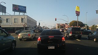
23rd Street is a major north-south trunk street in Richmond and San Pablo, California flanked by many Latino-oriented businesses.
Point Isabel Regional Shoreline in Richmond, California, is operated by East Bay Regional Park District, and is a multi-use park for joggers, windsurfers, kayakers, photographers, picnickers, and people walking dogs. It has access for pedestrians and via public transit, private vehicles, and bikes. It also features a concession offering food for people and grooming for pets. A longtime community organization and nonprofit, Point Isabel Dog Owners and Friends (PIDO), is active in the maintenance and improvement of the park.
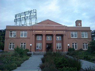
The Richmond Municipal Natatorium, commonly known as The Plunge or The Richmond Plunge, is a historic swim center in the Point Richmond neighborhood of Richmond, California. It was closed in August 2001 for seismic retrofitting and reopened in August 2010. It now is back to a regular schedule.
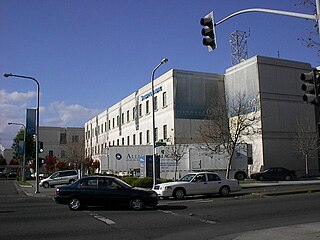
Richmond Medical Center also known as Kaiser Richmond, Kaiser Foundation Hospital Richmond and RMC, is a large Kaiser Permanente hospital in downtown Richmond, California which serves 77,000 members registered under its medical plans. It opened in 1995 replacing the historic 1942 Richmond Field Hospital that serviced Liberty shipyard workers and thus gave birth to the HMO. However it was deemed seismically unsafe and this new campus was built.

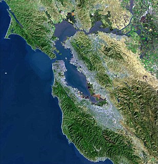
Downtown Richmond is the old center of Richmond, California. The area is roughly bordered by 6th street to the west, 23rd Street to the east, Barrett Avenue to the north, and Macdonald Avenue to the south. The area once featured major department stores and other chains such as J.C. Penney, Macy's, S. H. Kress & Co., and Sears before Hilltop Mall was built in the 1970s.The area is currently undergoing a revitalization effort by the city, which has included the Richmond Shopping Center anchored by a supermarket. The Richmond Transit Village—coined Metro Walk by the developers, the Olson Company—has also been built, along with remodeling of the Richmond BART and Amtrak station and a bus transit center served by AC Transit and Golden Gate Transit. A Kaiser Permanente hospital and a Social Security Administration processing center provide for a majority of the jobs in the area.

Brickyard Cove is an upscale waterfront neighborhood in Richmond, California.
Hilltop Green or "The Green"is a neighborhood in Richmond, California bordering the city of Pinole, the census-designated place of El Sobrante, the neighborhood of Hilltop, and Hilltop Mall.
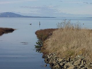
Stege Marsh, also known as the South Richmond Marshes, is a tidal marshland wetlands area in Richmond, California in western Contra Costa County.
The Dotson Family Marsh, formerly Breuner Marsh, is a 238-acre regional park on San Pablo Bay in the East San Francisco Bay Area city of Richmond, California, In 2009 the East Bay Regional Parks District acquired the Breuner Marsh site, adding it to Point Pinole Regional Shoreline. A habitat restoration plan for 60 acres of wetlands and 90 acres of California coastal prairie was subsequently approved.
Lobos Creek is a stream in the Presidio of San Francisco in San Francisco, California.
Miller/Knox Lagoon is a lake in Richmond, California.

Macdonald 80 Shopping Center or simply Macdonald 80 is a 200,000 sq. ft. (18,580m³) regional shopping mall in the North & East neighborhood in Richmond, California, anchored by a Target store. The center was largely demolished and rebuilt after suffering from urban decay and blight. It is the only entirely LEED certified mall. It is anchored by a large, "sprawling" Target store.
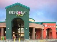
Pacific East Mall is an Asian mall in Richmond, California. It is owned by Pacific Infinity Company Incorporated.
Abella Center formerly International Marketplace and originally El Portal Shopping Center is a mixed-use city services, business, shopping center and housing village transit-oriented development that was formerly a mall in San Pablo, California.

Doctors Medical Center was an eight-story creekside hospital in San Pablo, California. It was the only cardiac/STEMI, stroke, and cancer center in Contra Costa County. The health facility once employed 1,100 people. The hospital has been described as the "backbone" of the community of 250,000 people between that is bordered by Vallejo to the north and Berkeley to the south. The West Contra Costa Healthcare District board voted on 26 March 2015 to close the facility in April. The hospital closed on April 21, 2015.