Kenn Church, Kenn Pier & Yew Tree Farm SSSI

Last updated
Kenn Church, Kenn Pier & Yew Tree Farm
Site of Special Scientific Interest
Apple Orchard - geograph.org.uk - 87025.jpg
Somerset UK location map.svg
Red pog.svg
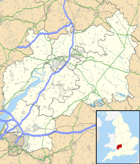
Location within Somerset
Area of Search Avon
Grid reference ST415689
Coordinates 51°25′17″N2°50′34″W / 51.4215°N 2.8427°W / 51.4215; -2.8427 Coordinates: 51°25′17″N2°50′34″W / 51.4215°N 2.8427°W / 51.4215; -2.8427
Interest Geological
Area 15.37 hectares (0.1537 km2; 0.0593 sq mi)
Notification 1997 (1997)
Natural England website

Kenn Church, Kenn Pier & Yew Tree Farm SSSI (grid reference ST415689 ) is a 15.37 hectare geological Site of Special Scientific Interest near the village of Kenn, Somerset, notified in 1997.

Ordnance Survey National Grid System of geographic grid references used in Great Britain

The Ordnance Survey National Grid reference system is a system of geographic grid references used in Great Britain, distinct from latitude and longitude. It is often called British National Grid (BNG).

Hectare metric unit of area

The hectare is an SI accepted metric system unit of area equal to a square with 100-metre sides, or 10,000 m2, and is primarily used in the measurement of land. There are 100 hectares in one square kilometre. An acre is about 0.405 hectare and one hectare contains about 2.47 acres.

Kenn, Somerset a village located in North Somerset, United Kingdom

Kenn is a small village and civil parish in county of Somerset, England. It falls within the area of the North Somerset unitary authority. It lies on the B3133 road near Clevedon in the North Somerset Levels. The parish has a population of 431.

The site is listed in the Geological Conservation Review because it consists of a complex sequence of Pleistocene sediments, including coarse glacial outwash gravels at the base overlain by a complex sequence of interglacial freshwater, estuarine and marine sands. The sequence is then capped by aeolian (windblown) coversands and Holocene silts. [1]

The Geological Conservation Review (GCR) is produced by the UK's Joint Nature Conservation Committee and is designed to identify those sites of national and international importance needed to show all the key scientific elements of the geological and geomorphological features of Britain. These sites display sediments, rocks, minerals, fossils, and features of the landscape that make a special contribution to an understanding and appreciation of Earth science and the geological history of Britain, which stretches back more than three billion years. The intention of the project, which was devised in 1974 by George Black and William Wimbledon working for the Governmental advisory agency, the Nature Conservancy Council (NCC), was activated in 1977. It aimed to provide the scientific rationale and information base for the conservation of geological SSSIs (Sites of Special Scientific Interest, protected under British law. The NCC and country conservation agencies were established in 1990 when JNCC became established and took over responsibility for managing the GCR site assessment process, and publishing accounts of accepted sites.

The Pleistocene is the geological epoch which lasted from about 2,588,000 to 11,700 years ago, spanning the world's most recent period of repeated glaciations. The end of the Pleistocene corresponds with the end of the last glacial period and also with the end of the Paleolithic age used in archaeology.

Related Research Articles

Site of Special Scientific Interest Conservation designation denoting a protected area in the United Kingdom

A Site of Special Scientific Interest (SSSI) in Great Britain or an Area of Special Scientific Interest (ASSI) in the Isle of Man and Northern Ireland is a conservation designation denoting a protected area in the United Kingdom and Isle of Man. SSSI/ASSIs are the basic building block of site-based nature conservation legislation and most other legal nature/geological conservation designations in the United Kingdom are based upon them, including national nature reserves, Ramsar sites, Special Protection Areas, and Special Areas of Conservation. The acronym "SSSI" is often pronounced "triple-S I".

Weston-in-Gordano SSSI

Weston-in-Gordano SSSI is a 12.55 hectare geological Site of Special Scientific Interest near the village of Weston in Gordano, North Somerset, notified in 1993.

Tickenham, Nailsea and Kenn Moors SSSI

Tickenham, Nailsea and Kenn Moors SSSI is a 129.4 hectare biological Site of Special Scientific Interest between Tickenham, Nailsea and Kenn on the North Somerset Levels, notified in 1995.

Cheddar Complex

The Cheddar Complex is a 441.3 hectare biological Site of Special Scientific Interest near Cheddar around the Cheddar Gorge and north east to Charterhouse in the Mendip Hills, Somerset, notified in 1952.

Great Quarry, Swindon is a 0.994 hectare geological Site of Special Scientific Interest (SSSI) in Wiltshire, England, notified in 1951.

Blue Anchor to Lilstock Coast SSSI

Blue Anchor to Lilstock Coast SSSI is a 742.8 hectare geological Site of Special Scientific Interest between Blue Anchor and Lilstock in Somerset, notified in 1971.

Glenthorne

Glenthorne is a 13.3 hectare geological Site of Special Scientific Interest in the parish of Oare within the Exmoor National Park, on the border of Somerset and Devon, notified in 1989.

Leighton Road Cutting

Leighton Road Cutting is a 0.6 hectare geological Site of Special Scientific Interest between East Cranmore and Cloford in Somerset, notified in 1984. It is a Geological Conservation Review site

Low Ham village in United Kingdom

Low Ham is a village in the civil parish of High Ham in the English county of Somerset.

Raisby Hill Quarry

Raisby Hill Quarry is a Site of Special Scientific Interest in east County Durham, England. It lies just under 2 km east of the village of Coxhoe.

Land Grove Quarry, Mitcheldean

Land Grove Quarry, Mitcheldean is a 3.8-hectare (9.4-acre) geological Site of Special Scientific Interest in Gloucestershire, notified in 1974. The site is listed in the 'Forest of Dean Local Plan Review' as a Key Wildlife Site (KWS).

Lydney Cliff

Lydney Cliff is a 8.0-hectare (20-acre) geological Site of Special Scientific Interest in Gloucestershire, notified in 1990. Part of the site is included in the Severn Estuary SSSI.

References