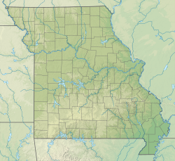
Kimmswick Limestone Stratigraphic range: Sandbian-Katian (Trentonian-Shermanian) ~ | |
---|---|
Type | Formation |
Underlies | Cape Limestone, Maquoketa Group [1] or the Fernvale Limestone in Arkansas [2] |
Overlies | Decorah Shale [1] or Plattin Limestone [2] |
Lithology | |
Primary | Limestone |
Other | Sandstone, dolomite [2] |
Location | |
Coordinates | 39°12′N90°48′W / 39.2°N 90.8°W Coordinates: 39°12′N90°48′W / 39.2°N 90.8°W |
Approximate paleocoordinates | 23°06′S66°00′W / 23.1°S 66.0°W |
Region | Arkansas, Illinois, Missouri |
Country | United States |
Type section | |
Named for | Kimmswick, Jefferson County, Missouri [3] |
Named by | Edward Oscar Ulrich |
Year defined | 1904 [1] |
The Kimmswick Limestone is an Ordovician geologic formation in Arkansas, Illinois and Missouri. Fossils occurring in the Kimmswick include corals, bryozoans, brachiopods, conodonts, [4] trilobites, crinoids and mollusks. [2]
The following fossils have been reported from the formation: [5]
The Devonian Jeffersonville Limestone is a mapped bedrock unit in Indiana and Kentucky. It is highly fossiliferous.
Paleontology in Wisconsin refers to paleontological research occurring within or conducted by people from the U.S. state of Wisconsin. The state has fossils from the Precambrian, much of the Paleozoic, and the later part of the Cenozoic. Most of the Paleozoic rocks are marine in origin. Because of the thick blanket of Pleistocene glacial sediment that covers the rock strata in most of the state, Wisconsin’s fossil record is relatively sparse. In spite of this, certain Wisconsin paleontological occurrences provide exceptional insights concerning the history and diversity of life on Earth.
The Chattanooga Shale is a geologic formation in Alabama, Arkansas, Kentucky, Missouri and Tennessee. It preserves conodont fossils dating to the Devonian Period. It occurs mostly as a subsurface geologic formation composed of layers of shale. It is located in Eastern Tennessee and also extends into southeastern Kentucky, northeastern Georgia, and northern Alabama. This part of Alabama is part of the Black Warrior Basin.
The Keokuk Limestone is a geologic formation in Illinois, Iowa and Missouri. It preserves fossils dating back to the Mississippian sub-period.
The Powell Formation or Powell Dolomite is a geologic formation in northern Arkansas, southeast Missouri and Virginia. It contains gastropod, cephalopod, and trilobite fossils dating back to the Ordovician Period.
The Cotter Formation is a geologic formation in Arkansas, Missouri, Oklahoma and in Virginia. It preserves fossils dating back to the Ordovician period.
The Fernvale Limestone is a geologic formation in Alabama, Arkansas, Illinois, Missouri, Oklahoma, and Tennessee. It preserves fossils dating back to the Ordovician period.
The Whitesburg Formation is a dark limestone with interbedded shales geologic formation in Tennessee and Virginia. It preserves fossils dating back to the Ordovician period.
The Collier Shale is a geologic formation in the Ouachita Mountains of Arkansas and Oklahoma. Dating from the Late Cambrian to Early Ordovician periods, the Collier Shale is the oldest stratigraphic unit exposed in Arkansas. First described in 1892, this unit was not named until 1909 by Albert Homer Purdue in his study of the Ouachita Mountains of Arkansas. Purdue assigned the type locality to the headwaters of Collier Creek in Montgomery County, Arkansas, but did not designate a stratotype. As of 2017, a reference section for this unit has yet to be designated.
The St. Joe Formation or St. Joe Limestone Member is a geologic formation or member in northern Arkansas, southern Missouri and northeastern Oklahoma. It preserves fossils of the Mississippian subperiod including crinoids, brachiopods, bryozoa, conodonts, blastoids, ostracods and rugose coral.
The Theodosia Formation is a geologic formation in Missouri. It preserves fossils dating back to the Ordovician period.
The St. Clair Limestone is a geologic formation in Arkansas, Indiana, Missouri, and Oklahoma. It preserves fossils dating back to the Silurian period. This high density, high magnesium dolomitic limestone was originally classified as a marble in Oklahoma due to the fact that it would hold a high polish, hence Marble City.
The Bonneterre Formation is an Upper Cambrian geologic formation which outcrops in the St. Francois Mountains of the Missouri Ozarks. The Bonneterre is a major host rock for the lead ores of the Missouri Lead Belt.
The Burlington Limestone is a geologic formation in Missouri, Iowa and the Midwest region. It preserves fossils dating back to the Mississippian subperiod.
The Stanton Formation is a geologic formation of limestone in Iowa, Nebraska, Missouri and Kansas. It preserves fossils dating back to the Carboniferous period. It is in the Upper Pennsylvanian series, forming the top of the Lansing Group.
The Survey Peak Formation is a stratigraphic unit of latest Cambrian to earliest Ordovician age. It is present on the western edge of the Western Canada Sedimentary Basin in the Canadian Rockies of Alberta and British Columbia. It was named for Survey Peak near Mount Erasmus in Banff National Park by J.D. Aitken and B.S. Norford in 1967. The Survey Peak Formation is fossiliferous and includes remains of trilobites and other marine invertebrates, as well as conodonts, stromatolites, and thrombolites.
The Mount Whyte Formation is a stratigraphic unit that is present on the western edge of the Western Canada Sedimentary Basin in the southern Canadian Rockies and the adjacent southwestern Alberta plains. It was deposited during Middle Cambrian time and consists of shale interbedded with other siliciclastic rock types and limestones. It was named for Mount Whyte in Banff National Park by Charles Doolittle Walcott, the discoverer of the Burgess shale fossils, and it includes several genera of fossil trilobites.
The Joachim Dolomite is a Middle Ordovician geologic formation in Arkansas, Illinois, and Missouri. The name was first introduced in 1894 by Arthur Winslow in his study of the geology of Missouri. Winslow designated a stratotype along Plattin Creek, which was misidentified as Joachim Creek, in Jefferson County. The name was introduced into Arkansas in 1911, replacing part of the, now abandoned, Izard Limestone.
The Plattin Limestone is a Middle Ordovician geologic formation in Arkansas, Illinois, and Missouri. The name was first introduced in 1904 by Edward Oscar Ulrich in his study of the geology of Missouri. A type locality was designated at the mouth of the Plattin Creek in Jefferson County, Missouri, however a stratotype was not assigned. As of 2017, a reference section has not been designated. The name was introduced into Arkansas in 1927, replacing part of the, now abandoned, Izard Limestone.
The Lafferty Limestone is a Middle to Late Silurian geologic formation in the Ozark Plateaus of Arkansas. The name was introduced in 1921 by Hugh Dinsmore Miser in his study of Arkansas, replacing part of the upper St. Clair Limestone. Miser designated a type locality at Tate Spring, located 1.25 miles north of the site of the old Penters Bluff railroad station in Izard County, Arkansas, however, he did not assign a stratotype. As of 2017, a reference section has not been designated for this unit.