Kinta, Oklahoma

Last updated

Kinta, Oklahoma
USA Oklahoma location map.svg
Red pog.svg
Kinta, Oklahoma
Location of Kinta, Oklahoma
Coordinates: 35°07′10″N95°14′16″W / 35.11944°N 95.23778°W / 35.11944; -95.23778
Country United States
State Oklahoma
County Haskell
Area
[1]
  Total0.64 sq mi (1.65 km2)
  Land0.63 sq mi (1.63 km2)
  Water0.01 sq mi (0.03 km2)
Elevation
[2]
551 ft (168 m)
Population
 (2020)
  Total285
  Density453.82/sq mi (175.09/km2)
Time zone UTC-6 (Central (CST))
  Summer (DST) UTC-5 (CDT)
ZIP code
74552
Area code(s) 539/918
FIPS code 40-39950 [3]
GNIS feature ID2412837 [2]

Kinta is a town in Haskell County, Oklahoma, United States. [4] The population was 297 at the 2010 census, an increase of 22.2 percent over the figure of 243 recorded in 2000. [5]

Contents

History

Kinta was founded in 1901 by George W. Scott, son-in-law of Greenwood McCurtain, the last chief of the Choctaw Nation before Oklahoma became a state. Scott named the town for nearby Beaver Creek, the name Kinta being the Choctaw word for "beaver." [4] He moved his store to Kinta from San Bois, established a post office in his store, and built the first permanent building in town in 1903. [upper-alpha 1] San Bois was then the Choctaw capital, but had been bypassed by the Fort Smith and Western Railroad. [4]

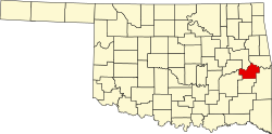
At the time of its founding, Kinta was located in the Moshulatubbee District of the Choctaw Nation. [6]

Historical population
CensusPop.Note
1920 393
1930 259−34.1%
1940 221−14.7%
1950 28328.1%
1960 233−17.7%
1970 2476.0%
1980 30322.7%
1990 233−23.1%
2000 2434.3%
2010 29722.2%
2020 285−4.0%
U.S. Decennial Census

During the first three decades of the 20th century, the town economy was supported by coal mining and the production of wood products. When these two industries declined sharply in the 1930s, the railroad ceased operations. The town nearly failed with them. The town survived somehow, and by the start of the 21st century, the major employer was the Kinta Public School System. [4]

Geography

Kinta is 40 miles (64 km) east of McAlester and 56 miles (90 km) south of Muskogee. [4]

According to the United States Census Bureau, the town has a total area of 0.6 square miles (1.6 km2), all land.

Demographics

As of the census [3] of 2000, there were 243 people, 104 households, and 68 families residing in the town. The population density was 388.2 inhabitants per square mile (149.9/km2). There were 131 housing units at an average density of 209.3 per square mile (80.8/km2). The racial makeup of the town was 82.72% White, 12.35% Native American, 0.41% from other races, and 4.53% from two or more races. Hispanic or Latino of any race were 0.82% of the population.

There were 104 households, out of which 26.9% had children under the age of 18 living with them, 55.8% were married couples living together, 6.7% had a female householder with no husband present, and 33.7% were non-families. 29.8% of all households were made up of individuals, and 20.2% had someone living alone who was 65 years of age or older. The average household size was 2.34 and the average family size was 2.91.

In the town, the population was spread out, with 22.6% under the age of 18, 9.5% from 18 to 24, 25.1% from 25 to 44, 22.6% from 45 to 64, and 20.2% who were 65 years of age or older. The median age was 39 years. For every 100 females, there were 92.9 males. For every 100 females age 18 and over, there were 77.4 males.

The median income for a household in the town was $26,111, and the median income for a family was $32,083. Males had a median income of $25,625 versus $13,750 for females. The per capita income for the town was $13,960. About 8.5% of families and 10.3% of the population were below the poverty line, including 3.2% of those under the age of eighteen and 33.3% of those 65 or over.

Notable person

Notes

  1. The building still stands and is listed on the National Register of Historic Places.

Related Research Articles

<span class="mw-page-title-main">McCurtain County, Oklahoma</span> County in Oklahoma, United States

McCurtain County is in the southeastern corner of the U.S. state of Oklahoma. As of the 2020 census, its population was 30,814. Its county seat is Idabel. It was formed at statehood from part of the earlier Choctaw Nation in Indian Territory. The name honors an influential Choctaw family who lived in the area. Green McCurtain was the last chief when Oklahoma became a state in 1907.

<span class="mw-page-title-main">LeFlore County, Oklahoma</span> County in Oklahoma, United States

LeFlore County is a county along the eastern border of the U.S state of Oklahoma. As of the 2020 census, the population was 48,129. Its county seat is Poteau. The county is part of the Fort Smith metropolitan area and the name honors a Choctaw family named LeFlore. The United States District Court for the Eastern District of Oklahoma is the federal district court with jurisdiction in LeFlore County.

<span class="mw-page-title-main">Haskell County, Oklahoma</span> County in Oklahoma, United States

Haskell County is a county located in the southeast quadrant of the U.S. state of Oklahoma. As of the 2020 census, the population was 11,561. Its county seat is Stigler. The county is named in honor of Charles N. Haskell, the first governor of Oklahoma.

<span class="mw-page-title-main">Choctaw County, Oklahoma</span> County in Oklahoma, United States

Choctaw County is a county located in the U.S. state of Oklahoma. As of the 2020 census, the population was 14,204. Its county seat is Hugo.

<span class="mw-page-title-main">Bokchito, Oklahoma</span> Town in Oklahoma, United States

Bokchito is a town in Bryan County, Oklahoma, United States. The population was 632 at the 2010 census, an increase of 12.1 percent over the figure of 564 recorded in 2000. In the Choctaw language, "bok" means river, and "chito" means big or large, literally translating into "big creek".

<span class="mw-page-title-main">Fort Towson, Oklahoma</span> Town in Oklahoma, United States

Fort Towson is a town in Choctaw County, Oklahoma, United States. The population was 510 at the 2010 census, a 15.1 percent decline from the figure of 611 recorded in 2000. It was named for nearby Fort Towson, which had been established in May 1824 and named for General Nathan Towson, a hero of the War of 1812. The town of Fort Towson was established in 1902, after the Arkansas and Choctaw Railway reached eastern Choctaw County.

<span class="mw-page-title-main">Sawyer, Oklahoma</span> Town in Oklahoma, United States

Sawyer is a town in Choctaw County, Oklahoma, United States. The population was 321 at the 2010 census.

<span class="mw-page-title-main">Soper, Oklahoma</span> Town in Oklahoma, United States

Soper is a town in Choctaw County, Oklahoma, United States. The population was 261 at the 2010 census. The town was named for Pliny L. Soper, who was an attorney for the Arkansas and Choctaw Railway.

Keota is a town in southeastern Haskell County, Oklahoma, United States. The population was 438 at the 2020 census, a 22.3 percent decrease over the figure of 564 recorded in 2010.

McCurtain is a town in Haskell County, Oklahoma, United States. The population was 357 at the 2020 census, a 30.8% decrease over the figure of 516 recorded in 2010. A coal mine disaster in 1912 killed 73 miners and ended McCurtain's prosperity. The mine explosion remains one of the worst disasters in Oklahoma history.

<span class="mw-page-title-main">Stigler, Oklahoma</span> City in Oklahoma, United States

Stigler is a city in and county seat of Haskell County, Oklahoma. The population was 2,685 at the time of the 2010 census, down from 2,731 recorded in 2000.

Tamaha is a town in Haskell County, Oklahoma, United States. The population was 152 at the time of the 2020 United States census. Tamaha is a Choctaw word meaning "town."

Whitefield is a town in northwestern Haskell County, Oklahoma, United States. The population was 377 at the 2020 census, compared with the figure of 391 recorded in 2010. It was named for Methodist bishop George Whitefield.

<span class="mw-page-title-main">Howe, Oklahoma</span> Town in Oklahoma, United States

Howe is a town in Le Flore County, Oklahoma, United States. It is part of the Fort Smith, Arkansas-Oklahoma Metropolitan Statistical Area. The population was 802 at the 2010 census, a gain of 15.1 percent over the figure of 697 recorded in 2000. The town was once noted for producing coal and coke, but today is chiefly supported by agriculture.

<span class="mw-page-title-main">Garvin, Oklahoma</span> Town in Oklahoma, United States

Garvin is a town in McCurtain County, Oklahoma, United States. The population was 256 at the 2010 census, compared to 143 in 2000.

<span class="mw-page-title-main">Haworth, Oklahoma</span> Town in Oklahoma, United States

Haworth is a town in McCurtain County, Oklahoma, United States. The population was 297 at the 2010 census.

<span class="mw-page-title-main">Idabel, Oklahoma</span> City in Oklahoma, United States

Idabel is a city in and the county seat of McCurtain County, Oklahoma, United States. The population was 7,010 at the 2010 census. It is in Oklahoma's southeast corner, a tourist area known as Choctaw Country.

<span class="mw-page-title-main">Valliant, Oklahoma</span> Town in Oklahoma, United States

Valliant is a town in McCurtain County, Oklahoma, United States. The population was 754 at the 2010 census.

<span class="mw-page-title-main">Quinton, Oklahoma</span> Town in Oklahoma, United States

Quinton is a town in Pittsburg County, Oklahoma, United States. The population was 1,051 at the 2010 census. The town was named for Elizabeth Quinton, who lived to be 116 years old. Her family still resides in and around the town of Quinton. Web address https://townofquinton.com/

<span class="mw-page-title-main">Fanshawe, Oklahoma</span> Town in Oklahoma, United States

Fanshawe is a town in Latimer and Le Flore counties in the U.S. state of Oklahoma. As of the 2020 Census, the town had a total population of 317. The Le Flore County portion of Fanshawe is part of the Fort Smith, Arkansas-Oklahoma Metropolitan Statistical Area.

References

  1. "ArcGIS REST Services Directory". United States Census Bureau. Retrieved September 20, 2022.
  2. 1 2 U.S. Geological Survey Geographic Names Information System: Kinta, Oklahoma
  3. 1 2 "U.S. Census website". United States Census Bureau . Retrieved January 31, 2008.
  4. 1 2 3 4 5 6 "Kinta". Glenn O. Hyder, Oklahoma Historical Society. Retrieved August 21, 2020.
  5. CensusViewer:Population of the City of Kinta, Oklahoma
  6. Morris, John W. Historical Atlas of Oklahoma (Norman: University of Oklahoma Press, 1986), plate 38.