Kirbyville, Texas | |
---|---|
Nickname: K-Ville | |
Coordinates: 30°39′33″N93°53′49″W / 30.65917°N 93.89694°W | |
Country | United States |
State | Texas |
County | Jasper |
Government | |
• Mayor | Frank George |
Area | |
• Total | 2.43 sq mi (6.28 km2) |
• Land | 2.42 sq mi (6.26 km2) |
• Water | 0.01 sq mi (0.02 km2) |
Elevation | 112 ft (34 m) |
Population (2020) | |
• Total | 2,036 |
• Density | 856.02/sq mi (330.56/km2) |
Time zone | UTC-6 (Central (CST)) |
• Summer (DST) | UTC-5 (CDT) |
ZIP code | 75956 |
Area code | 409 |
FIPS code | 48-39460 [3] |
GNIS feature ID | 1360696 [2] |
Website | cityofkirbyville.com |
Kirbyville is a city in Jasper County, Texas, United States. The population was 2,036 at the 2020 census.
The town was first established in 1895 when the Gulf, Beaumont, and Kansas City railroad reached the site. It was first named Kirby for John Henry Kirby, a lumber businessman who intended to use the site for building a facility to market his lumber. The post office was established the same year, but the name was changed to Kirbyville when a town already called Kirby was discovered. [4] The town became incorporated in 1926.
On September 24, 2005, Hurricane Rita made landfall in extreme Southwest Louisiana as a Category 3 hurricane. As Rita moved inland, the center of the storm moved very near Kirbyville. According to the National Weather Service, wind gusts around the area reached speeds of up to 120 mph. As a result, wind damage throughout the town and surrounding towns was extensive. Several buildings in the city sustained damage, some of which sustained major damage or were destroyed. Many residents were without power for several weeks due to the storm. [5]
According to the United States Census Bureau, the city has a total area of 2.4 square miles (6.2 km2), of which 2.4 square miles (6.2 km2) is land and 0.41% is covered by water.
The climate of Kirbyville and surrounding areas consists of mainly hot and humid summers, while winters are usually mild. According to the Köppen Climate Classification system, Kirbyville has a humid subtropical climate, mainly because of its close proximity to the warm waters of the Gulf of Mexico. [6]
Climate data for Kirbyville, Texas | |||||||||||||
---|---|---|---|---|---|---|---|---|---|---|---|---|---|
Month | Jan | Feb | Mar | Apr | May | Jun | Jul | Aug | Sep | Oct | Nov | Dec | Year |
Record high °F (°C) | 90 (32) | 86 (30) | 90 (32) | 98 (37) | 97 (36) | 101 (38) | 104 (40) | 105 (41) | 105 (41) | 98 (37) | 94 (34) | 87 (31) | 105 (41) |
Mean daily maximum °F (°C) | 57 (14) | 60 (16) | 68 (20) | 76 (24) | 83 (28) | 89 (32) | 91 (33) | 92 (33) | 87 (31) | 78 (26) | 67 (19) | 59 (15) | 76 (24) |
Mean daily minimum °F (°C) | 39 (4) | 42 (6) | 49 (9) | 56 (13) | 65 (18) | 71 (22) | 73 (23) | 73 (23) | 68 (20) | 57 (14) | 49 (9) | 41 (5) | 57 (14) |
Record low °F (°C) | 6 (−14) | 11 (−12) | 17 (−8) | 27 (−3) | 35 (2) | 46 (8) | 51 (11) | 55 (13) | 34 (1) | 22 (−6) | 22 (−6) | 13 (−11) | 6 (−14) |
Average precipitation inches (mm) | 5.28 (134) | 4.69 (119) | 4.96 (126) | 3.94 (100) | 4.49 (114) | 6.18 (157) | 3.90 (99) | 4.02 (102) | 4.29 (109) | 5.55 (141) | 6.34 (161) | 6.14 (156) | 59.78 (1,518) |
Source: [7] [8] |
Census | Pop. | Note | %± |
---|---|---|---|
1920 | 1,165 | — | |
1930 | 1,184 | 1.6% | |
1940 | 1,088 | −8.1% | |
1950 | 1,150 | 5.7% | |
1960 | 1,660 | 44.3% | |
1970 | 1,869 | 12.6% | |
1980 | 1,972 | 5.5% | |
1990 | 1,871 | −5.1% | |
2000 | 2,085 | 11.4% | |
2010 | 2,142 | 2.7% | |
2020 | 2,036 | −4.9% | |
U.S. Decennial Census [9] |
Race | Number | Percentage |
---|---|---|
White (NH) | 1,395 | 68.52% |
Black or African American (NH) | 375 | 18.42% |
Native American or Alaska Native (NH) | 15 | 0.74% |
Asian (NH) | 2 | 0.1% |
Pacific Islander (NH) | 1 | 0.05% |
Some Other Race (NH) | 6 | 0.29% |
Mixed/Multi-Racial (NH) | 102 | 5.01% |
Hispanic or Latino | 140 | 6.88% |
Total | 2,036 |
As of the 2020 United States census, there were 2,036 people, 972 households, and 511 families residing in the city.
As of the census [3] of 2000, 2,085 people, 828 households, and 550 families resided in the city. The population density was 856.1 inhabitants per square mile (330.5/km2). The 931 housing units averaged 382.2 per square mile (147.3/km2). The racial makeup of the city was 76.31% White, 21.20% African American, 0.34% Native American, 0.29% Asian, 1.20% from other races, and 0.67% from two or more races. Hispanics or Latinos of any race were 2.69% of the population.
Of the 828 households, 32.5% had children under the age of 18 living with them, 43.5% were married couples living together, 18.8% had a female householder with no husband present, and 33.5% were not families. About 30.7% of all households were made up of individuals, and 14.6% had someone living alone who was 65 years of age or older. The average household size was 2.42 and the average family size was 3.01.
In the city, the population was distributed as 27.4% under the age of 18, 9.0% from 18 to 24, 24.3% from 25 to 44, 21.0% from 45 to 64, and 18.4% who were 65 years of age or older. The median age was 37 years. For every 100 females, there were 79.3 males. For every 100 females age 18 and over, there were 72.2 males.
The median income for a household in the city was $25,438, and for a family was $32,381. Males had a median income of $30,144 versus $20,060 for females. The per capita income for the city was $12,839. About 22.6% of families and 26.1% of the population were below the poverty line, including 33.9% of those under age 18 and 17.2% of those age 65 or over.
The City of Kirbyville is served by the Kirbyville Consolidated Independent School District and home to the Kirbyville High School Wildcats.
Fulton is a town in Aransas County, Texas, United States. As of the 2010 census, this South Texas coastal fishing community had a population of 1,358. The town is named for George Ware Fulton, a land developer in the area.
China Grove is a town in Bexar County, Texas, United States, located on the far east side of San Antonio. The population was 1,141 at the 2020 census. It is part of the San Antonio Metropolitan Statistical Area.
Quitaque is a city in southeastern Briscoe County, Texas, United States. The town lies directly south of Caprock Canyon State Park and is a ranching and farming area in West Texas. The population was 411 at the 2010 census.
Paducah is a town in Cottle County, Texas, United States. The population was 1,186 at the 2010 census, down from 1,498 in 2000. It is the county seat of Cottle County. It is just south of the Texas Panhandle and east of the Llano Estacado.
Dickens is a city in and the county seat of Dickens County, Texas, United States. The population was 286 at the 2010 census, down from 332 at the 2000 census.
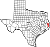
Kountze is a city in and the county seat of Hardin County, Texas, United States. The population was 1,981 at the 2020 census. The city is part of the Beaumont–Port Arthur Metropolitan Statistical Area.
Lumberton is a city in Hardin County, Texas, United States. The population was 13,554 at the 2020 census, up from 11,943 at the 2010 census. Lumberton is the home of Village Creek State Park. The city is part of the Beaumont–Port Arthur metropolitan area.
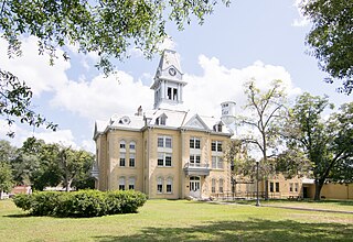
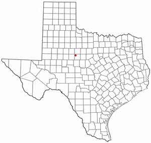
Trinidad is a city in Henderson County, Texas, United States, near the Trinity River from which the town's name was derived. The population was 860 at the 2020 census, down from 886 at the 2010 census.
Itascaeye-TAS-kə is a city in Hill County in Northern Central Texas, United States. As of the 2010 census, the city population was 1,644.
Grapeland is a city in Houston County, Texas, United States. Its population was 1,465 as of the 2020 census.
Stinnett is a city in and the county seat of Hutchinson County, Texas, United States. The population was 1,881 at the 2010 census, a decrease from 1,936 at the 2000 census.
Natalia is a city in Medina County, Texas, United States. The population was 1,202 at the 2020 census. It was founded in 1912 and was named after Natalie Pearson Nicholson, daughter of Frederick Stark Pearson, engineer, designer and builder of the Medina Dam.
Goldthwaite is a town and the county seat of Mills County, Texas, United States. The population was 1,878 at the 2010 census.
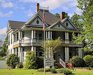
Newton is a city in and the county seat of Newton County, Texas, United States. The population was 1,633 at the 2020 census.
Taft is a city in San Patricio County, Texas, United States. The population was 3,048 at the 2010 census.
Stratford is a town and county seat of Sherman County, Texas, United States. The population was 2,017 at the 2010 census, up from 1,991 in 2000.
Merkel is a city in Taylor County, Texas, United States. Its population was 2,471 at the 2020 census. It is part of the Abilene metropolitan area.
Throckmorton is a town in Throckmorton County, Texas, United States. Its population was 828 at the 2010 census. It is the county seat of Throckmorton County.
Wheeler is a city, and the county seat of Wheeler County, Texas, United States, located on the eastern border of the Texas Panhandle. The population was last reported at 1,592 in the 2010 census.
Port Mansfield is a census-designated place (CDP) in Willacy County, Texas, United States. The population was 226 at the 2010 census.
Media related to Kirbyville, Texas at Wikimedia Commons