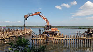
Mankada is a hillside village in the Malappuram district of Kerala state. It is located 15 km (9.3 mi) from Malappuram and is part of the Malappuram parliament constituency. The municipal town of Perinthalmanna is just 10 km (6.2 mi) away. Also, the municipal towns of Manjeri and Malappuram are just 15 km (9.3 mi) away. Mankada Kadannamanna Kovilakam was the seat of ruling family of the erstwhile Kingdom of Valluvanad.
Aliparamba is a village in Malappuram district in the state of Kerala, India.
Anamangad is a village in Malappuram district in the state of Kerala, India.
Ananthavoor is a village in Tirur Thaluk Malappuram District of the state of Kerala, India.

Edappatta is a village in Malappuram district in the state of Kerala, India.
Edayoor is an Indian village.

Keezhattur is a village in Malappuram district in the state of Kerala, India. Poonthanam illam, the birthplace of "bhakthakavi" Poonthanam namboothiri, famous ancient Malayalam poet, is located here. The poonthanam illam is now a popular cultural centre. Keezhattur is a moderately large panchayat.The major place in keezhattur panchayat is kizhattur.'kizhattur pooram' is the major festival in keezhattur. Its administrative offices are located in Akkaparambu, which is about 12 km away from Perinthalmanna, the largest city of Malappuram district.
Niramaruthur is a sandy coastal village and also a Gram panchayat in Tirur Taluk, Malappuram district in the state of Kerala, India. Tanur and Tirur are nearby municipal towns.
Ozhur is a village in the Malappuram district of the state of Kerala, India. The village was a part of the Kingdom of Tanur (Vettattnad) in medieval times.

Pulpatta or Pulpetta is a village in Eranad Taluk, Malappuram district in the state of Kerala, India. It is located 7 km away from Manjeri.

Purathur is a sandy coastal village and a Grama Panchayat in Tirur Taluk, Malappuram district in the state of Kerala, India. Bharathappuzha river and Tirur River merges together in Purathur and join with the Arabian Sea at Padinjarekara Azhimukham, which is also the southernmost tip of Purathur Gram panchayat. Opposite to Padinjarekara Azhimukham is Ponnani port. The village is located at the southernmost tip of Tirur Taluk and is bordered by historically important Ponnani port in Ponnani Municipality of Ponnani taluk to south.
Thalakkad is a census town in Malappuram district in the state of Kerala, India.
Tanalur is a census town in Malappuram district in the state of Kerala, India. It is a suburban town of neighbouring Tanur Municipality and comes under Tanur Block as well as Tanur. It falls under Tirur Taluk.

Triprangode is a village in Malappuram district in the state of Kerala, India. As of 2001 India census, Triprangode had a population of 37175 with 17422 males and 19753 females. Three sides of the village is surrounded by water bodies.
Valambur is a town in Malappuram district in the state of Kerala, India.
Vettathur is a village in Malappuram district in the state of Kerala, India.

Vettom is a local body of the Kerala government and village in Tirur Taluk, Malappuram district, India. It is the coastal suburb of Tirur Municipality. It was part of the Kingdom of Tanur (Vettathnad) in medieval times. Vettom gram panjayath is surrounded by water on all borders. Those are Tirur River and canoli canal.

Perinthalmanna Taluk, formerly known as Walluvanad Taluk, comes under Perinthalmanna revenue division in Malappuram district of Kerala, India. Its headquarters is the town of Perinthalmanna.The taluk encompasses 24 revenue villages. Perinthalmanna Taluk contains Perinthalmanna Municipality and 15 Gram panchayats. Most of the administrative offices are located in the Mini-Civil Station at Perinthalmanna.
Paravakkal is a town in the Kadungapuram village of the Puzhakkattiri panchayath, located in the Malappuram district, in the state of Kerala, southeast India. It was the homeland of Valluvanad, an erstwhile kingdom in Malabar. Perinthalmanna, Malappuram, and Kottakkal are some of the major towns nearby.
Kavapura is a small village/hamlet in Tirur Taluk in Malappuram District of Kerala State, India. It comes under Ozhur Panchayath. It belongs to North Kerala Division. It is located 20 km towards west from District headquarters Malappuram. 6 km from Tanur. 349 km from State capital Thiruvananthapuram.


