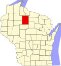
Lake, Price County, Wisconsin

Last updated

Lake, Wisconsin
WIMap-doton-Lake b.png
Location of Lake, Price County, Wisconsin
Coordinates: 45°55′47″N90°32′46″W / 45.92972°N 90.54611°W / 45.92972; -90.54611
Country Flag of the United States.svg  United States
State Flag of Wisconsin.svg  Wisconsin
County Price
Area
  Total92.2 sq mi (238.9 km2)
  Land88.6 sq mi (229.5 km2)
  Water3.6 sq mi (9.3 km2)
Elevation
[1]
1,480 ft (451 m)
Population
 (2000)
  Total1,319
  Density14.9/sq mi (5.7/km2)
Time zone UTC-6 (Central (CST))
  Summer (DST) UTC-5 (CDT)
Area code(s) 715 & 534
FIPS code 55-41150 [2]
GNIS feature ID1583509 [1]

Lake is a town in Price County, Wisconsin, United States. The population was 1,319 at the 2000 census. The unincorporated community of Kennedy is located in the town. The ghost town of Kaiser was also located in the town.

Contents

Geography

According to the United States Census Bureau, the town has a total area of 92.2 square miles (238.8 km2), of which, 88.6 square miles (229.6 km2) is land and 3.6 square miles (9.3 km2) (3.89%) is water.

Demographics

As of the census [2] of 2000, there were 1,319 people, 531 households, and 395 families residing in the town. The population density was 14.9 people per square mile (5.7/km2). There were 843 housing units at an average density of 9.5 per square mile (3.7/km2). The racial makeup of the town was 98.33% White, 0.15% African American, 0.23% Native American, 0.23% Asian, 0.15% Pacific Islander, 0.08% from other races, and 0.83% from two or more races. Hispanic or Latino people of any race were 0.30% of the population.

There were 531 households, out of which 29.8% had children under the age of 18 living with them, 66.1% were married couples living together, 4.5% had a female householder with no husband present, and 25.6% were non-families. 21.7% of all households were made up of individuals, and 10.5% had someone living alone who was 65 years of age or older. The average household size was 2.48 and the average family size was 2.92.

In the town, the population was spread out, with 23.8% under the age of 18, 3.8% from 18 to 24, 26.2% from 25 to 44, 29.3% from 45 to 64, and 16.9% who were 65 years of age or older. The median age was 43 years. For every 100 females, there were 103.5 males. For every 100 females age 18 and over, there were 103.9 males.

The median income for a household in the town was $39,783, and the median income for a family was $45,982. Males had a median income of $36,583 versus $18,839 for females. The per capita income for the town was $19,728. About 3.6% of families and 5.9% of the population were below the poverty line, including 4.6% of those under age 18 and 12.3% of those age 65 or over.

Related Research Articles

<span class="mw-page-title-main">Frisco City, Alabama</span> Town in Alabama, United States

Frisco City is a town in Monroe County, Alabama, United States. The population was 1,170 at the 2020 census.

<span class="mw-page-title-main">Silver Lake, Indiana</span> Town in Indiana, United States

Silver Lake is a town in Lake Township, Kosciusko County, in the U.S. state of Indiana. The population was 915 at the 2010 census.

<span class="mw-page-title-main">Fountain City, Indiana</span> Town in Indiana, United States

Fountain City, formerly Newport, is a town in New Garden Township, Wayne County, in the U.S. state of Indiana. The population was 796 at the 2010 census.

<span class="mw-page-title-main">Mount Auburn, Indiana</span> Town in Indiana, United States

Mount Auburn is a town in Jackson Township, Wayne County, in the U.S. state of Indiana. The population was 117 at the 2010 census. The town is sandwiched between Dublin and Cambridge City.

<span class="mw-page-title-main">Uniondale, Indiana</span> Town in Indiana, United States

Uniondale is a town in Union and Rockcreek townships, Wells County, in the U.S. state of Indiana. The population was 310 at the 2010 census, down from 271 at the 2020 Census.

Cornville is a town in Somerset County, Maine, United States. The population was 1,317 at the 2020 census.

<span class="mw-page-title-main">Myersville, Maryland</span> Town in the United States

Myersville is a town in Frederick County, Maryland, United States. The population was 1,626 at the 2010 United States Census.

<span class="mw-page-title-main">Blissfield, Michigan</span> Village in Michigan, United States

Blissfield is a village in Lenawee County in the U.S. state of Michigan. The population was 3,340 at the 2010 census. The village is mostly located within Blissfield Township with only very small portions extending west into Palmyra Township and south into Riga Township. The Blissfield post office first opened March 28, 1828. Hervey Bliss, who was the first white settler in 1824 and for whom the town is named, was the first postmaster.

Carolina Shores is a town in Brunswick County, North Carolina, United States. The population was 3,048 at the 2010 census, up from 1,482 in 2000. It is part of the Wilmington, NC Metropolitan Statistical Area.

<span class="mw-page-title-main">Ararat Township, Susquehanna County, Pennsylvania</span> Township in Pennsylvania, United States

Ararat Township is a township in Susquehanna County, Pennsylvania, United States. The population was 526 at the 2020 census.

<span class="mw-page-title-main">Lewiston, Utah</span> City in Utah, United States

Lewiston is a city in Cache County, Utah, United States. It is situated at the northern Utah border and borders the state of Idaho. The population was 1,766 at the 2010 census. It is included in the Logan, Utah-Idaho (partial) Metropolitan Statistical Area.

<span class="mw-page-title-main">Madison, West Virginia</span> City in West Virginia, United States

Madison is a city and former coal town in Boone County, West Virginia, United States. The population was 2,911 at the 2020 census. It is the county seat of Boone County.

<span class="mw-page-title-main">Lawrence, Brown County, Wisconsin</span> Town in Wisconsin, United States

Lawrence is a town in Brown County in the U.S. state of Wisconsin. The population was 6,306 as of the 2020 census, up from 4,284 at the 2010 census. The unincorporated community of Little Rapids is located in the town.

<span class="mw-page-title-main">Sand Lake, Burnett County, Wisconsin</span> Town in Wisconsin, United States

Sand Lake is a town in Burnett County in the U.S. state of Wisconsin. The population was 531 at the 2010 census.

<span class="mw-page-title-main">Taycheedah, Wisconsin</span> Town in Wisconsin, United States

Taycheedah is a town in Fond du Lac County, Wisconsin, United States. The population was 3,666 at the 2000 census. The census-designated places of St. Peter and Taycheedah and the unincorporated communities of Hopokoekau Beach, Linden Beach, Minawa Beach, Peebles, Silica, and Welling Beach are located in the town, as well as Malone, which is partially located in the town.

<span class="mw-page-title-main">Meeme, Wisconsin</span> Town in Wisconsin, United States

Meeme is a town in Manitowoc County, Wisconsin, United States. The population was 1,538 at the 2000 census. Its Menominee name is Omīnīw which means "pigeon". The Menominee sold this land to the United States in the 1831 Treaty of Washington.

<span class="mw-page-title-main">Union, Vernon County, Wisconsin</span> Town in Wisconsin, United States

Union is a town in Vernon County, Wisconsin, United States. The population was 531 at the 2000 census. The unincorporated community of White City is located in the town.

<span class="mw-page-title-main">Hazel Green, Wisconsin</span> Village in Wisconsin, United States

Hazel Green is a village in Grant and Lafayette counties in the U.S. state of Wisconsin. The population was 1,256 at the 2010 census. Of this, 1,243 were in Grant County, and only 13 were in Lafayette County. The village is located mostly within the Town of Hazel Green in Grant County; only a small portion extends into the Town of Benton in Lafayette County.

Hancock founded in 1850 is a town in Waushara County, Wisconsin, United States. The population was 531 at the 2000 census. The Village of Hancock is located within the town.

<span class="mw-page-title-main">Greenville (CDP), Maine</span> CDP in Maine, United States

Greenville is a census-designated place (CDP) in the town of Greenville in Piscataquis County, Maine, United States. The population was 1,010 at the 2020 census.

References

  1. 1 2 "US Board on Geographic Names". United States Geological Survey. October 25, 2007. Retrieved January 31, 2008.
  2. 1 2 "U.S. Census website". United States Census Bureau . Retrieved January 31, 2008.