The following is a list of naturally occurring lakes and other water bodies in Victoria, Australia; outside the Greater Melbourne area, in alphabetical order, for those lakes with a surface area greater than 70 hectares (170 acres):
| Lake name | Type | Region | Primary inflow | Primary outflow | Area | Image | Notes | |
|---|---|---|---|---|---|---|---|---|
| hectares | acres | |||||||
| Albacutya | Eutrophic | Wimmera | Outlet Creek | Evaporation | 5,500 | 14,000 | [1] | |
| Barracoota | Freshwater | East Gippsland | 240 | 590 | [2] | |||
| Beeac | Hypersaline | Western District Lakes | Evaporation | 560 | 1,400 | [3] | ||
| Boga | Freshwater water storage | The Mallee | outfall channel to the Little Murray River | 940 | 2,300 |  | [4] | |
| Bookar | Barwon South West | Evaporation | 450 | 1,100 | [5] | |||
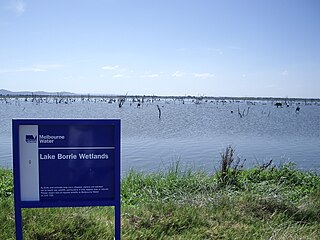
| Borrie | Coastal wetland | Greater Geelong | Little River | Port Phillip Bay | 70 | 170 |  | [6] |
| Bullen Merri | Brackish crater | Barwon South West | Evaporation | 460 | 1,100 |  | [7] [8] | |
| Buloke | Eutrophic | Wimmera | Richardson River | Evaporation | 4,300 | 11,000 | [9] | |
| Burrumbeet | Eutrophic | Western Victoria | Burrumbeet Creek | Evaporation | 2,300 | 5,700 | [10] | |
| Colac | Freshwater | Barwon South West | Barongarook Creek | Evaporation | 2,800 | 6,900 |  | [11] |
| Coleman | Freshwater | Gippsland | Latrobe River | Bass Strait | 1,300 | 3,200 | [12] | |
| Colungulac | Saline | Western District Lakes | Evaporation | 1,500 | 3,700 | [13] | ||
| Condah | Crater lake | Barwon South West | Darlot Creek | Evaporation | 250 | 620 | [14] | |
| Connewarre | Estuarine | Bellarine Peninsula | Barwon River | Barwon River | 880 | 2,200 |  | [15] |
| Coorong | Eutrophic | Wimmera | Yarriambiack Creek | Evaporation | 100 | 250 | [16] | |
| Coradgil | Freshwater | Western District Lakes | Evaporation | 78 | 190 | [17] | ||
| Corangamite | Hypersaline, endorheic | Western District Lakes | Woady Yaloak River | Evaporation | 17,000 | 42,000 | [18] | |
| Cundare | Hypersaline | Western District Lakes | Evaporation | 280 | 690 | [19] | ||
| Deep | Freshwater | Western Victoria | Evaporation | 85 | 210 | [20] | ||
| Elingamite | Freshwater | Western District Lakes | Elingamite Creek | Evaporation | 300 | 740 | [21] | |
| Gnarpurt | Saline | Western District Lakes | Evaporation | 2,350 | 5,800 | |||
| Gnotuk | ||||||||
| Hindmarsh | Eutrophic | Wimmera | Wimmera River | Outlet Creek | 13,500 | 33,000 | [22] | |
| Hume | Reservoir | Hume | Murray River | Murray River | 20,190 | 49,900 |  | [23] [24] |
| Keilambete | ||||||||
| King | Freshwater | Gippsland | Tambo River; Mitchell River | to Bass Strait | 4,400 | 11,000 | [25] | |
| Learmonth | ||||||||
| Logan | ||||||||
| Marmal | Wimmera | Evaporation | 130 | 320 | [26] | |||
| Martin | Freshwater | Western District Lakes | Woady Yaloak River | Woady Yaloak River | 2,200 | 5,400 | [27] | |
| Milangil | Saline | Western District Lakes | 310 | |||||
| Mokoan | Reservoir | Hume | Broken River | Evaporation | 9,400 | 23,000 |  | [28] |
| Monbeong | ||||||||
| Mulwala | Reservoir | Murray River | Murray River | 6,600 | 16,000 |  | [29] | |
| Murdeduke | Saline | Western District Lakes | 3,800 | |||||
| Nagambie | Reservoir | Goldfields | Goulburn River | Goulburn River | 170 | 420 |  | [30] |
| Narracan | Reservoir | West Gippsland | Latrobe River | Latrobe River | 281 | 690 | [31] | |
| Purrumbete | Crater lake | Western District Lakes | Evaporation | 552 | 1,360 | [32] | ||
| Reedy | Freshwater | Bellarine Peninsula | Barwon River | Barwon River | 550 | 1,400 |  | |
| Reeve | Freshwater | Gippsland | Carr Creek | to Bass Strait | 5,200 | 13,000 | [33] | |
| Rosine | ||||||||
| Round | ||||||||
| Tali Karng | formed by a natural landslide | Alpine | Snowden Creek, Nigothoruk Creek | underground to Wellington River | 14 | 35 | | [34] |
| Terangoon | Freshwater | Western District Lakes | 208 | 510 | ||||
| Tutchewop | Freshwater | The Mallee | Evaporation | 760 | 1,900 | [35] | ||
| Tyrrell | Salt lake | Mallee | Tyrrell Creek | Evaporation | 20,860 | 51,500 | [36] | |
| Tyers | Freshwater | Gippsland | Boggy Creek; Stony Creek | to Bass Strait | 950 | 2,300 | [37] | |
| Victoria (Bellarine) | Saline | Bellarine Peninsula | to Bass Strait | 139 | 340 |  | [38] | |
| Victoria (Gippsland) | Freshwater | Gippsland | Latrobe River; Mitchell River | to Bass Strait | 15,000 | 37,000 | [39] | |
| Weeranganuk | Freshwater | Barwon South West | Evaporation | 460 | 1,100 | [40] | ||
| Wellington | Freshwater | Gippsland | Latrobe River; Avon River | to Bass Strait | 15,000 | 37,000 | [41] | |
| Wendouree | Freshwater | Goldfields | Gong Gong Reservoir | Evaporation | 238 | 590 |  | [42] |
| William Hovell | Reservoir | Alpine | King River | King River | 113 | 280 |  | [43] |