
Amaro is a comune (municipality) in the Regional decentralization entity of Udine in the Italian region of Friuli-Venezia Giulia, located about 100 kilometres (62 mi) northwest of Trieste and about 35 kilometres (22 mi) northwest of Udine.

Ampezzo is a comune (municipality) in the Regional decentralization entity of Udine in the Italian region of Friuli-Venezia Giulia, located about 120 kilometres (75 mi) northwest of Trieste and about 50 kilometres (31 mi) northwest of Udine. As of 31 December 2004, it had a population of 1,137 and an area of 73.5 square kilometres (28.4 sq mi).

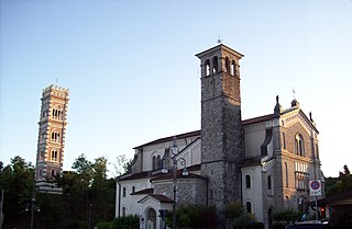
Artegna is a comune (municipality) in the Regional decentralization entity of Udine in the Italian region of Friuli-Venezia Giulia, located about 80 kilometres (50 mi) northwest of Trieste and about 20 kilometres (12 mi) northwest of Udine. As of 2008, it had a population of 2,951 and an area of 11.2 square kilometres (4.3 sq mi).

Bicinicco is a comune (municipality) in the Regional decentralization entity of Udine in the Italian region of Friuli-Venezia Giulia, located about 50 kilometres (31 mi) northwest of Trieste and about 15 kilometres (9 mi) south of Udine.

Bordano is a comune (municipality) in the Regional decentralization entity of Udine in the Italian region of Friuli-Venezia Giulia, located about 90 kilometres (56 mi) northwest of Trieste and about 30 kilometres (19 mi) northwest of Udine, on the right bank of the Tagliamento river.
Cassacco is a comune (municipality) in the Regional decentralization entity of Udine in the Italian region of Friuli-Venezia Giulia, located about 80 kilometres (50 mi) northwest of Trieste and about 12 kilometres (7 mi) northwest of Udine. As of 31 December 2004, it had a population of 2,880 and an area of 11.6 square kilometres (4.5 sq mi).

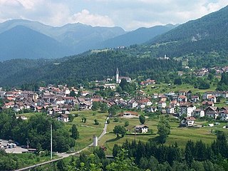
Comeglians is a comune (municipality) in the Regional decentralization entity of Udine in the Italian region of Friuli-Venezia Giulia, located about 120 kilometres (75 mi) northwest of Trieste and about 60 kilometres (37 mi) northwest of Udine. As of 31 December 2004, it had a population of 615 and an area of 19.5 square kilometres (7.5 sq mi).

Forni di Sotto is a comune (municipality) in the Regional decentralization entity of Udine in the Italian region of Friuli-Venezia Giulia, located about 120 kilometres (75 mi) northwest of Trieste and about 60 kilometres (37 mi) northwest of Udine. As of 31 December 2004, it had a population of 701 and an area of 93.0 square kilometres (35.9 sq mi).
Martignacco is a comune (municipality) in the Regional decentralization entity of Udine in the Italian region of Friuli-Venezia Giulia, located about 70 kilometres (43 mi) northwest of Trieste and about 9 kilometres (6 mi) northwest of Udine.

Moruzzo is a comune (municipality) in the Regional decentralization entity of Udine in the Italian region of Friuli-Venezia Giulia, located about 80 kilometres (50 mi) northwest of Trieste and about 11 kilometres (7 mi) northwest of Udine. As of 31 December 2004, it had a population of 2,240 and an area of 17.9 square kilometres (6.9 sq mi).
Ovaro is a comune (municipality) in the Regional decentralization entity of Udine in the Italian region of Friuli-Venezia Giulia, located about 120 kilometres (75 mi) northwest of Trieste and about 50 kilometres (31 mi) northwest of Udine. As of 31 December 2004, it had a population of 2,166 and an area of 57.8 square kilometres (22.3 sq mi).

Pagnacco is a comune (municipality) in the Regional decentralization entity of Udine in the Italian region of Friuli-Venezia Giulia, located about 70 kilometres (43 mi) northwest of Trieste and about 7 kilometres (4 mi) northwest of Udine. As of 31 December 2004, it had a population of 4,824 and an area of 14.9 square kilometres (5.8 sq mi).
Prato Carnico is a comune (municipality) in the Regional decentralization entity of Udine in the Italian region of Friuli-Venezia Giulia, located about 120 kilometres (75 mi) northwest of Trieste and about 60 kilometres (37 mi) northwest of Udine. As of 9 October 2011, it had a population of 927 and an area of 81.3 square kilometres (31.4 sq mi).

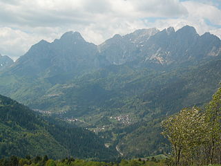
Ravascletto is a comune (municipality) in the Regional decentralization entity of Udine in the Italian region of Friuli-Venezia Giulia, located about 120 kilometres (75 mi) northwest of Trieste and about 60 kilometres (37 mi) northwest of Udine. As of 31 December 2004, it had a population of 601 and an area of 26.3 square kilometres (10.2 sq mi).

Raveo is a comune (municipality) in the Regional decentralization entity of Udine in the Italian region of Friuli-Venezia Giulia, located about 110 kilometres (68 mi) northwest of Trieste and about 50 kilometres (31 mi) northwest of Udine. As of 31 December 2004, it had a population of 486 and an area of 12.7 square kilometres (4.9 sq mi).
Remanzacco is a comune (municipality) in the Regional decentralization entity of Udine in the Italian region of Friuli-Venezia Giulia, located about 60 kilometres (37 mi) northwest of Trieste and about 7 kilometres (4 mi) northeast of Udine. As of 31 December 2004, it had a population of 5,774 and an area of 30.6 square kilometres (11.8 sq mi).
Rive d'Arcano is a comune (municipality) in the Regional decentralization entity of Udine in the Italian region of Friuli-Venezia Giulia, located about 80 kilometres (50 mi) northwest of Trieste and about 15 kilometres (9 mi) northwest of Udine. As of 31 December 2004, it had a population of 2,363 and an area of 22.5 square kilometres (8.7 sq mi).

Sutrio is a comune (municipality) in the Regional decentralization entity of Udine in the Italian region of Friuli-Venezia Giulia, located about 120 kilometres (75 mi) northwest of Trieste and about 60 kilometres (37 mi) northwest of Udine. As of 31 December 2004, it had a population of 1,392 and an area of 21.1 square kilometres (8.1 sq mi).
Villa Santina is a comune (municipality) in the Regional decentralization entity of Udine in the Italian region of Friuli-Venezia Giulia, located about 110 kilometres (68 mi) northwest of Trieste and about 45 kilometres (28 mi) northwest of Udine.

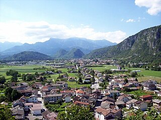
Forgaria nel Friuli is a comune (municipality) in the Regional decentralization entity of Udine, in the Italian region of Friuli-Venezia Giulia, located about 90 kilometres (56 mi) northwest of Trieste and about 25 kilometres (16 mi) northwest of Udine. As of 31 December 2004, it had a population of 1,944 and an area of 29.2 square kilometres (11.3 sq mi).


