
Badia is a comune (municipality) in South Tyrol, northern Italy. It is one of the five Ladin-speaking communities of the Val Badia which is part of the Ladinia region.

Airasca is a comune (municipality) in the Metropolitan City of Turin in the Italian region Piedmont, located about 25 kilometres (16 mi) southwest of Turin.

Carema is a comune (municipality) in the Metropolitan City of Turin in the Italian region Piedmont, located about 60 kilometres (37 mi) north of Turin.
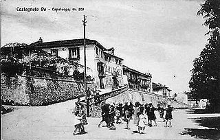
Castagneto Po is a comune (municipality) in the Metropolitan City of Turin in the Italian region Piedmont, located about 20 kilometres (12 mi) northeast of Turin.
Chiesanuova is a comune (municipality) in the Metropolitan City of Turin in the Italian region Piedmont, located about 40 kilometres (25 mi) north of Turin.
Isolabella is a comune (municipality) in the Metropolitan City of Turin in the Italian region Piedmont, located about 25 kilometres (16 mi) southeast of Turin.

Rubiana is a comune (municipality) in the Metropolitan City of Turin in the Italian region Piedmont, located about 25 kilometres (16 mi) northwest of Turin.
Campolongo sul Brenta is a town and comune in the province of Vicenza, Veneto, northern Italy. It is west of SS47 state road.
Campolongo Maggiore is a town in the Metropolitan City of Venice, Veneto, Italy. It is northeast of SS516.

Piove di Sacco is a comune (municipality) in the Province of Padua in the Italian region Veneto, located about 25 kilometres (16 mi) southwest of Venice and about 20 kilometres (12 mi) southeast of Padua. As of 31 December 2004, it had a population of 18,019 and an area of 35.6 square kilometres (13.7 sq mi).
Sant'Angelo di Piove di Sacco is a comune (municipality) in the Province of Padua in the Italian region Veneto, located about 25 kilometres (16 mi) west of Venice and about 12 kilometres (7.5 mi) east of Padua. As of 31 August 2021, it had a population of 7,283 and an area of 14.0 square kilometres (5.4 sq mi).
Aiello del Friuli is a comune (municipality) in the Regional decentralization entity of Udine in the Italian region of Friuli-Venezia Giulia, located about 45 kilometres (28 mi) northwest of Trieste and about 25 kilometres (16 mi) southeast of Udine.
Campolongo al Torre is a former comune of the Province of Udine in the Italian region Friuli-Venezia Giulia, located about 40 km northwest of Trieste and about 25 km southeast of Udine. Since 2009 it has been one of the two principal centres of Campolongo Tapogliano, a municipality formed by its merger with the former comune of Tapogliano.

Ruda is a comune (municipality) in the Regional decentralization entity of Udine in the Italian region of Friuli-Venezia Giulia, located about 40 kilometres (25 mi) northwest of Trieste and about 30 kilometres (19 mi) southeast of Udine.
San Vito al Torre is a comune (municipality) in the Regional decentralization entity of Udine in the Italian region Friuli-Venezia Giulia, located about 45 kilometres (28 mi) northwest of Trieste and about 20 kilometres (12 mi) southeast of Udine.
Tapogliano, is a locality and former comune (municipality) in the Province of Udine in the Italian region Friuli-Venezia Giulia, located about 40 km northwest of Trieste and about 25 km southeast of Udine. As of 31 December 2004, it had a population of 452 and an area of 5.0 km².
Romans d'Isonzo is a comune (municipality) in the Regional decentralization entity of Gorizia in the Italian region of Friuli-Venezia Giulia, located about 40 kilometres (25 mi) northwest of Trieste and about 15 kilometres (9 mi) southwest of Gorizia.

Villesse is a comune (municipality) in the Regional decentralization entity of Gorizia in the Italian region of Friuli-Venezia Giulia, located about 40 kilometres (25 mi) northwest of Trieste and about 15 kilometres (9 mi) southwest of Gorizia. As of 31 December 2004, it had a population of 1,560 and an area of 11.8 square kilometres (4.6 sq mi).

Montgiscard is a commune in the Haute-Garonne department of southwestern France.
Campolongo may refer to a neighbourhood in Spain:


