Pontebba

Last updated
Pontebba
Pontafel (German)
Tablja (Slovene)
Comune di Pontebba
Pontebba panorama.jpg
Bandiera Pontebba.gif
Location of Pontebba
Pontebba
Italy provincial location map 2016.svg
Red pog.svg
Pontebba
Location of Pontebba in Italy
Italy Friuli-Venezia Giulia location map.svg
Red pog.svg
Pontebba
Pontebba (Friuli-Venezia Giulia)
Coordinates: 46°30′N13°19′E / 46.500°N 13.317°E / 46.500; 13.317
Country Italy
Region Friuli-Venezia Giulia
Province Udine (UD)
Frazioni Aupa, Loc. Casali Costa, Loc. Casali Graben, Loc. Frattis, Loc. Gamischen, Passo Pramollo, Loc. Piani, Pietratagliata, Lagleise San Leopoldo, Studena Alta, Studena Bassa
Government
  MayorIvan Buzzi
Area
[1]
  Total97.7 km2 (37.7 sq mi)
Population
 (Oct. 2020) [2]
  Total1,344
  Density14/km2 (36/sq mi)
Demonym Pontebbani
Time zone UTC+1 (CET)
  Summer (DST) UTC+2 (CEST)
Postal code
33016
Dialing code 0428
ISTAT code 030076
Patron saintNatività di Maria
Saint daySeptember 8
Website Official website

Pontebba (German : Pontafel; Slovene : Tablja; Friulian : Ponteibe) is a comune (municipality) in the Regional decentralization entity of Udine in the Italian region of Friuli-Venezia Giulia.

Contents

Geography

Pontebba, named after Italian : ponte meaning "bridge", is situated at the confluence of the Pontebbana creek and the Fella River, itself a tributary of the Tagliamento. It is located about 100 kilometres (62 mi) northwest of Trieste and about 50 kilometres (31 mi) north of Udine, near the border with Austria. As of 31 October 2020, Pontebba had a population of 1,344 and an area of 97.7 square kilometres (37.7 sq mi). [3]

The municipality contains the frazioni (boroughs) of Aupa, Loc. Casali Costa, Loc. Casali Graben, Loc. Frattis, Loc. Gamischen, Passo Pramollo, Loc. Piani, Pietratagliata, Lagleise San Leopoldo, Studena Alta, Studena Bassa

Pontebba borders the following municipalities: Dogna in the south, Hermagor-Pressegger See (Austria) in the north, Malborghetto Valbruna in the east and Moggio Udinese in the west.

History

Historical border stone Alter Grenzstein Pontebba 02.JPG
Historical border stone
the Flugelaltar in Pieve of Santa Maria Maggiore Pontebba Flugelaltar.jpg
the Flügelaltar in Pieve of Santa Maria Maggiore

From the early 10th century onward, Pontebbana Creek formed the border between the March of Verona, the former Lombard Duchy of Friuli to the south, and the Bavarian March of Carinthia to the north. After the 1420 conquest of the Patriarchate of Aquileia, the settlement of Pontebba south of the creek belonged to the Domini di Terraferma of Venice. The corresponding settlement of Pontafel north of the bridge belonged to the Carinthian Canal Valley, an exclave held by the Imperial Prince-Bishopric of Bamberg, which was incorporated into the Inner Austrian territories of the Habsburg dynasty in 1759.

It was only in 1874 that the Telegraph came to Pontafel. The opening of a k.k. State telegraph station with "limited daily services" took place at the same time as in other smaller places of the monarchy. [4]

After World War I according to the Treaty of Saint-Germain-en-Laye, the border of the Kingdom of Italy with the Republic of Austria was shifted up the Canal Valley north to the town of Tarvisio. The two settlements of Pontebba (Italy) and Pontafel (formerly Austrian) were finally merged on 15 August 1924. During World War II, the rail line through the town was the target of heavy aerial bombardment by the United States Army Air Forces because it was used by Germany to transport supplies to Italy. However, the aerial bombardment did not succeed in damaging the rail line, which is still in use today.

Sports

Aquile Friuli-Venezia Giulia, the region's flagship ice hockey team, plays its home games at the PalaVuerich arena in Pontebba and is affiliated with the local ice sports society Sport Ghiaccio Pontebba. The team is a member of the Serie A and won the 2008 Italian Cup.

Transport

Road to Pontebba from the east Pontebba Ortseinfahrt Osten 08092007 01.jpg
Road to Pontebba from the east

Pontebba can be reached via the A23 autostrada, European route E55, running from Palmanova and the A4 to Tarvisio and the Austrian A2 Süd Autobahn, as well as by the parallel Strada Statale 13 Pontebbana. Here the Strade Provinciale 110 to the Naßfeld Pass (Italian : Passo di Pramollo) branches off.

The Pontebba train station is at the new Pontebbana railway line from Udine to Tarvisio and the Austrian border. Opened in 2000, it replaces the old k.k. Staatsbahn Tarvis-Pontafel built in 1879.

Demographic evolution

Pontebba

Notable residents

Related Research Articles

<span class="mw-page-title-main">Tarvisio</span> Comune in Friuli-Venezia Giulia, Italy

Tarvisio is a comune (municipality) in the Regional decentralization entity of Udine, in the autonomous Friuli-Venezia Giulia region of Italy.

<span class="mw-page-title-main">Cervignano del Friuli</span> Comune in Friuli-Venezia Giulia, Italy

Cervignano del Friuli is a comune (municipality) in the Regional decentralization entity of Udine, in Friuli-Venezia Giulia, Italy. It is the most important town of Bassa Friulana. It lies at about 12 kilometres (7 mi) from the Laguna di Grado and at about 18 kilometres (11 mi) from the Adriatic Sea; from the point of view of viability, its position is peculiar since it lies at the junction of the SS14, linking Venice to Trieste, and the SS352, linking Udine to Grado. Nevertheless, it is in Cervignano that the railroad from Austria, passing through Tarvisio and Udine, ends, and is linked to the one from Venice to Trieste. Its frazione (borough) of Strassoldo is a member of the I Borghi più belli d'Italia association.

<span class="mw-page-title-main">Sappada</span> Comune in Friuli Venezia Giulia, Italy

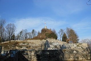
Sappada is a comune (municipality) in the Regional decentralization entity of Udine, in the Italian region of Friuli Venezia Giulia. It is a member of the I Borghi più belli d'Italia association.

<span class="mw-page-title-main">Chiusaforte</span> Comune in Friuli Venezia Giulia, Italy

Chiusaforte is a comune (municipality) in the Regional decentralization entity of Udine in the Italian region of Friuli Venezia Giulia.

Dogna is a comune (municipality) in the Regional decentralization entity of Udine in the Italian region of Friuli Venezia Giulia, located about 100 kilometres (62 mi) northwest of Trieste and about 45 kilometres (28 mi) north of Udine. As of 31 December 2004, it had a population of 235 and an area of 70.0 square kilometres (27.0 sq mi).

<span class="mw-page-title-main">Forni Avoltri</span> Comune in Friuli Venezia Giulia, Italy

Forni Avoltri is a comune (municipality) in the Regional decentralization entity of Udine in the Italian region of Friuli Venezia Giulia, located about 130 kilometres (81 mi) northwest of Trieste and about 70 kilometres (43 mi) northwest of Udine, on the border with Austria. As of 31 December 2004, it had a population of 704 and an area of 80.8 square kilometres (31.2 sq mi).

<span class="mw-page-title-main">Lusevera</span> Comune in Friuli Venezia Giulia, Italy

Lusevera is a comune (municipality) in the Regional decentralization entity of Udine in the Italian region of Friuli Venezia Giulia, located about 80 kilometres (50 mi) northwest of Trieste and about 20 kilometres (12 mi) north of Udine, on the border with Slovenia, and borders the following municipalities: Gemona del Friuli, Kobarid (Slovenia), Montenars, Nimis, Resia, Taipana, Tarcento, and Venzone.

<span class="mw-page-title-main">Malborghetto Valbruna</span> Comune in Friuli Venezia Giulia, Italy

Malborghetto Valbruna is a comune (municipality) in the Regional decentralization entity of Udine in Friuli Venezia Giulia, north-east Italy.

<span class="mw-page-title-main">Moggio Udinese</span> Comune in Friuli Venezia Giulia, Italy

Moggio Udinese is a comune (municipality) in the Regional decentralization entity of Udine in the Italian region of Friuli Venezia Giulia.

Montenars is a comune (municipality) in the Regional decentralization entity of Udine in the Italian region of Friuli Venezia Giulia, located about 80 kilometres (50 mi) northwest of Trieste and about 20 kilometres (12 mi) north of Udine. As of 31 December 2004, it had a population of 554 and an area of 20.6 square kilometres (8.0 sq mi).

<span class="mw-page-title-main">Osoppo</span> Municipality in Friuli-Venezia Giulia, Italy

Osoppo is a comune (municipality) in the Regional decentralization entity of Udine in the Italian region of Friuli Venezia Giulia, located about 90 kilometres (56 mi) northwest of Trieste and about 25 kilometres (16 mi) northwest of Udine.

<span class="mw-page-title-main">Paluzza</span> Comune in Friuli Venezia Giulia, Italy

Paluzza is a comune (municipality) in the Regional decentralization entity of Udine in the Italian region of Friuli Venezia Giulia.

<span class="mw-page-title-main">Paularo</span> Comune in Friuli Venezia Giulia, Italy

Paularo is a comune (municipality) in the Regional decentralization entity of Udine in the Italian region of Friuli Venezia Giulia, located about 110 kilometres (68 mi) northwest of Trieste and about 50 kilometres (31 mi) north of Udine, on the border with Austria.

<span class="mw-page-title-main">Ragogna</span> Comune in Friuli Venezia Giulia, Italy

Ragogna is a comune (municipality) in the Regional decentralization entity of Udine, in the Italian region of Friuli-Venezia Giulia, located about 90 kilometres (56 mi) northwest of Trieste and about 30 kilometres (19 mi) northwest of Udine.

<span class="mw-page-title-main">San Daniele del Friuli</span> Comune in Friuli Venezia Giulia, Italy

San Daniele del Friuli is a comune (municipality) in the province of Udine, in the Italian region of Friuli-Venezia Giulia, located about 80 kilometres (50 mi) northwest of Trieste and about 20 kilometres (12 mi) northwest of Udine.

Terzo d'Aquileia is a comune (municipality) in the Regional decentralization entity of Udine in the Italian region of Friuli Venezia Giulia, located about 40 kilometres (25 mi) northwest of Trieste and about 30 kilometres (19 mi) south of Udine.

<span class="mw-page-title-main">Trasaghis</span> Comune in Friuli Venezia Giulia, Italy

Trasaghis is a comune (municipality) in the Regional decentralization entity of Udine in the Italian region of Friuli Venezia Giulia, located about 90 kilometres (56 mi) northwest of Trieste and about 25 kilometres (16 mi) northwest of Udine.

Varmo is a comune (municipality) in the Regional decentralization entity of Udine in the Italian region of Friuli Venezia Giulia, located about 70 kilometres (43 mi) northwest of Trieste and about 30 kilometres (19 mi) southwest of Udine.

<span class="mw-page-title-main">Tarvisio Boscoverde railway station</span>

Tarvisio Boscoverde is a railway station serving the town of Tarvisio, in the region of Friuli Venezia Giulia, in Northern Italy. The station is managed by Rete Ferroviaria Italiana (RFI). Train services are operated by Trenitalia and ÖBB.

Tarvisio–Udine railway is an Italian railway line that connects Udine and Tarvisio. It is also called the ferrovia Pontebbana in Italian after the town of Pontebba, which was located near the former border between Italy and Austria-Hungary during the first thirty years of its operation.

References

  1. "Superficie di Comuni Province e Regioni italiane al 9 ottobre 2011". Italian National Institute of Statistics. Retrieved 16 March 2019.
  2. "Popolazione Residente al 1° Gennaio 2018". Italian National Institute of Statistics. Retrieved 16 March 2019.
  3. All demographics and other statistics: Italian statistical institute Istat.
  4. "Kundmachungen". Klagenfurter Zeitung (in German). Klagenfurt: ANNO. 1874-12-10. p. 6. Retrieved 2019-09-07.