
The Karimata Strait is a wide strait that connects the South China Sea to the Java Sea, separating the Indonesian islands of Belitung to the west and Borneo (Kalimantan) to the east. It is the widest strait between the South China Sea and the Java Sea, but its numerous islands and reefs reduce its navigability. Its weather and current is influenced by the annual southeast and northwest monsoon.

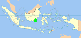
South Kalimantan is a province of Indonesia. It is the smallest province in Kalimantan, the Indonesian territory of Borneo. The provincial capital was Banjarmasin until 15 February 2022 when it was legally moved to Banjarbaru. The population of South Kalimantan was recorded at just over 3.625 million people at the 2010 Census, and at 4.07 million at the 2020 Census. The official estimate as at mid 2021 was 4,112,576. One of the five Indonesian provinces in Kalimantan, it is bordered by the Makassar Strait in the east, Central Kalimantan in the west and north, the Java Sea in the south, and East Kalimantan in the north. The province also includes the island of Laut, located off the eastern coast of Kalimantan. The province is divided into 11 regencies and 2 cities. South Kalimantan is the traditional homeland of the Banjar people, although some parts of East Kalimantan and Central Kalimantan are also included in this criteria. Nevertheless, South Kalimantan, especially the former capital city Banjarmasin has always been the cultural capital of Banjarese culture. Many Banjarese have migrated to other parts of Indonesia, as well as neighbouring countries such as Singapore and Malaysia. In addition, other ethnic groups also inhabit the province, such as several groups of the Dayaks, who mostly live in the interior part of the province, as well as the Javanese, who mostly migrated from Java due to the Transmigration program which dated from the Dutch colonial era.

East Kalimantan is a province of Indonesia. Its territory comprises the eastern portion of Borneo. It had a population of about 3.03 million at the 2010 census, 3.42 million at the 2015 census, and 3.766 million at the 2020 census. The official estimate as at mid 2021 was 3,808,235. Its capital is the city of Samarinda.

The Java Sea is an extensive shallow sea on the Sunda Shelf, between the Indonesian islands of Borneo to the north, Java to the south, Sumatra to the west, and Sulawesi to the east. Karimata Strait to its northwest links it to the South China Sea. It is a part of the western Pacific Ocean.

The Celebes Sea, or Sulawesi Sea, of the western Pacific Ocean is bordered on the north by the Sulu Archipelago and Sulu Sea and Mindanao Island of the Philippines, on the east by the Sangihe Islands chain, on the south by Sulawesi's Minahasa Peninsula, and on the west by northern Kalimantan in Indonesia. It extends 420 miles (675 km) north-south by 520 mi (840 km) east-west and has a total surface area of 110,000 square miles (280,000 km2), to a maximum depth of 20,300 feet (6,200 m). South of the Cape Mangkalihat, the sea opens southwest through the Makassar Strait into the Java Sea.

Makassar Strait is a strait between the islands of Borneo and Sulawesi in Indonesia. To the north it joins the Celebes Sea, while to the south it meets the Java Sea. To the northeast, it forms the Sangkulirang Bay south of the Mangkalihat Peninsula. The strait is an important regional shipping route in Southeast Asia.

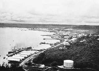
Kotabaru Regency is one of the eleven regencies in the Indonesian province of South Kalimantan. It consists of two parts; the smaller but more populated part comprises Laut Island, the largest island off the coast of Kalimantan, together with the smaller Sebuku Island off Laut Island's east coast and even smaller islands nearby; the larger but less populated part consists of districts on the mainland of Kalimantan. The regency has an area of 9,442.46 km2, and had a population of 290,142 at the 2010 Census and 325,622 at the 2020 Census. The official estimate as at mid 2021 was 329,483. The regency seat is located at the large town of Kotabaru at the northern tip of Laut Island.
The Bali Sea is the body of water north of the island of Bali and south of Kangean Island in Indonesia. The sea forms the south-west part of the Flores Sea, and the Madura Strait opens into it from the west.
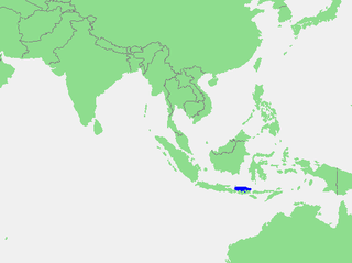
Laut is an island in the Kota Baru Regency in the Indonesian province of South Kalimantan. It has an area of 2,023.76 km2 and a population according to the official estimates as at mid 2021 of 162,591. The town of Kotabaru at the northern tip of the island is the administrative capital of the regency.

The Central Indo-Pacific is a biogeographic region of Earth's seas, comprising the tropical waters of the western Pacific Ocean, the eastern Indian Ocean, and the connecting seas.
Balikpapan Bay, is a bay in Indonesia, near Borneo island close to the city of Balikpapan, East Kalimantan, Indonesia. The Indonesian company Pertamina has its largest oil refinery on the eastern side of the bay.
Gusti Syamsir Alam Airport, or commonly known as Stagen Airport, is an airport on Laut Island in Kotabaru Regency, South Kalimantan, Indonesia.

Aviastar Flight 7503 was a regional flight from Masamba to Makassar, Indonesia. On 2 October 2015, the de Havilland Canada DHC-6 Twin Otter aircraft serving the route went missing with 10 on board near Palopo minutes after takeoff. There was no distress call from the plane.

The Indonesian Maritime Security Agency is a maritime patrol and rescue agency of the Republic of Indonesia. Bakamla is a non-ministerial government institution which reports directly to the President through Coordinating Ministry for Political, Legal, and Security Affairs. Bakamla's duty is to conduct security and safety patrols in the territorial waters of Indonesia and the jurisdiction of Indonesia. Previously Bakamla was a non-structural institution called the Coordinating Agency for the Security of the Republic of Indonesia. The agency is not part or associated with the Indonesian National Armed Forces, although its top-ranking leadership are handpicked from the Indonesian Navy. Bakamla and the Indonesian Navy, however, often conduct exercises and joint-operation together. While during search-and-rescue operations, Bakamla also conduct joint-operations with the National Search and Rescue Agency.

The Natuna Sea is an extensive shallow sea located around the Natuna Regency, extended from south of the Riau Islands, east of the Lingga Regency and west of Borneo, to the Bangka Belitung Islands. The islands of the Badas and Tambelan Archipelago are located at its center. Mostly located within Indonesian territorial waters, this sea is the southernmost portion of the South China Sea, and geologically is the part of Sunda Shelf. It communicates with the Java Sea to its southeast via the Karimata and Gaspar Strait east and west of Belitung, and with the Strait of Malacca to the west via the Berhala and Singapore Strait.

Beras Basah Island is a small island located in the Straits of Makassar and approximately 10 kilometers (6.2 mi) east off the coast of Borneo. Administratively, this island is under the City of Bontang government and Province of East Kalimantan. The island is known to be a tourist destination as a dive site that provides tropical underwater life.

Wawasan Nusantara or Indonesian Archipelagic Vision is the national vision of Indonesia towards their people, nation, and territory of the unitary state of the Republic of Indonesia; which includes its land, sea, also the air and space above it, as a unity of political, economic, social, cultural, defense and security entity. This national insight subsequently becomes the perspective or vision of the nation towards its national goals and ideals.

The Kangean or Kangeanese are an indigenous ethnic group native to the Indonesian island of Kangean, who speak the Kangean language and share common history and culture. There are approximately 127,000 Kangeanese, who mainly lived in the Kangean Archipelago in the northern Bali Sea.
