Lewisville, Oregon | |
|---|---|
 Lewisville, Oregon  Lewisville, Oregon | |
| Coordinates: 44°46′41″N123°20′42″W / 44.778°N 123.345°W | |
| Country | United States |
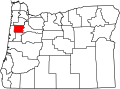
| State | Oregon |
| County | Polk |
| Elevation | 272 ft (83 m) |
| Time zone | UTC-8 (Pacific (PST)) |
| • Summer (DST) | UTC-7 (PDT) |
| ZIP code | 97361 |
| Area codes | 503 and 971 |
| GNIS feature ID | 1163101 [1] |
Lewisville is an unincorporated community in Polk County, Oregon, United States, [1] named for 1845 pioneer David R. Lewis. Its post office opened in 1868 and closed in 1905. Nothing remains of the community. [2]