Lexington, Minnesota

Last updated

Lexington
Anoka Cnty Minnesota Incorporated and Unincorporated areas Lexington Highlighted.png
Location of the city of Lexington
within Anoka County, Minnesota
Coordinates: 45°8′15″N93°10′20″W / 45.13750°N 93.17222°W / 45.13750; -93.17222
CountryUnited States
State Minnesota
County Anoka
Incorporated May 21, 1950
Government
   Mayor Gary Grote
Area
[1]
  Total0.69 sq mi (1.79 km2)
  Land0.69 sq mi (1.79 km2)
  Water0.00 sq mi (0.00 km2)
Elevation
[2]
912 ft (278 m)
Population
 (2020) [3]
  Total2,248
  Estimate 
(2022) [4]
3,072
  Density3,262.70/sq mi (1,259.20/km2)
Time zone UTC–6 (Central (CST))
  Summer (DST) UTC–5 (CDT)
ZIP code
55014
Area code 763
FIPS code 27-36836
GNIS feature ID2395696 [2]
Sales tax 8.125% [5]
Website ci.lexington.mn.us

Lexington is a city in Anoka County, Minnesota, United States, and is a northern suburb of the Twin Cities metropolitan area. The population was 2,248 at the 2020 census. [3]

Contents

Geography

According to the United States Census Bureau, the city has a total area of 0.69 square miles (1.79 km2), all land. [6]

Lake Drive / County 23 serves as a main route in the community. Other routes include Lexington Avenue and Lovell Road. Interstate 35W passes near the city.

The city of Lexington borders Blaine, Circle Pines, and Lino Lakes. The landscape in the area is uniformly flat because the city sits entirely on the Anoka Sand Plain.

Public service

The city of Lexington is served by the Centennial Lakes Police Department, the Lexington Fire Department and the Centennial School District.

Demographics

Historical population
CensusPop.Note
1960 1,457
1970 2,16548.6%
1980 2,150−0.7%
1990 2,2796.0%
2000 2,214−2.9%
2010 2,049−7.5%
2020 2,2489.7%
2022 (est.)3,072 [4] 36.7%
U.S. Decennial Census [7]
2020 Census [3]

2010 census

As of the census of 2010, there were 2,049 people, 787 households, and 519 families living in the city. The population density was 2,969.6 inhabitants per square mile (1,146.6/km2). There were 861 housing units at an average density of 1,247.8 per square mile (481.8/km2). The racial makeup of the city was 87.8% White, 2.7% African American, 1.1% Native American, 3.0% Asian, 0.1% Pacific Islander, 2.6% from other races, and 2.5% from two or more races. Hispanic or Latino of any race were 5.7% of the population.

There were 787 households, of which 34.4% had children under the age of 18 living with them, 43.6% were married couples living together, 15.1% had a female householder with no husband present, 7.2% had a male householder with no wife present, and 34.1% were non-families. 25.7% of all households were made up of individuals, and 4.3% had someone living alone who was 65 years of age or older. The average household size was 2.60 and the average family size was 3.13.

The median age in the city was 34.6 years. 25.5% of residents were under the age of 18; 9.8% were between the ages of 18 and 24; 28.9% were from 25 to 44; 29.1% were from 45 to 64; and 6.5% were 65 years of age or older. The gender makeup of the city was 52.0% male and 48.0% female.

2000 census

As of the census of 2000, there were 2,214 people, 847 households, and 553 families living in the city. The population density was 3,196.1 inhabitants per square mile (1,234.0/km2). There were 879 housing units at an average density of 1,268.9 per square mile (489.9/km2). The racial makeup of the city was 93.36% White, 1.49% African American, 0.95% Native American, 1.36% Asian, 0.09% Pacific Islander, 0.99% from other races, and 1.76% from two or more races. Hispanic or Latino of any race were 2.53% of the population.

There were 847 households, out of which 37.3% had children under the age of 18 living with them, 44.2% were married couples living together, 14.9% had a female householder with no husband present, and 34.6% were non-families. 27.0% of all households were made up of individuals, and 5.7% had someone living alone who was 65 years of age or older. The average household size was 2.61 and the average family size was 3.15.

In the city, the population was spread out, with 29.2% under the age of 18, 9.9% from 18 to 24, 36.9% from 25 to 44, 18.6% from 45 to 64, and 5.5% who were 65 years of age or older. The median age was 32 years. For every 100 females, there were 110.5 males. For every 100 females age 18 and over, there were 112.9 males.

The median income for a household in the city was $41,618, and the median income for a family was $48,047. Males had a median income of $35,903 versus $27,147 for females. The per capita income for the city was $18,944. About 9.6% of families and 10.7% of the population were below the poverty line, including 15.0% of those under age 18 and 12.4% of those age 65 or over.

Related Research Articles

<span class="mw-page-title-main">Hartford, Alabama</span> City in Alabama, United States

Hartford is a city in Geneva County, Alabama, United States. It incorporated in 1896. It is part of the Dothan, Alabama Metropolitan Statistical Area. At the 2020 census, the population was 2,651, an increase over the figure of 2,624 tabulated in 2010.

<span class="mw-page-title-main">Fairbank, Iowa</span> City in Iowa, United States

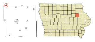
Fairbank is a city in Buchanan and Fayette counties in the U.S. state of Iowa. The population was 1,111 at the time of the 2020 census.

<span class="mw-page-title-main">Salt Lick, Kentucky</span> City in Kentucky, United States

Salt Lick is a home rule-class city in Bath County, Kentucky, in the United States. The population was 303 at the 2010 U.S. Census.

<span class="mw-page-title-main">Rockwood, Michigan</span> City in Michigan, United States

Rockwood is a city in southeastern Wayne County in the U.S. state of Michigan. The population was 3,289 at the 2010 census.

<span class="mw-page-title-main">Andover, Minnesota</span> City in Minnesota, United States

Andover is a city in Anoka County, Minnesota, United States. The population was 32,601 at the 2020 census.

<span class="mw-page-title-main">Circle Pines, Minnesota</span> City in Minnesota, United States

Circle Pines is a city in Anoka County, Minnesota, United States. The population was 5,025 at the 2020 census.

<span class="mw-page-title-main">Columbus, Minnesota</span> City in Minnesota, United States

Columbus is a city in Anoka County, Minnesota, United States. The population was 3,914 at the 2010 census.

<span class="mw-page-title-main">East Bethel, Minnesota</span> City in Minnesota, United States

East Bethel is a city in Anoka County, Minnesota, United States. The population was 11,786 at the 2020 census.

<span class="mw-page-title-main">Ham Lake, Minnesota</span> City in Minnesota, United States

Ham Lake is a city in Anoka County, Minnesota, United States. It is a suburb in the Minneapolis–Saint Paul metropolitan area. The population was 15,296 at the 2010 census. It is in the Anoka-Hennepin School District, one of Minnesota's largest school districts.

<span class="mw-page-title-main">Ramsey, Minnesota</span> City in Minnesota, United States

Ramsey is a suburban city 22 miles (35 km) north-northwest of downtown Minneapolis in Anoka County, Minnesota, United States. The population was 27,646 at the 2020 census. It is a northwest suburb of the Twin Cities.

<span class="mw-page-title-main">Hollandale, Minnesota</span> City in Minnesota, United States

Hollandale is a city on State Highway 251 in Freeborn County, Minnesota, United States. The population was 303 at the 2010 census.

<span class="mw-page-title-main">Marble, Minnesota</span> City in Minnesota, United States

Marble is a city in Itasca County, Minnesota, United States. It is part of the chain of small mining towns known as the Iron Range. The population was 701 at the 2010 census.

<span class="mw-page-title-main">Maplewood, Minnesota</span> City in Minnesota, United States

Maplewood is a city in Ramsey County, Minnesota, United States. The population was 42,088 at the 2020 census. Maplewood is ten minutes' drive from downtown Saint Paul. It stretches along the northern and eastern borders of Saint Paul.

<span class="mw-page-title-main">Hoyt Lakes, Minnesota</span> City in Minnesota, United States

Hoyt Lakes is a city in Saint Louis County, Minnesota. The population was 2,017 at the time of the 2010 census.

<span class="mw-page-title-main">Pleasant Hill, Missouri</span> City in Missouri, United States

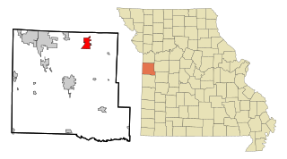
Pleasant Hill is a city in Cass and Jackson counties, Missouri, United States. The population was 8,113 at the 2010 census. It is part of the Kansas City metropolitan area.

<span class="mw-page-title-main">Northwoods, Missouri</span> City in Missouri, United States

Northwoods is a city in St. Louis County, Missouri, United States. The population was 4,227 at the 2010 census.

<span class="mw-page-title-main">Velda City, Missouri</span> City in Missouri, United States

Velda City is a city in St. Louis County, Missouri, United States. The population was 1,420 at the 2010 census.

<span class="mw-page-title-main">Centerville, Minnesota</span> City in Minnesota, United States

Centerville is a city in Anoka County, Minnesota, United States. The population was 3,896 at the 2020 census.

<span class="mw-page-title-main">Shawnee, Perry County, Ohio</span> Village in Ohio, United States

Shawnee is a village in Perry County, Ohio, United States. The population was 505 at the 2020 census. It is 9 miles (14 km) south of the county seat of New Lexington.

<span class="mw-page-title-main">Spring Lake Park, Minnesota</span> City in Minnesota, United States

Spring Lake Park is a city in Anoka and Ramsey counties in the state of Minnesota. The population was 6,412 at the 2010 census. The city is located mainly within Anoka County. Minnesota State Highways 47 and 65 and County Highway 10 are three of the main routes in the city.

References

  1. "2020 U.S. Gazetteer Files". United States Census Bureau. Retrieved July 24, 2022.
  2. 1 2 U.S. Geological Survey Geographic Names Information System: Lexington, Minnesota
  3. 1 2 3 "Explore Census Data". United States Census Bureau . Retrieved January 9, 2024.
  4. 1 2 "City and Town Population Totals: 2020-2022". United States Census Bureau. January 9, 2024. Retrieved January 9, 2024.
  5. "Lexington (MN) sales tax rate" . Retrieved January 9, 2024.
  6. "US Gazetteer files 2010". United States Census Bureau. Archived from the original on January 12, 2012. Retrieved November 13, 2012.
  7. United States Census Bureau. "Census of Population and Housing" . Retrieved June 4, 2015.