See also
Cave topics | |
|---|---|
| Main topics | |
| Types and formation processes | |
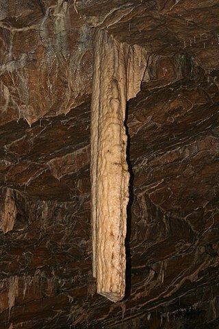
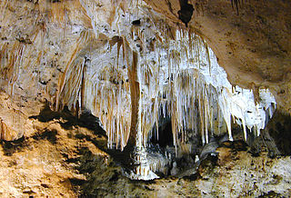
| Speleothems and Speleogens (Cave formations) | |
| Dwellings | |
| Popular culture | |
| Incidents | |
| Authority control databases: National |
|---|
Arkansas, with its karst topography, is home to many caves. This list compiles those with Wikipedia articles.
| Authority control databases: National |
|---|

Cave-diving is underwater diving in water-filled caves. It may be done as an extreme sport, a way of exploring flooded caves for scientific investigation, or for the search for and recovery of divers or, as in the 2018 Thai cave rescue, other cave users. The equipment used varies depending on the circumstances, and ranges from breath hold to surface supplied, but almost all cave-diving is done using scuba equipment, often in specialised configurations with redundancies such as sidemount or backmounted twinset. Recreational cave-diving is generally considered to be a type of technical diving due to the lack of a free surface during large parts of the dive, and often involves planned decompression stops. A distinction is made by recreational diver training agencies between cave-diving and cavern-diving, where cavern diving is deemed to be diving in those parts of a cave where the exit to open water can be seen by natural light. An arbitrary distance limit to the open water surface may also be specified.

Kents Cavern is a cave system in Torquay, Devon, England. It is notable both for its archaeological and geological features. The cave system is open to the public and has been a geological Site of Special Scientific Interest since 1952 and a Scheduled Ancient Monument since 1957.

Alabaster Caverns State Park is a 200-acre (0.81 km2) state park approximately 4.5 miles (7.2 km) south of Freedom, Oklahoma, United States near Oklahoma State Highway 50. The park attracted 24,706 visitors in FY 2016, The lowest count of the three parks in its part of Oklahoma. According to the Encyclopedia of Oklahoma History and Culture, the park previously attracted about 40,000 visitors per year. It is home to the largest natural gypsum cave in the world that is open to the public. The gypsum is mostly in the form of alabaster. There are several types of alabaster found at the site, including pink, white, and the rare black alabaster. This black alabaster can be found in only three veins in the world, one each in Oklahoma, Italy and China. Another form of gypsum can be found in the many selenite crystal formations.

Bulmer Cavern is New Zealand's longest cave system, running for 74.3 km (46.2 mi) through Mount Owen in the Tasman region of the northwest South Island. John Patterson discovered the cave on New Year's Day 1984, by dropping a rock down and counting the seconds until it reached the bottom.

A show cave—also called tourist cave, public cave, and, in the United States, commercial cave—is a cave which has been made accessible to the public for guided visits.

Thor's Cave is a natural cavern located at SK09865496 in the Manifold Valley of the White Peak in Staffordshire, England. It is classified as a karst cave. Located in a steep limestone crag, the cave entrance, a symmetrical arch 7.5 metres wide and 10 metres high, is prominently visible from the valley bottom, around 80 metres (260 feet) below. Reached by an easy stepped path from the Manifold Way, the cave is a popular tourist spot, with views over the Manifold Valley. The second entrance is known as the "West Window", below which is a second cave, Thor's Fissure Cavern.

Dos Ojos is part of a flooded cave system located north of Tulum, on the Caribbean coast of the Yucatán Peninsula, in the state of Quintana Roo, Mexico. The exploration of Dos Ojos began in 1987 and still continues. The surveyed extent of the cave system is 82 kilometers (51 mi) and there are 28 known sinkhole entrances, which are locally called cenotes. In January 2018, a connection was found between Sistema Dos Ojos and Sistema Sac Actun. The smaller Dos Ojos became a part of Sac Actun, making the Sistema Sac Actun the longest known underwater cave system in the world.

Moaning Caverns is a solutional cave located in the Calaveras County, California, near Vallecito, California in the heart of the state's Gold Country. It is developed in marble of the Calaveras Formation. It was discovered in modern times by gold miners in 1851, but it has long been known as an interesting geological feature by prehistoric peoples. It gets its name from the moaning sound that echoed out of the cave luring people to the entrance, however expansion of the opening to allow access for the public disrupted the sounds. The portion of the cave developed for tourists consists of a spacious vertical shaft 165 feet tall, which is descended by a combination of stairs and a unique 100-foot-high (30 m) spiral staircase built in the early 1900s. It is open to the public for walking tours and spelunking. Including the off-trail areas, the cave reaches a depth of 410 feet.

Lewis and Clark Caverns State Park is a 3,000-acre (1,200 ha) public recreation and nature preservation area located twelve miles (19 km) east of Whitehall in Jefferson County, Montana. The state park includes two visitor centers, ten miles of hiking trails, a campground, and its namesake limestone caverns. The Lewis and Clark Caverns Historic District was placed on the National Register of Historic Places in 2018.
Poole's Cavern or Poole's Hole is a two-million-year-old natural limestone cave on the edge of Buxton in the Peak District, in the county of Derbyshire, England.
Carlsbad Caverns National Park is a national park of the United States in the Guadalupe Mountains of southeastern New Mexico. The primary attraction of the park is the show cave Carlsbad Cavern. Visitors to the cave can hike in on their own via the natural entrance or take an elevator from the visitor center.

Longhorn Cavern State Park is a state park located in Burnet County, Texas, United States. The Texas Parks and Wildlife Department is administrator of the facility. The land for Longhorn Cavern State Park was acquired between 1932 and 1937 from private owners. It was dedicated as a state park in 1932 and in 1938 was opened to the public. In 1971, the cavern was dedicated as a National Natural Landmark. The park's administration building was listed as a Recorded Texas Historic Landmark in 1989.

Onondaga Cave State Park is a Missouri state park located on the Meramec River approximately 5 miles (8.0 km) southeast of the village of Leasburg. The park was established in 1982. Park activities include cave tours, camping, fishing, hiking, picnicking, and swimming.

Aggtelek is a village in the county of Borsod-Abaúj-Zemplén, Hungary. It is known for the vast stalactite caverns of the nearby Baradla-Domica cave system, part of the UNESCO World Heritage Site of Aggtelek and Slovak Karst.
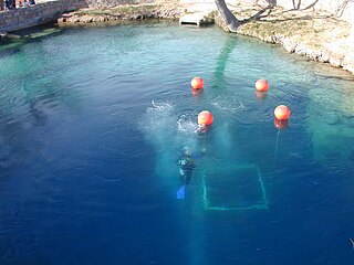
The Blue Hole of Santa Rosa, or simply the Blue Hole, is a circular, bell-shaped pool or small lake located along Route 66 east of Santa Rosa, New Mexico that is a tourist attraction and swimming venue, and one of the most popular dive destinations in the US for scuba diving and training. The Blue Hole is an artesian well and cenote that was once used as a fish hatchery.

The Cavern deities of the underworld were ancient Egyptian minor deities charged with punishing the damned souls by beheading and devouring them.
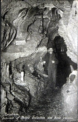
Windmill Hill Cavern is a limestone cave system in the town of Brixham, Devon. It was discovered in 1858 and later excavated by a team led by the geologist William Pengelly, who found proof that humans co-existed with extinct British fauna.