Related Research Articles

Caving – also known as spelunking in the United States and Canada and potholing in the United Kingdom and Ireland – is the recreational pastime of exploring wild cave systems. In contrast, speleology is the scientific study of caves and the cave environment.

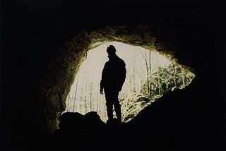
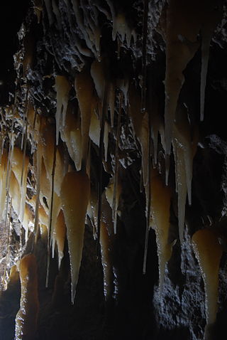
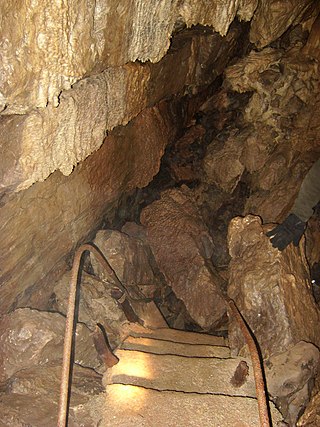
A cave or cavern is a natural void in the ground, specifically a space large enough for a human to enter. Caves often form by the weathering of rock and often extend deep underground. The word cave can refer to smaller openings such as sea caves, rock shelters, and grottos, that extend a relatively short distance into the rock and they are called exogene caves. Caves which extend further underground than the opening is wide are called endogene caves.

Karst is a topography formed from the dissolution of soluble rocks such as limestone, dolomite, and gypsum. It is characterized by underground drainage systems with sinkholes and caves. It has also been documented for more weathering-resistant rocks, such as quartzite, given the right conditions. Subterranean drainage may limit surface water, with few to no rivers or lakes. However, in regions where the dissolved bedrock is covered or confined by one or more superimposed non-soluble rock strata, distinctive karst features may occur only at subsurface levels and can be totally missing above ground.
Speleology is the scientific study of caves and other karst features, as well as their make-up, structure, physical properties, history, life forms, and the processes by which they form (speleogenesis) and change over time (speleomorphology). The term speleology is also sometimes applied to the recreational activity of exploring caves, but this is more properly known as caving, potholing, or spelunking. Speleology and caving are often connected, as the physical skills required for in situ study are the same.
Krubera Cave is the second-deepest-known cave on Earth, after the Veryovkina Cave. It is located in the Arabika Massif of the Gagra Range of the Western Caucasus, in the Gagra District of Abkhazia, a breakaway region of Georgia.
Stygofauna are any fauna that live in groundwater systems or aquifers, such as caves, fissures and vugs. Stygofauna and troglofauna are the two types of subterranean fauna. Both are associated with subterranean environments – stygofauna are associated with water, and troglofauna with caves and spaces above the water table. Stygofauna can live within freshwater aquifers and within the pore spaces of limestone, calcrete or laterite, whilst larger animals can be found in cave waters and wells. Stygofaunal animals, like troglofauna, are divided into three groups based on their life history - stygophiles, stygoxenes, and stygobites.
- Stygophiles inhabit both surface and subterranean aquatic environments, but are not necessarily restricted to either.
- Stygoxenes are like stygophiles, except they are defined as accidental or occasional presence in subterranean waters. Stygophiles and stygoxenes may live for part of their lives in caves, but don't complete their life cycle in them.
- Stygobites are obligate, or strictly subterranean, aquatic animals and complete their entire life in this environment.

Aillwee Cave is a cave system in the karst landscape of the Burren in County Clare, Ireland. The name Aillwee is derived from the Irish Aill Bhuí which means "yellow cliff". Privately owned, it forms part of the Aillwee Cave and Birds of Prey Centre attraction.

The Marble Arch Caves are a series of natural limestone caves located near the village of Florencecourt in County Fermanagh, Northern Ireland. The caves are named after the nearby Marble Arch, a natural limestone arch at the upstream end of Cladagh Glen under which the Cladagh River flows. The caves are formed from three rivers draining off the northern slopes of Cuilcagh mountain, which combine underground to form the Cladagh. On the surface, the river emerges from the largest karst resurgence in Ireland, and one of the largest in the United Kingdom. At 11.5 kilometres (7.1 mi) the Marble Arch Caves form the longest known cave system in Northern Ireland, and the karst is considered to be among the finest in the British Isles.
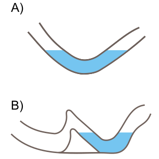
A sump, or siphon, is a passage in a cave that is submerged under water. A sump may be static, with no inward or outward flow, or active, with continuous through-flow. Static sumps may also be connected underwater to active stream passage. When short in length, a sump may be called a duck, however this can also refer to a section or passage with some (minimal) airspace above the water.

Crag Cave is a cave in Ireland, located just outside Castleisland, County Kerry.
Langcliffe Pot is a cave system on the slopes of Great Whernside in Upper Wharfedale, about 3 kilometres (1.9 mi) SSE of Kettlewell in North Yorkshire. It is part of the Black Keld Site of Special Scientific Interest where the "underground drainage system which feeds the stream resurgence at Black Keld is one of the largest and deepest in Britain, although only a small proportion of its cave passages are accessible at present." Mossdale Caverns is also part of the Black Keld SSSI. Although a considerable length of passage has been explored in Langcliffe Pot, the current end is over 170 metres (560 ft) above the resurgence, and over 4 kilometres (2.5 mi) in distance. A trip to the far end has been described as "one of the most serious undertakings in British Caving".
Shannon Cave is an active stream passage cave which straddles the border of County Fermanagh, Northern Ireland and County Cavan in the Republic of Ireland.
The Caves of the Tullybrack and Belmore hills are a collection of caves in southwest County Fermanagh, Northern Ireland. The region is also described as the West Fermanagh Scarplands by environmental agencies and shares many similar karst features with the nearby Marble Arch Caves Global Geopark.

The Friouato caves, also known as Gouffre de Friouato, are located about 30 km south of the city of Taza, Morocco. The farthest explored known point is about 272 meters, but its limit is still unknown. Experts believe that it is approximately six kilometers long. There are signs of an underground river believed to flow near the Grottes of Chiker. People of the nearby village say that there have been many explorers visiting the cave, some of whom never came back. A cave diving expedition by Exeter University Speleological Society passed two static sumps in 1969 to discover more large chambers and shafts. The system ends in a massive choke of boulders. This may well be the same massive choke of boulders that can be seen at the end of the upstream passages of the nearby Grotte du Chiker; this choke was also discovered in 1969 by the same group of cavers. Images of both cave systems were taken in 1976 during an expedition by the Cerberus Speleological Society from the UK.
The Nidderdale Caves are a series of caves in Upper Nidderdale in North Yorkshire, England. There are two cave systems and most of the caves are in some way linked with one or the other. The smaller system is the Eglin cave system in the valley of How Stean Beck, a tributary of the River Nidd, associated with How Stean Gorge. The larger system is the Goyden cave system under the valley of the River Nidd, which flows east from Scar House Reservoir, then south, and shortly after disappears underground down several sink holes to reappear at the rising just beyond the village of Lofthouse. Cavers are able to access several sections of this system via the different entrances.

Short Drop Cave and Gavel Pot are different entrances into the same cave system on Leck Fell, in Lancashire, England. The main top entrance, Short Drop Cave, is a small hole in a fenced off shakehole near the main stream sink; Gavel Pot, a window into the system, is a large fenced shakehole some 40-metre (130 ft) deep requiring tackle to descend. There are two other smaller entrances into Short Drop Cave. At its base the system links via a sump with Lost Johns' Cave, and is part of the Three Counties System, an 87 kilometres (54 mi) cave system which spans the borders of Cumbria, Lancashire, and North Yorkshire.

The Cliefden Caves ia heritage-listed geoheritage site in Mandurama, Cowra Shire, New South Wales, Australia. The caves comprises Ordovician fossil localities, limestone caves, a spring and tufa dams, and a site where limestone was first discovered in inland Australia.
Skirwith Cave is a major resurgence solutional cave on Ingleborough in Chapel-le-Dale, North Yorkshire, England; it was a show cave between 1964 and 1974. It is no longer open to the public but is still visited by cavers. It lies within the designated Ingleborough Site of Special Scientific Interest.

The Long Kin East Cave - Rift Pot system is a limestone cave system on the southern flanks of Ingleborough, North Yorkshire in England lying within the designated Ingleborough Site of Special Scientific Interest. Long Kin East Cave starts as a long meandering stream passage but then plummets down a 58-metre (190 ft) deep shaft when it meets a shattered fault into which Rift Pot also descends. At the bottom, the stream flows through some low canals and sumps, to eventually emerge at Austwick Beck Head in Crummackdale.

Cave diving is underwater diving in water-filled caves. The equipment used varies depending on the circumstances, and ranges from breath hold to surface supplied, but almost all cave diving is done using scuba equipment, often in specialised configurations with redundancies such as sidemount or backmounted twinset. Recreational cave diving is generally considered to be a type of technical diving due to the lack of a free surface during large parts of the dive, and often involves planned decompression stops. A distinction is made by recreational diver training agencies between cave diving and cavern diving, where cavern diving is deemed to be diving in those parts of a cave where the exit to open water can be seen by natural light. An arbitrary distance limit to the open water surface may also be specified. Despite the risks, water-filled caves attract scuba divers, cavers, and speleologists due to their often unexplored nature, and present divers with a technical diving challenge.
References
- ↑ "Natural Entrance Self-Guided Tour". National Park Service. Archived from the original on 2017-09-29.
- 1 2 3 4 "Caves & Caving: Glossary". uppercumberlandcaving.net.
- ↑ "caver". dictionary.cambridge.org.
- ↑ "What You Need to Know About Spelunking". Travel Channel.
- 1 2 3 "The Western Australian Speleological Group". www.wasg.org.au.