
In karst geology, estavelle or inversac is a ground orifice which, depending on weather conditions and season, can serve either as a sink or as a source of fresh water. It is a type of ponor or sinkhole. [1] [2]
In karst geology, estavelle or inversac is a ground orifice which, depending on weather conditions and season, can serve either as a sink or as a source of fresh water. It is a type of ponor or sinkhole. [1] [2]

Karst is a topography formed from the dissolution of soluble carbonate rocks such as limestone, dolomite, and gypsum. It is characterized by features like poljes above and drainage systems with sinkholes and caves underground. More weathering-resistant rocks, such as quartzite, can also occur, given the right conditions.

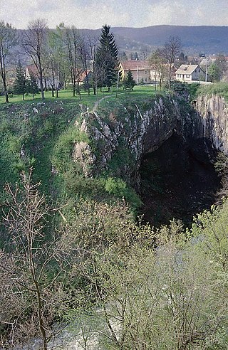
A sinkhole is a depression or hole in the ground caused by some form of collapse of the surface layer. The term is sometimes used to refer to doline, enclosed depressions that are also known as shakeholes, and to openings where surface water enters into underground passages known as ponor, swallow hole or swallet. A cenote is a type of sinkhole that exposes groundwater underneath. Sink and stream sink are more general terms for sites that drain surface water, possibly by infiltration into sediment or crumbled rock.

Paparoa National Park is on the west coast of the South Island of New Zealand. The park was established in 1987 and encompasses 430 km2 (170 sq mi). The park ranges from or near the coastline to the peaks of the Paparoa Range. A separate section of the park lies to the north and is centred at Ananui Creek. The park protects a limestone karst area. The park contains several caves, of which Metro Cave / Te Ananui Cave is a commercial tourist attraction. The majority of the park is forested with a wide variety of vegetation. The park was the site of the 1995 Cave Creek disaster where fourteen people died as a result of the collapse of a scenic viewing platform.

A polje, also called karst polje or karst field, is a large flat plain found in karstic geological regions of the world, with areas usually in the range of 5–400 km2 (2–154 sq mi). The name derives from the Slavic languages, where polje literally means 'field', whereas in English polje specifically refers to a karst plain or karst field.

Ha Ha Tonka State Park is a public recreation area encompassing over 5,000 acres (2,000 ha) on the Niangua arm of the Lake of the Ozarks, about five miles south of Camdenton, Missouri, in the United States. The state park's most notable feature is the ruins of Ha Ha Tonka, an early 20th-century stone mansion that was modeled after European castles of the 16th century.
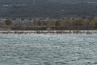
Buško Lake, also known as Buško Blato or Buško Jezero is an accumulation lake located near the Croatian border on the south side of Livanjsko Polje and northwest of Duvanjsko Polje in Canton 10, a canton of the Federation of Bosnia and Herzegovina, one of the two entities of Bosnia and Herzegovina. The name is also a reference to the area surrounding the lake which includes a number of villages, of which Prisoje is the largest.
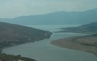
The Trebišnjica is a river in Bosnia and Herzegovina, and the right tributary of the Neretva. Before it was utilized for hydro exploitation via various hydrotechnical interventions and systems with different purposes, Trebišnjica used to be a sinking river, rising and sinking through its course before resurfacing at various places from the Neretva river below the Čapljina to the Adriatic coast, and along the coast from the Neretva Delta to Sutorina.
Speleogenesis is the origin and development of caves, the primary process that determines essential features of the hydrogeology of karst and guides its evolution. It often deals with the development of caves through limestone, caused by the presence of water with carbon dioxide dissolved within it, producing carbonic acid which permits the dissociation of the calcium carbonate in the limestone.

Giant's Hole is a well-known cave near Castleton in Derbyshire, consisting mostly of large passages. It is a stream-way cave, and part of the Karst topography of the area.
A ponor is a natural opening where surface water enters into underground passages; they may be found in karst landscapes where the geology and the geomorphology is typically dominated by porous limestone rock. Ponors can drain stream or lake water continuously or can at times work as springs, similar to estavelles. Morphologically, ponors come in forms of large pits and caves, large fissures and caverns, networks of smaller cracks, and sedimentary, alluvial drains.

An underground lake is a lake underneath the surface of the Earth. Most naturally occurring underground lakes are found in areas of karst topography, where limestone or other soluble rock has been weathered away, leaving a cave where water can flow and accumulate.
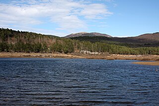
Lake Palčje is an intermittent lake in the Pivka basin north of the settlement Palčje in the Inner Carniola region of Slovenia. It fills an oval-shaped karst depression, crossed by Pivka, and approximately 1.5 km (0.93 mi) long and 0.5 km (0.31 mi) wide. Its bottom is relatively level at between 543 and 557 m above the sea, but the banks are steep. Lake Palčje is the largest among the Pivka Lakes with average maximum water area around 1 km2 (0.39 sq mi).

A karst spring or karstic spring is a spring that is part of a karst hydrological system.

Žabljak is a river near Livno in Western Bosnia, Bosnia and Herzegovina. It flows for roughly 6.6 kilometers westward through Livanjsko Polje before its confluence with the Bistrica, just upstream from beginning of its section with artificially created riverbed, from where river begins to turn southward toward Buško Blato.

The Municipality of Mirna Peč is a municipality in southeast Slovenia, located in the traditional region of Lower Carniola. The seat of the municipality, which was established in 1998, is Mirna Peč. With an estimated population of 2,800, the municipality is included in the Southeast Slovenia Statistical Region.

The Račna Karst Field is a karst field in the northern edge of the Lower Carniolan karst area, south of Grosuplje, Slovenia. It has rich natural and cultural value. Because of its ecological significance, it is anticipated that a nature park will be established there and that it will be included in the Natura 2000 program.

The Zalomka is a karstic river in the southern part of Bosnia and Herzegovina, and as part of the Neretva river system it is one of the largest sinking rivers in the country and Dinarides. It rises under the Morine plateau, near Brajićevići village in Gacko municipality, but also collects its upper course waters from Gatačko Polje.

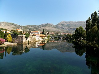
Trebišnjica wellspring-group is a system of two geographically and hydrologically distinct principal groupings of strong karstic springs, Trebišnjica and Čeplica, which together constitute source of the Trebišnjica river. Wellsprings are located just below town of Bileća in Bosnia and Herzegovina. The entire area where founts are situated is submerged under Bilećko Lake since 1967, formed after the construction of Trebinje-1 Hydroelectric Power Station and its large arch dam at Grnčarevo village.
Mostarsko Blato is a karst field and a seasonal karstic wetland (blato), forming as waters are collecting in a temporary karstic lake during a springtime. Blato is situated in the area of Široki Brijeg and Mostar, in Bosnia and Herzegovina. On the edge of the field are numerous villages and settlements.
| | This geology article is a stub. You can help Wikipedia by expanding it. |