Image Crossing Carries or connects Location Built Length Notes Coordinates William Felton "Bill" Russell Bridge (formerly Charlestown Bridge) [ 1] Route 99 (N. Washington St) Boston to Charlestown 1900 331.9 meters (1,089 ft) [ 2] The MBTA Orange Line used this bridge , before the upstream tunnel was completed in 1975. Site of a ferry established in 1630; [ 3] obsoleted by the Charles River Bridge, built 1786
42°22′08″N 71°03′36″W / 42.36889°N 71.06000°W / 42.36889; -71.06000 (Charlestown Bridge ) (New) Charles River Dam pedestrians and bikers 1978 Fish ladder, pumps and three locks for navigation. Site of the Warren Bridge , built 1828, demolished 1962.
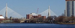
42°22′07″N 71°03′41.10″W / 42.36861°N 71.0614167°W / 42.36861; -71.0614167 (Charles River locks ) Leonard P. Zakim Bunker Hill Bridge I-93 / US 1 2003 442.2 meters (1,451 ft) [ 2] Replaced Charlestown High Bridge , built 1956, demolished 2004 42°22′08″N 71°03′49″W / 42.36889°N 71.06361°W / 42.36889; -71.06361 (Leonard P. Zakim Bunker Hill Bridge ) Haymarket North Extension tunnel MBTA Orange Line 1975 Leverett Circle Connector Bridge I-93 exit 18 onramp and offramp Boston to Cambridge 1999 253 meters (830 ft) [ 2] 42°22′08″N 71°03′52″W / 42.36889°N 71.06444°W / 42.36889; -71.06444 (Leverett Circle Connector Bridge ) MBTA Commuter Rail Charles River Bridge MBTA Commuter Rail at North Station 1931 Bascule drawbridge Site of Boston and Lowell Railroad Charles River Bridge, built 1835, first movable railroad bridge in the United States [ 4]
42°22′8.29″N 71°03′54.96″W / 42.3689694°N 71.0652667°W / 42.3689694; -71.0652667 (MBTA Commuter Rail ) MBTA Green Line Lechmere Viaduct MBTA Green Line 1912 42°22′2.32″N 71°04′8.29″W / 42.3673111°N 71.0689694°W / 42.3673111; -71.0689694 (MBTA Green Line ) (Old) Charles River Dam Bridge Route 28 (Charles River Dam Rd)1910 25 meters (82 ft) [ 2] The Boston Museum of Science is located on this bridge 42°22′01.66″N 71°04′08.87″W / 42.3671278°N 71.0691306°W / 42.3671278; -71.0691306 (Charles River Dam Bridge ) Longfellow Bridge Route 3 (Main St/Cambridge St)MBTA Red Line 1907 650.7 meters (2,135 ft) [ 2] MBTA Red Line in median; built in 1907 as the Cambridge Bridge, renamed for Henry Wadsworth Longfellow in 1927. Site of West Boston Bridge , built 1793
42°21′41″N 71°04′32″W / 42.36139°N 71.07556°W / 42.36139; -71.07556 (Longfellow Bridge ) Harvard Bridge Route 2A ( Massachusetts Avenue ) 1891, 1909 (rebuilt), 1924 (overhaul), 1990 (rebuilt) 659.9 meters (2,165 ft) [ 2] Longest bridge over the Charles. Northern terminus at MIT , not Harvard University . 42°21′15″N 71°05′28″W / 42.35417°N 71.09111°W / 42.35417; -71.09111 (Harvard Bridge ) Boston University Bridge Route 2 1927 built as the Cottage Farm Bridge, renamed in 1949 42°21′09.12″N 71°06′38.26″W / 42.3525333°N 71.1106278°W / 42.3525333; -71.1106278 (Boston University Bridge ) Grand Junction Railroad Bridge MBTA Grand Junction Branch crosses the river under the Boston University Bridge 42°21′09.69″N 71°06′36.72″W / 42.3526917°N 71.1102000°W / 42.3526917; -71.1102000 (Grand Junction Railroad bridge ) River Street Bridge River St/Cambridge St 1926 42°21′41″N 71°07′00″W / 42.36139°N 71.11667°W / 42.36139; -71.11667 (River Street Bridge ) Western Avenue Bridge Western Avenue 1924 85.3 meters (280 ft) [ 2] 42°21′51.25″N 71°07′01.13″W / 42.3642361°N 71.1169806°W / 42.3642361; -71.1169806 (Western Avenue Bridge ) John W. Weeks Bridge pedestrians 1926 the only footbridge across the basin, with a Harvard campus steam tunnel inside 42°22′6.63″N 71°07′05.26″W / 42.3685083°N 71.1181278°W / 42.3685083; -71.1181278 (John W. Weeks Bridge ) Anderson Memorial Bridge N. Harvard Street/JFK Street 1912 70.7 meters (232 ft) [ 2] A memorial to Nicholas Longworth Anderson donated by his son Larz Anderson Site of a ferry established 1635 at the foot of Dunster Street in Cambridge, at canal/creek; [ 5] obsoleted by Great Bridge , [ 6] built 1662, rebuilt 1862
42°22′08″N 71°07′23″W / 42.36889°N 71.12306°W / 42.36889; -71.12306 (Anderson Memorial Bridge ) Eliot Bridge Soldiers Field Rd , Memorial Drive 1950 91.4 meters (300 ft) [ 2] a memorial to Charles W. Eliot , Harvard president 1869–1909, and his son Charles Eliot , landscape architect for the Metropolitan Park Commission 42°22′18″N 71°07′59″W / 42.37167°N 71.13306°W / 42.37167; -71.13306 (Eliot Bridge ) Arsenal Street Bridge Arsenal St/Western Ave Brighton to Watertown 1925 61.9 meters (203 ft) [ 2] 42°21′42″N 71°08′50″W / 42.36167°N 71.14722°W / 42.36167; -71.14722 (Arsenal Street Bridge ) North Beacon Street Bridge US 20 1917 62.5 meters (205 ft) [ 2] 42°21′32″N 71°09′42″W / 42.35889°N 71.16167°W / 42.35889; -71.16167 (North Beacon Street Bridge ) Watertown Bridge Route 16 (Galen Street) Watertown about 1907 27.4 meters (90 ft) [ 2] 42°21′53″N 71°11′08″W / 42.36472°N 71.18556°W / 42.36472; -71.18556 (Watertown Bridge ) Watertown Dam no crossing 1900 The Charles River Watershed Association has proposed removal of the dam. [ 7] 42°21′55.27″N 71°11′21.34″W / 42.3653528°N 71.1892611°W / 42.3653528; -71.1892611 (Watertown Dam ) Cpl. Joseph U. Thompson Footbridge pedestrians and bicycles Demolished 2017 [ 8] 42°21′54.39″N 71°11′24.97″W / 42.3651083°N 71.1902694°W / 42.3651083; -71.1902694 (Pedestrian bridge ) Cpl. Joseph U. Thompson Footbridge (new) 2018 Replaced old span Bridge Street Bridge Bridge St Newton to Watertown 29.3 meters (96 ft) [ 2] 42°21′56.87″N 71°12′15.96″W / 42.3657972°N 71.2044333°W / 42.3657972; -71.2044333 (Bridge Street ) Bemis Dam (breached) no crossing 1821 [ 9] breached 1944 42°21′56.58″N 71°12′17.92″W / 42.3657167°N 71.2049778°W / 42.3657167; -71.2049778 (Bemis Dam ) Blue Heron Footbridge Charles River Bike Path 2005 42°21′53.33″N 71°12′45.85″W / 42.3648139°N 71.2127361°W / 42.3648139; -71.2127361 (Blue Heron Footbridge ) Farwell Street Bridge Farwell St Waltham 33.4 meters (110 ft) [ 2] 42°22′1.3″N 71°13′5.1″W / 42.367028°N 71.218083°W / 42.367028; -71.218083 (Farwell Street bridge ) Bleachery Footbridge Former pedestrian bridge site, demolished 1960s. 42°22′8.2″N 71°13′20.4″W / 42.368944°N 71.222333°W / 42.368944; -71.222333 (Bleachery Footbridge ) Bleachery Dam no crossing 1794 originally Gore Paper Mill dam 42°22′8.83″N 71°13′22.74″W / 42.3691194°N 71.2229833°W / 42.3691194; -71.2229833 (Bleachery Dam ) Mary T. Early Footbridge 2004 formerly Calvary Street Footbridge 42°22′10.74″N 71°13′25.94″W / 42.3696500°N 71.2238722°W / 42.3696500; -71.2238722 (Mary T. Early Footbridge ) Boston & Maine Railroad trestle (abandoned)abandoned Watertown Branch Railroad Demolished in 2016 42°22′11.11″N 71°13′26.29″W / 42.3697528°N 71.2239694°W / 42.3697528; -71.2239694 (Boston & Maine Railroad bridge ) Charles F. Graceffa Bridge Newton Street 1877 27.4 meters (90 ft) [ 2] 42°22′21.10″N 71°13′43.51″W / 42.3725278°N 71.2287528°W / 42.3725278; -71.2287528 (Newton Street bridge ) Elm Street Bridge Elm St 71.9 meters (236 ft) [ 2] 42°22′22.87″N 71°13′57.19″W / 42.3730194°N 71.2325528°W / 42.3730194; -71.2325528 (Elm Street bridge ) Boston & Maine Railroad trestle (abandoned)abandoned Watertown Branch Demolished in 2015 42°22′22.21″N 71°13′59.12″W / 42.3728361°N 71.2330889°W / 42.3728361; -71.2330889 (Boston & Maine Railroad bridge ) Richard Landry Park footbridge 1978 42°22′20.59″N 71°14′5.95″W / 42.3723861°N 71.2349861°W / 42.3723861; -71.2349861 (Richard Landry Park footbridge ) Waltham Dam or Moody Street Dam 1836 original Eden Vale dam built 1785 42°22′22.87″N 71°14′10.24″W / 42.3730194°N 71.2361778°W / 42.3730194; -71.2361778 (Moody Street Dam ) Moody Street bridge 1946 68.6 meters (225 ft) [ 2] original built 1846, rebuilt 1871, 1921 42°22′23.61″N 71°14′11.63″W / 42.3732250°N 71.2365639°W / 42.3732250; -71.2365639 (Moody Street bridge ) Gold Star Mothers Bridge 1889 40.2 meters (132 ft) [ 2] Carries Prospect Street; drawbridge 1882 42°22′7.91″N 71°14′36.93″W / 42.3688639°N 71.2435917°W / 42.3688639; -71.2435917 (Gold Star Mothers bridge ) Commonwealth Avenue /South Avenue Bridge Route 30 Newton to Weston site of old Norumbega Bridge 42°20′38.27″N 71°15′41.01″W / 42.3439639°N 71.2613917°W / 42.3439639; -71.2613917 (Commonwealth Avenue (MA 30) bridge ) I-90/I-95 connector I-90 / I-95 original Mass Pike terminus until 1964 42°20′29.76″N 71°15′42.51″W / 42.3416000°N 71.2618083°W / 42.3416000; -71.2618083 (I-90 / I-95 connector bridge ) Massachusetts Turnpike Boston Extension (Interstate 90 ) I-90 316.1 meters (1,037 ft) [ 2] 42°20′27.53″N 71°15′39.42″W / 42.3409806°N 71.2609500°W / 42.3409806; -71.2609500 (I-90 (Massachusetts Turnpike) bridge ) I-90/I-95 connector I-90 / I-95 42°20′27.62″N 71°15′34.98″W / 42.3410056°N 71.2597167°W / 42.3410056; -71.2597167 (I-90 / I-95 connector bridge ) Footbridge from Riverside Rd., Newton to Recreation Rd., Weston pedestrians demolished 2023; replacement under construction, scheduled for completion in 2025 [ 10] 42°20′28.36″N 71°15′29.73″W / 42.3412111°N 71.2582583°W / 42.3412111; -71.2582583 (Newton / Weston pedestrian bridge ) Archived September 26, 2015, at the Wayback Machine Road bridge from Riverside Rd., Newton to Recreation Rd., Weston demolished 1960s around time of Massachusetts Turnpike Extension 42°20′28.36″N 71°15′29.73″W / 42.3412111°N 71.2582583°W / 42.3412111; -71.2582583 (Newton / Weston road bridge ) CSX /MBTA railroad bridge Framingham/Worcester Line Single-arch concrete span 42°20′26.45″N 71°15′25.44″W / 42.3406806°N 71.2570667°W / 42.3406806; -71.2570667 (CSX / MBTA railroad bridge ) Pony Truss Bridge [ 11] pedestrians accessible from Riverside Park [ 12] off Recreation Rd., Weston 42°20′24.16″N 71°15′21.39″W / 42.3400444°N 71.2559417°W / 42.3400444; -71.2559417 (pedestrian bridge ) I-95 offramp 180.4 meters (592 ft) [ 2] northbound exits 23–25; originally Route 128 until 1964 42°20′15.466″N 71°15′26.56″W / 42.33762944°N 71.2573778°W / 42.33762944; -71.2573778 (I-95 offramp bridge ) I-95 / Route 128 I-95 / Route 128 93.6 meters (307 ft) [ 2] 42°20′11.83″N 71°15′31.04″W / 42.3366194°N 71.2586222°W / 42.3366194; -71.2586222 (Interstate 95 / MA-128 bridge ) Concord Street/Park Road bridge 24.7 meters (81 ft) [ 2] 42°19′50.04″N 71°16′4.53″W / 42.3305667°N 71.2679250°W / 42.3305667; -71.2679250 (Concord Street, Newton / Park Road, Weston bridge ) Leo J. Martin Golf Club Footbridge Newton to Wellesley 42°19′42.16″N 71°16′12.29″W / 42.3283778°N 71.2700806°W / 42.3283778; -71.2700806 (Leo J. Martin Golf Club Footbridge ) Newton–Wellesley Lower Falls Pedestrian and Bicycle Bridge rebuilt 2012 [ 13] formerly abandoned Boston & Albany RR Newton Lower Falls Branch bridge 42°19′36.34″N 71°15′40.58″W / 42.3267611°N 71.2612722°W / 42.3267611; -71.2612722 (Boston & Albany RR Newton Lower Falls Branch bridge ) Washington Street Bridge Route 16 43 meters (141 ft) [ 2] 42°19′31.15″N 71°15′30.07″W / 42.3253194°N 71.2583528°W / 42.3253194; -71.2583528 (Washington Street (Rt 16) bridge ) Finlay Dam 42°19′31.74″N 71°15′15.78″W / 42.3254833°N 71.2543833°W / 42.3254833; -71.2543833 (Finlay Dam ) Cordingly Dam and Falls 42°19′31.6″N 71°15′15.8″W / 42.325444°N 71.254389°W / 42.325444; -71.254389 (Cordingly Dam and Falls ) Mary Hunnewell Fyffe Footbridge 1983 [ 14] Previous bridges built in 1909 and before 1906 [ 14] 42°19′33″N 71°15′16″W / 42.32583°N 71.25444°W / 42.32583; -71.25444 (Mary Hunnewell Fyffe Footbridge ) Wales Street/Walnut Street Bridge 17.9 meters (59 ft) [ 2] 42°19′36.39″N 71°15′11.42″W / 42.3267750°N 71.2531722°W / 42.3267750; -71.2531722 (Wales Street / Walnut Street bridge ) Cochituate Aqueduct Closed. 1848 42°19′27.48″N 71°14′59.95″W / 42.3243000°N 71.2499861°W / 42.3243000; -71.2499861 (Cochituate Aqueduct bridge ) I-95 / Route 128 I-95 / Route 128 42°19′25.09″N 71°14′57.36″W / 42.3236361°N 71.2492667°W / 42.3236361; -71.2492667 (I-95 / MA-128 bridge ) Boston-Worcester Turnpike Bridge Route 9 23.2 meters (76 ft) [ 2] 42°19′00.5″N 71°13′41.2″W / 42.316806°N 71.228111°W / 42.316806; -71.228111 (Boston-Worcester Turnpike (MA 9) bridge ) Metropolitan Circular Dam No crossing. 2010s replacement for older dam 42°18′59.6″N 71°13′41.1″W / 42.316556°N 71.228083°W / 42.316556; -71.228083 (Metropolitan Circular Dam ) Echo Bridge pedestrians, bicycles, and the Sudbury Aqueduct Newton to Needham 1876 42°18′53.13″N 71°13′37.17″W / 42.3147583°N 71.2269917°W / 42.3147583; -71.2269917 (Echo Bridge / Sudbury Aqueduct ) Silk Mill Dam No crossing. 42°18′49.76″N 71°13′34.82″W / 42.3138222°N 71.2263389°W / 42.3138222; -71.2263389 (Silk Mill Dam ) Elliot Street/Central Avenue Bridge Eliot St/Central Ave 42°18′44.30″N 71°13′37.37″W / 42.3123056°N 71.2270472°W / 42.3123056; -71.2270472 (Elliot Street, Newton / Central Avenue, Needham bridge ) rail bridge Closed. Formerly carried the Charles River Railroad. A proposal was made in 2023 to rehabilitate the bridge as a link in a proposed "Newton/Needham Community Way". [ 15] 42°18′26.08″N 71°13′26.32″W / 42.3072444°N 71.2239778°W / 42.3072444; -71.2239778 (rail bridge ) Needham Street Bridge Needham Street, Newton / Highland Avenue, Needham 1875 27.7 meters (91 ft) [ 2] 42°18′23.51″N 71°13′1.02″W / 42.3065306°N 71.2169500°W / 42.3065306; -71.2169500 (Needham Street, Newton / Highland Avenue, Needham bridge ) Christina Street rail bridge Closed. The City of Newton is studying the replacement of this bridge with a new structure. [ 16] 42°18′21.65″N 71°12′46.73″W / 42.3060139°N 71.2129806°W / 42.3060139; -71.2129806 (rail bridge made pedestrian bridge ) Kendrick Street/Nahanton Street Bridge Kendrick St/Nahanton St 49.4 meters (162 ft) [ 2] 42°17′49.57″N 71°12′28.12″W / 42.2971028°N 71.2078111°W / 42.2971028; -71.2078111 (Kendrick Street, Needham / Nahanton Street, Newton bridge ) MBTA Commuter Rail Needham Line bridge West Roxbury to Needham 42°16′46.17″N 71°11′6.89″W / 42.2794917°N 71.1852472°W / 42.2794917; -71.1852472 (MBTA Commuter Rail Needham Line bridge ) Honorable Robert L. Cawley Bridge Route 109 Bridge Street, Dedham / Spring Street, West Roxbury
West Roxbury to Dedham 21.3 meters (70 ft) [ 2] 42°16′15.02″N 71°10′23.90″W / 42.2708389°N 71.1733056°W / 42.2708389; -71.1733056 (Honorable Robert L. Cawley Bridge ) Ames Street Bridge Dedham 35.7 meters (117 ft) [ 2] A footbridge was first built in this location in 1640 by William Bullard and John Eaton. It was the first crossing in Dedham. [ 17] 42°15′8.61″N 71°10′34.37″W / 42.2523917°N 71.1762139°W / 42.2523917; -71.1762139 (Ames Street bridge ) Bridge Street Bridge Route 109 21.3 meters (70 ft) [ 2] 42°15′14.85″N 71°10′51.60″W / 42.2541250°N 71.1810000°W / 42.2541250; -71.1810000 (Bridge Street bridge ) Interstate 95 /Route 128 I-95 / Route 128 Needham to Dedham 98.5 meters (323 ft) (SB)89 meters (292 ft) [ 2] (NB) [ 2] 42°16′1.96″N 71°12′10.20″W / 42.2672111°N 71.2028333°W / 42.2672111; -71.2028333 (I-95 / MA-128 bridge ) Greendale Avenue/Lyons Street Bridge 1879 [ 18] 17.1 meters (56 ft) [ 2] There has been a bridge on the site since the 1740s, but the current bridge was built in 1879. [ 18] [ a] 42°16′1.33″N 71°12′17.42″W / 42.2670361°N 71.2048389°W / 42.2670361; -71.2048389 (Greendale Avenue, Needham / Lyons Street, Dedham bridge ) Route 135/West Street/Dedham Avenue Bridge Route 135 17.1 meters (56 ft) [ 2] 42°16′3.67″N 71°13′4.89″W / 42.2676861°N 71.2180250°W / 42.2676861; -71.2180250 (Route 135 / West Street bridge ) Chestnut Street Bridge Needham to Dover 33.8 meters (111 ft) [ 2] 42°15′35.40″N 71°14′13.48″W / 42.2598333°N 71.2370778°W / 42.2598333; -71.2370778 (Chestnut Street bridge ) dam No crossing. A USGS flow gauge is located here. 42°15′22.7″N 71°15′34.8″W / 42.256306°N 71.259667°W / 42.256306; -71.259667 (dam ) dam No crossing. 42°15′31″N 71°15′46.8″W / 42.25861°N 71.263000°W / 42.25861; -71.263000 (dam ) Willow Street/South Street Bridge 17 meters (56 ft) [ 2] 42°15′32.66″N 71°15′47.26″W / 42.2590722°N 71.2631278°W / 42.2590722; -71.2631278 (Willow Street / South Street bridge ) rail bridge Closed. Formerly carried the Charles River Railroad 42°15′26.97″N 71°16′14.26″W / 42.2574917°N 71.2706278°W / 42.2574917; -71.2706278 (rail bridge ) Central Ave/Centre Street Bridge 20.7 meters (68 ft) [ 2] 42°15′32.37″N 71°16′17.31″W / 42.2589917°N 71.2714750°W / 42.2589917; -71.2714750 (Central Ave / Centre Street bridge ) missing bridge? 42°15′48.07″N 71°17′5.55″W / 42.2633528°N 71.2848750°W / 42.2633528; -71.2848750 (missing bridge? ) Dover Road/Charles River Street Bridge 38.6 meters (127 ft) [ 2] 42°16′9.50″N 71°17′59.43″W / 42.2693056°N 71.2998417°W / 42.2693056; -71.2998417 (Dover Road / Charles River Street bridge ) Cheney Drive Bridge 19.5 meters (64 ft) [ 2] Access road to Elm Bank Reservation . 42°16′32.68″N 71°18′34.38″W / 42.2757444°N 71.3095500°W / 42.2757444; -71.3095500 (Cheney Drive bridge ) Water Street Bridge No longer extant. South Natick 42°16′13.8″N 71°18′31.3″W / 42.270500°N 71.308694°W / 42.270500; -71.308694 (Water Street bridge ) Pleasant Street Bridge 34.4 meters (113 ft) [ 2] 42°16′18.13″N 71°18′54.52″W / 42.2717028°N 71.3151444°W / 42.2717028; -71.3151444 (Pleasant Street bridge ) South Natick Dam In 2022, the Town of Natick Select Board voted to seek state approval to remove the dam. [ 19] 42°16′17.27″N 71°18′56.57″W / 42.2714639°N 71.3157139°W / 42.2714639; -71.3157139 (dam ) Sargent Bridge No public access. 42°16′01″N 71°19′16″W / 42.26696°N 71.32112°W / 42.26696; -71.32112 (pedestrian crossing ) Farm Road/Bridge Street Bridge Sherborn to Dover 42°13′57.45″N 71°19′48.67″W / 42.2326250°N 71.3301861°W / 42.2326250; -71.3301861 (Farm Road / Bridge Street bridge ) rail bridge CSX Framingham Secondary Sherborn to Medfield 42°12′53.43″N 71°20′53.79″W / 42.2148417°N 71.3482750°W / 42.2148417; -71.3482750 (rail bridge ) South Main Street/North Meadows Road Bridge Route 27 (Hospital Road) 21.9 meters (72 ft) [ 2] 42°12′35.98″N 71°21′6.23″W / 42.2099944°N 71.3517306°W / 42.2099944; -71.3517306 (South Main Street / North Meadows Road bridge ) former bridge? 42°12′28.00″N 71°21′7.20″W / 42.2077778°N 71.3520000°W / 42.2077778; -71.3520000 (former bridge? ) rail bridge Millis Industrial Track Medfield to Millis 42°11′18.38″N 71°20′3.54″W / 42.1884389°N 71.3343167°W / 42.1884389; -71.3343167 (rail bridge ) Dover Road Bridge Bridge site going back to 1640s, including one burnt by Native Americans during King Philip's War in 1675. 42°11′19.41″N 71°19′59.76″W / 42.1887250°N 71.3332667°W / 42.1887250; -71.3332667 (Dover Road bridge ) Turner Bridge (Main Street Bridge) Route 109 20.1 meters (66 ft) [ 2] 42°10′52″N 71°19′21.52″W / 42.18111°N 71.3226444°W / 42.18111; -71.3226444 (Main Street bridge ) Dwight's Bridge Dwight Street Millis to Medfield Over the Charles River off Causeway Street on Dwight Street. This was so named and built so Timothy Dwight could get to land he owned in the area. This bridge was washed out in the Great 1936 Flood and never rebuilt. [ 20] 42°10′24.8″N 71°19′23.3″W / 42.173556°N 71.323139°W / 42.173556; -71.323139 (Dwight Street bridge site ) Forest Road/Orchard Street Bridge 17.7 meters (58 ft) [ 2] 42°9′28.26″N 71°19′55.43″W / 42.1578500°N 71.3320639°W / 42.1578500; -71.3320639 (Forest Road / Orchard Street bridge ) Norfolk Road Bridge Route 115 Millis 21.9 meters (72 ft) [ 2] 42°8′35.80″N 71°20′57.42″W / 42.1432778°N 71.3492833°W / 42.1432778; -71.3492833 (Norfolk Road bridge ) Dean Street/Pleasant Street Bridge 42°8′17.64″N 71°21′31.08″W / 42.1382333°N 71.3586333°W / 42.1382333; -71.3586333 (Dean Street / Pleasant Street bridge ) Destroyed railroad bridge Medway Branch 1852 Rail line was abandoned in 1864. Bridge abutments remain. 42°08′06″N 71°21′37″W / 42.135027°N 71.36036°W / 42.135027; -71.36036 Myrtle Street bridge 22.1 meters (73 ft) [ 2] 42°8′0.63″N 71°21′42.86″W / 42.1335083°N 71.3619056°W / 42.1335083; -71.3619056 (Myrtle Street bridge ) Destroyed railroad bridge Medway Branch 1852 Medway Rail line was abandoned in 1864. Bridge abutments remain. 42°08′16″N 71°23′10″W / 42.137669°N 71.386178°W / 42.137669; -71.386178 Walker Street Bridge 24.4 meters (80 ft) [ 2] 42°8′24.32″N 71°23′22.39″W / 42.1400889°N 71.3895528°W / 42.1400889; -71.3895528 (Walker Street bridge ) Sanford Street Bridge Medway to Franklin 42°8′17.96″N 71°23′54″W / 42.1383222°N 71.39833°W / 42.1383222; -71.39833 (Sanford Street bridge ) Sanford Mill Dam 42°8′19.2″N 71°23′55.4″W / 42.138667°N 71.398722°W / 42.138667; -71.398722 (Sanford Mill dam ) Shaw Street/Elm Street Bridge 42°8′11.40″N 71°25′6.72″W / 42.1365000°N 71.4185333°W / 42.1365000; -71.4185333 (Shaw Street / Elm Street bridge ) Woodland Park Bridge 42°8′19.39″N 71°25′18.92″W / 42.1387194°N 71.4219222°W / 42.1387194; -71.4219222 (Woodland Park bridge ) dam No crossing. 42°8′20.62″N 71°25′27.07″W / 42.1390611°N 71.4241861°W / 42.1390611; -71.4241861 (dam ) Franklin Street/Pond Street Bridge 10.1 meters (33 ft) [ 2] 42°8′17.36″N 71°25′51.87″W / 42.1381556°N 71.4310750°W / 42.1381556; -71.4310750 (Franklin Street / Pond Street bridge ) Pearl Street Bridge Bellingham 20.5 meters (67 ft) [ 2] 42°7′51.52″N 71°26′38.53″W / 42.1309778°N 71.4440361°W / 42.1309778; -71.4440361 (Pearl Street bridge ) Plymouth Road Bridge 12.5 meters (41 ft) [ 2] 42°7′22.07″N 71°26′51.69″W / 42.1227972°N 71.4476917°W / 42.1227972; -71.4476917 (Plymouth Road bridge ) Maple Street Bridge 12.2 meters (40 ft) [ 2] 42°7′10.32″N 71°27′12.35″W / 42.1195333°N 71.4534306°W / 42.1195333; -71.4534306 (Maple Street bridge ) Maple Street Dam 42°7′8.6″N 71°27′15.2″W / 42.119056°N 71.454222°W / 42.119056; -71.454222 (Maple Street dam ) I-495 bridge I-495 10.1 meters (33 ft) [ 2] 42°06′27″N 71°27′30″W / 42.10750°N 71.45833°W / 42.10750; -71.45833 (I-495 bridge ) High Street Bridge 10.7 meters (35 ft) [ 2] 42°5′50.69″N 71°27′33.07″W / 42.0974139°N 71.4591861°W / 42.0974139; -71.4591861 (High Street bridge ) footbridge Onetime road bridge site 42°5′22.91″N 71°28′13.16″W / 42.0896972°N 71.4703222°W / 42.0896972; -71.4703222 (Footbridge ) North Main Street Bridge Route 126 9.4 meters (31 ft) [ 2] 42°05′39″N 71°28′34″W / 42.09417°N 71.47611°W / 42.09417; -71.47611 (North Main Street bridge ) rail bridge 42°5′39.54″N 71°28′50.71″W / 42.0943167°N 71.4807528°W / 42.0943167; -71.4807528 (rail bridge ) Depot Street Bridge 16.5 meters (54 ft) [ 2] 42°5′38.39″N 71°28′55.65″W / 42.0939972°N 71.4821250°W / 42.0939972; -71.4821250 (Depot Street bridge ) Hartford Avenue Bridge Bellingham to Mendon /Hopedale 42°6′12.41″N 71°29′59.19″W / 42.1034472°N 71.4997750°W / 42.1034472; -71.4997750 (Hartford Avenue bridge ) rail bridge Bellingham to Hopedale 42°06′41.8″N 71°30′4.9″W / 42.111611°N 71.501361°W / 42.111611; -71.501361 (rail bridge ) Mellen Street Bridge and Dam Bellingham to Hopedale 42°07′0.8″N 71°30′5″W / 42.116889°N 71.50139°W / 42.116889; -71.50139 (Mellon Street bridge and dam ) Howard Street Bridge Hopedale to Milford 42°07′5.30″N 71°30′17.88″W / 42.1181389°N 71.5049667°W / 42.1181389; -71.5049667 (Howard Street bridge ) rail bridge 42°7′7.22″N 71°30′20.97″W / 42.1186722°N 71.5058250°W / 42.1186722; -71.5058250 (rail bridge ) Howard Street Bridge Milford 42°07′32″N 71°30′33″W / 42.12556°N 71.50917°W / 42.12556; -71.50917 (Howard Street bridge ) rail bridge 42°7′36.9″N 71°30′33.9″W / 42.126917°N 71.509417°W / 42.126917; -71.509417 (rail bridge ) Central Street Bridge 42°08′21″N 71°30′45″W / 42.13917°N 71.51250°W / 42.13917; -71.51250 (Central Street bridge ) Main Street Culvert Route 16 42°08′37″N 71°30′47″W / 42.14361°N 71.51306°W / 42.14361; -71.51306 (Main Street culvert ) Milford Pond Dam and Footbridge 42°08′50.9″N 71°30′49.2″W / 42.147472°N 71.513667°W / 42.147472; -71.513667 (Milford Pond Dam and Footbridge ) Dilla Street Bridge 42°09′41″N 71°30′43″W / 42.16139°N 71.51194°W / 42.16139; -71.51194 (Dilla Street bridge ) Dilla Street Dam 42°09′41.3″N 71°30′41.8″W / 42.161472°N 71.511611°W / 42.161472; -71.511611 (Dilla Street dam ) old road bridge 42°09′52.3″N 71°30′38.7″W / 42.164528°N 71.510750°W / 42.164528; -71.510750 (old road bridge ) culvert Upper Charles Trail 42°09′52.4″N 71°30′38.9″W / 42.164556°N 71.510806°W / 42.164556; -71.510806 (culvert ) I-495 culvert (Exit 20) I-495 42°10′04″N 71°30′41″W / 42.16778°N 71.51139°W / 42.16778; -71.51139 (I-495 bridge ) Wildcat Pond Bridge and Dam Private road 42°7′8.6″N 71°27′15.2″W / 42.119056°N 71.454222°W / 42.119056; -71.454222 (Wildcat Pond Bridge and Dam ) footbridge 42°10′22.3″N 71°30′34.3″W / 42.172861°N 71.509528°W / 42.172861; -71.509528 (footbridge ) bridge Upper Charles River Trail 42°10′25.7″N 71°30′30.6″W / 42.173806°N 71.508500°W / 42.173806; -71.508500 (Upper Charles River Trail bridge ) Route 85 bridge Route 85 42°10′26″N 71°30′30″W / 42.17389°N 71.50833°W / 42.17389; -71.50833 (Route 85 bridge ) footbridge 42°10′43.7″N 71°30′21.7″W / 42.178806°N 71.506028°W / 42.178806; -71.506028 (footbridge ) bridge Upper Charles River Trail 42°10′44.1″N 71°30′22.1″W / 42.178917°N 71.506139°W / 42.178917; -71.506139 (Upper Charles River Trail bridge ) footbridge 42°10′52.5″N 71°30′19.7″W / 42.181250°N 71.505472°W / 42.181250; -71.505472 (footbridge ) footbridge 42°10′54.8″N 71°30′20.8″W / 42.181889°N 71.505778°W / 42.181889; -71.505778 (footbridge ) Route 85 bridge Route 85 42°10′55″N 71°30′22″W / 42.18194°N 71.50611°W / 42.18194; -71.50611 (Route 85 bridge ) Echo Lake Dam No crossing. Hopkinton 42°11′32″N 71°30′28.7″W / 42.19222°N 71.507972°W / 42.19222; -71.507972 (Echo Lake Dam ) 


