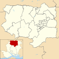
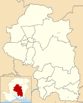
List of electoral wards in Hampshire

Last updated

This is a list of electoral divisions and wards in the ceremonial county of Hampshire in South East England. All changes since the re-organisation of local government following the passing of the Local Government Act 1972 are shown. The number of councillors elected for each electoral division or ward is shown in brackets.

Contents

County council

Hampshire

Electoral Divisions from 1 April 1974 (first election 12 April 1973) to 7 May 1981: [1] [2]

  1. Aldershot East (1)
  2. Aldershot West (1)
  3. Alton (1)
  4. Andover North (1)
  5. Andover Rural (1)
  6. Andover South (1)
  7. Baddesley (1)
  8. Basingstoke East (1)
  9. Basingstoke North (1)
  10. Basingstoke West (1)
  11. Battins & Bondfield (1)
  12. Bedhampton & Barncroft (1)
  13. Bishops Waltham & Droxford (1)
  14. Bramshott (1)
  15. Brockenhurst (1)
  16. Candover (1)
  17. Catherington (1)
  18. Eastleigh East (1)
  19. Eastleigh North (1)
  20. Eastleigh South (1)
  21. Fareham East (1)
  22. Fareham North East (1)
  23. Fareham South West (1)
  24. Fareham Titchfield (1)
  25. Fareham West (1)
  26. Farnborough East (1)
  27. Farnborough West (1)
  28. Fawley (1)
  29. Fleet (1)
  30. Gosport Alverstoke (1)
  31. Gosport Elson (1)
  32. Gosport Hardway (1)
  33. Gosport Leesland (1)
  34. Gosport Town (1)
  35. Hart Plain & Cowplain (1)
  36. Hartley Wintney (1)
  37. Havant & Warblington (1)
  38. Hayling (1)
  39. Headley (1)
  40. Hythe (1)
  41. Kingsclere & Whitchurch No. 1 (High (1)
  42. Kingsclere & Whitchurch No. 2 (King (1)
  43. Loddon (1)
  44. Lymington Central (1)
  45. Lymington East (1)
  46. Lymington West (1)
  47. Lyndhurst (1)
  48. Medstead & Selborne (1)
  49. Odiham (1)
  50. Petersfield (1)
  51. Portsmouth No. 1 (2)
  52. Portsmouth No. 2 (North End) (1)
  53. Portsmouth No. 3 (Paulsgrove) (1)
  54. Portsmouth No. 4 (Cosham) (1)
  55. Portsmouth No. 5 (Farlington) (1)
  56. Portsmouth No. 6 (Meredith) (1)
  57. Portsmouth No. 7 (St Thomas) (1)
  58. Portsmouth No. 8 (Buckland) (1)
  59. Portsmouth No. 9 (Kingston) (1)
  60. Portsmouth No. 10 (Highland) (1)
  61. Portsmouth No. 11 (Havelock) (1)
  62. Portsmouth No. 12 (St Simon) (1)
  63. Portsmouth No. 13 (St Jude) (1)
  64. Portsmouth No. 14 (Fratton) (1)
  65. Purbrook & Waterloo (1)
  66. Ringwood & Fordingbridge No. 1 (1)
  67. Ringwood & Fordingbridge No. 2 (1)
  68. Romsey (1)
  69. Southampton No. 1 (1)
  70. Southampton No. 2 (1)
  71. Southampton No. 3 (St Denys & Bitt (1)
  72. Southampton No. 4 (Swaythling) (1)
  73. Southampton No. 5 (Pear Tree & Bitt (1)
  74. Southampton No. 6 (Woolston) (1)
  75. Southampton No. 7 (Harefield) (1)
  76. Southampton No. 8 (Bitterne) (1)
  77. Southampton No. 9 (Sholing) (1)
  78. Southampton No. 10 (Banister) (1)
  79. Southampton No. 11 (Millbrook) (1)
  80. Southampton No. 12 (Coxford) (1)
  81. Southampton No. 13 (Shirley) (1)
  82. Southampton No. 14 (Portswood) (1)
  83. Southampton No. 15 (Bassett) (1)
  84. Southampton No. 16 (Redbridge) (1)
  85. Stockbridge (1)
  86. Stockheath & Leigh Park (1)
  87. Totton (1)
  88. Wickham (1)
  89. Winchester (St Bart St John St M (1)
  90. Winchester (St Paul & St Thomas) (1)
  91. Winchester Rural No. 1 (Alresford) (1)
  92. Winchester Rural No. 2 (Hound) (1)
  93. Winchester Rural No. 3 (Micheldever (1)
  94. Winchester Rural No. 4 (1)
  95. Winchester Rural No. 5 (1)
  96. Yateley & Hawley (1)

Electoral Divisions from 7 May 1981 to 5 May 2005: [3] [2]

  1. Aldershot North (1)
  2. Aldershot South (1)
  3. Alton (1)
  4. Andover North (1)
  5. Andover Rural (1)
  6. Andover South (1)
  7. Baddesley (1)
  8. Bargate (1); electoral division abolished in 1997 [4]
  9. Barncroft & Warren Park (1)
  10. Basingstoke East (1)
  11. Basingstoke North (1)
  12. Basingstoke North West (1)
  13. Basingstoke South (1)
  14. Basingstoke West (1)
  15. Bassett (1); electoral division abolished in 1997 [4]
  16. Battins & Bondfields (1)
  17. Bedhampton & St Faiths W. (1)
  18. Bishops Waltham (1)
  19. Bishopstoke & Central (1)
  20. Bitterne (1); electoral division abolished in 1997 [4]
  21. Bitterne Park (1); electoral division abolished in 1997 [4]
  22. Botley & Hedge End (1)
  23. Bramshott (1)
  24. Brockenhurst (1)
  25. Candovers (1)
  26. Catherington (1)
  27. Chandlers Ford (1)
  28. Charles Dickens (1); electoral division abolished in 1997 [4]
  29. Copnor (1); electoral division abolished in 1997 [4]
  30. Cosham (1); electoral division abolished in 1997 [4]
  31. Cowplain & Hart Plain (1)
  32. Coxford (1); electoral division abolished in 1997 [4]
  33. Dibden & Hythe (1)
  34. Downlands (1)
  35. Drayton & Farlington (1); electoral division abolished in 1997 [4]
  36. Eastgate (1)
  37. Emsworth & St Faiths East (1)
  38. Fair Oak & West End (1)
  39. Fareham Crofton (1)
  40. Fareham North West (1)
  41. Fareham Portchester (1)
  42. Fareham South East (1)
  43. Fareham Titchfield (1)
  44. Fareham Western Wards (1)
  45. Farnborough North (1)
  46. Farnborough South (1)
  47. Farnborough West (1)
  48. Fawley (1)
  49. Fleet (1)
  50. Fordingbridge (1)
  51. Fratton (1); electoral division abolished in 1997 [4]
  52. Freemantle (1); electoral division abolished in 1997 [4]
  53. Gosport Town (1)
  54. Hardway (1)
  55. Harefield (1); electoral division abolished in 1997 [4]
  56. Hartley Wintney (1)
  57. Havelock (1); electoral division abolished in 1997 [4]
  58. Hawley & Church Crookham (1)
  59. Hayling Island (1)
  60. Headley (1)
  61. Highland (1); electoral division abolished in 1997 [4]
  62. Hilsea (1); electoral division abolished in 1997 [4]
  63. Hound (1)
  64. Itchen Valley (1)
  65. Kingsclere & Tadley (1)
  66. Lee (1)
  67. Leesland (1)
  68. Loddon (1)
  69. Lymington (1)
  70. Lyndhurst (1)
  71. Medstead & Selborne (1)
  72. Meon Valley (1)
  73. Milford & Hordle (1)
  74. Millbrook (1); electoral division abolished in 1997 [4]
  75. Milton (1); electoral division abolished in 1997 [4]
  76. Nelson (1); electoral division abolished in 1997 [4]
  77. New Milton (1)
  78. North (1)
  79. Odiham (1)
  80. Paulsgrove (1); electoral division abolished in 1997 [4]
  81. Peartree (1); electoral division abolished in 1997 [4]
  82. Petersfield (1)
  83. Portswood (1); electoral division abolished in 1997 [4]
  84. Purbrook & Stakes South (1)
  85. Redbridge (1); electoral division abolished in 1997 [4]
  86. Ringwood (1)
  87. Romsey (1)
  88. Rowner (1)
  89. Shirley (1); electoral division abolished in 1997 [4]
  90. Sholing (1); electoral division abolished in 1997 [4]
  91. South (1)
  92. St Jude (1); electoral division abolished in 1997 [4]
  93. St Lukes (1); electoral division abolished in 1997 [4]
  94. St Thomas (1); electoral division abolished in 1997 [4]
  95. Stockbridge & Wellow (1)
  96. Totton North (1)
  97. Totton South (1)
  98. Waterloo & Stakes North (1)
  99. Westgate (1)
  100. Whitchurch & Clere (1)
  101. Woolston (1); electoral division abolished in 1997 [4]
  102. Yateley (1)

Electoral Divisions from 5 May 2005 to 4 May 2017: [5]

Hampshire UK electoral division map (blank).svg
  1. Aldershot East (1)
  2. Aldershot West (1)
  3. Alton Rural (1)
  4. Alton Town (1)
  5. Andover North (1)
  6. Andover South (1)
  7. Andover West (1)
  8. Baddesley (1)
  9. Basingstoke Central (1)
  10. Basingstoke North (1)
  11. Basingstoke North West (1)
  12. Basingstoke South East (1)
  13. Basingstoke South West (1)
  14. Bedhampton & Leigh Park (2)
  15. Bishops Waltham (1)
  16. Bishopstoke & Fair Oak (1)
  17. Bordon, Whitehill & Lindford (1)
  18. Botley & Hedge End (1)
  19. Bridgemary (1)
  20. Brockenhurst (1)
  21. Calleva & Kingsclere (1)
  22. Candovers (1)
  23. Catherington (1)
  24. Chandler’s Ford (1)
  25. Church Crookham & Ewshot (1)
  26. Cowplain & Hart Plain (1)
  27. Dibden & Hythe (1)
  28. Eastleigh East (1)
  29. Eastleigh West (1)
  30. Emsworth & St Faith's (1)
  31. Fareham Crofton (1)
  32. Fareham Portchester (1)
  33. Fareham Sarisbury (1)
  34. Fareham Titchfield (1)
  35. Fareham Town (2)
  36. Fareham Warsash (1)
  37. Farnborough North (1)
  38. Farnborough South (1)
  39. Farnborough West (1)
  40. Fleet (1)
  41. Fordingbridge (1)
  42. Hamble (1)
  43. Hardway (1)
  44. Hartley Wintney, Eversley & Yateley West (1)
  45. Hayling Island (1)
  46. Headley (1)
  47. Itchen Valley (1)
  48. Lee (1)
  49. Leesland & Town (2)
  50. Loddon (1)
  51. Lymington (1)
  52. Lyndhurst (1)
  53. Meon Valley (1)
  54. Milford & Hordle (1)
  55. New Milton (1)
  56. Odiham (1)
  57. Petersfield Butser (1)
  58. Petersfield Hangers (1)
  59. Purbrook & Stakes South (1)
  60. Ringwood (1)
  61. Romsey Extra (1)
  62. Romsey Town (1)
  63. South Waterside (1)
  64. Tadley & Baughurst (1)
  65. Test Valley Central (1)
  66. Totton North (1)
  67. Totton South & Marchwood (1)
  68. Waterloo & Stakes North (1)
  69. West End & Hedge End Grange Park (1)
  70. Whitchurch & Clere (1)
  71. Winchester Downlands (1)
  72. Winchester Eastgate (1)
  73. Winchester Southern Parishes (1)
  74. Winchester Westgate (1)
  75. Yateley East, Blackwater & Ancells (1)

Electoral Divisions from 4 May 2017 to present: [6]
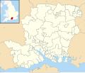
Hampshire UK electoral division map 2017 (blank).svg
  1. Aldershot North (1)
  2. Aldershot South (1)
  3. Alton Rural (1)
  4. Alton Town (1)
  5. Andover North (1)
  6. Andover South (1)
  7. Andover West (1)
  8. Baddesley (1)
  9. Basingstoke Central (1)
  10. Basingstoke North (1)
  11. Basingstoke North West (1)
  12. Basingstoke South East (1)
  13. Basingstoke South West (1)
  14. Bishops Waltham (1)
  15. Bishopstoke & Fair Oak (1)
  16. Botley & Hedge End North (1)
  17. Bridgemary (1)
  18. Brockenhurst (1)
  19. Calleva (1)
  20. Candovers, Oakley & Overton (1)
  21. Catherington (1)
  22. Chandler's Ford (1)
  23. Church Crookham & Ewshot (1)
  24. Cowplain & Hart Plain (1)
  25. Dibden & Hythe (1)
  26. Eastleigh North (1)
  27. Eastleigh South (1)
  28. Emsworth & St Faiths (1)
  29. Fareham Crofton (1)
  30. Fareham Portchester (1)
  31. Fareham Sarisbury (1)
  32. Fareham Titchfield (1)
  33. Fareham Town (2)
  34. Fareham Warsash (1)
  35. Farnborough North (1)
  36. Farnborough South (1)
  37. Farnborough West (1)
  38. Fleet Town (1)
  39. Hamble (1)
  40. Hardway (1)
  41. Hartley Wintney & Yateley West (1)
  42. Hayling Island (1)
  43. Hedge End & West End South (1)
  44. Itchen Valley (1)
  45. Lee (1)
  46. Leesland & Town (2)
  47. Liphook, Headley & Grayshott (1)
  48. Loddon (1)
  49. Lymington & Boldre (1)
  50. Lyndhurst & Fordingbridge (1)
  51. Meon Valley (1)
  52. New Milton (1)
  53. New Milton North, Milford & Hordle (1)
  54. North East Havant (1)
  55. North West Havant (1)
  56. Odiham & Hook (1)
  57. Petersfield Butser (1)
  58. Petersfield Hangers (1)
  59. Purbrook & Stakes South (1)
  60. Ringwood (1)
  61. Romsey Rural (1)
  62. Romsey Town (1)
  63. South Waterside (1)
  64. Tadley & Baughurst (1)
  65. Test Valley Central (1)
  66. Totton North & Netley Marsh (1)
  67. Totton South & Marchwood (1)
  68. Waterloo & Stakes North (1)
  69. West End & Horton Heath (1)
  70. Whitchurch & The Cleres (1)
  71. Whitehill, Bordon & Lindford (1)
  72. Winchester Downlands (1)
  73. Winchester Eastgate (1)
  74. Winchester Southern Parishes (1)
  75. Winchester Westgate (1)
  76. Yateley East & Blackwater (1)

Unitary authority councils

Portsmouth

Wards from 1 April 1974 (first election 7 June 1973) to 5 May 1983: [7]

Wards from 5 May 1983 to 2 May 2002: [8] [4]

Wards from 2 May 2002 to present: [9]

Portsmouth UK ward map 2010 (blank).svg
  1. Baffins (3)
  2. Central Southsea (3)
  3. Charles Dickens (3)
  4. Copnor (3)
  5. Cosham (3)
  6. Drayton & Farlington (3)
  7. Eastney & Craneswater (3)
  8. Fratton (3)
  9. Hilsea (3)
  10. Milton (3)
  11. Nelson (3)
  12. Paulsgrove (3)
  13. St Jude (3)
  14. St Thomas (3)

Southampton

Wards from 1 April 1974 (first election 7 June 1973) to 3 May 1979: [7]

Wards from 3 May 1979 to 2 May 2002: [10] [4]

Wards from 2 May 2002 to present: [11]

Southampton UK ward map 2010 (blank).svg
  1. Bargate (3)
  2. Bassett (3)
  3. Bevois (3)
  4. Bitterne (3)
  5. Bitterne Park (3)
  6. Coxford (3)
  7. Freemantle (3)
  8. Harefield (3)
  9. Millbrook (3)
  10. Peartree (3)
  11. Portswood (3)
  12. Redbridge (3)
  13. Shirley (3)
  14. Sholing (3)
  15. Swaythling (3)
  16. Woolston (3)

District councils

Basingstoke and Deane

Wards from 1 April 1974 (first election 7 June 1973) to 6 May 1976: [7]

Wards from 6 May 1976 to 7 May 1992: [12]

Wards from 7 May 1992 to 2 May 2002: [13]

  1. Basing (3)
  2. Baughurst & Heath End (2)
  3. Brighton Hill (3)
  4. Brookvale (2)
  5. Buckskin (2)
  6. Burghclere (1)
  7. Calleva (3)
  8. Chineham (3)
  9. Eastrop (2)
  10. East Woodhay (1)
  11. Grove (2)
  12. Hatch Warren (3)
  13. Highclere & Bourne (1)
  14. Kempshott (3)
  15. Kingsclere (2)
  16. Norden (3)
  17. Oakley & North Waltham (3)
  18. Overton & Laverstoke (2)
  19. Popley (3)
  20. Sherborne St John (1)
  21. South Ham (3)
  22. Tadley (3)
  23. Upton Grey (1)
  24. Whitchurch (2)
  25. Winklebury (3)

Wards from 2 May 2002 to 1 May 2008: [14] [15]

  1. Basing (3)
  2. Baughurst (1)
  3. Brighton Hill North (2)
  4. Brighton Hill South (2)
  5. Brookvale & Kings Furlong (2)
  6. Buckskin (2)
  7. Burghclere (1)
  8. Calleva (2)
  9. Chineham (3)
  10. East Woodhay (1)
  11. Eastrop (2)
  12. Grove (2)
  13. Hatch Warren & Beggarwood (3)
  14. Highclere & Bourne (1)
  15. Kempshott (3)
  16. Kingsclere (2)
  17. Norden (3)
  18. Oakley & North Waltham (3)
  19. Overton, Laverstoke & Steventon (2)
  20. Pamber (1)
  21. Popley East (2)
  22. Popley West (2)
  23. Rooksdown (1)
  24. Sherborne St John (1)
  25. South Ham (3)
  26. Tadley North (2)
  27. Tadley South (2)
  28. Upton Grey & The Candovers (1)
  29. Whitchurch (2)
  30. Winklebury (3)

Wards from 1 May 2008 to 6 May 2021: [16]

Basingstoke and Deane UK ward map 2010 (blank).svg
  1. Basing (3)
  2. Baughurst & Tadley North (2)
  3. Bramley & Sherfield (2)
  4. Brighton Hill North (2)
  5. Brighton Hill South (2)
  6. Brookvale & Kings Furlong (2)
  7. Buckskin (2)
  8. Burghclere, Highclere & St Mary Bourne (2)
  9. Chineham (3)
  10. East Woodhay (1)
  11. Eastrop (2)
  12. Grove (2)
  13. Hatch Warren & Beggarwood (3)
  14. Kempshott (3)
  15. Kingsclere (2)
  16. Norden (3)
  17. Oakley & North Waltham (3)
  18. Overton, Laverstoke & Steventon (2)
  19. Pamber & Silchester (2)
  20. Popley East (2)
  21. Popley West (2)
  22. Rooksdown (1)
  23. Sherborne St John (1)
  24. South Ham (3)
  25. Tadley Central (1)
  26. Tadley South (2)
  27. Upton Grey & The Candovers (1)
  28. Whitchurch (2)
  29. Winklebury (2)

Wards from 6 May 2021 to present: [17]

Basingstoke and Deane UK ward map 2021 (blank).svg
  1. Basing & Upton Grey (3)
  2. Bramley (3)
  3. Brighton Hill (3)
  4. Brookvale & Kings Furlong (3)
  5. Chineham (3)
  6. Eastrop & Grove (3)
  7. Evingar (3)
  8. Hatch Warren & Beggarwood (3)
  9. Kempshott & Buckskin (3)
  10. Norden (3)
  11. Oakley & The Candovers (3)
  12. Popley (3)
  13. Sherborne St John & Rooksdown (3)
  14. South Ham (3)
  15. Tadley & Pamber (3)
  16. Tadley North, Kingsclere & Baughurst (3)
  17. Whitchurch, Overton & Laverstoke (3)
  18. Winklebury & Manydown (3)

East Hampshire

Wards from 1 April 1974 (first election 7 June 1973) to 3 May 1979: [7]

Wards from 3 May 1979 to 1 May 2003: [18]

Wards from 1 May 2003 to 2 May 2019: [19]

East Hampshire UK ward map 2010 (blank).svg
  1. Alton Amery (1)
  2. Alton Ashdell (1)
  3. Alton Eastbrooke (1)
  4. Alton Westbrooke (1)
  5. Alton Whitedown (1)
  6. Alton Wooteys (1)
  7. Binsted & Bentley (1)
  8. Bramshott & Liphook (3)
  9. Clanfield & Finchdean (2)
  10. Downland (1)
  11. East Meon (1)
  12. Four Marks & Medstead (2)
  13. Froxfield & Steep (1)
  14. Grayshott (1)
  15. Headley (2)
  16. Holybourne & Froyle (1)
  17. Horndean Catherington & Lovedean (1)
  18. Horndean Downs (1)
  19. Horndean Hazleton & Blendworth (1)
  20. Horndean Kings (1)
  21. Horndean Murray (1)
  22. Lindford (1)
  23. Liss (2)
  24. Petersfield Bell Hill (1)
  25. Petersfield Causeway (1)
  26. Petersfield Heath (1)
  27. Petersfield Rother (1)
  28. Petersfield St Marys (1)
  29. Petersfield St Peters (1)
  30. Rowlands Castle (1)
  31. Ropley & Tisted (1)
  32. Selborne (1)
  33. The Hangers & Forest (1)
  34. Whitehill Chase (1)
  35. Whitehill Deadwater (1)
  36. Whitehill Hogmoor (1)
  37. Whitehill Pinewood (1)
  38. Whitehill Walldown (1)

Wards from 2 May 2019 to present: [20]

  1. Alton Amery (1)
  2. Alton Ashdell (1)
  3. Alton Eastbrooke (1)
  4. Alton Holybourne (1)
  5. Alton Westbrooke (1)
  6. Alton Whitedown (1)
  7. Alton Wooteys (1)
  8. Bentworth & Froyle (1)
  9. Binsted, Bentley & Selborne (2)
  10. Bramshott & Liphook (3)
  11. Buriton & East Meon (1)
  12. Clanfield (2)
  13. Four Marks & Medstead (3)
  14. Froxfield, Sheet & Steep (1)
  15. Grayshott (1)
  16. Headley (2)
  17. Horndean Catherington (1)
  18. Horndean Downs (1)
  19. Horndean Kings & Blendworth (2)
  20. Horndean Murray (1)
  21. Lindford (1)
  22. Liss (2)
  23. Petersfield Bell Hill (1)
  24. Petersfield Causeway (1)
  25. Petersfield Heath (1)
  26. Petersfield St Peter's (2)
  27. Ropley, Hawkley & Hangers (1)
  28. Rowlands Castle (1)
  29. Whitehill Chase (2)
  30. Whitehill Hogmoor & Greatham (2)
  31. Whitehill Pinewood (1)

Eastleigh

Wards from 1 April 1974 (first election 7 June 1973) to 6 May 1976: [7]

Wards from 6 May 1976 to 2 May 2002: [21]

Wards from 2 May 2002 to 3 May 2018: [22]

Eastleigh UK ward map 2010 (blank).svg
  1. Bishopstoke East (2)
  2. Bishopstoke West (2)
  3. Botley (2)
  4. Bursledon & Old Netley (3)
  5. Chandler’s Ford East (2)
  6. Chandler’s Ford West (2)
  7. Eastleigh Central (3)
  8. Eastleigh North (3)
  9. Eastleigh South (3)
  10. Fair Oak & Horton Heath (3)
  11. Hamble-le-Rice & Butlocks Heath (2)
  12. Hedge End St John's (3)
  13. Hedge End Grange Park (2)
  14. Hedge End Wildern (2)
  15. Hiltingbury East (2)
  16. Hiltingbury West (2)
  17. Netley Abbey (2)
  18. West End North (2)
  19. West End South (2)

Wards from 3 May 2018 to present: [23]

Eastleigh UK ward map 2018 (blank).svg
  1. Bishopstoke (3)
  2. Botley (2)
  3. Bursledon & Hound North (3)
  4. Chandler's Ford (3)
  5. Eastleigh Central (3)
  6. Eastleigh North (3)
  7. Eastleigh South (3)
  8. Fair Oak & Horton Heath (3)
  9. Hamble & Netley (3)
  10. Hedge End North (3)
  11. Hedge End South (3)
  12. Hiltingbury (3)
  13. West End North (2)
  14. West End South (2)

Fareham

Wards from 1 April 1974 (first election 7 June 1973) to 6 May 1976: [7]

Wards from 6 May 1976 to 2 May 2002: [24]

Wards from 2 May 2002 to present: [25]

Fareham UK ward map 2010 (blank).svg
  1. Fareham East (2)
  2. Fareham North (2)
  3. Fareham North-West (2)
  4. Fareham South (2)
  5. Fareham West (2)
  6. Hill Head (2)
  7. Locks Heath (2)
  8. Park Gate (2)
  9. Portchester East (3)
  10. Portchester West (2)
  11. Sarisbury (2)
  12. Stubbington (2)
  13. Titchfield (2)
  14. Titchfield Common (2)
  15. Warsash (2)

Gosport

Wards from 1 April 1974 (first election 7 June 1973) to 3 May 1979: [7]

Wards from 3 May 1979 to 2 May 2002: [26]

Wards from 2 May 2002 to 5 May 2022: [27]

Gosport UK ward map 2010 (blank).svg
  1. Alverstoke (2)
  2. Anglesey (2)
  3. Bridgemary North (2)
  4. Bridgemary South (2)
  5. Brockhurst (2)
  6. Christchurch (2)
  7. Elson (2)
  8. Forton (2)
  9. Grange (2)
  10. Hardway (2)
  11. Lee East (2)
  12. Lee West (2)
  13. Leesland (2)
  14. Peel Common (2)
  15. Privett (2)
  16. Rowner & Holbrook (2)
  17. Town (2)

Wards from 5 May 2022: [28]

  1. Alverstoke (2)
  2. Anglesey (2)
  3. Bridgemary (2)
  4. Brockhurst & Privett (2)
  5. Elson (2)
  6. Forton (2)
  7. Grange & Alver Valley (2)
  8. Harbourside & Town (2)
  9. Hardway (2)
  10. Lee East (2)
  11. Lee West (2)
  12. Leesland & Newtown (2)
  13. Peel Common (2)
  14. Rowner & Holbrook (2)

Hart

Wards from 1 April 1974 (first election 7 June 1973) to 6 May 1976: [7]

Wards from 6 May 1976 to 2 May 2002: [29]

Wards from 2 May 2002 to 22 May 2014: [30]

Hart UK ward map 2010 (blank).svg
  1. Blackwater & Hawley (2)
  2. Church Crookham East (2)
  3. Church Crookham West (2)
  4. Crondall (2)
  5. Eversley (1)
  6. Fleet Central (2)
  7. Fleet Courtmoor (2)
  8. Fleet North (2)
  9. Fleet Pondtail (2)
  10. Fleet West (2)
  11. Frogmore & Darby Green (2)
  12. Hartley Wintney (2)
  13. Hook (3)
  14. Long Sutton (1)
  15. Odiham (2)
  16. Yateley East (2)
  17. Yateley North (2)
  18. Yateley West (2)

Wards from 22 May 2014 to present: [31]

Hart UK ward map 2014 (blank).svg
  1. Blackwater & Hawley (3)
  2. Crookham East (3)
  3. Crookham West & Ewshot (3)
  4. Fleet Central (3)
  5. Fleet East (3)
  6. Fleet West (3)
  7. Hartley Wintney (3)
  8. Hook (3)
  9. Odiham (3)
  10. Yateley East (3)
  11. Yateley West (3)

Havant

Wards from 1 April 1974 (first election 7 June 1973) to 6 May 1976: [7]

Wards from 6 May 1976 to 2 May 2002: [32]

Wards from 2 May 2002 to present: [33]

Havant UK ward map 2010 (blank).svg
  1. Barncroft (2)
  2. Battins (2)
  3. Bedhampton (3)
  4. Bondfields (2)
  5. Cowplain (3)
  6. Emsworth (3)
  7. Hart Plain (3)
  8. Hayling East (3)
  9. Hayling West (3)
  10. Purbrook (3)
  11. St Faith's (3)
  12. Stakes (3)
  13. Warren Park (2)
  14. Waterloo (3)

New Forest

Wards from 1 April 1974 (first election 7 June 1973) to 6 May 1976: [7]

Wards from 6 May 1976 to 1 May 2003: [34]

Wards from 1 May 2003 to 2023: [35]

New Forest UK ward map 2010 (blank).svg
  1. Ashurst, Copythorne South & Netley Marsh (2)
  2. Barton (2)
  3. Bashley (1)
  4. Becton (2)
  5. Boldre & Sway (2)
  6. Bramshaw, Copythorne North & Minstead (1)
  7. Bransgore & Burley (2)
  8. Brockenhurst & Forest South East (2)
  9. Buckland (1)
  10. Butts Ash & Dibden Purlieu (2)
  11. Dibden & Hythe East (2)
  12. Downlands & Forest (1) †
  13. Fawley, Blackfield & Langley (2)
  14. Fernhill (2)
  15. Fordingbridge (2) †
  16. Forest North West (1) †
  17. Furzedown & Hardley (1)
  18. Holbury & North Blackfield (2)
  19. Hordle (2)
  20. Hythe West & Langdown (2)
  21. Lymington Town (2)
  22. Lyndhurst (1)
  23. Marchwood (2)
  24. Milford (2)
  25. Milton (2)
  26. Pennington (2)
  27. Ringwood East & Sopley (1)
  28. Ringwood North (2)
  29. Ringwood South (2)
  30. Totton Central (2)
  31. Totton East (2)
  32. Totton North (2)
  33. Totton South (2)
  34. Totton West (2)

† minor boundary changes in 2011 [36]

Wards from 2023: [37]

  1. Ashley, Bashley & Fernhill (2)
  2. Ashurst, Bramshaw, Copythorne & Netley Marsh (2)
  3. Ballard (1)
  4. Barton & Becton (2)
  5. Bransgore, Burley, Sopley & Ringwood East (2)
  6. Brockenhurst & Denny Lodge (1)
  7. Dibden & Dibden Purlieu (2)
  8. Downlands & Forest North (1)
  9. Fawley, Blackfield, Calshot & Langley (2)
  10. Fordingbridge, Godshill & Hyde (2)
  11. Forest & Solent (1)
  12. Hardley, Holbury & North Blackfield (2)
  13. Hythe Central (2)
  14. Hythe South (2)
  15. Lymington (2)
  16. Lyndhurst & Minstead (1)
  17. Marchwood & Eling (2)
  18. Milford & Hordle (3)
  19. Milton (2)
  20. Pennington (2)
  21. Ringwood North & Ellingham (2)
  22. Ringwood South (2)
  23. Sway (1)
  24. Totton Central (2)
  25. Totton North (3)
  26. Totton South (2)

Rushmoor

Wards from 1 April 1974 (first election 7 June 1973) to 3 May 1979: [7]

Wards from 3 May 1979 to 2 May 2002: [38]

Wards from 2 May 2002 to 3 May 2012: [39]

Rushmoor UK ward map 2010 (blank).svg
  1. Cove & Southwood (3)
  2. Empress (3)
  3. Fernhill (3)
  4. Grange (3)
  5. Heron Wood (3)
  6. Knellwood (3)
  7. Manor Park (3)
  8. Mayfield (3)
  9. North Town (3)
  10. Rowhill (3)
  11. St John's (3)
  12. St Mark's (3)
  13. Wellington (3)
  14. Westheath (3)

Wards from 3 May 2012 to present: [40]

Rushmoor UK ward map 2012 (blank).svg
  1. Aldershot Park (3)
  2. Cherrywood (3)
  3. Cove & Southwood (3)
  4. Empress (3)
  5. Fernhill (3)
  6. Knellwood (3)
  7. Manor Park (3)
  8. North Town (3)
  9. Rowhill (3)
  10. St John’s (3)
  11. St Mark’s (3)
  12. Wellington (3)
  13. West Heath (3)

Test Valley

Wards from 1 April 1974 (first election 7 June 1973) to 6 May 1976: [7]

Wards from 6 May 1976 to 1 May 2003: [41]

Wards from 1 May 2003 to 2 May 2019: [42]

Test Valley UK ward map 2010 (blank).svg
  1. Abbey (2)
  2. Alamein (3)
  3. Ampfield & Braishfield (1)
  4. Amport (1)
  5. Anna (2)
  6. Blackwater (2)
  7. Bourne Valley (1)
  8. Broughton & Stockbridge (2)
  9. Charlton (1)
  10. Chilworth, Nursling & Rownhams (3)
  11. Cupernham (2)
  12. Dun Valley (1)
  13. Harewood (1)
  14. Harroway (3)
  15. Kings Somborne & Michelmersh (1)
  16. Millway (3)
  17. North Baddesley (3)
  18. Over Wallop (1)
  19. Penton Bellinger (2)
  20. Romsey Extra (2)
  21. St Mary's (3)
  22. Tadburn (2)
  23. Valley Park (3)
  24. Winton (3)

Wards from 2 May 2019 to present: [43]

  1. Ampfield & Braishfield (1)
  2. Andover Downlands (2)
  3. Andover Harroway (3)
  4. Andover Millway (3)
  5. Andover Romans (3)
  6. Andover St Mary's (3)
  7. Andover Winton (2)
  8. Anna (2)
  9. Bellinger (1)
  10. Blackwater (2)
  11. Bourne Valley (1)
  12. Charlton & the Pentons (1)
  13. Chilworth, Nursling & Rownhams (3)
  14. Harewood (1)
  15. Mid Test (3)
  16. North Baddesley (3)
  17. Romsey Abbey (2)
  18. Romsey Cupernham (3)
  19. Romsey Tadburn (2)
  20. Valley Park (2)

Winchester

Wards from 1 April 1974 (first election 7 June 1973) to 6 May 1976: [7]

Wards from 6 May 1976 to 2 May 2002: [44]

Wards from 2 May 2002 to 5 May 2016: [45]

Winchester UK ward map 2010 (blank).svg
  1. Bishops Waltham (3)
  2. Boarhunt & Southwick (1)
  3. Cheriton & Bishops Sutton (1)
  4. Colden Common & Twyford (3)
  5. Compton & Otterbourne (2)
  6. Denmead (3)
  7. Droxford, Soberton & Hambledon (1)
  8. Itchen Valley (1)
  9. Kings Worthy (2)
  10. Littleton & Harestock (2)
  11. Olivers Battery & Badger Farm (2)
  12. Owslebury & Curdridge (2)
  13. St Barnabas (3)
  14. St Bartholomew (3)
  15. St John & All Saints (3)
  16. St Luke (3)
  17. St Michael (3)
  18. St Paul (3)
  19. Shedfield (2)
  20. Sparsholt (1)
  21. Swanmore & Newtown (2)
  22. The Alresfords (3)
  23. Upper Meon Valley (1)
  24. Whiteley (2)
  25. Wickham (2)
  26. Wonston & Micheldever (3)

Wards from 5 May 2016 to present: [46]

Winchester UK ward map 2016 (blank).svg
  1. Alresford & Itchen Valley (3)
  2. Badger Farm & Oliver’s Battery (3)
  3. Bishop’s Waltham (3)
  4. Central Meon Valley (3)
  5. Colden Common & Twyford (2)
  6. Denmead (3)
  7. St Barnabas (3)
  8. St Bartholomew (3)
  9. St Luke (2)
  10. St Michael (3)
  11. St Paul (3)
  12. Southwick & Wickham (3)
  13. The Worthys (3)
  14. Upper Meon Valley (2)
  15. Whiteley & Shedfield (3)
  16. Wonston & Micheldever (3)

Electoral wards by constituency

Aldershot

Blackwater and Hawley, Cove and Southwood, Empress, Fernhill, Frogmore and Darby Green, Grange, Heron Wood, Knellwood, Manor Park, Mayfield, North Town, Rowhill, St. John's, St. Mark's, Wellington, Westheath.

Basingstoke

Basing, Brighton Hill North, Brighton Hill South, Brookvale and Kings Furlong, Buckskin, Chineham, Eastrop, Grove, Hatch Warren and Beggarwood, Kempshott, Norden, Popley East, Popley West, Rooksdown, South Ham, Winklebury.

East Hampshire

Alton Amery, Alton Ashdell, Alton Eastbrooke, Alton Westbrooke, Alton Whitedown, Alton Wooteys, Binstead and Bentley, Bramshott and Liphook, Downland, East Meon, Four Marks and Medstead, Froxfield and Steep, Grayshott, Headley, Holybourne and Froyle, Lindford, Liss, Petersfield Bell Hill, Petersfield Causeway, Petersfield Heath, Petersfield Rother, Petersfield St Marys, Petersfield St Peters, Ropley and Tisted, Selborne, The Hangers and Forest, Whitehill Chase, Whitehill Deadwater, Whitehill Hogmoor, Whitehill Pinewood, Whitehill Walldown.

Eastleigh

Bishopstoke East, Bishopstoke West, Botley, Bursledon and Old Netley, Eastleigh Central, Eastleigh North, Eastleigh South, Fair Oak and Horton Heath, Hamble-le-Rice and Butlocks Heath, Hedge End Grange Park, Hedge End St John's, Hedge End Wildern, Netley Abbey, West End North, West End South.

Fareham

Fareham East, Fareham North, Fareham North-West, Fareham South, Fareham West, Locks Heath, Park Gate, Portchester East, Portchester West, Sarisbury, Titchfield, Titchfield Common, Warsash.

Gosport

Alverstoke, Anglesey, Bridgemary North, Bridgemary South, Brockhurst, Christchurch, Elson, Forton, Grange, Hardway, Hill Head, Lee East, Lee West, Leesland, Peel Common, Privett, Rowner and Holbrook, Stubbington, Town.

Havant

Barncroft, Battins, Bedhampton, Bondfields, Emsworth, Hayling East, Hayling West, Purbrook, St Faith's, Stakes, Warren Park.

Meon Valley

Bishops Waltham, Boarhunt and Southwick, Cheriton and Bishops Sutton, Clanfield and Finchdean, Cowplain, Denmead, Droxford, Soberton and Hambledon, Hart Plain, Horndean Catherington and Lovedean, Horndean Downs, Horndean Hazleton and Blendworth, Horndean Kings, Horndean Murray, Owslebury and Curdridge, Rowlands Castle, Shedfield, Swanmore and Newtown, Upper Meon Valley, Waterloo, Whiteley, Wickham.

New Forest East

Ashurst, Copythorne South and Netley Marsh, Boldre and Sway, Bramshaw, Copythorne North and Minstead, Brockenhurst and Forest South East, Butts Ash and Dibden Purlieu, Dibden and Hythe East, Fawley, Blackfield and Langley, Furzedown and Hardley, Holbury and North Blackfield, Hythe West and Langdown, Lyndhurst, Marchwood, Totton Central, Totton East, Totton North, Totton South, Totton West.

New Forest West

Barton, Bashley, Becton, Bransgore and Burley, Buckland, Downlands and Forest, Fernhill, Fordingbridge, Forest North West, Hordle, Lymington Town, Milford, Milton, Pennington, Ringwood East and Sopley, Ringwood North, Ringwood South.

North East Hampshire

Calleva, Church Crookham East, Church Crookham West, Crondall, Eversley, Fleet Central, Fleet Courtmoor, Fleet North, Fleet Pondtail, Fleet West, Hartley Wintney, Hook, Long Sutton, Odiham, Pamber, Sherborne St John, Upton Grey and The Candovers, Yateley East, Yateley North, Yateley West.

North West Hampshire

Alamein, Amport, Anna, Baughurst, Burghclere, Bourne Valley, Charlton, East Woodhay, Harroway, Highclere and Bourne, Kingsclere, Millway, Oakley and North Waltham, Overton, Laverstoke and Steventon, Penton Bellinger, St Mary's, Tadley North, Tadley South, Whitchurch, Winton.

Portsmouth North

Baffins, Copnor, Cosham, Drayton and Farlington, Hilsea, Nelson, Paulsgrove.

Portsmouth South

Central Southsea, Charles Dickens, Eastney and Craneswater, Fratton, Milton, St Jude, St Thomas.

Romsey and Southampton North

Abbey, Ampfield and Braishfield, Bassett, Blackwater, Broughton and Stockbridge, Chilworth, Nursling and Rownhams, Cupernham, Dun Valley, Harewood, Kings Somborne and Michelmersh, North Baddesley, Over Wallop, Romsey Extra, Swaythling, Tadburn, Valley Park.

Southampton, Itchen

Bargate, Bitterne, Bitterne Park, Harefield, Peartree, Sholing, Woolston.

Southampton, Test

Bevois, Coxford, Freemantle, Millbrook, Portswood, Redbridge, Shirley.

Winchester

Alresford & Itchen Valley, Badger Farm & Oliver's Battery, Chandler's Ford East, Chandler's Ford West, Colden Common & Twyford, Hiltingbury East, Hiltingbury West, St Barnabas, St Bartholomew, St Luke, St Michael, St Paul, The Worthys, Wonston & Micheldever.

See also

Related Research Articles

<span class="mw-page-title-main">Basingstoke and Deane</span> Borough and non-metropolitan district in England

Basingstoke and Deane is a local government district with borough status in Hampshire, England. The main town is Basingstoke, where the council is based. The district also includes the towns of Tadley and Whitchurch, along with numerous villages and surrounding rural areas. The modern district was created in 1974, initially being called Basingstoke. It changed its name to "Basingstoke and Deane" in 1978 at the same time that it was made a borough; Deane was added to the name to represent the rural parts of the borough, being the area's smallest village.

<span class="mw-page-title-main">East Hampshire</span> Non-metropolitan district in England

East Hampshire is a local government district in Hampshire, England. Its council is based in the town of Petersfield, although the largest town is Alton. The district also contains the town of Bordon along with many villages and surrounding rural areas.

<span class="mw-page-title-main">Borough of Fareham</span> Non-metropolitan and borough in England

The Borough of Fareham is a local government district with borough status in Hampshire, England. Its council is based in Fareham. Other places within the borough include Portchester, Hill Head, Sarisbury, Stubbington, Titchfield and Warsash. The borough covers much of the semi-urban area between the cities of Southampton and Portsmouth, and is part of the South Hampshire conurbation. The neighbouring districts are Eastleigh, Winchester, Portsmouth and Gosport. The district's southern boundary is the coast of the Solent.

<span class="mw-page-title-main">North West Hampshire (UK Parliament constituency)</span> Parliamentary constituency in the United Kingdom, 1983 onwards

North West Hampshire is a constituency represented in the House of Commons of the UK Parliament since 2015 by Conservative Kit Malthouse, who served as Education Secretary in 2022.

<span class="mw-page-title-main">North East Hampshire (UK Parliament constituency)</span> UK Parliament constituency since 1997

North East Hampshire is a constituency represented in the House of Commons of the UK Parliament by Ranil Jayawardena, a Conservative.

<span class="mw-page-title-main">East Hampshire (UK Parliament constituency)</span> UK Parliament constituency since 1983

East Hampshire is a constituency represented in the House of Commons of the UK Parliament since 2010 by Damian Hinds of the Conservative Party.

Hampshire 1 is an English level 10 Rugby Union league for teams based in Hampshire and the Isle of Wight. Up until the 2017–18 season it was known as Hampshire 2 but was changed to Hampshire 1 following the restructuring of the Hampshire leagues, which would see the re-introduction of a third division as well as 2nd and 3rd XV sides joining for the first time. Each year some of the clubs in this division also take part in the RFU Junior Vase - a level 9-12 national competition.

<span class="mw-page-title-main">2017 Hampshire County Council election</span> 2017 UK local government election

The 2017 Hampshire County Council election took place on 4 May 2017 as part of the 2017 local elections in the United Kingdom. All councillors were elected from electoral divisions by first-past-the-post voting for a four-year term of office. The electoral divisions were somewhat changed from the previous election, with some being split, merged or with boundary changes. No elections were held in Portsmouth and Southampton, which are unitary authorities and hold their elections in other years. Similarly the districts within Hampshire did also not hold elections this year.

References

  1. The County of Hampshire (Electoral Divisions) Order 1973
  2. 1 2 Rallings, Colin; Thrasher, Michael. Hampshire County Council Election Results 1973-2009 (PDF). The Elections Centre. Retrieved 12 May 2016.
  3. The County of Hampshire (Electoral Arrangements) Order 1981
  4. 1 2 3 4 5 6 7 8 9 10 11 12 13 14 15 16 17 18 19 20 21 22 23 24 25 26 27 28 29 30 legislation.gov.uk - The Hampshire (Cities of Portsmouth and Southampton) (Structural Change) Order 1995. Retrieved on 6 November 2015.
  5. legislation.gov.uk - The County of Hampshire (Electoral Changes) Order 2004. Retrieved on 3 November 2015.
  6. "The Hampshire (Electoral Changes) Order 2016". gov.uk . 13 December 2016. Retrieved 20 April 2022.
  7. 1 2 3 4 5 6 7 8 9 10 11 12 13 The County of Hampshire (District Wards) Order 1973
  8. legislation.gov.uk - The City of Portsmouth (Electoral Arrangements) Order 1979. Retrieved on 19 November 2015.
  9. legislation.gov.uk - The City of Portsmouth (Electoral Changes) Order 2001. Retrieved on 4 October 2015.
  10. The City of Southampton (Electoral Arrangements) Order 1976
  11. legislation.gov.uk - The City of Southampton (Electoral Changes) Order 2001. Retrieved on 4 October 2015.
  12. The District of Basingstoke (Electoral Arrangements) Order 1975
  13. legislation.gov.uk - The Borough of Basingstoke and Deane (Electoral Arrangements) Order 1992. Retrieved on 4 November 2015.
  14. legislation.gov.uk - The Borough of Basingstoke and Deane (Electoral Changes) Order 2001. Retrieved on 4 October 2015.
  15. legislation.gov.uk - The Borough of Basingstoke and Deane (Electoral Changes) (Amendment) Order 2004. Retrieved on 3 November 2015.
  16. legislation.gov.uk - The Borough of Basingstoke and Deane (Electoral Changes) Order 2008. Retrieved on 3 November 2015.
  17. "The Basingstoke and Deane (Electoral Changes) Order 2019". gov.uk . 15 July 2019. Retrieved 10 April 2022.
  18. The District of East Hampshire (Electoral Arrangements) Order 1976
  19. legislation.gov.uk - The District of East Hampshire (Electoral Changes) Order 2001. Retrieved on 4 October 2015.
  20. "The East Hampshire (Electoral Changes) Order 2018". gov.uk . 17 July 2018. Retrieved 10 April 2022.
  21. The Borough of Eastleigh (Electoral Arrangements) Order 1975
  22. legislation.gov.uk - The Borough of Eastleigh (Parishes and Electoral Changes) Order 2001. Retrieved on 4 October 2015.
  23. "The Eastleigh (Electoral Changes) Order 2016". gov.uk . 15 December 2016. Retrieved 20 April 2022.
  24. legislation.gov.uk - The Borough of Fareham (Electoral Arrangements) Order 1975. Retrieved on 19 November 2015.
  25. legislation.gov.uk - The Borough of Fareham (Electoral Changes) Order 2001. Retrieved on 4 October 2015.
  26. The Borough of Gosport (Electoral Arrangements) Order 1978
  27. legislation.gov.uk - The Borough of Gosport (Electoral Changes) Order 2001. Retrieved on 4 October 2015.
  28. "The Gosport (Electoral Changes) Order 2022". gov.uk . 10 February 2022. Retrieved 5 April 2022.
  29. legislation.gov.uk - The District of Hart (Electoral Arrangements) Order 1976. Retrieved on 19 November 2015.
  30. legislation.gov.uk - The District of Hart (Parishes and Electoral Changes) Order 2001. Retrieved on 4 October 2015.
  31. legislation.gov.uk - The Hart (Electoral Changes) Order 2012. Retrieved on 3 November 2015.
  32. legislation.gov.uk - The Borough of Havant (Electoral Arrangements) Order 1976. Retrieved on 19 November 2015.
  33. legislation.gov.uk - The Borough of Havant (Electoral Changes) Order 2001. Retrieved on 4 October 2015.
  34. legislation.gov.uk - The District of New Forest (Electoral Arrangements) Order 1976. Retrieved on 19 November 2015.
  35. legislation.gov.uk - The District of New Forest (Parishes and Electoral Changes) Order 2001. Retrieved on 4 October 2015.
  36. legislation.gov.uk - The New Forest (Electoral Changes) Order 2011. Retrieved on 3 November 2015.
  37. "The New Forest (Electoral Changes) Order 2021". gov.uk . 22 July 2021. Retrieved 10 April 2022.
  38. The Borough of Rushmoor (Electoral Arrangements) Order 1976
  39. legislation.gov.uk - The Borough of Rushmoor (Electoral Changes) Order 2001. Retrieved on 4 October 2015.
  40. legislation.gov.uk - The Rushmoor (Electoral Changes) Order 2012. Retrieved on 3 November 2015.
  41. legislation.gov.uk - The District of Test Valley (Electoral Arrangements) Order 1975. Retrieved on 19 November 2015.
  42. legislation.gov.uk - The Borough of Test Valley (Electoral Changes) Order 2001. Retrieved on 4 October 2015.
  43. "The Test Valley (Electoral Changes) Order 2018". gov.uk . 15 January 2018. Retrieved 10 April 2022.
  44. legislation.gov.uk - The City of Winchester (Electoral Arrangements) Order 1976. Retrieved on 19 November 2015.
  45. legislation.gov.uk - The City of Winchester (Electoral Changes) Order 2001. Retrieved on 4 October 2015.
  46. legislation.gov.uk - The Winchester (Electoral Changes) Order 2015. Retrieved on 20 April 2016.