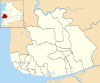
List of electoral wards in Lancashire

Last updated

This is a list of electoral divisions and wards in the ceremonial county of Lancashire in North West England. All changes since the re-organisation of local government following the passing of the Local Government Act 1972 are shown. The number of councillors elected for each electoral division or ward is shown in brackets.

Contents

County council

Lancashire

From 2017

Electoral Divisions from 4 May 2017 to present: [1]

Lancashire UK electoral division map 2017 (blank).svg
  1. Accrington North (1)
  2. Accrington South (1)
  3. Accrington West & Oswaldtwistle Central (1)
  4. Brierfield & Nelson West (1)
  5. Burnley Central East (1)
  6. Burnley Central West (1)
  7. Burnley North East (1)
  8. Burnley Rural (1)
  9. Burnley South West (1)
  10. Burscough & Rufford (1)
  11. Chorley Central (1)
  12. Chorley North (1)
  13. Chorley Rural East (1)
  14. Chorley Rural West (1)
  15. Chorley South (1)
  16. Clayton with Whittle (1)
  17. Cleveleys East (1)
  18. Cleveleys South & Carleton (1)
  19. Clitheroe (1)
  20. Euxton, Buckshaw & Astley (1)
  21. Fleetwood East (1)
  22. Fleetwood West & Cleveleys West (1)
  23. Fylde East (1)
  24. Fylde South (1)
  25. Fylde West (1)
  26. Great Harwood, Rishton & Clayton-le-Moors (2)
  27. Heysham (1)
  28. Hoghton with Wheelton (1)
  29. Lancaster Central (1)
  30. Lancaster East (1)
  31. Lancaster Rural East (1)
  32. Lancaster Rural North (1)
  33. Lancaster South East (1)
  34. Leyland Central (1)
  35. Leyland South (1)
  36. Longridge with Bowland (1)
  37. Lostock Hall & Bamber Bridge (1)
  38. Lytham (1)
  39. Mid-Rossendale (1)
  40. Morecambe Central (1)
  41. Morecambe North (1)
  42. Morecambe South (1)
  43. Moss Side & Farington (1)
  44. Nelson East (1)
  45. Ormskirk (1)
  46. Oswaldtwistle (1)
  47. Padiham & Burnley West (1)
  48. Pendle Central (1)
  49. Pendle Hill (1)
  50. Pendle Rural (2)
  51. Penwortham East & Walton-le-Dale (1)
  52. Penwortham West (1)
  53. Poulton-le-Fylde (1)
  54. Preston Central East (1)
  55. Preston Central West (1)
  56. Preston City (1)
  57. Preston East (1)
  58. Preston North (1)
  59. Preston Rural (1)
  60. Preston South East (1)
  61. Preston South West (1)
  62. Preston West (1)
  63. Ribble Valley North East (1)
  64. Ribble Valley South West (1)
  65. Rossendale East (1)
  66. Rossendale South (1)
  67. Rossendale West (1)
  68. Skelmersdale Central (1)
  69. Skelmersdale East (1)
  70. Skelmersdale West (1)
  71. Skerton (1)
  72. South Ribble East (1)
  73. South Ribble West (1)
  74. St Annes North (1)
  75. St Annes South (1)
  76. Thornton & Hambleton (1)
  77. West Lancashire East (1)
  78. West Lancashire North (1)
  79. West Lancashire West (1)
  80. Whitworth & Bacup (1)
  81. Wyre Rural Central (1)
  82. Wyre Rural East (1)

Historic

Electoral Divisions from 1 April 1974 (first election 12 April 1973) to 7 May 1981: [2] [3]

  1. Accrington No. 1 (1)
  2. Accrington No. 2 (1)
  3. Accrington No. 3 (1)
  4. Bacup (1)
  5. Barnoldswick (1)
  6. Blackburn No. 1 (1)
  7. Blackburn No. 2 (1)
  8. Blackburn No. 3 (1)
  9. Blackburn No. 4 (1)
  10. Blackburn No. 5 (1)
  11. Blackburn No. 6 (1)
  12. Blackburn No. 7 (1)
  13. Blackburn Rural (1)
  14. Blackpool No. 1 (1)
  15. Blackpool No. 2 (1)
  16. Blackpool No. 3 (1)
  17. Blackpool No. 4 (1)
  18. Blackpool No. 5 (1)
  19. Blackpool No. 6 (1)
  20. Blackpool No. 7 (1)
  21. Blackpool No. 8 (1)
  22. Blackpool No. 9 (1)
  23. Blackpool No. 10 (1)
  24. Blackpool No. 11 (1)
  25. Brierfield (1)
  26. Burnley No. 1 (1)
  27. Burnley No. 2 (1)
  28. Burnley No. 3 (1)
  29. Burnley No. 4 (1)
  30. Burnley No. 5 (1)
  31. Burnley Rural (1)
  32. Chorley North East (1)
  33. Chorley Rural No. 1 (1)
  34. Chorley Rural No. 2 (1)
  35. Chorley Rural No. 3 (1)
  36. Chorley South West (1)
  37. Clayton-le-Moors (1)
  38. Clitheroe (1)
  39. Colne No. 1 (1)
  40. Colne No. 2 (1)
  41. Darwen No. 1 (1)
  42. Darwen No. 2 (1)
  43. Darwen No. 3 (1)
  44. Fleetwood North (1)
  45. Fleetwood South (1)
  46. Fulwood No. 1 (1)
  47. Fulwood No. 2 (1)
  48. Fylde No. 1 (1)
  49. Fylde No. 2 (1)
  50. Garstang No. 1 (1)
  51. Garstang No. 2 (1)
  52. Great Harwood (1)
  53. Haslingden (1)
  54. Lancaster No. 1 (1)
  55. Lancaster No. 2 (1)
  56. Lancaster No. 3 (1)
  57. Lancaster Rural No. 1 (1)
  58. Lancaster Rural No. 2 (1)
  59. Lancaster Rural No. 3 (1)
  60. Leyland No. 1 (1)
  61. Leyland No. 2 (1)
  62. Longridge (1)
  63. Lytham St Annes No. 1 (1)
  64. Lytham St Annes No. 2 (1)
  65. Lytham St Annes No. 3 (1)
  66. Morecambe & Heysham No. 1 (1)
  67. Morecambe & Heysham No. 2 (1)
  68. Morecambe & Heysham No. 3 (1)
  69. Nelson North (1)
  70. Nelson South (1)
  71. Ormskirk No. 1 (1)
  72. Ormskirk No. 2 (1)
  73. Oswaldtwistle (1)
  74. Padiham (1)
  75. Poulton-le-Fylde (1)
  76. Preston No. 1 (2)
  77. Preston No. 2 (1)
  78. Preston No. 3 (1)
  79. Preston No. 4 (2)
  80. Preston No. 5 (1)
  81. Preston Rural No. 1 (1)
  82. Preston Rural No. 2 (1)
  83. Preston Rural No. 3 (1)
  84. Rawtenstall No. 1 (1)
  85. Rawtenstall No. 2 (1)
  86. Skelmersdale & Holland No. 1 (1)
  87. Skelmersdale & Holland No. 2 (1)
  88. Thornton Cleveleys No. 1 (1)
  89. Thornton Cleveleys No. 2 (1)
  90. Walton-le-Dale No. 1 (1)
  91. Walton-le-Dale No. 2 (1)
  92. West Lancashire No. 1 (1)
  93. West Lancashire No. 2 (1)
  94. Whitworth (1)

Electoral Divisions from 7 May 1981 to 5 May 2005: [3] [4]

  1. Accrington Central (1)
  2. Accrington South (1)
  3. Alexandra & Victoria (1); electoral division abolished in 1998 [5]
  4. Amounderness (1)
  5. Anchorsholme & Norbreck (1); electoral division abolished in 1998 [5]
  6. Bacup (1)
  7. Bank Top & Brookhouse (1); electoral division abolished in 1998 [5]
  8. Billinge & Revidge (1); electoral division abolished in 1998 [5]
  9. Bispham & Ingthorpe (1); electoral division abolished in 1998 [5]
  10. Brownhill & Pleckgate (1); electoral division abolished in 1998 [5]
  11. Brunswick & Claremont (1); electoral division abolished in 1998 [5]
  12. Burnley Central East (1)
  13. Burnley Central West (1)
  14. Burnley North East (1)
  15. Burnley Rural (1)
  16. Burnley South West (1)
  17. Burnley West (1)
  18. Cathedral & Green Bank (1); electoral division abolished in 1998 [5]
  19. Chorley East (1)
  20. Chorley North (1)
  21. Chorley Rural East (1)
  22. Chorley Rural North (1)
  23. Chorley Rural West (1)
  24. Chorley West (1)
  25. Church & Accrington North (1)
  26. Cleveleys (1)
  27. Clifton & Marton (1); electoral division abolished in 1998 [5]
  28. Clitheroe (1)
  29. Colne (1)
  30. Darwen South & Turton (1); electoral division abolished in 1998 [5]
  31. Earcroft & West Rural (1); electoral division abolished in 1998 [5]
  32. Ewood & Higher Croft (1); electoral division abolished in 1998 [5]
  33. Foxhall & Talbot (1); electoral division abolished in 1998 [5]
  34. Fylde East (1)
  35. Fylde West (1)
  36. Garstang (1)
  37. Great Harwood (1)
  38. Greenlands & Warbreck (1); electoral division abolished in 1998 [5]
  39. Haslingden (1)
  40. Hawes Side & Tyldesley (1); electoral division abolished in 1998 [5]
  41. Hesketh (1)
  42. Heysham (1)
  43. Highfield & Stanley (1); electoral division abolished in 1998 [5]
  44. Hillhouse (1)
  45. Lancaster City (1)
  46. Lancaster East (1)
  47. Lancaster Rural Central (1)
  48. Lancaster Rural North (1)
  49. Lancaster Rural South (1)
  50. Layton & Park (1); electoral division abolished in 1998 [5]
  51. Longridge (1)
  52. Lytham (1)
  53. Marine (1)
  54. Mill Hill & Moorgate (1); electoral division abolished in 1998 [5]
  55. Morecambe East (1)
  56. Morecambe West (1)
  57. Nelson (1)
  58. Ormskirk (1)
  59. Oswaldtwistle (1)
  60. Pendle East (1)
  61. Pendle South (1)
  62. Pendle West (1)
  63. Poulton-le-Fylde (1)
  64. Preston Central East (1)
  65. Preston Central West (1)
  66. Preston East (1)
  67. Preston North (1)
  68. Preston Rural East (1)
  69. Preston Rural West (1)
  70. Preston South East (1)
  71. Preston South West (1)
  72. Preston West (1)
  73. Queens Park & Shadsworth (1); electoral division abolished in 1998 [5]
  74. Ribble Valley North East (1)
  75. Ribble Valley South West (1)
  76. Rishton Clayton Altham (1)
  77. Rossendale East (1)
  78. Rossendale West (1)
  79. Skelmersdale Central (1)
  80. Skelmersdale East (1)
  81. Skelmersdale West (1)
  82. Skerton (1)
  83. South Ribble Central (1)
  84. South Ribble East (1)
  85. South Ribble North (1)
  86. South Ribble North West (1)
  87. South Ribble South (1)
  88. South Ribble South West (1)
  89. South Ribble West (1)
  90. Squires Gate & Waterloo (1); electoral division abolished in 1998 [5]
  91. St Annes North (1)
  92. St Annes South (1)
  93. Sudell & Sunnyhurst (1); electoral division abolished in 1998 [5]
  94. West Craven (1)
  95. West Lancashire East (1)
  96. West Lancashire North (1)
  97. West Lancashire South (1)
  98. Whitworth (1)
  99. Wyre Side (1)

Electoral Divisions from 5 May 2005 to 4 May 2017: [6]

Lancashire UK electoral division map (blank).svg
  1. Accrington North (1)
  2. Accrington South (1)
  3. Accrington West (1)
  4. Amounderness (1)
  5. Bamber Bridge & Walton-le-Dale (1)
  6. Brierfield & Nelson North (1)
  7. Burnley Central East (1)
  8. Burnley Central West (1)
  9. Burnley North East (1)
  10. Burnley Rural (1)
  11. Burnley South West (1)
  12. Chorley East (1)
  13. Chorley North (1)
  14. Chorley Rural East (1)
  15. Chorley Rural North (1)
  16. Chorley Rural West (1)
  17. Chorley South (1)
  18. Chorley West (1)
  19. Clitheroe (1)
  20. Farington (1)
  21. Fleetwood East (1)
  22. Fleetwood West (1)
  23. Fylde East (1)
  24. Fylde South (1)
  25. Fylde West (1)
  26. Garstang (1)
  27. Great Harwood (1)
  28. Heysham (1)
  29. Lancaster Central (1)
  30. Lancaster East (1)
  31. Lancaster Rural East (1)
  32. Lancaster Rural North (1)
  33. Lancaster South East (1)
  34. Leyland Central (1)
  35. Leyland South West (1)
  36. Longridge with Bowland (1)
  37. Lytham (1)
  38. Morecambe North (1)
  39. Morecambe South (1)
  40. Morecambe West (1)
  41. Nelson South (1)
  42. Ormskirk West (1)
  43. Oswaldtwistle (1)
  44. Padiham & Burnley West (1)
  45. Pendle Central (1)
  46. Pendle East (1)
  47. Pendle West (1)
  48. Penwortham North (1)
  49. Penwortham South (1)
  50. Poulton-le-Fylde (1)
  51. Preston Central North (1)
  52. Preston Central South (1)
  53. Preston City (1)
  54. Preston East (1) †
  55. Preston North (1)
  56. Preston North East (1)
  57. Preston North West (1)
  58. Preston Rural (1) †
  59. Preston South East (1)
  60. Preston West (1)
  61. Ribble Valley North East (1)
  62. Ribble Valley South West (1)
  63. Rishton & Clayton-le-Moors (1)
  64. Rossendale East (1)
  65. Rossendale North (1)
  66. Rossendale South (1)
  67. Rossendale West (1)
  68. Skelmersdale Central (1)
  69. Skelmersdale East (1)
  70. Skelmersdale West (1) †
  71. Skerton (1)
  72. South Ribble Rural East (1)
  73. South Ribble Rural West (1)
  74. St Annes North (1)
  75. St Annes South (1)
  76. Thornton Cleveleys Central (1)
  77. Thornton Cleveleys North (1)
  78. West Craven (1)
  79. West Lancashire East (1) †
  80. West Lancashire North (1)
  81. West Lancashire South (1) †
  82. West Lancashire West (1)
  83. Whitworth (1)
  84. Wyreside (1)

† minor boundary changes in 2009 [7] [8]

Unitary authority councils

Blackburn with Darwen

From 2018

Wards from 3 May 2018 to present: [9]

  1. Audley and Queens Park (3)
  2. Bastwell and Daisyfield (3)
  3. Billinge and Beardwood (3)
  4. Blackburn Central (3)
  5. Blackburn South and Lower Darwen (3)
  6. Blackburn South East (3)
  7. Darwen East (3)
  8. Darwen South (3)
  9. Darwen West (3)
  10. Ewood (3)
  11. Little Harwood and Whitebirk (3)
  12. Livesey with Pleasington (3)
  13. Mill Hill and Moorgate (3)
  14. Roe Lee (3)
  15. Shear Brow and Corporation Park (3)
  16. Wensley Fold (3)
  17. West Pennine (3)

Historic

Wards from 1 April 1974 (first election 7 June 1973) to 3 May 1979: [10]

Wards from 3 May 1979 to 1 May 1997: [11] [5]

Wards from 1 May 1997 to 10 June 2004: [12]

  1. Audley (3)
  2. Bastwell (3)
  3. Beardwood with Lammack (3)
  4. Corporation Park (3)
  5. Earcroft (3)
  6. East Rural (1)
  7. Ewood (3)
  8. Higher Croft (3)
  9. Little Harwood with Whitebirk (3)
  10. Livesey with Pleasington (3)
  11. Marsh House (3)
  12. Meadowhead (3)
  13. Mill Hill (3)
  14. North Turton with Tockholes (2)
  15. Queen’s Park (3)
  16. Roe Lee (3)
  17. Shadsworth (3)
  18. Shear Brow (3)
  19. Sudell (3)
  20. Sunnyhurst (3)
  21. Wensley Fold (3)
  22. Whitehall (2)

Wards from 10 June 2004 to 3 May 2018: [13]

Blackburn with Darwen UK ward map 2010 (blank).svg
  1. Audley (3)
  2. Bastwell (3)
  3. Beardwood with Lammack (3)
  4. Corporation Park (3)
  5. Earcroft (2)
  6. East Rural (1)
  7. Ewood (3)
  8. Fernhurst (3)
  9. Higher Croft (3)
  10. Little Harwood (3)
  11. Livesey with Pleasington (3)
  12. Marsh House (3)
  13. Meadowhead (3)
  14. Mill Hill (3)
  15. North Turton with Tockholes (2)
  16. Queen’s Park (3)
  17. Roe Lee (3)
  18. Shadsworth with Whitebirk (3)
  19. Shear Brow (3)
  20. Sudell (3)
  21. Sunnyhurst (3)
  22. Wensley Fold (3)
  23. Whitehall (2)


Blackpool

From 2003

Wards from 1 May 2003 to present: [14]

Blackpool UK ward map 2010 (blank).svg
  1. Anchorsholme (2)
  2. Bispham (2)
  3. Bloomfield (2)
  4. Brunswick (2)
  5. Claremont (2)
  6. Clifton (2)
  7. Greenlands (2)
  8. Hawes Side (2)
  9. Highfield (2)
  10. Ingthorpe (2)
  11. Layton (2)
  12. Marton (2)
  13. Norbreck (2)
  14. Park (2)
  15. Squires Gate (2)
  16. Stanley (2)
  17. Talbot (2)
  18. Tyldesley (2)
  19. Victoria (2)
  20. Warbreck (2)
  21. Waterloo (2)

Historic

Wards from 1 April 1974 (first election 7 June 1973) to 6 May 1976: [10]

Wards from 6 May 1976 to 1 May 1997: [15] [5]

Wards from 1 May 1997 to 1 May 2003: [16]

  1. Alexandra (2)
  2. Anchorsholme (2)
  3. Bispham (2)
  4. Brunswick (2)
  5. Claremont (2)
  6. Clifton (2)
  7. Foxhall (2)
  8. Greenlands (2)
  9. Hawes Side (2)
  10. Highfield (2)
  11. Ingthorpe (2)
  12. Layton (2)
  13. Marton (2)
  14. Norbreck (2)
  15. Park (2)
  16. Squires Gate (2)
  17. Stanley (2)
  18. Talbot (2)
  19. Tyldesley (2)
  20. Victoria (2)
  21. Warbreck (2)
  22. Waterloo (2)

District councils

Burnley

From 2002

Wards from 2 May 2002 to present: [17] [18]

Burnley UK ward map 2010 (blank).svg
  1. Bank Hall (3)
  2. Briercliffe (3)
  3. Brunshaw (3)
  4. Cliviger with Worsthorne (3)
  5. Coal Clough with Deerplay (3)
  6. Daneshouse with Stoneyholme (3)
  7. Gannow (3)
  8. Gawthorpe (3)
  9. Hapton with Park (3)
  10. Lanehead (3)
  11. Queensgate (3)
  12. Rosegrove with Lowerhouse (3)
  13. Rosehill with Burnley Wood (3)
  14. Trinity (3)
  15. Whittlefield with Ightenhill (3)

Historic

Wards from 1 April 1974 (first election 7 June 1973) to 6 May 1976: [10]

Wards from 6 May 1976 to 2 May 1991: [19]

Wards from 2 May 1991 to 2 May 2002: [20]

  1. Bank Hall (3)
  2. Barclay (3)
  3. Briercliffe (3)
  4. Brunshaw (3)
  5. Cliviger with Worsthorne (3)
  6. Coal Clough with Deerplay (3)
  7. Daneshouse (3)
  8. Fulledge (3)
  9. Gawthorpe (3)
  10. Hapton with Park (3)
  11. Lanehead (3)
  12. Lower-house (3)
  13. Queensgate (3)
  14. Rosehill (3)
  15. Trinity (3)
  16. Whittlefield with Ightenhill ()

Chorley

From 2021

Wards from 6 May 2021 to present: [21]

  1. Adlington & Anderton (3)
  2. Buckshaw & Whittle (3)
  3. Chorley East (3)
  4. Chorley North East (3)
  5. Chorley North West (3)
  6. Chorley North & Astley (3)
  7. Chorley South East & Heath Charnock (3)
  8. Chorley South West (3)
  9. Clayton East, Brindle & Hoghton (3)
  10. Clayton West & Cuerden (3)
  11. Coppull (3)
  12. Croston, Mawdesley & Euxton South (3)
  13. Eccleston, Heskin & Charnock Richard (3)
  14. Euxton

Historic

Wards from 1 April 1974 (first election 7 June 1973) to 6 May 1976: [10]

Wards from 6 May 1976 to 2 May 2002: [22]

Wards from 2 May 2002 to 6 May 2021: [23]

Chorley UK ward map 2010 (blank).svg
  1. Adlington & Anderton (3)
  2. Astley & Buckshaw (2)
  3. Brindle & Hoghton (1)
  4. Chisnall (2)
  5. Chorley East (3)
  6. Chorley North East (3)
  7. Chorley North West (3)
  8. Chorley South East (3)
  9. Chorley South West (3)
  10. Clayton-le-Woods & Whittle-le-Woods (3)
  11. Clayton-le-Woods North (3)
  12. Clayton-le-Woods West & Cuerden (2)
  13. Coppull (3)
  14. Eccleston & Mawdesley (3)
  15. Euxton North (2)
  16. Euxton South (2)
  17. Heath Charnock & Rivington (1)
  18. Lostock (2)
  19. Pennine (1)
  20. Wheelton & Withnell (2)

Fylde

From 2003

Wards from 1 May 2003 to present: [24]

Fylde UK ward map 2010 (blank).svg
  1. Ansdell (3)
  2. Ashton (3)
  3. Central (3)
  4. Clifton (3)
  5. Elswick & Little Eccleston (1)
  6. Fairhaven (3)
  7. Freckleton East (2)
  8. Freckleton West (2)
  9. Heyhouses (3)
  10. Kilnhouse (3)
  11. Kirkham North (3)
  12. Kirkham South (2)
  13. Medlar-with-Wesham (2)
  14. Newton & Treales (2)
  15. Park (3)
  16. Ribby-with-Wrea (1)
  17. Singleton & Greenhalgh (1)
  18. Staining & Weeton (2)
  19. St Johns (3)
  20. St Leonards (3)
  21. Warton & Westby (3)

Historic

Wards from 1 April 1974 (first election 7 June 1973) to 6 May 1976: [10]

Wards from 6 May 1976 to 1 May 2003: [25]

Hyndburn

From 2002

Wards from 2 May 2002 to present: [26]

Hyndburn UK ward map 2010 (blank).svg
  1. Altham (2)
  2. Barnfield (2)
  3. Baxenden (2)
  4. Central (2)
  5. Church (2)
  6. Clayton-le-Moors (2)
  7. Huncoat (2)
  8. Immanuel (2)
  9. Milnshaw (2)
  10. Netherton (2)
  11. Overton (3)
  12. Peel (2)
  13. Rishton (3)
  14. St Andrew's (2)
  15. St Oswald's (3)
  16. Spring Hill (2)

Historic

Wards from 1 April 1974 (first election 7 June 1973) to 3 May 1979: [10]

Wards from 3 May 1979 to 2 May 2002: [27]

Lancaster

From 2015

Wards from 7 May 2015 to present: [28]

Lancaster UK ward map 2015 (blank).svg
  1. Bare (3)
  2. Bolton & Slyne (3)
  3. Bulk (3)
  4. Carnforth & Millhead (3)
  5. Castle (2)
  6. Ellel (2)
  7. Halton-with-Aughton (1)
  8. Harbour (3)
  9. Heysham Central (2)
  10. Heysham North (2)
  11. Heysham South (3)
  12. John O’Gaunt (3)
  13. Kellet (1)
  14. Lower Lune Valley (2)
  15. Marsh (2)
  16. Overton (1)
  17. Poulton (2)
  18. Scotforth East (2)
  19. Scotforth West (3)
  20. Silverdale (1)
  21. Skerton East (3)
  22. Skerton West (3)
  23. Torrisholme (2)
  24. University & Scotforth Rural (3)
  25. Upper Lune Valley (1)
  26. Warton (1)
  27. Westgate (3)

Historic

Wards from 1 April 1974 (first election 7 June 1973) to 3 May 1979: [10]

Wards from 3 May 1979 to 1 May 2003: [29]

Wards from 1 May 2003 to 7 May 2015: [30]

Lancaster UK ward map 2010 (blank).svg
  1. Bare (2)
  2. Bolton-le-Sands (2)
  3. Bulk (3)
  4. Carnforth (2)
  5. Castle (3)
  6. Duke's (1)
  7. Ellel (2)
  8. Halton-with-Aughton (1)
  9. Harbour (3)
  10. Heysham Central (2)
  11. Heysham North (2)
  12. Heysham South (3)
  13. John O'Gaunt (3)
  14. Kellet (1)
  15. Lower Lune Valley (2)
  16. Overton (1)
  17. Poulton (3)
  18. Scotforth East (2)
  19. Scotforth West (3)
  20. Silverdale (1)
  21. Skerton East (3)
  22. Skerton West (3)
  23. Slyne-with-Hest (2)
  24. Torrisholme (3)
  25. University (2)
  26. Upper Lune Valley (1)
  27. Warton (1)
  28. Westgate (3)

Pendle

From 2021

Wards from 6 May 2021 to present: [31]

  1. Barnoldswick (3)
  2. Barrowford & Pendleside (3)
  3. Boulsworth & Foulridge (3)
  4. Bradley (3)
  5. Brierfield East & Clover Hill (3)
  6. Brierfield West & Reedley (2)
  7. Earby & Coates (3)
  8. Fence & Higham (1)
  9. Marsden & Southfield (3)
  10. Vivary Bridge (3)
  11. Waterside & Horsfield (3)
  12. Whitefield & Walverden (3)

Historic

Wards from 1 April 1974 (first election 7 June 1973) to 6 May 1976: [10]

Wards from 6 May 1976 to 2 May 2002: [32]

Wards from 2 May 2002 to 6 May 2021: [33]

Pendle UK ward map 2010 (blank).svg
  1. Barrowford (3)
  2. Blacko & Higherford (1)
  3. Boulsworth (3)
  4. Bradley (3)
  5. Brierfield (3)
  6. Clover Hill (3)
  7. Coates (3)
  8. Craven (3)
  9. Earby (3)
  10. Foulridge (1)
  11. Higham & Pendleside (1)
  12. Horsfield (3)
  13. Marsden (2)
  14. Old Laund Booth (1)
  15. Reedley (3)
  16. Southfield (3)
  17. Vivary Bridge (3)
  18. Walverden (2)
  19. Waterside (3)
  20. Whitefield (2)

Preston

From 2019

Wards from 2 May 2019 to present: [34]

  1. Ashton (3)
  2. Brookfield (3)
  3. Cadley (3)
  4. City Centre (3)
  5. Deepdale (3)
  6. Fishwick & Frenchwood (3)
  7. Garrison (3)
  8. Greyfriars (3)
  9. Ingol & Cottam (3)
  10. Lea & larches (3)
  11. Plungington (3)
  12. Preston Rural East (3)
  13. Preston Rural North (3)
  14. Ribbleton (3)
  15. Sharoe Green (3)
  16. St Matthew's (3)

Historic

Wards from 1 April 1974 (first election 7 June 1973) to 6 May 1976: [10]

Wards from 6 May 1976 to 3 May 1990: [35]

Wards from 3 May 1990 to 2 May 2002: [36]

  1. Ashton (3)
  2. Avenham (3)
  3. Brookfield (3)
  4. Cadley (3)
  5. Central (3)
  6. Deepdale (3)
  7. Fishwick (3)
  8. Greyfriars (3)
  9. Ingol (3)
  10. Larches (3)
  11. Moor Park (3)
  12. Preston Rural East (3)
  13. Preston Rural West (3)
  14. Ribbleton (3)
  15. Riversway (3)
  16. St Matthew's (3)
  17. Sharoe Green (3)
  18. Sherwood (3)
  19. Tulketh (3)

Wards from 2 May 2002 to 2 May 2019: [37]

Preston UK ward map 2010 (blank).svg
  1. Ashton (2)
  2. Brookfield (3) †
  3. Cadley (2)
  4. College (2)
  5. Deepdale (2)
  6. Fishwick (2)
  7. Garrison (3)
  8. Greyfriars (3)
  9. Ingol (3)
  10. Larches (3)
  11. Lea (3)
  12. Moor Park (2)
  13. Preston Rural East (2) †
  14. Preston Rural North (3)
  15. Ribbleton (3) †
  16. Riversway (3)
  17. Sharoe Green (3)
  18. St George's (2)
  19. St Matthew's (3)
  20. Town Centre (3)
  21. Tulketh (3)
  22. University (2)

† minor boundary changes in 2007 [7]

Ribble Valley

From 2019

Wards from 2 May 2019 to present: [38]

  1. Alston & Hothersall (2)
  2. Billington & Langho (2)
  3. Bowland (1)
  4. Brockhall & Dinckley (1)
  5. Chatburn (1)
  6. Chipping (1)
  7. Clayton-le-Dale & Salesbury (1)
  8. Derby & Thornley (2)
  9. Dilworth (2)
  10. East Whalley, Read & Simonstone (2)
  11. Edisford & Low Moor (2)
  12. Gisburn & Rimington (1)
  13. Hurst Green & Whitewell (1)
  14. Littlemoor (2)
  15. Mellor (2)
  16. Primrose (2)
  17. Ribchester (1)
  18. Sabden (1)
  19. Salthill (2)
  20. St Mary's (2)
  21. Waddington, Bashall Eaves & Mitton (1)
  22. West Bradford & Grindleton (1)
  23. Whalley & Painter Wood (2)
  24. Whalley Nethertown (1)
  25. Wilpshire & Ramsgreave (2)
  26. Wiswell & Barrow (2)

Historic

Wards from 1 April 1974 (first election 7 June 1973) to 6 May 1976: [10]

Wards from 6 May 1976 to 1 May 2003: [39]

Wards from 1 May 2003 to 2 May 2019: [40]

Ribble Valley UK ward map 2010 (blank).svg
  1. Aighton, Bailey & Chaigley (1)
  2. Alston & Hothersall (2)
  3. Billington & Old Langho (2)
  4. Bowland, Newton & Slaidburn (1)
  5. Chatburn (1)
  6. Chipping (1)
  7. Clayton-le-Dale with Ramsgreave (2)
  8. Derby & Thornley (2)
  9. Dilworth (2)
  10. Edisford & Low Moor (2)
  11. Gisburn, Rimington (1)
  12. Langho (2)
  13. Littlemoor (2)
  14. Mellor (2)
  15. Primrose (2)
  16. Read & Simonstone (2)
  17. Ribchester (1)
  18. St Mary's (2)
  19. Sabden (1)
  20. Salthill (2)
  21. Waddington & West Bradford (2)
  22. Whalley (2)
  23. Wilpshire (2)
  24. Wiswell & Pendleton (1)

Rossendale

From 2002

Wards from 2 May 2002 to present: [41]

Rossendale UK ward map 2010 (blank).svg
  1. Cribden (2)
  2. Eden (2)
  3. Facit & Shawforth (2)
  4. Goodshaw (2)
  5. Greenfield (3)
  6. Greensclough (3)
  7. Hareholme (3)
  8. Healey & Whitworth (2)
  9. Helmshore (3)
  10. Irwell (3)
  11. Longholme (3)
  12. Stacksteads (2)
  13. Whitewell (3)
  14. Worsley (3)

Historic

Wards from 1 April 1974 (first election 7 June 1973) to 6 May 1976: [10]

Wards from 6 May 1976 to 2 May 2002: [42]

South Ribble

From 2015

Wards from 7 May 2015 to present: [43]

South Ribble UK ward map 2015 (blank).svg
  1. Bamber Bridge East (2)
  2. Bamber Bridge West (2)
  3. Broad Oak (2)
  4. Broadfield (2)
  5. Buckshaw & Worden (2)
  6. Charnock (2)
  7. Coupe Green & Gregson Lane (2)
  8. Earnshaw Bridge (2)
  9. Farington East (2)
  10. Farington West (2)
  11. Hoole (2)
  12. Howick & Priory (3)
  13. Leyland Central (2)
  14. Longton & Hutton West (3)
  15. Lostock Hall (3)
  16. Middleforth (3)
  17. Moss Side (2)
  18. New Longton & Hutton East (2)
  19. St Ambrose (2)
  20. Samlesbury & Walton (2)
  21. Seven Stars (2)
  22. Walton-le-Dale East (2)
  23. Walton-le-Dale West (2)

Historic

Wards from 1 April 1974 (first election 7 June 1973) to 6 May 1976: [10]

Wards from 6 May 1976 to 7 May 1987: [44]

Wards from 7 May 1987 to 1 May 2003: [45]

  1. All Saints (3)
  2. Bamber Bridge Central (3)
  3. Bamber Bridge South (3)
  4. Charnock (1)
  5. Farington (3)
  6. Howick (2)
  7. Hutton & New Longton (3)
  8. Kingsfold (3)
  9. Leyland Central (2)
  10. Leyland St Ambrose (2)
  11. Leyland St John's (3)
  12. Leyland St Mary's (3)
  13. Little Hoole & Much Hoole (2)
  14. Longton Central & West (3)
  15. Lostock Hall (3)
  16. Manor (2)
  17. Middleforth Green (2)
  18. Moss Side (3)
  19. Priory (2)
  20. Samlesbury & Cuerdale (1)
  21. Seven Stars (2)
  22. Walton-le-Dale (3)

Wards from 1 May 2003 to 7 May 2015: [46] [47]

South Ribble UK ward map 2010 (blank).svg
  1. Bamber Bridge East (2)
  2. Bamber Bridge North (2)
  3. Bamber Bridge West (2)
  4. Broad Oak (2)
  5. Charnock (2)
  6. Coupe Green & Gregson Lane (2)
  7. Earnshaw Bridge (2)
  8. Farington East (2)
  9. Farington West (2)
  10. Golden Hill (2)
  11. Howick & Priory (2)
  12. Kingsfold (2)
  13. Leyland Central (2)
  14. Leyland St Ambrose (2)
  15. Leyland St Mary's (2)
  16. Little Hoole & Much Hoole (2)
  17. Longton & Hutton West (3)
  18. Lostock Hall (2)
  19. Lowerhouse (2)
  20. Middleforth (2)
  21. Moss Side (2)
  22. New Longton & Hutton East (2)
  23. Samlesbury & Walton (2)
  24. Seven Stars (2)
  25. Tardy Gate (2)
  26. Walton-le-Dale (2)
  27. Whitefield (2)

West Lancashire

From 2002

Wards from 2 May 2002 to present: [48]

West Lancashire UK ward map 2010 (blank).svg
  1. Ashurst (3)
  2. Aughton Park (2)
  3. Aughton & Downholland (3)
  4. Bickerstaffe (1) †
  5. Birch Green (2)
  6. Burscough East (2)
  7. Burscough West (2)
  8. Derby (3) †
  9. Digmoor (2)
  10. Halsall (1)
  11. Hesketh-with-Becconsall (2)
  12. Knowsley (3)
  13. Moorside (2)
  14. Newburgh (1) †
  15. North Meols (2)
  16. Parbold (2)
  17. Rufford (1)
  18. Scarisbrick (2)
  19. Scott (3)
  20. Skelmersdale North (2)
  21. Skelmersdale South (3) †
  22. Tanhouse (2)
  23. Tarleton (3)
  24. Up Holland (3)
  25. Wrightington (2)

† minor boundary changes in 2007 [8]

Historic

Wards from 1 April 1974 (first election 7 June 1973) to 6 May 1976: [10]

Wards from 6 May 1976 to 2 May 2002: [49]

Wyre

From 2015

Wards from 7 May 2015 to present: [50]

Wyre UK ward map 2015 (blank).svg
  1. Bourne (3)
  2. Breck (2)
  3. Brock with Catterall (2)
  4. Calder (1)
  5. Carleton (2)
  6. Cleveleys Park (2)
  7. Garstang (3)
  8. Great Eccleston (2)
  9. Hambleton & Stalmine (2)
  10. Hardhorn with High Cross (3)
  11. Jubilee (2)
  12. Marsh Mill (3)
  13. Mount (2)
  14. Park (2)
  15. Pharos (2)
  16. Pheasant’s Wood (1)
  17. Pilling (1)
  18. Preesall (3)
  19. Rossall (3)
  20. Stanah (2)
  21. Tithebarn (2)
  22. Victoria & Norcross (2)
  23. Warren (2)
  24. Wyresdale (1)

Historic

Wards from 1 April 1974 (first election 7 June 1973) to 3 May 1979: [10]

Wards from 3 May 1979 to 1 May 2003: [51]

Wards from 1 May 2003 to 7 May 2015: [52]

Wyre UK ward map 2010 (blank).svg
  1. Bourne (3)
  2. Breck (2)
  3. Brock (1)
  4. Calder (1)
  5. Carleton (2)
  6. Catterall (1)
  7. Cleveleys Park (3)
  8. Cabus (1)
  9. Garstang (3)
  10. Great Eccleston (2)
  11. Hambleton & Stalmine-with-Staynall (2)
  12. Hardhorn (2)
  13. High Cross (2)
  14. Jubilee (2)
  15. Mount (2)
  16. Norcross (2)
  17. Park (2)
  18. Pharos (3)
  19. Pilling (1)
  20. Preesall (3)
  21. Rossall (3)
  22. Staina (3)
  23. Tithebarn (2)
  24. Victoria (3)
  25. Warren (3)
  26. Wyresdale (1)

Electoral wards by constituency

Blackburn

  • Audley
  • Bastwell
  • Beardwood with Lammack
  • Corporation Park
  • Ewood
  • Higher Croft
  • Little Harwood
  • Livesey with Pleasington
  • Meadowhead
  • Mill Hill
  • Queen's Park
  • Roe Lee
  • Shadsworth with Whitebirk
  • Shear Brow
  • Wensley Fold

Blackpool North and Cleveleys

  • Anchorsholme
  • Bispham
  • Bourne
  • Claremont
  • Cleveleys Park
  • Greenlands
  • Ingthorpe
  • Jubilee
  • Layton
  • Norbreck
  • Park
  • Victoria
  • Warbreck

Blackpool South

  • Bloomfield
  • Brunswick
  • Clifton
  • Hawes Side
  • Highfield
  • Marton
  • Squires Gate
  • Stanley
  • Talbot
  • Tyldesley
  • Victoria
  • Waterloo

Burnley

  • Bank Hall
  • Briercliffe
  • Brunshaw
  • Cliviger with Worsthorne
  • Coal Clough with Deerplay
  • Daneshouse with Stoneyholme
  • Gannow
  • Gawthorpe
  • Hapton with Park
  • Lanehead
  • Queensgate
  • Rosegrove with Lowerhouse
  • Rosehill with Burnley Wood
  • Trinity
  • Whittlefield with Ightenhill

Chorley

  • Adlington and Anderton
  • Astley and Buckshaw
  • Brindle and Hoghton
  • Chisnall
  • Chorley East
  • Chorley North East
  • Chorley North West
  • Chorley South East
  • Chorley South West
  • Clayton-le-Woods and Whittle-le-Woods
  • Clayton-le-Woods North
  • Clayton-le-Woods West and Cuerden
  • Coppull
  • Euxton North
  • Euxton South
  • Heath Charnock and Rivington
  • Pennine
  • Wheelton and Withnell

Fylde

  • Ansdell
  • Ashton
  • Central
  • Clifton
  • Elswick and Little Eccleston
  • Fairhaven
  • Freckleton East
  • Freckleton West
  • Heyhouses
  • Kilnhouse
  • Kirkham North
  • Kirkham South
  • Lea
  • Medlar-with-Wesham
  • Newton and Treales
  • Park
  • Ribby-with-Wrea
  • St Johns
  • St Leonards
  • Singleton and Greenhalgh
  • Staining and Weeton
  • Warton and Westby

Hyndburn

  • Altham
  • Barnfield
  • Baxenden
  • Central
  • Church
  • Clayton-le-Moors
  • Greenfield
  • Huncoat
  • Immanuel
  • Milnshaw
  • Netherton
  • Overton
  • Peel
  • Rishton
  • St Andrew's
  • St Oswald's
  • Spring Hill
  • Worsley

Lancaster and Fleetwood

  • Bulk
  • Castle
  • Duke's
  • Ellel
  • John O'Gaunt
  • Lower Lune Valley
  • Mount
  • Park
  • Pharos
  • Pilling
  • Preesall
  • Rossall
  • Scotforth East
  • Scotforth West
  • University
  • Warren
  • Wyresdale

Morecambe and Lunesdale

  • Bare
  • Bolton-le-Sands
  • Carnforth
  • Halton-with-Aughton
  • Harbour
  • Heysham Central
  • Heysham North
  • Heysham South
  • Kellet
  • Overton
  • Poulton
  • Silverdale
  • Skerton East
  • Skerton West
  • Slyne-with-Hest
  • Torrisholme
  • Upper Lune Valley
  • Warton
  • Westgate

Pendle

Preston

Ribble Valley

Rossendale and Darwen

  • Cribden
  • Earcroft
  • East Rural
  • Eden
  • Facit and Shawforth
  • Fernhurst
  • Goodshaw
  • Greensclough
  • Hareholme
  • Healey and Whitworth
  • Helmshore
  • Irwell
  • Longholme
  • Marsh House
  • North Turton with Tockholes
  • Stacksteads
  • Sudell
  • Sunnyhurst
  • Whitehall
  • Whitewell

South Ribble

  • Broad Oak
  • Charnock
  • Earnshaw Bridge
  • Eccleston and Mawdesley
  • Golden Hill
  • Hesketh-with-Becconsall
  • Howick and Priory
  • Kingsfold
  • Leyland Central
  • Leyland St Ambrose
  • Leyland St Mary's
  • Little Hoole and Much Hoole
  • Longton and Hutton West
  • Lostock
  • Lowerhouse
  • Middleforth
  • Moss Side
  • New Longton and Hutton East
  • North Meols
  • Rufford
  • Seven Stars
  • Tarleton
  • Whitefield

West Lancashire

  • Ashurst
  • Aughton and Downholland
  • Aughton Park
  • Bickerstaffe
  • Birch Green
  • Burscough East
  • Burscough West
  • Derby
  • Digmoor
  • Halsall
  • Knowsley
  • Moorside
  • Newburgh
  • Parbold
  • Scarisbrick
  • Scott
  • Skelmersdale North
  • Skelmersdale South
  • Tanhouse
  • Up Holland
  • Wrightington.

Wyre and Preston North

See also

Related Research Articles

<span class="mw-page-title-main">Lancashire</span> County of England

Lancashire is a ceremonial county in North West England. It is bordered by Cumbria to the north, North Yorkshire and West Yorkshire to the east, Greater Manchester and Merseyside to the south, and the Irish Sea to the west. The largest settlement is Blackpool, and the county town is the city of Preston.

<span class="mw-page-title-main">West Lancashire</span> District of Lancashire, England

West Lancashire is a local government district with borough status in Lancashire, England. The council is based in Ormskirk, and the largest town is Skelmersdale. The district borders Fylde to the north, over the Ribble Estuary; South Ribble, Chorley, and Wigan to the east; St Helens, and Knowsley to the south; and Sefton to the south and west.

<span class="mw-page-title-main">South Ribble</span> Borough and non-metropolitan district in England

South Ribble is a local government district with borough status in Lancashire, England. Its council is based in Leyland. The borough also includes the towns and villages of Penwortham, Leyland, Farington, Hutton, Longton, Walmer Bridge, Salmesbury, Lostock Hall, Walton le Dale and Bamber Bridge. Many of the built-up areas in the borough form part of the wider Preston built-up area.

<span class="mw-page-title-main">Ribble Valley</span> Borough and non-metropolitan district in England

Ribble Valley is a local government district with borough status in Lancashire, England. Its council is based in Clitheroe, the largest town. The borough also includes the town of Longridge and numerous villages and surrounding rural areas. It is named after the River Ribble. Much of the district lies within the Forest of Bowland, a designated Area of Outstanding Natural Beauty.

<span class="mw-page-title-main">Borough of Chorley</span> Borough and non-metropolitan district in England

The Borough of Chorley is a local government district with borough status in Lancashire, England. It is named after the town of Chorley, which is an unparished area. The borough extends to several villages and hamlets including Adlington, Buckshaw Village, Croston, Eccleston, Euxton and Whittle-le-Woods.

<span class="mw-page-title-main">Civil parishes in Lancashire</span>

A civil parish is a subnational entity, forming the lowest unit of local government in England. There are 219 civil parishes in the ceremonial county of Lancashire; Blackpool is completely unparished; Pendle and Ribble Valley are entirely parished. At the 2001 census, there were 587,074 people living in the 219 parishes, accounting for 41.5 per cent of the county's population.

<span class="mw-page-title-main">Chorley (UK Parliament constituency)</span> Parliamentary constituency in the United Kingdom, 1885 onwards

Chorley is a constituency in Lancashire represented in the House of Commons of the UK Parliament since 1997 by Lindsay Hoyle. Hoyle was originally elected for the Labour Party, but in 2019 became the Speaker, making him unaffiliated.

<span class="mw-page-title-main">Ribble Valley (UK Parliament constituency)</span> Parliamentary constituency in the United Kingdom, 1983 onwards

Ribble Valley is a constituency in Lancashire represented in the House of Commons of the UK Parliament since 1992 by Nigel Evans, a Conservative. Evans has served as a Deputy Speaker of the House of Commons and Second Deputy Chairman of Ways and Means since January 2020; he previously served as First Deputy Chairman of Ways and Means from 2010 to 2013.

<span class="mw-page-title-main">South Ribble (UK Parliament constituency)</span> Parliamentary constituency in the United Kingdom, 1983 onwards

South Ribble is a constituency represented in the House of Commons of the UK Parliament since 2019 by Katherine Fletcher, a Conservative.

<span class="mw-page-title-main">Lostock Hall</span> Human settlement in England

Lostock Hall is a suburban village within the South Ribble borough of Lancashire, England. It is located on the south side of the River Ribble, some 3 miles (4.8 km) south of Preston and 3 miles (5 km) north of Leyland. It is bordered on its southeastern side by the interchange for the M6, M61 and M65 motorways.

<span class="mw-page-title-main">Lancashire County Council</span> British administrative authority

Lancashire County Council is the local authority for the non-metropolitan county of Lancashire, England. It consists of 84 councillors. Since the 2017 election, the council has been under Conservative control. Before the 2009 Lancashire County Council election, the county had been under Labour control since 1989.

<span class="mw-page-title-main">South Ribble Borough Council elections</span> Class of election in the United Kingdom

South Ribble Borough Council elections are held every four years. South Ribble Borough Council is the local authority for the non-metropolitan district of South Ribble in Lancashire, England. Since the last boundary changes in 2015, 50 councillors have been elected from 23 wards. The next borough council elections are due to take place in 2027 as part of the wider 2027 United Kingdom local elections.

<span class="mw-page-title-main">City of Preston, Lancashire</span> City and non-metropolitan district in Lancashire, England

The City of Preston, or simply Preston, is a local government district with city status in Lancashire, England. It lies on the north bank of the River Ribble and has a population of 147,617 (2021). The neighbouring districts are Ribble Valley, South Ribble, Fylde and Wyre.

<span class="mw-page-title-main">2021 Lancashire County Council election</span> Election in the United Kingdom

An election to Lancashire County Council took place on 6 May 2021, with counting on 8 May, as part of the 2021 United Kingdom local elections. All 84 councillors are elected from electoral divisions for a four-year term of office. The system of voting used is first-past-the-post. Elections are held in all electoral divisions across the present ceremonial county, excepting Blackpool and Blackburn with Darwen which are unitary authorities.

References

  1. "The Lancashire (Electoral Changes) Order 2016". gov.uk . 8 November 2016. Retrieved 21 April 2022.
  2. The County of Lancashire (Electoral Divisions) Order 1973
  3. 1 2 Rallings, Colin; Thrasher, Michael. Lancashire County Council Election Results 1973-2009 (PDF). The Elections Centre. Retrieved 12 May 2016.
  4. The County of Lancashire (Electoral Arrangements) Order 1981
  5. 1 2 3 4 5 6 7 8 9 10 11 12 13 14 15 16 17 18 19 20 21 22 23 legislation.gov.uk - The Lancashire (Boroughs of Blackburn and Blackpool) (Structural Change) Order 1996. Retrieved on 6 November 2015.
  6. legislation.gov.uk - The County of Lancashire (Electoral Changes) Order 2005. Retrieved on 3 November 2015.
  7. 1 2 legislation.gov.uk - The Preston (Electoral Changes) Order 2007. Retrieved on 3 November 2015.
  8. 1 2 legislation.gov.uk - The West Lancashire (Parish Electoral Arrangements and Electoral Changes) Order 2007. Retrieved on 3 November 2015.
  9. "Blackburn with Darwen". LGBCE . Retrieved 16 July 2021.
  10. 1 2 3 4 5 6 7 8 9 10 11 12 13 14 The County of Lancashire (District Wards) Order 1973
  11. The Borough of Blackburn (Electoral Arrangements) Order 1976
  12. legislation.gov.uk - The Borough of Blackburn (Parishes and Electoral Changes) Order 1997. Retrieved on 4 October 2015.
  13. legislation.gov.uk - The Borough of Blackburn with Darwen (Electoral Changes) Order 2002. Retrieved on 4 October 2015.
  14. legislation.gov.uk - The Borough of Blackpool (Electoral Changes) Order 2002. Retrieved on 4 October 2015.
  15. legislation.gov.uk - The Borough of Blackpool (Electoral Arrangements) Order 1975. Retrieved on 19 November 2015.
  16. legislation.gov.uk - The Borough of Blackpool (Electoral Changes) Order 1997. Retrieved on 4 October 2015.
  17. legislation.gov.uk - The Borough of Burnley (Electoral Changes) Order 2001. Retrieved on 4 October 2015.
  18. legislation.gov.uk - The Borough of Burnley (Electoral Changes) (Amendment) Order 2002. Retrieved on 4 October 2015.
  19. legislation.gov.uk - The Borough of Burnley (Electoral Arrangements) Order 1976. Retrieved on 19 November 2015.
  20. legislation.gov.uk - The Borough of Burnley (Electoral Arrangements) Order 1990. Retrieved on 4 November 2015.
  21. "The Chorley (Electoral Changes) Order 2019". gov.uk . 15 July 2019. Retrieved 17 July 2021.
  22. legislation.gov.uk - The Borough of Chorley (Electoral Arrangements) Order 1975. Retrieved on 19 November 2015.
  23. legislation.gov.uk - The Borough of Chorley (Electoral Changes) Order 2001. Retrieved on 4 October 2015.
  24. legislation.gov.uk - The Borough of Fylde (Electoral Changes) Order 2001. Retrieved on 4 October 2015.
  25. legislation.gov.uk - The Borough of Fylde (Electoral Arrangements) Order 1975. Retrieved on 19 November 2015.
  26. legislation.gov.uk - The Borough of Hyndburn (Electoral Changes) Order 2001. Retrieved on 4 October 2015.
  27. The Borough of Hyndburn (Electoral Arrangements) Order 1976
  28. legislation.gov.uk - The Lancaster (Electoral Changes) Order 2014. Retrieved on 3 November 2015.
  29. The City of Lancaster (Electoral Arrangements) Order 1977
  30. legislation.gov.uk - The City of Lancaster (Electoral Changes) Order 2001. Retrieved on 4 October 2015.
  31. "The Pendle (Electoral Changes) Order 2020". gov.uk . 4 March 2020. Retrieved 17 July 2021.
  32. The District of Pendle (Electoral Arrangements) Order 1975
  33. legislation.gov.uk - The Borough of Pendle (Electoral Changes) Order 2001. Retrieved on 4 October 2015.
  34. "The Preston (Electoral Changes) Order 2018". gov.uk . 25 April 2018. Retrieved 17 July 2021.
  35. The Borough of Preston (Electoral Arrangements) Order 1975
  36. legislation.gov.uk - The Borough of Preston (Electoral Arrangements) Order 1989. Retrieved on 4 November 2015.
  37. legislation.gov.uk - The Borough of Preston (Electoral Changes) Order 2001. Retrieved on 4 October 2015.
  38. "The Ribble Valley (Electoral Changes) Order 2017". gov.uk . 13 December 2017. Retrieved 12 April 2022.
  39. legislation.gov.uk - The Borough of Ribble Valley (Electoral Arrangements) Order 1976. Retrieved on 19 November 2015.
  40. legislation.gov.uk - The Borough of Ribble Valley (Electoral Changes) Order 2001. Retrieved on 4 October 2015.
  41. legislation.gov.uk - The Borough of Rossendale (Electoral Changes) Order 2001. Retrieved on 4 October 2015.
  42. legislation.gov.uk - The Borough of Rossendale (Electoral Arrangements) Order 1976. Retrieved on 19 November 2015.
  43. legislation.gov.uk - The South Ribble (Electoral Changes) Order 2014. Retrieved on 3 November 2015.
  44. The Borough of South Ribble (Electoral Arrangements) Order 1975
  45. legislation.gov.uk - The Borough of South Ribble (Electoral Arrangements) Order 1987. Retrieved on 4 November 2015.
  46. legislation.gov.uk - The Borough of South Ribble (Electoral Changes) Order 2001. Retrieved on 4 October 2015.
  47. legislation.gov.uk - The Borough of South Ribble (Electoral Changes) (Amendment) Order 2002. Retrieved on 4 October 2015.
  48. legislation.gov.uk - The District of West Lancashire (Electoral Changes) Order 2001. Retrieved on 4 October 2015.
  49. The District of West Lancashire (Electoral Arrangements) Order 1976
  50. legislation.gov.uk - The Wyre (Electoral Changes) Order 2014. Retrieved on 3 November 2015.
  51. The Borough of Wyre (Electoral Arrangements) Order 1976
  52. legislation.gov.uk - The Borough of Wyre (Electoral Changes) Order 2001. Retrieved on 4 October 2015.