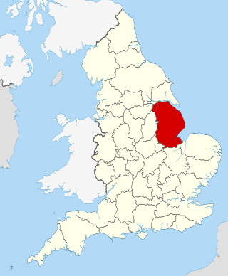
List of electoral wards in Lincolnshire

Last updated

This is a list of electoral divisions and wards in the ceremonial county of Lincolnshire in the East Midlands. All changes since the re-organisation of local government following the passing of the Local Government Act 1972 are shown. The number of councillors elected for each electoral division or ward is shown in brackets.

Contents

County council

Lincolnshire

Electoral Divisions from 1 April 1974 (first election 12 April 1973) to 7 May 1981: [1] [2]

  1. Boston No. 1 (1)
  2. Boston No. 2 (1)
  3. Boston No. 3 (1)
  4. Boston No. 4 (1)
  5. Boston Rural No. 1 (1)
  6. Boston Rural No. 2 (1)
  7. Boston Rural No. 3 (1)
  8. Bourne (1)
  9. Caistor Rural No. 1 (1)
  10. Caistor Rural No. 2 (1)
  11. East Elloe No. 1 (1)
  12. East Elloe No. 2 (1)
  13. East Elloe No. 3 (1)
  14. East Kesteven No. 1 (1)
  15. East Kesteven No. 2 (1)
  16. East Kesteven No. 3 (1)
  17. Gainsborough (Market) (1)
  18. Gainsborough (North) (1)
  19. Gainsborough (South) (1)
  20. Gainsborough Rural No. 1 (1)
  21. Gainsborough Rural No. 2 (1)
  22. Grantham No. 1 (1)
  23. Grantham No. 2 (1)
  24. Grantham No. 3 (1)
  25. Grantham No. 4 (1)
  26. Horncastle (1)
  27. Horncastle Rural No. 1 (1)
  28. Horncastle Rural No. 2 (1)
  29. Lincoln (Abbey) (1)
  30. Lincoln (Boultham) (1)
  31. Lincoln (Bracebridge) (1)
  32. Lincoln (Carholme) (1)
  33. Lincoln (Castle) (1)
  34. Lincoln (Ermine) (2)
  35. Lincoln (Hartsholme) (1)
  36. Lincoln (Minster) (1)
  37. Lincoln (Moorland) (1)
  38. Lincoln (Park) (1)
  39. Louth (North) (1)
  40. Louth (South) (1)
  41. Louth Rural No. 1 (Tetney) (1)
  42. Louth Rural No. 2 (1)
  43. Louth Rural No. 3 (1)
  44. Mablethorpe & Sutton (1)
  45. North Kesteven No. 1 (1)
  46. North Kesteven No. 2 (1)
  47. North Kesteven No. 3 (1)
  48. North Kesteven No. 4 (1)
  49. North Kesteven No. 5 (1)
  50. North Kesteven No. 6 (Skellingthorp (1)
  51. Skegness (North) (1)
  52. Skegness (South) (1)
  53. Sleaford (1)
  54. South Kesteven No. 1 (1)
  55. South Kesteven No. 2 (1)
  56. South Kesteven No. 3 (1)
  57. Spalding No. 1 (1)
  58. Spalding No. 2 (East) (1)
  59. Spalding No. 3 (1)
  60. Spalding Rural No. 1 (1)
  61. Spalding Rural No. 2 (1)
  62. Spalding Rural No. 3 (1)
  63. Spilsby No. 1 (1)
  64. Spilsby No. 2 (1)
  65. Spilsby No. 3 (1)
  66. Spilsby No. 4 (1)
  67. Stamford No. 1 (1)
  68. Stamford No. 2 (1)
  69. Welton No. 1 (1)
  70. Welton No. 2 (1)
  71. Welton No. 3 (1)
  72. West Kesteven No. 1 (1)
  73. West Kesteven No. 2 (1)
  74. West Kesteven No. 3 (1)

Electoral Divisions from 7 May 1981 to 7 June 2001: [2] [3]

  1. Alford & Spilsby (1)
  2. Alford Coast (1)
  3. Bardney & Cherry Willingham (1)
  4. Bassingham Rural (1)
  5. Billinghay & Cranwell (1)
  6. Birchwood (1)
  7. Bolingbroke Castle (1)
  8. Boston Rural South (1)
  9. Boston West (1)
  10. Boultham (1)
  11. Bourne Abbey (1)
  12. Bourne Castle (1)
  13. Caenby (1)
  14. Carholme (1)
  15. Cliff (1)
  16. Coastal (1)
  17. Crowland Rural (1)
  18. Devon & St Johns (1)
  19. Donington Rural (1)
  20. Earlesfield (1)
  21. East Elloe (1)
  22. Fenside (1)
  23. Folkingham Rural (1)
  24. Gainsborough East (1)
  25. Gainsborough North (1)
  26. Gainsborough Rural North (1)
  27. Gainsborough Rural South (1)
  28. Gainsborough South (1)
  29. Grantham North (1)
  30. Grantham South (1)
  31. Grantham West (1)
  32. Grimsthorpe (1)
  33. Harrowby (1)
  34. Holbeach (1)
  35. Holbeach Fen (1)
  36. Horncastle & Tetford (1)
  37. Hough (1)
  38. Hykeham Forum (1)
  39. Lincoln Abbey (1)
  40. Lincoln Bracebridge (1)
  41. Lincoln Castle (1)
  42. Lincoln Moorland (1)
  43. Lincoln Park (1)
  44. Longdales (1)
  45. Louth Marsh (1)
  46. Louth North (1)
  47. Louth Rural North (1)
  48. Louth South (1)
  49. Louth Wolds (1)
  50. Mablethorpe (1)
  51. Metheringham (1)
  52. Minster (1)
  53. Nettleham & Saxilby (1)
  54. North East Kesteven (1)
  55. North Wolds (1)
  56. Rasen Wolds (1)
  57. Skegness North (1)
  58. Skegness South (1)
  59. Skellingthorpe & Hykeham South (1)
  60. Skirbeck (1)
  61. Sleaford (1)
  62. Sleaford Rural North (1)
  63. Sleaford Rural South (1)
  64. Spalding Abbey (1)
  65. Spalding East & Weston (1)
  66. Spalding North West (1)
  67. Stamford North (1)
  68. Stamford South (1)
  69. Tattershall Castle (1)
  70. The Deepings (1)
  71. Tritton (1)
  72. Wainfleet & Burgh (1)
  73. West Elloe (1)
  74. Witham (1)
  75. Woodhall Spa & Wragby (1)
  76. Wyberton (1)

Electoral Divisions from 7 June 2001 to 4 May 2017: [4]

Lincolnshire UK electoral division map (blank).svg
  1. Alford & Sutton (1)
  2. Ancholme Cliff (1)
  3. Bardney & Cherry Willingham (1) †
  4. Bassingham Rural (1)
  5. Billinghay & Metheringham (1)
  6. Boston Coastal (1)
  7. Boston East (1)
  8. Boston Fishtoft (1)
  9. Boston North West (1)
  10. Boston Rural (1)
  11. Boston South (1)
  12. Boston West (1)
  13. Bourne Abbey (1)
  14. Bourne Castle (1)
  15. Bracebridge Heath & Waddington (1)
  16. Branston & Navenby (1)
  17. Colsterworth Rural (1)
  18. Crowland & Whaplode (1)
  19. Deeping St James (1)
  20. Donington Rural (1)
  21. Folkingham Rural (1)
  22. Gainsborough Hill (1)
  23. Gainsborough Rural South (1)
  24. Gainsborough Trent (1)
  25. Grantham Barrowby (1)
  26. Grantham East (1)
  27. Grantham North (1)
  28. Grantham North West (1)
  29. Grantham South (1)
  30. Heighington & Washingborough (1)
  31. Holbeach (1)
  32. Holbeach Rural (1)
  33. Horncastle & Tetford (1)
  34. Hough (1)
  35. Hykeham Forum (1)
  36. Ingoldmells Rural (1)
  37. Lincoln Birchwood (1)
  38. Lincoln Boultham (1)
  39. Lincoln Bracebridge (1)
  40. Lincoln East (1)
  41. Lincoln Glebe (1)
  42. Lincoln Hartsholme (1)
  43. Lincoln Moorland (1)
  44. Lincoln North (1)
  45. Lincoln Park (1)
  46. Lincoln West (1)
  47. Louth Marsh (1)
  48. Louth North (1)
  49. Louth Rural North (1)
  50. Louth South (1)
  51. Louth Wolds (1)
  52. Mablethorpe (1)
  53. Market & West Deeping (1)
  54. Market Rasen Wolds (1)
  55. Nettleham & Saxilby (1)
  56. North Wolds (1)
  57. Ruskington & Cranwell (1)
  58. Scotter Rural (1)
  59. Skegness North (1)
  60. Skegness South (1)
  61. Skellingthorpe & Hykeham South (1)
  62. Sleaford (1)
  63. Sleaford Rural South (1)
  64. Sleaford West & Leasingham (1)
  65. Spalding East & Moulton (1)
  66. Spalding Elloe (1)
  67. Spalding South (1)
  68. Spalding West (1)
  69. Spilsby Fen (1)
  70. Stamford North (1)
  71. Stamford Rural (1)
  72. Stamford West (1)
  73. Sutton Elloe (1)
  74. Tattershall Castle (1)
  75. Wainfleet & Burgh (1)
  76. Welton Rural (1) †
  77. Woodhall Spa & Wragby (1)

† minor boundary changes in 2009 [5]

Electoral Divisions from 4 May 2017 to present: [6]

Lincolnshire UK electoral division map 2017 (blank).svg
  1. Alford & Sutton (1)
  2. Bardney & Cherry Willingham (1)
  3. Bassingham & Welbourn (1)
  4. Birchwood (1)
  5. Boston Coastal (1)
  6. Boston North (1)
  7. Boston Rural (1)
  8. Boston South (1)
  9. Boston West (1)
  10. Boultham (1)
  11. Bourne North & Morton (1)
  12. Bourne South & Thurlby (1)
  13. Carholme (1)
  14. Colsterworth Rural (1)
  15. Crowland (1)
  16. Deepings East (1)
  17. Deepings West & Rural (1)
  18. Donington Rural (1)
  19. Eagle & Hykeham West (1)
  20. Ermine & Cathedral (1)
  21. Folkingham Rural (1)
  22. Gainsborough Hill (1)
  23. Gainsborough Rural South (1)
  24. Gainsborough Trent (1)
  25. Grantham Barrowby (1)
  26. Grantham East (1)
  27. Grantham North (1)
  28. Grantham South (1)
  29. Grantham West (1)
  30. Hartsholme (1)
  31. Heckington (1)
  32. Holbeach (1)
  33. Holbeach Rural (1)
  34. Horncastle & the Keals (1)
  35. Hough (1)
  36. Hykeham Forum (1)
  37. Ingoldmells Rural (1)
  38. Louth North (1)
  39. Louth South (1)
  40. Louth Wolds (1)
  41. Mablethorpe (1)
  42. Market Rasen Wolds (1)
  43. Metheringham Rural (1)
  44. Nettleham & Saxilby (1)
  45. North Wolds (1)
  46. Park (1)
  47. Potterhanworth & Coleby (1)
  48. Ruskington (1)
  49. Saltfleet & the Cotes (1)
  50. Scotter Rural (1)
  51. Skegness North (1)
  52. Skegness South (1)
  53. Skirbeck (1)
  54. Sleaford (1)
  55. Sleaford Rural (1)
  56. Spalding East (1)
  57. Spalding Elloe (1)
  58. Spalding South (1)
  59. Spalding West (1)
  60. St Giles (1)
  61. Stamford East (1)
  62. Stamford West (1)
  63. Swallow Beck & Witham (1)
  64. Tattershall Castle (1)
  65. The Suttons (1)
  66. Waddington & Hykeham East (1)
  67. Wainfleet (1)
  68. Washingborough (1)
  69. Welton Rural (1)
  70. Woodhall Spa & Wragby (1)

Unitary authority councils

North East Lincolnshire

Wards from 1 April 1996 (first election 4 May 1995) to 1 May 2003: [7]

  1. Croft Baker (3)
  2. Freshney (3)
  3. Haverstoe (3)
  4. Heneage (3)
  5. Humberston (3)
  6. Immingham (3)
  7. Marsh (3)
  8. North East (3)
  9. Park (Cleethorpes) (3)
  10. Park (Great Grimsby) (3)
  11. Scartho (3)
  12. South (3)
  13. Wold Parishes (3)
  14. Yarborough (3)

Wards from 1 May 2003 to present: [8]

North East Lincolnshire UK ward map 2010 (blank).svg
  1. Croft Baker (3)
  2. East Marsh (3)
  3. Freshney (3)
  4. Haverstoe (3)
  5. Heneage (3)
  6. Humberston & New Waltham (3)
  7. Immingham (3)
  8. Park (3)
  9. Scartho (3)
  10. Sidney Sussex (3)
  11. South (3)
  12. Waltham (2)
  13. West Marsh (2)
  14. Wolds (2)
  15. Yarborough (3)

North Lincolnshire

Wards from 1 April 1996 (first election 4 May 1995) to 1 May 2003: [7]

  1. Ashby (3)
  2. Bottesford (3)
  3. Brumby (3)
  4. Burton upon Stather & Gunness (2)
  5. Crosby & Park (3)
  6. Crowle, North Axholme & Keadby with Althorpe (2)
  7. Ferry (3)
  8. Frodingham & Town (3)
  9. Haven (3)
  10. Kingsway (3)
  11. Lincoln Gardens (3)
  12. North West & Winterton (2)
  13. Ridge (3)
  14. South Axholme (3)
  15. Wold (3)

Wards from 1 May 2003 to present: [9]

North Lincolnshire UK ward map 2010 (blank).svg
  1. Ashby (3)
  2. Axholme Central (2)
  3. Axholme North (2)
  4. Axholme South (2)
  5. Barton (3)
  6. Bottesford (3)
  7. Brigg & Wolds (3)
  8. Broughton & Appleby (2)
  9. Brumby (3)
  10. Burringham & Gunness (1)
  11. Burton upon Stather & Winterton (3)
  12. Crosby & Park (3)
  13. Ferry (3)
  14. Frodingham (2)
  15. Kingsway with Lincoln Gardens (3)
  16. Ridge (3)
  17. Town (2)

District councils

Boston

Wards from 1 April 1974 (first election 7 June 1973) to 3 May 1979: [10]

Wards from 3 May 1979 to 6 May 1999: [11]

Wards from 6 May 1999 to 7 May 2015: [12]

Boston UK ward map 2010 (blank).svg
  1. Central (1)
  2. Coastal (2)
  3. Fenside (2)
  4. Fishtoft (3)
  5. Five Village (2)
  6. Frampton & Holme (1)
  7. Kirton (2)
  8. North (2)
  9. Old Leake & Wrangle (2)
  10. Pilgrim (1)
  11. Skirbeck (3)
  12. South (1)
  13. Staniland South (2)
  14. Staniland North (1)
  15. Swineshead & Holland Fen (2)
  16. West (1)
  17. Witham (2)
  18. Wyberton (2)

Wards from 7 May 2015 to present: [13]

Boston UK ward map 2015 (blank).svg
  1. Coastal (2)
  2. Fenside (2)
  3. Fishtoft (3)
  4. Five Village (2)
  5. Kirton & Frampton (3)
  6. Old Leake & Wrangle (2)
  7. Skirbeck (3)
  8. St Thomas’ (1)
  9. Staniland (2)
  10. Station (1)
  11. Swineshead & Holland Fen (2)
  12. Trinity (2)
  13. West (1)
  14. Witham (2)
  15. Wyberton (2)

East Lindsey

Wards from 1 April 1974 (first election 7 June 1973) to 5 May 1983: [10]

Wards from 5 May 1983 to 6 May 1999: [14]

Wards from 6 May 1999 to 7 May 2015: [15]

East Lindsey UK ward map 2010 (blank).svg
  1. Alford (2)
  2. Binbrook (1)
  3. Burgh le Marsh (1)
  4. Chapel St Leonards (2)
  5. Coningsby & Tattershall (2)
  6. Croft (1)
  7. Frithville (1)
  8. Grimoldby (1)
  9. Halton Holegate (1)
  10. Holton le Clay (2)
  11. Horncastle (3)
  12. Hundleby (1)
  13. Ingoldmells (1)
  14. Legbourne (1)
  15. Ludford (1)
  16. Mablethorpe Central (1)
  17. Mablethorpe East (1)
  18. Mablethorpe North (1)
  19. Mareham le Fen (1)
  20. Marshchapel (1)
  21. North Holme (1)
  22. North Somercotes (1)
  23. North Thoresby (1)
  24. Priory (1)
  25. Roughton (1)
  26. St Clement's (2)
  27. St James' (1)
  28. St Margaret's (1)
  29. St Mary's (1)
  30. St Michael's (1)
  31. Scarbrough (2)
  32. Seacroft (2)
  33. Sibsey (1)
  34. Skidbrooke with Saltfleet Haven (1)
  35. Spilsby (1)
  36. Stickney (1)
  37. Sutton on Sea North (1)
  38. Sutton on Sea South (1)
  39. Tetford (1)
  40. Tetney (1)
  41. Trinity (1)
  42. Trusthorpe & Mablethorpe South (1)
  43. Wainfleet & Friskney (2)
  44. Willoughby with Sloothby (1)
  45. Winthorpe (2)
  46. Withern with Stain (1)
  47. Woodhall Spa (2)
  48. Wragby (1)

Wards from 7 May 2015 to present: [16]

East Lindsey UK ward map 2015 (blank).svg
  1. Alford (2)
  2. Binbrook (1)
  3. Burgh le Marsh (1)
  4. Chapel St Leonards (2)
  5. Coningsby & Mareham (3)
  6. Croft (1)
  7. Friskney (1)
  8. Fulstow (1)
  9. Grimoldby (1)
  10. Hagworthingham (1)
  11. Halton Holegate (1)
  12. Holton-le-Clay & North Thoresby (2)
  13. Horncastle (3)
  14. Ingoldmells (1)
  15. Legbourne (1)
  16. Mablethorpe (3)
  17. Marshchapel & Somercotes (2)
  18. North Holme (1)
  19. Priory & St James’ (2)
  20. Roughton (1)
  21. Scarbrough & Seacroft (3)
  22. Sibsey & Stickney (2)
  23. Spilsby (1)
  24. St Clement’s (2)
  25. St Margaret’s (1)
  26. St Mary’s (1)
  27. St Michael’s (1)
  28. Sutton on Sea (2)
  29. Tetford & Donington (1)
  30. Tetney (1)
  31. Trinity (1)
  32. Wainfleet (1)
  33. Willoughby with Sloothby (1)
  34. Winthorpe (2)
  35. Withern & Theddlethorpe (1)
  36. Woodhall Spa (2)
  37. Wragby (1)

Lincoln

Wards from 1 April 1974 (first election 7 June 1973) to 3 May 1979: [10]

  1. Abbey (3)
  2. Boultham (3)
  3. Bracebridge (3)
  4. Carholme (3)
  5. Castle (3)
  6. Ermine (3)
  7. Hartsholme (3)
  8. Minster (3)
  9. Moorland (3)
  10. Park (3)

Wards from 3 May 1979 to 6 May 1999: [17]

Lincoln UK ward map 1979 (blank).svg
  1. Abbey (3)
  2. Birchwood (3)
  3. Boultham (3)
  4. Bracebridge (3)
  5. Carholme (3)
  6. Castle (3)
  7. Longdales (3)
  8. Minster (3)
  9. Moorland (3)
  10. Park (3)
  11. Tritton (3)

Wards from 6 May 1999 to 3 May 2007: [18]

Lincoln UK ward map 1999 (blank).svg
  1. Abbey (3)
  2. Birchwood (3)
  3. Boultham (3)
  4. Bracebridge (3)
  5. Carholme (3)
  6. Castle (3)
  7. Glebe (3)
  8. Hartsholme (3)
  9. Minster (3)
  10. Moorland (3)
  11. Park (3)

Wards from 3 May 2007 to 5 May 2016: [19]

Lincoln UK ward map 2010 (blank).svg
  1. Abbey (3)
  2. Birchwood (3)
  3. Boultham (3)
  4. Bracebridge (3)
  5. Carholme (3)
  6. Castle (3)
  7. Glebe (3)
  8. Hartsholme (3)
  9. Minster (3)
  10. Moorland (3)
  11. Park (3)

Wards from 5 May 2016 to present: [20]

Lincoln UK ward map 2016 (blank).svg
  1. Abbey (3)
  2. Birchwood (3)
  3. Boultham (3)
  4. Carholme (3)
  5. Castle (3)
  6. Glebe (3)
  7. Hartsholme (3)
  8. Minster (3)
  9. Moorland (3)
  10. Park (3)
  11. Witham (3)

North Kesteven

Wards from 1 April 1974 (first election 7 June 1973) to 3 May 1979: [10]

Wards from 3 May 1979 to 6 May 1999: [21]

Wards from 6 May 1999 to 3 May 2007: [22]

  1. Ashby de la Launde (1)
  2. Bassingham (1)
  3. Billinghay (1)
  4. Bracebridge Heath & Waddington East (3)
  5. Branston & Mere (2)
  6. Brant Broughton (1)
  7. Cliff Villages (2)
  8. Cranwell & Byard’s Leap (1)
  9. Eagle & North Scarle (1)
  10. Heckington Rural (2)
  11. Heighington & Washingborough (3)
  12. Kyme (1)
  13. Leasingham & Roxholm (1)
  14. Martin (1)
  15. Metheringham (2)
  16. North Hykeham Forum (1)
  17. North Hykeham Memorial (1)
  18. North Hykeham Mill (1)
  19. North Hykeham Moor (1)
  20. North Hykeham Witham (1)
  21. Osbournby (1)
  22. Ruskington (2)
  23. Skellingthorpe (2)
  24. Sleaford Castle (1)
  25. Sleaford Holdingham (1)
  26. Sleaford Mareham (1)
  27. Sleaford Navigation (1)
  28. Sleaford Quarrington (1)
  29. Sleaford Westholme (1)
  30. Waddington West (1)

Wards from 3 May 2007 to present: [23]

North Kesteven UK ward map 2010 (blank).svg
  1. Ashby de la Launde & Cranwell (2)
  2. Bassingham & Brant Broughton (2)
  3. Billinghay, Martin & North Kyme (2)
  4. Bracebridge Heath & Waddington East (3)
  5. Branston (2)
  6. Cliff Villages (2)
  7. Eagle, Swinderby & Witham St Hughs (2)
  8. Heckington Rural (2)
  9. Heighington & Washingborough (3)
  10. Kirkby la Thorpe & South Kyme (1)
  11. Leasingham & Rauceby (1)
  12. Metheringham (2)
  13. North Hykeham Forum (1)
  14. North Hykeham Memorial (1)
  15. North Hykeham Mill (2)
  16. North Hykeham Moor (1)
  17. North Hykeham Witham (1)
  18. Osbournby (1)
  19. Ruskington (2)
  20. Skellingthorpe (2)
  21. Sleaford Castle (1)
  22. Sleaford Holdingham (1)
  23. Sleaford Navigation (1)
  24. Sleaford Quarrington & Mareham (3)
  25. Sleaford Westholme (1)
  26. Waddington West (1)

South Holland

Wards from 1 April 1974 (first election 7 June 1973) to 3 May 1979: [10]

Wards from 3 May 1979 to 6 May 1999: [24]

Wards from 6 May 1999 to 3 May 2007: [25]

  1. Crowland (2)
  2. Deeping St Nicholas (1)
  3. Donington (2)
  4. Fleet (1)
  5. Gedney (1)
  6. Gosberton Village (1)
  7. Holbeach Hurn (1)
  8. Holbeach St John's (1)
  9. Holbeach Town (3)
  10. Long Sutton (3)
  11. Pinchbeck (3)
  12. Spalding Castle (1)
  13. Spalding Monks House (2)
  14. Spalding St John's (2)
  15. Spalding St Mary's (2)
  16. Spalding St Paul's (2)
  17. Spalding Wygate (2)
  18. Surfleet (1)
  19. Sutton Bridge (2)
  20. The Saints (1)
  21. Weston & Moulton (3)
  22. Whaplode (1)

Wards from 3 May 2007 to present: [26]

South Holland UK ward map 2010 (blank).svg
  1. Crowland & Deeping St Nicholas (3)
  2. Donington, Quadring & Gosberton (3)
  3. Fleet (1)
  4. Gedney (1)
  5. Holbeach Hurn (1)
  6. Holbeach Town (3)
  7. Long Sutton (3)
  8. Moulton, Weston & Cowbit (3)
  9. Pinchbeck & Surfleet (3)
  10. Spalding Castle (1)
  11. Spalding Monks House (2)
  12. Spalding St John’s (2)
  13. Spalding St Mary’s (2)
  14. Spalding St Paul’s (2)
  15. Spalding Wygate (2)
  16. Sutton Bridge (2)
  17. The Saints (1)
  18. Whaplode & Holbeach St John’s (2)

South Kesteven

Wards from 1 April 1974 (first election 7 June 1973) to 3 May 1979: [10]

Wards from 3 May 1979 to 6 May 1999: [27]

Wards from 6 May 1999 to 7 May 2015: [28]

South Kesteven UK ward map 2010 (blank).svg
  1. All Saints (2)
  2. Aveland (1)
  3. Barrowby (1)
  4. Belmont (2)
  5. Bourne East (3)
  6. Bourne West (3)
  7. Deeping St James (3)
  8. Earlesfield (3)
  9. Ermine (1)
  10. Forest (1)
  11. Glen Eden (1)
  12. Grantham St John's (2)
  13. Green Hill (2)
  14. Greyfriars (2)
  15. Harrowby (3)
  16. Heath (1)
  17. Hillsides (1)
  18. Isaac Newton (1)
  19. Lincrest (1)
  20. Loveden (1)
  21. Market & West Deeping (3)
  22. Morkery (1)
  23. Peascliffe (1)
  24. Ringstone (1)
  25. Saxonwell (1)
  26. St Anne's (2)
  27. St George's (2)
  28. St Mary's (2)
  29. St Wulfram's (2)
  30. Stamford St John's (3)
  31. Thurlby (1)
  32. Toller (1)
  33. Truesdale (2)
  34. Witham Valley (1)

Wards from 7 May 2015 to present: [29]

South Kesteven UK ward map 2015 (blank).svg
  1. Aveland (1)
  2. Belmont (2)
  3. Belvoir (2)
  4. Bourne Austerby (3)
  5. Bourne East (2)
  6. Bourne West (2)
  7. Casewick (2)
  8. Castle (1)
  9. Deeping St James (3)
  10. Dole Wood (1)
  11. Glen (1)
  12. Grantham Arnoldfield (2)
  13. Grantham Barrrowby Gate (2)
  14. Grantham Earlesfield (2)
  15. Grantham Harrowby (2)
  16. Grantham St Vincent’s (3)
  17. Grantham St Wulfram’s (2)
  18. Grantham Springfield (2)
  19. Isaac Newton (2)
  20. Lincrest (1)
  21. Loveden Heath (1)
  22. Market & West Deeping (3)
  23. Morton (1)
  24. Peascliffe & Ridgeway (2)
  25. Stamford All Saints (2)
  26. Stamford St George’s (2)
  27. Stamford St John’s (2)
  28. Stamford St Mary’s (2)
  29. Toller (1)
  30. Viking (2)

West Lindsey

Wards from 1 April 1974 (first election 7 June 1973) to 3 May 1979: [10]

Wards from 3 May 1979 to 6 May 1999: [30]

Wards from 6 May 1999 to 7 May 2015: [31]

West Lindsey UK ward map 2010 (blank).svg
  1. Bardney (1)
  2. Caistor (2)
  3. Cherry Willingham (2)
  4. Dunholme (1)
  5. Fiskerton (1) †
  6. Gainsborough East (3)
  7. Gainsborough North (3)
  8. Gainsborough South-West (2)
  9. Hemswell (1)
  10. Kelsey (1)
  11. Lea (1)
  12. Market Rasen (2)
  13. Middle Rasen (1)
  14. Nettleham (2)
  15. Saxilby (2)
  16. Scampton (1)
  17. Scotter (2)
  18. Stow (1)
  19. Sudbrooke (1) †
  20. Thonock (1)
  21. Torksey (1)
  22. Waddingham & Spital (1)
  23. Welton (2)
  24. Wold View (1)
  25. Yarborough (1)

† minor boundary changes in 2008 [5]

Wards from 7 May 2015 to present: [32]

West Lindsey UK ward map 2015 (blank).svg
  1. Bardney (1)
  2. Caistor & Yarborough (2)
  3. Cherry Willingham (3)
  4. Dunholme & Welton (3)
  5. Gainsborough East (3)
  6. Gainsborough North (3)
  7. Gainsborough South-West (2)
  8. Hemswell (1)
  9. Kelsey Wold (1)
  10. Lea (1)
  11. Market Rasen (3)
  12. Nettleham (2)
  13. Saxilby (2)
  14. Scampton (1)
  15. Scotter & Blyton (3)
  16. Stow (1)
  17. Sudbrooke (1)
  18. Torksey (1)
  19. Waddingham & Spital (1)
  20. Wold View (1)

Former county council

Humberside

Electoral Divisions from 1 April 1974 (first election 12 April 1973) to 7 May 1981: [33] [34]

  1. Barton upon Humber (1)
  2. Beverley (Minster) (1)
  3. Beverley (St Marys) (1)
  4. Beverley Rural No. 1 (1)
  5. Beverley Rural No. 2 (1)
  6. Beverley Rural No. 3 (1)
  7. Beverley Rural No. 4 (1)
  8. Bridlington No. 1 (1)
  9. Bridlington No. 2 (1)
  10. Bridlington No. 3 (Old Town East) (1)
  11. Bridlington No. 4 (Quay North) (1)
  12. Bridlington Rural (1)
  13. Brigg (1)
  14. Cleethorpes No. 1 (Alexandra) (1)
  15. Cleethorpes No. 2 (South) (1)
  16. Cleethorpes No. 3 (2)
  17. Driffield (1)
  18. Driffield Rural (1)
  19. Glanford Brigg No. 1 (1)
  20. Glanford Brigg No. 2 (1)
  21. Glanford Brigg No. 3 (1)
  22. Glanford Brigg No. 4 (1)
  23. Glanford Brigg No. 5 (1)
  24. Goole No. 1 (1)
  25. Goole No. 2 (1)
  26. Goole Rural (1)
  27. Grimsby No. 1 (East Marsh) (1)
  28. Grismby No. 2 (Littlecoates) (1)
  29. Grimsby No. 3 (Springfield) (1)
  30. Grimsby No. 4 (Alexandra) (1)
  31. Grimsby No. 5 (Weelsby) (1)
  32. Grimsby No. 6 (West) (1)
  33. Grimsby No. 7 (Clee) (1)
  34. Grimsby No. 8 (Central) (1)
  35. Grimsby No. 9 (Littlefield) (1)
  36. Grimsby No. 10 (Nunsthorpe) (1)
  37. Grimsby No. 11 (Wellow) (1)
  38. Grimsby Rural No. 1 (Humberstone) (1)
  39. Grimsby Rural No. 2 (Laceby) (1)
  40. Grimsby Rural No. 3 (Immingham) (1)
  41. Haltemprice (Central) (2)
  42. Haltemprice (Cottingham) (2)
  43. Haltemprice (Hessle) (2)
  44. Holderness No. 1 (1)
  45. Holderness No. 2 (1)
  46. Holderness No. 3 (1)
  47. Hornsea (1)
  48. Howden No. 1 (1)
  49. Howden No. 2 (1)
  50. Isle of Axholme No. 1 (West Butterw (1)
  51. Isle of Axholme No. 2 (Epworth) (1)
  52. Kingston upon Hull No. 1 (Longhill) (3)
  53. Kingston upon Hull No. 2 (Greatfiel (3)
  54. Kingston upon Hull No. 3 (Holdernes (3)
  55. Kingston upon Hull No. 4 (Stoneferr (3)
  56. Kingston upon Hull No. 5 (Drypool/M (3)
  57. Kingston upon Hull No. 6 (Coltman/S (3)
  58. Kingston upon Hull No. 7 (Pickering (3)
  59. Kingston upon Hull No. 8 (Boothferr (3)
  60. Kingston upon Hull No. 9 (Beverley/ (3)
  61. Kingston upon Hull No. 10 (Avenue/N (3)
  62. Kingston upon Hull No. 11 (Greenwoo (3)
  63. Pocklington No. 1 (1)
  64. Pocklington No. 2 (1)
  65. Scunthorpe No. 1 (Ashby) (1)
  66. Scunthorpe No. 2 (Brumby) (1)
  67. Scunthorpe No. 3 (Crosby Town) (1)
  68. Scunthorpe No. 4 (Frodingham & Gran (1)
  69. Scunthorpe No. 5 (Lincoln Gardens) (1)
  70. Scunthorpe No. 6 (Park) (1)
  71. Scunthorpe No. 7 (Riddings) (1)
  72. Scunthorpe No. 8 (West) (1)
  73. Withernsea (1)

Electoral Divisions from 7 May 1981 to 1 April 1996 (county abolished): [34] [35]

  1. Alexandra (1)
  2. Ashby (1)
  3. Avenue (1)
  4. Bellfield (1)
  5. Beverley Rural (1)
  6. Bilton Grange (1)
  7. Boothferry West (1)
  8. Bottesford (1)
  9. Bridlington North (1)
  10. Bridlington Old Town (1)
  11. Bridlington South (1)
  12. Brumby (1)
  13. Cottingham North (1)
  14. Cottingham South (1)
  15. Croft Baker (1)
  16. Crosby/Park (1)
  17. Dale (1)
  18. Derringham (1)
  19. Driffield & Rural (1)
  20. Drypool (1)
  21. East Bransholme (1)
  22. East Ella (1)
  23. East Park (1)
  24. East Wolds & Coastal (1)
  25. Endike (1)
  26. Ermine (1)
  27. Ferry (Glanford) (1)
  28. Ferry (Hull) (1)
  29. Freshney (1)
  30. Frodingham/Town (1)
  31. Goole (1)
  32. Haven (1)
  33. Haverstoe (1)
  34. Heneage (1)
  35. Hessle (1)
  36. Howdenshire (1)
  37. Humberston (1)
  38. Immingham (1)
  39. Inglemire (1)
  40. Kingsway (1)
  41. Lincoln Gardens (1)
  42. Longhill (1)
  43. Marfleet (1)
  44. Marsh (1)
  45. Mid Boothferry (1)
  46. Mid Holderness (1)
  47. Minster (1)
  48. Myton (1)
  49. Newington (1)
  50. Newland (1)
  51. North East (1)
  52. North Holderness (1)
  53. Orchard Park (1)
  54. Park (Cleethorpes) (1)
  55. Park (Grimsby) (1)
  56. Park (Hull) (1)
  57. Pickering (1)
  58. Pocklington Provincial (1)
  59. Ridge (1)
  60. Scartho (1)
  61. South (1)
  62. South Axholme (1)
  63. South Hunsley (1)
  64. Southeast Holderness (1)
  65. Southwest Holderness (1)
  66. St Andrews (1)
  67. St Marys (1)
  68. Sutton (1)
  69. Tranby (1)
  70. West Bransholme (1)
  71. Wold (1)
  72. Wold Parishes (1)
  73. Wolds Weighton (1)
  74. Wolfreton (1)
  75. Yarborough (1)

Former district councils

Boothferry

See: List of electoral wards in the East Riding of Yorkshire#Boothferry

Cleethorpes

Wards from 1 April 1974 (first election 7 June 1973) to 3 May 1979: [36]

Wards from 3 May 1979 to 1 April 1996 (district abolished): [37]

Glanford

Wards from 1 April 1974 (first election 7 June 1973) to 3 May 1979: [36]

Wards from 3 May 1979 to 1 April 1996 (district abolished): [38]

Great Grimsby

Wards from 1 April 1974 (first election 7 June 1973) to 3 May 1979: [36]

Wards from 3 May 1979 to 1 April 1996 (district abolished): [39]

Scunthorpe

Wards from 1 April 1974 (first election 7 June 1973) to 3 May 1979: [36]

Wards from 3 May 1979 to 1 April 1996 (district abolished): [40]

Electoral wards by constituency

Brigg and Goole

Axholme Central, Axholme North, Axholme South, Brigg and Wolds, Broughton and Appleby, Burringham and Gunness, Burton upon Stather and Winterton, Goole North, Goole South, Snaith, Airmyn, Rawcliffe and Marshland.

Boston and Skegness

Burgh le Marsh, Central, Coastal, Croft, Fenside, Fishtoft, Five Village, Frampton and Holme, Frithville, Ingoldmells, Kirton, North, Old Leake and Wrangle, Pilgrim, St Clement's, Scarbrough, Seacroft, Sibsey, Skirbeck, South, Staniland North, Staniland South, Stickney, Swineshead and Holland Fen, Wainfleet and Friskney, West, Winthorpe, Witham, Wyberton.

Cleethorpes

Barton, Croft Baker, Ferry, Haverstoe, Humberston and New Waltham, Immingham, Sidney Sussex, Waltham, Wolds.

Gainsborough

Bardney, Caistor, Cherry Willingham, Dunholme, Fiskerton, Gainsborough East, Gainsborough North, Gainsborough South-West, Hemswell, Kelsey, Lea, Market Rasen, Middle Rasen, Nettleham, Saxilby, Scampton, Scotter, Stow, Sudbrooke, Thonock, Torksey, Waddingham and Spital, Welton, Wold View, Wragby, Yarborough.

Grantham and Stamford

All Saints, Aveland, Belmont, Bourne East, Bourne West, Earlesfield, Forest, Glen Eden, Grantham St John's, Green Hill, Greyfriars, Harrowby, Hillsides, Isaac Newton, Lincrest, Morkery, Ringstone, St Anne's, St George's, St Mary's, St Wulfram's, Stamford St John's, Thurlby, Toller, Truesdale.

Great Grimsby

East Marsh, Freshney, Heneage, Park, Scartho, South, West Marsh, Yarborough.

Lincoln

Abbey, Birchwood, Boultham, Bracebridge, Bracebridge Heath and Waddington East, Carholme, Castle, Glebe, Hartsholme, Minster, Moorland, Park, Skellingthorpe.

Louth and Horncastle

Alford, Binbrook, Chapel St Leonards, Coningsby and Tattershall, Grimoldby, Halton Holegate, Holton le Clay, Horncastle, Hundleby, Legbourne, Ludford, Mablethorpe Central, Mablethorpe East, Mablethorpe North, Mareham le Fen, Marshchapel, North Holme, North Somercotes, North Thoresby, Priory, Roughton, St James’, St Margaret's, St Mary's, St Michael's, Skidbrooke with Saltfleet Haven, Spilsby, Sutton on Sea North, Sutton on Sea South, Tetford, Tetney, Trinity, Trusthorpe and Mablethorpe South, Willoughby with Sloothby, Withern with Stain, Woodhall Spa.

Scunthorpe

Ashby, Bottesford, Brumby, Crosby and Park, Frodingham, Kingsway with Lincoln Gardens, Ridge, Town.

Sleaford and North Hykeham

Ashby de la Launde, Barrowby, Bassingham, Billinghay, Branston and Mere, Brant Broughton, Cliff Villages, Cranwell and Byard's Leap, Eagle and North Scarle, Ermine, Heath, Heckington Rural, Heighington and Washingborough, Kyme, Leasingham and Roxholm, Loveden, Martin, Metheringham, North Hykeham Forum, North Hykeham Memorial, North Hykeham Mill, North Hykeham Moor, North Hykeham Witham, Osbournby, Peascliffe, Ruskington, Saxonwell, Sleaford Castle, Sleaford Holdingham, Sleaford Mareham, Sleaford Navigation, Sleaford Quarrington, Sleaford Westholme, Waddington West, Witham Valley.

South Holland and The Deepings

Crowland, Deeping St James, Deeping St Nicholas, Donington, Fleet, Gedney, Gosberton Village, Holbeach Hurn, Holbeach St John's, Holbeach Town, Long Sutton, Market and West Deeping, Pinchbeck, Spalding Castle, Spalding Monks House, Spalding St John's, Spalding St Mary's, Spalding St Paul's, Spalding Wygate, Surfleet, Sutton Bridge, The Saints, Weston and Moulton, Whaplode.

See also

Related Research Articles

<span class="mw-page-title-main">Lincolnshire</span> County of England

Lincolnshire is a county in the east of England, with a long coastline on the North Sea. It is divided between the East Midlands and the Yorkshire and Humber regions. It borders Norfolk to the south-east, Cambridgeshire to the south, Rutland to the south-west, Leicestershire and Nottinghamshire to the west, South Yorkshire to the north-west, and the East Riding of Yorkshire to the north. It also borders Northamptonshire in the south for just 20 yards (19 m), England's shortest county boundary. The county town is Lincoln, where the county council is also based.

<span class="mw-page-title-main">Kesteven</span> Traditional division of Lincolnshire, England

The Parts of Kesteven are a traditional division of Lincolnshire, England. This division had long had a separate county administration, along with the two other Parts of Lincolnshire, Lindsey and Holland.

<span class="mw-page-title-main">East Lindsey</span> Non-metropolitan district in England

East Lindsey is a local government district in Lincolnshire, England. The population of the district council was 142,300 at the 2021 census. The council is based in Horncastle having moved from its former headquarters at Manby in December 2022. Other major settlements in the district include Alford, Wragby, Spilsby, Mablethorpe, Skegness, Horncastle, Chapel St Leonards, Louth and Woodhall Spa. Skegness is the largest town in East Lindsey, followed by Louth.

<span class="mw-page-title-main">North Kesteven</span> District in England

North Kesteven is a local government district in Lincolnshire, England. The district is located to the east of Nottinghamshire, north-east of Leicestershire and south of the city of Lincoln. Its council, North Kesteven District Council, is based in Sleaford in the former offices of Kesteven County Council. Notable towns and villages in the district include Cranwell, Metheringham, North Hykeham, Sleaford and Waddington.

<span class="mw-page-title-main">Parts of Lindsey</span> Historic division of Lincolnshire, England

The Parts of Lindsey are a traditional division of Lincolnshire, England, covering the northern part of the county. The Isle of Axholme, which is on the west side of the River Trent, has normally formed part of it. The district's name originated from the Kingdom of Lindsey of Anglo-Saxon times, whose territories were merged with that of Stamford to form Lincolnshire.

<span class="mw-page-title-main">Grantham and Stamford (UK Parliament constituency)</span> Parliamentary constituency in the United Kingdom, 1997 onwards

Grantham and Stamford is a constituency represented in the House of Commons of the UK Parliament since 2019 by Gareth Davies, a Conservative.

<span class="mw-page-title-main">Louth and Horncastle (UK Parliament constituency)</span> Parliamentary constituency in the United Kingdom, 1997 onwards

Louth and Horncastle is a constituency in Lincolnshire represented in the House of Commons of the UK Parliament since 2015 by Victoria Atkins, a Conservative.

<span class="mw-page-title-main">Sleaford and North Hykeham (UK Parliament constituency)</span> Parliamentary constituency in the United Kingdom, 1997 onwards

Sleaford and North Hykeham is a parliamentary constituency in Lincolnshire, England which elects a single Member of Parliament (MP) to the House of Commons of the UK Parliament. It has been represented since 2016 by Dr Caroline Johnson, who is a member of the Conservative Party. The seat was created in 1997 and has always been represented by Members of Parliament (MPs) from the Conservative Party; like all British constituencies, it elects one candidate by the first-past-the-post voting system. Johnson became the MP for the constituency after a by-election in December 2016, following the resignation of the previous MP for the seat, Stephen Phillips. The constituency is considered a safe seat for the Conservatives.

<span class="mw-page-title-main">Lincolnshire Police</span> English territorial police force

Lincolnshire Police is the territorial police force covering the non-metropolitan county of Lincolnshire in the East Midlands of England. Despite the name, the force's area does not include North East Lincolnshire and North Lincolnshire, which are covered by Humberside Police instead.

Lincolnshire is one of the few counties within the UK that still uses the eleven-plus to decide who may attend grammar school, in common with Buckinghamshire and Kent.

<span class="mw-page-title-main">Spalding railway station</span> Railway station in Lincolnshire, England

Spalding railway station serves the town of Spalding, Lincolnshire, England. It lies on the Peterborough–Lincoln line.

Midlands 3 East (North) is a level 8 English Rugby Union league and level 3 of the Midlands League, made up of teams from the northern part of the East Midlands region including clubs from Derbyshire, Lincolnshire, Nottinghamshire and the occasional team from Leicestershire, with home and away matches played throughout the season. When this division began in 1992 it was known as Midlands East 2, until it was split into two regional divisions called Midlands 4 East (North) and Midlands 4 East (South) ahead of the 2000–01 season. Further restructuring of the Midlands leagues ahead of the 2009–10 season, led to the current name of Midlands 3 East (North).

<span class="mw-page-title-main">Bracebridge, Lincolnshire</span> Suburb of Lincoln, England

Bracebridge is a suburb of Lincoln, Lincolnshire, England. It is situated approximately 2 miles (3 km) south from the city centre on the main A1434 Newark Road, stretching approximately from St Catherine's to Swallowbeck alongside the east bank of the River Witham, and the village of Bracebridge Heath.

The Lincolnshire lines of the Great Northern Railway are the railways, past and present, in the English county built or operated by the Great Northern Railway.

<span class="mw-page-title-main">Central Lincolnshire</span>

Central Lincolnshire is the name given to a region of Lincolnshire in the East Midlands, England. The area covers the districts of North Kesteven and West Lindsey as well as the City of Lincoln. The name is used for the planning and development of a part of Lincolnshire surrounding Lincoln, North Hykeham, Sleaford, Market Rasen, Caistor and Gainsborough as well as other outlying villages and hamlets.

References

  1. The County of Lincolnshire (Electoral Divisions) Order 1973
  2. 1 2 Rallings, Colin; Thrasher, Michael. Lincolnshire County Council Election Results 1973-2009 (PDF). The Elections Centre. Retrieved 12 May 2016.
  3. The County of Lincolnshire (Electoral Arrangements) Order 1980
  4. legislation.gov.uk - The County of Lincolnshire (Electoral Changes) Order 2000. Retrieved on 4 October 2015.
  5. 1 2 legislation.gov.uk - The West Lindsey (Electoral Changes) Order 2007. Retrieved on 3 November 2015.
  6. "The Lincolnshire (Electoral Changes) Order 2016". gov.uk . 13 December 2016. Retrieved 21 April 2022.
  7. 1 2 legislation.gov.uk - The Humberside (Structural Change) Order 1995. Retrieved on 6 November 2015.
  8. legislation.gov.uk - The Borough of North East Lincolnshire (Electoral Changes) Order 2001. Retrieved on 4 October 2015.
  9. legislation.gov.uk - The Borough of North Lincolnshire (Electoral Changes) Order 2001. Retrieved on 4 October 2015.
  10. 1 2 3 4 5 6 7 The County of Lincolnshire (District Wards) Order 1973
  11. The Borough of Boston (Electoral Arrangements) Order 1977
  12. legislation.gov.uk - The Borough of Boston (Electoral Changes) Order 1998. Retrieved on 4 October 2015.
  13. legislation.gov.uk - The Boston (Electoral Changes) Order 2013. Retrieved on 3 November 2015.
  14. The District of East Lindsey (Electoral Arrangements) Order 1979
  15. legislation.gov.uk - The District of East Lindsey (Electoral Changes) Order 1998. Retrieved on 4 October 2015.
  16. legislation.gov.uk - The East Lindsey (Electoral Changes) Order 2014. Retrieved on 3 November 2015.
  17. The City of Lincoln (Electoral Arrangements) Order 1978
  18. legislation.gov.uk - The City of Lincoln (Electoral Changes) Order 1998. Retrieved on 4 October 2015.
  19. legislation.gov.uk - The City of Lincoln (Electoral Changes) Order 2006. Retrieved on 3 November 2015.
  20. legislation.gov.uk - The Lincoln (Electoral Changes) Order 2015. Retrieved on 3 November 2015.
  21. The District of North Kesteven (Electoral Arrangements) Order 1977
  22. legislation.gov.uk - The District of North Kesteven (Parishes and Electoral Changes) Order 1998. Retrieved on 4 October 2015.
  23. legislation.gov.uk - The District of North Kesteven (Electoral Changes) Order 2006. Retrieved on 3 November 2015.
  24. legislation.gov.uk - The District of South Holland (Electoral Arrangements) Order 1978. Retrieved on 19 November 2015.
  25. legislation.gov.uk - The District of South Holland (Electoral Changes) Order 1998. Retrieved on 4 October 2015.
  26. legislation.gov.uk - The District of South Holland (Electoral Changes) Order 2007. Retrieved on 3 November 2015.
  27. The District of South Kesteven (Electoral Arrangements) Order 1978
  28. legislation.gov.uk - The District of South Kesteven (Electoral Changes) Order 1998. Retrieved on 4 October 2015.
  29. legislation.gov.uk - The South Kesteven (Electoral Changes) Order 2014. Retrieved on 3 November 2015.
  30. legislation.gov.uk - The District of West Lindsey (Electoral Arrangements) Order 1978. Retrieved on 19 November 2015.
  31. legislation.gov.uk - The District of West Lindsey (Electoral Changes) Order 1998. Retrieved on 4 October 2015.
  32. legislation.gov.uk - The West Lindsey (Electoral Changes) Order 2012. Retrieved on 3 November 2015.
  33. The County of Humberside (Electoral Divisions) Order 1973
  34. 1 2 Rallings, Colin; Thrasher, Michael. Humberside County Council Election Results 1973-1993 (PDF). The Elections Centre. Retrieved 12 May 2016.
  35. The County of Humberside (Electoral Arrangements) Order 1981
  36. 1 2 3 4 The County of Humberside (District Wards) Order 1973
  37. The Borough of Cleethorpes (Electoral Arrangements) Order 1976
  38. The Borough of Glanford (Electoral Arrangements) Order 1976
  39. The Borough of Grimsby (Electoral Arrangements) Order 1978
  40. The Borough of Scunthorpe (Electoral Arrangements) Order 1976