List of electoral wards in Shropshire

Last updated

This is a list of electoral divisions and wards in the ceremonial county of Shropshire in the West Midlands. All changes since the re-organisation of local government following the passing of the Local Government Act 1972 are shown. The number of councillors elected for each electoral division or ward is shown in brackets.

Contents

County council

Shropshire

Electoral Divisions from 1 April 1974 (first election 12 April 1973) to 7 May 1981: [1] [2]

  1. Albrighton (1)
  2. Baschurch (1)
  3. Bishops Castle & Chirbury (1)
  4. Bridgnorth (2)
  5. Broseley (1)
  6. Chelmarsh (1)
  7. Church Stretton (1)
  8. Clee Hill & Corvedale (1)
  9. Cleobury Mortimer (1)
  10. Clun & Lydbury (1)
  11. Condover (1)
  12. Dawley Magna (1)
  13. Donnington (1)
  14. Drayton (1)
  15. Ellesmere (1)
  16. Ford (1)
  17. Hadley (1)
  18. High Ercall (1)
  19. Highley (1)
  20. Hinstock (1)
  21. Hodnet (1)
  22. Lilleshall (1)
  23. Ludlow (1)
  24. Madeley (2)
  25. Malinsee (1)
  26. Montford (1)
  27. Morfe (1)
  28. Much Wenlock (1)
  29. Newport (2)
  30. Oswestry (Eastern) (1)
  31. Oswestry (Western) (1)
  32. Pontesbury (1)
  33. Prees (1)
  34. Ruyton-XI-Towns (1)
  35. Shawbury (1)
  36. Shifnal (1)
  37. Shrewsbury (Abbey) (1)
  38. Shrewsbury (Battlefield & Harlescott (2)
  39. Shrewsbury (Belle Vue) (2)
  40. Shrewsbury (Castle) (1)
  41. Shrewsbury (Ditherington) (1)
  42. Shrewsbury (Kingsland) (1)
  43. Shrewsbury (Monkmoor) (1)
  44. Shrewsbury (Welsh) (1)
  45. St Oswald (1)
  46. Teme (1)
  47. Wellington (Haygate) (1)
  48. Wellington (Park) (2)
  49. Wem (1)
  50. Weston Rhyn (1)
  51. Whitchurch (1)
  52. Whittington (1)
  53. Wombridge (2)
  54. Wrekin (1)
  55. Wrockwardine Wood (1)
  56. Wroxeter (1)

Electoral Divisions from 7 May 1981 to 5 May 2005: [2] [3]

  1. Albrighton (1)
  2. Bagley (1)
  3. Bayston Hill (1)
  4. Belle Vue (1)
  5. Bishops Castle (1)
  6. Bridgnorth Rural (1)
  7. Bridgnorth Town (1)
  8. Brookside (1); electoral division abolished in 1998 [4]
  9. Broseley (1)
  10. Burnell (1)
  11. Castlefields & Ditherington (1)
  12. Church Stretton (1)
  13. Clee Hill (1)
  14. Clun (1)
  15. College (1); electoral division abolished in 1998 [4]
  16. Copthorne (1)
  17. Corvedale (1)
  18. Cuckoo Oak (1); electoral division abolished in 1998 [4]
  19. Dawley Magna (1); electoral division abolished in 1998 [4]
  20. Donnington (1); electoral division abolished in 1998 [4]
  21. Dothill (1); electoral division abolished in 1998 [4]
  22. Edgmond (1); electoral division abolished in 1998 [4]
  23. Ellesmere (1)
  24. Hadley (1); electoral division abolished in 1998 [4]
  25. Harlescott (1)
  26. Haygate (1); electoral division abolished in 1998 [4]
  27. Hodnet (1)
  28. Hollinswood (1); electoral division abolished in 1998 [4]
  29. Ketley (1); electoral division abolished in 1998 [4]
  30. Lawley (1); electoral division abolished in 1998 [4]
  31. Lilleshall (1); electoral division abolished in 1998 [4]
  32. Loton (1)
  33. Ludlow (1)
  34. Madeley (1); electoral division abolished in 1998 [4]
  35. Market Drayton (1)
  36. Meole Brace (1)
  37. Monkmoor (1)
  38. Morfe (1)
  39. Much Wenlock (1)
  40. Myddle (1)
  41. Newport North (1); electoral division abolished in 1998 [4]
  42. Newport South (1); electoral division abolished in 1998 [4]
  43. Oswestry East (1)
  44. Oswestry West (1)
  45. Prees (1)
  46. Priorslee (1); electoral division abolished in 1998 [4]
  47. Quarry (1)
  48. Rea Valley (1)
  49. Ruyton-XI-Towns (1)
  50. Shifnal (1)
  51. St Oswald (1)
  52. Stirchley (1); electoral division abolished in 1998 [4]
  53. Stottesdon (1)
  54. Sundorne (1)
  55. Sutton (1)
  56. Tern (1)
  57. Underdale (1)
  58. Wem (1)
  59. Weston Rhyn (1)
  60. Whitchurch (1)
  61. Whittington (1)
  62. Wombridge (1); electoral division abolished in 1998 [4]
  63. Woodside (1); electoral division abolished in 1998 [4]
  64. Woore (1)
  65. Wrekin Rural (1); electoral division abolished in 1998 [4]
  66. Wrockwardine Wood (1); electoral division abolished in 1998 [4]

Electoral Divisions from 5 May 2005 to 4 June 2009: [5] [6]

  1. Albrighton (1)
  2. Bagley (1)
  3. Baschurch (1)
  4. Bayston Hill (1)
  5. Belle-Vue (1)
  6. Bishop’s Castle (1)
  7. Bridgnorth East (1)
  8. Bridgnorth Rural (1)
  9. Bridgnorth West (1)
  10. Broseley (1)
  11. Burnell (1)
  12. Castlefields & Ditherington (1)
  13. Church Stretton (1)
  14. Clee (1)
  15. Clun (1)
  16. Copthorne (1)
  17. Corvedale (1)
  18. Ellesmere (1)
  19. Harlescott (1)
  20. Loton (1)
  21. Ludlow (1)
  22. Ludlow Rural (1)
  23. Market Drayton (2)
  24. Market Drayton Rural (1)
  25. Meole-Brace (1)
  26. Monkmoor (1)
  27. Morfe (1)
  28. Much Wenlock (1)
  29. Oswestry (2)
  30. Porthill (1)
  31. Prees (1)
  32. Rea Valley (1)
  33. Ruyton-XI-Towns (1)
  34. Shawbury (1)
  35. Shifnal (1)
  36. St Oswald (1)
  37. Stottesdon (1)
  38. Sundorne (1)
  39. Sutton & Reabrook (1)
  40. Tern (1)
  41. Underdale (1)
  42. Wem (1)
  43. Wem Rural (1)
  44. Weston Rhyn (1)
  45. Whitchurch (1)
  46. Whittington (1)

Electoral Divisions from 4 June 2009 to present: [7]

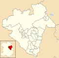
Shropshire Council UK ward map 2010 (blank).svg
  1. Abbey (1)
  2. Albrighton (1)
  3. Alveley & Claverley (1)
  4. Bagley (1)
  5. Battlefield (1)
  6. Bayston Hill, Column & Sutton (3)
  7. Belle Vue (1)
  8. Bishop’s Castle (1)
  9. Bowbrook (1)
  10. Bridgnorth East & Astley Abbotts (2)
  11. Bridgnorth West & Tasley (2)
  12. Broseley (1)
  13. Brown Clee (1)
  14. Burnell (1)
  15. Castlefields & Ditherington (1)
  16. Cheswardine (1)
  17. Chirbury & Worthen (1)
  18. Church Stretton & Craven Arms (2)
  19. Clee (1)
  20. Cleobury Mortimer (2)
  21. Clun (1)
  22. Copthorne (1)
  23. Corvedale (1)
  24. Ellesmere Urban (1)
  25. Harlescott (1)
  26. Highley (1)
  27. Hodnet (1)
  28. Llanymynech (1)
  29. Longden (1)
  30. Loton (1)
  31. Ludlow East (1)
  32. Ludlow North (1)
  33. Ludlow South (1)
  34. Market Drayton East (1)
  35. Market Drayton West (2)
  36. Meole (1)
  37. Minsterley (1); renamed Rea Valley in 2010 [8]
  38. Monkmoor (1)
  39. Much Wenlock (1)
  40. Oswestry East (2) †
  41. Oswestry South (1) †
  42. Oswestry West (1) †
  43. Porthill (1)
  44. Prees (1)
  45. Quarry & Coton Hill (1)
  46. Radbrook (1)
  47. Ruyton & Baschurch (1) †
  48. Selattyn & Gobowen (2); renamed Gobowen, Selattyn & Weston Rhyn in 2011 [9]
  49. Severn Valley (1)
  50. Shawbury (1)
  51. Shifnal North (1)
  52. Shifnal South & Cosford (1)
  53. St Martin’s (1)
  54. St Oswald (1) †
  55. Sundorne (1)
  56. Tern (1)
  57. The Meres (1)
  58. Underdale (1)
  59. Wem (2)
  60. Whitchurch North (2)
  61. Whitchurch South (1)
  62. Whittington (1) †
  63. Worfield (1)

† minor boundary changes in 2013 [10]
Unitary authority council

Telford and Wrekin

Wards from 1 April 1974 (first election 7 June 1973) to 3 May 1979: [11]

Wards from 3 May 1979 to 1 May 1997: [12] [4]

Wards from 1 May 1997 to 1 May 2003: [13]

  1. Arleston (1)
  2. Brookside (2)
  3. Church Aston & Lilleshall (1)
  4. College (1)
  5. Cuckoo Oak (2)
  6. Dawley Magna (3)
  7. Donnington (2)
  8. Donnington Wood & Muxton (2)
  9. Dothill (1)
  10. Edgmond (1)
  11. Ercall (1)
  12. Ercall Magna (1)
  13. Hadley (2)
  14. Haygate (1)
  15. Hollinswood & Randlay (2)
  16. Ironbridge Gorge (1)
  17. Ketley (1)
  18. Ketley Bank (1)
  19. Lawley (2)
  20. Leegomery (2)
  21. Madeley (2)
  22. Malinslee & Langley (3)
  23. Newport East (1)
  24. Newport North (1)
  25. Newport South (1)
  26. Newport West (1)
  27. Park (1)
  28. Shawbirch (1)
  29. St George’s & Priorslee (3)
  30. Stirchley (2)
  31. Wombridge (2)
  32. Woodside (2)
  33. Wrockwardine (2)
  34. Wrockwardine Wood (2)

Wards from 1 May 2003 to 7 May 2015: [14]

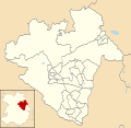
Telford and Wrekin UK ward map 2010 (blank).svg
  1. Apley Castle (1)
  2. Arleston (1)
  3. Brookside (2)
  4. Church Aston & Lilleshall (1)
  5. College (1)
  6. Cuckoo Oak (2)
  7. Dawley Magna (3)
  8. Donnington (2)
  9. Dothill (1)
  10. Edgmond (1)
  11. Ercall (1)
  12. Ercall Magna (1)
  13. Hadley & Leegomery (3)
  14. Haygate (1)
  15. Horsehay & Lightmoor (2)
  16. Ironbridge Gorge (1)
  17. Ketley & Oakengates (3)
  18. Lawley & Overdale (2)
  19. Madeley (2)
  20. Malinslee (2)
  21. Muxton (2)
  22. Newport East (1)
  23. Newport North (1)
  24. Newport South (1)
  25. Newport West (1)
  26. Park (1)
  27. Priorslee (2)
  28. Shawbirch (1)
  29. St Georges (2)
  30. The Nedge (3)
  31. Woodside (2)
  32. Wrockwardine (2)
  33. Wrockwardine Wood & Trench (2)

Wards from 7 May 2015 to present: [15]

Telford and Wrekin UK ward map 2015 (blank).svg
  1. Admaston & Bratton (1)
  2. Apley Castle (1)
  3. Arleston (1)
  4. Brookside (2)
  5. Church Aston & Lilleshall (1)
  6. College (1)
  7. Dawley & Aqueduct (3)
  8. Donnington (2)
  9. Dothill (1)
  10. Edgmond & Ercall Magna (2)
  11. Ercall (1)
  12. Hadley & Leegomery (3)
  13. Haygate (1)
  14. Horsehay & Lightmoor (2)
  15. Ironbridge Gorge (1)
  16. Ketley & Overdale (3)
  17. Madeley & Sutton Hill (3)
  18. Malinslee & Dawley Bank (2)
  19. Muxton (2)
  20. Newport North & West (2)
  21. Newport South & East (2)
  22. Oakengates & Ketley Bank (3)
  23. Park (1)
  24. Priorslee (2)
  25. Shawbirch (1)
  26. St Georges (2)
  27. The Nedge (3)
  28. Woodside (2)
  29. Wrockwardine (1)
  30. Wrockwardine Wood & Trench (2)

Former district councils

Bridgnorth

Wards from 1 April 1974 (first election 7 June 1973) to 3 May 1979: [11]

Wards from 3 May 1979 to 1 May 2003: [16]

Wards from 1 May 2003 to 1 April 2009 (district abolished): [17]

  1. Albrighton South (2)
  2. Alveley (2)
  3. Bridgnorth Castle (2)
  4. Bridgnorth East (2)
  5. Bridgnorth Morfe (2)
  6. Bridgnorth West (2)
  7. Broseley East (2)
  8. Broseley West (2)
  9. Claverley (1)
  10. Ditton Priors (1)
  11. Donington & Albrighton North (2)
  12. Glazeley (1)
  13. Harrington (1)
  14. Highley (2)
  15. Morville (1)
  16. Much Wenlock (2)
  17. Shifnall Idsall (2)
  18. Shifnal Manor (2)
  19. Shifnal Rural (1)
  20. Stottesdon (1)
  21. Worfield (1)

North Shropshire

Wards from 1 April 1974 (first election 7 June 1973) to 6 May 1976: [11]

Wards from 6 May 1976 to 1 May 2003: [18]

Wards from 1 May 2003 to 1 April 2009 (district abolished): [19] [20]

  1. Baschurch (1)
  2. Clive & Myddle (2)
  3. Cockshutt (1)
  4. Dudleston Heath (1)
  5. Ellesmere & Welshampton (3)
  6. Hinstock (2)
  7. Hodnet (2)
  8. Hordley, Tetchill & Lyneal (1)
  9. Market Drayton East (2)
  10. Market Drayton North (3)
  11. Market Drayton South (2)
  12. Prees (2)
  13. Shavington (1)
  14. Shawbury (2)
  15. Sutton (1)
  16. Wem East (2)
  17. Wem Rural (1)
  18. Wem West (2)
  19. Whitchurch North (2)
  20. Whitchurch Rural (1)
  21. Whitchurch South (2)
  22. Whitchurch West (2)
  23. Whixhall (1)
  24. Woore (1)

Oswestry

Wards from 1 April 1974 (first election 7 June 1973) to 6 May 1976: [11]

Wards from 6 May 1976 to 1 May 2003: [21]

Wards from 1 May 2003 to 1 April 2009 (district abolished): [22]

  1. Cabin Lane (2)
  2. Cambrian (2)
  3. Carreg Llwyd (2)
  4. Castle (2)
  5. Gatacre (2)
  6. Gobowen (3)
  7. Kinnerley (1)
  8. Llanyblodwel & Pant (2)
  9. Maserfield (2)
  10. Ruyton & West Felton (2)
  11. St Martin's (2)
  12. Sweeney & Trefonen (3)
  13. Weston Rhyn (2)
  14. Whittington (2)

Shrewsbury and Atcham

Wards from 1 April 1974 (first election 7 June 1973) to 6 May 1976: [11]

Wards from 6 May 1976 to 2 May 2002: [23]

Wards from 2 May 2002 to 1 April 2009 (district abolished): [24]

  1. Bagley (2)
  2. Battlefield & Heathgates (2)
  3. Bayston Hill (2)
  4. Belle Vue (2)
  5. Bowbrook (2)
  6. Castlefields & Quarry (2)
  7. Column (2)
  8. Condover (1)
  9. Copthorne (2)
  10. Hanwood & Longden (1)
  11. Harlescott (2)
  12. Haughmond & Attingham (1)
  13. Lawley (1)
  14. Meole Brace (2)
  15. Monkmoor (2)
  16. Montford (1)
  17. Pimhill (1)
  18. Porthill (2)
  19. Rea Valley (2)
  20. Rowton (1)
  21. Severn Valley (1)
  22. Sundorne (2)
  23. Sutton & Reabrook (2)
  24. Underdale (2)

South Shropshire

Wards from 1 April 1974 (first election 7 June 1973) to 6 May 1976: [11]

Wards from 6 May 1976 to 1 May 2003: [25]

Wards from 1 May 2003 to 1 April 2009 (district abolished): [26] [27]

  1. Apedale (1)
  2. Bishop’s Castle with Onny Valley (2)
  3. Bitterley with Stoke St Milborough (1)
  4. Bucknell (1)
  5. Burford (1)
  6. Caynham with Ashford (1)
  7. Chirbury (1)
  8. Church Stretton North (2)
  9. Church Stretton South (2)
  10. Clee (2)
  11. Cleobury Mortimer (2)
  12. Clun (1)
  13. Clun Forest (1)
  14. Corve Valley (1)
  15. Kemp Valley (1)
  16. Ludlow Henley (2)
  17. Ludlow St Laurence's (2)
  18. Ludlow St Peter's (2)
  19. Ludlow Sheet with Ludford (2)
  20. Stokesay (2)
  21. Upper Corvedale (1)
  22. Wistanstow with Hopesay (1)
  23. Worthen (2)

Electoral wards by constituency

Ludlow

Alveley and Claverley, Bishop's Castle, Bridgnorth East and Astley Abbotts, Bridgnorth West and Tasley, Broseley, Brown Clee, Church Stretton and Craven Arms, Clee, Cleobury Mortimer, Clun, Corvedale, Highley, Ludlow East, Ludlow North, Ludlow South, Much Wenlock, Worfield.

North Shropshire

Cheswardine, Ellesmere Urban, Gobowen, Selattyn and Weston Rhyn, Hodnet, Llanymynech, Market Drayton East, Market Drayton West, Oswestry East, Oswestry South, Oswestry West, Prees, Ruyton and Baschurch, Shawbury, St Martin's, St Oswald, The Meres, Wem, Whitchurch North, Whitchurch South, Whittington.

Shrewsbury and Atcham

Abbey, Bagley, Battlefield, Bayston Hill, Column and Sutton, Belle Vue, Bowbrook, Burnell, Castlefields and Ditherington, Chirbury and Worthen, Copthorne, Harlescott, Longden, Loton, Meole, Monkmoor, Porthill, Quarry and Coton Hill, Radbrook, Rea Valley, Severn Valley, Sundorne, Tern, Underdale.

Telford

Brookside, Cuckoo Oak, Dawley Magna, Horsehay and Lightmoor, Ironbridge Gorge, Ketley and Oakengates, Lawley and Overdale, Madeley, Malinslee, Priorslee, St Georges, The Nedge, Woodside, Wrockwardine Wood and Trench.

The Wrekin

Albrighton, Apley Castle, Arleston, Church Aston and Lilleshall, College, Donnington, Dothill, Edgmond, Ercall, Ercall Magna, Hadley and Leegomery, Haygate, Muxton, Newport East, Newport North, Newport South, Newport West, Park, Shifnal North, Shifnal South and Cosford, Shawbirch, Wrockwardine.

See also

Related Research Articles

<span class="mw-page-title-main">Shropshire</span> County between the West Midlands region of England

Shropshire is a landlocked historic county in the West Midlands region of England. It is bordered by Wales to the west and the English counties of Cheshire to the north, Staffordshire to the east, Worcestershire to the southeast, and Herefordshire to the south. A unitary authority of the same name was created in 2009, taking over from the previous county council and five district councils, now governed by Shropshire Council. The borough of Telford and Wrekin has been a separate unitary authority since 1998, but remains part of the ceremonial county.

<span class="mw-page-title-main">Telford and Wrekin</span> Unitary authority area and borough in West Midlands, United Kingdom

Telford and Wrekin is a borough and unitary authority in Shropshire, England. In 1974, a non-metropolitan district of Shropshire was created called The Wrekin, named after a prominent hill to the west of Telford. In 1998, the district became a unitary authority and was renamed "Telford and Wrekin", which remains part of the Shropshire ceremonial county and shares institutions such as the Fire and Rescue Service and Community Health with the rest the county.

<span class="mw-page-title-main">North Shropshire</span> Local government district in England

North Shropshire was a local government district in Shropshire, England from 1974 to 2009. The district council was based at Edinburgh House in Wem. Other settlements included the towns of Ellesmere, Market Drayton, Wem and Whitchurch, as well as the large villages of Shawbury and Baschurch. The district bordered onto Wales, Cheshire and Staffordshire as well as the Shropshire districts of Oswestry, Shrewsbury and Atcham and the unitary Telford and Wrekin.

<span class="mw-page-title-main">Bridgnorth District</span>

Bridgnorth District was, between 1974 and 2009, a local government district in Shropshire, England. Its main town was Bridgnorth and other towns in its area were Much Wenlock, Shifnal and Broseley. The villages of Albrighton and Sheriffhales as well as RAF Cosford were also in the district.

Shropshire was established during the division of Saxon Mercia into shires in the 10th century. It is first mentioned in 1006. After the Norman Conquest it experienced significant development, following the granting of the principal estates of the county to eminent Normans, such as Roger De Montgomery and his son Robert de Bellême.

<span class="mw-page-title-main">Rail transport in Shropshire</span> Overview of rail transport in Shropshire, England

The English county of Shropshire has a fairly large railway network, with 19 National Rail stations on various national lines; there are also a small number of heritage and freight lines, including the famous heritage Severn Valley Railway running along its eastern border with Worcestershire.

<span class="mw-page-title-main">Ludlow (UK Parliament constituency)</span> Parliamentary constituency in the UK

Ludlow is a constituency in Shropshire represented in the House of Commons of the UK Parliament since 2005 by Philip Dunne, a member of the Conservative Party.

<span class="mw-page-title-main">North Shropshire (UK Parliament constituency)</span> Parliamentary constituency in the United Kingdom, 1983 onwards

North Shropshire is a constituency in the county of Shropshire, represented in the House of Commons of the UK Parliament by Helen Morgan of the Liberal Democrats after a by-election on 16 December 2021. The former MP, Owen Paterson of the Conservatives, resigned his seat on 5 November 2021 when faced with suspension from the Commons for a breach of advocacy rules and the consequent possibility of a recall petition. The seat had previously been a safe seat for the Conservatives.

<span class="mw-page-title-main">The Wrekin (UK Parliament constituency)</span> Parliamentary constituency in the United Kingdom, 1918 onwards

The Wrekin is a constituency in the House of Commons of the British Parliament, located in the county of Shropshire in the West Midlands of England. It has existed continuously since its creation by the Representation of the People Act 1918, and is named after a prominent landmark hill in the area, The Wrekin. The constituency has periodically swung back and forth between the Labour and Conservative parties since the 1920s, and has been held since 2005 by a Conservative MP, Mark Pritchard.

The geology of Shropshire is very diverse with a large number of periods being represented at outcrop. The bedrock consists principally of sedimentary rocks of Palaeozoic and Mesozoic age, surrounding restricted areas of Precambrian metasedimentary and metavolcanic rocks. The county hosts in its Quaternary deposits and landforms, a significant record of recent glaciation. The exploitation of the Coal Measures and other Carboniferous age strata in the Ironbridge area made it one of the birthplaces of the Industrial Revolution. There is also a large amount of mineral wealth in the county, including lead and baryte. Quarrying is still active, with limestone for cement manufacture and concrete aggregate, sandstone, greywacke and dolerite for road aggregate, and sand and gravel for aggregate and drainage filters. Groundwater is an equally important economic resource.

The Shropshire County Premier Football League was an English association football league based in the county of Shropshire. The league, usually known as the Shropshire County League, was founded in 1950 and in the final season had two divisions which sat at levels 13 and 14 of the English football league system. It was dissolved in May 2012 and all member clubs transferred to a new, larger Mercian Regional Football League for the 2012–13 season.

Shropshire Council elections are held every four years. Shropshire Council is the local authority for the unitary authority area of Shropshire, within the larger ceremonial county of Shropshire, England. The unitary authority was created on 1 April 2009 as part of the 2009 structural changes to local government in England, taking over the functions of the abolished Shropshire County Council and the five non-metropolitan districts of Bridgnorth, North Shropshire, Oswestry, Shrewsbury and Atcham, and South Shropshire. The Telford and Wrekin district had already become a separate unitary authority in 1998. Since the last full review of boundaries in 2009, 74 councillors have been elected from 63 electoral divisions.

Elections to Shropshire Council in England were held on 4 June 2009. These were the first elections to the new unitary body, which replaced Shropshire County Council and the district councils of Bridgnorth, North Shropshire, Oswestry, Shrewsbury and Atcham and South Shropshire on 1 April as part of the 2009 local government restructuring across England.

The Shropshire Premier League was an English association football league based in the county of Shropshire. It was formed as the Mercian Regional Football League for the 2012–13 season, with all member clubs of the dissolved Shropshire County Premier Football League transferring membership across. Several teams from the Telford Combination, which also folded at the end of the 2011–12 season, also became members of the Mercian League and joined either Division One or Two.

There are a number of listed buildings in Shropshire. The term "listed building", in the United Kingdom, refers to a building or structure designated as being of special architectural, historical, or cultural significance. Details of all the listed buildings are contained in the National Heritage List for England. They are categorised in three grades: Grade I consists of buildings of outstanding architectural or historical interest, Grade II* includes significant buildings of more than local interest and Grade II consists of buildings of special architectural or historical interest. Buildings in England are listed by the Secretary of State for Culture, Media and Sport on recommendations provided by English Heritage, which also determines the grading.

The Marches Local Enterprise Partnership is one of 39 Local Enterprise Partnerships set up by the UK Government to drive economic development in England.

<span class="mw-page-title-main">Shropshire (district)</span> District in West Midlands

Shropshire is a district with the status of a unitary authority in the ceremonial county of Shropshire, in the West Midlands region of England. It is named after the historic county of Shropshire. It covers the former districts of Bridgnorth, North Shropshire, Oswestry, Shrewsbury and Atcham and South Shropshire. These were merged into the modern-day unitary authority of Shropshire. The large town of Telford was not affected by this as it has been a unitary authority since 1996 under Telford and Wrekin borough. It contains 188 civil parishes.

References

  1. The County of Salop (Electoral Divisions) Order 1973
  2. 1 2 Rallings, Colin; Thrasher, Michael. Shropshire County Council Election Results 1973-2005 (PDF). The Elections Centre. Retrieved 12 May 2016.
  3. The County of Shropshire (Electoral Arrangements) Order 1980
  4. 1 2 3 4 5 6 7 8 9 10 11 12 13 14 15 16 17 18 19 20 21 22 23 legislation.gov.uk - The Shropshire (District of The Wrekin) (Structural Change) Order 1996. Retrieved on 6 November 2015.
  5. legislation.gov.uk - The County of Shropshire (Electoral Changes) Order 2004. Retrieved on 3 November 2015.
  6. legislation.gov.uk - The Shropshire (Structural Change) Order 2008. Retrieved on 6 November 2015.
  7. legislation.gov.uk - The County of Shropshire (Electoral Changes) Order 2009. Retrieved on 3 November 2015.
  8. Shropshire County Council letter dated 29 March 2010
  9. Shropshire County Council letter dated 27 March 2011
  10. legislation.gov.uk - The County of Shropshire (Electoral Changes) Order 2012. Retrieved on 3 November 2015.
  11. 1 2 3 4 5 6 The County of Salop (District Wards) Order 1973
  12. The District of The Wrekin (Electoral Arrangements) Order 1978
  13. legislation.gov.uk - The District of The Wrekin (Parishes and Electoral Changes) Order 1997. Retrieved on 4 October 2015.
  14. legislation.gov.uk - The Borough of Telford and Wrekin (Electoral Changes) Order 2002. Retrieved on 4 October 2015.
  15. legislation.gov.uk - The Telford & Wrekin (Electoral Changes) Order 2014. Retrieved on 3 November 2015.
  16. The District of Bridgnorth (Electoral Arrangements) Order 1976
  17. legislation.gov.uk - The District of Bridgnorth (Electoral Changes) Order 2000. Retrieved on 4 October 2015.
  18. legislation.gov.uk - The District of North Shropshire (Electoral Arrangements) Order 1976. Retrieved on 19 November 2015.
  19. legislation.gov.uk - The District of North Shropshire (Electoral Changes) Order 2000. Retrieved on 4 October 2015.
  20. legislation.gov.uk - The District of North Shropshire (Electoral Changes) (Amendment) Order 2006. Retrieved on 3 November 2015.
  21. The Borough of Oswestry (Electoral Arrangements) Order 1975
  22. legislation.gov.uk - The Borough of Oswestry (Electoral Changes) Order 2000. Retrieved on 4 October 2015.
  23. legislation.gov.uk - The Borough of Shrewsbury and Atcham (Electoral Arrangements) Order 1975. Retrieved on 19 November 2015.
  24. legislation.gov.uk - The Borough of Shrewsbury and Atcham (Electoral Changes) Order 2000. Retrieved on 4 October 2015.
  25. The District of South Shropshire (Electoral Arrangements) Order 1976
  26. legislation.gov.uk - The District of South Shropshire (Electoral Changes) Order 2000. Retrieved on 4 October 2015.
  27. legislation.gov.uk - The District of South Shropshire (Electoral Changes) (Amendment) Order 2000. Retrieved on 4 October 2015.