County council
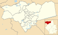
Cambridgeshire
Electoral Divisions from 1 April 1974 (first election 12 April 1973) to 2 May 1985: [1] [2]
- Abbey (1)
- Arbury (1)
- Barnack (1)
- Castle (1)
- Chatteris (1)
- Cherry Hinton No. 1 (1)
- Cherry Hinton No. 2 (1)
- Chesterton No. 1 (1)
- Chesterton No. 2 (1)
- Chesterton No. 3 (1)
- Chesterton No. 4 (1)
- Chesterton No. 5 (1)
- Chesterton No. 6 (1)
- Chesterton No. 7 (1)
- Coleridge (1)
- East Chesterton (1)
- Ely (1)
- Ely Rural No. 1 (1)
- Ely Rural No. 2 (1)
- Huntingdon & Godmanchester No. 1 (1)
- Huntingdon & Godmanchester No. 2 (1)
- Huntingdon Rural No. 1 (1)
- Huntingdon Rural No. 2 (1)
- March No. 1 (1)
- March No. 2 (1)
- Market (1)
- Newmarket Rural No. 1 (1)
- Newmarket Rural No. 2 (1)
- Newmarket Rural No. 3 (1)
- Newnham No. 1 (1)
- Newnham No. 2 (1)
- Norman Cross (1)
- North Witchford (1)
- Old Fletton No. 1 (1)
- Old Fletton No. 2 (1)
- Peterborough No. 1 (Central) (1)
- Peterborough No. 2 (Dogsthorpe) (1)
- Peterborough No. 3 (East) (1)
- Peterborough No. 4 (Minster) (1)
- Peterborough No. 5 (North) (1)
- Peterborough No. 6 (Park) (1)
- Peterborough No. 7 (Paston & Werr (1)
- Peterborough No. 8 (South) (1)
- Peterborough No. 9 (Westwood) (2)
- Peterborough Rural (1)
- Petersfield (1)
- Ramsey (1)
- Romsey (1)
- South Cambridgeshire No. 1 (1)
- South Cambridgeshire No. 2 (1)
- South Cambridgeshire No. 3 (1)
- South Cambridgeshire No. 4 (1)
- South Cambridgeshire No. 5 (1)
- St Ives (1)
- St Ives Rural No. 1 (1)
- St Ives Rural No. 2 (1)
- St Neots No. 1 (1)
- St Neots No. 2 (1)
- St Neots Rural (1)
- Thorney Rural (1)
- Trumpington (1)
- West Chesterton (1)
- Whittlesey (1)
- Wisbech No. 1 (1)
- Wisbech No. 2 (1)
- Wisbech Rural No. 1 (1)
- Wisbech Rural No. 2 (1)
Electoral Divisions from 2 May 1985 to 5 May 2005: [2] [3]
- Abbey (1)
- Arbury (1)
- Bassingbourn (1)
- Benwick & Doddington (1)
- Brampton (1)
- Bretton (1)
- Buckden (1)
- Burwell (1)
- Castle (1)
- Chatteris (1)
- Cherry Hinton (1)
- Coleridge (1)
- Comberton (1)
- Cottenham (1)
- Dogsthorpe (1); electoral division abolished in 1998 [4]
- East Chesterton (1)
- Eaton (1)
- Elm (1)
- Ely North & South (1)
- Ely West (1)
- Eynesbury (1)
- Fletton (1); electoral division abolished in 1998 [4]
- Fulbourn (1)
- Gamlingay (1)
- Girton (1)
- Harston (1)
- Histon (1)
- Houghton & Wyton (1)
- Huntingdon & Godmanchester (1)
- Huntingdon North (1)
- Kings Hedges (1)
- Leverington (1)
- Linton (1)
- Littleport (1)
- March East (1)
- March West (1)
- Market (1)
- Melbourn (1)
- Newnham (1)
- Norman Cross (1)
- Orton Longueville (1); electoral division abolished in 1998 [4]
- Orton Waterville (1); electoral division abolished in 1998 [4]
- Park (1); electoral division abolished in 1998 [4]
- Paston (1); electoral division abolished in 1998 [4]
- Peterborough Central (1); electoral division abolished in 1998 [4]
- Peterborough East (1); electoral division abolished in 1998 [4]
- Peterborough North (1); electoral division abolished in 1998 [4]
- Peterborough Rural West (1); electoral division abolished in 1998 [4]
- Peterborough West (1); electoral division abolished in 1998 [4]
- Petersfield (1)
- Priory Park (1)
- Queen Ediths (1)
- Ramsey (1)
- Ravensthorpe (1); electoral division abolished in 1998 [4]
- Romsey (1)
- Sawston (1)
- Sawtry (1)
- Shelford (1)
- Soham (1)
- Somersham (1)
- South Bretton (1); electoral division abolished in 1998 [4]
- St Ives North & Warboys (1)
- St Ives South (1)
- Stanground (1); electoral division abolished in 1998 [4]
- Sutton (1)
- Thorney (1); electoral division abolished in 1998 [4]
- Trumpington (1)
- Walton (1); electoral division abolished in 1998 [4]
- Waterbeach (1)
- Werrington (1); electoral division abolished in 1998 [4]
- West Chesterton (1)
- West Hunts (1)
- Whittlesey (1)
- Willingham (1)
- Wisbech North (1)
- Wisbech South (1)
- Woodditton (1)
Electoral Divisions from 5 May 2005 to 4 May 2017: [5]


- Abbey (1)
- Arbury (1)
- Bar Hill (1)
- Bassingbourn (1)
- Bourn (1) †
- Brampton & Kimbolton (1) ‡
- Buckden, Gransden & The Offords (1) ‡
- Burwell (1)
- Castle (1)
- Chatteris (1)
- Cherry Hinton (1)
- Coleridge (1)
- Cottenham, Histon & Impington (2)
- Duxford (1)
- East Chesterton (1)
- Ely North & East (1)
- Ely South & West (1)
- Forty Foot (1)
- Fulbourn (1)
- Gamlingay (1)
- Godmanchester (2); renamed Godmanchester & Huntingdon East in 2009 [6]
- Haddenham (1)
- Hardwick (1)
- Huntingdon (2) ‡
- King’s Hedges (1)
- Linton (1)
- Little Paxton & St Neots North (2) ‡
- Littleport (1)
- March East (1)
- March North (1)
- March West (1)
- Market (1)
- Melbourn (1)
- Newnham (1)
- Norman Cross (2)
- Papworth & Swavesey (1) †
- Petersfield (1)
- Queen Edith's (1)
- Ramsey (1) ‡
- Roman Bank & Peckover (1)
- Romsey (1)
- Sawston (2)
- Sawtry & Ellington (1) ‡
- Soham & Fordham Villages (2)
- Somersham & Earith (1) ‡
- St Ives (2) ‡
- St Neots Eaton Socon (2); renamed St Neots Eaton Socon & Eynesbury in 2009 [6] ‡
- Sutton (1)
- The Hemingfords & Fenstanton (1) ‡
- Trumpington (1)
- Waldersey (1)
- Warboys & Upwood (1) ‡
- Waterbeach (1)
- West Chesterton (1)
- Whittlesey North (1)
- Whittlesey South (1)
- Willingham (1)
- Wisbech North (1)
- Wisbech South (1)
- Woodditton (1)
† minor boundary changes in 2009 [7] ‡ minor boundary changes in 2013 [8]
Electoral Divisions from 4 May 2017 to present: [9]

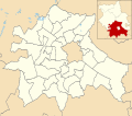
City of Cambridge
- Abbey (1)
- Arbury (1)
- Castle (1)
- Cherry Hinton (1)
- Chesterton (1)
- King’s Hedges (1)
- Market (1)
- Newnham (1)
- Petersfield (1)
- Queen Edith’s (1)
- Romsey (1)
- Trumpington (1)
East Cambridgeshire District
- Burwell (1)
- Ely North (1)
- Ely South (1)
- Littleport (1)
- Soham North & Isleham (1)
- Soham South & Haddenham (1)
- Sutton (1)
- Woodditton
Fenland District
- Chatteris (1)
- March North & Waldersey (2)
- March South & Rural (1)
- Roman Bank & Peckover (1)
- Whittlesey North (1)
- Whittlesey South (1)
- Wisbech East (1)
- Wisbech West (1)
Huntingdonshire District
- Alconbury & Kimbolton (1)
- Brampton & Buckden (1)
- Godmanchester & Huntingdon South (1)
- Huntingdon North & Hartford (1)
- Huntingdon West (1)
- Ramsey & Bury (1)
- St Ives North & Wyton (1)
- St Ives South & Needingworth (1)
- St Neots East & Gransden (1)
- St Neots Eynesbury (1)
- St Neots Priory Park & Little Paxton (1)
- St Neots The Eatons (1)
- Sawtry & Stilton (1)
- Somersham & Earith (1)
- The Hemingfords & Fenstanton (1)
- Warboys & The Stukeleys (1)
- Yaxley & Farcet (1)
South Cambridgeshire District
- Bar Hill (1)
- Cambourne (1)
- Cottenham & Willingham (1)
- Duxford (1)
- Fulbourn (1)
- Gamlingay (1)
- Hardwick (1)
- Histon & Impington (1)
- Linton (1)
- Longstanton, Northstowe & Over (1)
- Melbourn & Bassingbourn (1)
- Papworth & Swavesey (1)
- Sawston & Shelford (2)
- Waterbeach (1)