List of electoral wards in the East Riding of Yorkshire

Last updated

This is a list of electoral divisions and wards in the ceremonial county of East Riding of Yorkshire in Yorkshire and the Humber. All changes since the re-organisation of local government following the passing of the Local Government Act 1972 are shown. The number of councillors elected for each electoral division or ward is shown in brackets.

Contents

Unitary authority councils

East Riding of Yorkshire

Wards from 1 April 1996 (first election 4 May 1995) to 1 May 2003: [1]

  1. Beverley Rural (2)
  2. Boothferry West (2)
  3. Bridlington North (3)
  4. Bridlington Old Town (3)
  5. Bridlington South (3)
  6. Cottingham North (3)
  7. Cottingham South (2)
  8. Dale (3)
  9. Driffield & Rural (3)
  10. East Wolds & Coastal (3)
  11. Goole (2)
  12. Hessle (2)
  13. Howden (1)
  14. Howdenshire (3)
  15. Mid Holderness (3)
  16. Minster (3)
  17. North East Holderness (3)
  18. Pocklington Provincial (3)
  19. Snaith, Airmyn & Rawcliffe & Marshland (2)
  20. South Hunsley (3)
  21. South West Holderness (3)
  22. St Mary's (2)
  23. Tranby (3)
  24. Wolds Weighton (3)
  25. Wolfreton (2)

Wards from 1 May 2003 to present: [2] [3]

East Riding of Yorkshire Council UK ward map 2010 (blank).svg
  1. Beverley Rural (3)
  2. Bridlington Central & Old Town (2)
  3. Bridlington North (3)
  4. Bridlington South (3)
  5. Cottingham North (2)
  6. Cottingham South (2)
  7. Dale (3)
  8. Driffield & Rural (3)
  9. East Wolds & Coastal (3)
  10. Goole North (2)
  11. Goole South (2)
  12. Hessle (3)
  13. Howden (1)
  14. Howdenshire (3)
  15. Mid Holderness (3)
  16. Minster & Woodmansey (3)
  17. North Holderness (2)
  18. Pocklington Provincial (3)
  19. Snaith, Airmyn, Rawcliffe & Marshland (2)
  20. South East Holderness (3)
  21. South Hunsley (2)
  22. South West Holderness (3)
  23. St Mary's (3)
  24. Tranby (2)
  25. Willerby & Kirk Ella (3)
  26. Wolds Weighton (3)

Kingston upon Hull

Wards from 1 April 1974 (first election 7 June 1973) to 5 May 1983: [4]

Wards from 5 May 1983 to 2 May 2002: [5] [1]

Wards from 2 May 2002 to 3 May 2018: [6]

Kingston upon Hull UK ward map 2010 (blank).svg
  1. Avenue (3)
  2. Beverley (2)
  3. Boothferry (3)
  4. Bransholme East (2)
  5. Bransholme West (2)
  6. Bricknell (2)
  7. Derringham (3)
  8. Drypool (3)
  9. Holderness (3)
  10. Ings (3)
  11. Kings Park (2)
  12. Longhill (3)
  13. Marfleet (3)
  14. Myton (3)
  15. Newington (3)
  16. Newland (2)
  17. Orchard Park & Greenwood (3)
  18. Pickering (3)
  19. St Andrew's (2)
  20. Southcoates East (2)
  21. Southcoates West (2)
  22. Sutton (3)
  23. University (2)

Wards from 3 May 2018 to present: [7]

Kingston upon Hull UK ward map 2018 (blank).svg
  1. Avenue (3)
  2. Beverley & Newland (3)
  3. Boothferry (3)
  4. Bricknell (2)
  5. Central (2)
  6. Derringham (3)
  7. Drypool (3)
  8. Holderness (3)
  9. Ings (2)
  10. Kingswood (2)
  11. Longhill & Bilton Grange (3)
  12. Marfleet (3)
  13. Newington & Gipsyville (3)
  14. North Carr (3)
  15. Orchard Park (3)
  16. Pickering (2)
  17. Southcoates (3)
  18. St Andrew's & Docklands (3)
  19. Sutton (3)
  20. University (2)
  21. West Carr (3)

Former county council

Humberside

Electoral Divisions from 1 April 1974 (first election 12 April 1973) to 7 May 1981: [8] [9]

  1. Barton upon Humber (1)
  2. Beverley (Minster) (1)
  3. Beverley (St Marys) (1)
  4. Beverley Rural No. 1 (1)
  5. Beverley Rural No. 2 (1)
  6. Beverley Rural No. 3 (1)
  7. Beverley Rural No. 4 (1)
  8. Bridlington No. 1 (1)
  9. Bridlington No. 2 (1)
  10. Bridlington No. 3 (Old Town East) (1)
  11. Bridlington No. 4 (Quay North) (1)
  12. Bridlington Rural (1)
  13. Brigg (1)
  14. Cleethorpes No. 1 (Alexandra) (1)
  15. Cleethorpes No. 2 (South) (1)
  16. Cleethorpes No. 3 (2)
  17. Driffield (1)
  18. Driffield Rural (1)
  19. Glanford Brigg No. 1 (1)
  20. Glanford Brigg No. 2 (1)
  21. Glanford Brigg No. 3 (1)
  22. Glanford Brigg No. 4 (1)
  23. Glanford Brigg No. 5 (1)
  24. Goole No. 1 (1)
  25. Goole No. 2 (1)
  26. Goole Rural (1)
  27. Grimsby No. 1 (East Marsh) (1)
  28. Grismby No. 2 (Littlecoates) (1)
  29. Grimsby No. 3 (Springfield) (1)
  30. Grimsby No. 4 (Alexandra) (1)
  31. Grimsby No. 5 (Weelsby) (1)
  32. Grimsby No. 6 (West) (1)
  33. Grimsby No. 7 (Clee) (1)
  34. Grimsby No. 8 (Central) (1)
  35. Grimsby No. 9 (Littlefield) (1)
  36. Grimsby No. 10 (Nunsthorpe) (1)
  37. Grimsby No. 11 (Wellow) (1)
  38. Grimsby Rural No. 1 (Humberstone) (1)
  39. Grimsby Rural No. 2 (Laceby) (1)
  40. Grimsby Rural No. 3 (Immingham) (1)
  41. Haltemprice (Central) (2)
  42. Haltemprice (Cottingham) (2)
  43. Haltemprice (Hessle) (2)
  44. Holderness No. 1 (1)
  45. Holderness No. 2 (1)
  46. Holderness No. 3 (1)
  47. Hornsea (1)
  48. Howden No. 1 (1)
  49. Howden No. 2 (1)
  50. Isle of Axholme No. 1 (West Butterw (1)
  51. Isle of Axholme No. 2 (Epworth) (1)
  52. Kingston upon Hull No. 1 (Longhill) (3)
  53. Kingston upon Hull No. 2 (Greatfiel (3)
  54. Kingston upon Hull No. 3 (Holdernes (3)
  55. Kingston upon Hull No. 4 (Stoneferr (3)
  56. Kingston upon Hull No. 5 (Drypool/M (3)
  57. Kingston upon Hull No. 6 (Coltman/S (3)
  58. Kingston upon Hull No. 7 (Pickering (3)
  59. Kingston upon Hull No. 8 (Boothferr (3)
  60. Kingston upon Hull No. 9 (Beverley/ (3)
  61. Kingston upon Hull No. 10 (Avenue/N (3)
  62. Kingston upon Hull No. 11 (Greenwoo (3)
  63. Pocklington No. 1 (1)
  64. Pocklington No. 2 (1)
  65. Scunthorpe No. 1 (Ashby) (1)
  66. Scunthorpe No. 2 (Brumby) (1)
  67. Scunthorpe No. 3 (Crosby Town) (1)
  68. Scunthorpe No. 4 (Frodingham & Gran (1)
  69. Scunthorpe No. 5 (Lincoln Gardens) (1)
  70. Scunthorpe No. 6 (Park) (1)
  71. Scunthorpe No. 7 (Riddings) (1)
  72. Scunthorpe No. 8 (West) (1)
  73. Withernsea (1)

Electoral Divisions from 7 May 1981 to 1 April 1996 (county abolished): [9] [10]

Humberside UK ward map (blank).svg
  1. Alexandra (1)
  2. Ashby (1)
  3. Avenue (1)
  4. Bellfield (1)
  5. Beverley Rural (1)
  6. Bilton Grange (1)
  7. Boothferry West (1)
  8. Bottesford (1)
  9. Bridlington North (1)
  10. Bridlington Old Town (1)
  11. Bridlington South (1)
  12. Brumby (1)
  13. Cottingham North (1)
  14. Cottingham South (1)
  15. Croft Baker (1)
  16. Crosby/Park (1)
  17. Dale (1)
  18. Derringham (1)
  19. Driffield & Rural (1)
  20. Drypool (1)
  21. East Bransholme (1)
  22. East Ella (1)
  23. East Park (1)
  24. East Wolds & Coastal (1)
  25. Endike (1)
  26. Ermine (1)
  27. Ferry (Glanford) (1)
  28. Ferry (Hull) (1)
  29. Freshney (1)
  30. Frodingham/Town (1)
  31. Goole (1)
  32. Haven (1)
  33. Haverstoe (1)
  34. Heneage (1)
  35. Hessle (1)
  36. Howdenshire (1)
  37. Humberston (1)
  38. Immingham (1)
  39. Inglemire (1)
  40. Kingsway (1)
  41. Lincoln Gardens (1)
  42. Longhill (1)
  43. Marfleet (1)
  44. Marsh (1)
  45. Mid Boothferry (1)
  46. Mid Holderness (1)
  47. Minster (1)
  48. Myton (1)
  49. Newington (1)
  50. Newland (1)
  51. North East (1)
  52. North Holderness (1)
  53. Orchard Park (1)
  54. Park (Cleethorpes) (1)
  55. Park (Grimsby) (1)
  56. Park (Hull) (1)
  57. Pickering (1)
  58. Pocklington Provincial (1)
  59. Ridge (1)
  60. Scartho (1)
  61. South (1)
  62. South Axholme (1)
  63. South Hunsley (1)
  64. Southeast Holderness (1)
  65. Southwest Holderness (1)
  66. St Andrews (1)
  67. St Marys (1)
  68. Sutton (1)
  69. Tranby (1)
  70. West Bransholme (1)
  71. Wold (1)
  72. Wold Parishes (1)
  73. Wolds Weighton (1)
  74. Wolfreton (1)
  75. Yarborough (1)

Former district councils

Boothferry

Wards from 1 April 1974 (first election 7 June 1973) to 6 May 1976: [4]

Wards from 6 May 1976 to 1 April 1996 (district abolished): [11]

East Yorkshire

Wards from 1 April 1974 (first election 7 June 1973) to 6 May 1976: [4]

Wards from 6 May 1976 to 1 April 1996 (district abolished): [12]

East Yorkshire Borough of Beverley

Wards from 1 April 1974 (first election 7 June 1973) to 3 May 1979: [4]

Wards from 3 May 1979 to 1 April 1996 (district abolished): [13]

Holderness

Wards from 1 April 1974 (first election 7 June 1973) to 6 May 1976: [4]

Wards from 6 May 1976 to 1 April 1996 (district abolished): [14]

Electoral wards by constituency

Beverley and Holderness

Beverley Rural (Conservative), Mid Holderness (Conservative), Minster and Woodmansey (Conservative), North Holderness (Conservative), St Mary’s (Liberal Democrats), South East Holderness (Conservative), South West Holderness (Conservative).

Brigg and Goole

Axholme Central, Axholme North, Axholme South, Brigg and Wolds, Broughton and Appleby, Burringham and Gunness, Burton upon Stather and Winterton, Goole North, Goole South, Snaith, Airmyn, Rawcliffe and Marshland.

East Yorkshire

Bridlington Central and Old Town, Bridlington North, Bridlington South, Driffield and Rural, East Wolds and Coastal, Pocklington Provincial, Wolds Weighton.

Haltemprice and Howden

Cottingham North, Cottingham South, Dale, Howden, Howdenshire, South Hunsley, Tranby, Willerby and Kirk Ella.

Kingston upon Hull East

Drypool, Holderness, Ings, Longhill, Marfleet, Southcoates East, Southcoates West, Sutton.

Kingston upon Hull North

Avenue, Beverley, Bransholme East, Bransholme West, Bricknell, Kings Park, Newland, Orchard Park and Greenwood, University.

Kingston upon Hull West and Hessle

Boothferry, Derringham, Hessle, Myton, Newington, Pickering, St Andrew’s.

See also

Related Research Articles

<span class="mw-page-title-main">East Riding of Yorkshire</span> County and district in England

The East Riding of Yorkshire, or simply East Riding or East Yorkshire, is a ceremonial county and unitary authority area in the Yorkshire and the Humber region of England. It borders North Yorkshire to the north and west, South Yorkshire to the south-west, and Lincolnshire to the south.

<span class="mw-page-title-main">North Lincolnshire</span> Unitary authority and borough in England

North Lincolnshire is a unitary authority area in Lincolnshire, England, with a population of 167,446 in the 2011 census. The borough includes the towns of Scunthorpe, Brigg, Haxey, Crowle, Epworth, Bottesford, Kirton in Lindsey and Barton-upon-Humber. North Lincolnshire is part of the Yorkshire and Humber region.

<span class="mw-page-title-main">Humberside</span> Former county of England

Humberside was a non-metropolitan and ceremonial county in Northern England from 1 April 1974 until 1 April 1996. It was composed of land from either side of the Humber Estuary, created from portions of the East Riding of Yorkshire, West Riding of Yorkshire, and the northern part of Lindsey, Lincolnshire. The county council's headquarters was County Hall at Beverley, inherited from East Riding County Council. Its largest settlement and only city was Kingston upon Hull. Other notable towns included Goole, Beverley, Scunthorpe, Grimsby, Cleethorpes and Bridlington. The county stretched from Wold Newton in its northern tip to a different Wold Newton at its most southern point.

<span class="mw-page-title-main">Parts of Lindsey</span> Historic division of Lincolnshire, England

The Parts of Lindsey are a traditional division of Lincolnshire, England, covering the northern part of the county. The Isle of Axholme, which is on the west side of the River Trent, has normally formed part of it. The district's name originated from the Kingdom of Lindsey of Anglo-Saxon times, whose territories were merged with that of Stamford to form Lincolnshire.

<span class="mw-page-title-main">Kingston upon Hull East (UK Parliament constituency)</span> Parliamentary constituency in the United Kingdom

Kingston upon Hull East is a borough constituency for the House of Commons of the Parliament of the United Kingdom. It elects one Member of Parliament (MP) at least once every five years by the first-past-the-post electoral system. The constituency has been represented by Karl Turner of the Labour Party since the 2010 general election.

<span class="mw-page-title-main">Brigg and Goole (UK Parliament constituency)</span> Parliamentary constituency in the United Kingdom

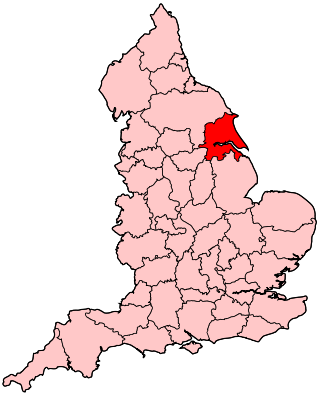
Brigg and Goole is a constituency in Yorkshire and Lincolnshire represented in the House of Commons of the UK Parliament since 2010 by Andrew Percy, a Conservative.

<span class="mw-page-title-main">A1079 road</span> Road in Northern England

The A1079 is a major road in Northern England. It links the cities of York and Kingston upon Hull, both in Yorkshire. The road is noted for its past safety issues, and regularly features in the Road Safety Foundations reports on Britain's most dangerous roads. Campaigners have been calling for the entire route to be made into a dual carriageway.

<span class="mw-page-title-main">Boothferry (UK Parliament constituency)</span> Parliamentary constituency in the United Kingdom, 1983–1997

Boothferry was a constituency in Humberside which returned one Member of Parliament (MP) to the House of Commons of the Parliament of the United Kingdom. It was created for the 1983 general election, and abolished for the 1997 general election.

<span class="mw-page-title-main">Humberside (European Parliament constituency)</span> Constituency of the European Parliament

Humberside was a European Parliament constituency, covering most of the former Humberside district of England.

The High Sheriff of Humberside was a High Sheriff title which was in existence from 1974 until 1996, covering the former county of Humberside, England.

The East Riding of Yorkshire is a local government district with unitary authority status, and is a ceremonial county of England. It is named after the historic East Riding of Yorkshire which was one of three ridings alongside the North Riding and West Riding, which were constituent parts a Yorkshire ceremonial and administrative county until 1974. From 1974 to 1996 the area of the modern East Riding of Yorkshire constituted the northern part of Humberside.

<span class="mw-page-title-main">2012 Hull City Council election</span>

The 2012 Hull City Council election took place on 3 May 2012 to elect members of Hull City Council in England. This was held on the same day as other 2012 United Kingdom local elections. One third of the council was up for election and Labour retained control of the council with an increased majority.

<span class="mw-page-title-main">2010 Hull City Council election</span>

The 2010 Hull City Council election took place on 6 May 2010 to elect members of Hull City Council in England. One third of the council was up for election and Liberal Democrats retained control of the council.

The 2015 East Riding of Yorkshire Council election took place on 7 May 2015 to elect members of East Riding of Yorkshire Council in England. This was on the same day as other local elections across the country. All 67 seats were contested. The Conservatives retained control of the council, surpassing the 34-seat majority threshold with 51 seats, down 2 from the last election.

The 2011 East Riding of Yorkshire Council election took place on 5 May 2011 to elect members of East Riding of Yorkshire Council in England. This was on the same day as other local elections across the country. All 67 seats were contested. The Conservatives retained control of the council, surpassing the 34-seat majority threshold with 53 seats, up 6 from the last election.

References

  1. 1 2 legislation.gov.uk – The Humberside (Structural Change) Order 1995. Retrieved on 6 November 2015.
  2. legislation.gov.uk – The District of East Riding (Electoral Changes) Order 2001. Retrieved on 4 October 2015.
  3. legislation.gov.uk – The District of East Riding (Electoral Changes) (Amendment) Order 2002. Retrieved on 4 October 2015.
  4. 1 2 3 4 5 The County of Humberside (District Wards) Order 1973
  5. The City of Kingston upon Hull (Electoral Arrangements) Order 1979
  6. legislation.gov.uk – The City of Kingston upon Hull (Electoral Changes) Order 2001. Retrieved on 4 October 2015.
  7. "The Kingston upon Hull (Electoral Changes) Order 2017". gov.uk . 13 December 2017. Retrieved 18 April 2022.
  8. The County of Humberside (Electoral Divisions) Order 1973
  9. 1 2 Rallings, Colin; Thrasher, Michael. Humberside County Council Election Results 1973–1993 (PDF). The Elections Centre. Retrieved 12 May 2016.
  10. The County of Humberside (Electoral Arrangements) Order 1981
  11. The District of Boothferry (Electoral Arrangements) Order 1975
  12. legislation.gov.uk – The Borough of North Wolds (Electoral Arrangements) Order 1975. Retrieved on 19 November 2015.
  13. The Borough of Beverley (Electoral Arrangements) Order 1976
  14. The District of Holderness (Electoral Arrangements) Order 1975