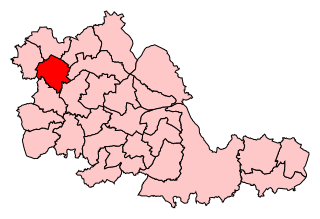
List of electoral wards in the West Midlands (county)

Last updated

This is a list of electoral divisions and wards in the ceremonial county of West Midlands in the West Midlands. All changes since the re-organisation of local government following the passing of the Local Government Act 1972 are shown. The number of councillors elected for each electoral division or ward is shown in brackets.

Contents

District councils

Birmingham

Wards from 1 April 1974 (first election 10 May 1973) to 6 May 1982: [1]

Wards from 6 May 1982 to 10 June 2004: [2]

Wards from 10 June 2004 to 2018: [3]

Birmingham UK ward map 2010 (blank).svg
  1. Acocks Green (3)
  2. Aston (3)
  3. Bartley Green (3)
  4. Billesley (3)
  5. Bordesley Green (3)
  6. Bournville (3)
  7. Brandwood (3)
  8. Edgbaston (3)
  9. Erdington (3)
  10. Hall Green (3)
  11. Handsworth Wood (3)
  12. Harborne (3)
  13. Hodge Hill (3)
  14. Kings Norton (3)
  15. Kingstanding (3)
  16. Ladywood (3)
  17. Longbridge (3)
  18. Lozells & East Handsworth (3)
  19. Moseley & Kings Heath (3)
  20. Nechells (3)
  21. Northfield (3)
  22. Oscott (3)
  23. Perry Barr (3)
  24. Quinton (3)
  25. Selly Oak (3)
  26. Shard End (3)
  27. Sheldon (3)
  28. Soho (3)
  29. South Yardley (3)
  30. Sparkbrook (3)
  31. Springfield (3)
  32. Stechford & Yardley North (3)
  33. Stockland Green (3)
  34. Sutton Four Oaks (3)
  35. Sutton New Hall (3)
  36. Sutton Trinity (3)
  37. Sutton Vesey (3)
  38. Tyburn (3)
  39. Washwood Heath (3)
  40. Weoley (3)

Wards from May 2018 [4] [5]

  1. Acocks Green (2)
  2. Allens Cross (1)
  3. Alum Rock (2)
  4. Aston (2)
  5. Balsall Heath West (1)
  6. Bartley Green (2)
  7. Billesley (2)
  8. Birchfield (1)
  9. Bordesley & Highgate (1)
  10. Bordesley Green (1)
  11. Bournbrook & Selly Park (2)
  12. Bournville & Cotteridge (2)
  13. Brandwood & King's Heath (2)
  14. Bromford & Hodge Hill (2)
  15. Castle Vale (1)
  16. Druids Heath & Monyhull (1)
  17. Edgbaston (2)
  18. Erdington (2)
  19. Frankley Great Park (1)
  20. Garretts Green (1)
  21. Glebe Farm & Tile Cross (2)
  22. Gravelly Hill (1)
  23. Hall Green North (2)
  24. Hall Green South (1)
  25. Handsworth (1)
  26. Handsworth Wood (2)
  27. Harborne (2)
  28. Heartlands (1)
  29. Highter's Heath (1)
  30. Holyhead (1)
  31. King's Norton North (1)
  32. King's Norton South (1)
  33. Kingstanding (2)
  34. Ladywood (2)
  35. Longbridge & West Heath (2)
  36. Lozells (1)
  37. Moseley (2)
  38. Nechells (1)
  39. Newtown (1)
  40. North Edgbaston (2)
  41. Northfield (1)
  42. Oscott (2)
  43. Perry Barr (2)
  44. Perry Common (1)
  45. Pype Hayes (1)
  46. Quinton (2)
  47. Rubery & Rednal (1)
  48. Shard End (1)
  49. Sheldon (2)
  50. Small Heath (2)
  51. Soho & Jewellery Quarter (2)
  52. South Yardley (1)
  53. Sparkbrook & Balsall Heath (2)
  54. Sparkhill (2)
  55. Stirchley (1)
  56. Stockland Green (2)
  57. Sutton Four Oaks (1)
  58. Sutton Mere Green (1)
  59. Sutton Reddicap (1)
  60. Sutton Roughley (1)
  61. Sutton Trinity (1)
  62. Sutton Vesey (2)
  63. Sutton Walmley & Minworth (2)
  64. Sutton Wylde Green (1)
  65. Tyseley & Hay Mills (1)
  66. Ward End (1)
  67. Weoley & Selly Oak (2)
  68. Yardley East (1)
  69. Yardley West & Stechford (1)

Coventry

Wards from 1 April 1974 (first election 10 May 1973) to 1 May 1980: [1]

Wards from 1 May 1980 to 10 June 2004: [6]

Wards from 10 June 2004 to present: [7]

Coventry UK ward map 2010 (blank).svg
  1. Bablake (3)
  2. Binley & Willenhall (3)
  3. Cheylesmore (3)
  4. Earlsdon (3)
  5. Foleshill (3)
  6. Henley (3)
  7. Holbrook (3)
  8. Longford (3)
  9. Lower Stoke (3)
  10. Radford (3)
  11. St Michael's (3)
  12. Sherbourne (3)
  13. Upper Stoke (3)
  14. Wainbody (3)
  15. Westwood (3)
  16. Whoberley (3)
  17. Woodlands (3)
  18. Wyken (3)

Dudley

Wards from 1 April 1974 (first election 10 May 1973) to 6 May 1982: [1]

  1. Dudley: Brierley Hill (3)
  2. Dudley: Quarry Bank (3)
  3. Dudley: St James (3)
  4. Dudley: Sedgley (3)
  5. Dudley: Wordsley (3)
  6. Dudley: Brockmoor & Pensnett (3)
  7. Dudley: Castle & St Thomas (3)
  8. Dudley: Coseley East (3)
  9. Dudley: Coseley West (3)
  10. Dudley: Gornal (3)
  11. Dudley: Kingswinford & Wall Heath (3)
  12. Dudley: Netherton & Woodside (3)
  13. Dudley: Priory (3)
  14. Dudley: St Andrews (3)
  15. Halesowen: North (3)
  16. Halesowen: Belle Vale & Cradley (3)
  17. Halesowen: Central & Lapal (3)
  18. Halesowen: Hasbury & Hayley Green (3)
  19. Stourbridge: Amblecote & Wollaston (3)
  20. Stourbridge: Lye & Wollescote (3)
  21. Stourbridge: Norton & West (3)
  22. Stourbridge: Pedmore & East (3)

Wards from 6 May 1982 to 10 June 2004: [8]

  1. Amblecote (3)
  2. Belle Vale & Hasbury (3)
  3. Brierley Hill (3)
  4. Brockmoor & Pensnett (3)
  5. Castle & Priory (3)
  6. Coseley East (3)
  7. Coseley West (3)
  8. Gornal (3)
  9. Halesowen North (3)
  10. Halesowen South (3)
  11. Hayley Green (3)
  12. Kingswinford North & Wall Heath (3)
  13. Kingswinford South (3)
  14. Lye & Wollescote (3)
  15. Netherton & Woodside (3)
  16. Norton (3)
  17. Pedmore & Stourbridge East (3)
  18. Quarry Bank & Cradley (3)
  19. Sedgley (3)
  20. St. Andrews (3)
  21. St. James (3)
  22. St. Thomas (3)
  23. Wollaston & Stourbridge West (3)
  24. Wordsley (3)

Wards from 10 June 2004 to present: [9]

Dudley UK ward map 2010 (blank).svg
  1. Amblecote (3)
  2. Belle Vale (3)
  3. Brierley Hill (3)
  4. Brockmoor & Pensnett (3)
  5. Castle & Priory (3)
  6. Coseley Eastv (3)
  7. Cradley & Foxcote (3); renamed Cradley & Wollescote in 2011 [10]
  8. Gornal (3)
  9. Halesowen North (3)
  10. Halesowen South (3)
  11. Hayley Green & Cradley South (3)
  12. Kingswinford North & Wall Heath (3)
  13. Kingswinford South (3)
  14. Lye & Wollescote (3); renamed Lye & Stourbridge North in 2011 [10]
  15. Netherton, Woodside & St Andrews (3)
  16. Norton (3)
  17. Pedmore & Stourbridge East (3)
  18. Quarry Bank & Dudley Wood (3)
  19. St James's (3)
  20. St Thomas's (3)
  21. Sedgley (3)
  22. Upper Gornal & Woodsetton (3)
  23. Wollaston & Stourbridge Town (3)
  24. Wordsley (3)

Sandwell

Wards from 1 April 1974 (first election 10 May 1973) to 3 May 1979: [1]

Wards from 3 May 1979 to 10 June 2004: [11]

Wards from 10 June 2004 to present: [12]

Sandwell UK ward map 2010 (blank).svg
  1. Abbey (3)
  2. Blackheath (3)
  3. Bristnall (3)
  4. Charlemont with Grove Vale (3)
  5. Cradley Heath & Old Hill (3)
  6. Friar Park (3)
  7. Great Barr with Yew Tree (3)
  8. Great Bridge (3)
  9. Greets Green & Lyng (3)
  10. Hateley Heath (3)
  11. Langley (3)
  12. Newton (3)
  13. Oldbury (3)
  14. Old Warley (3)
  15. Princes End (3)
  16. Rowley (3)
  17. St Pauls (3)
  18. Smethwick (3)
  19. Soho & Victoria (3)
  20. Tipton Green (3)
  21. Tividale (3)
  22. Wednesbury North (3)
  23. Wednesbury South (3)
  24. West Bromwich Central (3)

Solihull

Wards from 1 April 1974 (first election 10 May 1973) to 3 May 1979: [1]

Wards from 3 May 1979 to 10 June 2004: [13]

Wards from 10 June 2004 to present: [14]

Solihull UK ward map 2010 (blank).svg
  1. Bickenhill (3)
  2. Blythe (3)
  3. Castle Bromwich (3)
  4. Chelmsley Wood (3)
  5. Dorridge & Hockley Heath (3)
  6. Elmdon (3)
  7. Kingshurst & Fordbridge (3)
  8. Knowle (3)
  9. Lyndon (3)
  10. Meriden (3)
  11. Olton (3)
  12. St Alphege (3)
  13. Shirley East (3)
  14. Shirley South (3)
  15. Shirley West (3)
  16. Silhill (3)
  17. Smith’s Wood (3)

Walsall

Wards from 1 April 1974 (first election 10 May 1973) to 1 May 1980: [1]

Wards from 1 May 1980 to 10 June 2004: [15]

Wards from 10 June 2004 to present: [16]

Walsall UK ward map 2010 (blank).svg
  1. Aldridge Central & South (3)
  2. Aldridge North & Walsall Wood (3)
  3. Bentley & Darlaston North (3)
  4. Birchills Leamore (3)
  5. Blakenall (3)
  6. Bloxwich East (3)
  7. Bloxwich West (3)
  8. Brownhills (3)
  9. Darlaston South (3)
  10. Paddock (3)
  11. Palfrey (3)
  12. Pelsall (3)
  13. Pheasey Park Farm (3)
  14. Pleck (3)
  15. Rushall–Shelfield (3)
  16. St Matthew's (3)
  17. Short Heath (3)
  18. Streetly (3)
  19. Willenhall North (3)
  20. Willenhall South (3)

Wolverhampton

Wards from 1 April 1974 (first election 10 May 1973) to 6 May 1982: [1]

Wards from 6 May 1982 to 10 June 2004: [17]

Wards from 10 June 2004 to present: [18]

Wolverhampton UK ward map 2010 (blank).svg
  1. Bilston East (3)
  2. Bilston North (3)
  3. Blakenhall (3)
  4. Bushbury North (3)
  5. Bushbury South & Low Hill (3)
  6. East Park (3)
  7. Ettingshall (3)
  8. Fallings Park (3)
  9. Graiseley (3)
  10. Heath Town (3)
  11. Merry Hill (3)
  12. Oxley (3)
  13. Park (3)
  14. Penn (3)
  15. St Peter's (3)
  16. Spring Vale (3)
  17. Tettenhall Regis (3)
  18. Tettenhall Wightwick (3)
  19. Wednesfield North (3)
  20. Wednesfield South (3)

Former county council

West Midlands

Electoral Divisions from 1 April 1974 (first election 12 April 1973) to 1 April 1986 (county abolished): [1] [19] [20]

  1. Acocks Green (1)
  2. Aldridge Brownhills No. 1 (1)
  3. Aldridge Brownhills No. 2 (1)
  4. Aldridge Brownhills No. 3 (1)
  5. All Saints (1)
  6. Aston (1)
  7. Billesley (1)
  8. Brandwood (1)
  9. Coventry No. 1 (3)
  10. Coventry No. 2 (3)
  11. Coventry No. 3 (3)
  12. Coventry No. 4 (3)
  13. Deritend (1)
  14. Duddeston (1)
  15. Dudley No. 1 (1)
  16. Dudley No. 2 (1)
  17. Dudley No. 3 (1)
  18. Dudley No. 4 (1)
  19. Dudley No. 5 (1)
  20. Dudley No. 6 (1)
  21. Dudley No. 7 (1)
  22. Edgbaston (1)
  23. Erdington (1)
  24. Fox Hollies (1)
  25. Gravelly Hill (1)
  26. Halesowen No. 1 (1)
  27. Halesowen No. 2 (1)
  28. Hall Green (1)
  29. Handsworth (1)
  30. Harborne (1)
  31. Kings Norton (1)
  32. Kingstanding (1)
  33. Ladywood (1)
  34. Longbridge (1)
  35. Meriden No. 1 (1)
  36. Meriden No. 2 (1)
  37. Meriden No. 3 (1)
  38. Moseley (1)
  39. Newtown (1)
  40. Northfield (1)
  41. Oscott (1)
  42. Perry Barr (1)
  43. Quinton (1)
  44. Rotton Park (1)
  45. Saltley (1)
  46. Sandwell (1)
  47. Selly Oak (1)
  48. Shard End (1)
  49. Sheldon (1)
  50. Small Heath (1)
  51. Soho (1)
  52. Solihull No. 1 (1)
  53. Solihull No. 2 (1)
  54. Solihull No. 3 (1)
  55. Solihull No. 4 (1)
  56. Sparkbrook (1)
  57. Sparkhill (1)
  58. Stechford (1)
  59. Stockland Green (1)
  60. Stourbridge No. 1 (1)
  61. Stourbridge No. 2 (1)
  62. Sutton Coldfield No. 1 (1)
  63. Sutton Coldfield No. 2 (1)
  64. Sutton Coldfield No. 3 (1)
  65. Walsall No. 1 (1)
  66. Walsall No. 2 (1)
  67. Walsall No. 3 (1)
  68. Walsall No. 4 (1)
  69. Walsall No. 5 (1)
  70. Walsall No. 6 (1)
  71. Walsall No. 7 (1)
  72. Warley No. 1 (1)
  73. Warley No. 2 (1)
  74. Warley No. 3 (1)
  75. Warley No. 4 (1)
  76. Warley No. 5 (1)
  77. Warley No. 6 (1)
  78. Washwood Heath (1)
  79. Weoley (1)
  80. West Bromwich No. 1 (1)
  81. West Bromwich No. 2 (1)
  82. West Bromwich No. 3 (1)
  83. West Bromwich No. 4 (1)
  84. West Bromwich No. 5 (1)
  85. West Bromwich No. 6 (1)
  86. Wolverhampton No. 1 (1)
  87. Wolverhampton No. 2 (1)
  88. Wolverhampton No. 3 (1)
  89. Wolverhampton No. 4 (1)
  90. Wolverhampton No. 5 (1)
  91. Wolverhampton No. 6 (1)
  92. Wolverhampton No. 7 (1)
  93. Wolverhampton No. 8 (1)
  94. Wolverhampton No. 9 (1)
  95. Wolverhampton No. 10 (1)
  96. Yardley (1)

Electoral Divisions due from 2 May 1985 (order revoked by the Local Government Act 1985): [21]

  1. Abbey & Old Warley (1)
  2. Acock's Green (1)
  3. Aldridge & Walsall Wood (1)
  4. Allesley Park (1)
  5. Amblecote, Quarry Bank & Cradley (1)
  6. Aston (1)
  7. Bartley Green (1)
  8. Bentley & Darlaston (1)
  9. Bickenhill & Meriden (1)
  10. Billesley (1)
  11. Bilston (1)
  12. Birchills Leamore & Pleck (1)
  13. Blackheath, Cradley Heath & Old Hill (1)
  14. Blakenall & Bloxwich East (1)
  15. Blakenhall & Spring Vale (1)
  16. Bloxwich West & Willenhall North (1)
  17. Bournville (1)
  18. Brandwood (1)
  19. Brownhills & Pelsall (1)
  20. Bushbury & Oxley (1)
  21. Caludon (1)
  22. Cannon Park (1)
  23. Castle Bromwich (1)
  24. Charlemont & Newton (1)
  25. Charterhouse (1)
  26. Chelmsley Wood (1)
  27. Coseley East, Castle & Priory (1)
  28. Daimler (1)
  29. Edgbaston (1)
  30. Elmdon & Lyndon (1)
  31. Erdington (1)
  32. Ernesford (1)
  33. Ettingshall & East Park (1)
  34. Fox Hollies (1)
  35. Gornal & Pensnett (1)
  36. Graiseley & Park (1)
  37. Great Barr & Friar Park (1)
  38. Great Bridge, Greets Green & Lyng (1)
  39. Halesowen East (1)
  40. Halesowen West (1)
  41. Hall Green (1)
  42. Handsworth (1)
  43. Harborne (1)
  44. Hearsall (1)
  45. Heath Town & St Peter's (1)
  46. Hereward (1)
  47. Hodge Hill (1)
  48. Humber (1)
  49. Jaguar (1)
  50. King's Norton (1)
  51. Kingsbury (1)
  52. Kingstanding (1)
  53. Kingswinford & Wall Heath (1)
  54. Knowle & Packwood (1)
  55. Ladywood (1)
  56. Langley & Oldbury (1)
  57. Longbridge (1)
  58. Low Hill & Fallings Park (1)
  59. Merry Hill & Penn (1)
  60. Morris (1)
  61. Moseley (1)
  62. Nechells (1)
  63. Netherton & St Andrews (1)
  64. Northfield (1)
  65. Olton & Silhill (1)
  66. Oscott (1)
  67. Paddock & Hatherton Rushall (1)
  68. Perry Barr (1)
  69. Pheasey & Streetly (1)
  70. Quinton (1)
  71. Rowley & Tividale (1)
  72. Sandwell (1)
  73. Sedgley & Coseley West (1)
  74. Selly Oak (1)
  75. Shard End (1)
  76. Sheldon (1)
  77. Shirley South & West (1)
  78. Short Heath & Willenhall South (1)
  79. Small Heath (1)
  80. Smethwick & Bristnall (1)
  81. Soho (1)
  82. Sparkbrook (1)
  83. Sparkhill (1)
  84. St Alphege & Shirley East (1)
  85. St James's & St Thomas's (1)
  86. St Matthew's & Palfrey (1)
  87. St Pauls, Soho & Victoria (1)
  88. Stockland Green (1)
  89. Stourbridge East (1)
  90. Stourbridge West (1)
  91. Sutton Four Oaks (1)
  92. Sutton New Hall (1)
  93. Sutton Vesey (1)
  94. Tettenhall (1)
  95. Tipton (1)
  96. Washwood Heath (1)
  97. Wednesbury (1)
  98. Wednesfield (1)
  99. Weoley (1)
  100. West Bromwich Central & Hateley Heath (1)
  101. Whittle (1)
  102. Wordsley & Brierley Hill (1)
  103. Yardley (1)

Electoral wards by constituency

Aldridge-Brownhills

Aldridge Central and South, Aldridge North and Walsall Wood, Brownhills, Pelsall, Rushall-Shelfield, Streetly.

Birmingham, Edgbaston

Bartley Green, Edgbaston, Harborne, Quinton.

Birmingham, Erdington

Erdington, Kingstanding, Stockland Green, Tyburn.

Birmingham, Hall Green

Hall Green, Moseley and Kings Heath, Sparkbrook, Springfield.

Birmingham, Hodge Hill

Bordesley Green, Hodge Hill, Shard End, Washwood Heath.

Birmingham, Ladywood

Aston, Ladywood, Nechells, Soho.

Birmingham, Northfield

Kings Norton, Longbridge, Northfield, Weoley.

Birmingham, Perry Barr

Handsworth Wood, Lozells and East Handsworth, Oscott, Perry Barr.

Birmingham, Selly Oak

Billesley, Bournville, Brandwood, Selly Oak.

Birmingham, Yardley

Acocks Green, Sheldon, South Yardley, Stechford and Yardley North.

Coventry North East

Foleshill, Henley, Longford, Lower Stoke, Upper Stoke, Wyken.

Coventry North West

Bablake, Holbrook, Radford, Sherbourne, Whoberley, Woodlands.

Coventry South

Binley and Willenhall, Cheylesmore, Earlsdon, St Michael's, Wainbody, Westwood.

Dudley North

Castle and Priory, Gornal, St James's, St Thomas's, Sedgley, Upper Gornal and Woodsetton.

Dudley South

Brierley Hill, Brockmoor and Pensnett, Kingswinford North and Wall Heath, Kingswinford South, Netherton, Woodside and St Andrews, Wordsley.

Halesowen and Rowley Regis

Belle Vale, Blackheath, Cradley Heath and Old Hill, Halesowen North, Halesowen South, Hayley Green and Cradley South, Rowley.

Meriden

Bickenhill, Blythe, Castle Bromwich, Chelmsley Wood, Dorridge and Hockley Heath, Kingshurst and Fordbridge, Knowle, Meriden, Smith's Wood.

Solihull

Elmdon, Lyndon, Olton, St Alphege, Shirley East, Shirley South, Shirley West, Silhill.

Stourbridge

Amblecote, Cradley and Foxcote, Lye and Wollescote, Norton, Pedmore and Stourbridge East, Quarry Bank and Dudley Wood, Wollaston and Stourbridge Town.

Sutton Coldfield

Sutton Four Oaks, Sutton New Hall, Sutton Trinity, Sutton Vesey.

Walsall North

Birchills Leamore, Blakenall, Bloxwich East, Bloxwich West, Short Heath, Willenhall North, Willenhall South.

Walsall South

Bentley and Darlaston North, Darlaston South, Paddock, Palfrey, Pheasey Park Farm, Pleck, St Matthew's.

Warley

Abbey, Bristnall, Langley, Old Warley, St Pauls, Smethwick, Soho and Victoria.

West Bromwich East

Charlemont with Grove Vale, Friar Park, Great Barr with Yew Tree, Greets Green and Lyng, Hateley Heath, Newton, West Bromwich Central.

West Bromwich West

Great Bridge, Oldbury, Princes End, Tipton Green, Tividale, Wednesbury North, Wednesbury South.

Wolverhampton North East

Bushbury North, Bushbury South and Low Hill, Fallings Park, Heath Town, Oxley, Wednesfield North, Wednesfield South.

Wolverhampton South East

Bilston East, Bilston North, Blakenhall, Coseley East, East Park, Ettingshall, Spring Vale.

Wolverhampton South West

Graiseley, Merry Hill, Park, Penn, St Peter's, Tettenhall Regis, Tettenhall Wightwick.

See also

Related Research Articles

<span class="mw-page-title-main">West Midlands (county)</span> County of England

West Midlands is a metropolitan and ceremonial county in the larger West Midlands region of England. A landlocked county, it is bordered by Staffordshire to the north and west, Worcestershire to the south, and is surrounded by Warwickshire to the east. The largest settlement is the city of Birmingham.

<span class="mw-page-title-main">Sandwell</span> Metropolitan borough in England

Sandwell is a metropolitan borough of the West Midlands county in England. The borough is named after the Sandwell Priory, and spans a densely populated part of the West Midlands conurbation. Sandwell Metropolitan Borough Council defines the borough as the six amalgamated towns of Oldbury, Rowley Regis, Smethwick, Tipton, Wednesbury and West Bromwich. Rowley Regis includes the towns of Blackheath and Cradley Heath.

<span class="mw-page-title-main">Blackheath, West Midlands</span> Human settlement in England

Blackheath is a town in the Sandwell Metropolitan Borough, in the county of West Midlands, England.

<span class="mw-page-title-main">Brierley Hill</span> Human settlement in England

Brierley Hill is a town and electoral ward in the Metropolitan Borough of Dudley, West Midlands, England, 3 miles (4.8 km) south of Dudley and 1 mile (1.6 km) north of Stourbridge. Part of the Black Country and in a heavily industrialised area, it has a population of 13,935 at the 2011 census. It is best known for glass and steel manufacturing, although the industry has declined considerably since the 1970s. One of the largest factories in the area was the Round Oak Steelworks, which closed down and was redeveloped in the 1980s to become the Merry Hill Shopping Centre. Brierley Hill was originally in Staffordshire.

<span class="mw-page-title-main">County Borough of Warley</span>

Warley was a short-lived county borough and civil parish in the geographical county of Worcestershire, England, forming part of the West Midlands conurbation. It was formed in 1966 by the combination of the existing county borough of Smethwick with the municipal boroughs of Oldbury and Rowley Regis, by recommendation of the Local Government Commission for England. It was abolished just 8 years later in 1974 under the Local Government Act 1972, with its area passing to the Metropolitan Borough of Sandwell.

The West Midlands region straddles the historic borders between the counties of Warwickshire, Staffordshire in the north, and Worcestershire in the south.

<span class="mw-page-title-main">Cradley Heath</span> Human settlement in England

Cradley Heath is a town in the Metropolitan Borough of Sandwell, West Midlands, England. It is in the Black Country, 8 miles (13 km) west of Birmingham. The town was known for the manufacture of chains in the first half of the twentieth century.

<span class="mw-page-title-main">Civil parishes in the West Midlands (county)</span> Subnational entity

A civil parish is a subnational entity, forming the lowest unit of local government in England. There are 21 civil parishes in the ceremonial county of West Midlands, most of the county being unparished; Dudley, Sandwell, Walsall and Wolverhampton are completely unparished. At the 2001 census, there were 89,621 people living in the parishes, accounting for 3.5 per cent of the county's population.

<span class="mw-page-title-main">Halesowen and Rowley Regis (UK Parliament constituency)</span> Parliamentary constituency in the United Kingdom, 1997 onwards

Halesowen and Rowley Regis is a constituency in the West Midlands represented in the House of Commons of the UK Parliament since 2010 by James Morris, a Conservative.

<span class="mw-page-title-main">Wolverhampton South East (UK Parliament constituency)</span> Parliamentary constituency in the United Kingdom, 1974 onwards

Wolverhampton South East is a borough constituency represented in the House of Commons of the Parliament of the United Kingdom. It elects one Member of Parliament (MP) by the first past the post system of election.

Dudley West was a parliamentary constituency, centred on the town of Dudley in the West Midlands. It existed from 1974 to 1997, returning one Member of Parliament (MP) to the House of Commons of the Parliament of the United Kingdom by the first past the post system.

Warley West was a parliamentary constituency in the borough of Sandwell in the West Midlands of England. It was initially centred on the towns of Rowley Regis and Cradley Heath, and from 1983 also incorporated parts of Oldbury.

Wall Heath is a suburban village in the Dudley Metropolitan Borough in the West Midlands of England. It is located on the A449 road, approximately 1.5 miles northwest of Kingswinford, 5 miles west of Dudley Town Centre and 9 miles north of Kidderminster. It forms part of the West Midlands-South Staffordshire border.

<span class="mw-page-title-main">Midlands West (European Parliament constituency)</span> Constituency of the European Parliament

Midlands West was a constituency of the European Parliament in the United Kingdom which existed from 1979 to 1999, prior to the adoption of proportional representation in England, Scotland and Wales. It elected one Member of the European Parliament by the first-past-the-post electoral system.

<span class="mw-page-title-main">2016 Dudley Metropolitan Borough Council election</span>

The 2016 Dudley Metropolitan Borough Council election took place on 5 May 2016 to elect a third of the members of Dudley Metropolitan Borough Council in England. This was on the same day as other local elections.

References

  1. 1 2 3 4 5 6 7 8 The County of West Midlands (Electoral Divisions and Wards) Order 1973
  2. legislation.gov.uk - The City of Birmingham (Electoral Arrangement) Order 1980. Retrieved on 19 November 2015.
  3. legislation.gov.uk - The City of Birmingham (Electoral Changes) Order 2003. Retrieved on 3 November 2015.
  4. "Local Government Boundary Review". Birmingham City Council. Retrieved 23 June 2017.
  5. "New Ward Maps". Birmingham City Council. Retrieved 23 June 2017.
  6. The City of Coventry (Electoral Arrangements) Order 1979
  7. legislation.gov.uk - The City of Coventry (Electoral Changes) Order 2003. Retrieved on 3 November 2015.
  8. The Borough of Dudley (Electoral Arrangements) Order 1980
  9. legislation.gov.uk - The Borough of Dudley (Electoral Changes) Order 2003. Retrieved on 3 November 2015.
  10. 1 2 Dudley Borough Council letter dated 22 March 2011
  11. The Borough of Sandwell (Electoral Arrangements) Order 1978
  12. legislation.gov.uk - The Borough of Sandwell (Electoral Changes) Order 2003. Retrieved on 3 November 2015.
  13. legislation.gov.uk - The Borough of Solihull (Electoral Arrangements) Order 1978. Retrieved on 19 November 2015.
  14. legislation.gov.uk - The Borough of Solihull (Electoral Changes) Order 2003. Retrieved on 3 November 2015.
  15. legislation.gov.uk - The Borough of Walsall (Electoral Arrangements) Order 1979. Retrieved on 19 November 2015.
  16. legislation.gov.uk - The Borough of Walsall (Electoral Changes) Order 2003. Retrieved on 3 November 2015.
  17. The Borough of Wolverhampton (Electoral Arrangements) Order 1980
  18. legislation.gov.uk - The City of Wolverhampton (Electoral Changes) Order 2003. Retrieved on 3 November 2015.
  19. Rallings, Colin; Thrasher, Michael. Local Elections Handbook 1973. The Elections Centre. Retrieved 3 May 2016.
  20. Rallings, Colin; Thrasher, Michael. Local Elections Handbook 1977. The Elections Centre. Retrieved 3 May 2016.
  21. legislation.gov.uk - The County of West Midlands (Electoral Arrangements) Order 1982. Retrieved on 19 November 2015.