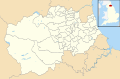
List of electoral wards in County Durham

Last updated

This is a list of electoral divisions and wards in the ceremonial county of Durham in North East England. All changes since the re-organisation of local government following the passing of the Local Government Act 1972 are shown. The number of councillors elected for each electoral division or ward is shown in brackets.

Contents

Current councils

Durham

This is about the area covered by the former non-metropolitan county and its successor unitary authority.

Electoral Divisions from 1 April 1974 (first election 12 April 1973) to 7 May 1981: [1] [2]

  1. Barnard Castle (1)
  2. Bishop Auckland No. 1 (1)
  3. Bishop Auckland No. 2 (1)
  4. Bishop Auckland No. 3 (1)
  5. Bishop Auckland No. 4 (1)
  6. Brandon No. 1 (1)
  7. Brandon No. 2 (1)
  8. Chester-le-Street No. 1 (1)
  9. Chester-le-Street No. 2 (1)
  10. Chester-le-Street No. 3 (1)
  11. Chester-le-Street Rural No. 1 (1)
  12. Chester-le-Street Rural No. 2 (1)
  13. Chester-le-Street Rural No. 3 (1)
  14. Consett No. 1 (1)
  15. Consett No. 2 (1)
  16. Consett No. 3 (1)
  17. Consett No. 4 (1)
  18. Crook & Willington No. 1 (1)
  19. Crook & Willington No. 2 (1)
  20. Crook & Willington No. 3 (1)
  21. Darlington No. 1 (1)
  22. Darlington No. 2 (Cockerton) (1)
  23. Darlington No. 3 (Eastbourne) (1)
  24. Darlington No. 4 (Harrowgate Hill) (1)
  25. Darlington No. 5 (Haughton) (1)
  26. Darlington No. 6 (Lingfield) (1)
  27. Darlington No. 7 (North Road) (1)
  28. Darlington No. 8 (Pierremont) (1)
  29. Darlington No. 9 (South) (1)
  30. Darlington No. 10 (West) (1)
  31. Darlington Rural No. 1 (1)
  32. Darlington Rural No. 2 (1)
  33. Darlington Rural No. 3 (1)
  34. Durham No. 1 (Framwellgate) (1)
  35. Durham No. 2 (1)
  36. Durham No. 3 (1)
  37. Durham Rural No. 1 (Coxhoe) (1)
  38. Durham Rural No. 2 (Sherburn) (1)
  39. Durham Rural No. 3 (1)
  40. Durham Rural No. 4 (1)
  41. Easington No. 1 (Blackhalls) (1)
  42. Easington No. 2 (Horden) (1)
  43. Easington No. 3 (Shotton) (1)
  44. Easington No. 4 (Thornley) (1)
  45. Easington No. 5 (Wingate) (1)
  46. Easington No. 6 (1)
  47. Easington No. 7 (1)
  48. Easington No. 8 (1)
  49. Easington No. 9 (1)
  50. Esh (1)
  51. Evenwood (1)
  52. Lanchester (1)
  53. Seaham No. 1 (1)
  54. Seaham No. 2 (1)
  55. Seaham No. 3 (1)
  56. Sedgefield No. 1 (Cornforth) (1)
  57. Sedgefield No. 2 (Ferryhill) (1)
  58. Sedgefield No. 3 (1)
  59. Sedgefield No. 4 (1)
  60. Shildon No. 1 (1)
  61. Shildon No. 2 (1)
  62. Spennymoor No. 1 (1)
  63. Spennymoor No. 2 (1)
  64. Staindrop (1)
  65. Stanhope (1)
  66. Stanley No. 1 (1)
  67. Stanley No. 2 (1)
  68. Stanley No. 3 (1)
  69. Stanley No. 4 (1)
  70. Stanley No. 5 (1)
  71. Startforth (1)
  72. Wolsingham (1)

Electoral Divisions from 7 May 1981 to 5 May 2005: [2] [3]

  1. Annfield Plain (1)
  2. Aycliffe East (1)
  3. Aycliffe North (1)
  4. Aycliffe West (1)
  5. Barnard Castle East (1)
  6. Barnard Castle West (1)
  7. Belmont (1)
  8. Benfieldside (1)
  9. Bishop Auckland Town (1)
  10. Blackhalls (1)
  11. Brandon (1)
  12. Burnopfield & Dipton (1)
  13. Chester le Street Central (1)
  14. Chester le Street North East (1)
  15. Chester le Street South (1)
  16. Chilton (1)
  17. Cockerton (1); electoral division abolished in 1997 [4]
  18. Consett (1)
  19. Coundon (1)
  20. Coxhoe (1)
  21. Craghead & South Moor (1)
  22. Crook North (1)
  23. Crook South (1)
  24. Darlington Rural (1); electoral division abolished in 1997 [4]
  25. Dawdon (1)
  26. Deerness Valley (1)
  27. Delves Lane (1)
  28. Deneside (1)
  29. Easington (1)
  30. Eastbourne (1); electoral division abolished in 1997 [4]
  31. Elvet (1)
  32. Esh (1)
  33. Evenwood (1)
  34. Ferryhill (1)
  35. Framwellgate Moor (1)
  36. Gilesgate (1)
  37. Harrowgate Hill (1); electoral division abolished in 1997 [4]
  38. Haughton (1); electoral division abolished in 1997 [4]
  39. Horden (1)
  40. Hurworth (1); electoral division abolished in 1997 [4]
  41. Lanchester (1)
  42. Leadgate & Medomsley (1)
  43. Lingfield (1); electoral division abolished in 1997 [4]
  44. Lumley (1)
  45. Mowden (1); electoral division abolished in 1997 [4]
  46. Murton (1)
  47. Nevilles Cross (1)
  48. Newton Hall (1)
  49. Northgate (1); electoral division abolished in 1997 [4]
  50. Park (1); electoral division abolished in 1997 [4]
  51. Pelton (1)
  52. Peterlee Central (1)
  53. Peterlee Dene (1)
  54. Pierremont (1); electoral division abolished in 1997 [4]
  55. Sacriston (1)
  56. Seaham (1)
  57. Sedgefield (1)
  58. Sherburn (1)
  59. Shildon North East (1)
  60. Shildon South West (1)
  61. Shotton (1)
  62. Spennymoor (1)
  63. Stanley (1)
  64. Tanfield (1)
  65. Thornley (1)
  66. Trimdon (1)
  67. Tudhoe (1)
  68. Weardale (1)
  69. West Auckland (1)
  70. Willington (1)
  71. Wingate (1)
  72. Woodhouse Close (1)

Electoral Divisions from 5 May 2005 to 2 May 2013: [5]

Durham Council UK ward map 2010 (blank).svg
  1. Annfield Plain (1)
  2. Aycliffe East (1)
  3. Aycliffe North (1)
  4. Aycliffe West (1)
  5. Barnard Castle East (1)
  6. Barnard Castle West (1)
  7. Belmont (1)
  8. Benfieldside (1)
  9. Bishop Auckland Town (1)
  10. Blackhalls (1)
  11. Brandon (1)
  12. Burnopfield & Dipton (1)
  13. Chester-le-Street North & East (1)
  14. Chester-le-Street South (1)
  15. Chester-le-Street West Central (1)
  16. Chilton (1)
  17. Consett North (1)
  18. Coundon (1)
  19. Coxhoe (1)
  20. Craghead & South Moor (1)
  21. Crook North & Tow Law (1)
  22. Crook South (1)
  23. Dawdon (1)
  24. Deerness Valley (1)
  25. Delves Lane & Consett South (1)
  26. Deneside (1)
  27. Durham South (1)
  28. Easington (1)
  29. Elvet (1)
  30. Esh (1)
  31. Evenwood (1)
  32. Ferryhill (1)
  33. Framwellgate Moor (1)
  34. Gilesgate (1)
  35. Horden (1)
  36. Lanchester (1)
  37. Leadgate & Medomsley (1)
  38. Lumley (1)
  39. Murton (1)
  40. Neville’s Cross (1)
  41. Newton Hall (1)
  42. Ouston & Urpeth (1)
  43. Pelton (1)
  44. Peterlee East (1)
  45. Peterlee West (1)
  46. Sacriston (1)
  47. Seaham (1)
  48. Sedgefield (1)
  49. Sherburn (1)
  50. Shildon East (1)
  51. Shildon West (1)
  52. Shotton (1)
  53. Spennymoor & Middlestone (1)
  54. Stanley (1)
  55. Tanfield (1)
  56. Thornley (1)
  57. Trimdon (1)
  58. Tudhoe (1)
  59. Weardale (1)
  60. West Auckland (1)
  61. Willington (1)
  62. Wingate (1)
  63. Woodhouse Close (1)

All Electoral Divisions were changed to (2) in 2008 [6]

Electoral Divisions from 2 May 2013 to present: [7]

Durham Council UK ward map 2013 (blank).svg
  1. Annfield Plain (2)
  2. Aycliffe East (2)
  3. Aycliffe North & Middridge (3)
  4. Aycliffe West (2)
  5. Barnard Castle East (2)
  6. Barnard Castle West (2)
  7. Belmont (3)
  8. Benfieldside (2)
  9. Bishop Auckland Town (2)
  10. Bishop Middleham & Cornforth (1)
  11. Blackhalls (2)
  12. Brandon (2)
  13. Burnopfield & Dipton (2)
  14. Chester-le-Street East (1)
  15. Chester-le-Street North (1)
  16. Chester-le-Street South (2)
  17. Chester-le-Street West Central (2)
  18. Chilton (1)
  19. Consett North (2)
  20. Consett South (1)
  21. Coundon (1)
  22. Coxhoe (3)
  23. Craghead & South Moor (2)
  24. Crook (3)
  25. Dawdon (2)
  26. Deerness (3)
  27. Delves Lane (2)
  28. Deneside (2)
  29. Durham South (1)
  30. Easington (2)
  31. Elvet & Gilesgate (2)
  32. Esh & Witton Gilbert (2)
  33. Evenwood (2)
  34. Ferryhill (3)
  35. Framwellgate & Newton Hall (3)
  36. Horden (2)
  37. Lanchester (2)
  38. Leadgate & Medomsley (2)
  39. Lumley (2)
  40. Murton (2)
  41. Neville’s Cross (2)
  42. North Lodge (1)
  43. Passfield (1)
  44. Pelton (3)
  45. Peterlee East (2)
  46. Peterlee West (2)
  47. Sacriston (2)
  48. Seaham (2)
  49. Sedgefield (2)
  50. Sherburn (2)
  51. Shildon & Dene Valley (3)
  52. Shotton & South Hetton (2)
  53. Spennymoor (3)
  54. Stanley (2)
  55. Tanfield (2)
  56. Tow Law (1)
  57. Trimdon & Thornley (3)
  58. Tudhoe (2)
  59. Weardale (2)
  60. West Auckland (2)
  61. Willington & Hunwick (2)
  62. Wingate (1)
  63. Woodhouse Close (2)

Darlington

Wards from 1 April 1974 (first election 7 June 1973) to 3 May 1979: [8]

  1. No. 1 (Harrowgate Hill) (3)
  2. No. 2 (North Road) (3)
  3. No. 3 (Cockerton) (5)
  4. No. 4 (Central & Northgate) (4)
  5. No. 5 (Pierremont) (4)
  6. No. 6 (Haughton) (4)
  7. No. 7 (Eastbourne) (6)
  8. No. 8 (West) (6)
  9. No. 9 (South) (4)
  10. No. 10 (Lingfield) (4)
  11. Heighington (1)
  12. Hurworth (2)
  13. Middleton St George (1)
  14. Sadberge (1)
  15. Whessoe (1)

Wards from 3 May 1979 to 1 May 2003: [9] [4]

Wards from 1 May 2003 to 7 May 2015: [10]

Darlington UK ward map 2010 (blank).svg
  1. Bank Top (2)
  2. Central (2)
  3. Cockerton East (3)
  4. Cockerton West (2)
  5. College (2)
  6. Eastbourne (3)
  7. Faverdale (1)
  8. Harrowgate Hill (3)
  9. Haughton East (2)
  10. Haughton North (2)
  11. Haughton West (3)
  12. Heighington & Coniscliffe (2)
  13. Hummersknott (2)
  14. Hurworth (2)
  15. Lascelles (2)
  16. Lingfield (2)
  17. Middleton St George (2)
  18. Mowden (2)
  19. Northgate (2)
  20. North Road (3)
  21. Park East (3)
  22. Park West (2)
  23. Pierremont (3)
  24. Sadberge & Whessoe (1)

Wards from 7 May 2015 to present: [11]

Darlington UK ward map 2015 (blank).svg
  1. Bank Top & Lascelles (3)
  2. Brinkburn & Faverdale (3)
  3. Cockerton (3)
  4. College (2)
  5. Eastbourne (3)
  6. Harrowgate Hill (3)
  7. Haughton & Springfield (3)
  8. Heighington & Coniscliffe (2)
  9. Hummersknott (2)
  10. Hurworth (2)
  11. Mowden (2)
  12. North Road (3)
  13. Northgate (2)
  14. Park East (3)
  15. Park West (2)
  16. Pierremont (3)
  17. Red Hall & Lingfield (2)
  18. Sadberge & Middleton St George (3)
  19. Stephenson (2)
  20. Whinfield (2)

Hartlepool

Wards from 1 April 1974 (first election 7 June 1973) to 6 May 1976: [12]

  1. No. 8 (Stranton) (3)
  2. No. 10 (Jackson) (3)
  3. No. 11 (Throston) (3)
  4. No. 12 (Dyke House) (3)
  5. No. 15 (Hart) (3)
  6. No. 16 (Greatham) (1)
  7. Brinkburn (3)
  8. Brus (3)
  9. Fens (3)
  10. Grange (3)
  11. Owton (3)
  12. Park (3)
  13. Rift House (3)
  14. Rossmere (3)
  15. Seaton (3)
  16. St Hilda (3)

Wards from 6 May 1976 to 10 June 2004: [13] [14]

Wards from 10 June 2004 to 3 May 2012: [15]

Hartlepool UK ward map 2010 (blank).svg
  1. Brus (3)
  2. Burn Valley (3)
  3. Dyke House (3)
  4. Elwick (1)
  5. Fens (3)
  6. Foggy Furze (3)
  7. Grange (3)
  8. Greatham (1)
  9. Hart (3)
  10. Owton (3)
  11. Park (3)
  12. Rift House (3)
  13. Rossmere (3)
  14. St Hilda (3)
  15. Seaton (3)
  16. Stranton (3)
  17. Throston (3)

Wards from 3 May 2012 to 6 May 2021: [16]

Hartlepool UK ward map 2012 (blank).svg
  1. Burn Valley (3)
  2. De Bruce (3)
  3. Fens & Rossmere (3)
  4. Foggy Furze (3)
  5. Hart (3)
  6. Headland & Harbour (3)
  7. Jesmond (3)
  8. Manor House (3)
  9. Rural West (3)
  10. Seaton (3)
  11. Victoria (3)

Wards from 6 May 2021 to present: [17] [18]

  1. Burn Valley (3)
  2. De Bruce (3)
  3. Fens and Greatham (3)
  4. Foggy Furze (3)
  5. Hart (3)
  6. Headland and Harbour (3)
  7. Manor House (3)
  8. Rossmere (3)
  9. Rural West (3)
  10. Seaton (3)
  11. Throston (3)
  12. Victoria (3)

Stockton-on-Tees

Wards from 1 April 1974 (first election 7 June 1973) to 3 May 1979: [12]

  1. No. 1 (Billingham East) (6)
  2. No. 2 (Billingham West) (7)
  3. No. 3 (Grangefield) (4)
  4. No. 4 (Hartburn) (6)
  5. No. 5 (Mile House) (7)
  6. No. 6 (North End) (4)
  7. No. 7 (Norton) (6)
  8. No. 8 (Stockton South) (4)
  9. No. 9 (Thornaby East) (5)
  10. No. 10 (Thornaby West) (4)
  11. No. 11 (Egglescliffe) (3)
  12. No. 12 (Preston) (1)
  13. No. 13 (Wolviston) (1)
  14. No. 14 (Yarm) (2)

Wards from 3 May 1979 to 5 May 2005: [19] [14]

Wards from 5 May 2005 to present: [20] [21]

Stockton-on-Tees UK ward map 2010 (blank).svg
  1. Billingham Central (2)
  2. Billingham East (2)
  3. Billingham North (3)
  4. Billingham South (2)
  5. Billingham West (2)
  6. Bishopsgarth & Elm Tree (2)
  7. Eaglescliffe (3)
  8. Fairfield (2)
  9. Grangefield (2)
  10. Hardwick (2); renamed Hardwick & Salters Lane in 2014 [22]
  11. Hartburn (2)
  12. Ingleby Barwick East (3)
  13. Ingleby Barwick West (3)
  14. Mandale & Victoria (3)
  15. Newtown (2)
  16. Northern Parishes (1)
  17. Norton North (2)
  18. Norton South (2)
  19. Norton West (2)
  20. Parkfield & Oxbridge (2)
  21. Roseworth (2)
  22. Stainsby Hill (2)
  23. Stockton Town Centre (2)
  24. Village (2)
  25. Western Parishes (1)
  26. Yarm (3)

Former councils

Cleveland

Electoral Divisions from 1 April 1974 (first election 12 April 1973) to 2 May 1985: [23] [24]

  1. Acklam (3)
  2. Ayresome (2)
  3. Berwick Hills (3)
  4. Billingham East (3)
  5. Billingham West (3)
  6. Brinkburn (1)
  7. Brus (1)
  8. Coatham (2)
  9. Dyke House (1)
  10. Eston Grange (3)
  11. Fens (1)
  12. Grange (1)
  13. Grangefield (2)
  14. Gresham (2)
  15. Guisborough East (1)
  16. Guisborough West (1)
  17. Hart (1)
  18. Hartburn (3)
  19. Jackson (1)
  20. Kirkleatham (2)
  21. Linthorpe (3)
  22. Loftus (1)
  23. Marske (2)
  24. Marton & Nunthorpe (2)
  25. Mile House (3)
  26. North End (2)
  27. North Ormesby (2)
  28. Norton (2)
  29. Ormesby (3)
  30. Owton (1)
  31. Park (1)
  32. Redcar (2)
  33. Rift House (1)
  34. Rossmere (1)
  35. Saltburn (1)
  36. Seaton (1)
  37. Skelton & Brotton No. 1 (1)
  38. Skelton & Brotton No. 2 (1)
  39. South Bank (3)
  40. St Hilda (1)
  41. St Hildas (2)
  42. Stockton Rural No. 1 (1)
  43. Stockton Rural No. 2 (1)
  44. Stockton South (2)
  45. Stokesley (1)
  46. Stranton (1)
  47. Thornaby East (2)
  48. Thornaby West (2)
  49. Thorntree (2)
  50. Throston (1)
  51. Tollesby (3)

Electoral Divisions from 2 May 1985 to 1 April 1996 (county abolished): [24] [25]

  1. Ayresome (1)
  2. Belle Vue (1)
  3. Berwick Hills (1)
  4. Bishopsgarth (1)
  5. Blue Hall (1)
  6. Boundary (1)
  7. Brierton (1)
  8. Britannia (1)
  9. Brookfield (1)
  10. Brotton & Skinningthorpe (1)
  11. Brus (1)
  12. Burn (1)
  13. Cambridge Road (1)
  14. Cargo Fleet (1)
  15. Catcote (1)
  16. Charltons (1)
  17. College Road (1)
  18. Coulby Newham (1)
  19. Dormanstown (1)
  20. Dyke House (1)
  21. Egglescliffe (1)
  22. Eston (1)
  23. Fairfield (1)
  24. Foggy Furze (1)
  25. Glebe (1)
  26. Golden Flatts (1)
  27. Grangefield (1)
  28. Grangetown (1)
  29. Gresham (1)
  30. Guisborough (1)
  31. Hardwick (1)
  32. Hartburn (1)
  33. Ingleby Barwick (1)
  34. Jackson (1)
  35. Kader (1)
  36. Kirkleatham (1)
  37. Lingdale (1)
  38. Loftus (1)
  39. Longbeck (1)
  40. Low Grange (1)
  41. Mandale (1)
  42. Marsh House (1)
  43. Marton Grove (1)
  44. Middlesbrough Park (1)
  45. Mile House (1)
  46. Mill Hill (1)
  47. Mowbray (1)
  48. Netherby (1)
  49. Newcomen (1)
  50. Newham Grange (1)
  51. Newton under Roseberry (1)
  52. Normanby (1)
  53. Norton (1)
  54. Ormesby (1)
  55. Park End (1)
  56. Parkfield (1)
  57. Preston Whitton & Wolviston (1)
  58. Roworth (1)
  59. Rye Hill (1)
  60. Saltburn (1)
  61. Sandy Lane (1)
  62. Skelton (1)
  63. South Bank (1)
  64. St Anns (1)
  65. St Cuthberts (1)
  66. St Germains (1)
  67. St Hildas (1)
  68. Stadium (1)
  69. Stewart Park (1)
  70. Teesville (1)
  71. Throston (1)
  72. Tollesby (1)
  73. Victoria (1)
  74. Village (1)
  75. West Dyke (1)
  76. Yarm (1)
  77. Zetland Park (1)

Chester-le-Street

Wards from 1 April 1974 (first election 7 June 1973) to 3 May 1979: [8]

  1. No. 1 (Chester South) (5)
  2. No. 2 (Chester Central) (1)
  3. No. 3 (Chester West) (3)
  4. No. 4 (Chester North) (4)
  5. No. 5 (Pelton Fell) (2)
  6. No. 6 (Bournmoor) (3)
  7. No. 7 (Edmondsley & Waldridge) (1)
  8. No. 9 (Lumley) (2)
  9. No. 11 (Pelton & Grange Villa) (4)
  10. North Lodge (1)
  11. Ouston (2)
  12. Plawsworth (1)
  13. Sacriston (3)
  14. Urpeth (1)

Wards from 3 May 1979 to 1 May 2003: [26]

Wards from 1 May 2003 to 1 April 2009 (district abolished): [27]

  1. Bournmoor (2)
  2. Chester Central (2)
  3. Chester East (2)
  4. Chester North (3)
  5. Chester South (2)
  6. Chester West (2)
  7. Edmondsley & Waldridge (3)
  8. Grange Villa & West Pelton (1)
  9. Kimblesworth & Plawsworth (1)
  10. Lumley (3)
  11. North Lodge (2)
  12. Ouston (2)
  13. Pelton (3)
  14. Pelton Fell (1)
  15. Sacriston (3)
  16. Urpeth (2)

Derwentside

Wards from 1 April 1974 (first election 7 June 1973) to 3 May 1979: [8]

  1. No. 1 (Ebchester) (1)
  2. No. 2 (Medomsley) (2)
  3. No. 3 (Leadgate) (3)
  4. No. 5 (Blackhill) (3)
  5. No. 6 (Consett North) (2)
  6. No. 7 (Delves Lane & Crookhall) (4)
  7. No. 8 (Consett South) (3)
  8. No. 12 (Catchgate) (2)
  9. No. 13 (Annfield Plain) (2)
  10. No. 14 (South Moor) (3)
  11. No. 15 (Havannah) (4)
  12. No. 16 (Towneley) (5)
  13. No. 17 (Craghead) (2)
  14. No. 18 (Lanchester) (4)
  15. No. 19 (Cornsay) (1)
  16. No. 21 (Castleside) (1)
  17. Benfieldside (3)
  18. Burnopfield (3)
  19. Dipton (2)
  20. Esh (3)
  21. Tanfield (2)

Wards from 3 May 1979 to 1 May 2003: [28]

Wards from 1 May 2003 to 1 April 2009 (district abolished): [29]

  1. Annfield Plain (3)
  2. Benfieldside (3)
  3. Blackhill (3)
  4. Burnhope (1)
  5. Burnopfield (3)
  6. Castleside (1)
  7. Catchgate (2)
  8. Consett East (2)
  9. Consett North (3)
  10. Consett South (2)
  11. Cornsay (1)
  12. Craghead & South Stanley (3)
  13. Delves Lane (3)
  14. Dipton (2)
  15. Ebchester & Medomsley (3)
  16. Esh (3)
  17. Havannah (3)
  18. Lanchester (3)
  19. Leadgate (3)
  20. South Moor (3)
  21. Stanley Hall (3)
  22. Tanfield (3)

Durham

Wards from 1 April 1974 (first election 7 June 1973) to 3 May 1979: [8]

  1. No. 1 (Durham: Nevilles Cross) (3)
  2. No. 2 (Durham: Framwellgate) (6)
  3. No. 3 (Durham: Crossgate) (2)
  4. No. 4 (Durham: Elvet) (2)
  5. No. 5 (Durham: St Nicholas) (2)
  6. No. 6 (Durham: Gilesgate) (3)
  7. No. 7 (Durham: Pelaw) (2)
  8. No. 9 (Brandon: East) (1)
  9. No. 10 (Brandon: South) (1)
  10. No. 15 (Belmont & Carrville) (6)
  11. No. 17 (Coxhoe) (3)
  12. No. 19 (Kelloe) (1)
  13. No. 20 (Pittington) (1)
  14. No. 25 (West Rainton) (2)
  15. Bearpark (2)
  16. Brandon (3)
  17. Cassop cum Quarrinton (4)
  18. Croxdale (1)
  19. Deerness (3)
  20. Framwellgate Moor (3)
  21. New Brancepeth (1)
  22. Shadforth (1)
  23. Sherburn (2)
  24. Shincliffe (1)
  25. Ushaw Moor (3)
  26. Witton Gilbert (2)

Wards from 3 May 1979 to 1 May 2003: [30]

Wards from 1 May 2003 to 1 April 2009 (district abolished): [31]

  1. Bearpark & Witton Gilbert (3)
  2. Belmont (2)
  3. Brancepeth, Langley Moor & Meadowfield (2)
  4. Brandon (3)
  5. Carrville & Gilesgate Moor (3)
  6. Cassop-cum-Quarrington (3)
  7. Coxhoe (3)
  8. Crossgate & Framwelgate (3)
  9. Deerness (2)
  10. Elvet (3)
  11. Framwellgate Moor (3)
  12. Neville’s Cross (2)
  13. New Brancepeth & Ushaw Moor (3)
  14. Newton Hall North (2)
  15. Newton Hall South (2)
  16. Pelaw & Gilesgate (3)
  17. Pittington & West Rainton (2)
  18. St Nicholas (2)
  19. Shadforth & Sherburn (3)
  20. Shincliffe (1)

Easington

Wards from 1 April 1974 (first election 7 June 1973) to 3 May 1979: [8]

  1. No. 1 (Park-Seaham-South) (5)
  2. No. 2 (Deneside & High Colliery) (4)
  3. No. 6 (East Murton) (6)
  4. No. 9 (Horden) (6)
  5. No. 10 (Hutton Henry) (1)
  6. No. 11 (Monkhesleden) (4)
  7. Acre Rigg (3)
  8. Dawdon (4)
  9. Deaf Hill (1)
  10. Dene House (3)
  11. Easington Colliery (4)
  12. Easington Village (1)
  13. Eden Hill (3)
  14. Haswell (1)
  15. Howletch (1)
  16. Passfield (1)
  17. Shotton (3)
  18. South Hetton (2)
  19. Thornley (2)
  20. Wheatley Hill (3)
  21. Wingate (2)

Wards from 3 May 1979 to 1 May 2003: [32]

Wards from 1 May 2003 to 1 April 2009 (district abolished): [33]

  1. Acre Rigg (2)
  2. Blackhalls (3)
  3. Dawdon (3)
  4. Dene House (2)
  5. Deneside (3)
  6. Easington Colliery (3)
  7. Easington Village & South Hetton (3)
  8. Eden Hill (2)
  9. Haswell & Shotton (3)
  10. Horden North (3)
  11. Horden South (2)
  12. Howletch (2)
  13. Hutton Henry (1)
  14. Murton East (2)
  15. Murton West (2)
  16. Passfield (3)
  17. Seaham Harbour (3)
  18. Seaham North (3)
  19. Thornley & Wheatley Hill (3)
  20. Wingate (3)

Sedgefield

Wards from 1 April 1974 (first election 7 June 1973) to 5 May 1983: [8]

  1. No. 5 (Tudhoe) (4)
  2. No. 6 (Low Spennymoor) (2)
  3. No. 12 (Woodham) (2)
  4. No. 15 (Broom & Chilton) (4)
  5. No. 16 (Bishop Middleham & Cornforth) (3)
  6. No. 17 (Windlestone) (3)
  7. No. 18 (Trimdon) (5)
  8. Byerley (3)
  9. Ferryhill (3)
  10. Middlestone (3)
  11. Middridge (1)
  12. Neville (2)
  13. Sedgefield (3)
  14. Shafto (2)
  15. Simpasture (2)
  16. Spennymoor (3)
  17. Sunnydale (2)
  18. Thickley (3)
  19. West (3)

Wards from 5 May 1983 to 1 May 2003: [34]

Wards from 1 May 2003 to 1 April 2009 (district abolished): [35]

  1. Bishop Middleham & Cornforth (2)
  2. Broom (3)
  3. Byerley (2)
  4. Chilton (3)
  5. Ferryhill (3)
  6. Fishburn & Old Trimdon (3)
  7. Greenfield Middridge (3)
  8. Low Spennymoor & Tudhoe Grange (3)
  9. Middlestone (3)
  10. Neville & Simpasture (3)
  11. New Trimdon & Trimdon Grange (1)
  12. Sedgefield (3)
  13. Shafto St Marys (3)
  14. Spennymoor (3)
  15. Sunnydale (2)
  16. Thickley (2)
  17. Tudhoe (2)
  18. West (3)
  19. Woodham (3)

Teesdale

Wards from 1 April 1974 (first election 7 June 1973) to 5 May 1983: [8]

  1. No. 1 (Barnard Castle) (6)
  2. No. 5 (Staindrop) (2)
  3. No. 7 (Lynesack & Softley) (2)
  4. No. 11 (Evenwood & Barony) (3)
  5. Barningham & Ovington (1)
  6. Cockfield (2)
  7. Cotherstone with Lartington (1)
  8. Eggleston (1)
  9. Etherley (2)
  10. Gainford & Winston (2)
  11. Greta (1)
  12. Ingleton (1)
  13. Middleton in Teesdale (2)
  14. Romaldkirk (1)
  15. Startforth with Boldron (1)
  16. Streatlam & Whorlton (1)

Wards from 5 May 1983 to 1 May 2003: [36]

Wards from 1 May 2003 to 1 April 2009 (district abolished): [37]

  1. Barnard Castle East (2)
  2. Barnard Castle North (2)
  3. Barnard Castle West (3)
  4. Barningham & Ovington (1)
  5. Cockfield (2)
  6. Cotherstone with Lartington (1)
  7. Eggleston (1)
  8. Etherley (3)
  9. Evenwood, Ramshaw & Lands (3)
  10. Gainford & Winston (2)
  11. Greta (1)
  12. Hamsterley & South Bedburn (1)
  13. Ingleton (1)
  14. Lynesack (2)
  15. Middleton-in-Teesdale (2)
  16. Romaldkirk (1)
  17. Staindrop (2)
  18. Startforth (1)
  19. Streatlam & Whorlton (1)

Wear Valley

Wards from 1 April 1974 (first election 7 June 1973) to 5 May 1983: [8]

  1. No. 2 (Cockton Hill) (4)
  2. No. 3 (Woodhouse Close) (3)
  3. No. 4 (St Helens & West Auckland) (3)
  4. No. 7 (West Auckland & Coundon Grange) (3)
  5. No. 9 (Crook East) (1)
  6. No. 10 (Crook North) (1)
  7. No. 11 (Crook South) (2)
  8. Bishop Auckland Town (3)
  9. Coundon (3)
  10. Escomb (1)
  11. Howden le Wear (1)
  12. Hunwick (1)
  13. St Johns Chapel (1)
  14. Stanhope (2)
  15. Stanley (1)
  16. Tow Law (2)
  17. Wheatbottom & Helmington Row (2)
  18. Willington East (3)
  19. Willington West (2)
  20. Wolsingham (2)

Wards from 5 May 1983 to 1 May 2003: [38]

Wards from 1 May 2003 to 1 April 2009 (district abolished): [39]

  1. Bishop Auckland Town (2)
  2. Cockton Hill (3)
  3. Coundon (3)
  4. Crook North (1)
  5. Crook South (3)
  6. Dene Valley (2)
  7. Escomb (2)
  8. Henknowle (2)
  9. Howden (1)
  10. Hunwick (1)
  11. St John’s Chapel (1)
  12. Stanhope (2)
  13. Tow Law & Stanley (3)
  14. West Auckland (3)
  15. Wheatbottom & Helmington Row (2)
  16. Willington Central (3)
  17. Willington West End (1)
  18. Wolsingham & Witton-le-Wear (2)
  19. Woodhouse Close (3)

Electoral wards by constituency

Bishop Auckland

Barnard Castle East, Barnard Castle North, Barnard Castle West, Bishop Auckland Town, Barningham and Ovington, Byerley, Cockfield, Cockton Hill, Cotherstone with Lartington, Coundon, Dene Valley, Eggleston, Escomb, Etherley, Evenwood, Gainford and Winston, Greta, Hamsterley and South Bedburn, Henknowle, Ingleton, Lynesack, Low Spennymoor and Tudhoe Grange, Middlestone, Middleton-in-Teesdale, Ramshaw and Lands, Romaldkirk, Spennymoor, Startforth, Streatlam and Whorlton, Sunnydale, Thickley, Tudhoe. West Auckland, Woodhouse Close.

City of Durham

Bearpark and Witton Gilbert, Belmont, Brancepeth, Langley Moor and Meadowfield, Brandon, Carrville and Gilesgate Moor, Cassop-cum-Quarrington, Coxhoe, Crossgate and Framwelgate, Deerness, Elvet, Framwellgate Moor, Neville’s Cross, New Brancepeth and Ushaw Moor, Newton Hall North, Newton Hall South, Pelaw and Gilesgate, Pittington and West Rainton, St Nicholas, Shadforth and Sherburn, Shincliffe.

Darlington

Bank Top, Central, Cockerton East, Cockerton West, College, Eastbourne, Faverdale, Harrowgate Hill, Haughton East, Haughton North, Haughton West, Hummersknott, Lascelles, Lingfield, Mowden, Northgate, North Road, Park East, Park West, Pierremont.

Easington

Acre Rigg, Blackhalls, Dawdon, Dene House, Deneside, Easington Colliery, Easington Village and South Hetton, Eden Hill, Haswell and Shotton, Horden North, Horden South, Howletch, Hutton Henry, Murton East, Murton West, Passfield, Seaham Harbour, Seaham North.

Hartlepool

Brus, Burn Valley, Dyke House, Elwick, Fens, Foggy Furze, Grange, Greatham, Hart, Owton, Park, Rift House, Rossmere, St Hilda, Seaton, Stranton, Throston.

North Durham

Annfield Plain, Bournmoor, Catchgate, Chester Central, Chester East, Chester North, Chester South, Chester West, Craghead and South Stanley, Edmondsley and Waldridge, Grange Villa and West Pelton, Havannah, Kimblesworth and Plawsworth, Lumley, North Lodge, Ouston, Pelton, Pelton Fell, Sacriston, South Moor, Stanley Hall, Tanfield, Urpeth.

North West Durham

Benfieldside, Blackhill, Burnhope, Burnopfield, Castleside, Consett East, Consett North, Consett South, Cornsay, Crook North, Crook South, Delves Lane, Dipton, Ebchester and Medomsley, Esh, Howden, Hunwick, Lanchester, Leadgate, St John’s Chapel, Stanhope, Tow Law and Stanley, Wheatbottom and Helmington Row, Willington Central, Willington West End, Wolsingham and Witton-le-Wear.

Sedgefield

Bishop Middleham and Cornforth, Broom, Chilton, Ferryhill, Fishburn and Old Trimdon, Greenfield Middridge, Heighington and Coniscliffe, Hurworth, Middleton St George, Neville and Simpasture, New Trimdon and Trimdon Grange, Sadberge and Whessoe, Sedgefield, Shafto St Marys, Thornley and Wheatley Hill, West, Wingate, Woodham.

Stockton North

Billingham Central, Billingham East, Billingham North, Billingham South, Billingham West, Hardwick, Newtown, Northern Parishes, Norton North, Norton South, Norton West, Roseworth, Stockton Town Centre, Western Parishes.

Stockton South

Bishopsgarth and Elm Tree, Eaglescliffe, Fairfield, Grangefield, Hartburn, Parkfield-and-Oxbridge.

See also

Related Research Articles

<span class="mw-page-title-main">Northern Football League</span> Association football league in England

The Northern League is a men's football league in north east England. Having been founded in 1889, it is the second-oldest football league in the world still in existence after the English Football League.

<span class="mw-page-title-main">County Durham</span> Ceremonial county in North East England

County Durham, officially simply Durham, is a ceremonial county in North East England. The ceremonial county was created from the historic County Palatine of Durham in 1853.

<span class="mw-page-title-main">Sedgefield (borough)</span> Former local government district in England

Sedgefield District was, from 1974 to 2009, a local government district and, borough in County Durham, in North East England. It had a population of about 87,000. It was named after Sedgefield, but its largest town was Newton Aycliffe. Other places included Shildon, Ferryhill and Spennymoor.

<span class="mw-page-title-main">Easington District</span> Former local government district in England

Easington was, from 1974 to 2009, a local government district in eastern County Durham, England. It contained the settlements of Easington, Seaham, Peterlee, Murton, Horden, Blackhall, Wingate and Castle Eden. It did not however include Easington Lane which is administered as part of the City of Sunderland.

<span class="mw-page-title-main">Sedgefield (UK Parliament constituency)</span> Parliamentary constituency in the United Kingdom since 1983

Sedgefield is a constituency in County Durham represented in the House of Commons of the UK Parliament since 2019 by Paul Howell of the Conservative Party. It elects one Member of Parliament (MP) by the first past the post system of election.

<span class="mw-page-title-main">Easington (UK Parliament constituency)</span> UK Parliament constituency since 1950

Easington is a constituency created in 1950 represented in the House of Commons of the UK Parliament since 2010 by Grahame Morris of the Labour Party.

<span class="mw-page-title-main">North West Durham (UK Parliament constituency)</span> Parliamentary constituency in the United Kingdom

North West Durham is a constituency represented in the House of Commons of the UK Parliament since 12 December 2019 by Richard Holden of the Conservative Party.

<span class="mw-page-title-main">North Durham (UK Parliament constituency)</span> Parliamentary constituency in the United Kingdom, 1983 onwards

North Durham is a constituency represented in the House of Commons of the UK Parliament since 2001 by Kevan Jones of the Labour Party.

South East Durham was a county constituency represented in the House of Commons of the Parliament of the United Kingdom. It elected one Member of Parliament (MP) by the first past the post system of election between 1885 and 1918.

<span class="mw-page-title-main">Durham County Council</span> Local authority in North East England

Durham County Council is a local unitary authority governing local government functions for the County Durham district of North East England. The council area covers part of wider ceremonial County Durham. County Hall in Durham is the council's headquarters.

<span class="mw-page-title-main">Durham Challenge Cup</span> Football tournament

The Durham County Challenge Cup is an annual football competition held between the clubs of the Durham County Football Association which was first played in 1884. It is the senior county cup for the historic county of Durham, which includes Durham, Darlington, Gateshead, Hartlepool, South Tyneside, Stockton-on-Tees, and Sunderland. The first winners were Sunderland.

The 2018–19 Northern Football League season is the 121st in the history of Northern Football League, a football competition in England.

<span class="mw-page-title-main">County Durham (district)</span> District in North East England

County Durham is a unitary authority area in the ceremonial county of Durham, North East England. It covers seven former districts: Durham (city), Easington, Sedgefield (borough), Teesdale, Wear Valley, Derwentside, and Chester-le-Street. It is governed by Durham County Council and has 136 civil parishes.

The 2022–23 Northern Football League season is the 125th in the history of the Northern Football League, a football competition in England. The league operates two divisions in the English football league system, Division One at step 5, and Division Two at step 6.

The county of Durham has returned 7 MPs to the UK Parliament since 1983. Under the Local Government Act 1972, which came into effect on 1 April 1974, the boundaries of the historic/administrative county were significantly altered with the north-east of the county, comprising more than half the electorate, being transferred to the new metropolitan county of Tyne and Wear. In addition, the borough of Hartlepool was included in the new county of Cleveland. These changes were reflected in the following redistribution of parliamentary seats which did not come into effect until the 1983 general election, resulting in a reduction in the county's representation from 16 to 7 MPs.

References

  1. The County of Durham (Electoral Divisions) Order 1973
  2. 1 2 Rallings, Colin; Thrasher, Michael. Durham County Council Election Results 1973-2005 (PDF). The Elections Centre. Retrieved 12 May 2016.
  3. The County of Durham (Electoral Arrangements) Order 1981
  4. 1 2 3 4 5 6 7 8 9 10 11 12 legislation.gov.uk - The Durham (Borough of Darlington) (Structural Change) Order 1995. Retrieved on 6 November 2015.
  5. legislation.gov.uk - The County of Durham (Electoral Changes) Order 2005. Retrieved on 3 November 2015.
  6. legislation.gov.uk - The County Durham (Structural Change) Order 2008. Retrieved on 6 November 2015.
  7. legislation.gov.uk - The Durham (Electoral Changes) Order 2012. Retrieved on 3 November 2015.
  8. 1 2 3 4 5 6 7 8 The County of Durham (District Wards) Order 1973
  9. The Borough of Darlington (Electoral Arrangements) Order 1976
  10. legislation.gov.uk - The Borough of Darlington (Electoral Changes) Order 2001. Retrieved on 4 October 2015.
  11. legislation.gov.uk - The Darlington (Electoral Changes) Order 2014. Retrieved on 3 November 2015.
  12. 1 2 The County of Cleveland (District Wards) Order 1973
  13. legislation.gov.uk - The Borough of Hartlepool (Electoral Arrangements) Order 1975. Retrieved on 19 November 2015.
  14. 1 2 legislation.gov.uk - The Cleveland (Structural Change) Order 1995. Retrieved on 6 November 2015.
  15. legislation.gov.uk - The Borough of Hartlepool (Electoral Changes) Order 2003. Retrieved on 3 November 2015.
  16. legislation.gov.uk - The Hartlepool (Electoral Changes) Order 2012. Retrieved on 3 November 2015.
  17. "Local electoral arrangements finalised for Hartlepool Borough Council". LGBCE . 5 February 2019. Retrieved 16 July 2021.
  18. McGuckin, Denise (9 May 2021). "Declaration of Result of Poll" (PDF). Hartlepool Borough Council . Retrieved 16 July 2021.
  19. The Borough of Stockton-on-Tees (Electoral Arrangements) Order 1976
  20. legislation.gov.uk - The Borough of Stockton-on-Tees (Electoral Changes) Order 2003. Retrieved on 3 November 2015.
  21. legislation.gov.uk - The Borough of Stockton-on-Tees (Electoral Changes) (Amendment) Order 2005. Retrieved on 3 November 2015.
  22. Stockton-on-Tees Borough Council letter dated 17 February 2014
  23. The County of Cleveland (Electoral Divisions) Order 1973
  24. 1 2 Rallings, Colin; Thrasher, Michael. Cleveland County Council Election Results 1973-1993 (PDF). The Elections Centre. Retrieved 12 May 2016.
  25. The County of Cleveland (Electoral Arrangements) Order 1985
  26. The District of Chester-le-Street (Electoral Arrangements) Order 1976
  27. legislation.gov.uk - The District of Chester-le-Street (Electoral Changes) Order 1999. Retrieved on 4 October 2015.
  28. legislation.gov.uk - The District of Derwentside (Electoral Arrangements) Order 1978. Retrieved on 19 November 2015.
  29. legislation.gov.uk - The District of Derwentside (Electoral Changes) Order 1999. Retrieved on 4 October 2015.
  30. The City of Durham (Electoral Arrangements) Order 1978
  31. legislation.gov.uk - The City of Durham (Electoral Changes) Order 1999. Retrieved on 4 October 2015.
  32. legislation.gov.uk - The District of Easington (Electoral Arrangements) Order 1978. Retrieved on 19 November 2015.
  33. legislation.gov.uk - The District of Easington (Electoral Changes) Order 1999. Retrieved on 4 October 2015.
  34. The District of Sedgefield (Electoral Arrangements) Order 1979
  35. legislation.gov.uk - The Borough of Sedgefield (Electoral Changes) Order 1999. Retrieved on 4 October 2015.
  36. legislation.gov.uk - The District of Teesdale (Electoral Arrangements) Order 1979. Retrieved on 19 November 2015.
  37. legislation.gov.uk - The District of Teesdale (Electoral Changes) Order 1999. Retrieved on 4 October 2015.
  38. The District of Wear Valley (Electoral Arrangements) Order 1979
  39. legislation.gov.uk - The District of Wear Valley (Electoral Changes) Order 1999. Retrieved on 4 October 2015.