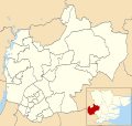
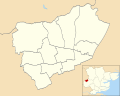
List of electoral wards in Essex

Last updated

This is a list of electoral divisions and wards in the ceremonial county of Essex in the East of England. All changes since the re-organisation of local government following the passing of the Local Government Act 1972 are shown. The number of councillors elected for each electoral division or ward is shown in brackets.

Contents

County council

Essex

Electoral Divisions from 1 April 1974 (first election 12 April 1973) to 7 May 1981: [1] [2]

  1. Bardfield (1)
  2. Basildon No. 1 (Billericay) (1)
  3. Basildon No. 2 (Central) (1)
  4. Basildon No. 3 (Fryerns) (1)
  5. Basildon No. 4 (Laindon) (1)
  6. Basildon No. 5 (Langdon Hills) (1)
  7. Basildon No. 6 (Pitsea) (1)
  8. Basildon No. 7 (Ramsden) (1)
  9. Basildon No. 8 (Wickford) (1)
  10. Benfleet (Benfleet) (1)
  11. Benfleet (Hadleigh) (1)
  12. Benfleet (Thundersley) (1)
  13. Bocking (1)
  14. Braintree (1)
  15. Brentwood Central (1)
  16. Brentwood Hutton (1)
  17. Brentwood North (1)
  18. Brentwood South (1)
  19. Brightlingsea (1)
  20. Canvey Island (East) (1)
  21. Canvey Island (West) (1)
  22. Chelmsford (East) (1)
  23. Chelmsford (North) (1)
  24. Chelmsford (South) (1)
  25. Chelmsford (West) (1)
  26. Chelmsford Rural No. 1 (1)
  27. Chelmsford Rural No. 2 (1)
  28. Chelmsford Rural No. 3 (1)
  29. Chelmsford Rural No. 4 (1)
  30. Chelmsford Rural No. 5 (Great Baddo (1)
  31. Chigwell (Buckhurst Hill) (1)
  32. Chigwell (Chigwell) (1)
  33. Chigwell (Loughton North) (1)
  34. Chigwell (Loughton South) (1)
  35. Clacton No. 1 (North) (1)
  36. Clacton No. 2 (1)
  37. Clacton No. 3 (1)
  38. Coggeshall (1)
  39. Colchester No. 1 (East) (1)
  40. Colchester No. 2 (South) (1)
  41. Colchester No. 3 (West) (1)
  42. Colchester No. 4 (1)
  43. Colchester No. 5 (1)
  44. Dedham (1)
  45. Dunmow (1)
  46. Epping (1)
  47. Epping & Ongar No. 1 (1)
  48. Epping & Ongar No. 2 (1)
  49. Epping & Ongar No. 3 (1)
  50. Frinton & Walton (1)
  51. Halstead (1)
  52. Harlow (Great Parndon) (1)
  53. Harlow (Harlow & Mark Hall) (1)
  54. Harlow (Harlow Common) (1)
  55. Harlow (Little Parndon & Town Centre) (1)
  56. Harlow (Netteswellbury) (1)
  57. Harwich (1)
  58. Hedingham (1)
  59. Lexden (1)
  60. Maldon (1)
  61. Mersea (1)
  62. Rayleigh (North) (1)
  63. Rayleigh (South) (1)
  64. Rochford (North) (1)
  65. Rochford (South) (1)
  66. Rochford (West) (1)
  67. Saffron Walden (1)
  68. Southend No. 1 (Eastwood) (1)
  69. Southend No. 2 (Prittlewell) (1)
  70. Southend No. 3 (Leigh) (1)
  71. Southend No. 4 (St Clements) (1)
  72. Southend No. 5 (Chalkwell) (1)
  73. Southend No. 6 (2)
  74. Southend No. 7 (2)
  75. Southend No. 8 (Shoebury) (1)
  76. Southend No. 9 (Thorpe) (1)
  77. Southend No. 10 (1)
  78. Southend No. 11 (1)
  79. Southminster (1)
  80. Stansted (1)
  81. Tendring Rural No. 1 (Tendring) (1)
  82. Tendring Rural No. 2 (1)
  83. Thaxted (1)
  84. Thurrock No. 1 (Chadwell) (1)
  85. Thurrock No. 2 (Grays Thurrock) (1)
  86. Thurrock No. 3 (Little Thurrock) (1)
  87. Thurrock No. 4 (Orsett & Stifford) (1)
  88. Thurrock No. 5 (South Ockendon) (1)
  89. Thurrock No. 6 (Corringham) (1)
  90. Thurrock No. 7 (Tilbury) (1)
  91. Thurrock No. 8 (West Thurrock & Ave (1)
  92. Thurrock No. 9 (Stanford-le-Hope) (1)
  93. Tollesbury (1)
  94. Waltham Abbey (1)
  95. Witham (1)

Electoral Divisions from 7 May 1981 to 5 May 2005: [2] [3]

  1. Basildon Crouch (1)
  2. Basildon Fryerns (1)
  3. Basildon Gloucester Park (1)
  4. Basildon Laindon (1)
  5. Basildon Pitsea (1)
  6. Basildon Vange (1)
  7. Basildon Westley Heights (1)
  8. Belfairs & Blenheim (1); electoral division abolished in 1998 [4]
  9. Benfleet (1)
  10. Billericay North (1)
  11. Billericay South (1)
  12. Bocking (1)
  13. Braintree East (1)
  14. Braintree West (1)
  15. Brentwood Central (1)
  16. Brentwood Hutton (1)
  17. Brentwood North (1)
  18. Brentwood Rural (1)
  19. Brentwood South (1)
  20. Brightlingsea (1)
  21. Broomfield & Writtle (1)
  22. Buckhurst Hill (1)
  23. Canvey Island East (1)
  24. Canvey Island West (1)
  25. Chadwell (1); electoral division abolished in 1998 [4]
  26. Chalkwell (1); electoral division abolished in 1998 [4]
  27. Chelmsford East (1)
  28. Chelmsford North (1)
  29. Chelmsford South (1)
  30. Chelmsford West (1)
  31. Chigwell (1)
  32. Clacton East (1)
  33. Clacton North (1)
  34. Clacton West (1)
  35. Constable (1)
  36. Corringham (1); electoral division abolished in 1998 [4]
  37. Drury (1)
  38. Dunmow (1)
  39. Eastwood (1); electoral division abolished in 1998 [4]
  40. Epping (1)
  41. Frinton & Walton (1)
  42. Grays Thurrock (1); electoral division abolished in 1998 [4]
  43. Great Baddow (1)
  44. Great Parndon (1)
  45. Great Tarpots (1)
  46. Hadleigh (1)
  47. Halstead (1)
  48. Harlow & Mark Hall (1)
  49. Harlow Common (1)
  50. Harwich (1)
  51. Hedingham (1)
  52. Leigh (1); electoral division abolished in 1998 [4]
  53. Little Parndon & Town Centre (1)
  54. Loughton St Johns (1)
  55. Loughton St Marys (1)
  56. Maldon (1)
  57. Maypole (1)
  58. Mersea & Stanway (1)
  59. Milton (1); electoral division abolished in 1998 [4]
  60. Netteswellbury (1)
  61. North Weald & Nazeing (1)
  62. Old Heath (1)
  63. Ongar (1)
  64. Orsett & Stifford (1); electoral division abolished in 1998 [4]
  65. Park (1)
  66. Parsons Heath (1)
  67. Prittlewell (1); electoral division abolished in 1998 [4]
  68. Rayleigh North (1)
  69. Rayleigh South (1)
  70. Rochford North (1)
  71. Rochford South (1)
  72. Rochford West (1)
  73. Saffron Walden (1)
  74. Shoebury (1); electoral division abolished in 1998 [4]
  75. South Ockendon (1); electoral division abolished in 1998 [4]
  76. Southchurch (1); electoral division abolished in 1998 [4]
  77. Southminster (1)
  78. Springfield (1)
  79. Stanford-le-Hope (1); electoral division abolished in 1998 [4]
  80. Stansted (1)
  81. Stock (1)
  82. Tendring Rural East (1)
  83. Tendring Rural West (1)
  84. Thaxted (1)
  85. Thorpe (1); electoral division abolished in 1998 [4]
  86. Thundersley (1)
  87. Tilbury (1); electoral division abolished in 1998 [4]
  88. Tiptree (1)
  89. Tollesbury (1)
  90. Victoria (1); electoral division abolished in 1998 [4]
  91. Waltham Abbey (1)
  92. West Thurrock & Aveley (1); electoral division abolished in 1998 [4]
  93. Westborough (1); electoral division abolished in 1998 [4]
  94. Wickford (1)
  95. Witham Northern (1)
  96. Witham Southern (1)
  97. Wivenhoe St Andrew (1)
  98. Woodham Ferrers & Danbury (1)

Electoral Divisions from 5 May 2005 to present: [5]

Essex UK electoral division map (blank).svg
  1. Abbey (1)
  2. Basildon Laindon Park & Fryerns (2)
  3. Basildon Pitsea (2)
  4. Basildon Westley Heights (1)
  5. Billericay & Burstead (2)
  6. Bocking (1)
  7. Braintree Eastern (1)
  8. Braintree Town (1)
  9. Brentwood Hutton (1)
  10. Brentwood North (1)
  11. Brentwood Rural (1)
  12. Brentwood South (1)
  13. Brightlingsea (1)
  14. Broomfield & Writtle (1)
  15. Buckhurst Hill & Loughton South (1)
  16. Canvey Island East (1)
  17. Canvey Island West (1)
  18. Chelmer (1)
  19. Chelmsford Central (1)
  20. Chelmsford North (1)
  21. Chelmsford West (1)
  22. Chigwell & Loughton Broadway (1)
  23. Clacton East (1)
  24. Clacton North (1)
  25. Clacton West (1)
  26. Constable (1)
  27. Drury (1)
  28. Dunmow (1) †
  29. Epping & Theydon Bois (1)
  30. Frinton & Walton (1)
  31. Great Baddow (1)
  32. Hadleigh (1)
  33. Halstead (1)
  34. Harlow North (1)
  35. Harlow South East (1)
  36. Harlow West (2)
  37. Harwich (1)
  38. Hedingham (1)
  39. Heybridge & Tollesbury (1)
  40. Loughton Central (1)
  41. Maldon (1)
  42. Maypole (1)
  43. Mersea & Tiptree (1)
  44. Mile End & Highwoods (1)
  45. North Weald & Nazeing (1) ‡
  46. Ongar & Rural (1) ‡
  47. Parsons Heath & East Gates (1)
  48. Rayleigh North (1)
  49. Rayleigh South (1)
  50. Rochford North (1)
  51. Rochford South (1)
  52. Rochford West (1)
  53. Saffron Walden (1)
  54. South Benfleet (1)
  55. South Woodham Ferrers (1)
  56. Southminster (1)
  57. Springfield (1)
  58. Stansted (1) †
  59. Stanway & Pyefleet (1)
  60. Stock (1)
  61. Tendring Rural East (1)
  62. Tendring Rural West (1)
  63. Thaxted (1)
  64. Three Fields with Great Notley (1)
  65. Thundersley (1)
  66. Waltham Abbey (1)
  67. Wickford Crouch (2)
  68. Witham Northern (1)
  69. Witham Southern (1)
  70. Wivenhoe St Andrew (1)

† minor boundary changes in 2009 [6] ‡ minor boundary changes in 2013 [7]

Unitary authority councils

Southend-on-Sea

Wards from 1 April 1974 (first election 7 June 1973) to 6 May 1976: [8]

  1. All Saints (2)
  2. Blenheim (3)
  3. Chalkwell (3)
  4. Eastwood (5)
  5. Leigh (3)
  6. Milton (3)
  7. Pier (2)
  8. Prittlewell (3)
  9. Shoebury (3)
  10. Southbourne (3)
  11. Southchurch (3)
  12. St Clements (3)
  13. Temple Sutton (3)
  14. Thorpe (4)
  15. Victoria (2)
  16. Westborough (3)

Wards from 6 May 1976 to 7 June 2001: [9] [4]

  1. Belfairs (3)
  2. Blenheim (3)
  3. Chalkwell (3)
  4. Eastwood (3)
  5. Leigh (3)
  6. Milton (3)
  7. Prittlewell (3)
  8. Shoebury (3)
  9. Southchurch (3)
  10. St Lukes (3)
  11. Thorpe (3)
  12. Victoria (3)
  13. Westborough (3)

Wards from 7 June 2001 to present: [10]

Southend-on-Sea UK ward map 2010 (blank).svg
  1. Belfairs (3)
  2. Blenheim Park (3)
  3. Chalkwell (3)
  4. Eastwood Park (3)
  5. Kursaal (3)
  6. Leigh (3)
  7. Milton (3)
  8. Prittlewell (3)
  9. St Laurence (3)
  10. St Luke's (3)
  11. Shoeburyness (3)
  12. Southchurch (3)
  13. Thorpe (3)
  14. Victoria (3)
  15. Westborough (3)
  16. West Leigh (3)
  17. West Shoebury (3)

Thurrock

Wards from 1 April 1974 (first election 7 June 1973) to 3 May 1979: [8]

  1. Aveley (3)
  2. Chadwell St Mary (3)
  3. Corringham (3)
  4. Grays (6)
  5. Little Thurrock (3)
  6. Orsett (3)
  7. South Ockendon (6)
  8. Stanford-le-Hope (3)
  9. Stifford (3)
  10. Tilbury (3)
  11. West Thurrock (3)

Wards from 3 May 1979 to 1 May 1997: [11]

  1. Aveley (3)
  2. Belhus (3)
  3. Chadwell St Mary (3)
  4. Corringham & Fobbing (3)
  5. East Tilbury (); was due to change to (2) in 1997 [4]
  6. Grays Thurrock North (1)
  7. Grays Thurrock Town (3)
  8. Little Thurrock (3)
  9. Ockendon (3)
  10. Orsett (2)
  11. Stanford-le-Hope (3)
  12. Stifford (3)
  13. The Homesteads (3)
  14. Tilbury (3)
  15. West Thurrock (); was due to change to (3) in 1997 [4]

Wards from 1 May 1997 to 10 June 2004: [12]

  1. Aveley (3)
  2. Belhus (3)
  3. Chadwell St Mary (3)
  4. Chafford Hundred (2)
  5. Corringham & Fobbing (2)
  6. Corringham West (2)
  7. East Tilbury (2)
  8. Grays Riverside (3)
  9. Grays Thurrock (3)
  10. Little Thurrock Blackshots (2)
  11. Little Thurrock Rectory (2)
  12. Ockendon (3)
  13. Orsett (2)
  14. Stanford-le-Hope East (2)
  15. Stanford-le-Hope West (2)
  16. Stifford (3)
  17. The Homesteads (3)
  18. Tilbury Riverside (2)
  19. Tilbury St Chads (2)
  20. West Thurrock (3)

Wards from 10 June 2004 to present: [13] [14]

Thurrock UK ward map 2010 (blank).svg
  1. Aveley & Uplands (3)
  2. Belhus (3)
  3. Chadwell St Mary (3)
  4. Chafford & North Stifford (2)
  5. Corringham & Fobbing (2)
  6. East Tilbury (2)
  7. Grays Riverside (3)
  8. Grays Thurrock (3)
  9. Little Thurrock Blackshots (2)
  10. Little Thurrock Rectory (2)
  11. Ockendon (3)
  12. Orsett (2)
  13. South Chafford (2)
  14. Stanford East & Corringham Town (3)
  15. Stanford-le-Hope West (2)
  16. Stifford Clays (2)
  17. The Homesteads (3)
  18. Tilbury Riverside & Thurrock Park (2)
  19. Tilbury St Chads (2)
  20. West Thurrock & South Stifford (3)

District councils

Basildon

Wards from 1 April 1974 (first election 7 June 1973) to 3 May 1979: [8] [15]

  1. Barstable (3)
  2. Billericay (3)
  3. Burstead (3)
  4. Buttsbury (3)
  5. Castledon (4)
  6. Central (3)
  7. Fryerns East (3)
  8. Fryerns West (3)
  9. Laindon (4)
  10. Langdon Hills (3)
  11. Lee Chapel North (3)
  12. Pitsea (3)
  13. Vange (4)
  14. Wickford (4)

Wards from 3 May 1979 to 2 May 2002: [16] [15]

Basildon UK ward map 1979 (blank).svg
  1. Billericay East (3)
  2. Billericay West (3)
  3. Burstead (3)
  4. Fryerns Central (3)
  5. Fryerns East (3)
  6. Laindon (3)
  7. Langdon Hills (3)
  8. Lee Chapel North (3)
  9. Nethermayne (3)
  10. Pitsea East (3)
  11. Pitsea West (3)
  12. Vange (3)
  13. Wickford North (3)
  14. Wickford South (3)

Wards from 2 May 2002 to present: [17]

Basildon UK ward map 2010 (blank).svg
  1. Billericay East (3)
  2. Billericay West (3)
  3. Burstead (3)
  4. Crouch (2)
  5. Fryerns (3)
  6. Laindon Park (3)
  7. Langdon Hills (2)
  8. Lee Chapel North (3)
  9. Nethermayne (3)
  10. Pitsea North West (3)
  11. Pitsea South East (3)
  12. St Martin's (2)
  13. Vange (2)
  14. Wickford Castledon (2)
  15. Wickford North (3)
  16. Wickford Park (2)

Braintree

Wards from 1 April 1974 (first election 7 June 1973) to 3 May 1979: [8]

  1. No. 1 (Braintree: East) (4)
  2. No. 2 (Braintree: West) (4)
  3. No. 3 (Bocking: North) (3)
  4. No. 4 (Bocking: South) (4)
  5. No. 7 (Witham: West) (2)
  6. No. 8 (Witham: North) (2)
  7. No. 9 (Witham: Rivenhall North) (2)
  8. No. 10 (Witham: Rivenhall South) (2)
  9. No. 11 (Witham: Central) (1)
  10. No. 12 (Witham: South) (1)
  11. Black Notley (1)
  12. Bumpstead (1)
  13. Castle Hedingham (1)
  14. Coggeshall (3)
  15. Colne Engaine & Greenstead Green (1)
  16. Cressing (1)
  17. Earls Colne (2)
  18. Gosfield (1)
  19. Halstead Holy Trinity (3)
  20. Halstead St Andrews (2)
  21. Hatfield Peverel (2)
  22. Kelvedon (3)
  23. Panfield (1)
  24. Rayne (1)
  25. Sible Hedingham (2)
  26. Stour Valley Central (1)
  27. Stour Valley North (1)
  28. Stour Valley South (1)
  29. Terling (1)
  30. Three Fields (2)
  31. Upper Colne (1)
  32. Yeldham (1)

Wards from 3 May 1979 to 1 May 2003: [18]

Wards from 1 May 2003 to 7 May 2015: [19]

Braintree UK ward map 2010 (blank).svg
  1. Black Notley & Terling (2)
  2. Bocking Blackwater (3)
  3. Bocking North (2)
  4. Bocking South (2)
  5. Bradwell, Silver End & Rivenhall (2)
  6. Braintree Central (3)
  7. Braintree East (3)
  8. Braintree South (3)
  9. Bumpstead (1)
  10. Coggeshall & North Feering (2)
  11. Cressing & Stisted (1)
  12. Gosfield & Greenstead Green (1)
  13. Great Notley & Braintree West (3)
  14. Halstead St Andrew's (3)
  15. Halstead Trinity (2)
  16. Hatfield Peverel (2)
  17. Hedingham & Maplestead (3)
  18. Kelvedon (2)
  19. Panfield (1)
  20. Rayne (1)
  21. Stour Valley North (1)
  22. Stour Valley South (1)
  23. The Three Colnes (2)
  24. Three Fields (2)
  25. Upper Colne (1)
  26. Witham Chipping Hill & Central (2)
  27. Witham North (2)
  28. Witham South (3)
  29. Witham West (3)
  30. Yeldham (1)

Wards from 7 May 2015 to present: [20]

Braintree UK ward map 2015 (blank).svg
  1. Bocking Blackwater (3)
  2. Bocking North (2)
  3. Bocking South (2)
  4. Braintree Central & Beckers Green (3)
  5. Braintree South (2)
  6. Braintree West (2)
  7. Bumpstead (1)
  8. Coggeshall (2)
  9. Gosfield & Greenstead Green (1)
  10. Great Notley & Black Notley (3)
  11. Halstead St Andrew's (2)
  12. Halstead Trinity (2)
  13. Hatfield Peverel & Terling (2)
  14. Hedingham (2)
  15. Kelvedon & Feering (2)
  16. Rayne (1)
  17. Silver End & Cressing (2)
  18. Stour Valley North (1)
  19. Stour Valley South (1)
  20. The Colnes (2)
  21. Three Fields (2)
  22. Witham Central (2)
  23. Witham North (2)
  24. Witham South (2)
  25. Witham West (2)
  26. Yeldham (1)

Brentwood

Wards from 1 April 1974 (first election 7 June 1973) to 6 May 1976: [8]

  1. No. 1 (Brentwood: Central) (6)
  2. No. 2 (Brentwood: Hutton East) (4)
  3. No. 3 (Brentwood: Hutton West) (4)
  4. No. 4 (Brentwood: Ingrave) (2)
  5. No. 5 (Brentwood: Pilgrims Hatch) (3)
  6. No. 6 (Brentwood: Shenfield) (3)
  7. No. 7 (Brentwood: South Weald) (1)
  8. No. 8 (Brentwood: Three Arch Bridge) (2)
  9. No. 9 (Brentwood: Warley) (4)
  10. Blackmore (1)
  11. Brizes (1)
  12. Doddinghurst (2)
  13. Hook End & Wyatts Green (1)
  14. Ingatestone & Fryerning (3)
  15. Mountnessing (1)

Wards from 6 May 1976 to 2 May 2002: [21]

  1. Blackmore (1)
  2. Brentwood North (3)
  3. Brentwood South (3)
  4. Brentwood West (3)
  5. Brizes (1)
  6. Doddinghurst (2)
  7. Herongate & Ingrave (1)
  8. Hook End & Wyatts Green (1)
  9. Hutton East (3)
  10. Hutton North (3)
  11. Hutton South (3)
  12. Ingatestone & Fryerning (3)
  13. Mountnessing (1)
  14. Pilgrims Hatch (3)
  15. Shenfield (3)
  16. South Weald (1)
  17. Warley (3)
  18. West Horndon (1)

Wards from 2 May 2002 to present: [22]

Brentwood UK ward map 2010 (blank).svg
  1. Brentwood North (3)
  2. Brentwood South (3)
  3. Brentwood West (3)
  4. Brizes & Doddinghurst (3)
  5. Herongate, Ingrave & West Horndon (2)
  6. Hutton Central (2)
  7. Hutton East (2)
  8. Hutton North (2)
  9. Hutton South (2)
  10. Ingatestone, Fryerning & Mountnessing (3)
  11. Pilgrims Hatch (3)
  12. Shenfield (3)
  13. South Weald (1)
  14. Tipps Cross (2)
  15. Warley (3)

Castle Point

Wards from 1 April 1974 (first election 7 June 1973) to 3 May 1979: [8]

  1. No. 1 (Benfleet: Boyce) (4)
  2. No. 2 (Benfleet: St Georges) (4)
  3. No. 3 (Benfleet: St James) (4)
  4. No. 4 (Benfleet: St Marys) (4)
  5. No. 5 (Benfleet: St Peters) (4)
  6. No. 6 (Benfleet: Victoria) (4)
  7. No. 9 (Canvey Island: North) (3)
  8. No. 11 (Canvey Island: West) (2)
  9. No. 12 (Canvey Island: Wintergardens) (2)
  10. Canvey Island Central (3)
  11. Canvey Island East (3)
  12. Canvey Island South (2)

Wards from 3 May 1979 to 1 May 2003: [23]

Wards from 1 May 2003 to present: [24]

Castle Point UK ward map 2010 (blank).svg
  1. Appleton (3)
  2. Boyce (3)
  3. Canvey Island Central (3)
  4. Canvey Island East (3)
  5. Canvey Island North (3)
  6. Canvey Island South (3)
  7. Canvey Island West (2)
  8. Canvey Island Winter Gardens (3)
  9. Cedar Hall (3)
  10. St George's (3)
  11. St James (3)
  12. St Mary's (3)
  13. St Peter's (3)
  14. Victoria (3)

Chelmsford

Wards from 1 April 1974 (first election 7 June 1973) to 6 May 1976: [8]

  1. No. 1 (Chelmsford: East) (6)
  2. No. 2 (Chelmsford: North) (10)
  3. No. 3 (Chelmsford: South) (7)
  4. No. 4 (Chelmsford: West) (5)
  5. No. 11 (Ramsden Heath & Downham) (1)
  6. No. 15 (Rettendon & South Hanningfield) (1)
  7. No. 22 (Runwell East) (1)
  8. No. 23 (Runwell West) (1)
  9. Baddow Road (2)
  10. Boreham & Springfield (2)
  11. Broomfield & Chignall (2)
  12. Danbury & Sandon (3)
  13. East & West Hanningfield (1)
  14. Galleywood (2)
  15. Good Easter-Mashbury-Roxwell (1)
  16. Great & Little Leighs & Little Waltham (1)
  17. Great Baddow Village (3)
  18. Great Waltham & Pleshey (1)
  19. Highwood & Margaretting (1)
  20. Little Baddow (1)
  21. Rothmans (2)
  22. Stock (1)
  23. Woodham Ferrers North (1)
  24. Woodham Ferrers South (1)
  25. Writtle (3)

Wards from 6 May 1976 to 7 May 1987: [25]

  1. All Saints (3)
  2. Baddow Road (2)
  3. Boreham & Springfield (2)
  4. Broomfield & Chignall (2)
  5. Cathedral (3)
  6. Danbury & Sandon (3)
  7. East & West Hanningfield (1)
  8. Galleywood (3)
  9. Goat Hall (2)
  10. Good Easter, Mashbury & Roxwell (1)
  11. Great & Little Leighs & Little Waltham (1)
  12. Great Baddow Village (2)
  13. Great Waltham & Pleshey (1)
  14. Highwood & Margaretting (1)
  15. Little Baddow (1)
  16. Mildmays (2)
  17. Moulsham Lodge (2)
  18. Oaklands (3)
  19. Patching Hall (3)
  20. Ramsden Heath & Downham (1)
  21. Rettendon & South Hanningfield (1)
  22. Rothmans (2)
  23. Runwell (2)
  24. St Andrews (3)
  25. Stock (1)
  26. The Lawns (3)
  27. Waterhouse Farm (3)
  28. Woodham Ferrers North (1)
  29. Woodham Ferrers South (2)
  30. Writtle (3)

Wards from 7 May 1987 to 1 May 2003: [26]

  1. All Saints (2)
  2. Baddow Road & Great Baddow Village (3)
  3. Boreham (1)
  4. Broomfield, Pleshey & Great Waltham (2)
  5. Cathedral (2)
  6. Chignall, Good Easter, Highwood, Mashbury & Roxwell (1)
  7. East & West Hanningfield (1)
  8. Galleywood (2)
  9. Goat Hall (2)
  10. Great & Little Leighs & Little Waltham (1)
  11. Little Baddow, Danbury & Sandon (3)
  12. Margaretting & Stock (1)
  13. Moulsham Lodge (2)
  14. Old Moulsham (3)
  15. Patching Hall (3)
  16. Rettendon & Runwell (2)
  17. Rothmans (2)
  18. St Andrews (3)
  19. South Hanningfield (1)
  20. South Woodham—Collingwood East & West (3)
  21. South Woodham—Elmwood & Woodville (3)
  22. Springfield North (3)
  23. Springfield South (3)
  24. The Lawns (2)
  25. Waterhouse Farm (2)
  26. Woodham Ferrers & Bicknacre (1)
  27. Writtle (2)

Wards from 1 May 2003 to present: [27]

Chelmsford UK ward map 2010 (blank).svg
  1. Bicknacre & East & West Hanningfield (2)
  2. Boreham & The Leighs (2)
  3. Broomfield & The Walthams (3)
  4. Chelmer Village & Beaulieu Park (3)
  5. Chelmsford Rural West (1)
  6. Galleywood (2)
  7. Goat Hall (2)
  8. Great Baddow East (3)
  9. Great Baddow West (2)
  10. Little Baddow, Danbury & Sandon (3)
  11. Marconi (2)
  12. Moulsham & Central (3)
  13. Moulsham Lodge (2)
  14. Patching Hall (3)
  15. Rettendon & Runwell (2)
  16. St Andrews (3)
  17. South Hanningfield, Stock & Margaretting (2)
  18. South Woodham—Chetwood & Collingwood (3)
  19. South Woodham—Elmwood & Woodville (3)
  20. Springfield North (3)
  21. The Lawns (2)
  22. Trinity (2)
  23. Waterhouse Farm (2)
  24. Writtle (2)

Colchester

Wards from 1 April 1974 (first election 7 June 1973) to 6 May 1976: [8]

  1. No. 1 (Colchester: Berechurch) (4)
  2. No. 2 (Colchester: Castle) (3)
  3. No. 3 (Colchester: Harbour) (3)
  4. No. 4 (Colchester: Lexden) (5)
  5. No. 5 (Colchester: Mile End) (3)
  6. No. 6 (Colchester: New Town) (3)
  7. No. 7 (Colchester: St Johns) (8)
  8. No. 8 (Colchester: St Marys) (4)
  9. No. 9 (Colchester: Shrub End) (4)
  10. No. 23 (Tiptree: Church) (1)
  11. No. 24 (Tiptree: Heath) (1)
  12. No. 25 (Tiptree: Maypole) (1)
  13. Birch-Messing (1)
  14. Boxted & Langham (1)
  15. Copford & Eight Ash Green (1)
  16. Dedham (1)
  17. East Donyland (1)
  18. Fordham (1)
  19. Great & Little Horkesley (1)
  20. Great Tey (1)
  21. Marks Tey (2)
  22. Pyefleet (1)
  23. Stanway (2)
  24. West Bergholt (1)
  25. West Mersea (3)
  26. Winstree (1)
  27. Wivenhoe (3)

Wards from 6 May 1976 to 3 May 1990: [28]

  1. Berechurch (3)
  2. Birch-Messing (1)
  3. Boxted & Langham (1)
  4. Castle (3)
  5. Copford & Eight Ash Green (1)
  6. Dedham (1)
  7. East Donyland (1)
  8. Fordham (1)
  9. Great & Little Horkesley (1)
  10. Great Tey (1)
  11. Harbour (3)
  12. Lexden (3)
  13. Marks Tey (1)
  14. Mile End (3)
  15. New Town (3)
  16. Prettygate (3)
  17. Pyefleet (1)
  18. Shrub End (3)
  19. St Andrews (3)
  20. St Annes (3)
  21. St Johns (3)
  22. St Marys (3)
  23. Stanway (3)
  24. Tiptree (3)
  25. West Bergholt (1)
  26. West Mersea (3)
  27. Winstree (1)
  28. Wivenhoe (3)

Wards from 3 May 1990 to 2 May 2002: [29]

  1. Berechurch (3)
  2. Birch/Messing & Copford (1)
  3. Boxted & Langham (1)
  4. Castle (3)
  5. Dedham (1)
  6. East Donyland (1)
  7. Fordham (1)
  8. Great & Little Horkesley (1)
  9. Great Tey (1)
  10. Harbour (3)
  11. Lexden (3)
  12. Marks Tey (1)
  13. Mile End (3)
  14. New Town (3)
  15. Prettygate (3)
  16. Pyefleet (1)
  17. St Andrew's (3)
  18. St Anne's (3)
  19. St John's (3)
  20. St Mary's (3)
  21. Shrub End (3)
  22. Stanway (3)
  23. Tiptree (3)
  24. West Bergholt & Eight Ash Green (2)
  25. West Mersea (3)
  26. Winstree (1)
  27. Wivenhoe (3)

Wards from 2 May 2002 to 5 May 2016: [30]

Colchester UK ward map 2010 (blank).svg
  1. Berechurch (3)
  2. Birch & Winstree (2)
  3. Castle (3)
  4. Christ Church (2)
  5. Copford & West Stanway (1)
  6. Dedham & Langham (1)
  7. East Donyland (1)
  8. Fordham & Stour (2)
  9. Great Tey (1)
  10. Harbour (2); renamed Old Heath in 2012 [31]
  11. Highwoods (3)
  12. Lexden (2)
  13. Marks Tey (1)
  14. Mile End (3)
  15. New Town (3)
  16. Prettygate (3)
  17. Pyefleet (1)
  18. St Andrew's (3)
  19. St Anne's (3)
  20. St John's (2)
  21. Shrub End (3)
  22. Stanway (3)
  23. Tiptree (3)
  24. West Bergholt & Eight Ash Green (2)
  25. West Mersea (3)
  26. Wivenhoe Cross (2)
  27. Wivenhoe Quay (2)

Wards from 5 May 2016 to present: [32]

Colchester UK ward map 2016 (blank).svg
  1. Berechurch (3)
  2. Castle (3)
  3. Greenstead (3)
  4. Highwoods (3)
  5. Lexden & Braiswick (3)
  6. Marks Tey & Layer (3)
  7. Mersea & Pyefleet (3)
  8. Mile End (3)
  9. New Town & Christ Church (3)
  10. Old Heath & The Hythe (3)
  11. Prettygate (3)
  12. Rural North (3)
  13. Shrub End (3)
  14. St Anne's & St John's (3)
  15. Stanway (3)
  16. Tiptree (3)
  17. Wivenhoe (3)

Epping Forest

Wards from 1 April 1974 (first election 7 June 1973) to 3 May 1979: [8]

  1. No. 1 (Buckhurst Hill) (7)
  2. No. 2 (Chigwell) (6)
  3. No. 3 (Loughton North) (8)
  4. No. 4 (Loughton South) (8)
  5. No. 5 (Epping) (6)
  6. No. 8 (Waltham Abbey) (5)
  7. No. 13 (Passingford) (1)
  8. No. 14 (Lambourne) (1)
  9. No. 15 (Theydon Bois) (2)
  10. No. 18 (Epping Upland) (1)
  11. No. 22 (Hastingwood & Thornwood) (1)
  12. No. 23 (North Weald Village) (1)
  13. Chipping Ongar (1)
  14. Greensted & Marden Ash (1)
  15. High Beech (1)
  16. High Ongar (1)
  17. Moreton & Matching (1)
  18. Nazeing (2)
  19. Paternoster (1)
  20. Roothing Country (1)
  21. Roydon (1)
  22. Sheering (1)
  23. Shelley (1)

Wards from 3 May 1979 to 2 May 2002: [33]

Wards from 2 May 2002 to present: [34] [35]

Epping Forest UK ward map 2010 (blank).svg
  1. Broadley Common, Epping Upland & Nazeing (1)
  2. Buckhurst Hill East (2)
  3. Buckhurst Hill West (3)
  4. Chigwell Row (1)
  5. Chigwell Village (2)
  6. Chipping Ongar, Greensted & Marden Ash (2)
  7. Epping Hemnall (3)
  8. Epping Lindsey & Thornwood Common (3)
  9. Grange Hill (3)
  10. Hastingwood, Matching & Sheering Village (1) †
  11. High Ongar, Willingale & The Rodings (1)
  12. Lambourne (1)
  13. Loughton Alderton (2)
  14. Loughton Broadway (2)
  15. Loughton Fairmead (2)
  16. Loughton Forest (2)
  17. Loughton Roding (2)
  18. Loughton St John's (2)
  19. Loughton St Mary's (2)
  20. Lower Nazeing (2)
  21. Lower Sheering (1)
  22. Moreton & Fyfield (1) †
  23. North Weald Bassett (2)
  24. Passingford (1)
  25. Roydon (1)
  26. Shelley (1)
  27. Theydon Bois (2)
  28. Waltham Abbey High Beach (1)
  29. Waltham Abbey Honey Lane (3)
  30. Waltham Abbey North East (2)
  31. Waltham Abbey Paternoster (2)
  32. Waltham Abbey South West (2)

† minor boundary changes in 2012 [7]

Harlow

Wards from 1 April 1974 (first election 7 June 1973) to 6 May 1976: [8]

  1. Brays Grove (3)
  2. Great Parndon (2)
  3. Hare Street & Town Centre (3)
  4. Kingsmoor (2)
  5. Latton Bush (3)
  6. Little Parndon (3)
  7. Mark Hall North (2)
  8. Mark Hall South (4)
  9. Netteswell (5)
  10. Old Harlow (3)
  11. Passmores (3)
  12. Potter Street (3)
  13. Stewards (3)
  14. Tye Green (3)

Wards from 6 May 1976 to 2 May 2002: [36]

  1. Brays Grove (3)
  2. Great Parndon (2)
  3. Hare Street & Town Centre (2)
  4. Katherines with Sumners (2)
  5. Kingsmoor (3)
  6. Latton Bush (3)
  7. Little Parndon (3)
  8. Mark Hall North (2)
  9. Mark Hall South (3)
  10. Netteswell East (2)
  11. Netteswell West (2)
  12. Old Harlow (3)
  13. Passmores (3)
  14. Potter Street (3)
  15. Stewards (3)
  16. Tye Green (3)

Wards from 2 May 2002 to present: [37]

Harlow UK ward map 2010 (blank).svg
  1. Bush Fair (3)
  2. Church Langley (3)
  3. Great Parndon (3)
  4. Harlow Common (3)
  5. Little Parndon & Hare Street (3)
  6. Mark Hall (3)
  7. Netteswell (3)
  8. Old Harlow (3)
  9. Staple Tye (3)
  10. Sumners & Kingsmoor (3)
  11. Toddbrook (3)

Maldon

Wards from 1 April 1974 (first election 7 June 1973) to 3 May 1979: [8]

  1. No. 1 (Maldon) (7)
  2. No. 2 (Heybridge) (3)
  3. No. 3 (Burnham-on-Crouch) (4)
  4. No. 7 (Althorne & Mayland) (1)
  5. No. 8 (Latchingdon) (1)
  6. Cold Norton (1)
  7. Goldhanger (1)
  8. Great Totham (2)
  9. Purleigh (1)
  10. Southminster (2)
  11. St Lawrence (1)
  12. Tillingham & Bradwell (1)
  13. Tollesbury (2)
  14. Tolleshunt D'Arcy (1)
  15. Wickham Bishops (1)
  16. Woodham (1)

Wards from 3 May 1979 to 1 May 2003: [38]

Wards from 1 May 2003 to present: [39]

Maldon UK ward map 2010 (blank).svg
  1. Althorne (2)
  2. Burnham-on-Crouch North (2)
  3. Burnham-on-Crouch South (2)
  4. Great Totham (2)
  5. Heybridge East (2)
  6. Heybridge West (2)
  7. Maldon East (1)
  8. Maldon North (2)
  9. Maldon South (2)
  10. Maldon West (2)
  11. Mayland (2)
  12. Purleigh (2)
  13. Southminster (2)
  14. Tillingham (1)
  15. Tollesbury (1)
  16. Tolleshunt D'Arcy (2)
  17. Wickham Bishops & Woodham (2)

Rochford

Wards from 1 April 1974 (first election 7 June 1973) to 6 May 1976: [8]

  1. Ashingdon (2)
  2. Barling & Sutton (1)
  3. Canewdon (1)
  4. Downhall (2)
  5. Foulness & Great Wakering East (1)
  6. Grange & Rawreth (3)
  7. Great Wakering Central (1)
  8. Great Wakering West (1)
  9. Hawkwell East (3)
  10. Hawkwell West (2)
  11. Hockley Central (1)
  12. Hockley East (2)
  13. Hockley West (1)
  14. Hullbridge Riverside (2)
  15. Hullbridge South (2)
  16. Lodge (2)
  17. Rayleigh Central (2)
  18. Rochford Eastwood (1)
  19. Rochford Roche (1)
  20. Rochford St Andrews (2)
  21. Trinity (3)
  22. Wheatley (2)
  23. Whitehouse (2)

Wards from 6 May 1976 to 2 May 2002: [40]

  1. Ashingdon (2
  2. Barling & Sutton (1)
  3. Canewdon (1)
  4. Downhall (2)
  5. Foulness & Great Wakering East (1)
  6. Grange & Rawreth (3)
  7. Great Wakering Central (1)
  8. Great Wakering West (1)
  9. Hawkwell East (3)
  10. Hawkwell West (2)
  11. Hockley Central (1)
  12. Hockley East (2)
  13. Hockley West (1)
  14. Hullbridge Riverside (2)
  15. Hullbridge South (2)
  16. Lodge (3)
  17. Rayleigh Central (2)
  18. Rochford Eastwood (1)
  19. Rochford Roche (1)
  20. Rochford St Andrews (2)
  21. Trinity (2)
  22. Wheatley (2)
  23. Whitehouse (2)

Wards from 2 May 2002 to 5 May 2016: [41]

Rochford UK ward map 2010 (blank).svg
  1. Ashingdon & Canewdon (2)
  2. Barling & Sutton (1)
  3. Downhall & Rawreth (2)
  4. Foulness & Great Wakering (3)
  5. Grange (2)
  6. Hawkwell North (2)
  7. Hawkwell South (2)
  8. Hawkwell West (2)
  9. Hockley Central (3)
  10. Hockley North (1)
  11. Hockley West (1)
  12. Hullbridge (3)
  13. Lodge (2)
  14. Rayleigh Central (2)
  15. Rochford (3)
  16. Sweyne Park (2)
  17. Trinity (2)
  18. Wheatley (2)
  19. Whitehouse (2)

Wards from 5 May 2016 to present: [42]

Rochford UK ward map 2016 (blank).svg
  1. Downhall & Rawreth (3)
  2. Foulness & The Wakerings (3)
  3. Hawkwell East (3)
  4. Hawkwell West (3)
  5. Hockley (3)
  6. Hockley & Ashingdon (3)
  7. Hullbridge (3)
  8. Lodge (3)
  9. Roche North & Rural (3)
  10. Roche South (3)
  11. Sweyne Park & Grange (3)
  12. Trinity (3)
  13. Wheatley (3)

Tendring

Wards from 1 April 1974 (first election 7 June 1973) to 6 May 1976: [8]

  1. No. 1 (Harwich: East) (2)
  2. No. 2 (Harwich: East Central) (2)
  3. No. 3 (Harwich: West) (2)
  4. No. 4 (Harwich: West Central) (2)
  5. No. 5 (Brightlingsea) (4)
  6. No. 6 (Clacton: Central) (4)
  7. No. 7 (Clacton: East) (4)
  8. No. 8 (Clacton: Jaywick) (2)
  9. No. 9 (Clacton: North) (7)
  10. No. 10 (Clacton: West) (6)
  11. No. 20 (Elmstead) (1)
  12. No. 21 (Alresford & Thorrington) (2)
  13. Ardleigh (1)
  14. Beaumont & Thorpe (1)
  15. Bradfield Wrabness & Wix (1)
  16. Frinton (3)
  17. Great & Little Oakley (1)
  18. Great Bentley (1)
  19. Great Bromley Little Bromley Etc. (1)
  20. Holland & Kirby (2)
  21. Lawford & Manningtree (2)
  22. Little Clacton (1)
  23. Mistley (1)
  24. Ramsey & Parkeston (1)
  25. St Osyth & Point Clear (2)
  26. Tendring & Weeley (1)
  27. Walton (3)

Wards from 6 May 1976 to 1 May 2003: [43]

  1. Alresford Thorrington Etc. (2)
  2. Ardleigh (1)
  3. Beaumont & Thorpe (1)
  4. Bockings Elm (2)
  5. Bradfield Wrabness & Wix (1)
  6. Brightlingsea East (2)
  7. Brightlingsea West (2)
  8. Elmstead (1)
  9. Frinton (3)
  10. Golf Green (2)
  11. Great & Little Oakley (1)
  12. Great Bentley (1)
  13. Great Bromley Little Bromley Etc. (1)
  14. Harwich East (2)
  15. Harwich East Central (2)
  16. Harwich West (2)
  17. Harwich West Central (2)
  18. Haven (2)
  19. Holland & Kirby (2)
  20. Lawford & Manningtree (2)
  21. Little Clacton (1)
  22. Mistley (1)
  23. Ramsey & Parkeston (1)
  24. Rush Green (3)
  25. Southcliff (3)
  26. St Bartholomews (2)
  27. St James (3)
  28. St Johns (3)
  29. St Marys (3)
  30. St Osyth & Point Clear (2)
  31. Tendring & Weeley (1)
  32. Walton (3)

Wards from 1 May 2003 to 2 May 2019: [44]

Tendring UK ward map 2010 (blank).svg
  1. Alresford (1)
  2. Alton Park (2)
  3. Ardleigh & Little Bromley (1)
  4. Beaumont & Thorpe (1)
  5. Bockings Elm (2)
  6. Bradfield, Wrabness & Wix (1)
  7. Brightlingsea (3)
  8. Burrsville (1)
  9. Frinton (2)
  10. Golf Green (2)
  11. Great & Little Oakley (1)
  12. Great Bentley (1)
  13. Hamford (2)
  14. Harwich East (1)
  15. Harwich East Central (2)
  16. Harwich West (2)
  17. Harwich West Central (2)
  18. Haven (1)
  19. Holland & Kirby (2)
  20. Homelands (1)
  21. Lawford (2)
  22. Little Clacton & Weeley (2)
  23. Manningtree, Mistley, Little Bentley & Tendring (2)
  24. Peter Bruff (2)
  25. Pier (2)
  26. Ramsey & Parkeston (1)
  27. Rush Green (2)
  28. St Bartholomews (2)
  29. St James (2)
  30. St Johns (2)
  31. St Marys (2)
  32. St Osyth & Point Clear (2)
  33. St Pauls (2)
  34. Thorrington, Frating, Elmstead & Great Bromley (2)
  35. Walton (2)

Wards from 2 May 2019 to present: [45]

  1. Alresford & Elmstead (2)
  2. Ardleigh & Little Bromley (1)
  3. Bluehouse (2)
  4. Brightlingsea (3)
  5. Burrsville (2)
  6. Cann Hall (2)
  7. Coppins (2)
  8. Dovercourt All Saints (2)
  9. Dovercourt Bay (1)
  10. Dovercourt Tollgate (1)
  11. Dovercourt Vines & Parkeston (1)
  12. Eastcliff (1)
  13. Frinton (2)
  14. Harwich & Kingsway (1)
  15. Homelands (1)
  16. Kirby Cross (1)
  17. Kirby-le-Soken & Hamford (1)
  18. Lawford, Manningtree & Mistley (3)
  19. Little Clacton (1)
  20. Pier (1)
  21. St Bartholomew's (2)
  22. St James (2)
  23. St John's (2)
  24. St Osyth (2)
  25. St Paul's (1)
  26. Stour Valley (1)
  27. The Bentleys & Frating (1)
  28. The Oakleys & Wix (1)
  29. Thorpe, Beaumont & Great Holland (1)
  30. Walton (1)
  31. Weeley & Tendring (1)
  32. West Clacton & Jaywick Sands (2)

Uttlesford

Wards from 1 April 1974 (first election 7 June 1973) to 6 May 1976: [8]

  1. No. 1 (Saffron Walden) (8)
  2. No. 4 (Great Dunmow) (4)
  3. No. 21 (Stort Valley)
  4. Ashdon (1)
  5. Birchanger (1)
  6. Clavering (1)
  7. Elsenham (1)
  8. Felsted (2)
  9. Great Hallingbury (1)
  10. Hatfield Broad Oak (1)
  11. Hatfield Heath (1)
  12. Henham (1)
  13. Little Hallingbury (1)
  14. Littlebury (1)
  15. Newport (1)
  16. Rickling (1)
  17. Stansted Mountfitchet (3)
  18. Stebbing (1)
  19. Takeley (2)
  20. Thaxted (2)
  21. The Canfields (1)
  22. The Chesterfords (1)
  23. The Eastons (1)
  24. The Rodings (1)
  25. The Sampfords (1)
  26. Wenden Lofts (1)
  27. Wimbish & Debden (1)

Wards from 6 May 1976 to 1 May 2003: [46]

  1. Ashdon (1)
  2. Birchanger (1)
  3. Clavering (1)
  4. Elsenham (1)
  5. Felsted (2)
  6. Great Dunmow (North) (2)
  7. Great Dunmow (South) (2)
  8. Great Hallingbury (1)
  9. Hatfield Broad Oak (1)
  10. Hatfield Heath (1)
  11. Henham (1)
  12. Little Hallingbury (1)
  13. Littlebury (1)
  14. Newport (1)
  15. Rickling (1)
  16. Saffron Walden (Audley) (2)
  17. Saffron Walden (Castle) (2)
  18. Saffron Walden (Plantation) (2)
  19. Saffron Walden (Shire) (2)
  20. Stansted Mountfitchet (3)
  21. Stebbing (1)
  22. Stort Valley (1)
  23. Takeley (2)
  24. Thaxted (2)
  25. The Canfields (1)
  26. The Chesterfords (1)
  27. The Eastons (1)
  28. The Rodings (1)
  29. The Sampfords (1)
  30. Wenden Lofts (1)
  31. Wimbish & Debden (1)

Wards from 1 May 2003 to 7 May 2015: [47]

Uttlesford UK ward map 2010 (blank).svg
  1. Ashdon (1)
  2. Barnston & High Easter (1)
  3. Birchanger (1) †
  4. Broad Oak & the Hallingburys (2) †
  5. Clavering (1)
  6. Elsenham & Henham (2)
  7. Felsted (2)
  8. Great Dunmow North (2)
  9. Great Dunmow South (3)
  10. Hatfield Heath (1)
  11. Littlebury (1)
  12. Newport (2)
  13. Saffron Walden Audley (3)
  14. Saffron Walden Castle (3) †
  15. Saffron Walden Shire (3)
  16. Stansted North (2)
  17. Stansted South (2) †
  18. Stebbing (1)
  19. Stort Valley (1)
  20. Takeley & the Canfields (2) †
  21. Thaxted (2)
  22. The Chesterfords (1) †
  23. The Eastons (1)
  24. The Rodings (1)
  25. The Sampfords (1)
  26. Wenden Lofts (1)
  27. Wimbish & Debden (1)

† minor boundary changes in 2011 [6]

Wards from 7 May 2015 to present: [48]

Uttlesford UK ward map 2015 (blank).svg
  1. Ashdon (1)
  2. Broad Oak & the Hallingburys (2)
  3. Clavering (1)
  4. Debden & Wimbish (1)
  5. Elsenham & Henham (2)
  6. Felsted & Stebbing (2)
  7. Flitch Green & Little Dunmow (1)
  8. Great Dunmow North (2)
  9. Great Dunmow South & Barnston (3)
  10. Hatfield Heath (1)
  11. High Easter & the Rodings (1)
  12. Littlebury, Chesterford & Wenden Lofts (2)
  13. Newport (2)
  14. Saffron Walden Audley (2)
  15. Saffron Walden Castle (2)
  16. Saffron Walden Shire (3)
  17. Stansted North (2)
  18. Stansted South & Birchanger (2)
  19. Stort Valley (1)
  20. Takeley (3)
  21. Thaxted & the Eastons (2)
  22. The Sampfords (1)

Electoral wards by constituency

Basildon and Billericay

Billericay East, Billericay West, Burstead, Crouch, Fryerns, Laindon Park, Lee Chapel North, St Martin's.

Braintree

Bocking Blackwater, Bocking North, Bocking South, Braintree Central, Braintree East, Braintree South, Bumpstead, Cressing and Stisted, Gosfield and Greenstead Green, Great Notley and Braintree West, Halstead St Andrews, Halstead Trinity, Hedingham and Maplestead, Panfield, Rayne, Stour Valley North, Stour Valley South, The Three Colnes, Three Fields, Upper Colne, Yeldham.

Brentwood and Ongar

Brentwood North, Brentwood South, Brentwood West, Brizes and Doddinghurst, Chipping Ongar, Greensted and Marden Ash, Herongate, Ingrave and West Horndon, High Ongar, Willingale and The Rodings, Hutton Central, Hutton East, Hutton North, Hutton South, Ingatestone, Fryerning and Mountnessing, Lambourne, Moreton and Fyfield, North Weald Bassett, Passingford, Pilgrims Hatch, Shelley, Shenfield, South Weald, Tipps Cross, Warley.

Castle Point

Appleton, Boyce, Canvey Island Central, Canvey Island East, Canvey Island North, Canvey Island South, Canvey Island West, Canvey Island Winter Gardens, Cedar Hall, St George's, St James, St Mary's, St Peter's, Victoria.

Chelmsford

Chelmer Village and Beaulieu Park, Galleywood, Goat Hall, Great Baddow East, Great Baddow West, Marconi, Moulsham and Central, Moulsham Lodge, Patching Hall, St Andrews, Springfield North, The Lawns, Trinity, Waterhouse Farm.

Clacton

Alton Park, Beaumont and Thorpe, Bockings Elm, Burrsville, Frinton, Golf Green, Hamford, Haven, Holland and Kirby, Homelands, Little Clacton and Weeley, Peter Bruff, Pier, Rush Green, St Bartholomews, St James, St Johns, St Marys, St Osyth and Point Clear, St Pauls, Walton.

Colchester

Berechurch, Castle, Christ Church, Harbour, Highwoods, Lexden, Mile End, New Town, Prettygate, St Andrew's, St Anne's, St John's, Shrub End.

Epping Forest

Broadley Common, Epping Upland and Nazeing, Buckhurst Hill East, Buckhurst Hill West, Chigwell Row, Chigwell Village, Epping Hemnall, Epping Lindsey and Thornwood Common, Grange Hill, Loughton Alderton, Loughton Broadway, Loughton Fairmead, Loughton Forest, Loughton Roding, Loughton St John's, Loughton St Mary's, Theydon Bois, Waltham Abbey High Beach, Waltham Abbey Honey Lane, Waltham Abbey North East, Waltham Abbey Paternoster, Waltham Abbey South West.

Harlow

Bush Fair, Church Langley, Great Parndon, Harlow Common, Hastingwood, Matching and Sheering Village, Little Parndon and Hare Street, Lower Nazeing, Lower Sheering, Mark Hall, Netteswell, Old Harlow, Roydon, Staple Tye, Sumners and Kingsmoor, Toddbrook.

Harwich and North Essex

Alresford, Ardleigh and Little Bromley, Bradfield, Wrabness and Wix, Brightlingsea, Dedham and Langham, East Donyland, Fordham and Stour, Great and Little Oakley, Great Bentley, Great Tey, Harwich East, Harwick East Central, Harwich West, Harwich West Central, Lawford, Manningtree, Mistley, Little Bentley and Tendring, Pyefleet, Ramsey and Parkeston, Thorrington, Frating, Elmstead and Great Bromley, West Bergholt and Eight Ash Green, West Mersea, Wivenhoe Cross, Wivenhoe Quay.

Maldon

Althorne, Bicknacre and East and West Hanningfield, Burnham-on-Crouch North, Burnham-on-Crouch South, Heybridge East, Heybridge West, Little Baddow, Danbury and Sandon, Maldon East, Maldon North, Maldon South, Maldon West, Mayland, Purleigh, Rettendon and Runwell, South Hanningfield, Stock and Margaretting, South Woodham -Chetwood and Collingwood, South Woodham - Elmwood and Woodville, Southminster, Tillingham.

Rayleigh and Wickford

Ashingdon and Canewdon, Downhall and Rawreth, Grange, Hawkwell North, Hawkwell South, Hawkwell West, Hockley Central, Hockley North, Hockley West, Hullbridge, Lodge, Rayleigh Central, Sweyne Park, Trinity, Wheatley, Whitehouse, Wickford Castledon, Wickford North, Wickford Park.

Rochford and Southend East

Barling and Sutton, Foulness and Great Wakering, Kursaal, Milton, Rochford, St Luke's, Shoeburyness, Southchurch, Thorpe, Victoria, West Shoebury.

Saffron Walden

Ashdon, Barnston and High Easter, Birchanger, Boreham and The Leighs, Broad Oak and the Hallingburys, Broomfield and The Walthams, Chelmsford Rural West, Clavering, Elsenham and Henham, Felsted, Great Dunmow North, Great Dunmow South, Hatfield Heath, Littlebury, Newport, Saffron Walden Audley, Saffron Walden Castle, Saffron Walden Shire, Stansted North, Stansted South, Stebbing, Stort Valley, Takeley and the Canfields, Thaxted, The Chesterfords, The Eastons, The Rodings, The Sampfords, Wenden Lofts, Wimbish and Debden, Writtle.

South Basildon and East Thurrock

Corringham and Fobbing, East Tilbury, Langdon Hills, Nethermayne, Orsett, Pitsea North West, Pitsea South East, Stanford East and Corringham Town, Stanford-le-Hope West, The Homesteads, Vange.

Southend West

Belfairs, Blenheim Park, Chalkwell, Eastwood Park, Leigh, Prittlewell, St Laurence, Westborough, West Leigh.

Thurrock

Aveley and Uplands, Belhus, Chadwell St Mary, Chafford and North Stifford, Grays Riverside, Grays Thurrock, Little Thurrock Blackshots, Little Thurrock Rectory, Ockendon, South Chafford, Stifford Clays, Tilbury Riverside and Thurrock Park, Tilbury St Chads, West Thurrock and South Stifford.

Witham

Black Notley and Terling, Birch and Winstree, Bradwell, Silver End and Rivenhall, Coggeshall and North Feering, Copford and West Stanway, Great Totham, Hatfield Peverel, Kelvedon, Marks Tey, Stanway, Tiptree, Tollesbury, Tolleshunt D'Arcy, Wickham Bishops and Woodham, Witham Chipping Hill and Central, Witham North, Witham South, Witham West.

See also

Related Research Articles

<span class="mw-page-title-main">Borough of Basildon</span> Non-metropolitan district and borough in England

The Borough of Basildon is a local government district with borough status in Essex, England. It is named after its largest town, Basildon, where the council is based. The borough also includes the towns of Billericay and Wickford and surrounding rural areas.

<span class="mw-page-title-main">City of Chelmsford</span> City and borough in Essex, England

The City of Chelmsford is a local government district with borough and city status in Essex, England. It is named after its main settlement, Chelmsford, which is also the county town of Essex. As well as the settlement of Chelmsford itself, the district also includes the surrounding rural area and the town of South Woodham Ferrers.

<span class="mw-page-title-main">Borough of Brentwood</span> District in Essex, England

The Borough of Brentwood is a local government district with borough status in Essex, England. The borough is named after its main town of Brentwood, where the council is based; it includes several villages and the surrounding rural area.

<span class="mw-page-title-main">History of Essex</span>

Essex is a county in the East of England which originated as the ancient Kingdom of Essex and one of the seven kingdoms, or heptarchy, that went on to form the Kingdom of England.

<span class="mw-page-title-main">Braintree (UK Parliament constituency)</span> Parliamentary constituency in the United Kingdom since 1974

Braintree is a constituency in Essex represented in the House of Commons of the UK Parliament since 2015 by James Cleverly, a member of the Conservative Party.

<span class="mw-page-title-main">Billericay (UK Parliament constituency)</span> Parliamentary constituency in the United Kingdom, 1950-1974 & 1983–2010

Billericay was a constituency represented in the House of Commons of the Parliament of the United Kingdom. It elected one Member of Parliament (MP) by the first past the post system of election.

<span class="mw-page-title-main">First Essex</span> Bus operator in Essex, England

First Essex is a bus company operating services in the county of Essex. It is a subsidiary of FirstGroup.

<span class="mw-page-title-main">Chelmsford (UK Parliament constituency)</span> Parliamentary constituency in the United Kingdom (1885-1997 and 2010 onwards)

Chelmsford is a constituency in Essex represented in the House of Commons of the UK Parliament since 2017 by Vicky Ford of the Conservative Party.

The Mid-Essex Football League is a football competition based in England. The top division of this league, the Mid-Essex League Premier Division, sits at level 14 of the English football league system and is a feeder to the Essex Olympian Football League. The league has a total of five divisions.

<span class="mw-page-title-main">Eastern National Omnibus Company</span> Former British bus operator

Eastern National was a bus company operating in south-east England, primarily in Essex, from 1929 to the 1990s.

London 2 North East is an English level 7 Rugby Union League. When this division began in 1987 it was known as London 3 North East, changing to its current name ahead of the 2009–10 season. It is made up of teams predominantly from north east London, Cambridgeshire, Suffolk, Norfolk and Essex. The twelve teams play home and away matches from September through to April. Each year all clubs in the division also take part in the RFU Intermediate Cup - a level 7 national competition.

<span class="mw-page-title-main">2013 Essex County Council election</span>

An election to Essex County Council took place on 2 May 2013 as part of the 2013 United Kingdom local elections. 75 councillors were elected from 70 electoral divisions, which returned either one or two county councillors each by first-past-the-post voting for a four-year term of office. The electoral divisions were the same as those used at the previous election in 2009. No elections were held in Thurrock or Southend-on-Sea, which are unitary authorities outside the area covered by the County Council.

<span class="mw-page-title-main">Essex</span> Ceremonial county in the East of England

Essex is a ceremonial county in the East of England, and one of the home counties. It is bordered by Cambridgeshire and Suffolk to the north, the North Sea to the east, Kent across the Thames Estuary to the south, Greater London to the south-west, and Hertfordshire to the west. The largest settlement is Southend-on-Sea, and the county town is Chelmsford.

The Essex Rugby Football Union is the governing body for the sport of rugby union in the county of Essex in England. The union is the constituent body of the Rugby Football Union (RFU) for Essex, and administers and organises rugby union clubs and competitions in the county. It also administers the Essex county rugby representative teams.

<span class="mw-page-title-main">2021 Essex County Council election</span>

The 2021 Essex County Council election took place on 6 May 2021 as part of the 2021 United Kingdom local elections. All 75 councillors were elected from 70 electoral divisions, with each returning either one or two councillors by first-past-the-post voting for a four-year term of office.

References

  1. The County of Essex (Electoral Divisions) Order 1973
  2. 1 2 Rallings, Colin; Thrasher, Michael. Essex County Council Election Results 1973-2009 (PDF). The Elections Centre. Retrieved 12 May 2016.
  3. The County of Essex (Electoral Arrangements) Order 1981
  4. 1 2 3 4 5 6 7 8 9 10 11 12 13 14 15 16 17 18 19 20 21 22 legislation.gov.uk - The Essex (Boroughs of Colchester, Southend-on-Sea and Thurrock and District of Tendring) (Structural, Boundary and Electoral Changes) Order 1996. Retrieved on 6 November 2015.
  5. legislation.gov.uk - The County of Essex (Electoral Changes) Order 2004. Retrieved on 3 November 2015.
  6. 1 2 legislation.gov.uk - The Uttlesford (Electoral Changes) Order 2008. Retrieved on 3 November 2015.
  7. 1 2 legislation.gov.uk - The Epping Forest (Electoral Changes) Order 2011. Retrieved on 3 November 2015.
  8. 1 2 3 4 5 6 7 8 9 10 11 12 13 14 The County of Essex (District Wards) Order 1973
  9. The Borough of Southend-on-Sea (Electoral Arrangements) Order 1975
  10. legislation.gov.uk - The Borough of Southend-on-Sea (Electoral Changes) Order 2000. Retrieved on 4 October 2015.
  11. legislation.gov.uk - The Borough of Thurrock (Electoral Arrangements) Order 1976. Retrieved on 19 November 2015.
  12. legislation.gov.uk - The Borough of Thurrock (Electoral Changes) Order 1997. Retrieved on 4 October 2015.
  13. legislation.gov.uk - The Borough of Thurrock (Electoral Changes) Order 2002. Retrieved on 4 October 2015.
  14. legislation.gov.uk - The Borough of Thurrock (Electoral Changes) (Amendment) Order 2003. Retrieved on 3 November 2015.
  15. 1 2 "Basildon District Council Election Results 1973-2012" (PDF). Elections Centre. Retrieved 3 August 2019.
  16. The District of Basildon (Electoral Arrangements) Order 1978
  17. legislation.gov.uk - The District of Basildon (Electoral Changes) Order 2001. Retrieved on 4 October 2015.
  18. The District of Braintree (Electoral Arrangements) Order 1976
  19. legislation.gov.uk - The District of Braintree (Electoral Changes) Order 2001. Retrieved on 4 October 2015.
  20. legislation.gov.uk - The Braintree (Electoral Changes) Order 2014. Retrieved on 3 November 2015.
  21. legislation.gov.uk - The District of Brentwood (Electoral Arrangements) Order 1975. Retrieved on 19 November 2015.
  22. legislation.gov.uk - The Borough of Brentwood (Electoral Changes) Order 2001. Retrieved on 4 October 2015.
  23. The District of Castle Point (Electoral Arrangements) Order 1976
  24. legislation.gov.uk - The Borough of Castle Point (Electoral Changes) Order 2001. Retrieved on 4 October 2015.
  25. legislation.gov.uk - The District of Chelmsford (Electoral Arrangements) Order 1975. Retrieved on 19 November 2015.
  26. legislation.gov.uk - The Borough of Chelmsford (Electoral Arrangements) Order 1987. Retrieved on 4 November 2015.
  27. legislation.gov.uk - The District of Chelmsford (Electoral Changes) Order 2001. Retrieved on 4 October 2015.
  28. The Borough of Colchester (Electoral Arrangements) Order 1975
  29. legislation.gov.uk - The Borough of Colchester (Electoral Arrangements) Order 1989. Retrieved on 4 November 2015.
  30. legislation.gov.uk - The Borough of Colchester (Electoral Changes) Order 2001. Retrieved on 4 October 2015.
  31. Colchester Borough Council letter dated 17 October 2012
  32. legislation.gov.uk - The Colchester (Electoral Changes) Order 2015. Retrieved on 20 April 2016.
  33. The District of Epping Forest (Electoral Arrangements) Order 1977
  34. legislation.gov.uk - The District of Epping Forest (Electoral Changes) Order 2001. Retrieved on 4 October 2015.
  35. legislation.gov.uk - The District of Epping Forest (Electoral Changes) (Amendment) Order 2002. Retrieved on 4 October 2015.
  36. legislation.gov.uk - The District of Harlow (Electoral Arrangements) Order 1975. Retrieved on 19 November 2015.
  37. legislation.gov.uk - The District of Harlow (Electoral Changes) Order 2001. Retrieved on 4 October 2015.
  38. The District of Maldon (Electoral Arrangements) Order 1976
  39. legislation.gov.uk - The District of Maldon (Electoral Changes) Order 2001. Retrieved on 4 October 2015.
  40. legislation.gov.uk - The District of Rochford (Electoral Arrangements) Order 1975. Retrieved on 19 November 2015.
  41. legislation.gov.uk - The District of Rochford (Electoral Changes) Order 2001. Retrieved on 4 October 2015.
  42. legislation.gov.uk - The Rochford (Electoral Changes) Order 2015. Retrieved on 20 April 2016.
  43. The District of Tendring (Electoral Arrangements) Order 1975
  44. legislation.gov.uk - The District of Tendring (Electoral Changes) Order 2001. Retrieved on 4 October 2015.
  45. "The Tendring (Electoral Changes) Order 2017". gov.uk . 20 November 2017. Retrieved 10 April 2022.
  46. legislation.gov.uk - The District of Uttlesford (Electoral Arrangements) Order 1975. Retrieved on 19 November 2015.
  47. legislation.gov.uk - The District of Uttlesford (Electoral Changes) Order 2001. Retrieved on 4 October 2015.
  48. legislation.gov.uk - The Uttlesford (Electoral Changes) Order 2014. Retrieved on 3 November 2015.