List of electoral wards in Hertfordshire

Last updated

This is a list of electoral divisions and wards in the ceremonial county of Hertfordshire in the East of England. All changes since the re-organisation of local government following the passing of the Local Government Act 1972 are shown. The number of councillors elected for each electoral division or ward is shown in brackets.

Contents

County council

Hertfordshire

Electoral Divisions from 1 April 1974 (first election 12 April 1973) to 7 May 1981: [1] [2]

  1. Baldock (1)
  2. Bishops Stortford (Eastern) (1)
  3. Bishops Stortford (Western) (1)
  4. Braughing (1)
  5. Bushey No. 1 (North) (1)
  6. Bushey No. 2 (Heath) (1)
  7. Cheshunt (Central) (1)
  8. Cheshunt (North West) (1)
  9. Cheshunt (South East) (1)
  10. Chorleywood (1)
  11. Elstree (North) (1)
  12. Elstree (South) (1)
  13. Gaddesden (1)
  14. Great Berkhamsted (1)
  15. Harpenden (North) (1)
  16. Harpenden (South) (1)
  17. Hatfield (East) (1)
  18. Hatfield (West) (1)
  19. Hemel Hempstead No. 1 (1)
  20. Hemel Hempstead No. 2 (2)
  21. Hemel Hempstead No. 3 (2)
  22. Hertford (All Saints) (1)
  23. Hertford (Rural) (1)
  24. Hertford (St Andrews) (1)
  25. Hitchin (East) (1)
  26. Hitchin (West) (1)
  27. Hoddesdon (North) (1)
  28. Hoddesdon (South) (1)
  29. Kimpton (1)
  30. Kings Langley (1)
  31. Knebworth (1)
  32. Letchworth (East) (1)
  33. Letchworth (West) (1)
  34. North Mymms (1)
  35. Potters Bar (East) (1)
  36. Potters Bar (West) (1)
  37. Rickmansworth (East) (1)
  38. Rickmansworth (West) (1)
  39. Royston (1)
  40. Sawbridgeworth (1)
  41. St Albans (East) (1)
  42. St Albans (North) (1)
  43. St Albans (South) (1)
  44. St Albans (West) (1)
  45. St Albans Rural No. 1 (Colney Heat (1)
  46. St Albans Rural No. 2 (Wheathampst (1)
  47. St Albans Rural No. 3 (1)
  48. Stevenage No. 1 (2)
  49. Stevenage No. 2 (Bedwell) (1)
  50. Stevenage No. 3 (Old Stevenage) (1)
  51. Stevenage No. 4 (Pin Green) (1)
  52. Tring (1)
  53. Ware (1)
  54. Ware Rural (1)
  55. Watford (Garston & Knutsford) (1)
  56. Watford (Harebreaks & Bradshaw) (1)
  57. Watford (Harwoods) (1)
  58. Watford (Kings & Oxhey) (1)
  59. Watford (Leavesden) (1)
  60. Watford (Queens) (1)
  61. Watford (St Andrews & Cassiobury) (1)
  62. Watford Rural No. 1 (Aldenham) (1)
  63. Watford Rural No. 2 (1)
  64. Watford Rural No. 3 (1)
  65. Watford Rural No. 4 (1)
  66. Welwyn (1)
  67. Welwyn Garden City (North) (1)
  68. Welwyn Garden City (West) (1)
  69. Welwyn Garden City (South) (1)

Electoral Divisions from 7 May 1981 to 7 June 2001: [2] [3]

  1. Abbotts Langley (1)
  2. All Saints (1)
  3. Bedwell (1)
  4. Berkhamsted (1)
  5. Bishops Stortford Central Parsonag (1)
  6. Bishops Stortford Chantry Thorley (1)
  7. Braughing (1)
  8. Bridgewater (1)
  9. Broadwater (1)
  10. Bushey Heath (1)
  11. Bushey North (1)
  12. Callowland Leggatts (1)
  13. Central Oxhey (1)
  14. Chells (1)
  15. Cheshunt Central (1)
  16. Cheshunt North (1)
  17. Cheshunt West (1)
  18. Chorleywood (1)
  19. Croxley (1)
  20. Elstree (1)
  21. Haldens (1)
  22. Harpenden North East (1)
  23. Harpenden South West (1)
  24. Hatfield East (1)
  25. Hatfield North (1)
  26. Hatfield South (1)
  27. Hemel Hempstead East (1)
  28. Hemel Hempstead North East (1)
  29. Hemel Hempstead North West (1)
  30. Hemel Hempstead South East (1)
  31. Hemel Hempstead St Pauls (1)
  32. Hemel Hempstead Town (1)
  33. Hertford Rural (1)
  34. Hitchin North East (1)
  35. Hitchin South (1)
  36. Hoddesdon North (1)
  37. Hoddesdon South (1)
  38. Kings Langley (1)
  39. Knebworth & Codicote (1)
  40. Letchworth East & Baldock (1)
  41. Letchworth North West (1)
  42. Letchworth South (1)
  43. Lyndhurst (1)
  44. Meriden Tudor (1)
  45. Nascot Park (1)
  46. North Herts Rural (1)
  47. North Mymms (1)
  48. Offa (1)
  49. Old Stevenage (1)
  50. Oxhey Park (1)
  51. Potters Bar North East (1)
  52. Potters Bar South West (1)
  53. Rickmansworth (1)
  54. Royston (1)
  55. Sandridge (1)
  56. Sawbridgeworth (1)
  57. Shephall (1)
  58. South Oxhey (1)
  59. St Albans Central (1)
  60. St Albans East (1)
  61. St Albans North (1)
  62. St Albans Rural (1)
  63. St Albans South (1)
  64. St Andrews (1)
  65. St Nicholas (1)
  66. St Stephens (1)
  67. The Colneys (1)
  68. Tring (1)
  69. Vicarage Holywell (1)
  70. Waltham Cross (1)
  71. Ware North (1)
  72. Ware South (1)
  73. Watling (1)
  74. Welwyn (1)
  75. Welwyn Garden City South (1)
  76. Welwyn Garden City West (1)
  77. Woodside Stanborough (1)

Electoral Divisions from 7 June 2001 to 4 May 2017: [4]

Hertfordshire UK electoral division map (blank).svg
  1. Abbots Langley (1)
  2. All Saints (1)
  3. Bedwell (1)
  4. Berkhamsted (1)
  5. Bishop’s Stortford East (1)
  6. Bishop’s Stortford Rural (1)
  7. Bishop’s Stortford West (1)
  8. Borehamwood North (1)
  9. Borehamwood South (1)
  10. Braughing (1)
  11. Bridgewater (1)
  12. Broadwater (1)
  13. Bushey North (1)
  14. Bushey South (1)
  15. Callowland Leggatts (1)
  16. Central Oxhey (1)
  17. Chells (1)
  18. Cheshunt Central (1)
  19. Chorleywood (1)
  20. Croxley (1)
  21. Flamstead End & Turnford (1)
  22. Goffs Oak & Bury Green (1)
  23. Haldens (1)
  24. Handside & Peartree (1)
  25. Harpenden North East (1)
  26. Harpenden South West (1) †
  27. Hatfield North (1)
  28. Hatfield Rural (1)
  29. Hatfield South (1)
  30. Hemel Hempstead East (1)
  31. Hemel Hempstead North East (1)
  32. Hemel Hempstead North West (1)
  33. Hemel Hempstead South East (1)
  34. Hemel Hempstead St Paul's (1)
  35. Hemel Hempstead Town (1)
  36. Hertford Rural (1)
  37. Hitchin North (1)
  38. Hitchin Rural (1)
  39. Hitchin South (1)
  40. Hoddesdon North (1)
  41. Hoddesdon South (1)
  42. Kings Langley (1)
  43. Knebworth & Codicote (1)
  44. Letchworth East & Baldock (1)
  45. Letchworth North West (1)
  46. Letchworth South (1)
  47. Meriden Tudor (1)
  48. Nascot Park (1)
  49. North Herts Rural (1)
  50. Old Stevenage (1)
  51. Oxhey Park (1)
  52. Potters Bar East (1)
  53. Potters Bar West & Shenley (1)
  54. Rickmansworth (1)
  55. Royston (1)
  56. Sandridge (1)
  57. Sawbridgeworth (1)
  58. Shephall (1)
  59. South Oxhey (1)
  60. St Albans Central (1)
  61. St Albans East (1)
  62. St Albans North (1)
  63. St Albans Rural (1) †
  64. St Albans South (1)
  65. St Andrew's (1)
  66. St Nicholas (1)
  67. St Stephen's (1)
  68. The Colneys (1)
  69. Tring (1)
  70. Vicarage Holywell (1)
  71. Waltham Cross (1)
  72. Ware North (1)
  73. Ware South (1)
  74. Watling (1)
  75. Welwyn (1)
  76. Welwyn Garden City South (1)
  77. Woodside Stanborough (1)

† minor boundary changes in 2009 [5]

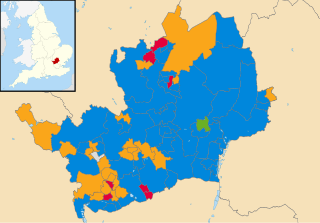
Electoral Divisions from 4 May 2017 to present: [6]

Hertfordshire UK electoral division map 2017 with numbers.svg
  1. Abbots Langley (1)
  2. Baldock & Letchworth East (1)
  3. Bedwell (1)
  4. Berkhamsted (1)
  5. Bishops Stortford East (1)
  6. Bishops Stortford Rural (1)
  7. Bishops Stortford West (1)
  8. Borehamwood North (1)
  9. Borehamwood South (1)
  10. Bridgewater (1)
  11. Broadwater (1)
  12. Buntingford (1)
  13. Bushey North (1)
  14. Bushey South (1)
  15. Central Watford & Oxhey (1)
  16. Chells (1)
  17. Cheshunt Central (1)
  18. Colney Heath & Marshalswick (1)
  19. Croxley (1)
  20. Flamstead End & Turnford (1)
  21. Goffs Oak & Bury Green (1)
  22. Haldens (1)
  23. Handside & Peartree (1)
  24. Harpenden North East (1)
  25. Harpenden Rural (1)
  26. Harpenden South West (1)
  27. Hatfield East (1)
  28. Hatfield North (1)
  29. Hatfield Rural (1)
  30. Hatfield South (1)
  31. Hemel Hempstead East (1)
  32. Hemel Hempstead North East (1)
  33. Hemel Hempstead North West (1)
  34. Hemel Hempstead South East (1)
  35. Hemel Hempstead St Pauls (1)
  36. Hemel Hempstead Town (1)
  37. Hertford All Saints (1)
  38. Hertford Rural (1)
  39. Hertford St Andrews (1)
  40. Hitchin North (1)
  41. Hitchin Rural (1)
  42. Hitchin South (1)
  43. Hoddesdon North (1)
  44. Hoddesdon South (1)
  45. Kings Langley (1)
  46. Knebworth & Codicote (1)
  47. Letchworth North (1)
  48. Letchworth South (1)
  49. London Colney (1)
  50. Meriden Tudor (1)
  51. Nascot Park (1)
  52. North Watford (1)
  53. Old Stevenage (1)
  54. Potters Bar East (1)
  55. Potters Bar West & Shenley (1)
  56. Rickmansworth East & Oxhey Park (1)
  57. Rickmansworth West (1)
  58. Royston East & Ermine (1)
  59. Royston West & Rural (1)
  60. Sawbridgeworth (1)
  61. Shephall (1)
  62. South Oxhey & Eastbury (1)
  63. St Albans Central (1)
  64. St Albans East (1)
  65. St Albans North (1)
  66. St Albans South (1)
  67. St Nicholas (1)
  68. St Stephen’s (1)
  69. Three Rivers Rural (1)
  70. Tring (1)
  71. Waltham Cross (1)
  72. Ware North (1)
  73. Ware South (1)
  74. Watling (1)
  75. Welwyn (1)
  76. Welwyn Garden City South (1)
  77. West Watford (1)
  78. Woodside Stanborough (1)

District councils

Broxbourne

Wards from 1 April 1974 (first election 7 June 1973) to 6 May 1976: [7]

Wards from 6 May 1976 to 6 May 1999: [8]

Wards from 6 May 1999 to 3 May 2012: [9]

Broxbourne UK ward map 2010 (blank).svg
  1. Broxbourne (3)
  2. Bury Green (3)
  3. Cheshunt Central (3)
  4. Cheshunt North (3)
  5. Flamstead End (3)
  6. Goffs Oak (3)
  7. Hoddesdon North (3)
  8. Hoddesdon Town (3)
  9. Rosedale (2)
  10. Rye Park (3)
  11. Theobalds (3)
  12. Waltham Cross (3)
  13. Wormley & Turnford (3)

Wards from 3 May 2012 to present: [10]

Broxbourne UK ward map 2012 (blank).svg
  1. Broxbourne & Hoddesdon South (3)
  2. Cheshunt North (3)
  3. Cheshunt South & Theobalds (3)
  4. Flamstead End (3)
  5. Goffs Oak (3)
  6. Hoddesdon North (3)
  7. Hoddesdon Town & Rye Park (3)
  8. Rosedale & Bury Green (3)
  9. Waltham Cross (3)
  10. Wormley & Turnford (3)

Dacorum

Wards from 1 April 1974 (first election 7 June 1973) to 3 May 1979: [7]

Wards from 3 May 1979 to 6 May 1999: [11]

Wards from 6 May 1999 to 3 May 2007: [12]

  1. Adeyfield East (2)
  2. Adeyfield West (2)
  3. Aldbury & Wigginton (1)
  4. Apsley (1)
  5. Ashridge (1)
  6. Bennetts End (2)
  7. Berkhamsted Castle (2)
  8. Berkhamsted East (2)
  9. Berkhamsted West (2)
  10. Bovingdon, Flaunden & Chipperfield (3)
  11. Boxmoor (2)
  12. Chaulden & Shrubhill (2)
  13. Corner Hall (2)
  14. Gadebridge (2)
  15. Grove Hill (3)
  16. Hemel Hempstead Central (2)
  17. Highfield & St Pauls (3)
  18. Kings Langley (2)
  19. Leverstock Green (3)
  20. Nash Mills (1)
  21. Northchurch (1)
  22. Tring Central (2)
  23. Tring East (1)
  24. Tring West (2)
  25. Warners End (2)
  26. Watling (2)
  27. Woodhall (2)

Wards from 3 May 2007 to present: [13]

Dacorum UK ward map 2010 (blank).svg
  1. Adeyfield East (2)
  2. Adeyfield West (2)
  3. Aldbury & Wigginton (1)
  4. Apsley & Corner Hall (3)
  5. Ashridge (1)
  6. Bennetts End (2)
  7. Berkhamsted Castle (2)
  8. Berkhamsted East (2)
  9. Berkhamsted West (2)
  10. Bovingdon, Flaunden & Chipperfield (3)
  11. Boxmoor (3)
  12. Chaulden & Warners End (3)
  13. Gadebridge (2)
  14. Grovehill (3)
  15. Hemel Hempstead Town (2)
  16. Highfield (2)
  17. Kings Langley (2)
  18. Leverstock Green (3)
  19. Nash Mills (1)
  20. Northchurch (1)
  21. Tring Central (2)
  22. Tring East (1)
  23. Tring West & Rural (2)
  24. Watling (2)
  25. Woodhall Farm (2)

East Hertfordshire

Wards from 1 April 1974 (first election 7 June 1973) to 3 May 1979: [7]

Wards from 3 May 1979 to 6 May 1999: [14]

Wards from 6 May 1999 to present: [15]

East Hertfordshire UK ward map 2010 (blank).svg
  1. Bishop’s Stortford All Saints (3)
  2. Bishop’s Stortford Central (3)
  3. Bishop’s Stortford Meads (2)
  4. Bishop’s Stortford Silverleys (2)
  5. Bishop’s Stortford South (3)
  6. Braughing (1)
  7. Buntingford (2)
  8. Datchworth & Aston (1)
  9. Great Amwell (1)
  10. Hertford Bengeo (3)
  11. Hertford Castle (3)
  12. Hertford Heath (1)
  13. Hertford Kingsmead (2)
  14. Hertford Rural North (1)
  15. Hertford Rural South (1)
  16. Hertford Sele (2)
  17. Hunsdon (1)
  18. Little Hadham (1)
  19. Mundens & Cottered (1)
  20. Much Hadham (1)
  21. Puckeridge (1)
  22. Sawbridgeworth (3)
  23. Stanstead Abbots (1)
  24. Thundridge & Standon (1)
  25. Walkern (1)
  26. Ware Chadwell (1)
  27. Ware Christchurch (2)
  28. Ware St Mary's (2)
  29. Ware Trinity (2)
  30. Watton-at-Stone (1)

Hertsmere

Wards from 1 April 1974 (first election 7 June 1973) to 6 May 1976: [7]

Wards from 6 May 1976 to 6 May 1999: [16]

Wards from 6 May 1999 to 2 May 2019: [17]

Hertsmere UK ward map 2010 (blank).svg
  1. Aldenham East (2)
  2. Aldenham West (2)
  3. Borehamwood Brookmeadow (3)
  4. Borehamwood Cowley Hill (3)
  5. Borehamwood Hillside (3)
  6. Borehamwood Kenilworth (2)
  7. Bushey Heath (3)
  8. Bushey North (3)
  9. Bushey Park (2)
  10. Bushey St James (3)
  11. Elstree (2)
  12. Potters Bar Furzefield (3)
  13. Potters Bar Oakmere (3)
  14. Potters Bar Parkfield (3)
  15. Shenley (2)

Wards from 2 May 2019 to present: [18]

  1. Aldenham East (2)
  2. Aldenham West (2)
  3. Bentley Heath & The Royds (2)
  4. Borehamwood Brookmeadow (3)
  5. Borehamwood Cowley Hill (3)
  6. Borehamwood Hillside (3)
  7. Borehamwood Kenilworth (3)
  8. Bushey Heath (2)
  9. Bushey North (3)
  10. Bushey Park (3)
  11. Bushey St James (3)
  12. Elstree (2)
  13. Potters Bar Furzefield (2)
  14. Potters Bar Oakmere (2)
  15. Potters Bar Parkfield (2)
  16. Shenley (2)

North Hertfordshire

Wards from 1 April 1974 (first election 7 June 1973) to 3 May 1979: [7]

Wards from 3 May 1979 to 6 May 1999: [19]

Wards from 6 May 1999 to 3 May 2007: [20]

  1. Arbury (1)
  2. Baldock East (1)
  3. Baldock Town (3)
  4. Cadwell (1)
  5. Codicote (1)
  6. Ermine (1)
  7. Graveley & Wymondley (1)
  8. Hitchin Bearton (3)
  9. Hitchin Highbury (3)
  10. Hitchin Oughton (2)
  11. Hitchin Priory (2)
  12. Hitchin Walsworth (3)
  13. Hitchwood (1)
  14. Hoo (1)
  15. Kimpton (1)
  16. Knebworth (2)
  17. Letchworth East (3)
  18. Letchworth Grange (3)
  19. Letchworth South East (3)
  20. Letchworth South West (3)
  21. Letchworth Wilbury (2)
  22. Offa (1)
  23. Royston Heath (2)
  24. Royston Meridian (2)
  25. Royston Palace (2)
  26. Weston & Sandon (1)

Wards from 3 May 2007 to present: [21]

North Hertfordshire UK ward map 2010 (blank).svg
  1. Arbury (1)
  2. Baldock East (1)
  3. Baldock Town (3)
  4. Cadwell (1)
  5. Chesfield (2)
  6. Codicote (1)
  7. Ermine (1)
  8. Hitchin Bearton (3)
  9. Hitchin Highbury (3)
  10. Hitchin Oughton (2)
  11. Hitchin Priory (2)
  12. Hitchin Walsworth (3)
  13. Hitchwood, Offa & Hoo (3)
  14. Kimpton (1)
  15. Knebworth (2)
  16. Letchworth East (2)
  17. Letchworth Grange (3)
  18. Letchworth South East (3)
  19. Letchworth South West (3)
  20. Letchworth Wilbury (2)
  21. Royston Heath (2)
  22. Royston Meridian (2)
  23. Royston Palace (2)
  24. Weston & Sandon (1)

St Albans

Wards from 1 April 1974 (first election 7 June 1973) to 3 May 1979: [7]

Wards from 3 May 1979 to 6 May 1999: [22]

Wards from 6 May 1999 to 5 May 2022: [23]

St Albans UK ward map 2010 (blank).svg
  1. Ashley (3)
  2. Batchwood (3)
  3. Clarence (3)
  4. Colney Heath (2)
  5. Cunningham (3)
  6. Harpenden East (3)
  7. Harpenden North (3)
  8. Harpenden South (3) †
  9. Harpenden West (3)
  10. London Colney (3)
  11. Marshalswick North (3)
  12. Marshalswick South (3)
  13. Park Street (3)
  14. Redbourn (3)
  15. St Peters (3)
  16. St Stephen (3)
  17. Sandridge (2)
  18. Sopwell (3)
  19. Verulam (3)
  20. Wheathampstead (3) †

† minor boundary changes in 2007 [5]

Wards from 5 May 2022: [24]

  1. Batchwood (3)
  2. Bernards Heath (3)
  3. Clarence (3)
  4. Colney Heath (1)
  5. Cunningham (3)
  6. Harpenden East (3)
  7. Harpenden North & Rural (3)
  8. Harpenden South (3)
  9. Harpenden West (3)
  10. Hill End (3)
  11. London Colney (3)
  12. Marshalswick East & Jersey Farm (3)
  13. Marshalswick West (2)
  14. Park Street (3)
  15. Redbourn (2)
  16. Sandridge & Wheathampstead (3)
  17. Sopwell (3)
  18. St Peters (3)
  19. St Stephen (3)
  20. Verulam (3)

Stevenage

Wards from 1 April 1974 (first election 7 June 1973) to 6 May 1976: [7] [25]

  1. Broadwater (5)
  2. Shephall (6)
  3. Bedwell (5)
  4. Old Stevenage (6)
  5. Chells (5)
  6. Pin Green (8)

Wards from 6 May 1976 to 3 May 1979: [7] [25]

  1. Broadwater (5)
  2. Shephall (6)
  3. Bedwell (5)
  4. Old Stevenage (5)
  5. Chells (5)
  6. Pin Green (8)
Stevenage UK ward map 1979 (blank).svg

Wards from 3 May 1979 to 6 May 1999: [26] [25]

  1. Bandley Hill (3)
  2. Bedwell Plash (3)
  3. Chells (2)
  4. Longmeadow (3)
  5. Martins Wood (3)
  6. Mobbsbury (3)
  7. Monkswood (3)
  8. Old Stevenage (3)
  9. Pin Green (3)
  10. Roebuck (3)
  11. Shephall (3)
  12. St Nicholas (3)
  13. Symonds Green (3)
  14. Wellfield (1)
Stevenage UK ward map 2010 (blank).svg

Wards from 6 May 1999 to present: [27]

  1. Bandley Hill (3)
  2. Bedwell (3)
  3. Chells (3)
  4. Longmeadow (3)
  5. Manor (3)
  6. Martins Wood (3)
  7. Old Town (3)
  8. Pin Green (3)
  9. Roebuck (3)
  10. St Nicholas (3)
  11. Shephall (3)
  12. Symonds Green (3)
  13. Woodfield (3)

Three Rivers

Wards from 1 April 1974 (first election 7 June 1973) to 6 May 1976: [7]

Wards from 6 May 1976 to 6 May 1999: [28]

  1. Chorleywood West (2); changed to (3) in 1991 [29]

Wards from 6 May 1999 to 22 May 2014: [30]

Three Rivers UK ward map 2010 (blank).svg
  1. Abbots Langley (3)
  2. Ashridge (2)
  3. Bedmond and Primrose Hill (2)
  4. Carpenders Park (3)
  5. Chorleywood East (2)
  6. Chorleywood West (3)
  7. Croxley Green (3)
  8. Croxley Green North (2)
  9. Croxley Green South (2)
  10. Hayling (2)
  11. Langleybury (3)
  12. Leavesden (3)
  13. Maple Cross and Mill End (3)
  14. Moor Park and Eastbury (3)
  15. Northwick (3)
  16. Oxhey Hall (2)
  17. Penn (2)
  18. Rickmansworth (2)
  19. Rickmansworth West (2)
  20. Sarratt (1)

Wards from 22 May 2014 to present: [31]

Three Rivers UK ward map 2014 (blank).svg
  1. Abbots Langley and Bedmond (3)
  2. Carpenders Park (3)
  3. Chorleywood North and Sarratt (3)
  4. Chorleywood South and Maple Cross (3)
  5. Dickinsons (3)
  6. Durrants (3)
  7. Gade Valley (3)
  8. Leavesden (3)
  9. Moor Park and Eastbury (3)
  10. Oxhey Hall and Hayling (3)
  11. Penn and Mill End (3)
  12. Rickmansworth Town (3)
  13. South Oxhey (3)

Watford

Wards from 1 April 1974 (first election 7 June 1973) to 6 May 1976: [7]

Wards from 6 May 1976 to 6 May 1999: [32]

Wards from 6 May 1999 to 5 May 2016: [33]

Watford UK ward map 2010 (blank).svg
  1. Callowland (3)
  2. Central (3)
  3. Holywell (3)
  4. Leggatts (3)
  5. Meriden (3)
  6. Nascot (3)
  7. Oxhey (3)
  8. Park (3)
  9. Stanborough (3)
  10. Tudor (3)
  11. Vicarage (3)
  12. Woodside (3)

Wards from 5 May 2016 to present: [34]

Watford UK ward map 2016 (blank).svg
  1. Callowland (3)
  2. Central (3)
  3. Holywell (3)
  4. Leggatts (3)
  5. Meriden (3)
  6. Nascot (3)
  7. Oxhey (3)
  8. Park (3)
  9. Stanborough (3)
  10. Tudor (3)
  11. Vicarage (3)
  12. Woodside (3)

Welwyn Hatfield

Wards from 1 April 1974 (first election 7 June 1973) to 6 May 1976: [7]

Wards from 6 May 1976 to 2 May 1991: [35]

Wards from 2 May 1991 to 6 May 1999: [36]

  1. Brookmans Park & Little Heath (3)
  2. Haldens (3)
  3. Handside (3)
  4. Hatfield Central (3)
  5. Hatfield East (3)
  6. Hatfield North (3)
  7. Hatfield West (3)
  8. Hollybush (3)
  9. Howlands (3)
  10. Northaw (3)
  11. Panshanger (3)
  12. Peartree (3)
  13. Sherrards (3)
  14. Welham Green & Redhall (3)
  15. Welwyn North (2)
  16. Welwyn South (3))

Wards from 6 May 1999 to 1 May 2008: [37]

  1. Brookmans Park & Little Heath (3)
  2. Haldens (3)
  3. Handside (3)
  4. Hatfield Central (3)
  5. Hatfield East (3)
  6. Hatfield North (3)
  7. Hatfield South (2)
  8. Hatfield West (3)
  9. Hollybush (3)
  10. Howlands (3)
  11. Northaw (3)
  12. Panshanger (3)
  13. Peartree (3)
  14. Sherrards (3)
  15. Welham Green (2)
  16. Welwyn South (3)
  17. Welwyn North (2)

Wards from 1 May 2008 to 5 May 2016: [38]

Welwyn Hatfield UK ward map 2010 (blank).svg
  1. Brookmans Park & Little Heath (3)
  2. Haldens (3)
  3. Handside (3)
  4. Hatfield Central (3)
  5. Hatfield East (3)
  6. Hatfield South (2)
  7. Hatfield Villages (3)
  8. Hatfield West (3)
  9. Hollybush (3)
  10. Howlands (3)
  11. Northaw & Cuffley (3)
  12. Panshanger (3)
  13. Peartree (3)
  14. Sherrards (3)
  15. Welham Green (2)
  16. Welwyn East (3)
  17. Welwyn West (2)

Wards from 5 May 2016 to present: [39]

Welwyn Hatfield UK ward map 2016 (blank).svg
  1. Brookmans Park & Little Heath (3)
  2. Haldens (3)
  3. Handside (3)
  4. Hatfield Central (3)
  5. Hatfield East (3)
  6. Hatfield South West (3)
  7. Hatfield Villages (3)
  8. Hollybush (3)
  9. Howlands (3)
  10. Northaw & Cuffley (3)
  11. Panshanger (3)
  12. Peartree (3)
  13. Sherrards (3)
  14. Welham Green & Hatfield South (3)
  15. Welwyn East (3)
  16. Welwyn West (3)

Electoral wards by constituency

Broxbourne

Broxbourne, Bury Green, Cheshunt Central, Cheshunt North, Flamstead End, Goffs Oak, Hoddesdon North, Hoddesdon Town, Northaw, Rosedale, Rye Park, Theobalds, Waltham Cross, Wormley & Turnford.

Hemel Hempstead

Adeyfield East, Adeyfield West, Apsley, Ashridge, Bennetts End, Boxmoor, Chaulden & Shrubhill, Corner Hall, Gadebridge, Grove Hill, Hemel Hempstead Central, Highfield & St Pauls, Kings Langley, Leverstock Green, Nash Mills, Warners End, Watling, Woodhall.

Hertford and Stortford

Bishop's Stortford All Saints, Bishop's Stortford Central, Bishop's Stortford Meads, Bishop's Stortford Silverleys, Bishop's Stortford South, Great Amwell, Hertford Bengeo, Hertford Castle, Hertford Heath, Hertford Kingsmead, Hertford Sele, Hunsdon, Much Hadham, Sawbridgeworth, Stanstead Abbots, Ware Chadwell, Ware Christchurch, Ware St Mary's, Ware Trinity.

Hertsmere

Aldenham East, Aldenham West, Borehamwood Brookmeadow, Borehamwood Cowley Hill, Borehamwood Hillside, Borehamwood Kenilworth, Bushey Heath, Bushey North, Bushey Park, Bushey St James, Elstree, Potters Bar Furzefield, Potters Bar Oakmere, Potters Bar Parkfield, Shenley.

Hitchin and Harpenden

Cadwell, Graveley & Wymondley, Harpenden East, Harpenden North, Harpenden South, Harpenden West, Hitchin Bearton, Hitchin Highbury, Hitchin Oughton, Hitchin Priory, Hitchin Walsworth, Hitchwood, Hoo, Kimpton, Offa, Redbourn, Sandridge, Wheathampstead.

North East Hertfordshire

Arbury, Baldock East, Baldock Town, Braughing, Buntingford, Hertford Rural North, Hertford Rural South, Ermine, Letchworth East, Letchworth Grange, Letchworth South East, Letchworth South West, Letchworth Wilbury, Little Hadham, Mundens and Cottered, Puckeridge, Royston Heath, Royston Meridian, Royston Palace, Thundridge & Standon, Walkern, Watton-at-Stone, Weston and Sandon.

South West Hertfordshire

Aldbury and Wigginton, Ashridge, Berkhamsted Castle, Berkhamsted East, Berkhamsted West, Bovingdon, Chorleywood East, Chorleywood West, Croxley Green, Croxley Green North, Croxley Green South, Flaunden & Chipperfield, Hayling, Maple Cross & Mill End, Moor Park & Eastbury, Northchurch, Northwick, Penn, Rickmansworth, Rickmansworth West, Sarratt, Tring Central, Tring East, Tring West.

St Albans

Ashley, Batchwood, Bedmond & Primrose Hill, Clarence, Colney Heath, Cunningham, London Colney, Marshalswick North, Marshalswick South, Park Street, St Peters, St Stephen, Sopwell, Verulam.

Stevenage

Bandley Hill, Bedwell, Chells, Codicote, Datchworth and Aston, Knebworth, Longmeadow, Manor, Martins Wood, Old Town, Pin Green, Roebuck, St Nicholas, Shephall, Symonds Green, Woodfield.

Watford

Abbots Langley, Callowland, Carpenders Park, Central, Holywell, Langleybury, Leavesden, Leggatts, Meriden, Nascot, Oxhey, Oxhey Hall, Park, Stanborough, Tudor, Vicarage, Woodside.

Welwyn Hatfield

Brookmans Park and Little Heath, Haldens, Handside, Hatfield Central, Hatfield East, Hatfield North, Hatfield South, Hatfield Villages, Hollybush, Howlands, Panshanger, Peartree, Sherrards, Welham Green, Welwyn North, Welwyn South.

See also

Related Research Articles

<span class="mw-page-title-main">Hertfordshire</span> County of England

Hertfordshire is one of the home counties in southern England. It borders Bedfordshire and Cambridgeshire to the north, Essex to the east, Greater London to the south, and Buckinghamshire to the west. For government statistical purposes, it forms part of the East of England region.

<span class="mw-page-title-main">St Albans City and District</span> Local authority district in England

The City and District of St Albans is a local authority district in Hertfordshire in the East of England region. The main urban settlements are St Albans and Harpenden. The council offices are in St Albans.

BBC Three Counties Radio is the BBC's local radio station serving the counties of Bedfordshire, Hertfordshire and Buckinghamshire.

<span class="mw-page-title-main">St Albans (UK Parliament constituency)</span> Parliamentary constituency in the United Kingdom, 1885 onwards

St Albans is a constituency represented in the House of Commons of the UK Parliament since 2019 by Daisy Cooper, a Liberal Democrat.

<span class="mw-page-title-main">Hitchin and Harpenden (UK Parliament constituency)</span> Parliamentary constituency in the United Kingdom

Hitchin and Harpenden is a constituency represented in the House of Commons of the UK Parliament since 2017 by Bim Afolami, a Conservative.

<span class="mw-page-title-main">Hertfordshire Senior County League</span> Association football league in England

The Hertfordshire Senior County League is a football competition based in Hertfordshire, England. Founded in 1898, there are currently two divisions at senior level and two divisions at reserve and development level. Sitting at step 7 of the National League System, the Premier Division is a feeder to the Spartan South Midlands Football League. The League operates a knock-out competition called the 'Aubrey Cup' and New Salamis are the current holders.

Hertford was the name of a parliamentary constituency in Hertfordshire, which elected Members of Parliament (MPs) from 1298 until 1974.

<span class="mw-page-title-main">Hertfordshire County Football Association</span> Governing body of association football in Hertfordshire

The Hertfordshire County Football Association, also simply known as Hertfordshire FA, is the governing body of football in the county of Hertfordshire, England. The Hertfordshire FA was founded accidentally in 1885 after the existing teams agreed to hold a meeting to discuss their position, and ended up affiliating.

The Herts Charity Cup, officially titled the Hertfordshire Football Association Charity Cup, was begun in the 1900-01 season as a fund raising competition for the chosen charities of the Hertfordshire County Football Association. It is second only in status to the Herts Senior Cup within the competitions run by the Herts FA and is the third longest running, following the Herts Senior Cup (1886-87) and the Herts Junior Cup (1894-95). The charity aspect of the competition is still maintained with the Herts FA donating £525 from the 2008-09 competition to various chosen football-connected charities such as the St Johns Ambulance Brigade and Disability Sport England.

London 3 North West is a level 8 league within the RFU league structure and is made up of teams predominantly from north-west London and Hertfordshire. Promoted sides tend to move up to London 2 North West while relegated teams drop to Herts/Middlesex 1. Each year all clubs in the division also take part in the RFU Senior Vase - a level 8 national competition.

London 2 North West is an English rugby union league which is at the seventh tier of club rugby union in England and is made up of teams predominantly from north-west London and Hertfordshire. When this division began in 1987 it was known as London 3 North West, changing to its current name ahead of the 2009–10 season.

The Hertfordshire Rugby Football Union is the governing body for the sport of rugby union in the county of Hertfordshire in England. The union is the constituent body of the Rugby Football Union (RFU) for Hertfordshire, and administers and organises rugby union clubs and competitions in the county. It also administers the Hertfordshire county rugby representative teams.

Hertfordshire 1 was an English level 10 Rugby Union league with teams from Hertfordshire and parts of north London taking part. Promoted teams used to move up to Herts/Middlesex 1 and relegation was to Hertfordshire 2 until that division was cancelled at the end of the 1989–90 season. The division was cancelled in at the end of the 1995–96 campaign after nine seasons due to the merger of the Hertfordshire and Middlesex regional leagues.

<span class="mw-page-title-main">2021 Hertfordshire County Council election</span>

Elections to Hertfordshire County Council took place on 6 May 2021 alongside other local elections in the United Kingdom. All 78 seats to the council were elected.

References

  1. The County of Hertfordshire (Electoral Divisions) Order 1973
  2. 1 2 Rallings, Colin; Thrasher, Michael. Hertfordshire County Council Election Results 1973-2009 (PDF). The Elections Centre. Retrieved 12 May 2016.
  3. legislation.gov.uk - The County of Hertfordshire (Electoral Arrangements) Order 1980. Retrieved on 19 November 2015.
  4. legislation.gov.uk - The County of Hertfordshire (Electoral Changes) Order 2000. Retrieved on 4 October 2015.
  5. 1 2 legislation.gov.uk - The St Albans (Parish Electoral Arrangements and Electoral Changes) Order 2007. Retrieved on 3 November 2015.
  6. legislation.gov.uk - The Hertfordshire (Electoral Changes) Order 2015. Retrieved on 20 April 2016.
  7. 1 2 3 4 5 6 7 8 9 10 11 The County of Hertfordshire (District Wards) Order 1973
  8. The Borough of Broxbourne (Electoral Arrangements) Order 1975
  9. legislation.gov.uk - The Borough of Broxbourne (Electoral Changes) Order 1998. Retrieved on 4 October 2015.
  10. legislation.gov.uk - The Broxbourne (Electoral Changes) Order 2012. Retrieved on 3 November 2015.
  11. The District of Dacorum (Electoral Arrangements) Order 1976
  12. legislation.gov.uk - The Borough of Dacorum (Electoral Changes) Order 1998. Retrieved on 4 October 2015.
  13. legislation.gov.uk - The Borough of Dacorum (Electoral Changes) Order 2007. Retrieved on 3 November 2015.
  14. The District of East Hertfordshire (Electoral Arrangements) Order 1976
  15. legislation.gov.uk - The District of East Hertfordshire (Electoral Changes) Order 1998. Retrieved on 4 October 2015.
  16. legislation.gov.uk - The District of Hertsmere (Electoral Arrangements) Order 1976. Retrieved on 19 November 2015.
  17. legislation.gov.uk - The Borough of Hertsmere (Electoral Changes) Order 1998. Retrieved on 4 October 2015.
  18. "The Hertsmere (Electoral Changes) Order 2018". gov.uk . 25 April 2018. Retrieved 28 September 2021.
  19. The District of North Hertfordshire (Electoral Arrangements) Order 1977
  20. legislation.gov.uk - The District of North Hertfordshire (Electoral Changes) Order 1998. Retrieved on 4 October 2015.
  21. legislation.gov.uk - The District of North Hertfordshire (Electoral Changes) Order 2006. Retrieved on 3 November 2015.
  22. The City of St Albans (Electoral Arrangements) Order 1978
  23. legislation.gov.uk - The City of St Albans (Electoral Changes) Order 1998. Retrieved on 4 October 2015.
  24. "The St Albans (Electoral Changes) Order 2021". gov.uk . 22 July 2021. Retrieved 5 April 2022.
  25. 1 2 3 "Stevenage Borough Council Election Results 1973-2012" (PDF). Elections Centre. Retrieved 11 July 2019.
  26. The Borough of Stevenage (Electoral Arrangements) Order 1976
  27. legislation.gov.uk - The Borough of Stevenage (Electoral Changes) Order 1998. Retrieved on 4 October 2015.
  28. The District of Three Rivers (Electoral Arrangements) Order 1975
  29. legislation.gov.uk - The Buckinghamshire, Hertfordshire, Northamptonshire and Oxfordshire (County Boundaries) Order 1991. Retrieved on 5 November 2015.
  30. legislation.gov.uk - The District of Three Rivers (Parishes and Electoral Changes) Order 1998. Retrieved on 4 October 2015.
  31. legislation.gov.uk - The Three Rivers (Electoral Changes) Order 2014. Retrieved on 3 November 2015.
  32. The Borough of Watford (Electoral Arrangements) Order 1975
  33. legislation.gov.uk - The Borough of Watford (Electoral Changes) Order 1998. Retrieved on 4 October 2015.
  34. legislation.gov.uk - The Watford (Electoral Changes) Order 2016. Retrieved on 20 April 2016.
  35. The District of Welwyn Hatfield (Electoral Arrangements) Order 1976
  36. legislation.gov.uk - The District of Welwyn Hatfield (Electoral Arrangements) Order 1991. Retrieved on 4 November 2015.
  37. legislation.gov.uk - The District of Welwyn Hatfield (Electoral Changes) Order 1998. Retrieved on 4 October 2015.
  38. legislation.gov.uk - The Borough of Welwyn Hatfield (Electoral Changes) Order 2008. Retrieved on 3 November 2015.
  39. legislation.gov.uk - The Welwyn Hatfield (Electoral Changes) Order 2016. Retrieved on 20 April 2016.