This article is being considered for deletion in accordance with Wikipedia's deletion policy. Please share your thoughts on the matter at this article's deletion discussion page. |
The Republic of Algeria has the second largest number of hospitals and hospital beds per person of countries in Africa, second only to South Africa. Almost all Algerian hospitals are public and provide services to 90 percent of the Algerian population. The largest number of hospitals are located in the more populous areas of Algeria on the north coast. There are hospitals in each of the 58 Provinces of Algeria (fr: Wilayah; ar:ولاية). All public health establishments are managed administratively and financially by the Ministry of Health, Population and Hospital Reform or local offices of the Ministry. Some of the older hospitals in Algiers, Annaba, and Oran Provinces were established between 1883 and 1889 during the French Colonial period in Algeria. At the start of Algerian independence in 1962, the healthcare system was small with few doctors. From 1975 onward, the Algerian government introduced a free national healthcare system. In 2020, there were, according to the Ministry, 586 public health establishments in Algeria with 76,53 beds, including 6,584 beds in community hospitals. [1] [2]
The public health establishments are categorized using the French naming system as follows: [3] [4] [5]
The locations of Algerian hospitals are shown on the map link below. Hospitals are grouped by Province in the following sections that show the city, coordinates, and number of hospital beds and date of establishment when known. Hospital category is shown when known.
01 Adrar | 02 Chlef | 03 Laghouat | 04 Oum El Bouaghi | 05 Batna | 06 Béjaïa | 07 Biskra | 08 Béchar | 09 Blida | 10 Bouïra |
11 Tamanrasset | 12 Tébessa | 13 Tlemcen | 14 Tiaret | 15 Tizi Ouzou | 16 Alger | 17 Djelfa | 18 Jijel | 19 Sétif | 20 Saïda |
21 Skikda | 22 Sidi Bel Abbès | 23 Annaba | 24 Guelma | 25 Constantine | 26 Médéa | 27 Mostaganem | 28 M'Sila | 29 Mascara | 30 Ouargla |
31 Oran | 32 El Bayadh | 33 Illizi | 34 Bordj Bou Arréridj | 35 Boumerdès | 36 El Tarf | 37 Tindouf | 38 Tissemsilt | 39 El Oued | 40 Khenchela |
41 Souk Ahras | 42 Tipaza | 43 Mila | 44 Aïn Defla | 45 Naâma | 46 Aïn Témouchent | 47 Ghardaïa | 48 Relizane | 49 El M'ghair | 50 El Menia |
51 Ouled Djellal | 52 Bordj Baji Mokhtar | 53 Béni Abbès | 54 Timimoun | 55 Touggourt | 56 Djanet | 57 In Salah | 58 In Guezzam | See also | References |
Wilayah | Code | Arabic name | Capital | Area (km2) | Area (sq mi) | Population (2008 [7] ) |
---|---|---|---|---|---|---|
Adrar | 01 | أدرار | Adrar | 254,471 | 98,252 | 261,258 |
The hospitals in Adrar Province include: [8]
Wilayah | Code | Arabic name | Capital | Area (km2) | Area (sq mi) | Population (2008 [7] ) | Public hospital beds |
---|---|---|---|---|---|---|---|
Aïn Defla | 44 | عين الدفلى | Aïn Defla | 4,891 | 1,888 | 766,013 | 986 |
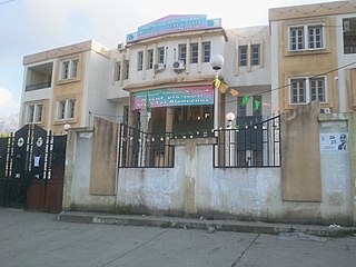
The hospitals in Aïn Defla Province include: [16]
Name | City | Province | Coordinates | Beds/References | Photo |
---|---|---|---|---|---|
EPH Makour Hamou | Aïn Defla | Aïn Defla | 36°15′55″N1°57′50″E / 36.265324392690616°N 1.9638784970808283°E | 314 beds [16] | |
EPH Khemis-Miliana | Khemis Miliana | Aïn Defla | 36°15′35″N2°13′57″E / 36.25974876390077°N 2.232469976709254°E | 196 beds [16] | |
EPH Fares Yahia Miliana | Miliana | Aïn Defla | 36°18′20″N2°13′23″E / 36.305558596252°N 2.2231740076773696°E | 284 beds [16] | |
EPH El Attaf | El Attaf | Aïn Defla | 196 beds [16] |
Wilayah | Code | Arabic name | Capital | Area (km2) | Area (sq mi) | Population (2008 [7] ) |
---|---|---|---|---|---|---|
Aïn Témouchent | 46 | عين تموشنت | Aïn Témouchent | 2,379 | 919 | 371,239 |
The hospitals in Aïn Témouchent Province include:
Name | City | Province | Coordinates | Beds/References | Photo |
---|---|---|---|---|---|
EH Doctor Benzerdjeb Hospital | Aïn Témouchent | Aïn Témouchent | 35°18′57″N1°07′52″W / 35.31572990689871°N 1.1309964819283373°W | [17] [18] | |
Ahmed Medeghri Hospital | Aïn Témouchent | Aïn Témouchent | 35°18′13″N1°08′37″W / 35.30359715156856°N 1.1437029199506978°W | [19] | |
EPSP Béni Saf Hospital | Béni Saf | Aïn Témouchent | 35°18′04″N1°23′13″W / 35.30101399029982°N 1.3868613602745965°W | Established in 1962 [17] [18] | |
EPSP Hammam Bou Hadjar Hospital | Hammam Bou Hadjar | Aïn Témouchent | 35°22′50″N0°58′03″W / 35.38048777086048°N 0.967498225632247°W | [17] | |
EPSP Aïn Témouchent Maternity | Aïn Témouchent | Aïn Témouchent | 35°18′42″N0°59′09″W / 35.31179073305144°N 0.985772516073608°W | [17] [18] | |
EPH El Amria Hospital | El Amria | Aïn Témouchent | 35°31′25″N1°01′40″W / 35.52371761369375°N 1.027867076442809°W | [17] [18] |
Wilayah | Code | Arabic name | Capital | Area (km2) | Area (sq mi) | Population (2008 [7] ) |
---|---|---|---|---|---|---|
Algiers | 16 | الجزائر | Algiers | 1,190 | 460 | 2,988,145 |
There are 25 public sector hospitals in Algiers Province, including four CHU with 3,593 beds, 13 specialized university hospitals with 2,478 beds, and eight general university hospitals with 1,633 beds. Public, military and private hospitals in Algiers Province include: [20]
Wilayah | Code | Arabic name | Capital | Area (km2) | Area (sq mi) | Population (2008 [7] ) |
---|---|---|---|---|---|---|
Annaba | 23 | عنابة | Annaba | 1,439 | 556 | 609,499 |
The hospitals located in the Annaba Province include: [37]
Wilayah | Code | Arabic name | Capital | Area (km2) | Area (sq mi) | Population (2008 [7] ) |
---|---|---|---|---|---|---|
Batna | 05 | باتنة | Batna | 12,192 | 4,707 | 1,119,791 |
The hospitals in Batna Province include the following:
Wilayah | Code | Arabic name | Capital | Area (km2) | Area (sq mi) | Population (2008 [7] ) |
---|---|---|---|---|---|---|
Béchar | 08 | بشار | Béchar | 60,850 | 23,490 | 219,898 |
The hospitals in Béchar Province include the following: [44]
Name | City | Province | Coordinates | Beds/References | Photo |
---|---|---|---|---|---|
EPH Boudjemaa Tourabi | Tnkerod | Béchar Province | 31°36′08″N2°14′12″W / 31.602360715951036°N 2.236694060760567°W , | 240 beds [45] | |
Taghit Hospital | Béchar Province | ||||
Abadla Hospital | Béchar Province | ||||
Mohamed Boudiaf Hospital (Debdaba) | Tnkerod | Béchar Province | 31°37′32″N2°12′20″W / 31.625586365210136°N 2.205520350713959°W |
Wilayah | Code | Arabic name | Capital | Area (km2) | Area (sq mi) | Population (2008 [7] ) |
---|---|---|---|---|---|---|
Béjaïa | 06 | بجاية | Béjaïa | 3,268 | 1,262 | 912,577 |
The hospitals in Bejaia Province include the following: [46]
Wilayah | Code | Arabic name | Capital | Area (km2) | Area (sq mi) | Population (2008 [7] ) |
---|---|---|---|---|---|---|
Béni Abbès | 53 | بني عباس | Béni Abbès | 101,350 | 39,130 | 50,163 |
The hospitals in Béni Abbès Province include the following:
Name | City | Province | Coordinates | Beds/References | Photo |
---|---|---|---|---|---|
EPH Béni Abbès | Béni Abbès | Béni Abbès Province | 30°07′50″N2°09′40″W / 30.130518127394033°N 2.161133588315497°W | [18] |
Wilayah | Code | Arabic name | Capital | Area (km2) | Area (sq mi) | Population (2008 [7] ) |
---|---|---|---|---|---|---|
Biskra | 07 | بسكرة | Biskra | 9,576 | 3,697 | 547,137 |
Hospitals in Biskra Province include the following:
Name | City | Province | Coordinates | Beds/References | Photo |
---|---|---|---|---|---|
EPH Bachir Ben Nacer Hospital | Biskra | Biskra Province | 34°51′04″N5°44′35″E / 34.851217461385666°N 5.742991713359429°E | 232 beds [49] | |
EPH Dr Hakim Saadane Hospital | Biskra | Biskra Province | 34°50′38″N5°43′45″E / 34.84375057467228°N 5.72908709535508°E | 120 beds | |
EPH Ziouchi Mohmed Tolga | Tolga | Biskra Province | 120 beds [50] | ||
EPH Alag Eseghir Zeribat | El Oued | Biskra Province | 80 beds [51] | ||
EHS Maternity | Biskra | Biskra Province | 98 beds [52] | ||
EHS Ophthalmology | Biskra | Biskra Province | 80 beds [53] | ||
EHS Psychiatry Akid Si L'haous | M'Chouneche | Biskra Province | 60 beds. [54] |
Wilayah | Code | Arabic name | Capital | Area (km2) | Area (sq mi) | Population (2008 [7] ) |
---|---|---|---|---|---|---|
Blida | 09 | البليدة | Blida | 1,575 | 608 | 1,002,937 |
Hospitals in Blida Province include the following:
Wilayah | Code | Arabic name | Capital | Area (km2) | Area (sq mi) | Population (2008 [7] ) |
---|---|---|---|---|---|---|
Bouira | 10 | البويرة | Bouira | 4,439 | 1,714 | 695,583 |
The hospitals in Bouira Province include the following:
Name | City | Province | Coordinates | Beds/References | Photo |
---|---|---|---|---|---|
EPH Bouira | Bouira | Bouira Province | 36°22′15″N3°52′59″E / 36.37089051353593°N 3.882949953208974°E | ||
Mohamed Boudiaf Hospital | Bouira | Bouira Province | 36°26′13″N3°51′32″E / 36.436889713786556°N 3.8589477713645843°E | 290 beds [58] | |
EPH M'Chedellah | M'Chedallah | Bouira Province | 36°21′51″N4°16′11″E / 36.36429668969251°N 4.269746997086037°E | 88 beds [59] | |
EPH Amar Ouamrane Lakhdaria | Lakhdaria | Bouira Province | 36°34′08″N3°35′46″E / 36.56875539990534°N 3.596165039810698°E | 157 beds [60] | |
EPH Chahid Yahiaoui Kaci Sour El Ghozlane | Sour El-Ghozlane | Bouira Province | 36°10′19″N3°41′02″E / 36.17204049869152°N 3.683938989055538°E | 227 beds [61] [18] | |
EPSP Bachir Mohamed Aïn Bessam | Aïn Bessem | Bouira Province | 36°17′41″N3°40′25″E / 36.29475451684617°N 3.673562638651863°E | 92 beds [62] |
Wilayah | Code | Arabic name | Capital | Area (km2) | Area (sq mi) | Population (2008 [7] ) |
---|---|---|---|---|---|---|
Bordj Bou Arréridj | 34 | برج بوعريريج | Bordj Bou Arréridj | 4,115 | 1,589 | 628,475 |
The hospitals in Bordj Bou Arréridj Province include the following:
Name | City | Province | Coordinates | Beds/References | Photo |
---|---|---|---|---|---|
Bordj Ghédir Hospital | Bordj Ghédir | Bordj Bou Arréridj Province | 35°54′21″N4°53′23″E / 35.90577714127731°N 4.889782772008285°E | 60 beds [63] | |
Bouzidi Lakhdar Hospital | Bordj Bou Arréridj | Bordj Bou Arréridj Province | 36°03′49″N4°46′16″E / 36.06374772302662°N 4.771046971311524°E | 316 beds [63] | |
EPSP Mansourah | Mansourah District (Bordj Bou Arréridj Province) | Bordj Bou Arréridj Province | 36°04′49″N4°28′08″E / 36.08034966660235°N 4.468750368098774°E | 60 beds [63] [18] | |
EPSP Medjana | Medjana | Bordj Bou Arréridj Province | 36°07′48″N4°40′13″E / 36.13000765302402°N 4.670382073359337°E | 66 beds [63] | |
Ras El Oued Hospital | Ras El Oued | Bordj Bou Arréridj Province | 35°56′29″N5°02′25″E / 35.94152181100393°N 5.040144368607433°E | 276 beds [63] | |
EPH Belhoucine Rachid Maternity | Bordj Bou Arréridj | Bordj Bou Arréridj Province | 36°04′12″N4°45′59″E / 36.07006149426759°N 4.766267655607254°E | 200 beds [63] [18] |
Wilayah | Code | Arabic name | Capital | Area (km2) | Area (sq mi) | Population (2008 [7] ) |
---|---|---|---|---|---|---|
Bordj Baji Mokhtar | 52 | برج باجي مختار | Bordj Badji Mokhtar | 120,026 | 46,342 | 16,437 |
This province was formerly attached to Adrar Province until it was created on November 26, 2019. The hospitals in Bordj Baji Mokhtar Province include the following:
Name | City | Province | Coordinates | Beds/References | Photo |
---|---|---|---|---|---|
EPH Bordj Badji Mokhtar | Bordj Badji Mokhtar | Bordj Baji Mokhtar Province | 21°19′52″N0°57′39″E / 21.3311683°N 0.9609193°E | 60 [64] [18] |
Wilayah | Code | Arabic name | Capital | Area (km2) | Area (sq mi) | Population (2008 [7] ) |
---|---|---|---|---|---|---|
Boumerdès | 35 | بومرداس | Boumerdès | 1,356 | 524 | 802,083 |
Hospitals in Boumerdès Province include the following: [65]
Name | City | Province | Coordinates | Beds/References | Photo |
---|---|---|---|---|---|
EPH Thénia | Thénia | Boumerdès Province | 36°44′01″N3°33′14″E / 36.73348411083087°N 3.553800576080871°E | 250 beds [66] [18] | |
EPH Bordj Ménaïel | Bordj Menaïel | Boumerdès Province | 36°44′53″N3°43′13″E / 36.74802456306541°N 3.7201402368399727°E | 230 beds [67] | |
EPH Mohamed Boudaoud Dellys | Dellys | Boumerdès Province | 36°55′01″N3°53′43″E / 36.91692108041043°N 3.8951620402832834°E | 154 beds [68] [18] |
Wilayah | Code | Arabic name | Capital | Area (km2) | Area (sq mi) | Population (2008 [7] ) |
---|---|---|---|---|---|---|
Chlef | 02 | الشلف | Chlef | 4,795 | 1,851 | 1,002,088 |
The hospitals in Chlef Province include:
Wilayah | Code | Arabic name | Capital | Area (km2) | Area (sq mi) | Population (2008 [7] ) |
---|---|---|---|---|---|---|
Constantine | 25 | قسنطينة | Constantine | 2,187 | 844 | 938,475 |
The hospitals in Constantine Province include the following: [78]
Wilayah | Code | Arabic name | Capital | Area (km2) | Area (sq mi) | Population (2008 [7] ) |
---|---|---|---|---|---|---|
Djanet | 56 | جانت | Djanet | 86,185 | 33,276 | 17,618 |
Djanet Province was created in 2019 from Illizi Province. The hospitals in Djanet Province include the following:
Wilayah | Code | Arabic name | Capital | Area (km2) | Area (sq mi) | Population (2008 [7] ) |
---|---|---|---|---|---|---|
Djelfa | 17 | الجلفة | Djelfa | 66,415 | 25,643 | 1,092,184 |
The hospitals in Djelfa Province include the following:
Name | City | Province | Coordinates | Beds/References | Photo |
---|---|---|---|---|---|
Djelfa Anti-Cancer Center (under construction) | Djelfa | Djelfa Province | |||
EPH Djelfa | Djelfa | Djelfa Province | 280 beds [82] [18] | ||
EPSP Aïn Oussara | Aïn Oussara | Djelfa Province | 35°27′14″N2°53′05″E / 35.45385405778997°N 2.8846448107503777°E | 188 beds [82] | |
EPH Messaad | Messaad, Djelfa | Djelfa Province | 34°40′30.6″N3°16′06.3″E / 34.675167°N 3.268417°E | 180 beds [82] [83] | |
EPH Hassi Bahbah | Hassi Bahbah | Djelfa Province | 35°04′42″N3°02′16″E / 35.07825623564165°N 3.0377059558201553°E | 260 beds [82] [18] | |
EHS Djelfa Ophthalmology Algeria-Cuba Friendship | Djelfa | Djelfa Province | 34°39′27″N3°15′43″E / 34.657520419268224°N 3.2618196306965994°E | 120 beds [82] | |
El Idrissia Hospital | El Idrissia | Djelfa Province | 34°29′13″N2°31′02″E / 34.48701152519902°N 2.517231931449262°E | 116 Beds [82] | |
EHS Maternity and Pediatrics | Djelfa | Djelfa Province | 34°39′46″N3°15′54″E / 34.662709302979465°N 3.264888076699704°E | [82] |
Wilayah | Code | Arabic name | Capital | Area (km2) | Area (sq mi) | Population (2008 [7] ) |
---|---|---|---|---|---|---|
El Bayadh | 32 | البيض | El Bayadh | 78,870|km2|disp=table | 228,624 |
The hospitals in El Bayadh Province include the following:
Name | City | Province | Coordinates | Beds/References | Photo |
---|---|---|---|---|---|
EPH Mohamed-Boudiaf À El-Bayadh | El Bayadh | El Bayadh Province | 33°40′27″N1°00′55″E / 33.67422311371966°N 1.015374696721513°E | 240 beds [84] | |
EPH El Abiodh Sidi Cheikh | El Abiodh Sidi Cheikh | El Bayadh Province | 32°53′46″N0°32′57″E / 32.89615921911349°N 0.5492547047236835°E | 90 beds [84] | |
EPH Bougtob | Bougtob | El Bayadh Province | 34°02′34″N0°05′21″E / 34.04265987573507°N 0.0891952028158395°E | 60 beds [84] | |
EPH Boualem (Mujahid Hospital Hunter Ahme) | Boualem | El Bayadh Province | 33°43′37″N1°31′59″E / 33.72681439851046°N 1.5331516812016726°E | 60 beds. [84] |
Wilayah | Code | Arabic name | Capital | Area (km2) | Area (sq mi) | Population (2008 [7] ) |
---|---|---|---|---|---|---|
El Menia | 50 | El Menia | 62,215 | 24,021 | 57,276 |
The hospitals in El Menia Province include the following:
Name | City | Province | Coordinates | Beds/References | Photo |
---|---|---|---|---|---|
EPH El Ménéa Hospital | El Menia | El Menia Province [85] | [18] |
Wilayah | Code | Arabic name | Capital | Area (km2) | Area (sq mi) | Population (2008 [7] ) |
---|---|---|---|---|---|---|
El M'Ghair | 49 | المغير | El M'Ghair | 8,835 | 3,411 | 162,267 |
The hospitals in El M'Ghair Province include the following:
Name | City | Province | Coordinates | Beds/References | Photo |
---|---|---|---|---|---|
EPH El M'Ghair Hospital | El M'Ghair | El M'Ghair Province | 34°01′03″N5°54′07″E / 34.0174586477571°N 5.901955604391531°E | 139 beds [86] |
Wilayah | Code | Arabic name | Capital | Area (km2) | Area (sq mi) | Population (2008 [7] ) |
---|---|---|---|---|---|---|
El Oued | 39 | الوادي | El Oued | 45,738 | 17,660 | 485,281 |
The hospitals in El Oued Province include the following:
Wilayah | Code | Arabic name | Capital | Area (km2) | Area (sq mi) | Population (2008 [7] ) |
---|---|---|---|---|---|---|
El Tarf | 36 | الطارف | El Tarf | 3,339 | 1,289 | 408,414 |
The hospitals in El Tarf Province include the following:
Name | City | Province | Coordinates | Beds/References | Photo |
---|---|---|---|---|---|
EPSP El Tarf | El Tarf | El Tarf Province | 36°46′10″N8°18′58″E / 36.769312718673355°N 8.316042912546774°E | 95 beds [87] | |
EPH El Kala | El Kala | El Tarf Province | 36°53′13″N8°26′26″E / 36.88685166422852°N 8.440496683030009°E | 254 beds [88] | |
EPH Bouhadjar | Bouhadjar | El Tarf Province | 36°30′37″N8°06′03″E / 36.51014118661812°N 8.1008777529082°E | 130 beds [89] [18] | |
EPH Besbes | Besbes | El Tarf Province | 36°42′28″N7°50′01″E / 36.707905048977786°N 7.833540048298351°E | 240 beds. [90] [91] [18] |
Wilayah | Code | Arabic name | Capital | Area (km2) | Area (sq mi) | Population (2008 [7] ) |
---|---|---|---|---|---|---|
Ghardaïa | 47 | غرداية | Ghardaïa | 23,890 | 9,220 | 306,322 |
The hospitals in Ghardaïa Province include the following:
Name | City | Province | Coordinates | Beds/References | Photo |
---|---|---|---|---|---|
Brahim Tirichine Hospital | Ghardaïa | Ghardaïa Province | [92] | ||
EPH Ghardaïa | Ghardaïa | Ghardaïa Province | 32°29′50″N3°41′43″E / 32.49715691970453°N 3.6953869416520533°E | [18] | |
EPSP Metlili | Metlili | Ghardaïa Province | 32°16′57″N3°37′42″E / 32.28256432384226°N 3.628336341441868°E | ||
EHS Gueddi Bakir Gynecology and Obstetrics | Ghardaïa | Ghardaïa Province | [93] [18] | ||
EPH El Guerrara | El Guerrara | Ghardaïa Province | 32°47′34″N4°30′20″E / 32.79282705696916°N 4.505508639742889°E | [18] | |
EPH 18 February | Metlili | Ghardaïa Province | 32°17′27.0″N3°35′56.4″E / 32.290833°N 3.599000°E | [94] | |
EPH Chirifi | El Guerrara | Ghardaïa Province | 32°47′24.2″N4°29′32.0″E / 32.790056°N 4.492222°E | [94] |
Wilayah | Code | Arabic name | Capital | Area (km2) | Area (sq mi) | Population (2008 [7] ) |
---|---|---|---|---|---|---|
Guelma | 24 | قالمة | Guelma | 4,101 | 1,583 | 482,430 |
The hospitals in Guelma Province include the following:
Name | City | Province | Coordinates | Beds/References | Photo |
---|---|---|---|---|---|
EPH Hakim El Okbi Hospital | Guelma | Guelma Province | 36°27′23″N7°26′07″E / 36.45636754229364°N 7.435390239415352°E | 306 beds [95] [18] | |
EPH Ibn Zohr Hospital | Guelma | Guelma Province | 36°27′49″N7°25′47″E / 36.463722421012775°N 7.429619068252017°E | 120 beds [95] [18] | |
EPH Aïn Larbi Hospital | Aïn Larbi | Guelma Province | 90 beds [95] [18] | ||
EPH Oued Zenati | Oued Zenati | Guelma Province | 36°19′41″N7°09′44″E / 36.327965139126796°N 7.162334562105698°E | 188 beds [95] | |
EPH Bouchegouf Hospital | Bouchegouf | Guelma Province | 36°28′27″N7°43′31″E / 36.474278616931414°N 7.725371290837991°E | 100 beds [95] [18] |
Wilayah | Code | Arabic name | Capital | Area (km2) | Area (sq mi) | Population (2008 [7] ) |
---|---|---|---|---|---|---|
Illizi | 33 | اليزي | Illizi | 198,815 | 76,763 | 34,715 |
The hospitals in Illizi Province include the following:
Wilayah | Code | Arabic name | Capital | Area (km2) | Area (sq mi) | Population (2008 [7] ) |
---|---|---|---|---|---|---|
Guezzam | 58 | عين قزّام | In Guezzam | 88,126 | 34,026 | 11,202 |
The only known hospital in In Guezzam Province, which was created in 2019, is as follows:
Wilayah | Code | Arabic name | Capital | Area (km2) | Area (sq mi) | Population (2008 [7] ) |
---|---|---|---|---|---|---|
In Salah | 57 | عين صالح | In Salah | 131,220 | 50,660 | 50,392 |
The hospitals in In Salah Province, which was created in 2019, include the following:
Wilayah | Code | Arabic name | Capital | Area (km2) | Area (sq mi) | Population (2008 [7] ) |
---|---|---|---|---|---|---|
Jijel | 18 | جيجل | Jijel | 2,577 | 995 | 636,948 |
Hospitals in Jijel Province include the following:
Wilayah | Code | Arabic name | Capital | Area (km2) | Area (sq mi) | Population (2008 [7] ) |
---|---|---|---|---|---|---|
Khenchela | 50 | خنشلة | Khenchela | 9,811 | 3,788 | 386,683 |
The hospitals in Khenchela Province include the following: [103]
Wilayah | Code | Arabic name | Capital | Area (km2) | Area (sq mi) | Population (2008 [7] ) |
---|---|---|---|---|---|---|
Laghouat | 03 | الأغواط | Laghouat | 25,057 | 9,675 | 455,602 |
The Laghouat Province includes the following hospitals:
Name | City | Province | Coordinates | Beds/References | Photo |
---|---|---|---|---|---|
CHU Baloguat University | Laghouat | Laghouat Province | 33°47′31″N2°51′00″E / 33.792041992044155°N 2.8501201424160043°E | 240 beds, University of Laghouat [104] | |
Hmida Ben Adjila Hospital | Laghouat | Laghouat Province | 240 beds [105] | ||
Aflou Hospital | Laghouat Province | 238 beds [105] | |||
Ksar El Hirane Hospital | Laghouat Province | 121 beds [105] | |||
EHS Dr Hakim Saadane Laghouat | Laghouat Province | 24 beds [105] | |||
Maternity Hospital EHS (under construction) | Laghouat | Laghouat Province | 33°48′13″N2°52′24″E / 33.80352421253471°N 2.8733614009642436°E | 120 beds | |
EHS CAC (under construction) | Laghouat Province | 140 beds |
Wilayah | Code | Arabic name | Capital | Area (km2) | Area (sq mi) | Population (2008 [7] ) |
---|---|---|---|---|---|---|
M'Sila | 28 | المسيلة | M'Sila | 18,718 | 7,227 | 990,591 |
M'Sila Province includes the following hospitals: [106]
Wilayah | Code | Arabic name | Capital | Area (km2) | Area (sq mi) | Population (2008 [7] ) |
---|---|---|---|---|---|---|
Mascara | 29 | معسكر | Mascara | 5,941 | 2,294 | 784,073 |
Mascara Province includes the following hospitals:
Wilayah | Code | Arabic name | Capital | Area (km2) | Area (sq mi) | Population (2008 [7] ) |
---|---|---|---|---|---|---|
Médéa | 26 | المدية | Médéa | 8,866 | 3,423 | 819,932 |
Hospitals in Médéa Province include the following:
Name | City | Province | Coordinates | Beds/References | Photo |
---|---|---|---|---|---|
Médéa Hospital | Médéa | Médéa Province | 580 beds [107] | ||
EPH Ben Youcef Ben Khed | Berrouaghia | Médéa Province | 36°08′09″N2°54′51″E / 36.1358460694611°N 2.9141597050416705°E | 194 beds [107] | |
EPH Tablat | Tablat | Médéa Province | 36°24′28″N3°18′28″E / 36.407778932306854°N 3.3078932853389635°E | 101 beds [107] | |
Aïn Boussif Hospital | Aïn Boucif | Médéa Province | 35°55′07″N3°08′40″E / 35.91861443222035°N 3.1443716210108086°E | 121 beds [107] | |
EPSP Ksar El Boukhari | Médéa Province | 35°55′01″N2°44′51″E / 35.9168534174633°N 2.7474870402452°E | 204 beds [107] | ||
Béni Slimane Hospital | Beni Slimane | Médéa Province | 192 beds [107] | ||
EPSP Chellalet El Adhaoura | Challalat El Adhaoura | Médéa Province | 35°58′24″N3°24′54″E / 35.97342368803347°N 3.415076707699568°E |
Wilayah | Code | Arabic name | Capital | Area (km2) | Area (sq mi) | Population (2008 [7] ) |
---|---|---|---|---|---|---|
Mila | 43 | ميلة | Mila | 3,407 | 1,315 | 766,886 |
Hospitals in Mila Province include the following:
Wilayah | Code | Arabic name | Capital | Area (km2) | Area (sq mi) | Population (2008 [7] ) |
---|---|---|---|---|---|---|
Mostaganem | 27 | مستغانم | Mostaganem | 2,175 | 840 | 737,118 |
The hospitals in Mostaganem Province include the following: [108]
Wilayah | Code | Arabic name | Capital | Area (km2) | Area (sq mi) | Population (2008 [7] ) |
---|---|---|---|---|---|---|
Naâma | 45 | النعامة | Naâma | 29,950 | 11,560 | 192,891 |
Naâma Province includes the following hospitals:
Wilayah | Code | Arabic name | Capital | Area (km2) | Area (sq mi) | Population (2008 [7] ) |
---|---|---|---|---|---|---|
Oran | 31 | وهران | Oran | 2,121 | 819 | 1,454,078 |
Hospitals in Oran Province include the following: [111]
Wilayah | Code | Arabic name | Capital | Area (km2) | Area (sq mi) | Population (2008 [7] ) |
---|---|---|---|---|---|---|
Ouled Djellal | 51 | أولاد جلال | Ouled Djellal | 11,410 | 4,410 | 174,219 |
The hospitals in Ouled Djellal Province include the following:
Name | City | Province | Coordinates | Beds/References | Photo |
---|---|---|---|---|---|
EPH Achour Ziane Ouled Djellal | Ouled Djellal | Ouled Djellal Province | 150 beds [113] |
Wilayah | Code | Arabic name | Capital | Area (km2) | Area (sq mi) | Population (2008 [7] ) |
---|---|---|---|---|---|---|
Oum El Gouaghi | 04 | أم البواقي | Oum El Bouaghi | 6,783 | 2,619 | 621,612 |
The hospitals in Oum El Bouaghi Province include the following:
Name | City | Province | Coordinates | Beds/References | Photo |
---|---|---|---|---|---|
Mohamed Boudiaf Hospital | Barika | Oum El Bouaghi Province | 35°29′49″N5°22′27″E / 35.496996778910244°N 5.374079071391355°E | 192 [114] | |
Ibn Sina Hospital | Oum El Bouaghi | Oum El Bouaghi Province | 90 [114] | ||
Zerdani Salah Hospital | Aïn Beïda | Oum El Bouaghi Province | 35°47′26″N7°22′58″E / 35.79044316172628°N 7.382707894132397°E | 250 [114] | |
Hospital Mohamed Bouhafs Meskiana | Meskiana | Oum El Bouaghi Province | 148 [114] | ||
Hospital Sliamane Amirat Aïn M'lila | Aïn M'lila | Oum El Bouaghi Province | 36°01′31″N6°34′15″E / 36.02541524784293°N 6.570809049158618°E | 280 [114] | |
Hospital Hammouda Amor Aïn Fakroun | Aïn Fakroun | Oum El Bouaghi Province | 93 [114] | ||
Hospital Boumali Mohamed Ain Beida | Aïn Beïda | Oum El Bouaghi Province | 93 [114] |
Wilayah | Code | Arabic name | Capital | Area (km2) | Area (sq mi) | Population (2008 [7] ) |
---|---|---|---|---|---|---|
Ouargla | 30 | ورقلة | Ouargla | 194,552 | 75,117 | 311,337 |
Hospitals in Ouargla Province include the following:
Wilayah | Code | Arabic name | Capital | Area (km2) | Area (sq mi) | Population (2008 [7] ) |
---|---|---|---|---|---|---|
Relizane | 48 | غليزان | Relizane | 4,870 | 1,880 | 726,180 |
Relizane Province includes the following hospitals:
Wilayah | Code | Arabic name | Capital | Area (km2) | Area (sq mi) | Population (2008 [7] ) |
---|---|---|---|---|---|---|
Sétif | 19 | سطيف | Sétif | 6,504 | 2,511 | 1,489,979 |
The hospitals in Sétif Province include the following:
Wilayah | Code | Arabic name | Capital | Area (km2) | Area (sq mi) | Population (2008 [7] ) |
---|---|---|---|---|---|---|
Saïda | 20 | سعيدة | Saïda | 6,764 | 2,612 | 330,641 |
Saïda Province includes the following hospitals:
Wilayah | Code | Arabic name | Capital | Area (km2) | Area (sq mi) | Population (2008 [7] ) |
---|---|---|---|---|---|---|
Skikda | 21 | سكيكدة | Skikda | 4,026 | 1,554 | 898,680 |
Skikda Province includes the following hospitals:
Wilayah | Code | Arabic name | Capital | Area (km2) | Area (sq mi) | Population (2008 [7] ) |
---|---|---|---|---|---|---|
Sidi Bel Abbès | 22 | سيدي بلعباس | Sidi Bel Abbès | 9,096 | 3,512 | 604,744 |
The hospitals in Sidi Bel Abbès Province include the following:
Wilayah | Code | Arabic name | Capital | Area (km2) | Area (sq mi) | Population (2008 [7] ) |
---|---|---|---|---|---|---|
Souk Ahras | 41 | سوق أهراس | Souk Ahras | 4,541|km2|disp=table | 438,127 |
Souk Ahras Province includes the following hospitals: [130]
Wilayah | Code | Arabic name | Capital | Area (km2) | Area (sq mi) | Population (2008 [7] ) |
---|---|---|---|---|---|---|
Tamanrasset | 11 | تمنراست | Tamanrasset | 336,839 | 130,054 | 115,043 |
Tamanrasset is the largest province in Algeria with an area of 336,854 square km but a population of only 115,043. The hospitals in Tamanrasset Province include the following:
Wilayah | Code | Arabic name | Capital | Area (km2) | Area (sq mi) | Population (2008 [7] ) |
---|---|---|---|---|---|---|
Tébessa | 12 | تبسة | Tébessa | 14,227 | 5,493 | 648,703 |
The Tébessa Province includes the following hospitals:
Wilayah | Code | Arabic name | Capital | Area (km2) | Area (sq mi) | Population (2008 [7] ) |
---|---|---|---|---|---|---|
Tiaret | 14 | تيارت | 20,673 | 7,982 | 846,823 |
Tiaret Provinceincludes the following hospitals:
Wilayah | Code | Arabic name | Capital | Area (km2) | Area (sq mi) | Population (2008 [7] ) |
---|---|---|---|---|---|---|
Timimoun | 54 | تيميمون | 65,203 | 25,175 | 122,019 |
This province was created on November 26, 2019. It was previously attached to Adrar Province. The hospitals in Timimoun Province include the following:
Name | City | Province | Coordinates | Beds/References |
---|---|---|---|---|
EPH Mohamed Hachemi | Timimoun | Adrar Province | 29°15′21″N0°14′03″E / 29.255849°N 0.2340817°E | 218 beds [135] [9] |
Wilayah | Code | Arabic name | Capital | Area (km2) | Area (sq mi) | Population (2008 [7] ) |
---|---|---|---|---|---|---|
Tindouf | 37 | تندوف | Tindouf | 159,000|km2|disp=table | 49,149 |
The hospitals in Tindouf Province include the following:
Wilayah | Code | Arabic name | Capital | Area (km2) | Area (sq mi) | Population (2008 [7] ) |
---|---|---|---|---|---|---|
Tipaza | 42 | تيبازة | Tipaza | 1,605 | 620 | 591,010 |
There hospitals in Tipaza Province that include the following: [136]
Wilayah | Code | Arabic name | Capital | Area (km2) | Area (sq mi) | Population (2008 [7] ) | No. of public hospital beds |
---|---|---|---|---|---|---|---|
Tissemsilt | 38 | تسمسيلت | Tissemsilt | 3,152 | 1,217 | 294,476 | 586 |
The hospitals in Tissemsilt Province include the following: [139]
Wilayah | Code | Arabic name | Capital | Area (km2) | Area (sq mi) | Population (2008 [7] ) | No. of public hospital beds |
---|---|---|---|---|---|---|---|
Tizi Ouzou | 15 | تيزي وزو | Tizi Ouzou | 2,956 | 1,141 | 1,127,608 | 2,915 [140] |
Tizi Ouzou Province includes the following hospitals: [140]
Wilayah | Code | Arabic name | Capital | Area (km2) | Area (sq mi) | Population (2008 [7] ) |
---|---|---|---|---|---|---|
Tlemcen | 13 | تلمسان | Tlemcen | 9,061 | 3,498 | 949,135 |
Hospitals in Tlemcen Province include the following:
Wilayah | Code | Arabic name | Capital | Area (km2) | Area (sq mi) | Population (2008 [7] ) |
---|---|---|---|---|---|---|
Touggourt | 55 | Touggourt | تقرت | 17,428 | 6,729 | 247,221 |
Hospitals in Touggourt Province include the following:
As the tenth-largest country in the world, and the largest in Africa and in the Mediterranean region, Algeria has a vast transportation system that includes a large transportation infrastructure.
Algeria, since December 18, 2019, is divided into 58 wilayas (provinces). The 58 provinces are divided into 1541 baladiyahs (municipalities). The name of a province is always that of its capital city.
Touggourt is a city and commune, former sultanate and capital of Touggourt District, in Touggourt Province, Algeria, built next to an oasis in the Sahara. As of the 2008 census, the commune had a population of 39,409 people, up from 32,940 in 1998, and an annual growth rate of 1.8%. Touggourt's urban area includes the communes of Nezla, Tebesbest and Zaouia El Abidia, for a total population of 146,108.
The National Republican Alliance is a minor Algerian political party led by ex-Prime Minister Redha Malek and founded on 5 May 1995. It is sometimes considered an offshoot of the older FLN. The ANR is strongly anti-Islamist, and denounced the 1995 Sant'Egidio accords, while later backing the referendum on national reconciliation. It received 208,379 votes in the elections of June 1997, but boycotted the 2002 elections, claiming they would be rigged.
Tizi Ouzou or Thizi Wezzu is a city in north central Algeria. It is among the largest cities in Algeria. It is the second most populous city in the Kabylie region after Bejaia.
The following outline is provided as an overview of and topical guide to Algeria:
Algeria is the largest country in Africa; one of the main tourist attractions is the Sahara, the second largest desert in the world. Algeria has been a member of the World Tourism Organization since 1976. According to a report of the World Tourism Organization published in 2014, Algeria was the 4th largest tourist destination in Africa in 2013 with 2,7 million foreign tourists, and ranks 111th on the international tourism scene, according to the London-based World Tourism and Travel Council (WTTC). The tourism sector in Algeria accounts for 3.9% of the volume of exports, 9.5% of the productive investment rate and 8.1% of the gross domestic product.
Aït Aissa Mimoune, Kabyle name Ath Aissa Mimoune, known formerly Djebel Aïssa Mimoun, is a commune (borough) in the District of Ouaguenoun, Tizi Ouzou Province, Kabylie region, Algeria.
Aïn El Hammam District is a district of Tizi Ouzou Province, Algeria.
El Allia is a town and commune in El Hadjira District, Ouargla Province, Algeria. According to the 2008 census it has a population of 7,509, up from 6,530 in 1998, and an annual growth rate of 1.4%.
Tebesbest is a town and commune in Touggourt District, Touggourt Province, Algeria, and forms a part of the urban area of Touggourt. According to the 2008 census it has a population of 35,032, up from 29,840 in 1998, and a population growth rate of 1.7%. It is a predominantly agricultural community, with dates being the main product.
Aïn El Hammam is a town and commune in Tizi Ouzou Province in northern Algeria.
Tizi N'Tleta is a town and commune in Tizi Ouzou Province in Kabylie.
The 1996–97 Algerian Cup was the 32nd edition of the Algerian Cup. USM Alger won the Cup by defeating CA Batna 1-0. It was USM Alger third Algerian Cup in its history.
The top tier of Division 1 was renamed the Algerian Ligue Professionnelle 1 for the start of the 2010–11 season. The following page details the football records and statistics of the Premier League.
Kuku, Kuko or Koukou is a village in the Aït Yahia commune of Tizi Ouzou Province in northern Algeria.
The Ministry of Health, Population and Hospital Reform (MSPRH) is the health ministry of Republic of Algeria. It is located in El Madania, a municipality of Algiers. The Ministry is responsible for public health facilities and population monitoring. The Minister is a member of the Council of Ministers of Algeria, which reports to the President of Algeria as part of the executive branch of the government.
The COVID-19 pandemic in Algeria is part of the worldwide pandemic of coronavirus disease 2019 caused by severe acute respiratory syndrome coronavirus 2. The virus was confirmed to have spread to Algeria in February 2020. In December it was announced that Algeria intended to launch COVID-19 vaccinations in January 2021.
The 2021 Algeria wildfires are multiple wildfires happening in Algeria since 9 August 2021, and have killed 90 people, including 57 civilians and 33 soldiers. The soldiers died after being trapped in the blaze during rescue operations.
In Algeria, the high cost of housing leads to informal settlements, many of which are on squatted land. Another factor causing squatting has been displacement, since during the Algerian War of 1954 until 1962 up to 2.5 million people were forcibly resettled. In the north-eastern city of Annaba, squats sprang up after the country became independent in 1962 and tend to lack connection to sanitation and electricity. The Directorate for Planning and Construction (DUC) announced in 2007 that there were 3,612 buildings in more than 104 informal settlements across the province of Tizi Ouzou.