List of international bridges in North America

Last updated

An international bridge is a structure that provides transportation across borders. Tourists and cross-border commuters travelling between countries often use these bridges. [1] Such bridges also facilitate international trade. [2] Below is a list of international bridges in North America:

Contents

CanadaUnited States

CountriesBridgeDescription
Flag of Canada (Pantone).svg  Canada (New Brunswick)
Flag of the United States (23px).png  United States (Maine)
Clair–Fort Kent Bridge A steel truss bridge connecting Clair, New Brunswick, with Fort Kent, Maine.
Flag of Canada (Pantone).svg  Canada (New Brunswick)
Flag of the United States (23px).png  United States (Maine)
Edmundston–Madawaska Bridge A bridge connecting Edmundston, New Brunswick, with Madawaska, Maine.
Flag of Canada (Pantone).svg  Canada (New Brunswick)
Flag of the United States (23px).png  United States (Maine)
Ferry Point International Bridge A bridge connecting St. Stephen, New Brunswick, with Calais, Maine.
Flag of Canada (Pantone).svg  Canada (New Brunswick)
Flag of the United States (23px).png  United States (Maine)
Franklin Delano Roosevelt Bridge A bridge connecting Campobello Island, New Brunswick, with Lubec, Maine.
Flag of Canada (Pantone).svg  Canada (New Brunswick)
Flag of the United States (23px).png  United States (Maine)
International Avenue Bridge A bridge connecting St. Stephen, New Brunswick, with Calais, Maine.
Flag of Canada (Pantone).svg  Canada (New Brunswick)
Flag of the United States (23px).png  United States (Maine)
Milltown International Bridge A bridge connecting St. Stephen, New Brunswick, with Calais, Maine.
Flag of Canada (Pantone).svg  Canada (New Brunswick)
Flag of the United States (23px).png  United States (Maine)
Saint Croix–Vanceboro Bridge A bridge connecting Saint Croix, New Brunswick, with Vanceboro, Maine.
Flag of Canada (Pantone).svg  Canada (New Brunswick)
Flag of the United States (23px).png  United States (Maine)
Saint Croix–Vanceboro Railway Bridge A railway bridge connecting Saint Croix, New Brunswick, with Vanceboro, Maine.
Flag of Canada (Pantone).svg  Canada (New Brunswick)
Flag of the United States (23px).png  United States (Maine)
Saint Leonard–Van Buren Bridge A bridge connecting St. Leonard, New Brunswick with Van Buren, Maine.
Flag of Canada (Pantone).svg  Canada (Ontario)
Flag of the United States (23px).png  United States (New York)
Honeymoon Bridge A defunct bridge connecting Niagara Falls, Ontario, with Niagara Falls, New York.
Flag of Canada (Pantone).svg  Canada (Ontario)
Flag of the United States (23px).png  United States (New York)
International Railway Bridge A bridge connecting Fort Erie, Ontario, with Buffalo, New York.
Flag of Canada (Pantone).svg  Canada (Ontario)
Flag of the United States (23px).png  United States (New York)
Lewiston–Queenston Bridge A bridge connecting Lewiston, New York, with Queenston, Ontario.
Flag of Canada (Pantone).svg  Canada (Ontario)
Flag of the United States (23px).png  United States (New York)
Michigan Central Railway Bridge A defunct railway bridge connecting Niagara Falls, Ontario, with Niagara Falls, New York.
Flag of Canada (Pantone).svg  Canada (Ontario)
Flag of the United States (23px).png  United States (New York)
Niagara Cantilever Bridge A defunct railway bridge connecting Niagara Falls, Ontario, with Niagara Falls, New York.
Flag of Canada (Pantone).svg  Canada (Ontario)
Flag of the United States (23px).png  United States (New York)
Niagara Clifton Bridge A defunct suspension bridge connecting Clifton, Ontario, and Niagara Falls, New York.
Flag of Canada (Pantone).svg  Canada (Ontario)
Flag of the United States (23px).png  United States (New York)
Niagara Falls Suspension Bridge A defunct railway suspension bridge connecting Niagara Falls, Ontario, with Niagara Falls, New York.
Flag of Canada (Pantone).svg  Canada (Ontario)
Flag of the United States (23px).png  United States (New York)
Ogdensburg–Prescott International Bridge A suspension bridge connecting Johnstown, Ontario with Ogdensburg, New York.
Flag of Canada (Pantone).svg  Canada (Ontario)
Flag of the United States (23px).png  United States (New York)
Peace Bridge An arch bridge connecting Fort Erie, Ontario, with Buffalo, New York.
Flag of Canada (Pantone).svg  Canada (Ontario)
Flag of the United States (23px).png  United States (New York)
Rainbow Bridge A steel arch bridge connecting Niagara Falls, Ontario, with Niagara Falls, New York.
Flag of Canada (Pantone).svg  Canada (Ontario)
Flag of the United States (23px).png  United States (New York)
Thousand Islands Bridge A bridge connecting the Canadian and American portions of Thousand Islands.
Flag of Canada (Pantone).svg  Canada (Ontario)
Flag of the United States (23px).png  United States (New York)
Seaway International Bridge A bridge connecting Cornwall, Ontario, with Massena, New York.
Flag of Canada (Pantone).svg  Canada (Ontario)
Flag of the United States (23px).png  United States (New York)
Whirlpool Rapids Bridge A bridge connecting Niagara Falls, Ontario, with Niagara Falls, New York.
Flag of Canada (Pantone).svg  Canada (Ontario)
Flag of the United States (23px).png  United States (Michigan)
Ambassador Bridge A suspension bridge connecting Windsor, Ontario, with Detroit, Michigan.
Flag of Canada (Pantone).svg  Canada (Ontario)
Flag of the United States (23px).png  United States (Michigan)
Blue Water Bridge A bridge connecting Point Edward, Ontario, with Port Huron, Michigan.
Flag of Canada (Pantone).svg  Canada (Ontario)
Flag of the United States (23px).png  United States (Michigan)
Gordie Howe International Bridge A bridge connecting Windsor, Ontario, with Detroit, Michigan.
Flag of Canada (Pantone).svg  Canada (Ontario)
Flag of the United States (23px).png  United States (Michigan)
Sault Ste. Marie International Bridge A bridge connecting Sault Ste. Marie, Ontario, and Sault Ste. Marie, Michigan.
Flag of Canada (Pantone).svg  Canada (Ontario)
Flag of the United States (23px).png  United States (Michigan)
Sault Ste. Marie International Railroad Bridge A railway bridge connecting Sault Ste. Marie, Ontario, with Sault Ste. Marie, Michigan.
Flag of Canada (Pantone).svg  Canada (Ontario)
Flag of the United States (23px).png  United States (Minnesota)
Baudette–Rainy River International Bridge A bridge connecting Rainy River, Ontario, with Baudette, Minnesota.
Flag of Canada (Pantone).svg  Canada (Ontario)
Flag of the United States (23px).png  United States (Minnesota)
Fort Frances–International Falls International Bridge A bridge connecting Fort Frances, Ontario, with International Falls, Minnesota.
Flag of Canada (Pantone).svg  Canada (Quebec)
Flag of the United States (23px).png  United States (Vermont)
Missisquoi River Bridge A bridge connecting Sutton, Quebec, with Richford, Vermont.

Guatemala–Mexico

MexicoUnited States

CountriesBridgeDescription
Flag of Mexico.svg  Mexico (Chihuahua)
Flag of the United States (23px).png  United States (Texas)
Bridge of the Americas A bridge connecting Ciudad Juárez, Chihuahua, with El Paso, Texas.
Flag of Mexico.svg  Mexico (Chihuahua)
Flag of the United States (23px).png  United States (Texas)
Fabens–Caseta International Bridge A bridge connecting Caseta, Chihuahua, with Fabens, Texas.
Flag of Mexico.svg  Mexico (Chihuahua)
Flag of the United States (23px).png  United States (Texas)
Fort Hancock–El Porvenir International Bridge A bridge connecting El Porvenir, Chihuahua, with Fort Hancock, Texas.
Flag of Mexico.svg  Mexico (Chihuahua)
Flag of the United States (23px).png  United States (Texas)
Paso del Norte International Bridge A bridge connecting Ciudad Juárez, Chihuahua, with El Paso, Texas.
Flag of Mexico.svg  Mexico (Chihuahua)
Flag of the United States (23px).png  United States (Texas)
Presidio–Ojinaga International Bridge A bridge connecting Ojinaga, Chihuahua, with Presidio, Texas.
Flag of Mexico.svg  Mexico (Chihuahua)
Flag of the United States (23px).png  United States (Texas)
Presidio–Ojinaga International Rail Bridge A bridge connecting Ojinaga, Chihuahua, with Presidio, Texas.
Flag of Mexico.svg  Mexico (Chihuahua)
Flag of the United States (23px).png  United States (Texas)
Stanton Street Bridge A bridge connecting Ciudad Juárez, Chihuahua, with El Paso, Texas.
Flag of Mexico.svg  Mexico (Chihuahua)
Flag of the United States (23px).png  United States (Texas)
Ysleta–Zaragoza International Bridge A bridge connecting Ciudad Juárez, Chihuahua, with El Paso, Texas.
Flag of Mexico.svg  Mexico (Chihuahua)
Flag of the United States (23px).png  United States (Texas)
Tornillo–Guadalupe International Bridge A bridge connecting Guadalupe, Chihuahua, with Tornillo, Texas.
Flag of Mexico.svg  Mexico (Coahuila)
Flag of the United States (23px).png  United States (Texas)
Camino Real International Bridge A bridge connecting Piedras Negras, Coahuila, with Eagle Pass, Texas.
Flag of Mexico.svg  Mexico (Coahuila)
Flag of the United States (23px).png  United States (Texas)
Del Río–Ciudad Acuña International Bridge A bridge connecting Ciudad Acuña, Coahuila, with Del Rio, Texas.
Flag of Mexico.svg  Mexico (Coahuila)
Flag of the United States (23px).png  United States (Texas)
Eagle Pass–Piedras Negras International Bridge A bridge connecting Piedras Negras, Coahuila, with Eagle Pass, Texas.
Flag of Mexico.svg  Mexico (Coahuila)
Flag of the United States (23px).png  United States (Texas)
La Linda International Bridge A bridge connecting La Linda, Coahuila, to the Big Bend area of Texas.
Flag of Mexico.svg  Mexico (Coahuila)
Flag of the United States (23px).png  United States (Texas)
Lake Amistad Dam International Crossing A bridge connecting Ciudad Acuña, Coahuila, with Del Rio, Texas.
Flag of Mexico.svg  Mexico (Coahuila)
Flag of the United States (23px).png  United States (Texas)
Union Pacific International Railroad Bridge A bridge connecting Piedras Negras, Coahuila, with Eagle Pass, Texas.
Flag of Mexico.svg  Mexico (Nuevo León)
Flag of the United States (23px).png  United States (Texas)
Laredo–Colombia Solidarity International Bridge A bridge connecting Colombia, Nuevo León, with Laredo, Texas.
Flag of Mexico.svg  Mexico (Tamaulipas)
Flag of the United States (23px).png  United States (Texas)
Anzalduas International Bridge A bridge connecting Reynosa, Tamaulipas, with Mission, Texas.
Flag of Mexico.svg  Mexico (Tamaulipas)
Flag of the United States (23px).png  United States (Texas)
Brownsville & Matamoros International Bridge A bridge connecting Matamoros, Tamaulipas, with Brownsville, Texas.
Flag of Mexico.svg  Mexico (Tamaulipas)
Flag of the United States (23px).png  United States (Texas)
Donna–Río Bravo International Bridge A bridge connecting Río Bravo, Tamaulipas, with Donna, Texas.
Flag of Mexico.svg  Mexico (Tamaulipas)
Flag of the United States (23px).png  United States (Texas)
Free Trade International Bridge A bridge connecting Matamoros, Tamaulipas, with Los Indios, Texas.
Flag of Mexico.svg  Mexico (Tamaulipas)
Flag of the United States (23px).png  United States (Texas)
Gateway International Bridge A bridge connecting Matamoros, Tamaulipas, with Brownsville, Texas.
Flag of Mexico.svg  Mexico (Tamaulipas)
Flag of the United States (23px).png  United States (Texas)
Gateway to the Americas International Bridge A bridge connecting Nuevo Laredo, Tamaulipas, with Laredo, Texas.
Flag of Mexico.svg  Mexico (Tamaulipas)
Flag of the United States (23px).png  United States (Texas)
Lake Falcon Dam International Crossing A bridge connecting Nueva Ciudad Guerrero, Tamaulipas, with Falcon Heights, Texas.
Flag of Mexico.svg  Mexico (Tamaulipas)
Flag of the United States (23px).png  United States (Texas)
McAllen–Hidalgo–Reynosa International Bridge A bridge connecting Reynosa, Tamaulipas, with Hidalgo and McAllen, Texas.
Flag of Mexico.svg  Mexico (Tamaulipas)
Flag of the United States (23px).png  United States (Texas)
Pharr–Reynosa International Bridge A bridge connecting Reynosa, Tamaulipas, with Pharr, Texas.
Flag of Mexico.svg  Mexico (Tamaulipas)
Flag of the United States (23px).png  United States (Texas)
Progreso–Nuevo Progreso International Bridge A bridge connecting Nuevo Progreso, Río Bravo, Tamaulipas, with Progreso, Texas.
Flag of Mexico.svg  Mexico (Tamaulipas)
Flag of the United States (23px).png  United States (Texas)
Rio Grande City–Camargo International Bridge A bridge connecting Camargo, Tamaulipas, with Rio Grande City, Texas.
Flag of Mexico.svg  Mexico (Tamaulipas)
Flag of the United States (23px).png  United States (Texas)
Roma–Ciudad Miguel Alemán International Bridge A bridge connecting Ciudad Miguel Alemán, Tamaulipas, with Roma, Texas.
Flag of Mexico.svg  Mexico (Tamaulipas)
Flag of the United States (23px).png  United States (Texas)
Texas Mexican Railway International Bridge A bridge connecting Nuevo Laredo, Tamaulipas, with Laredo, Texas.
Flag of Mexico.svg  Mexico (Tamaulipas)
Flag of the United States (23px).png  United States (Texas)
Veterans International Bridge at Los Tomates A bridge connecting Matamoros, Tamaulipas, with Brownsville, Texas.
Flag of Mexico.svg  Mexico (Tamaulipas)
Flag of the United States (23px).png  United States (Texas)
World Trade International Bridge A bridge connecting Nuevo Laredo, Tamaulipas, with Laredo, Texas.

See also

Related Research Articles

The vast majority of passenger travel in the United States occurs by automobile for shorter distances and airplane or railroad for longer distances. Most cargo in the U.S. is transported by, in descending order, railroad, truck, pipeline, or boat; air shipping is typically used only for perishables and premium express shipments. Transportation is the largest source of greenhouse gas emissions in the United States.

<span class="mw-page-title-main">Jacksonville Transportation Authority</span> Agency responsible for public transit in Jacksonville

The Jacksonville Transportation Authority (JTA) is the independent agency responsible for public transit in the city of Jacksonville, Florida, and roadway infrastructure that connects northeast Florida. However, they do not maintain any roadways. In 2023, the system had a ridership of 6,687,200, or about 24,600 per weekday as of the third quarter of 2024.

<span class="mw-page-title-main">SEPTA Regional Rail</span> Commuter rail service in Pennsylvania, US

The SEPTA Regional Rail system is a commuter rail network owned by SEPTA and serving the Philadelphia metropolitan area. The system has 13 branches and more than 150 active stations in Philadelphia, Pennsylvania, its suburbs and satellite towns and cities. It is the sixth-busiest commuter railroad in the United States. In 2016, the Regional Rail system had an average of 132,000 daily riders and 118,800 daily riders as of 2019.

<span class="mw-page-title-main">Golden Gate Transit</span> Public transit operator in the North Bay region of California

Golden Gate Transit (GGT) is a public transportation system serving the North Bay region of the San Francisco Bay Area in California, United States. It primarily serves Marin County, Sonoma County, and San Francisco, and also provides limited service to Contra Costa County. In 2023, Golden Gate Transit had a ridership of 1,366,600, or about 4,800 per weekday as of the third quarter of 2024.

<span class="mw-page-title-main">Fairmount Line</span> MBTA Commuter Rail line

The Fairmount Line or Dorchester Branch is a line of the MBTA Commuter Rail system in Boston, Massachusetts, USA. Except for a short portion in Milton, it lies entirely within Boston, running southwest from South Station through the neighborhoods of Dorchester, Mattapan and Hyde Park. Weekend service began on November 29, 2014. Most trains reverse direction at the south end at Readville, but some Franklin/Foxboro Line trains use the Fairmount Line rather than the Northeast Corridor.

<span class="mw-page-title-main">New Hampshire Department of Transportation</span> Government agency in the U.S. state of New Hampshire

The New Hampshire Department of Transportation (NHDOT) is a government agency of the U.S. state of New Hampshire. The Commissioner of NHDOT is Victoria Sheehan. The main office of the NHDOT is located in the J. O. Morton Building in Concord.

<span class="mw-page-title-main">Transportation in the San Francisco Bay Area</span>

People in the San Francisco Bay Area rely on a complex multimodal transportation infrastructure consisting of roads, bridges, highways, rail, tunnels, airports, seaports, and bike and pedestrian paths. The development, maintenance, and operation of these different modes of transportation are overseen by various agencies, including the California Department of Transportation (Caltrans), the Association of Bay Area Governments, San Francisco Municipal Transportation Agency, and the Metropolitan Transportation Commission. These and other organizations collectively manage several interstate highways and state routes, eight passenger rail networks, eight trans-bay bridges, transbay ferry service, local and transbay bus service, three international airports, and an extensive network of roads, tunnels, and bike paths.

Andheri ([ən̪d̪ʱeɾiː]) is a suburb situated in Western Mumbai, Maharashtra, India.

<span class="mw-page-title-main">Transport in Delhi</span> Overview of transport in Delhi, India

Delhi has significant reliance on its transport infrastructure. The city has developed a highly efficient public transport system with the introduction of the Delhi Metro, which is undergoing a rapid modernization and expansion since 2006. There are 16.6 million registered vehicles in the city as of 30 June 2014, which is the highest in the world among all cities, most of which do not follow any pollution emission norm, while the Delhi metropolitan region has 11.2 million vehicles. Delhi and NCR lose nearly 42 crore man-hours every month while commuting between home and office through public transport, due to the traffic congestion. Therefore, serious efforts, including a number of transport infrastructure projects, are under way to encourage usage of public transport in the city.
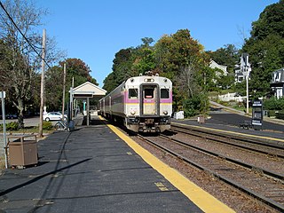
<span class="mw-page-title-main">Haverhill Line</span> MBTA Commuter Rail line

The Haverhill Line is a branch of the MBTA Commuter Rail system, running north from downtown Boston, Massachusetts to Haverhill. The service operates on the Western Route of the former Boston and Maine Railroad, which extends north to Portland, Maine, though MBTA commuter rail service has not continued north of Massachusetts since 1967.

<span class="mw-page-title-main">Transportation in California</span>

California's transportation system is complex and dynamic. Although known for its car culture and extensive network of freeways and roads, the state also has a vast array of rail, sea, and air transport. Several subway, light rail, and commuter rail networks are found in many of the state's largest population centers. In addition, with the state's location on the West Coast of the United States, several important ports in California handle freight shipments from the Pacific Rim and beyond. A number of airports are also spread out across the state, ranging from small general aviation airports to large international hubs like Los Angeles International Airport and San Francisco International Airport.

<span class="mw-page-title-main">Haverhill station (Massachusetts)</span> Train station in Haverhill, Massachusetts

Haverhill station is an intercity and regional rail station located in downtown Haverhill, Massachusetts, United States. It is served by Amtrak's Downeaster service and the MBTA Commuter Rail Haverhill/Reading Line; it is the northern terminus of MBTA service on the line. Haverhill is one of two major hubs for MVRTA local bus service; the Washington Square Transit Center is located 15 mile (0.3 km) east of the rail station.

The Puget Sound Regional Council (PSRC) is a metropolitan planning organization that develops policies and makes decisions about transportation planning, economic development, and growth management throughout the four-county Seattle metropolitan area surrounding Puget Sound. It is a forum for cities, towns, counties, transit agencies, port districts, Native American tribes, and state agencies to address regional issues.

The Good Neighbor International Bridge, commonly known as the Stanton Street Bridge, is an international bridge connecting the United States–Mexico border cities of El Paso, Texas, and Ciudad Juárez, Chihuahua, across the Rio Grande. The bridge is also known as "Friendship Bridge", "Puente Río Bravo" and "Puente Ciudad Juárez-Stanton El Paso". The Good Neighbor International Bridge is a five lane bridge with 3 lanes for south bound traffic and one for Secure Electronic Network for Travelers Rapid Inspection northbound traffic. The bridge was completed in 1967 and is 880 feet (270 m) long. The U.S. side of the bridge is owned by the City of El Paso. From January 26, 1999 through at least August 24, 2022, a designated commuter lane on the bridge was co-leased and operated by the United States General Services Administration and the El Paso Chamber.

<span class="mw-page-title-main">South Coast Rail</span> Railway construction project in Massachusetts

South Coast Rail is a project to build a new southern line of the MBTA Commuter Rail system along several abandoned and freight-only rail lines. The line will restore passenger rail service between Boston and the cities of Taunton, Fall River, and New Bedford, via the towns of Berkley, and Freetown, on the south coast of Massachusetts. It includes passenger service to some of the southern lines of the former Old Colony Railroad and the New York, New Haven and Hartford Railroad.

<i>CapeFlyer</i> Seasonal rail service in Massachusetts

The CapeFlyer is a passenger rail service in Massachusetts between Boston and Cape Cod that began in 2013. It is operated by the Cape Cod Regional Transit Authority (CCRTA) in collaboration with the Massachusetts Bay Transportation Authority (MBTA) and the Massachusetts Department of Transportation (MassDOT). The service runs on the weekends, beginning Friday evenings and including holidays, between Memorial Day weekend and Labor Day weekend.

National Highway 715A, commonly called NH 715A is a national highway in India. It is a spur road of National Highway 15. NH-715A traverses between Jagiroad, Bhuragaon and Balugaon in the state of Assam in India.

<span class="mw-page-title-main">North–South Commuter Railway</span> Commuter rail under construction in Luzon, Philippines

The North–South Commuter Railway, also known as the Clark–Calamba Railway, is a 147-kilometer (91-mile) commuter rail system under construction on the island of Luzon in the Philippines. Running from New Clark City in Capas, Tarlac, to Calamba, Laguna, with 36 stations and four services, the railway is designed to improve connectivity within the Greater Manila Area and will be integrated with the railway network in the region.

References

  1. Orange, Richard (12 August 2024). "Denmark-Sweden bridge sees bump in commuter traffic". The Local. Retrieved 17 August 2024.
  2. Park, JiYoung; Kwon, Changhyun; Son, Minsu (2014). "Economic implications of the Canada–U.S. border bridges: Applying a binational local economic model for international freight movements". Research in Transportation Business & Management. 11: 123. doi:10.1016/j.rtbm.2014.06.003.