List of municipalities in Lycoming County, Pennsylvania

Last updated

Map of Lycoming County, Pennsylvania with municipal labels showing cities and boroughs (red) and townships (white) Map of Lycoming County Pennsylvania With Municipal and Township Labels.png
Map of Lycoming County, Pennsylvania with municipal labels showing cities and boroughs (red) and townships (white)

There are 52 municipalities in Lycoming County, Pennsylvania . Under Pennsylvania law, counties have three main types of incorporated municipalities, of which Lycoming County has one city, nine boroughs and 42 townships. [1] As of the most recent United States Census (2020), Pennsylvania has 67 counties, which contain 1,547 townships, 955 boroughs (and 2 towns), and 56 cities. There are no unincorporated areas in the county, since all territory in Pennsylvania is incorporated. [1]

Contents

The 52 incorporated municipalities in Lycoming County are the subject of the first list, which gives their names and etymologies, dates settled and incorporated, what they were formed from, area, population in 2020, and a map of their location within the county. Twenty other Pennsylvania counties were formed from or contain land originally in Lycoming County. [2] The second list is of the 22 townships which were formerly incorporated in Lycoming County, and now are part of these other counties. It gives the same information as the first list, based on the current status of these townships.

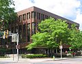
In the 2020 census, the population of Lycoming County was 114,188, [3] making it a "Fifth Class County" (defined by Pennsylvania law as having a population from "90,000 to 144,999"). [4] The county seat is Williamsport, [1] and Lycoming County is included in the Williamsport, Pennsylvania metropolitan statistical area. [5] Lycoming County is located in north central Pennsylvania, about 130 miles (210 km) northwest of Philadelphia and 165 miles (266 km) east-northeast of Pittsburgh. [6]

Municipalities

Location of Lycoming County within Pennsylvania Map of Pennsylvania highlighting Lycoming County.svg
Location of Lycoming County within Pennsylvania

As of 2024, Lycoming County has 52 incorporated municipalities: one city, nine boroughs, and 42 townships. [1] Townships may contain villages, which the Pennsylvania Department of Transportation (PennDOT) marks with signs and defines as "unincorporated built-up areas which have a post office or a generally recognized name". [7] [8] Lycoming County's 42 townships include 96 villages (according to PennDOT), although three of these villages are partly located in neighboring Clinton County. [9] Five of these villages (including one partly in Clinton County) [10] [11] [12] [13] [14] are also recognized by the United States Census Bureau as census-designated places (CDPs), which are geographical areas defined for the purposes of compiling demographic data. Neither villages nor CDPs are actual jurisdictions under Pennsylvania law, and their territory is legally part of the incorporated township(s) where they are located. [15] The first list also names the villages and CDPs within their respective townships. Four townships in Lycoming County do not include any villages: Anthony, [16] Clinton, [17] Mifflin, [18] and Porter. [19]

At 1,228.9 square miles (3,183 km2) as of 2023, [20] Lycoming County is the largest county by land area in Pennsylvania. [3] Lycoming County is larger than Rhode Island, the smallest U.S. state, which has a land area of 1,033.9 square miles (2,678 km2). [21] Lycoming County's incorporated municipalities range in size from 0.552 square miles (1.43 km2) (Montgomery borough) to 76.699 square miles (198.65 km2) (McHenry Township). [20] The city of Williamsport has the highest population of any municipality (27,754 or 24.3% of the county total as of 2020), while Brown Township in the northwest corner of the county has the lowest population (93 or 0.081%). [3] Most of the county's population is in the valley along the West Branch Susquehanna River. [a]

Incorporated municipalities of Lycoming County, Pennsylvania
Municipality
(type) [8]
Etymology [22]   Settled [23] [24]   Incorporated [23]   Formed from [22] [23]   Area in square miles (km2)   [20] Population
as of 2020    [3]
Map  
Williamsport (city)Named for William Ross (son of founder Michael Ross); county seat; laid out 179617691806 (borough),
1866 (city)
Loyalsock Township 9.472 sq mi (24.53 km2)27,754 Map of Lycoming County Pennsylvania Highlighting Williamsport.png
Duboistown (borough)Named for founders John and Mathias Dubois, laid out 185217731878 Armstrong Township 0.678 sq mi (1.76 km2)1,200 Map of Lycoming County Pennsylvania Highlighting Duboistown.png
Hughesville (borough)Named for founder Jeptha Hughes; laid out 181618161852 Muncy Township 0.645 sq mi (1.67 km2)2,154 Map of Lycoming County Pennsylvania Highlighting Hughesville.png
Jersey Shore (borough)Named the "Jersey Shore" as its founders were from New Jersey and it was on the shore of the West Branch Susquehanna River; laid out 182017851826 Porter Township 1.182 sq mi (3.06 km2)4,166 Map of Lycoming County Pennsylvania Highlighting Jersey Shore.png
Montgomery (borough)Named for the "Montgomery Station" post office; known as "Black Hole" until circa 1836 (for Black Hole Creek)17831887 Clinton Township 0.552 sq mi (1.43 km2)1,568 Map of Lycoming County Pennsylvania Highlighting Montgomery.png
Montoursville (borough)Named for Madame Montour and her son Andrew Montour; laid out 182017681850 Fairfield Township 4.182 sq mi (10.83 km2)4,750 Map of Lycoming County Pennsylvania Highlighting Montoursville.png
Muncy (borough)Named for the Munsee phratry of the Lenape; laid out 179717971826 Muncy Township 0.844 sq mi (2.19 km2)2,440 Map of Lycoming County Pennsylvania Highlighting Muncy.png
Picture Rocks (borough)Named for Native American pictographs on the cliffs above Muncy Creek18481875 Wolf Township 1.001 sq mi (2.59 km2)643 Map of Lycoming County Pennsylvania Highlighting Picture Rocks.png
Salladasburg (borough)Named for founder Jacob P. Sallada; laid out 183718371884 Mifflin Township 0.790 sq mi (2.05 km2)250 Map of Lycoming County Pennsylvania Highlighting Salladasburg.png
South Williamsport (borough)Named for its geographic location, south of Williamsport;17901886 Armstrong Township 2.162 sq mi (5.60 km2)6,261 Map of Lycoming County Pennsylvania Highlighting South Williamsport.png
Anthony Township Named for Joseph B. Anthony, a county judge circa 1844 and later Pennsylvania Supreme Court justice [16] 17731844 Lycoming Township 15.595 sq mi (40.39 km2)867 Map of Lycoming County Pennsylvania Highlighting Anthony Township.png
Armstrong Township Named for James Armstrong, a local lawyer; includes the villages of Allens and Sylvan Dell [25] 17951842 Clinton Township 25.505 sq mi (66.06 km2)686 Map of Lycoming County Pennsylvania Highlighting Armstrong Township.png
Bastress Township Named for Solomon Bastress of Jersey Shore, former member of the state legislature and associate judge; includes the village of Bastress [26] 18371854 Susquehanna Township 9.423 sq mi (24.41 km2)527 Map of Lycoming County Pennsylvania Highlighting Bastress Township.png
Brady Township Named for the Brady family, some of the earliest settlers in the area; includes the village of Maple Hill and part of United States Penitentiary, Allenwood [27] 17901855 Washington Township 9.052 sq mi (23.44 km2)501 Map of Lycoming County Pennsylvania Highlighting Brady Township.png
Brown Township Named for Jacob Brown, a general from Pennsylvania in the War of 1812; includes the villages of Beulah Land, Cedar Run, Hillborn, Pump Station, and Slate Run [28] 17901815 Mifflin and Pine Townships 74.030 sq mi (191.74 km2)93 Map of Lycoming County Pennsylvania Highlighting Brown Township.png
Cascade Township Named for its cascading mountain streams; includes the villages of Kellyburg, Masten, and Wallis Run [29] 18431843 Hepburn and Plunketts Creek Townships 39.527 sq mi (102.37 km2)422 Map of Lycoming County Pennsylvania Highlighting Cascade Township.png
Clinton Township Named for DeWitt Clinton, governor of New York (1817–1822, 1824–1828) [17] 18251825 Washington Township 28.338 sq mi (73.40 km2)3,720 Map of Lycoming County Pennsylvania Highlighting Clinton Township.png
Cogan House Township Named for David Cogan, a pioneer who settled on Larrys Creek in 1825; includes the villages of Beech Grove, Brookside, Cogan House, Steam Valley, Steuben, and White Pine [30] 18251843 Jackson and Mifflin Townships 69.986 sq mi (181.26 km2)935 Map of Lycoming County Pennsylvania Highlighting Cogan House Township.png
Cummings Township 
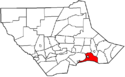
Named for John Cummings, an associate on the bench; includes the villages of Ramsey and Waterville, as well as Little Pine and Upper Pine Bottom state parks [31] 17841832 Mifflin and Brown Townships 69.990 sq mi (181.27 km2)265 Map of Lycoming County Pennsylvania Highlighting Cummings Township.png
Eldred Township Named for C. D. Eldred, an associate on the bench; includes the village of Warrensville [32] 18021858 Hepburn Township 14.343 sq mi (37.15 km2)1,997 Map of Lycoming County Pennsylvania Highlighting Eldred Township.png
Fairfield Township Named for "beautiful rolling land of the fertile river bottom"; [24] includes the village of Bella Vista [33] 17421825–1826 Muncy Township 12.355 sq mi (32.00 km2)2,834 Map of Lycoming County Pennsylvania Highlighting Fairfield Township.png
Franklin Township Named for Benjamin Franklin; includes the villages of Lairdsville and North Mountain [34] 17951822 Moreland Township 24.048 sq mi (62.28 km2)903 Map of Lycoming County Pennsylvania Highlighting Franklin Township.png
Gamble Township Named for James Gamble, the judge who authorized the election that led to its creation; includes the village of Calvert and Rose Valley Lake [35] 17841875 Lewis and Cascade Townships 46.775 sq mi (121.15 km2)778 Map of Lycoming County Pennsylvania Highlighting Gamble Township.png
Hepburn Township 
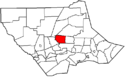
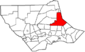
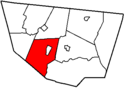
Named for William Hepburn, a founding father of Williamsport and Lycoming County; includes the villages of Balls Mills, Cogan Station, Haleeka, and Hepburnville [36] 17841804 Loyalsock Township 16.765 sq mi (43.42 km2)2,578 Map of Lycoming County Pennsylvania Highlighting Hepburn Township.png
Jackson Township Named for Andrew Jackson (prior to his presidency); includes the villages of Buttonwood and Jackson Corners [37] 18111824 Lycoming Township 37.256 sq mi (96.49 km2)396 Map of Lycoming County Pennsylvania Highlighting Jackson Township.png
Jordan Township 
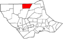
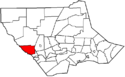
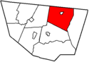
Named for Alexander Jordan, president judge of the district court when formed; includes the villages of Biggertown, Lungerville, Richarts Grove, and Unityville [38] 18121854 Franklin Township 20.927 sq mi (54.20 km2)850 Map of Lycoming County Pennsylvania Highlighting Jordan Township.png
Lewis Township Named for Ellis Lewis, president judge of the district court when formed; includes the villages of Bodines, Grays Run, Powys, and Trout Run [39] 18121835 Hepburn Township 37.442 sq mi (96.97 km2)862 Map of Lycoming County Pennsylvania Highlighting Lewis Township.png
Limestone Township Named for its abundant limestone, originally "Adams Township" for John Adams (until 1835); includes the villages of Collomsville and Oriole, and the villages and CDPs of Oval, [11] and Rauchtown [12] (also in Crawford Township, Clinton County) [40] [41] 17891824 Nippenose and Wayne Townships [b] 33.745 sq mi (87.40 km2)1,966 Map of Lycoming County Pennsylvania Highlighting Limestone Township.png
Loyalsock Township Named for Loyalsock Creek; second most populous municipality in the county; includes the CDPs and villages of Faxon [13] and Kenmar [14] [42] 17681786 Muncy Township 21.451 sq mi (55.56 km2)11,561 Map of Lycoming County Pennsylvania Highlighting Loyalsock Township.png
Lycoming Township Named for Lycoming Creek; includes the villages of Oak Lynn (also in Old Lycoming Township), Perryville, and Quiggleville [43] 17731858 Old Lycoming Township 15.282 sq mi (39.58 km2)1,606 Map of Lycoming County Pennsylvania Highlighting Lycoming Township.png
McHenry Township Named for Alexander H. McHenry, a Jersey Shore surveyor; includes the villages of Bluestone, Cammal, Haneyville (also in Gallagher Township, Clinton County), [44] Jersey Mills, Okome, and Ross [45] 17851861 Brown and Cummings Townships 76.699 sq mi (198.65 km2)122 Map of Lycoming County Pennsylvania Highlighting McHenry Township.png
McIntyre Township Named for Archibald McIntyre, a founder of the Williamsport and Elmira Railroad; includes the villages of Langdon, Marsh Hill, and Ralston [46] 17941848 Lewis Township 47.460 sq mi (122.92 km2)461 Map of Lycoming County Pennsylvania Highlighting McIntyre Township.png
McNett Township Named for H. I. McNett, who led the drive for its formation; includes the villages of Chemung, Ellenton, Leolyn, and Yorktown [47] 18051878 McIntyre Township 33.917 sq mi (87.84 km2)143 Map of Lycoming County Pennsylvania Highlighting McNett Township.png
Mifflin Township Named for Thomas Mifflin, the first governor of Pennsylvania (1790–1799) [18] 17901803 Old Lycoming Township 27.816 sq mi (72.04 km2)1,089 Map of Lycoming County Pennsylvania Highlighting Mifflin Township.png
Mill Creek Township Named for Mill Creek; includes part of the village of Huntersville (also in Wolf Township) [48] 17951879 Muncy Township 11.426 sq mi (29.59 km2)582 Map of Lycoming County Pennsylvania Highlighting Mill Creek Township.png
Moreland Township Named for a legend that the acres surveyed here were larger than a standard acre; includes the villages of Moreland and Opp [49] 17901813 Muncy Creek Township 24.047 sq mi (62.28 km2)1,015 Map of Lycoming County Pennsylvania Highlighting Moreland Township.png
Muncy Township Named for the Munsee phratry of the Lenape; as it is older than Lycoming County, it is often called the "Mother Township"; includes the village of Pennsdale [50] 17721772One of the seven original townships of Northumberland County 15.708 sq mi (40.68 km2)1,178 Map of Lycoming County Pennsylvania Highlighting Muncy Township.png
Muncy Creek Township Named for Muncy Creek; includes the village of Clarkstown [51] 17731797 Muncy Township 20.724 sq mi (53.67 km2)3,573 Map of Lycoming County Pennsylvania Highlighting Muncy Creek Township.png
Nippenose Township Named for the Native American word "Nippeno-wi", meaning a warm and genial summer-like place; includes the village of Antes Fort [52] (named for Fort Antes, abandoned during the Big Runaway)17691786 Bald Eagle Township [a] 11.517 sq mi (29.83 km2)661 Map of Lycoming County Pennsylvania Highlighting Nippenose Township.png
Old Lycoming Township Named indirectly for Lycoming Creek, it was originally part of Lycoming Township, the name was changed in 1858 when the township was divided; includes the CDP and village of Garden View [10] and villages of Grimesville and Oak Lynn (also in Lycoming Township) [53] 17731785Iroquois land purchased as part of Northumberland County, before this was run by the Fair Play Men 9.442 sq mi (24.45 km2)4,975 Map of Lycoming County Pennsylvania Highlighting Old Lycoming Township.png
Penn Township Named for Penn Township, Berks County; includes the villages of Beaver Lake and Strawbridge [54] 17741828 Muncy Township 26.587 sq mi (68.86 km2)895 Map of Lycoming County Pennsylvania Highlighting Penn Township.png
Piatt Township Named for William Piatt, an associate county judge when it was created; includes the villages of Larrys Creek and Larryville [55] 17691858 Mifflin Township 10.092 sq mi (26.14 km2)1,047 Map of Lycoming County Pennsylvania Highlighting Piatt Township.png
Pine Township Named for its vast stands of pine trees; includes the villages of Carsontown, English Center, Lorenton, Oregon Hill, and Texas [56] 18061856 Brown, Cummings and Cogan House Townships 75.072 sq mi (194.44 km2)258 Map of Lycoming County Pennsylvania Highlighting Pine Township.png
Plunketts Creek Township Named for Plunketts Creek; includes the villages of Barbours, Dunwoody Camp, Hoppestown, and Proctor [57] 17761838 Franklin Township and Davidson Township now part of Sullivan County 54.075 sq mi (140.05 km2)597 Map of Lycoming County Pennsylvania Highlighting Plunketts Creek Township.png
Porter Township Named for David R. Porter, Pennsylvania governor (1839–1845) [19] 17721840 Mifflin Township 7.903 sq mi (20.47 km2)1,528 Map of Lycoming County Pennsylvania Highlighting Porter Township.png
Shrewsbury Township Named for Shrewsbury Township, New Jersey; includes the villages of Camp Genesee, Glen Mawr, and Tivoli [58] 17941804 Muncy Township 18.748 sq mi (48.56 km2)418 Map of Lycoming County Pennsylvania Highlighting Shrewsbury Township.png
Susquehanna Township Named for the West Branch Susquehanna River which forms its northern boundary; includes the village of Nisbet [59] 18011838 Nippenose and Armstrong Townships 7.179 sq mi (18.59 km2)968 Map of Lycoming County Pennsylvania Highlighting Susquehanna Township.png
Upper Fairfield Township Originally named "Pollock Township" for local judge, name changed in 1853; includes the villages of Fairfield Center, Farragut, and Loyalsockville [60] 17961851 Fairfield Township 18.118 sq mi (46.93 km2)1,807 Map of Lycoming County Pennsylvania Highlighting Upper Fairfield Township.png
Washington Township Named for George Washington; includes the villages of Elimsport and Texas Village [61] 17601785 Bald Eagle Township [b] 48.327 sq mi (125.17 km2)1,768 Map of Lycoming County Pennsylvania Highlighting Washington Township.png
Watson Township Named for Oliver Watson, president of a bank in Williamsport; includes the villages of Springer Corners (also in Gallagher Township, Clinton County) [44] and Tomb [62] 17841845 Porter and Cummings Townships 23.425 sq mi (60.67 km2)534 Map of Lycoming County Pennsylvania Highlighting Watson Township.png
Wolf Township Named for George Wolf, governor of Pennsylvania (1829–1835); includes the villages of Bryan Mills and Huntersville (also in Mill Creek Township) [63] 17771834 Muncy Township 19.777 sq mi (51.22 km2)3,105 Map of Lycoming County Pennsylvania Highlighting Wolf Township.png
Woodward Township Named for Apollos Woodward, an associate judge; includes the villages of Linden and Pine Run [64] 17721855 Anthony Township 13.543 sq mi (35.08 km2)2,046 Map of Lycoming County Pennsylvania Highlighting Woodward Township.png

Former townships

Map of the original extent of Lycoming County circa 1795, with current Pennsylvania county outlines for reference. Click on map to see dates. Original Lycoming County Pennsylvania Map.png
Map of the original extent of Lycoming County circa 1795, with current Pennsylvania county outlines for reference. Click on map to see dates.

The territory which today makes up Lycoming County was purchased from the Iroquois in two treaties signed at Fort Stanwix in New York: the first treaty was in 1768, and the second treaty was in 1784. The county was formed on April 13, 1795, from part of Northumberland County. [22] The county originally contained seven townships when formed: Lower Bald Eagle, Loyalsock, Lycoming, Muncy, Nippenose, Pine Creek, and Washington. Today Pine Creek is part of Clinton County and Lower Bald Eagle is part of both Centre and Clinton counties, but the rest are still in Lycoming County, although many other municipalities have been formed from these since. [22]

When originally formed in 1795, Lycoming County was "roughly estimated at about 12,000 square miles" (31,000 km2). [22] Its territory stretched north to the New York state line, west to the Allegheny River, south nearly to the source of the West Branch Susquehanna River, and east to include modern Sullivan County and a bit beyond. However, by 1800, just five years after its formation, the first territory was taken from it to form new counties, a process that continued until 1847. [22] [2]

Twenty other Pennsylvania counties today contain land that was once part of Lycoming County: five were formed completely from it (Jefferson, McKean, Potter, Tioga, and Sullivan), eight were formed from it and other counties (Armstrong, Bradford, Centre, Clearfield, Clinton, Indiana, Venango, and Warren), three were formed from counties that were themselves formed partly from it (Cameron, Clarion, and Elk), Forest was formed from a county that was formed completely from it (Jefferson), two (Luzerne and Wyoming) contain territory that was part of lycoming County in 1795, and finally Union received a township from it in 1861. [22] [2] [65] The second table lists each of the twenty two known former incorporated areas in the county, and information on the modern township successors of these today.

Former townships of Lycoming County, Pennsylvania
Municipality
(type)
Remarks [22] SettledIncorporated Area in square miles (km2)Population
as of 2020
Map
Allison Township [c] Now in Clinton County, incorporated as part of Lycoming County [66] [67]  ?before 18391.627 sq mi (4.21 km2) [68] 229 [69] Map of Allison Township, Clinton County, Pennsylvania Highlighted.png
Brady Township (now Gregg Township)Now in Union County, incorporated as part of Lycoming County [22] 1798179815.113 sq mi (39.14 km2) [70] 4,096 [71] Map of Gregg Township, Union County, Pennsylvania Highlighted.PNG
Ceres Township Now in McKean County, incorporated as part of Lycoming County [72] 1798179840.514 sq mi (104.93 km2) [73] 846 [74] Map of Ceres Township, McKean County, Pennsylvania Highlighted.png
Chapman Township [c] Now in Clinton County, incorporated as part of Lycoming County [66] [67] 1780before 1839100.974 sq mi (261.52 km2) [75] 893 [76] Map of Chapman Township, Clinton County, Pennsylvania Highlighted.png
Cherry Township [d] Now in Sullivan County, incorporated as part of Lycoming County [77] 1816182458.183 sq mi (150.69 km2) [78] 1,481 [79] Map of Sullivan County Pennsylvania Highlighting Cherry Township.png
Colebrook Township [c] Now in Clinton County, incorporated as part of Lycoming County [66] [67] 1777before 183918.629 sq mi (48.25 km2) [80] 196 [81] Map of Colebrook Township, Clinton County, Pennsylvania Highlighted.png
Davidson Township [d] Now in Sullivan County, incorporated as part of Lycoming County [77] 1806183377.921 sq mi (201.81 km2) [82] 549 [83] Map of Sullivan County Pennsylvania Highlighting Davidson Township.png
Dunnstable Township [c] Now in Clinton County, incorporated as part of Lycoming County [66] [67] [84] 1785before 18109.611 sq mi (24.89 km2) [85] 1,005 [86] Map of Dunnstable Township, Clinton County, Pennsylvania Highlighted.png
Elkland Township [d] Now in Sullivan County, incorporated as part of Lycoming County [77] 1798180438.690 sq mi (100.21 km2) [87] 549 [88] Map of Sullivan County Pennsylvania Highlighting Elkland Township.png
Forks Township [d] Now in Sullivan County, incorporated as part of Lycoming County [77] 1794183343.432 sq mi (112.49 km2) [89] 374 [90] Map of Sullivan County Pennsylvania Highlighting Forks Township.png
Fox Township [d] Now in Sullivan County, incorporated as part of Lycoming County [77] 1800183938.949 sq mi (100.88 km2) [91] 310 [92] Map of Sullivan County Pennsylvania Highlighting Fox Township.png
Grove Township [c] Now in Cameron County, incorporated as part of Lycoming County, then one of twelve original townships in Clinton County (1839), then one of four original townships in Cameron (1860) [67] [93] 1811before 183973.926 sq mi (191.47 km2) [94] 113 [95] Map of Grove Township, Cameron County, Pennsylvania Highlighted.png
Limestone Township (now Crawford Township) [c] Now in Clinton County, incorporated as part of Lycoming County, [66] [67] name changed 1841.1780182422.134 sq mi (57.33 km2) [96] 973 [97] Map of Crawford Township, Clinton County, Pennsylvania Highlighted.png
Lower Bald Eagle Township [b] (now Bald Eagle Township)Now in Clinton County, incorporated as part of Northumberland County, became part of Lycoming County in 1795 [22] 1772177242.055 sq mi (108.92 km2) [98] 1,005 [99] Map of Bald Eagle Township, Clinton County, Pennsylvania Highlighted.png
Lumber Township [c] Now in Cameron County, incorporated as part of Lycoming County, then one of twelve original townships in Clinton County (1839), then one of four original townships in Cameron (1860) [67] [93] 1810before 183973.926 sq mi (191.47 km2) [100] 182 [101] Map of Lumber Township, Cameron County, Pennsylvania Highlighted.png
Pine Creek Township [c] Now in Clinton County, incorporated as part of Lycoming County [66] [67] 1785177214.910 sq mi (38.62 km2) [102] 3,416 [103] Map of Pine Creek Township, Clinton County, Pennsylvania Highlighted.png
Pine Creek Township Now in Jefferson County, incorporated as part of Lycoming County [24] [104] 1785177228.596 sq mi (74.06 km2) [105] 1,323 [106] Map of Pine Creek Township, Jefferson County, Pennsylvania Highlighted.PNG
Plunketts Creek Township [d] (now Hillsgrove Township)Now in Sullivan County, incorporated as part of Lycoming County, [77] name changed in 1856. [107] 1786184728.529 sq mi (73.89 km2) [108] 227 [109] Map of Sullivan County Pennsylvania Highlighting Hillsgrove Township.png
Shrewsbury Township [d] Now in Sullivan County, incorporated as part of Lycoming County [77] 1799180347.579 sq mi (123.23 km2) [110] 304 [111] Map of Sullivan County Pennsylvania Highlighting Shrewsbury Township.png
Tioga Township Now in Tioga County, incorporated as part of Lycoming County [112] 1792179739.858 sq mi (103.23 km2) [113] 938 [114] Map of Tioga Township, Tioga County, Pennsylvania Highlighted.png
Upper Bald Eagle Township [b] (now Spring Township)Now in Centre County, incorporated as part of Northumberland County, became part of Lycoming County in 1795; [22] Name changed in 1801 to "Spring Township" [115] 1772177226.735 sq mi (69.24 km2) [116] 7,979 [117] Map of Spring Township, Centre County, Pennsylvania Highlighted.png
Wayne Township [c] Now in Clinton County, incorporated as part of Lycoming County; [66] [67] named for "Mad" Anthony Wayne [22] 1768179822.861 sq mi (59.21 km2) [118] 1,451 [119] Map of Wayne Township, Clinton County, Pennsylvania Highlighted.png

Map of municipalities

Williamsport
1) Duboistown
1
2) Hughesville
2
3) Jersey Shore
3
4) Montgomery
4
5) Montoursville
5
6) Muncy
6
7) Picture Rocks
7
8) Salladasburg
8
9) South Williamsport
9
Anthony
Twp.
Armstrong
Twp.
Bastress Twp.
Brady
       Twp.
Brown Twp.
Cascade Twp.
Clinton Twp.
Cogan
House
Twp.
Cummings Twp.
Eldred
Twp.
Fairfield
  Twp.
Franklin
   Twp.
Gamble Twp.
Hepburn
Twp.
Jackson Twp.
Jordan
Twp.
Lewis Twp.
Limestone Twp.
Loyalsock Twp.
Lyco-
ming
 Twp.
McHenry Twp.
McIntyre Twp.
McNett Twp.
Mifflin
Twp.
Mill
Creek
Twp.
Moreland
Twp.
Muncy
Twp.
Muncy
Creek Twp.
   Nippe-
nose Twp.
Old
Lycoming
Twp.
Piatt Twp.
Pine Twp.
Penn
Twp.
Plunketts
Creek
Twp.
Porter
Twp.
Shrewsbury
  Twp.
Susque-
hanna Twp.
Upper
Fairfield
Twp.
Washington Twp.
Watson Twp.
Wolf
Twp.
Woodward
 Twp.
Map of Lycoming County, Pennsylvania All Blank.PNG
Bald Eagle Mountain Panorama.JPG
Bald Eagle Mountain Panorama as seen looking south from Loyalsock Township

See also

Notes

a. ^ The sum of the 2020 US Census populations of all the municipalities that border the West Branch Susquehanna River in Lycoming County is 76,002, or 66.56% of the county's total population. The municipalities bordering the river are: Williamsport (city); Duboistown, Jersey Shore, Montgomery, Montoursville, and South Williamsport (boroughs); and Armstrong, Brady, Clinton, Fairfield, Loyalsock, Muncy, Muncy Creek, Nippenose, Piatt, Porter, Susquehanna, and Woodward (townships).
b. ^ Northumberland County was formed in 1772 with seven original townships. Only two of the seven (Bald Eagle and Muncy Townships) had land which is now part of Lycoming County. In August 1785, Washington Township was formed from Bald Eagle Township, and in November 1785 parts of Bald Eagle were added to the newly formed Lycoming and Pine Creek townships (the bulk of their territory had been purchased from the Iroquois in 1784). In May 1786, Bald Eagle Township was split into three new townships: Nippenose, Upper Bald Eagle, and Lower Bald Eagle. In 1789, Mifflin County was formed from Upper Bald Eagle Township and half of Potter Township (itself formed partly from the original Bald Eagle Township in May 1774). [22] [120]
When Lycoming County was formed in 1795, Lower Bald Eagle was one of its original seven townships. Centre County was formed in 1800 from parts of Huntingdon, Lycoming, Mifflin, and Northumberland counties. Centre County originally had eight townships, with two (Lower Bald Eagle and Upper Bald Eagle), taken from Lycoming County. It is not clear if this Upper Bald Eagle was a newly formed township, or some portion of the original Northumberland County township not taken when Mifflin County was formed. [121] Some territory from Lower Bald Eagle Township remained in Lycoming County after Centre county was formed. [22]
In 1801, Centre County renamed "Upper Bald Eagle Township" as "Spring Township" and "Lower Bald Eagle Township" as "Bald Eagle Township". In 1839 Clinton County was formed from Centre and Lycoming counties, with Bald Eagle Township as one of three taken from Centre County. Today neither Centre nor Lycoming counties have a township named "Bald Eagle". [23] [66] [115]
c. ^ When Clinton County was formed in 1839, there were 12 original townships. It "embraced the following townships then in Centre County, viz., Bald Eagle, Lamar, and Logan; and from Lycoming, Allison, Chapman, Colebrook, Dunstable, Grove, Lumber, Limestone, Pine Creek, and Wayne." [67] Since Lamar was formed from Bald Eagle, 11 of the 12 original townships came at least indirectly from Lycoming County. Limestone was split from the Lycoming County township of the same name, then attached to Wayne Township, and renamed Crawford Township when it was reformed. Grove and Lumber townships became part of Cameron County, but the remaining ten townships are still in Clinton County. [67]
Wayne Township is now in Clinton County. According to Meginness (Chapter 14), Wayne was formed from Nippenose Township in 1798, while part of Lycoming County. [22] Note that the PHMC sheet on Clinton County incorrectly says it was formed as part of Northumberland County, [66] but neither the Lycoming nor Northumberland County histories support this. [22] [120]
d. ^ When originally formed in 1803 as part of Lycoming County, Shrewsbury Township encompassed all of what is now Sullivan County. Elkland Township was formed from Shrewsbury in 1804, as were Cherry (1824), Davidson and Forks Townships (both 1833). Plunketts Creek Township was formed from Franklin and Davidson Townships in 1838, and Fox Township was formed from Elkland in 1839. When Sullivan County was formed in 1847 (entirely from Lycoming County), both Shrewsbury and Plunketts Creek Townships were split, with each county originally having a township of that name (Plunketts Creek Township in Sullivan County changed its name to Hillsgrove Township in 1856). [107]

Related Research Articles

<span class="mw-page-title-main">Lycoming County, Pennsylvania</span> County in Pennsylvania, United States

Lycoming County is a county in the Commonwealth of Pennsylvania. As of the 2020 census, the population was 114,188. Its county seat is Williamsport. The county is part of the Central Pennsylvania region of the state.

<span class="mw-page-title-main">Montgomery, Pennsylvania</span> Borough in Pennsylvania, United States

Montgomery is a borough in Lycoming County, Pennsylvania, United States. The population was 1,570 at the 2020 census. It is part of the Williamsport, Pennsylvania Metropolitan Statistical Area.

<span class="mw-page-title-main">Salladasburg, Pennsylvania</span> Borough in Pennsylvania, United States

Salladasburg is a borough in Lycoming County, Pennsylvania, United States. The population was 252 at the 2020 census, making it the smallest borough in Lycoming County. It is part of the Williamsport, Pennsylvania Metropolitan Statistical Area.

<span class="mw-page-title-main">South Williamsport, Pennsylvania</span> Borough in Pennsylvania, United States

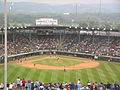
South Williamsport is a borough in Lycoming County, Pennsylvania, United States. It is famous for hosting the Little League World Series. The population was 6,259 at the 2020 census. It is part of the Williamsport, Pennsylvania Metropolitan Statistical Area.

<span class="mw-page-title-main">Washington Township, Lycoming County, Pennsylvania</span> Township in Pennsylvania, United States

Washington Township is a township in Lycoming County, Pennsylvania, United States. The population was 1,769 at the 2020 census. It is part of the Williamsport Metropolitan Statistical Area.

<span class="mw-page-title-main">Watson Township, Lycoming County, Pennsylvania</span> Township in Pennsylvania, United States

Watson Township is a township in Lycoming County, Pennsylvania, United States. The population was 534 at the 2020 census. It is part of the Williamsport Metropolitan Statistical Area.

<span class="mw-page-title-main">Wolf Township, Pennsylvania</span> Township in Pennsylvania, United States

Wolf Township is a township in Lycoming County, Pennsylvania, United States. The population was 3,109 at the 2020 census. It is part of the Williamsport Metropolitan Statistical Area.

<span class="mw-page-title-main">White Deer Hole Creek</span> Tributary of the West Branch Susquehanna River

White Deer Hole Creek is a 20.5-mile (33.0 km) tributary of the West Branch Susquehanna River in Clinton, Lycoming and Union counties in the U.S. state of Pennsylvania. A part of the Chesapeake Bay drainage basin, the White Deer Hole Creek watershed drains parts of ten townships. The creek flows east in a valley of the Ridge-and-valley Appalachians, through sandstone, limestone, and shale from the Ordovician, Silurian, and Devonian periods.

<span class="mw-page-title-main">Upper Pine Bottom State Park</span> State park in Lycoming County, Pennsylvania, United States

Upper Pine Bottom State Park is a 5-acre (2.0 ha) Pennsylvania state park in Lycoming County, Pennsylvania in the United States. The park is in Cummings Township on Pennsylvania Route 44 and is surrounded by the Tiadaghton State Forest. It is on Upper Pine Bottom Run, which gave the park its name and is a tributary of Pine Creek. Upper Pine Bottom State Park is in the Pine Creek Gorge, where the streams have cut through five major rock formations from the Devonian and Carboniferous periods.

Conewago Creek is a 23.0-mile-long (37.0 km) tributary of the Susquehanna River in Lebanon, Dauphin, and Lancaster counties in Pennsylvania in the United States. The source is at an elevation of 1,100 feet (340 m) at Mount Gretna Heights in Lebanon County. The mouth is the confluence with the Susquehanna River at an elevation of 261 feet (80 m) at the border of Dauphin and Lancaster counties, just south of Three Mile Island in the river and just north of the unincorporated village of Falmouth in Conoy Township, Lancaster County.

<span class="mw-page-title-main">Conewago Creek (west)</span> Tributary of the Susquehanna River in Pennsylvania, United States

Conewago Creek is an 80.2-mile-long (129.1 km) tributary of the Susquehanna River in Adams and York counties in Pennsylvania in the United States, with its watershed also draining a small portion of Carroll County, Maryland. The source is at an elevation of 1,440 feet (440 m), east of Caledonia State Park, in Franklin Township in Adams County. The mouth is the confluence with the Susquehanna River at York Haven in York County at an elevation of 259 feet (79 m).

<span class="mw-page-title-main">Bucktail State Park Natural Area</span> State park in Pennsylvania, United States

Bucktail State Park Natural Area is a 16,433-acre (6,650 ha) Pennsylvania state park in Cameron and Clinton Counties in Pennsylvania in the United States. The park follows Pennsylvania Route 120 for 75 miles (121 km) between Emporium and Lock Haven. Bucktail State Park Natural Area park runs along Sinnemahoning Creek and the West Branch Susquehanna River and also passes through Renovo. The park is named for the Civil War Pennsylvania Bucktails Regiment and is primarily dedicated to wildlife viewing, especially elk.

<span class="mw-page-title-main">Hyner Run State Park</span> State Park in Pennsylvania, United States

Hyner Run State Park is a 180-acre (73 ha) Pennsylvania state park in Chapman Township, Clinton County, Pennsylvania in the United States. The park is 6 miles (9.7 km) east of Renovo and 3 miles (5 km) north of Hyner on Pennsylvania Route 120. Hyner Run State Park is surrounded by Sproul State Forest.

<span class="mw-page-title-main">Hyner View State Park</span> State park in Pennsylvania, United States

Hyner View State Park is a 6-acre (2.4 ha) Pennsylvania state park in Chapman Township, Clinton County, Pennsylvania in the United States. The park is 6 miles (9.7 km) east of Renovo and 3 miles (4.8 km) north of Hyner on Pennsylvania Route 120. Hyner View State Park is surrounded by Sproul State Forest.

<span class="mw-page-title-main">McCalls Dam State Park</span> State park in Pennsylvania, United States

McCalls Dam State Park is a Pennsylvania state park on 8 acres (3.2 ha) in Miles Township, Centre County, Pennsylvania in the United States. The park is in the easternmost tip of Centre County, south of Clinton County and north of Union County. McCalls Dam State Park is in a remote location on a gravel road between R. B. Winter State Park on Pennsylvania Route 192 and Eastville on Pennsylvania Route 880. The park can only be accessed in the winter months by snowmobiling or cross-country skiing.

Mill Creek is the name of four different tributaries of Loyalsock Creek in Lycoming and Sullivan counties in Pennsylvania in the United States. There are two more streams named "Mill Creek" in the Loyalsock Creek drainage basin and one named "Mill Run".

<span class="mw-page-title-main">Pleasant Stream</span>

Pleasant Stream is a 13.1-mile-long (21.1 km) tributary of Lycoming Creek in Lycoming and Sullivan counties, Pennsylvania, in the United States.

<span class="mw-page-title-main">Rauchtown, Pennsylvania</span> Census-designated place in Pennsylvania, United States

Rauchtown is a census-designated place in Crawford Township, Clinton County, and a small portion in Limestone Township, Lycoming County, in the U.S. state of Pennsylvania. As of the 2010 census the population was 726.

References

  1. 1 2 3 4 Commonwealth of Pennsylvania (2023). "Section 6 - Local Government". The Pennsylvania Manual, Volume 126. ISBN   978-0-8182-0397-8. Archived from the original (PDF) on 2024-03-07.
  2. 1 2 3 Long, John H. (ed.). "Pennsylvania: Consolidated Chronology of State and County Boundaries". The Newberry Library, The Dr. William M. School Center for American History and Culture. Archived from the original on 2023-05-28. Retrieved 2025-01-05.
  3. 1 2 3 4 "Lycoming County, Pennsylvania". U.S. Census Bureau. 2020. Retrieved 2024-12-17.
  4. "County Classes". The Unified Judicial System of Pennsylvania. Retrieved 2025-01-05.
  5. "Metropolitan and Micropolitan Statistical Areas Map (March 2020)". U.S. Census Bureau. 2020. Retrieved 2024-12-27.
  6. "Latitude/Longitude Distance Calculator". National Hurricane Center and Central Pacific Hurricane Center, National Oceanic and Atmospheric Administration. Retrieved 2025-01-05.
  7. "I10-3, Village Name Sign". Handbook of Approved Signs, Publication 236 (PDF). Pennsyolvania Department of Transportation. 2013-11-19. p. 747. Retrieved 2025-01-02.
  8. 1 2 Lycoming County Economic Development and Planning Services, GIS Division (2005). Lycoming County, Pennsylvania (PDF) (Map). Archived from the original (PDF) on 2007-08-10. Retrieved 2007-09-17.Note: Official Lycoming County Map showing cities, boroughs, townships, and some villages
  9. 2024 General Highway Map Lycoming County Pennsylvania (PDF) (Map). Pennsylvania Department of Transportation, Bureau of Planning and Research, Geographic Information Division. Retrieved 2025-01-07.
  10. 1 2 "Garden View CDP, Pennsylvania". United States Census Bureau. 2020. Retrieved 2025-01-07.
  11. 1 2 "Oval CDP, Pennsylvania". United States Census Bureau. 2020. Retrieved 2025-01-07.
  12. 1 2 "Rauchtown CDP, Pennsylvania". United States Census Bureau. 2020. Retrieved 2025-01-07. Note: Rauchtown is not shown in Lycoming County on the PennDOT maps, but the US Census maps do show it in both counties.
  13. 1 2 "Faxon CDP, Pennsylvania". United States Census Bureau. 2020. Retrieved 2025-01-07.
  14. 1 2 "Kenmar CDP, Pennsylvania". United States Census Bureau. 2020. Retrieved 2025-01-07.
  15. "Census Designated Places". United States Census Bureau. 2025-01-02. Retrieved 2025-01-07.
  16. 1 2 Pennsylvania Department of Transportation, Bureau of Planning and Research, Geographic Information Division (2020-08-27). Anthony, Second Class Township, Lycoming County (PDF) (Map). Retrieved 2025-01-02.{{cite map}}: CS1 maint: multiple names: authors list (link)
  17. 1 2 Pennsylvania Department of Transportation, Bureau of Planning and Research, Geographic Information Division (2020-07-29). Clinton, Second Class Township, Lycoming County (PDF) (Map). Retrieved 2025-01-02.{{cite map}}: CS1 maint: multiple names: authors list (link)
  18. 1 2 Pennsylvania Department of Transportation, Bureau of Planning and Research, Geographic Information Division (2008-03-07). Mifflin, Second Class Township, Lycoming County (PDF) (Map). Retrieved 2025-01-02.{{cite map}}: CS1 maint: multiple names: authors list (link)
  19. 1 2 Pennsylvania Department of Transportation, Bureau of Planning and Research, Geographic Information Division (2019-08-19). Porter, Second Class Township, Lycoming County (PDF) (Map). Retrieved 2025-01-01.{{cite map}}: CS1 maint: multiple names: authors list (link)
  20. 1 2 3 "GEOINFO Annual Geographic Information Table: Anthony township, Lycoming County, Pennsylvania". U.S. Census Bureau. 2023. Retrieved 2024-12-19. Note: Each municipality can be selected on the map, which displays its area. Multiple selections can be shown in a table.
  21. "Rhode Island". U.S. Census Bureau. 2020. Retrieved 2024-12-17. Note: Rhode Island also has a water area of 511.1 square miles (1,324 km2)
  22. 1 2 3 4 5 6 7 8 9 10 11 12 13 14 15 16 Meginness, John Franklin (1892). History of Lycoming County, Pennsylvania: including its aboriginal history; the colonial and revolutionary periods; early settlement and subsequent growth; organization and civil administration; the legal and medical professions; internal improvement; past and present history of Williamsport; manufacturing and lumber interests; religious, educational, and social development; geology and agriculture; military record; sketches of boroughs, townships, and villages; portraits and biographies of pioneers and representative citizens, etc. etc (1st ed.). Chicago: Brown, Runk & Co. ISBN   0-7884-0428-8 . Retrieved 2025-01-07. Note: ISBN refers to Heritage Books July 1996 reprint.
  23. 1 2 3 4 "Lycoming County 5th class" (PDF). Pennsylvania Historical and Museum Commission . Retrieved 2025-01-07.
  24. 1 2 3 Godcharles, Frederic A. (1933). Pennsylvania: Political, Governmental, Military and Civil: Political and Civil History Volume (First ed.). New York: The American Historical Society.
  25. Pennsylvania Department of Transportation, Bureau of Planning and Research, Geographic Information Division (2018-01-18). Armstrong, Second Class Township, Lycoming County (PDF) (Map). Retrieved 2025-01-02.{{cite map}}: CS1 maint: multiple names: authors list (link)
  26. Pennsylvania Department of Transportation, Bureau of Planning and Research, Geographic Information Division (2019-08-20). Bastress, Second Class Township, Lycoming County (PDF) (Map). Retrieved 2025-01-02.{{cite map}}: CS1 maint: multiple names: authors list (link)
  27. Pennsylvania Department of Transportation, Bureau of Planning and Research, Geographic Information Division (2013-05-20). Brady, Second Class Township, Lycoming County (PDF) (Map). Retrieved 2025-01-02.{{cite map}}: CS1 maint: multiple names: authors list (link)
  28. Pennsylvania Department of Transportation, Bureau of Planning and Research, Geographic Information Division (2018-10-19). Brown, Second Class Township, Lycoming County (PDF) (Map). Retrieved 2025-01-02.{{cite map}}: CS1 maint: multiple names: authors list (link)
  29. Pennsylvania Department of Transportation, Bureau of Planning and Research, Geographic Information Division (2020-08-27). Cascade, Second Class Township, Lycoming County (PDF) (Map). Retrieved 2025-01-02.{{cite map}}: CS1 maint: multiple names: authors list (link)
  30. Pennsylvania Department of Transportation, Bureau of Planning and Research, Geographic Information Division (2024-02-09). Cogan House, Second Class Township, Lycoming County (PDF) (Map). Retrieved 2025-01-02.{{cite map}}: CS1 maint: multiple names: authors list (link)
  31. Pennsylvania Department of Transportation, Bureau of Planning and Research, Geographic Information Division (2024-09-13). Cummings, Second Class Township, Lycoming County (PDF) (Map). Retrieved 2025-01-02.{{cite map}}: CS1 maint: multiple names: authors list (link)
  32. Pennsylvania Department of Transportation, Bureau of Planning and Research, Geographic Information Division (2020-07-29). Eldred, Second Class Township, Lycoming County (PDF) (Map). Retrieved 2025-01-02.{{cite map}}: CS1 maint: multiple names: authors list (link)
  33. Pennsylvania Department of Transportation, Bureau of Planning and Research, Geographic Information Division (2022-04-21). Fairfield, Second Class Township, Lycoming County (PDF) (Map). Retrieved 2025-01-02.{{cite map}}: CS1 maint: multiple names: authors list (link)
  34. Pennsylvania Department of Transportation, Bureau of Planning and Research, Geographic Information Division (2022-04-19). Franklin, Second Class Township, Lycoming County (PDF) (Map). Retrieved 2025-01-02.{{cite map}}: CS1 maint: multiple names: authors list (link)
  35. Pennsylvania Department of Transportation, Bureau of Planning and Research, Geographic Information Division (2024-12-24). Gamble, Second Class Township, Lycoming County (PDF) (Map). Retrieved 2025-01-02.{{cite map}}: CS1 maint: multiple names: authors list (link)
  36. Pennsylvania Department of Transportation, Bureau of Planning and Research, Geographic Information Division (2020-08-28). Hepburn, Second Class Township, Lycoming County (PDF) (Map). Retrieved 2025-01-02.{{cite map}}: CS1 maint: multiple names: authors list (link)
  37. Pennsylvania Department of Transportation, Bureau of Planning and Research, Geographic Information Division (2014-11-05). Jackson, Second Class Township, Lycoming County (PDF) (Map). Retrieved 2025-01-02.{{cite map}}: CS1 maint: multiple names: authors list (link)
  38. Pennsylvania Department of Transportation, Bureau of Planning and Research, Geographic Information Division (2020-07-20). Jordan, Second Class Township, Lycoming County (PDF) (Map). Retrieved 2025-01-02.{{cite map}}: CS1 maint: multiple names: authors list (link)
  39. Pennsylvania Department of Transportation, Bureau of Planning and Research, Geographic Information Division (2020-07-29). Lewis, Second Class Township, Lycoming County (PDF) (Map). Retrieved 2025-01-02.{{cite map}}: CS1 maint: multiple names: authors list (link)
  40. Pennsylvania Department of Transportation, Bureau of Planning and Research, Geographic Information Division (2019-08-19). Limestone, Second Class Township, Lycoming County (PDF) (Map). Retrieved 2025-01-02.{{cite map}}: CS1 maint: multiple names: authors list (link)
  41. Pennsylvania Department of Transportation, Bureau of Planning and Research, Geographic Information Division (2023-04-13). Crawford, Second Class Township, Clinton County (PDF) (Map). Retrieved 2025-01-07.{{cite map}}: CS1 maint: multiple names: authors list (link)
  42. Pennsylvania Department of Transportation, Bureau of Planning and Research, Geographic Information Division (2021-01-25). Loyalsock, Second Class Township, Lycoming County (PDF) (Map). Retrieved 2025-01-02.{{cite map}}: CS1 maint: multiple names: authors list (link)
  43. Pennsylvania Department of Transportation, Bureau of Planning and Research, Geographic Information Division (2020-08-31). Lycoming, Second Class Township, Lycoming County (PDF) (Map). Retrieved 2025-01-02.{{cite map}}: CS1 maint: multiple names: authors list (link)
  44. 1 2 Pennsylvania Department of Transportation, Bureau of Planning and Research, Geographic Information Division (2023-12-13). Gallagher, Second Class Township, Clinton County (PDF) (Map). Retrieved 2025-01-07.{{cite map}}: CS1 maint: multiple names: authors list (link)
  45. Pennsylvania Department of Transportation, Bureau of Planning and Research, Geographic Information Division (2018-10-19). McHenry, Second Class Township, Lycoming County (PDF) (Map). Retrieved 2025-01-02.{{cite map}}: CS1 maint: multiple names: authors list (link)
  46. Pennsylvania Department of Transportation, Bureau of Planning and Research, Geographic Information Division (2024-12-24). McIntyre, Second Class Township, Lycoming County (PDF) (Map). Retrieved 2025-01-02.{{cite map}}: CS1 maint: multiple names: authors list (link)
  47. Pennsylvania Department of Transportation, Bureau of Planning and Research, Geographic Information Division (2024-12-24). McNett, Second Class Township, Lycoming County (PDF) (Map). Retrieved 2025-01-02.{{cite map}}: CS1 maint: multiple names: authors list (link)
  48. Pennsylvania Department of Transportation, Bureau of Planning and Research, Geographic Information Division (2022-04-15). Mill Creek, Second Class Township, Lycoming County (PDF) (Map). Retrieved 2025-01-01.{{cite map}}: CS1 maint: multiple names: authors list (link)
  49. Pennsylvania Department of Transportation, Bureau of Planning and Research, Geographic Information Division (2022-03-24). Moreland, Second Class Township, Lycoming County (PDF) (Map). Retrieved 2025-01-01.{{cite map}}: CS1 maint: multiple names: authors list (link)
  50. Pennsylvania Department of Transportation, Bureau of Planning and Research, Geographic Information Division (2022-04-19). Muncy, Second Class Township, Lycoming County (PDF) (Map). Retrieved 2025-01-01.{{cite map}}: CS1 maint: multiple names: authors list (link)
  51. Pennsylvania Department of Transportation, Bureau of Planning and Research, Geographic Information Division (2022-04-18). Muncy Creek, Second Class Township, Lycoming County (PDF) (Map). Retrieved 2025-01-01.{{cite map}}: CS1 maint: multiple names: authors list (link)
  52. Pennsylvania Department of Transportation, Bureau of Planning and Research, Geographic Information Division (2019-08-19). Nippenose, Second Class Township, Lycoming County (PDF) (Map). Retrieved 2025-01-01.{{cite map}}: CS1 maint: multiple names: authors list (link)
  53. Pennsylvania Department of Transportation, Bureau of Planning and Research, Geographic Information Division (2020-09-01). Old Lycoming, Second Class Township, Lycoming County (PDF) (Map). Retrieved 2025-01-01.{{cite map}}: CS1 maint: multiple names: authors list (link)
  54. Pennsylvania Department of Transportation, Bureau of Planning and Research, Geographic Information Division (2022-04-15). Penn, Second Class Township, Lycoming County (PDF) (Map). Retrieved 2025-01-01.{{cite map}}: CS1 maint: multiple names: authors list (link)
  55. Pennsylvania Department of Transportation, Bureau of Planning and Research, Geographic Information Division (2021-01-25). Piatt, Second Class Township, Lycoming County (PDF) (Map). Retrieved 2025-01-01.{{cite map}}: CS1 maint: multiple names: authors list (link)
  56. Pennsylvania Department of Transportation, Bureau of Planning and Research, Geographic Information Division (2016-01-14). Pine, Second Class Township, Lycoming County (PDF) (Map). Retrieved 2025-01-01.{{cite map}}: CS1 maint: multiple names: authors list (link)
  57. Pennsylvania Department of Transportation, Bureau of Planning and Research, Geographic Information Division (2022-04-19). Plunketts Creek, Second Class Township, Lycoming County (PDF) (Map). Retrieved 2025-01-01.{{cite map}}: CS1 maint: multiple names: authors list (link)
  58. Pennsylvania Department of Transportation, Bureau of Planning and Research, Geographic Information Division (2022-04-20). Shrewsbury, Second Class Township, Lycoming County (PDF) (Map). Retrieved 2024-12-30.{{cite map}}: CS1 maint: multiple names: authors list (link)
  59. Pennsylvania Department of Transportation, Bureau of Planning and Research, Geographic Information Division (2008-03-14). Susquehanna, Second Class Township, Lycoming County (PDF) (Map). Retrieved 2024-12-30.{{cite map}}: CS1 maint: multiple names: authors list (link)
  60. Pennsylvania Department of Transportation, Bureau of Planning and Research, Geographic Information Division (2022-04-15). Upper Fairfield, Second Class Township, Lycoming County (PDF) (Map). Retrieved 2024-12-30.{{cite map}}: CS1 maint: multiple names: authors list (link)
  61. Pennsylvania Department of Transportation, Bureau of Planning and Research, Geographic Information Division (2013-05-20). Washington, Second Class Township, Lycoming County (PDF) (Map). Retrieved 2024-12-30.{{cite map}}: CS1 maint: multiple names: authors list (link)
  62. Pennsylvania Department of Transportation, Bureau of Planning and Research, Geographic Information Division (2008-03-14). Watson, Second Class Township, Lycoming County (PDF) (Map). Retrieved 2024-12-30.{{cite map}}: CS1 maint: multiple names: authors list (link)
  63. Pennsylvania Department of Transportation, Bureau of Planning and Research, Geographic Information Division (2023-04-26). Wolf, Second Class Township, Lycoming County (PDF) (Map). Retrieved 2024-12-30.{{cite map}}: CS1 maint: multiple names: authors list (link)
  64. Pennsylvania Department of Transportation, Bureau of Planning and Research, Geographic Information Division (2024-12-26). Woodward, Second Class Township, Lycoming County (PDF) (Map). Retrieved 2024-12-30.{{cite map}}: CS1 maint: multiple names: authors list (link)
  65. "Atlas of Historical County Boundaries: Pennsylvania". The Newberry Library, The Dr. William M. School Center for American History and Culture. Archived from the original (Interactive map) on 2024-12-10. Retrieved 2025-01-05.
  66. 1 2 3 4 5 6 7 8 9 "Clinton County 7th class" (PDF). Pennsylvania Historical and Museum Commission. Retrieved 2025-01-07.
  67. 1 2 3 4 5 6 7 8 9 10 11 Linn, John Blair (1883). "Chapter CI: Organization, Civil List, etc.". History of Centre and Clinton Counties, Pennsylvania (Digitized scan) (First ed.). Philadelphia: Louis H. Everts. Retrieved 2025-01-07.
  68. "GEOINFO Annual Geographic Information Table: Allison township, Clinton County, Pennsylvania". U.S. Census Bureau. 2023. Retrieved 2025-01-06.
  69. "Allison township, Clinton County, Pennsylvania". U.S. Census Bureau. 2020. Retrieved 2025-01-06.
  70. "GEOINFO Annual Geographic Information Table: Gregg township, Union County, Pennsylvania". U.S. Census Bureau. 2023. Retrieved 2025-01-06.
  71. "Gregg township, Union County, Pennsylvania". U.S. Census Bureau. 2020. Retrieved 2025-01-06.
  72. "McKean County 6th class" (PDF). Pennsylvania Historical and Museum Commission. Retrieved 2025-01-07.
  73. "GEOINFO Annual Geographic Information Table: Ceres township, McKean County, Pennsylvania". U.S. Census Bureau. 2023. Retrieved 2025-01-06.
  74. "Ceres township, McKean County, Pennsylvania". U.S. Census Bureau. 2020. Retrieved 2025-01-06.
  75. "GEOINFO Annual Geographic Information Table: Chapman township, Clinton County, Pennsylvania". U.S. Census Bureau. 2023. Retrieved 2025-01-06.
  76. "Chapman township, Clinton County, Pennsylvania". U.S. Census Bureau. 2020. Retrieved 2025-01-06.
  77. 1 2 3 4 5 6 7 "Sullivan County 8th class" (PDF). Pennsylvania Historical and Museum Commission. Retrieved 2025-01-07.
  78. "GEOINFO Annual Geographic Information Table: Cherry township, Sullivan County, Pennsylvania". U.S. Census Bureau. 2023. Retrieved 2025-01-06.
  79. "Cherry township, Sullivan County, Pennsylvania". U.S. Census Bureau. 2020. Retrieved 2025-01-06.
  80. "GEOINFO Annual Geographic Information Table: Colebrook township, Clinton County, Pennsylvania". U.S. Census Bureau. 2023. Retrieved 2025-01-06.
  81. "Chapman township, Clinton County, Pennsylvania". U.S. Census Bureau. 2020. Retrieved 2025-01-06.
  82. "GEOINFO Annual Geographic Information Table: Davidson township, Sullivan County, Pennsylvania". U.S. Census Bureau. 2023. Retrieved 2025-01-06.
  83. "Davidson township, Sullivan County, Pennsylvania". U.S. Census Bureau. 2020. Retrieved 2025-01-06.
  84. "Townships of Clinton County (from Maynard's "Historical View of Clinton, County, Pennsylvania")". US GenWeb Project. Archived from the original on 2003-04-24. Retrieved 2007-10-30.
  85. "GEOINFO Annual Geographic Information Table: Dunnstable township, Clinton County, Pennsylvania". U.S. Census Bureau. 2023. Retrieved 2025-01-06.
  86. "Dunnstable township, Clinton County, Pennsylvania". U.S. Census Bureau. 2020. Retrieved 2025-01-06.
  87. "GEOINFO Annual Geographic Information Table: Elkland township, Sullivan County, Pennsylvania". U.S. Census Bureau. 2023. Retrieved 2025-01-06.
  88. "Elkland township, Sullivan County, Pennsylvania". U.S. Census Bureau. 2020. Retrieved 2025-01-06.
  89. "GEOINFO Annual Geographic Information Table: Forks township, Sullivan County, Pennsylvania". U.S. Census Bureau. 2023. Retrieved 2025-01-06.
  90. "Forks township, Sullivan County, Pennsylvania". U.S. Census Bureau. 2020. Retrieved 2025-01-06.
  91. "GEOINFO Annual Geographic Information Table: Fox township, Sullivan County, Pennsylvania". U.S. Census Bureau. 2023. Retrieved 2025-01-06.
  92. "Fox township, Sullivan County, Pennsylvania". U.S. Census Bureau. 2020. Retrieved 2025-01-06.
  93. 1 2 "Cameron County 8th class" (PDF). Pennsylvania Historical and Museum Commission. Retrieved 2025-01-07.
  94. "GEOINFO Annual Geographic Information Table: Grove township, Cameron County, Pennsylvania". U.S. Census Bureau. 2023. Retrieved 2025-01-06.
  95. "Grove township, Cameron County, Pennsylvania". U.S. Census Bureau. 2020. Retrieved 2025-01-06.
  96. "GEOINFO Annual Geographic Information Table: Crawford township, Clinton County, Pennsylvania". U.S. Census Bureau. 2023. Retrieved 2025-01-06.
  97. "Crawford township, Clinton County, Pennsylvania". U.S. Census Bureau. 2020. Retrieved 2025-01-06.
  98. "GEOINFO Annual Geographic Information Table: Bald Eagle township, Clinton County, Pennsylvania". U.S. Census Bureau. 2023. Retrieved 2025-01-06.
  99. "Bald Eagle township, Clinton County, Pennsylvania". U.S. Census Bureau. 2020. Retrieved 2025-01-06.
  100. "GEOINFO Annual Geographic Information Table: Lumber township, Cameron County, Pennsylvania". U.S. Census Bureau. 2023. Retrieved 2025-01-06.
  101. "Lumber township, Cameron County, Pennsylvania". U.S. Census Bureau. 2020. Retrieved 2025-01-06.
  102. "GEOINFO Annual Geographic Information Table: Pine Creek township, Clinton County, Pennsylvania". U.S. Census Bureau. 2023. Retrieved 2025-01-06.
  103. "Pine Creek township, Clinton County, Pennsylvania". U.S. Census Bureau. 2020. Retrieved 2025-01-06.
  104. "Jefferson County 6th class" (PDF). Pennsylvania Historical and Museum Commission. Archived from the original (PDF) on 2009-03-20. Retrieved 2025-01-07.
  105. "GEOINFO Annual Geographic Information Table: Pine Creek township, Jefferson County, Pennsylvania". U.S. Census Bureau. 2023. Retrieved 2025-01-06.
  106. "Pine Creek township, Jefferson County, Pennsylvania". U.S. Census Bureau. 2020. Retrieved 2025-01-06.
  107. 1 2 Thomas J. Ingham (1899). History of Sullivan County, Pennsylvania: Compendium of Biography. Chicago: Lewis Publishing Co. Retrieved 2025-01-07.
  108. "GEOINFO Annual Geographic Information Table: Hillsgrove township, Sullivan County, Pennsylvania". U.S. Census Bureau. 2023. Retrieved 2025-01-06.
  109. "Hillsgrove township, Sullivan County, Pennsylvania". U.S. Census Bureau. 2020. Retrieved 2025-01-06.
  110. "GEOINFO Annual Geographic Information Table: Shrewsbury township, Sullivan County, Pennsylvania". U.S. Census Bureau. 2023. Retrieved 2025-01-06.
  111. "Shrewsbury township, Sullivan County, Pennsylvania". U.S. Census Bureau. 2020. Retrieved 2025-01-06.
  112. "Tioga County 7th class" (PDF). Pennsylvania Historical and Museum Commission. Archived from the original (PDF) on 2009-03-20. Retrieved 2025-01-07.
  113. "GEOINFO Annual Geographic Information Table: Tioga township, Tioga County, Pennsylvania". U.S. Census Bureau. 2023. Retrieved 2025-01-06.
  114. "Tioga township, Tioga County, Pennsylvania". U.S. Census Bureau. 2020. Retrieved 2025-01-06.
  115. 1 2 "Centre County 6th class" (PDF). Pennsylvania Historical and Museum Commission. Archived from the original (PDF) on 2009-03-20. Retrieved 2025-01-07.
  116. "GEOINFO Annual Geographic Information Table: Spring township, Centre County, Pennsylvania". U.S. Census Bureau. 2023. Retrieved 2025-01-06.
  117. "Spring township, Centre County, Pennsylvania". U.S. Census Bureau. 2020. Retrieved 2025-01-06.
  118. "GEOINFO Annual Geographic Information Table: Wayne township, Clinton County, Pennsylvania". U.S. Census Bureau. 2023. Retrieved 2025-01-06.
  119. "Wayne township, Clinton County, Pennsylvania". U.S. Census Bureau. 2020. Retrieved 2025-01-06.
  120. 1 2 Bell, Herbert C. (1891). History of Northumberland County, Pennsylvania, Including its Aboriginal History; the Colonial and Revolutionary Periods; Early Settlement and Subsequent Growth; Political Organization; Agricultural, Mining, and Manufacturing Interests; Internal Improvements; Religious, Educational, Social, and Military History; Sketches of its Boroughs, Villages, and Townships; Portraits and Biographies of Pioneers and Representative Citizens etc, etc. Chicago: Brown, Runk & Co. Retrieved 2025-01-07.
  121. "Centre County: Chronological Township Formation". North Central Pennsylvania. Retrieved 2007-11-04.