Plunketts Creek Township, Pennsylvania

Last updated
Plunketts Creek Township,
Pennsylvania
Proctor General Store.JPG
Map of Lycoming County Pennsylvania Highlighting Plunketts Creek Township.png
Map of Lycoming County, Pennsylvania highlighting Plunketts Creek Township
Map of Pennsylvania highlighting Lycoming County.svg
Map of Lycoming County, Pennsylvania
Coordinates: 41°24′1″N76°48′47″W / 41.40028°N 76.81306°W / 41.40028; -76.81306
Country United States
State Pennsylvania
County Lycoming
Settled1770
Formed1836
Area
[1]
  Total54.08 sq mi (140.05 km2)
  Land53.55 sq mi (138.69 km2)
  Water0.53 sq mi (1.36 km2)
Elevation
1,611 ft (491 m)
Population
 (2020) [2]
  Total595 Decrease2.svg
  Estimate 
(2021) [2]
591
  Density12.85/sq mi (4.96/km2)
Time zone UTC-5 (Eastern Time Zone (North America))
  Summer (DST) UTC-4 (EDT)
ZIP code
17701
Area code 570
FIPS code 42-081-61640
GNIS feature ID1216770 [3]
Website www.plunkettscreektownship.org

Plunketts Creek Township is a township in Lycoming County, Pennsylvania, United States. It includes the villages of Barbours and Proctor. The population was 595 at the 2020 census, [2] down from 684 at the 2010 census. It is part of the Williamsport Metropolitan Statistical Area.

Contents

History

Colonial and Revolutionary era

Plunketts Creek Township was formed from parts of Franklin Township, Lycoming County, and what is now Davidson Township, Sullivan County, by the Court of Quarter Sessions of the Peace of Lycoming County in 1838. The township was once much larger in size, but several townships in both Lycoming and Sullivan counties have been carved from its original boundaries. The township is named for Plunketts Creek, a tributary of Loyalsock Creek. The creek is in turn named for Colonel William Plunkett, a frontier doctor and militia officer during the pre-Revolution years in the Province of Pennsylvania. He was noted for his skill in dressing the wounds of pioneers who had been scalped during the French and Indian War. Plunkett was also a veteran of the Pennamite–Yankee War, which had pitted settlers from Connecticut to the Wyoming Valley of Pennsylvania against those who had been established in Pennsylvania prior to the Connecticut settlers' arrival. He received title to land at the mouth of the creek that is now named for him. [4]

The township was originally to be called Plunkett Township. Some residents of the township did not approve of this name. They questioned William Plunkett's loyalty, for he had remained largely "passive" regarding the American Revolution. Some believed that he had sympathized with the cause of the Tories during the Revolution, [5] but others wanted to honor one of the first and most important settlers to the area. A compromise was reached by naming it "Plunketts Creek Township". [4]

Pluketts Creek Township and the Loyalsock Creek valley (from the Doe Pen Vista in Rider Park). Plunketts Creek Township from Doe Pen Vista.JPG
Pluketts Creek Township and the Loyalsock Creek valley (from the Doe Pen Vista in Rider Park).

The first white man to live in Plunketts Creek Township had the surname of Paulhamus. Tradition states that he was a deserter during the Revolutionary War. He fled from the Redcoats and cleared a small piece of land in the wilderness along Loyalsock Creek near the mouth of Bear Creek. Paulhamus was a squatter on the land from 1770 until 1776, when it is thought that he was forced to rejoin the British Army. Permanent settlers did not arrive in Plunketts Creek Township until 1818. Three men, Donelly, Smith and Payne, found the cabin that had been abandoned by Paulhamus. They expanded Paulhamus' improvements and began farming, fishing and hunting in the area.

Logging and tanning era

Logging was the principal industry in Plunketts Creek Township during the mid-to-late 19th century. Thousands of acres of old-growth forest were harvested and floated down Loyalsock Creek and its tributaries to one of the many sawmills that had sprung up throughout Lycoming County. There were several sawmills in Barbours, a village along Loyalsock Creek in the township.

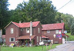
In 1832, John Barbour built a sawmill on Loyalsock Creek near the mouth of Plunketts Creek, and the village of Barbours Mills (today Barbours) developed at the site. In the 19th century, Barbours had several blacksmiths, a temperance hotel, a post office, many sawmills, a school, store and wagon maker. In 1840, a road was built north from Barbours along Plunketts Creek, crossing it several times. This is the earliest possible date for construction of the bridge, but the surviving county road docket on the construction does not mention either bridges or fords for crossing the creek.

A 1916 map showing Plunketts Creek and the four bridges over it between the villages of Barbours and Proctor 1916 Plunketts Creek Map.png
A 1916 map showing Plunketts Creek and the four bridges over it between the villages of Barbours and Proctor

The bridge is at the mouth of Coal Mine Hollow, [6] and the road it was on was used by the lumber and coal industries, which were active in Plunketts Creek Township during the 19th century and early 20th century. [7] Creeks in the township supplied water power to 14 mills in 1861, and in 1876 there were 19 sawmills, a shingle mill, a woolen factory, and a tannery there. [7] [8] These industries supported the inhabitants of two villages in Plunketts Creek Township by the latter half of the 19th century.

In 1868 the village of Proctorville was built as a company town for Thomas E. Proctor's tannery. [7] [9] Proctor, as it is now known, is 1.66 miles (2.67 km) north of Barbours along Plunketts Creek. [10] The bark from Eastern hemlock trees was used in the tanning process, and the village originally sat in the midst of vast forests of hemlock. [7] The tannery employed "several hundred" at wages between 50 cents and US$1.75 a day. These employees lived in 120 company houses, which each rented for $2 a month. [4] [9] [11] In 1892, Proctor had a barbershop, two blacksmiths, cigar stand, I.O.O.F hall, leather shop, news stand, a post office (established in 1885), a two-room school, two stores, and a wagon shop. [4] [9]

Hemlock bark, used in the tanning process, was hauled to the tannery from up to 8 miles (13 km) away in both summer and winter, using wagons and sleds. The hides which were tanned to make leather came from the United States and as far away as Mexico, Argentina, and China. [12] Finished sole leather was hauled by horse-drawn wagon south about 8 miles (13 km) to Little Bear Creek, where it was exchanged for "green" hides and other supplies brought north from Montoursville. [9] The lumber boom on Plunketts Creek ended when the virgin timber ran out. By 1898, the old-growth hemlock was exhausted and the Proctor tannery, then owned by the Elk Tanning Company, was closed and dismantled. [11]

20th century

Without timber and the tannery, the populations of Proctor and Barbours declined. The Barbours post office closed in the 1930s, and the Proctor post office closed on July 1, 1953. Both villages also lost their schools and almost all of their businesses. [11] [13] Proctor celebrated its centennial in 1968, and a 1970 newspaper article on its 39th annual "Proctor Homecoming" reunion called it a "near-deserted old tannery town". [11] [12] In the 1980s, the last store in Barbours closed, and the former hotel (which had become a hunting club) was torn down to make way for a new bridge across Loyalsock Creek. [8]

Plunketts Creek Township has been a place for both lumber and tourism since its villages were founded, and as industry declined, nature recovered. [8] Second-growth forests have since covered most of the clear-cut land. Pennsylvania's state legislature authorized the acquisition of abandoned and clear-cut land for Pennsylvania State Game Lands in 1919, and the Pennsylvania Game Commission (PGC) acquired property along Plunketts Creek for State Game Lands Number 134 between 1937 and 1945. [7] [14] The main entrance to State Game Lands 134 is just north of the bridge site, on the east side of the creek. [7] [15]

The PGC established the Northcentral State Game Farm in 1945 on part of State Game Lands 134 to raise wild turkey. The farm was converted to ringneck pheasant production in 1981, and, as of 2007, it was one of four Pennsylvania state game farms producing about 200,000 pheasants each year for release on land open to public hunting. [16] The Northcentral State Game Farm is chiefly in the Plunketts Creek valley, just south of Proctor and north of the bridge. [7] [15] The opening weekend of the trout season brings more people into the village of Barbours at the mouth of Plunketts Creek than any other time of the year. [8]

The Bridge in Plunketts Creek Township was added to the National Register of Historic Places in 1988, but delisted in 2002, after being washed out by a flood in 1996. [17]

Geography

Plunketts Creek cutting through Camp Mountain in the village of Proctor: the creek's ecosystem has recovered since it was a tannery's waste disposal system, from 1868 to 1898. Big Plunketts Creek Winter Panorama crop.jpg
Plunketts Creek cutting through Camp Mountain in the village of Proctor: the creek's ecosystem has recovered since it was a tannery's waste disposal system, from 1868 to 1898.

Plunketts Creek Township is on the eastern edge of Lycoming County. It is bordered by Sullivan County to the northeast, Shrewsbury Township to the southeast, Wolf, Mill Creek and Upper Fairfield townships to the south, Eldred Township to the southwest, Gamble Township to the west, and Cascade Township to the northwest. Pennsylvania Route 87 crosses the center of the township, following Loyalsock Creek and passing through the village of Barbours. PA-87 leads northeastward 15 miles (24 km) to Forksville and southwestward the same distance to Montoursville in the valley of the West Branch Susquehanna River.

According to the United States Census Bureau, the township has a total area of 54.1 square miles (140.1 km2), of which 53.6 square miles (138.7 km2) are land and 0.66 square miles (1.7 km2), or 0.97%, are water. [1] All of the township is in the watershed of Loyalsock Creek except for the southeastern corner, where a small area drains to tributaries of Muncy Creek, like Loyalsock Creek a tributary of the West Branch Susquehanna. Allegheny Ridge, with summit elevations from 1,665 to 2,100 feet (507 to 640 m), runs from west to east just north of the southern border of the township.

Demographics

Historical population
CensusPop.Note
2010 684
2020 595−13.0%
2021 (est.)591 [2] −0.7%
U.S. Decennial Census [18]

As of the census [19] of 2000, there were 771 people, 322 households, and 226 families residing in the township. The population density was 14.0 people per square mile (5.4/km2). There were 501 housing units at an average density of 9.1/sq mi (3.5/km2). The racial makeup of the township was 98.44% White, 0.52% African American, 0.91% Native American, and 0.13% from two or more races. Hispanic or Latino of any race were 0.26% of the population.

There were 322 households, out of which 27.6% had children under the age of 18 living with them, 62.1% were married couples living together, 4.7% had a female householder with no husband present, and 29.8% were non-families. 23.6% of all households were made up of individuals, and 12.4% had someone living alone who was 65 years of age or older. The average household size was 2.39 and the average family size was 2.84.

In the township the population was spread out, with 21.4% under the age of 18, 5.4% from 18 to 24, 29.2% from 25 to 44, 25.4% from 45 to 64, and 18.5% who were 65 years of age or older. The median age was 42 years. For every 100 females, there were 97.2 males. For every 100 females age 18 and over, there were 100.7 males.

The median income for a household in the township was $40,481, and the median income for a family was $43,542. Males had a median income of $31,125 versus $22,014 for females. The per capita income for the township was $20,563. About 4.7% of families and 6.5% of the population were below the poverty line, including 11.6% of those under age 18 and 1.9% of those age 65 or over.

Related Research Articles

<span class="mw-page-title-main">Lycoming County, Pennsylvania</span> County in Pennsylvania, United States

Lycoming County is a county in the Commonwealth of Pennsylvania. As of the 2020 census, the population was 114,188. Its county seat is Williamsport.

<span class="mw-page-title-main">Armstrong Township, Lycoming County, Pennsylvania</span> Township in Pennsylvania, United States

Armstrong Township is a township in Lycoming County, Pennsylvania, United States. The population was 685 at the 2020 census. It is part of the Williamsport, Pennsylvania Metropolitan Statistical Area.

<span class="mw-page-title-main">Brown Township, Lycoming County, Pennsylvania</span> Township in Pennsylvania, United States

Brown Township is a township in Lycoming County, Pennsylvania, United States. The population was 92 at the 2020 census. It is part of the Williamsport, Pennsylvania Metropolitan Statistical Area.

<span class="mw-page-title-main">Cascade Township, Lycoming County, Pennsylvania</span> Township in Pennsylvania, United States

Cascade Township is a township in Lycoming County, Pennsylvania, United States. The population was 420 at the 2020 census. It is part of the Williamsport, Pennsylvania Metropolitan Statistical Area.

<span class="mw-page-title-main">Cogan House Township, Lycoming County, Pennsylvania</span> Township in Pennsylvania, United States

Cogan House Township is a township in Lycoming County, Pennsylvania, United States. The population was 930 at the 2020 census. It is part of the Williamsport, Pennsylvania Metropolitan Statistical Area.

<span class="mw-page-title-main">Cummings Township, Lycoming County, Pennsylvania</span> Township in Pennsylvania, United States

Cummings Township is a township in Lycoming County, Pennsylvania, United States. The population was 264 at the 2020 census, down from 273 in 2010. It is part of the Williamsport, Pennsylvania Metropolitan Statistical Area. Cummings Township is home to Little Pine State Park and Upper Pine Bottom State Park.

<span class="mw-page-title-main">Eldred Township, Lycoming County, Pennsylvania</span> Township in Pennsylvania, United States

Eldred Township is a township in Lycoming County, Pennsylvania, United States. The population was 1,996 at the 2020 census. It is part of the Williamsport Metropolitan Statistical Area. The unincorporated village of Warrensville is located in Eldred Township.

<span class="mw-page-title-main">Gamble Township, Lycoming County, Pennsylvania</span> Township in Pennsylvania, United States

Gamble Township is a township in Lycoming County, Pennsylvania, United States. The population was 780 at the 2020 census, up from 756 in 2010. It is part of the Williamsport Metropolitan Statistical Area.

<span class="mw-page-title-main">Hepburn Township, Lycoming County, Pennsylvania</span> Township in Pennsylvania, United States

Hepburn Township is a township in Lycoming County, Pennsylvania, United States. The population was 2,579 at the 2020 census. It is part of the Williamsport Metropolitan Statistical Area.

<span class="mw-page-title-main">Loyalsock Township, Lycoming County, Pennsylvania</span> Township in Pennsylvania, United States

Loyalsock Township is a township in Lycoming County, Pennsylvania, United States. The population was 11,561 at the 2020 census. It is part of the Williamsport Metropolitan Statistical Area. It is the second largest municipality in Lycoming County, in terms of population, behind the county seat, Williamsport.

<span class="mw-page-title-main">Upper Fairfield Township, Pennsylvania</span> Township in Pennsylvania, United States

Upper Fairfield Township is a township in Lycoming County, Pennsylvania, United States. The population was 1,807 at the 2020 census. It is part of the Williamsport Metropolitan Statistical Area.

<span class="mw-page-title-main">Washington Township, Lycoming County, Pennsylvania</span> Township in Pennsylvania, United States

Washington Township is a township in Lycoming County, Pennsylvania, United States. The population was 1,769 at the 2020 census. It is part of the Williamsport Metropolitan Statistical Area.

<span class="mw-page-title-main">Worlds End State Park</span> Park in Sullivan County, Pennsylvania

Worlds End State Park is a 780-acre (316 ha) Pennsylvania state park in Sullivan County, Pennsylvania. The park, nearly surrounded by Loyalsock State Forest, is in the Loyalsock Creek valley on Pennsylvania Route 154 in Forks and Shrewsbury Townships southeast of the borough of Forksville. The name Worlds End has been used since at least 1872, but its origins are uncertain. Although it was founded as Worlds End State Forest Park by Governor Gifford Pinchot in 1932, the park was officially known as Whirls End State Forest Park from 1936 to 1943.

<span class="mw-page-title-main">Larrys Creek</span> Tributary of the West Branch Susquehanna River

Larrys Creek is a 22.9-mile-long (36.9 km) tributary of the West Branch Susquehanna River in Lycoming County in the U.S. state of Pennsylvania. A part of the Chesapeake Bay drainage basin, its watershed drains 89.1 square miles (231 km2) in six townships and a borough. The creek flows south from the dissected Allegheny Plateau to the Ridge-and-valley Appalachians through sandstone, limestone, and shale from the Devonian, Mississippian, and Pennsylvanian periods.

<span class="mw-page-title-main">Loyalsock Creek</span> River in Pennsylvania, United States

Loyalsock Creek is a 64-mile-long (103 km) tributary of the West Branch Susquehanna River located chiefly in Sullivan and Lycoming counties in Pennsylvania in the United States. As the crow flies, Lycoming County is about 130 miles (209 km) northwest of Philadelphia and 165 miles (266 km) east-northeast of Pittsburgh.

<span class="mw-page-title-main">Plunketts Creek (Loyalsock Creek tributary)</span> River in the US state of Pennsylvania

Plunketts Creek is an approximately 6.2-mile-long (10 km) tributary of Loyalsock Creek in Lycoming and Sullivan counties in the U.S. state of Pennsylvania. Two unincorporated villages and a hamlet are on the creek, and its watershed drains 23.6 square miles (61 km2) in parts of five townships. The creek is a part of the Chesapeake Bay drainage basin via Loyalsock Creek and the West Branch Susquehanna and Susquehanna Rivers.

The Williamsport and North Branch Railroad was a short line that operated in north-central Pennsylvania between 1872 and 1937. After a long struggle to finance its construction, it was completed in 1893. It derived most of its freight revenue from logging and to a certain extent from anthracite coal traffic. It also carried many passengers to mountain resorts in Sullivan County, Pennsylvania. With the decline of the logging industry and increased accessibility of the region by automobile in the 1910s and 1920s, the railroad's business rapidly declined. The economic blow of the Great Depression proved insurmountable, and it was abandoned as unprofitable in 1937.

<span class="mw-page-title-main">Plunketts Creek Bridge No. 3</span> Bridge over Plunketts Creek in Pennsylvania

Plunketts Creek Bridge No. 3 was a rubble masonry stone arch bridge over Plunketts Creek in Plunketts Creek Township, Lycoming County in the U.S. state of Pennsylvania. It was built between 1840 and 1875, probably closer to 1840, when the road along the creek between the unincorporated villages of Barbours and Proctor was constructed. Going upstream from the mouth, the bridge was the third to cross the creek, hence its name.

References

The confluence of Plunketts Creek (foreground) with the much larger Loyalsock Creek in the village of Barbours. Plunketts Creek Mouth.JPG
The confluence of Plunketts Creek (foreground) with the much larger Loyalsock Creek in the village of Barbours.
  1. 1 2 "2016 U.S. Gazetteer Files". United States Census Bureau. Retrieved Aug 14, 2017.
  2. 1 2 3 4 Bureau, US Census. "City and Town Population Totals: 2020-2021". Census.gov. US Census Bureau. Retrieved 15 July 2022.
  3. "US Board on Geographic Names". United States Geological Survey. 2007-10-25. Retrieved 2008-01-31.
  4. 1 2 3 4 Meginness, John Franklin (1892). "Plunkett's Creek, Lewis, Cascade, and Gamble". History of Lycoming County, Pennsylvania: including its aboriginal history; the colonial and revolutionary periods; early settlement and subsequent growth; organization and civil administration; the legal and medical professions; internal improvement; past and present history of Williamsport; manufacturing and lumber interests; religious, educational, and social development; geology and agriculture; military record; sketches of boroughs, townships, and villages; portraits and biographies of pioneers and representative citizens, etc. etc (1st ed.). Chicago: Brown, Runk & Co. ISBN   0-7884-0428-8 . Retrieved 2007-04-10. (Note: ISBN refers to Heritage Books July 1996 reprint. URL is to a scan of the 1892 version with some OCR typos).
  5. "Historical Overview of Militia Toryism in New England and New York: "Right to Keep and Bear Arms"". RightsOfThePeople.com. Retrieved August 7, 2007.[ dead link ]
  6. United States Geological Survey. "USGS Barbours (PA) Topo Map". The National Map . MSR Maps . Retrieved 2008-06-07.
  7. 1 2 3 4 5 6 7 Scherkoske, Deborah A. (August 1996). "Plunkett's Creek Bridge No. 3, Spanning Plunkett's Creek at State Route 1005, Barbours vicinity, Lycoming County, PA" (PDF). Historic American Engineering Record and Library of Congress. Archived from the original (PDF) on 25 February 2009. Retrieved 24 November 2008. Metadata here Archived 2012-12-13 at archive.today . For a summary, see page 4 of the PDF.
  8. 1 2 3 4 Barr, James P (January 12, 1997). "Sock Country casts Spell on Residents of Tiny Barbours". Williamsport Sun-Gazette . pp. B9–10.
  9. 1 2 3 4 "Proctorville - Historic Village". Now and Then (The Journal of the Muncy, Pennsylvania Historical Society). XV (5): 277. October 1966.The article has a note that it was written in 1959, but the author's name was lost prior to publication in 1966.
  10. Pennsylvania Gazetteer of Streams (PDF). Pennsylvania Department of Environmental Protection. September 2005. Archived from the original (PDF) on 2008-06-25. Retrieved December 19, 2008.
  11. 1 2 3 4 "History Recalled as Proctor Plans to Celebrate Centennial". Williamsport Sun-Gazette . August 18, 1968. p. 11.
  12. 1 2 "Near-Deserted Old Tannery Town Schedules 39th Annual Homecoming". Grit (Williamsport Edition). August 9, 1970. p. 20.
  13. Pollom, Leon J (August 18, 1994). "Community Profile: Is there a Better Place in God's Country than the Village of Barbours?". Williamsport Sun-Gazette . p. 11.
  14. Pennsylvania Game Commission (January 24, 2007). "2007 Press Release: Release #012-07: Board Approves Acquisition of Nearly 160 Acres". Archived from the original on July 24, 2007. Retrieved December 3, 2008.
  15. 1 2 State Game Lands 134, Lycoming and Sullivan Counties (PDF) (Map). Pennsylvania Game Commission. July 1993. Archived from the original (PDF) on 2006-04-03. Retrieved December 3, 2008.
  16. "Pheasant Program - A guide to pheasant releases and more". Pennsylvania Game Commission. Archived from the original on June 3, 2008. Retrieved December 3, 2008.
  17. "National Register Information System". National Register of Historic Places . National Park Service. July 9, 2010.
  18. "Census of Population and Housing". Census.gov. Retrieved June 4, 2016.
  19. "U.S. Census website". United States Census Bureau . Retrieved 2008-01-31.