Related Research Articles

The Klickitat River is a tributary of the Columbia River, nearly 96 miles (154 km) long, in south-central Washington in the United States. It drains a rugged plateau area on the eastern side of the Cascade Range northeast of Portland, Oregon. In 1986, 10 miles (16 km) of the river were designated Wild and Scenic from the confluence with Wheeler Creek, near the town of Pitt, to the confluence with the Columbia River.

The Squamish River is a short but very large river in the Canadian province of British Columbia. Its drainage basin is 3,328 square kilometres (1,285 sq mi) in size. The total length of the Squamish River is approximately 80 kilometres (50 mi).
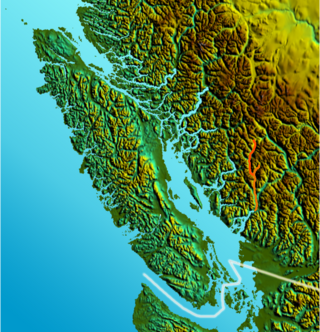
The Elaho River is a c.70 km long river beginning in the Coast Mountains northwest of the towns of Whistler and Pemberton, British Columbia. It is a tributary of the Squamish River and is known for its whitewater rafting and kayaking as well as for the intense alpine scenery lining its route.
The Mamquam River is a c.35 km tributary of the Squamish River.

The Kettle River is a 281-kilometre (175 mi) tributary of the Columbia River, encompassing a 10,877-square-kilometre (4,200 sq mi) drainage basin, of which 8,228 square kilometres (3,177 sq mi) are in southern British Columbia, Canada and 2,649 square kilometres (1,023 sq mi) in northeastern Washington, US.
The Coweeman River is a tributary of the Cowlitz River, in the South West corner of the U.S. state of Washington. Its name comes from the Cowlitz word ko-wee-na, meaning "short one", referring to a short Indian who once lived along the river.

The Yoho River is a silty, swift tributary of the Kicking Horse River in the Canadian province of British Columbia. The river is entirely within Yoho National Park.
The Thompson River is a tributary of the Clark Fork in the U.S. state of Montana. It is part of the Columbia River basin, as Clark Fork is a tributary of the Pend Oreille River, which is a tributary of the Columbia River.
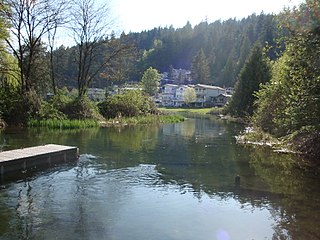
The Sweltzer River is a river in British Columbia, Canada, that drains the waters of Cultus Lake into the Chilliwack River. It is about 3 kilometres (2 mi) long, and much of it runs through Soowahlie Indian Reserve No. 14, which is under the administration of the Soowahlie Indian Band.
Ashlu Creek is a short and swift river-like creek in British Columbia. It is a tributary of the Squamish River and enters it about 24.3 km northwest of Squamish.
The Rainy River is a short river that enters the Thornbrough Channel at Port Mellon, British Columbia, Canada. While it does come close to doing so, it never enters Tetrahedron Provincial Park.
The Stawamus River is a small, creek-like river in British Columbia. It enters the Howe Sound east of the mouth of the Squamish River.
Clendinning Creek is a river in British Columbia. It is the largest tributary of the Elaho River. It is located entirely within Clendinning Provincial Park.
The Clowhom River is a short, 19.8-kilometre (12.3 mi) river in British Columbia. It flows into the head of the Salmon Inlet about 26.2 km west of Squamish.
The Tzoonie River is a remote, short river that enters the head of the Narrows Inlet about 36.6 km north of Sechelt, British Columbia.
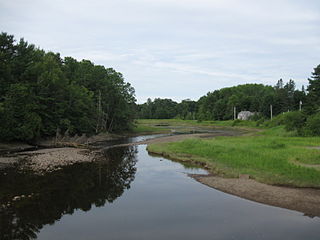
The Pennamaquan River is a short, 8.1-mile (13 km) river in the U.S. state of Maine, draining from medium-sized, low-elevation Pennamaquan Lake into Cobscook Bay.
The Templeton River is a 21-kilometre (13 mi) long river in British Columbia. It is a tributary of the Columbia River, entering the Columbia via the Columbia Wetlands, upstream from the mouth of the Spillimacheen River.

The Emerald River is a short river in British Columbia. It is about 6.5 kilometres (4.0 mi) long and drains the waters of Emerald Lake to the Kicking Horse River. The river exits the lake's south end and flows in a southern direction for about 6.5 kilometres (4.0 mi) to its mouth, which is at almost exactly the same place as the mouth of the Amiskwi River. It picks up three named tributaries; Hamilton Creek, Russell Creek and Kendel Creek.
The Amiskwi River is a stream of about 31.5 kilometres (19.6 mi) in length in British Columbia, Canada. It is a tributary of the Kicking Horse River. The name Amiskwi is a Cree word for Beavertail.
The Kiwetinok River is a short river in British Columbia. It is the largest tributary of the Amiskwi River.
References
- ↑ Source elevation derived from Google Earth search using GNIS source coordinates.
- ↑ Mouth elevation derived from Google Earth search using GNIS source coordinates.
- ↑ "Kiwetinok Lake". BC Geographical Names .
- ↑ "Little Yoho River". BC Geographical Names .