Loos-en-Gohelle | |
---|---|
Coordinates: 50°27′30″N2°47′39″E / 50.4583°N 2.7942°E | |
Country | France |
Region | Hauts-de-France |
Department | Pas-de-Calais |
Arrondissement | Lens |
Canton | Wingles |
Intercommunality | CA Lens-Liévin |
Government | |
• Mayor (2023–2026) | Geoffrey Mathon [1] |
Area 1 | 12.7 km2 (4.9 sq mi) |
Population (2021) [2] | 6,896 |
• Density | 540/km2 (1,400/sq mi) |
Time zone | UTC+01:00 (CET) |
• Summer (DST) | UTC+02:00 (CEST) |
INSEE/Postal code | 62528 /62750 |
Elevation | 31–74 m (102–243 ft) (avg. 44 m or 144 ft) |
1 French Land Register data, which excludes lakes, ponds, glaciers > 1 km2 (0.386 sq mi or 247 acres) and river estuaries. |
Loos-en-Gohelle is a commune in the Pas-de-Calais department in the Hauts-de-France region of France. [3]
A former coal mining town, three miles northwest of the centre of Lens, at the junction of the D943 and the A21 autoroute. Its nearest neighbours are Lens to the south, Grenay to the west, Hulluch to the northeast and Bénifontaine to the east. The two largest (184 m & 182 m) spoil heaps in Europe are found here.
The name has changed considerably over the years: Lothae, Lo, Lohes, Loes, Loez and Loos. It was not until 1791 that the name of "Loos" was officially sanctioned. According to some[ who? ], the name comes from the Germanic "Lôh" and Dutch "Loo" which mean "wood", but there is no archaeological evidence of what could have been a forest. According to others, the name derives from the Germanic "Laupo" which means marshy meadows, which, given the topography of the town, tends to support this theory. In 1937, after much confusion with Loos-lez-Lille (today Loos), it was decided to add the region's name (Gohelle) to that of the commune.
The place was first documented in 1071, as "Lohes". The oldest documents that specify the existence of Loos date from the eleventh century, at the time of construction of the abbey of Anchin. But with the foundation of a church dedicated to Saint Vaast, it suggests that the village existed long before (St. Vaast lived in the 6th century).
By the Middle Ages, Loos-en-Gohelle was a large village whose inhabitants lived mainly by farming: in 1569, 350 inhabitants, in 1759, 600 people ; In 1824, 700 inhabitants and in 1850 around 800 people.
Around 1850 the town started to become prosperous; farmers could fertilize previously uncultivated land, thanks to technology provided by Guislain Decrombecque and the discovery of coal resulted in a very rapid increase of population.
Coal was mined here by the Compagnie des mines de Béthune from 1855 until 1946, and by its nationalized successor until 1986. The very rural village changed into a town, with many foreign workers, especially from Poland, swelling the workforce. A former mining site (Écopole) has been preserved and now hosts many cultural, economic and environmental activities which are the symbol of new developments for the commune. Écopole 11/19 comprises buildings dating from 1923 and a modern concrete winding tower (height 66m) which operated from 1960 to 1986.
During World War I the town was completely destroyed, particularly during the Battle of Loos, from 25 September - 8 October 1915. Many monuments and cemeteries reflect the destruction. A major battle was fought by the Canadian Expeditionary Force at Hill 70 between 15–25 August 1917, resulting in the capture of that landscape feature dominating nearby Lens. Six Victoria Crosses were awarded for valour during that battle; a war memorial was officially unveiled there on 8 April 2017. At the end of the war, not a single building or tree had survived the pounding of artillery. Reminders of the war persist with the periodic discovery of unexploded ordnance.
The mining infrastructure, industry and transport were hit again during World War II.
In recent years, Loos has experienced another kind of destruction: As the population left the mining towns seeking work elsewhere, about 1000 homes have been demolished in the recent past.
The landscape is still marked by enormous coal spoil heaps, those of pits 11 and 19, visible for miles around. They are part of the mines of the Nord-Pas de Calais region that have become the 38th French site on the list of UNESCO World Heritage Sites as "a living and changing landscape". [4]
Several times in its history Loos came close to being removed from the map of France. Instead it has been reborn 5 times, and is still undergoing transformation. As of 2008, Loos-en-Gohelle was a town whose economy was dominated by light industry, textiles and workshops for artisans and professionals, but it also still retained a strong rural connection with thirty farms within the commune.
Year | Pop. | ±% p.a. |
---|---|---|
1968 | 7,733 | — |
1975 | 6,958 | −1.50% |
1982 | 6,706 | −0.53% |
1990 | 6,561 | −0.27% |
1999 | 6,992 | +0.71% |
2007 | 6,816 | −0.32% |
2012 | 6,647 | −0.50% |
2017 | 6,751 | +0.31% |
Source: INSEE [5] |
The Pas-de-Calais is a department in northern France named after the French designation of the Strait of Dover, which it borders. It has the most communes of all the departments of France, with 890, and is the 8th most populous. It had a population of 1,465,278 in 2019. The Calais Passage connects to the Port of Calais on the English Channel. The Pas-de-Calais borders the departments of Nord and Somme and is connected to the English county of Kent via the Channel Tunnel.
Lens is a city in the Pas-de-Calais department in northern France. It is one of the main towns of Hauts-de-France along with Lille, Valenciennes, Amiens, Roubaix, Tourcoing, Arras and Douai. The inhabitants are called Lensois.
Liévin is a commune in the Pas-de-Calais department in northern France. The inhabitants are called Liévinois in French.
Billy-Montigny is a commune in the Pas-de-Calais department in the Hauts-de-France region in northern France.
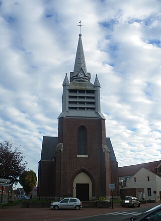
Carvin is a commune in the Pas-de-Calais department in the Hauts-de-France region of France.
Courrières is a commune in the Pas-de-Calais department in the Hauts-de-France region of France.
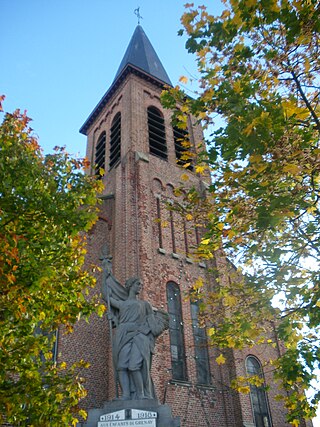
Givenchy-en-Gohelle is a commune in the Pas-de-Calais department in the Hauts-de-France region of France. The village was destroyed during World War I but was rebuilt after the war.
Sains-en-Gohelle is a commune in the Pas-de-Calais department in the Hauts-de-France region of France.
Sallaumines is a commune in the Pas-de-Calais department of northern France.
Souchez is a commune in the Pas-de-Calais department in the Hauts-de-France region of France. It is located 3.2 kilometres (2.0 mi) northwest of the Canadian National Vimy Memorial dedicated to the Battle of Vimy Ridge and the missing First World War Canadian soldiers with no known grave; the Memorial is also the site of two Canadian cemeteries.
Bully-les-Mines is a commune in the Pas-de-Calais département in northern France. It forms part of the Lens-Liévin agglomeration community, which encompasses 36 French communes and 250,000 inhabitants. For many years it was a major coal mining center.
Avion is a commune in the Pas-de-Calais department in the Hauts-de-France region of France.
Neuville-Saint-Vaast is a commune in the Pas-de-Calais department in the Hauts-de-France region of France. It is located 3.2 kilometres (2.0 mi) south of the Canadian National Vimy Memorial dedicated to the Battle of Vimy Ridge. The Memorial was built on Hill 145, the highest point of the ridge to commemorate the battle and the Canadian soldiers who lost their lives during the First World War. The Memorial is also the site of the Canadian Cemetery No. 2, Neuville-St.-Vaast and Givenchy Road Canadian Cemetery, Neuville-St.-Vaast.
Hulluch is a commune in the Pas-de-Calais department in the Hauts-de-France region of France.
Grenay is a commune in the Pas-de-Calais department in the Hauts-de-France region of France. It is part of the arrondissement of Lens, the canton of Wingles and the Communaupole de Lens-Liévin. Its population was 6,799 in 2019. The current mayor is Christelle Buissette, elected in 2023.
Mazingarbe is a commune in the Pas-de-Calais department in the Hauts-de-France region of France.
Nœux-les-Mines is a commune in the Pas-de-Calais department in the Hauts-de-France region of France.
Rivière is a commune in the Pas-de-Calais department in the Hauts-de-France region of France.
Thélus is a commune in the Pas-de-Calais department in the Hauts-de-France region of France. It is located four kilometres (2.5 mi) southeast of the Canadian National Vimy Memorial dedicated to the Battle of Vimy Ridge and the missing First World War Canadian soldiers with no known grave; the Memorial is also the site of two Canadian cemeteries.
Vermelles is a commune in the Pas-de-Calais department in the Hauts-de-France region of France.