
The Dharug National Park is a protected national park that is located in the Central Coast region of New South Wales, in eastern Australia. The 14,850-hectare (36,700-acre) national park is situated approximately 81 kilometres (50 mi) north of the Sydney and 25 kilometres (16 mi) west of Gosford.
Greenwich is a suburb on the Lower North Shore of Sydney, New South Wales, Australia. Greenwich is located 7 kilometres (4 mi) north-west of the Sydney central business district, in the local government area of the Municipality of Lane Cove.

The Hawkesbury River, or Hawkesbury-Nepean River a river located northwest of Sydney, New South Wales, Australia. The Hawkesbury River and its associated main tributary, the Nepean River, almost encircle the metropolitan region of Sydney. The river between Wisemans Ferry and the Pacific Ocean marks the boundary of Greater Metropolitan Sydney in the south and the Central Coast region to the north.

The Colo River, a perennial stream that is part of the Hawkesbury-Nepean catchment, is located in the Central Tablelands of New South Wales, Australia.

St Albans is a small and historic village on the Macdonald River, New South Wales, Australia, about 94 kilometres (65 mi) north west of Sydney. At the 2011 census, St Albans and the surrounding area had a population of 305 people.

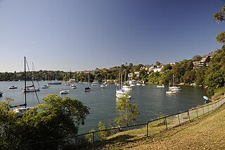
Brooklyn is a suburb and the northern most town on the Pacific Highway in Sydney, New South Wales, Australia. Brooklyn is located on the northern outskirts of Sydney and is located in the local government area of the Hornsby Shire with a population of 737 as of the 2021 census. Brooklyn is surrounded by the Muogamarra Nature Reserve and occupies a strip of waterfront along the southern bank of the Hawkesbury River.

The City of Hawkesbury is a local government area of New South Wales, Australia, located on the northern and north-western fringe of the Greater Sydney area, about 50 kilometres (31 mi) north-west of the Sydney central business district. Hawkesbury City is named after the Hawkesbury River. Major suburbs in the City of Hawkesbury are Windsor, Richmond and Pitt Town. It is a member council of the Hawkesbury River County Council.

The Hills District is a region of Sydney, within the northern part of the Greater Western Sydney region of Sydney, in the state of New South Wales, Australia.

Lavender Bay is a harbourside suburb on the lower North Shore of Sydney, New South Wales, Australia. Lavender Bay is located three kilometres north of the Sydney central business district, in the local government area of North Sydney Council.
Canoelands is a suburb of northern Sydney, in the state of New South Wales, Australia. Canoelands is 60 kilometres north of the Sydney central business district, in the local government area of Hornsby Shire and The Hills Shire.

North Richmond is a town in the state of New South Wales, Australia. North Richmond is located 67 kilometres (42 mi) north-west of the Sydney in the local government area of the City of Hawkesbury. It is separated from the town of Richmond to its south-east by pasture land and the Hawkesbury River. North Richmond is not part of Sydney metropolitan area, however it is considered part of the Greater Sydney region.

Sackville North is a suburb of Sydney, in the state of New South Wales, Australia 80 kilometres north-west of the Sydney central business district in the local government area of The Hills Shire.

Cattai is an historic suburb of Sydney, in the state of New South Wales, Australia. It is located 44 kilometres north-west of the Sydney central business district and 30 kilometres north-west of Parramatta. It is in the local government areas of The Hills Shire and City of Hawkesbury. Cattai's state electoral district is Hawkesbury, and its federal electoral divisions are Berowra and Macquarie.

Wisemans Ferry is a town on the northern outskirts of Sydney and the south-west of the Central Coast region in the state of New South Wales, Australia, located 75 kilometres north north-west of Sydney. It is located in the Sydney local government areas of the Hornsby Shire, The Hills Shire, City of Hawkesbury and the Central Coast Council. The town is a tourist spot with picnic and barbecue facilities. As well as a rich convict and colonial heritage in the area, the Dharug National Park and Yengo National Park are close by.

Kurrajong is a small town in New South Wales, Australia. Kurrajong is located 75 kilometres (47 mi) north-west of Sydney, in the local government area of the City of Hawkesbury.

Mooney Mooney is a small waterfront village and suburb of the Central Coast region of New South Wales, Australia. It is located in the Central Coast Council local government area at the end of a peninsula extending southwards into the Hawkesbury River, that is situated 50 kilometres (31 mi) north of Sydney. Mooney Mooney has two islands which are Peat Island and Spectacle Island.

Sackville (Doorumbolooa) is a suburb of Sydney, in the state of New South Wales, Australia. It is located in the City of Hawkesbury and at the 2021 census had a population of 230, 22 of whom identified as Aboriginal and Torres Strait Islander (9.6%). Sackville is situated on the Hawkesbury River, and is the site of the Sackville Ferry, a car ferry that crosses the river to North Sackville. The suburb is home to five National Heritage Listed sites: Three residences, St Thomas' Anglican Church and the Sackville Cemetery, which dates back to 1828.

Gunderman is a locality of the Central Coast region of New South Wales, Australia, located on the north bank of the Hawkesbury River between the towns of Wisemans Ferry and Spencer. It is located within the Central Coast Council local government area. It adjoins the Dharug National Park. At the 2021 census, Gunderman had a population of 189 people.

Bilpin is a small town on the historic Bells Line of Road in the City of Hawkesbury local government area in the Blue Mountains, west of Sydney, New South Wales.

The Sackville Ferry is a cable ferry across the Hawkesbury River in New South Wales, Australia. The vehicular ferry connects the communities of Sackville, on the north/west bank of the river, and Sackville North, on the south/east bank. Because of the tortuous course of the river, the ferry actually runs north-west from Sackville to Sackville North.

