Lumber City, Georgia

Last updated

Lumber City, Georgia
Telfair County Georgia Incorporated and Unincorporated areas Lumber City Highlighted.svg
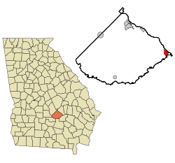
Location in Telfair County and the state of Georgia
Coordinates: 31°55′48″N82°41′1″W / 31.93000°N 82.68361°W / 31.93000; -82.68361
Country United States
State Georgia
County Telfair
Area
[1]
  Total
1.94 sq mi (5.02 km2)
  Land1.93 sq mi (4.99 km2)
  Water0.01 sq mi (0.03 km2)
Elevation
138 ft (42 m)
Population
 (2020)
  Total
967
  Density502.08/sq mi (193.90/km2)
Time zone UTC-5 (Eastern (EST))
  Summer (DST) UTC-4 (EDT)
ZIP code
31549
Area code 912
FIPS code 13-47952 [2]
GNIS feature ID0356372 [3]

Lumber City is a city located in Telfair County, Georgia, United States. As of the 2020 census, the city had a total population of 967.

Contents

History

The Georgia General Assembly incorporated Lumber City as a town in 1889. [4] The community was named for a sawmill near the original town site. [5]

Geography

Lumber City is located at 31°55'48" North, 82°41'1" West (31.930033, -82.683723). [6]

U.S. Route 23/341 is the main route through the city, and leads northwest 17 mi (27 km) to McRae-Helena, the Telfair County seat, and southeast 7 mi (11 km) to Hazlehurst. Other highways that run through the city include Georgia State Routes 19 and 117.

According to the United States Census Bureau, the city has a total area of 1.9 square miles (5.0 km2), all land.

It is located at the confluence of the Ocmulgee and Oconee rivers, which combine to form the Altamaha River.

Demographics

Historical population
CensusPop.Note
1890 471
1900 76061.4%
1910 1,19557.2%
1920 978−18.2%
1930 1,0436.6%
1940 1,0440.1%
1950 1,23218.0%
1960 1,36010.4%
1970 1,3771.3%
1980 1,4263.6%
1990 1,4290.2%
2000 1,247−12.7%
2010 1,3286.5%
2020 967−27.2%
U.S. Decennial Census [7]
1850-1870 [8] 1870-1880 [9]
1890-1910 [10] 1920-1930 [11]
1940 [12] 1950 [13] 1960 [14]
1970 [15] 1980 [16] 1990 [17]
2000 [18] 2010 [19] 2020 [20]

2020 census

Lumber City, Georgia – Racial and ethnic composition
Note: the US Census treats Hispanic/Latino as an ethnic category. This table excludes Latinos from the racial categories and assigns them to a separate category. Hispanics/Latinos may be of any race.
Race / Ethnicity (NH = Non-Hispanic)Pop 2000 [21] Pop 2010 [22] Pop 2020 [20] % 2000% 2010% 2020
White alone (NH)58063241346.51%47.59%42.71%
Black or African American alone (NH)62867750750.36%50.98%52.43%
Native American or Alaska Native alone (NH)1120.08%0.08%0.21%
Asian alone (NH)0010.00%0.00%0.10%
Pacific Islander alone (NH)0000.00%0.00%0.00%
Other race alone (NH)3030.24%0.00%0.31%
Mixed race or Multiracial (NH)24220.16%0.30%2.28%
Hispanic or Latino (any race)3314192.65%1.05%1.96%
Total1,2471,328967100.00%100.00%100.00%

As of the 2020 United States census, there were 967 people, 494 households, and 268 families residing in the city.

Related Research Articles

<span class="mw-page-title-main">Wilcox County, Georgia</span> County in Georgia, United States

Wilcox County is a county located in the south-central portion of the U.S. state of Georgia. As of the 2020 census, the population was 8,766. The county seat is Abbeville.

<span class="mw-page-title-main">Charlton County, Georgia</span> County in Georgia, United States

Charlton County is the southernmost county of the U.S. state of Georgia, located in the southeastern part of the state. As of the 2020 census, the population was 12,518. The county seat is Folkston.

<span class="mw-page-title-main">Newton, Georgia</span> City in Georgia, United States

Newton is a city in Baker County, Georgia, United States. As of the 2020 census, the city population was 602. The city is the county seat of Baker County.

<span class="mw-page-title-main">White Plains, Georgia</span> City in Georgia, United States

White Plains is a city in Greene County, Georgia, United States. The population was 284 at the 2010 census.

<span class="mw-page-title-main">Mountain Park, Gwinnett County, Georgia</span> Place in Georgia, United States

Mountain Park is an unincorporated community and census-designated place (CDP) in Gwinnett County, Georgia, United States. The population was 11,554 at the 2010 census. The older name for the area is Trickum, which is reflected in Five Forks-Trickum Road which bisects the community. The older community was centered on Five Forks and Rockbridge Roads.

<span class="mw-page-title-main">Wrightsville, Georgia</span> City in Georgia, United States

Wrightsville is a city in and the county seat of Johnson County, Georgia, United States. The population was 2,195 at the 2010 census, down from 2,223 at the 2000 census. By 2020, its population grew to 3,449. The city limits include Johnson State Prison on the northeast side of town. Wrightsville is part of the Dublin Micropolitan Statistical Area.

<span class="mw-page-title-main">Oglethorpe, Georgia</span> City in Georgia, United States

Oglethorpe is a city in Macon County, Georgia, United States. The population was 995 at the 2020 census, down from 1,328 in 2010. The city is the county seat of Macon County. It was named for Georgia's founder, James Oglethorpe.

<span class="mw-page-title-main">Hiltonia, Georgia</span> City in Georgia, United States

Hiltonia is a city in Screven County, Georgia, United States. The population was 310 in 2020.

<span class="mw-page-title-main">Oliver, Georgia</span> City in Georgia, United States

Oliver is a city in Screven County, Georgia, United States. The population was 210 as of 2020.

<span class="mw-page-title-main">Richland, Georgia</span> City in Georgia, United States

Richland is a city in Stewart County, Georgia, United States. Per the 2020 census, the population was 1,370.

<span class="mw-page-title-main">De Soto, Georgia</span> City in Georgia, United States

De Soto is a city in Sumter County, Georgia, United States. The population was 214 at the 2000 census. It is part of the Americus micropolitan statistical area.

<span class="mw-page-title-main">Geneva, Georgia</span> Town in Georgia, United States

Geneva is a town in Talbot County, Georgia, United States. The population was 75 at the 2020 census.

<span class="mw-page-title-main">Sharon, Georgia</span> City in Georgia, United States

Sharon is a city in Taliaferro County, Georgia, United States. The population was 104 in 2020.

<span class="mw-page-title-main">Sunnyside, Georgia</span> Place in Georgia, United States

Sunnyside is an unincorporated community and census-designated place (CDP) in Ware County, Georgia, United States. The population was 1,472 in 2020. It is part of the Waycross micropolitan statistical area.

<span class="mw-page-title-main">Norwood, Georgia</span> City in Georgia, United States

Norwood is a city in Warren County, Georgia, United States. The population was 202 in 2020.

<span class="mw-page-title-main">Tennille, Georgia</span> City in Georgia, United States

Tennille is a city in Washington County, Georgia, United States. The population was 1,469 in 2020.

<span class="mw-page-title-main">Alamo, Georgia</span> Town in Georgia, United States

Alamo is a town in Wheeler County, Georgia, United States. As of the 2020 census, the town had a population of 771. The town is the county seat of Wheeler County.

Cedar Springs is an unincorporated community and census-designated place (CDP) in Early County, Georgia, United States. At the time of the 2020 census, the population was 75. Cedar Springs has a post office with ZIP code 39832. Georgia State Route 273 passes through the community. Georgia Pacific is 2 miles southwest from it.

Norristown is an unincorporated community and census-designated place (CDP) in Emanuel County, Georgia, United States. Its population was 54 as of the 2020 census.

Satilla is a unincorporated community and census designated place in Jeff Davis County, Georgia, United States. Its population was 487 as of the 2020 census. U.S. Route 23 passes through the community.

References

  1. "2020 U.S. Gazetteer Files". United States Census Bureau. Retrieved December 18, 2021.
  2. "U.S. Census website". United States Census Bureau . Retrieved January 31, 2008.
  3. "US Board on Geographic Names". United States Geological Survey. October 25, 2007. Retrieved January 31, 2008.
  4. Candler, Allen Daniel; Evans, Clement Anselm (1906). Georgia: Comprising Sketches of Counties, Towns, Events, Institutions, and Persons Arranged in Cyclopedic Form. State historical association. p.  498.
  5. Krakow, Kenneth K. (1975). Georgia Place-Names: Their History and Origins (PDF). Macon, GA: Winship Press. p. 138. ISBN   0-915430-00-2.
  6. "US Gazetteer files: 2010, 2000, and 1990". United States Census Bureau. February 12, 2011. Retrieved April 23, 2011.
  7. "Decennial Census of Population and Housing by Decade". United States Census Bureau.
  8. "1870 Census of Population - Georgia - Population of Civil Divisions less than Counties" (PDF). United States Census Bureau. 1870.
  9. "1880 Census of Population - Georgia - Population of Civil Divisions less than Counties" (PDF). United States Census Bureau. 1880.
  10. "1910 Census of Population - Georgia" (PDF). United States Census Bureau. 1910.
  11. "1930 Census of Population - Georgia" (PDF). United States Census Bureau. 1930. pp. 251–256.
  12. "1940 Census of Population - Georgia" (PDF). United States Census Bureau. 1940.
  13. "1950 Census of Population - Georgia" (PDF). United States Census Bureau. 1950.
  14. "1960 Census of Population - Population of County Subdivisions - Georgia" (PDF). United States Census Bureau. 1960.
  15. "1970 Census of Population - Population of County Subdivisions - Georgia" (PDF). United States Census Bureau. 1970.
  16. "1980 Census of Population - Number of Inhabitants - Georgia" (PDF). United States Census Bureau. 1980.
  17. "1990 Census of Population - Summary Social, Economic, and Housing Characteristics - Georgia" (PDF). United States Census Bureau. 1990.
  18. "2000 Census of Population - General Population Characteristics - Georgia" (PDF). United States Census Bureau. 2000.
  19. "2010 Census of Population - General Population Characteristics - Georgia" (PDF). United States Census Bureau. 2010.
  20. 1 2 "P2: Hispanic or Latino, and Not Hispanic or Latino by Race – 2020: DEC Redistricting Data (PL 94-171) – Lumber City city, Georgia". United States Census Bureau .
  21. "P004: Hispanic or Latino, and Not Hispanic or Latino by Race – 2000: DEC Summary File 1 – Lumber City city, Georgia". United States Census Bureau .
  22. "P2: Hispanic or Latino, and Not Hispanic or Latino by Race – 2010: DEC Redistricting Data (PL 94-171) – Lumber City city, Georgia". United States Census Bureau .