
The Warrego Highway is located in southern Queensland, Australia. It connects coastal centres to the south western areas of the state, and is approximately 715 km in length. It takes its name from the Warrego River, which is the endpoint of the highway. The entire highway is part of the National Highway system linking Darwin and Brisbane: formerly National Highway 54, Queensland began to convert to the alphanumeric system much of Australia had adopted in the early-2000s and this road is now designated as National Highway A2.
The Gateway Motorway is a major tolled motorway in Brisbane, Queensland, Australia which includes the Sir Leo Hielscher Bridges. The motorway is operated by toll road operator Transurban.

The M2/M6 Logan Motorway is a 30-kilometre toll road between Ipswich and the M1 or Pacific Motorway at Loganholme, and the Gateway Motorway, providing access to the Gold Coast on the eastern seaboard and to the rural areas of the Darling Downs to the west. The M6 portion runs from the Pacific Motorway to the junction with the Gateway Motorway at Drewvale, where it then becomes the M2, continuing on to merge with the Ipswich Motorway at Gailes.

The Ipswich Motorway (M7) is a major road that connects Brisbane and Ipswich in South East Queensland, Australia. It commences at the junction of Ipswich Road and Granard Road and proceeds through to the M2 Logan Motorway interchange. It is then signed M2 until the junction of the Warrego Highway and the Cunningham Highway.

Wacol is a suburb in the City of Brisbane, Queensland, Australia. In the 2021 census, Wacol had a population of 4,253 people.

The M5 (Centenary Motorway) is a 43-kilometre (27 mi) motorway in the western suburbs of Brisbane, Australia.

Chuwar is a town and suburb of Ipswich in the City of Ipswich and a locality of the City of Brisbane in South East Queensland, Australia. In the 2021 census, the suburb of Chuwar had a population of 2,178 people.

The road transport in Brisbane, Australia, consists of a network of highways, freeways and motorways. Some motorways have tolls applied.

Pine Mountain is a semi-rural locality in the City of Ipswich, Queensland, Australia. In the 2021 census, Pine Mountain had a population of 1,695 people.

North Ipswich is a suburb of Ipswich in the City of Ipswich, Queensland, Australia. In the 2021 census, North Ipswich had a population of 4,527 people.

Dinmore is a suburb of Ipswich in the City of Ipswich, Queensland, Australia. In the 2021 census, Dinmore had a population of 1,109 people.
Riverview is a suburb of Ipswich in the City of Ipswich, Queensland, Australia. In the 2021 census, Riverview had a population of 3,067 people.

Brassall is a suburb in the City of Ipswich, Queensland, Australia. In the 2021 census, Brassall had a population of 12,115 people.

Gailes is a suburb of Ipswich in the City of Ipswich, Queensland, Australia. In the 2021 census, Gailes had a population of 1,831 people.

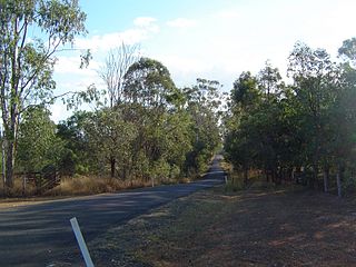
Muirlea is a rural locality in the City of Ipswich, Queensland, Australia. In the 2021 census, Muirlea had a population of 174 people.
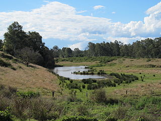
Ironbark is a rural locality in the City of Ipswich, Queensland, Australia. In the 2021 census, Ironbark had a population of 1,173 people.
The (M7/A7) in Brisbane, Queensland, Australia, is a major urban road corridor. It extends from the M2/M7 Ipswich Motorway/Logan Motorway junction at Gailes via Ipswich Road at Woolloongabba, Clem Jones Tunnel and Airport Link to the junction with Southern Cross Way which links with the Gateway Motorway.

The Toowoomba Connection Road is a 27.3 km (17.0 mi) former section of the Warrego Highway that passes through the city of Toowoomba in Queensland, Australia. With the opening of the Toowoomba Bypass in 2019 the Warrego Highway was redirected to it, and the bypassed section of the highway was renamed Toowoomba Connection Road and assigned the route number A21.
Warrego Highway state-controlled roads presents information about how the Warrego Highway is described for administrative and funding purposes by the Queensland Department of Transport and Main Roads, and about the state-controlled roads that intersect with it.
 (M2) Northern Ipswich Bypass [1] (Warrego Highway) from Brassall to Dinmore
 (M2) Logan Motorway from Gailes to Drewvale