Magnolia, Massachusetts

Last updated

Magnolia
Magnolia village aerial, July 2016.JPG
Aerial view of Magnolia village in 2016
USA Massachusetts location map.svg
Red pog.svg
Magnolia
Coordinates: 42°34′30″N70°42′45″W / 42.57500°N 70.71250°W / 42.57500; -70.71250
Country United States
State Massachusetts
County Gloucester, Massachusetts
Time zone UTC-5 (Eastern)
Zip Code
01930

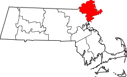
Magnolia is a small village in Gloucester, located in Essex County, Massachusetts, United States, on the Manchester-by-the-Sea town line in the southwestern part of the city. Straddling the town line between the two communities is Surf Park, [1] a two-acre swath of land that has scenic views of Kettle Cove.

Contents

Magnolia has its own library, [2] restaurants, and shops. Another feature of Magnolia is its beach, which goes by the official name Gray Beach [3] and is a part of Coolidge Reservation. Union Congregational Church [4] is located in Magnolia, as is Hammond Castle. [5] The village has its own Women's Community Club, which has been in existence for over 60 years. [6]

History

Hammond Castle Hammond castle back.jpg
Hammond Castle

After the Civil War, Bostonians began to summer in Magnolia. For example, Rev. James Freeman Clarke, well-known Unitarian minister, author, and social reformer of Boston's Church of the Disciples, after searching the North Shore for the best possible summer resort, purchased land in Magnolia in 1879 and built a house he called "Septingle" because it had seven open fireplaces. It was constructed on a cliff overlooking the rocky shore and the curving beach on its left. Clarke often walked on that beach for relaxation or sat on the long piazza of his house while working on one of his many books. Everywhere he saw scarlet lilies and red wild roses, green bushes and vines, and heard gulls in the sky and the ever constant surf. The center of Magnolia was but a short stroll along a footpath, and trains from nearby Manchester made it convenient to get to Boston. Here, he and his family enjoyed the summers of the 1880s. [7]

The Oceanside and cottages The Oceanside and Cottages, Magnolia, Massachusetts (76396).jpg
The Oceanside and cottages

At the dawn of the twentieth century, Magnolia was well known as a vacation destination. The Oceanside Hotel and Casino, before it burnt down, attracted several big names in music and film. John Philip Sousa and Lucille Ball were among those known to vacation in Magnolia. During the Victorian era, many wealthy businessmen and their families built large mansions along Shore Road, which were staffed by newly arrived immigrants to Massachusetts. They served the transient summer residents and visitors as servants, cooks, housekeepers, gardeners and clerks in the posh branch stores of firms from New York City, London, Paris, and Palm Beach that lined both sides of Lexington Avenue. Some of them were able to save their money and opened local businesses such as the Magnolia Hand Laundry that was located on Field Road. [8]

Historical sites

Related Research Articles

<span class="mw-page-title-main">Essex County, Massachusetts</span> County in Massachusetts, United States

Essex County is a county in the northeastern part of the U.S. state of Massachusetts. At the 2020 census, the total population was 809,829, making it the third-most populous county in the state, and the seventy-eighth-most populous in the country. It is part of the Greater Boston area. The largest city in Essex County is Lynn. The county was named after the English county of Essex. It has two traditional county seats: Salem and Lawrence. Prior to the dissolution of the county government in 1999, Salem had jurisdiction over the Southern Essex District, and Lawrence had jurisdiction over the Northern Essex District, but currently these cities do not function as seats of government. However, the county and the districts remain as administrative regions recognized by various governmental agencies, which gathered vital statistics or disposed of judicial case loads under these geographic subdivisions, and are required to keep the records based on them. The county has been designated the Essex National Heritage Area by the National Park Service.

<span class="mw-page-title-main">Wells, Maine</span> Town in Maine, United States

Wells is a resort town in York County, Maine, United States. Founded in 1643, it is the third-oldest town in Maine. The population was 11,314 at the 2020 census. Wells Beach is a popular summer destination.

<span class="mw-page-title-main">Beverly, Massachusetts</span> City in the United States

Beverly is a city in Essex County, Massachusetts, United States, and a suburb of Boston. The population was 42,670 at the time of the 2020 United States Census. A resort, residential, and manufacturing community on the Massachusetts North Shore, Beverly includes Ryal Side, North Beverly, Montserrat, Beverly Farms and Prides Crossing. Beverly is a rival of Marblehead for the title of being the "birthplace of the U.S. Navy".

<span class="mw-page-title-main">Gloucester, Massachusetts</span> City in Massachusetts, United States

Gloucester is a city in Essex County, Massachusetts, United States. It sits on Cape Ann and is a part of Massachusetts's North Shore. The population was 29,729 at the 2020 U.S. Census. An important center of the fishing industry and a popular summer destination, Gloucester consists of an urban core on the north side of the harbor and the outlying neighborhoods of Annisquam, Bay View, Lanesville, Folly Cove, Magnolia, Riverdale, East Gloucester, and West Gloucester.

<span class="mw-page-title-main">Lynn, Massachusetts</span> City in Essex County, Massachusetts

Lynn is the eighth-largest municipality in Massachusetts, United States, and the largest city in Essex County. Situated on the Atlantic Ocean, 3.7 miles (6.0 km) north of the Boston city line at Suffolk Downs, Lynn is part of Greater Boston's urban inner core.

<span class="mw-page-title-main">Manchester-by-the-Sea, Massachusetts</span> Town in Massachusetts, United States

Manchester-by-the-Sea is a coastal town on Cape Ann, in Essex County, Massachusetts, United States. The town is known for scenic beaches and vista points. According to the 2020 population census, the population is 5,395.

<span class="mw-page-title-main">Northampton, Massachusetts</span> City in Massachusetts, United States

The city of Northampton is the county seat of Hampshire County, Massachusetts, United States. As of the 2020 census, the population of Northampton was 29,571.

<span class="mw-page-title-main">Essex, Massachusetts</span> Town in Massachusetts, United States

Essex is a coastal town in Essex County, Massachusetts, United States, 26 miles (42 km) north of Boston and 13 miles (21 km) southeast of Newburyport. It is known for its former role as a center of shipbuilding. The population was 3,675 at the 2020 census.

<span class="mw-page-title-main">Kennebunkport, Maine</span> Town in the state of Maine, United States

Kennebunkport is a resort town in York County, Maine, United States. The population was 3,629 people at the 2020 census. It is part of the Portland–South Portland–Biddeford metropolitan statistical area.

<span class="mw-page-title-main">East Boston</span> Area of Boston in Massachusetts, US

East Boston, nicknamed Eastie, is a neighborhood of Boston, Massachusetts, United States that was annexed by the city of Boston in 1637. Neighboring communities include Winthrop, Revere, and Chelsea. It is separated from the Boston neighborhood of Charlestown and downtown Boston by Boston Harbor. The footprint of the East Boston neighborhood as it is known today was created in the 1940s by connecting five of the inner harbor islands using land fill. Logan International Airport is located in East Boston, connecting Boston to domestic and international locations.

<span class="mw-page-title-main">Rockport, Massachusetts</span> Town in Massachusetts, United States

Rockport is a seaside town in Essex County, Massachusetts, United States. The population was 6,992 in 2020. Rockport is located approximately 40 miles (64 km) northeast of Boston, at the tip of the Cape Ann peninsula. Rockport borders Gloucester to its west, and is surrounded by the Atlantic Ocean in all other directions.

<span class="mw-page-title-main">North Shore (Massachusetts)</span> Region of Massachusetts in the United States

The North Shore is a region in the U.S. state of Massachusetts, loosely defined as the sea coast between Boston and New Hampshire. Its counterpart is the South Shore region extending south and east of Boston.

<span class="mw-page-title-main">Revere Beach</span> Public beach in Revere, Massachusetts, U.S.

Revere Beach is a public beach in Revere, Massachusetts, measuring over three miles (4.8 km) long and located about five miles (8 km) north of downtown Boston. In 1875, a rail link was constructed to the beach, leading to its increasing popularity as a summer recreation area, and in 1896, it became the first public beach in the United States. It is still easily accessible from Boston by the MBTA subway's Blue Line, and can accommodate as many as one million visitors in a weekend during its annual sand sculpture competition. The Revere Beach Reservation and Revere Beach Reservation Historic District is listed on the National Register of Historic Places.

<span class="mw-page-title-main">Ravenswood Park</span>

Ravenswood Park is a nature reserve in the western section of Gloucester, Massachusetts owned and managed by the Trustees of Reservations, which acquired the property in 1993. It can be accessed from Western Avenue, the road to Manchester through the Magnolia area. Ravenswood Park is frequented by cross-country skiers during the winter.

<span class="mw-page-title-main">Beverly Farms</span> Neighborhood of Beverly, Massachusetts, US

Beverly Farms is a neighborhood comprising the eastern part of the city of Beverly, Massachusetts, in the state's North Shore region, approximately 20 miles north of Boston. Beverly Farms is an oceanfront community with a population of about 3,500, extending west from the Manchester-by-the-Sea border to another section of Beverly, known as Prides Crossing. The western boundary of Beverly Farms is in dispute. For instance, the boundaries of West Beach were defined by Chapter 157 of the Massachusetts Acts and Resolves of 1852, in terms of landmarks and property lines that existed at the time, and those are sometimes used as the boundaries of Beverly Farms. Others have demarcated the Western border as the location at which a local trolley line from downtown Beverly ended; more specifically, this location is called "Chapman's Corner" and is at the corner of Hale and Boyle's Streets.

<span class="mw-page-title-main">Massachusetts's 6th congressional district</span> U.S. House district for Massachusetts

Massachusetts's 6th congressional district is located in northeastern Massachusetts. It contains most of Essex County, including the North Shore and Cape Ann, as well as part of Middlesex County. It is represented by Seth Moulton, who has represented the district since January 2015. The shape of the district went through minor changes effective from the elections of 2012 after Massachusetts congressional redistricting to reflect the 2010 census. The towns of Tewksbury and Billerica were added, along with a small portion of the town of Andover.

<span class="mw-page-title-main">Massachusetts Route 127</span> State highway in Essex County, Massachusetts, US

Route 127 is a 26.70-mile-long (42.97 km) north–south Massachusetts state route that runs from Beverly to Gloucester. Much of the northern part of the route is in Cape Ann. Route 127's southern terminus is at Route 1A and the southern terminus of Route 22 in Beverly and the northern terminus is at Route 128 in Gloucester.

<span class="mw-page-title-main">Nantasket Beach</span> Beach in Massachusetts

Nantasket Beach is a beach in the town of Hull, Massachusetts. It is part of the Nantasket Beach Reservation, administered by the state Department of Conservation and Recreation. The shore has fine, light gray sand and is one of the most highly rated beaches in Greater Boston. Due to its gentle slope, at low tide, the beach extends several hundred yards in width, forming tide pools that have become a well known, pictoresque characteristic of the site, renowned for their reflections of the sunsets and sunrises. The northern part of the beach is private, administered by the Town of Hull, and does not allow visitors to park except as guests of residents. The beach is a habitat for federally protected species, including the Piping Plover, Least Tern, and occasionally harbor seals.

<span class="mw-page-title-main">Demographics of Massachusetts</span>

Massachusetts has an estimated population of 6.981 million as of 2022 according to the U.S. Census Bureau. This represents a −0.7% decrease in population from the 2020 census, when the population was 7.029 million. Currently, Massachusetts is the sixteenth most populous U.S. state.

This is a timeline of the history of the city of Gloucester, Massachusetts, USA.

References

  1. "Surf Park".
  2. http://magnolialibrary.org/ [ bare URL ]
  3. "Coolidge Reservation | Manchester-by-the-Sea, MA | the Trustees of Reservations". Archived from the original on July 5, 2011. Retrieved December 2, 2013.
  4. "Union Congregational Church Magnolia, MA". Archived from the original on September 6, 2011. Retrieved July 11, 2011.
  5. "Home".
  6. Silverstein, Stephanie (October 17, 2007). "Magnolia women's club celebrates 60 years". Archived from the original on November 11, 2012. Retrieved July 11, 2011.
  7. Pp. 345-46, Arthur S. Bolster, jr., James Freeman Clarke, Disciple to Advancing Truth, Beacon Press, 1954
  8. Pg. 10, Alan Seaburg, At the Fair The Boston Immigrant Experience, Foreword by Philip A. M. Taylor, Department of American Studies, Hull University, England, 1990. ISBN   0-9625794-0-8 [8]