Main Eastern Highway

Last updated

SH KL 8.svg
State Highway 8
Main Eastern Highway
SH 8 highlighted in red
Route information
Maintained by Kerala Public Works Department
Length153.6 km (95.4 mi)
Major junctions
South endNH744-IN.svg NH 744 in Punalur
Major intersections
North endSH1-IN jct.svg SH 1 in Muvattupuzha
Location
Country India
State Kerala
Districts Kollam, Pathanamthitta, Kottayam, Idukki, Ernakulam
Highway system
State Highways in Kerala
SH KL 7.svg SH 7 SH KL 9.svg SH 9
Ghat section of The Main Eastern Highway MainEasternHighway Kerala.jpg
Ghat section of The Main Eastern Highway
Pathanamthitta town is on The Main Eastern Highway RingRoad Pathanamthitta City Main Eastern Highway.jpg
Pathanamthitta town is on The Main Eastern Highway
A sign-board that indicates the direction to Sabarimala. The multilingual board is written in Hindi, Malayalam, Tamil, Kannada, Telugu language and English language Pathanamthitta-to-sabarimala.jpg
A sign-board that indicates the direction to Sabarimala. The multilingual board is written in Hindi, Malayalam, Tamil, Kannada, Telugu language and English language
Large rubber plantations are generally seen along the Main Eastern Highway Rubber trees in Kerala, India.jpg
Large rubber plantations are generally seen along the Main Eastern Highway
A journey through The Main Eastern Highway is a refreshing experience MainEasternHighway01 Kerala.jpg
A journey through The Main Eastern Highway is a refreshing experience

The Main Eastern Highway is the lifeline of the high range townships of the midlands and highlands of eastern kerala Kerala state, India. It is also known as Punalur-Muvattupuzha Highway. Main Eastern Highway is categorized as State Highway - 08 ( SH-08 ) of Kerala. It is the second longest State Highway of Kerala covering a distance of 153.6 km. The districts it passes through are Kollam, Pathanamthitta, Kottayam, Idukki and Ernakulam.

Contents

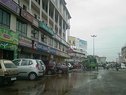
It interconnects the major towns of Punalur, Pathanapuram, Konni, Pathanamthitta, Ranni, Manimala, Ponkunnam, Pala, Thodupuzha to the main intersection at Muvattupuzha merging to MC Road which extends northwards till Angamaly at NH 66.

Route description

Punalur - Alimukku - Piravanthoor - Pathanapuram - Kallumkadavu Junction (joins SH 05) - Kalanjoor - Koodal - Konni - Kumbazha (Pathanamthitta, meets T.K.Road / SH - 07) - Mylapra - Ranni - Manimala - Cheruvally - Ponkunnam - Paika- Pala - Thodupuzha - Vazhakulam - Muvattupuzha (joins MC Road -SH 01) The economy of the High-Ranges of South and Central Kerala largely depends on the Main Eastern Highway. The main trunk road to Sabarimala, Kerala's Largest Pilgrim Centre starts from Main Eastern Highway near Pathanamthitta. Though it is the shortest route to Angamaly and Northern Kerala townships from Punalur, (The Second Largest City of Kollam District) and in turn from the Tamil Nadu townships Tenkasi, Tirunelveli and Thoothukudi. It is not developed to its capacity. It acts as a parallel road to the Main Central Road. (M.C.Road/SH-01). It is also the Shortest route to the Kerala State Capital Thiruvananthapuram from Kumali and other major townships of Idukki district Like Munnar, Kattappana, Thodupuzha, Moolamattam, Nedumkandam etc.

Townships on the Main Eastern Highway

The townships Punalur, Alimukku, Piravanthoor, Pathanapuram, Koodal, Konni, Kumbazha, Ranni, Manimala, Ponkunnam, Pala, Thodupuzha, Muvattupuzha comes under the Main eastern highway road

Future

KSTP Project

The upgrading work of Punalur -Ponkunnam-Thodupuzha stretch is currently under progress as part of the World Bank funded Kerala State Transport Project (KSTP). [1]

Related Research Articles

<span class="mw-page-title-main">Pathanamthitta district</span> District in Kerala, India

Pathanamthitta District, is one of the 14 districts in the Indian state of Kerala. The district headquarters is in the town of Pathanamthitta. There are four municipalities in Pathanamthitta: Adoor, Pandalam, Pathanamthitta and Thiruvalla.

<span class="mw-page-title-main">Muvattupuzha</span> Municipality in Kerala, India

Muvattupuzha is a municipality in the Ernakulam district of Kerala, India. It is located 26 km (16.2 mi) east of the district headquarters in Thrikkakara and about 170 km (105.6 mi) north of the state capital Thiruvananthapuram. As per the 2011 Indian census, Muvattupuzha has a population of 30,397 people, and a population density of 2,306/km2 (5,970/sq mi).

<span class="mw-page-title-main">Kanjirappally</span> Town in Kerala, India

Kanjirappally is a taluk and a town in Kottayam district situated about 38 km (24 mi) away from the district capital, in the state of Kerala, in southwestern India.

Mundakayam, is a town in Kanjirappally Taluk in the Kottayam District of Kerala. It is the doorway to the high ranges of southern Kerala, and is at the border of Kottayam and Idukki districts. The next nearest town, Kanjirappally, is 14 km (8.7 mi) & Erumely is 12 km from Mundakayam. Mundakayam has rubber plantations, and greenery. The Manimala River runs through Mundakayam. It is located 48 km east of the district headquarters at Kottayam and 148 km from the state capital, Thiruvananthapuram. The name Mundakayam is said to be derived from the Mundi cranes that used to be seen along the Manimala River banks.

The Main Central Road popularly known as MC Road is the arterial State Highway starting from Kesavadasapuram in Trivandrum city and ends at Angamaly, a suburb of Kochi city in Ernakulam District, in the state of Kerala, India. It is designated as State Highway 1 by the Kerala Public Works Department. The highway was built by Raja Kesavadas, Dewan of Travancore, in the 1790s. Plan for a new highway called Thiruvananthapuram–Angamaly Greenfield Highway, which runs parallel to the MC Road is proposed and is under early stage of development.

<span class="mw-page-title-main">Ponkunnam</span> Town in Kerala, India

Ponkunnam is a census town in Kerala, India, part of Kottayam district under Kanjirappally taluk. Ponkunnam literally means golden mountain (ponn = gold, kunn = mountain). Nearby towns are Kanjirappalli, Pampady, Manimala and Pala. This part of Kerala is famous for its fertile land and rubber plantations. It is at an altitude of 495 ft (151 m) above mean sea level. The town is at the junction of two major roads in Kerala: NH 183 and Main Eastern Highway. The climate is moderate with timely cold breezes and the town is the gateway to the Western Ghats. The town is famous for its volleyball traditions and customs. Almost every year there is an ever-rolling volleyball tournament happening in Ponkunnam Mahatma Gandhi Mini Stadium.

<span class="mw-page-title-main">Pathanamthitta</span> Town in Kerala, India

Pathanamthitta, is a municipality situated in the Southern Kerala, India, spread over an area of 23.50 km2. It is the administrative capital of Pathanamthitta district. The town has a population of 37,538. The Hindu pilgrim centre Sabarimala is situated in the Pathanamthitta district; as the main transport hub to Sabarimala, the town is known as the 'Pilgrim Capital of Kerala'. Pathanamthitta District, the thirteenth revenue district of the State of Kerala, was formed with effect from 1 November 1982, with headquarters at Pathanamthitta. Forest covers more than half of the total area of the District. Pathanamthitta District ranks the 7th in area in the State. The district has its borders with Allepey, Kottayam, Kollam and Idukki districts of Kerala and Tamil Nadu. Nearest town is Thiruvalla, located at a distance of 30 km. Thiruvalla railway station is 30 km via Thiruvalla-Kumbazha highway. Buses ply every 5 Minutes from Thiruvalla To Pathanamthitta & vice versa.

<span class="mw-page-title-main">Konni, Kerala</span> Town in Kerala, India

Konni, also spelt Konny, is a town and taluk headquarters in Pathanamthitta district of Kerala, India. Konni is known for its elephant cages, forests, and rubber plantations. It is also known as "Aanakoodinte Nadu". Nearest town is Pathanamthitta. Konni is located 32 km (20 mi) from Chengannur railway station and NH 183 in Chengannur. It is well-connected via Muvattupuzha - Punalur state highway. Buses ply frequently from Pathanamthitta KSRTC bus station to Konni.

Kumbazha is a main junction nestled within the heart of Pathanamthitta Municipality of Pathanamthitta Town, located in Kerala state, India. The serene Achenkovil river gracefully meanders through this historic locale. The town's prominence is further accentuated by the terminus of the Thiruvalla - Kumbazha (SH-7) road, also known as the T.K road. Once a bustling marketplace, Kumbazha derives its name from the Malayalam word "Kumbhi," signifying an elephant, hinting at its past grandeur.

<span class="mw-page-title-main">Koodal</span> Town in Kerala, India

Koodal is the second largest town in Konni Taluk at Pathanamthitta District, located in Kerala state, India.Koodal Situates On Main Eastern Highway.

Anikkad is a village in Ernakulam district in the state of Kerala, India. It is located near the Muvattupuzha town in Avoly Panchayat.

<span class="mw-page-title-main">Kalanjoor</span> Village in Kerala, India

Kalanjoor is a village located in Pathanamthitta district state of Kerala, India. The place is 22 km away from district headquarters. As a part of Konni Assembly constituency and Pathanamthitta Lok Sabha constituency. Kalanjoor is also a panchayath where share the border of Kollam and Pathanamthitta district as the part of Parakode Block Panchayat.

<span class="mw-page-title-main">State Highway 7 (Kerala)</span> Road in Kerala, India

The SH-07 / T.K.Road is the life line of the Central Travancore.


State Highway 43 is a State Highway in Kerala, India that starts in Muvattupuzha and ends in Theni Town. The highway is 105 km long. The Route Starts from Chali Bridge at Muvattupuzha Connecting to NH 49 towards Kothamangalam.

<span class="mw-page-title-main">Outline of Kerala</span> Overview of and topical guide to Kerala

The following outline is provided as an overview of and topical guide to Kerala:

<span class="mw-page-title-main">Kollappally</span> Town in Kerala, India

Kollappally is a developing town in Kottayam district near Pala Kerala, India. It is located between two major cities of Kerala, Pala and Thodupuzha, on the Main Eastern Highway. It connects Kottayam to two towns in Idukki district - Pynavu, the headquarters of Idukki district and Thodupuzha, the business centre of Idukki district. The next nearest village is Ullanadu. Kollappally is 180 km away from the state capital, Trivandrum. The Lalam river flows through the heart of the town.

Sabarimala Railway is a proposed 111-kilometre (69 mi)-long railway line in Kerala, India, that will run from Angamaly to Erumeli. It was sanctioned in 1998 by Indian Railways. The line's name comes from the fact that it will provide a railway facility to pilgrims visiting the Sabarimala Temple.

Transport in Ernakulam district consists of various modes.

References

See also