Malone-Porter, Washington

Last updated
Malone-Porter, Washington
Grays Harbor County Washington Incorporated and Unincorporated areas Malone-Porter Highlighted.svg
Location of Malone-Porter, Washington
Coordinates: 46°58′42″N123°18′21″W / 46.97833°N 123.30583°W / 46.97833; -123.30583 Coordinates: 46°58′42″N123°18′21″W / 46.97833°N 123.30583°W / 46.97833; -123.30583
Country United States
State Washington
County Grays Harbor
Area
  Total10.5 sq mi (27.3 km2)
  Land10.5 sq mi (27.3 km2)
  Water0.0 sq mi (0.0 km2)
Elevation
400 ft (100 m)
Population
 (2000)
  Total473
  Density45/sq mi (17.3/km2)
Time zone UTC-8 (Pacific (PST))
  Summer (DST) UTC-7 (PDT)
ZIP code
98559 (Malone)
Area code(s) 360
FIPS code 53-42355 [1]

Malone-Porter was a census-designated place (CDP) in Grays Harbor County, Washington, United States. The population was 473 at the 2000 census. For the 2010 census the area was split into two CDPs, Malone and Porter, two small towns located just off U.S. Route 12, southeast of Elma and northwest of Oakville, and along a shortline that is part of Puget Sound and Pacific Railroad.

Contents

Malone

Malone is the home of Red's Hop N' Market, a mini-mart that is also the U.S. Postal Service's (USPS) first official village post office, a post office located within an existing retail establishment, with limited service and no full-time postmaster. [2] The mini-mart's owner is paid $2,000/year by the US Postal Service to sell stamps and shipping supplies and allow the USPS to place mailboxes on-site.

Porter

Porter was named after Fairchild Porter, who settled in the area around 1860. [3] [4]

Much of Porter was destroyed by fire on January 31, 1924. Porter Saloon was re-built later that same year. When it re-opened in 1933 following the repeal of Prohibition, it was one of the first establishments to receive a liquor license in the State of Washington.[ citation needed ]

Geography

The Malone-Porter CDP was located at 46°57′26″N123°19′16″W / 46.957344°N 123.321008°W / 46.957344; -123.321008 (46.957344, -123.321008). [5]

According to the United States Census Bureau, the CDP had a total area of 27.3 km2 (10.5 sq mi), all of it land.

Demographics

As of the census [1] of 2000, there were 473 people, 172 households, and 124 families residing in the CDP. The population density was 44.9 people per square mile (17.3/km2). There were 194 housing units at an average density of 18.4/sq mi (7.1/km2). The racial makeup of the CDP was 90.70% White, 0.85% Native American, 0.21% Asian, 1.06% from other races, and 7.19% from two or more races. Hispanic or Latino of any race were 6.77% of the population.

There were 172 households out of which 37.8% had children under the age of 18 living with them, 61.0% were married couples living together, 6.4% had a female householder with no husband present, and 27.9% were non-families. 20.9% of all households were made up of individuals and 7.0% had someone living alone who was 65 years of age or older. The average household size was 2.75 and the average family size was 3.23.

In the CDP, the population was spread out with 29.6% under the age of 18, 6.8% from 18 to 24, 29.2% from 25 to 44, 24.5% from 45 to 64, and 9.9% who were 65 years of age or older. The median age was 36 years. For every 100 females, there were 97.9 males. For every 100 females age 18 and over, there were 99.4 males.

The median income for a household in the CDP was $37,875, and the median income for a family was $43,036. Males had a median income of $32,266 versus $27,768 for females. The per capita income for the CDP was $15,434. About 9.1% of families and 8.7% of the population were below the poverty line, including 9.5% of those under age 18 and none of those age 65 or over.

Related Research Articles

Napoleon, Michigan Census-designated place in Michigan, United States

Napoleon is an unincorporated community and census-designated place (CDP) in Napoleon Township of Jackson County in the U.S. state of Michigan. The population of the CDP was 1,258 at the 2010 census.

Wye, Montana CDP in Montana, United States

Wye is a census-designated place (CDP) in Missoula County, Montana, United States. It is part of the Missoula, Montana Metropolitan Statistical Area. The population was 511 at the 2010 census, an increase from its population of 381 in 2000. Wye is named for the "y"-shaped DeSmet Junction where US 93 and MT 200 met former US 10.

Old Orchard, Pennsylvania Place in Pennsylvania, United States

Old Orchard is a census-designated place (CDP) in Palmer Township, Northampton County, Pennsylvania, United States. It is located in the Lehigh Valley region of the state.

Sheffield, Pennsylvania Census-designated place in Pennsylvania, United States

Sheffield is a census-designated place (CDP) in within Sheffield Township in southeastern Warren County, Pennsylvania, United States. The population was 1,123 at the 2010 census.

River Road, Washington Census-designated place in Washington, United States

River Road is a census-designated place (CDP) in Clallam County, Washington, United States. The population was 454 at the 2010 census. It is a primarily residential area next to the city of Sequim.

Aberdeen Gardens, Washington CDP in Washington, United States

Aberdeen Gardens is a census-designated place (CDP) in Grays Harbor County, Washington, USA. The population was 279 at the 2010 census.

Brady, Washington Census-designated place in Washington, United States

Brady is a census-designated place (CDP) in Grays Harbor County, Washington, United States. The population was 676 at the 2010 census.

Central Park, Washington CDP in Washington, United States

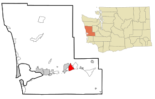
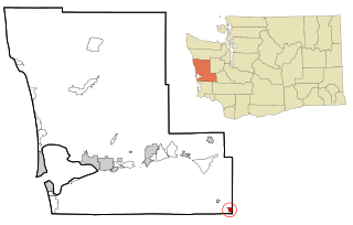
Central Park is a census-designated place (CDP) in Grays Harbor County, Washington, United States. The population was 2,685 at the 2010 census.

Chehalis Village, Washington Former CDP in Washington, United States

Chehalis Village is a former census-designated place (CDP) in Grays Harbor County, Washington, United States. The population was 346 at the 2000 census. The area was no longer listed as a CDP for the 2010 census.

Cohassett Beach, Washington CDP in Washington, United States

Cohassett Beach is a census-designated place (CDP) in Grays Harbor County, Washington, United States. The population was 722 at the 2010 census.

Markham, Washington CDP in Washington, United States

Markham is a census-designated place (CDP) in Grays Harbor County, Washington, United States. The population was 111 at the 2010 census.

Satsop, Washington Census-designated place in Washington, United States

Satsop is a census-designated place (CDP) in Grays Harbor County, Washington, United States. The population was 675 at the 2010 census, up from 619 at the 2000 census.

Baring, Washington Census-designated place in Washington, United States

Baring is an unincorporated community and census-designated place (CDP) in King County, Washington, United States. The population was 220 at the 2010 census. It is located on U.S. Highway 2 about 23 miles (37 km) west of Stevens Pass, along a very flat and straight three-mile section of highway that has been dubbed the "Baring Straight", since US-2 is otherwise hilly and curvy through the mountains.

Skokomish, Washington CDP in Washington, United States

Skokomish is a census-designated place (CDP) in Mason County, Washington, United States. The population was 617 at the 2010 census. The town is the headquarters of the Skokomish Indian Tribe.

Bay Center, Washington CDP in Washington, United States

Bay Center is a census-designated place (CDP) in Pacific County, Washington, United States. The population was 174 at the 2000 census. The population increased to 276 at the 2010 census.

Lebam, Washington CDP in Washington, United States

Lebam is a census-designated place (CDP) in Pacific County, Washington, United States. The population was 160 at the 2010 census.

Cathcart, Washington CDP in Washington, United States

Cathcart is a census-designated place (CDP) in Snohomish County, Washington, United States. The population was 2,458 at the 2010 census. Based on per capita income, one of the more reliable measures of affluence, Cathcart ranks 45th of 522 areas in the state of Washington to be ranked. Cathcart was named for Isaac Cathcart, a businessperson in the lumber industry.

Martha Lake, Washington CDP in Washington, United States

Martha Lake is a census-designated place (CDP) in Snohomish County, Washington, United States. The population was 15,473 at the 2010 census. It lies west of Mill Creek and northeast of Lynnwood, near the lake of the same name.

East Cathlamet, Washington CDP in Washington, United States

East Cathlamet is a census-designated place (CDP) in Wahkiakum County, Washington, on the eastern border of the town of Cathlamet. The population was 491 as of the 2010 census. The CDP includes the Indian Village Mobile Home Park community. The East Cathlamet community is part of the Wahkiakum School District, a K-12 school district of about 430 students. The name "Kathlamet" (Cathlamet) comes from the Kathlamet tribe, which in their language, means "rocky shore."

Morgan Farm, Texas CDP in Texas, United States

Morgan Farm is a census-designated place (CDP) in San Patricio County, Texas, United States. The population was 463 at the 2010 census. Prior to the 2010 census Morgan Farm CDP was known as Morgan Farm Area CDP.

References

  1. 1 2 "American FactFinder". United States Census Bureau. Archived from the original on 2020-02-12. Retrieved 2008-01-31.
  2. The new face of the U.S. post office, a September 12, 2011 CNN article
  3. Majors, Harry M. (1975). Exploring Washington. Van Winkle Publishing Co. p. 116. ISBN   978-0-918664-00-6.
  4. Meany, Edmond S. (1923). Origin of Washington geographic names. Seattle: University of Washington Press. p. 229.
  5. "US Gazetteer files: 2010, 2000, and 1990". United States Census Bureau. 2011-02-12. Retrieved 2011-04-23.