Markham, Washington

Last updated
Markham, Washington
CDP
Grays Harbor County Washington Incorporated and Unincorporated areas Markham Highlighted.svg
Location of Markham, Washington
Coordinates: 46°54′47″N123°59′7″W / 46.91306°N 123.98528°W / 46.91306; -123.98528 Coordinates: 46°54′47″N123°59′7″W / 46.91306°N 123.98528°W / 46.91306; -123.98528
Country United States
State Washington
County Grays Harbor
Area
  Total1.1 sq mi (2.9 km2)
  Land1.1 sq mi (2.9 km2)
  Water0.0 sq mi (0.0 km2)
Elevation
23 ft (7 m)
Population
 (2010)
  Total111
  Density84.6/sq mi (32.7/km2)
Time zone UTC-8 (Pacific (PST))
  Summer (DST) UTC-7 (PDT)
ZIP code
98520
Area code(s) 360
FIPS code 53-43640 [1]
GNIS feature ID1511125 [2]

Markham is a census-designated place (CDP) in Grays Harbor County, Washington, United States. The population was 111 at the 2010 census.

Contents

Geography

Markham is located at 46°54′47″N123°59′07″W / 46.913041°N 123.985296°W / 46.913041; -123.985296 (46.913041, -123.985296). [3]

According to the United States Census Bureau, the CDP has a total area of 1.1 square miles (2.9 km2), all of it land.

Demographics

Historical population
CensusPop.
2000 95
2010 11116.8%
U.S. Decennial Census

As of the census [1] of 2000, there were 95 people, 41 households, and 30 families residing in the CDP. The population density was 84.6 people per square mile (32.7/km2). There were 51 housing units at an average density of 45.4/sq mi (17.6/km2). The racial makeup of the CDP was 94.74% White, 1.05% Native American, 2.11% Asian, 1.05% from other races, and 1.05% from two or more races. Hispanic or Latino of any race were 2.11% of the population.

There were 41 households, out of which 17.1% had children under the age of 18 living with them, 65.9% were married couples living together, 4.9% had a female householder with no husband present, and 26.8% were non-families. 19.5% of all households were made up of individuals, and 2.4% had someone living alone who was 65 years of age or older. The average household size was 2.32 and the average family size was 2.67.

In the CDP, the population was spread out, with 12.6% under the age of 18, 6.3% from 18 to 24, 22.1% from 25 to 44, 47.4% from 45 to 64, and 11.6% who were 65 years of age or older. The median age was 48 years. For every 100 females, there were 115.9 males. For every 100 females age 18 and over, there were 107.5 males.

The median income for a household in the CDP was $63,750, and the median income for a family was $96,816. Males had a median income of $40,625 versus $23,750 for females. The per capita income for the CDP was $23,700. There were no families and 12.3% of the population living below the poverty line, including no under eighteens and 100.0% of those over 64.

Related Research Articles

Silver Springs, Alaska CDP in Alaska, United States

Silver Springs is a census-designated place (CDP) in Valdez-Cordova Census Area, Alaska, United States. At the 2010 census the population was 114, down from 130 in 2000.

Tonalea, Arizona CDP in Arizona, United States

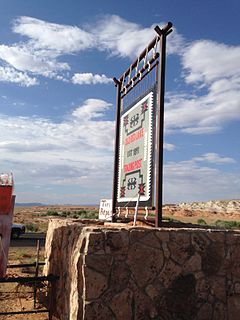
Tonalea is a census-designated place (CDP) in Coconino County, Arizona, United States. The population was 549 at the 2010 census. It has also been known as Red Lake.

Homestead Base, Florida CDP in Florida, United States

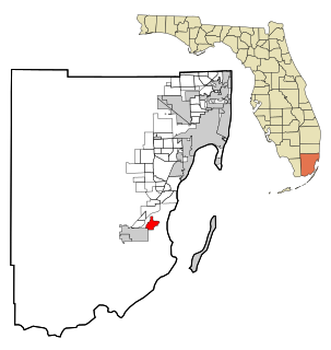
Homestead Base is a census-designated place (CDP) in Miami-Dade County, Florida, United States. The population was 446 at the 2000 census.

Waikoloa Village, Hawaii Census-designated place in Hawaii, U.S.

Waikōloa Village is a census-designated place (CDP) in Hawaiʻi County, Hawaii, United States. The population was 6,362 at the 2010 census, up from 4,806 at the 2000 census. The name Waikoloa is used by the local post office.

Hayward, Missouri Census-designated place in Missouri, United States

Hayward is a census-designated place and former village in Pemiscot County, Missouri, United States. The population was 131 at the 2010 census.

Gardnerville Ranchos, Nevada CDP in Nevada, United States

Gardnerville Ranchos is a census-designated place (CDP) in Douglas County, Nevada, United States. As of the 2010 census, the CDP population was 11,312. The area is the namesake for the Gardnerville Ranchos Micropolitan Statistical area which includes other areas of Douglas County.

Neskowin, Oregon Census-designated place in Oregon, United States

Neskowin is an unincorporated community in Tillamook County, Oregon, United States, along the Pacific Ocean between Cascade Head and Nestucca Bay. For statistical purposes, the United States Census Bureau has defined Neskowin as a census-designated place (CDP). The census definition of the area may not precisely correspond to local understanding of the area with the same name. The population of the CDP was 134 at the 2010 census, a decrease from 169 at the 2000 census.

Oceanside, Oregon Census-designated place in Oregon, United States

Oceanside is a census-designated place (CDP) and unincorporated community in Tillamook County, Oregon, United States. The population was 361 at the 2010 census. Oregon Route 131's northern terminus is in the community, which is just north of Netarts. Symons State Park is in Oceanside, while Three Arch Rocks National Wildlife Refuge lies just offshore.

Locustdale, Pennsylvania Census-designated place in Pennsylvania, United States

Locustdale is a census-designated place (CDP) in Columbia and Schuylkill counties, Pennsylvania, United States. The population was 177 at the 2010 census. It is part of the Bloomsburg–Berwick Micropolitan Statistical Area.

Mount Gretna Heights, Pennsylvania CDP in Pennsylvania, United States

Mount Gretna Heights is a census-designated place (CDP) in Lebanon County, Pennsylvania, United States, near the borough of Mount Gretna. The population was 360 at the 2000 census.

Beurys Lake, Pennsylvania CDP in Pennsylvania, United States

Beurys Lake is a census-designated place in Schuylkill County, Pennsylvania, United States. The population was 133 at the 2000 census.

Sheppton, Pennsylvania CDP in Pennsylvania, United States

Sheppton is a census-designated place (CDP) in Schuylkill County, Pennsylvania, United States. The population was 239 at the 2000 census. Scott Yagielniskie has been the mayor since 2014.

Sheffield, Pennsylvania Census-designated place in Pennsylvania, United States

Sheffield is a census-designated place (CDP) in within Sheffield Township in southeastern Warren County, Pennsylvania, United States. The population was 1,123 at the 2010 census.

Loomis, South Dakota CDP in South Dakota, United States

Loomis is a census-designated place (CDP) in Davison County, South Dakota, United States. The population was 34 at the 2010 census. It is part of the Mitchell, South Dakota Micropolitan Statistical Area.

Palmyra, Utah CDP in Utah, United States

Palmyra is a census-designated place (CDP) in Utah County, Utah, United States. It is part of the Provo–Orem Metropolitan Statistical Area. The population was 491 at the 2010 census. Palmyra is located directly west of Springville and northwest of Spanish Fork.

Central Park, Washington CDP in Washington, United States

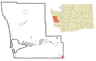
Central Park is a census-designated place (CDP) in Grays Harbor County, Washington, United States. The population was 2,685 at the 2010 census.

Chehalis Village, Washington Former CDP in Washington, United States

Chehalis Village is a former census-designated place (CDP) in Grays Harbor County, Washington, United States. The population was 346 at the 2000 census. The area was no longer listed as a CDP for the 2010 census.

Junction City, Washington Census-designated place in Washington, United States

Junction City is a census-designated place (CDP) in Grays Harbor County, Washington, United States. The population was 18 at the 2010 census.

Skokomish, Washington CDP in Washington, United States

Skokomish is a census-designated place (CDP) in Mason County, Washington, United States. The population was 617 at the 2010 census. The town is the headquarters of the Skokomish Indian Tribe.

The Buttes, Wyoming Unincorporated community in Wyoming, United States

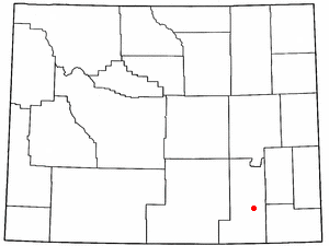
The Buttes is an unincorporated community in Albany County, Wyoming, United States. The population was 31 at the 2000 census, when it was a census-designated place (CDP).

References

  1. 1 2 "U.S. Census website". United States Census Bureau . Retrieved 2008-01-31.
  2. "Markham". Geographic Names Information System . United States Geological Survey.
  3. "US Gazetteer files: 2010, 2000, and 1990". United States Census Bureau. 2011-02-12. Retrieved 2011-04-23.