Junction City, Washington

Last updated
Junction City, Washington
Grays Harbor County Washington Incorporated and Unincorporated areas Junction City Highlighted.svg
Location of Junction City, Washington
Coordinates: 46°58′22″N123°46′22″W / 46.97278°N 123.77278°W / 46.97278; -123.77278 Coordinates: 46°58′22″N123°46′22″W / 46.97278°N 123.77278°W / 46.97278; -123.77278
Country United States
State Washington
County Grays Harbor
Area
  Total1.61 sq mi (4.16 km2)
  Land1.42 sq mi (3.67 km2)
  Water0.19 sq mi (0.50 km2)
Elevation
30 ft (9 m)
Population
 (2010)
  Total18
  Density13/sq mi (4.9/km2)
Time zone UTC-8 (Pacific (PST))
  Summer (DST) UTC-7 (PDT)
ZIP code
98520
Area code(s) 360
FIPS code 53-34470 [1]
GNIS feature ID1512338 [2]

Junction City is a census-designated place (CDP) in Grays Harbor County, Washington, United States. The population was 18 at the 2010 census. [3]

Contents

Geography

Junction City is located in south-central Grays Harbor County at 46°58′22″N123°46′22″W / 46.97278°N 123.77278°W / 46.97278; -123.77278 (46.972789, -123.772785). [4] It is bordered to the west by the city of Aberdeen and to the south by the city of Cosmopolis. The CDP is on low ground in the valley of the Chehalis River, between the Chehalis to the west and Elliott Slough to the northeast. U.S. Route 12 runs along the northern edge of the CDP, leading west into Aberdeen and east 18 miles (29 km) to Elma. Olympia is 49 miles (79 km) to the east of Junction City via U.S. 12 and State Route 8.

According to the United States Census Bureau, the Junction City CDP has a total area of 1.6 square miles (4.2 km2), of which 1.4 square miles (3.7 km2) are land and 0.2 square miles (0.5 km2), or 11.92%, are water. [3]

Demographics

Historical population
CensusPop.
2000 80
2010 18−77.5%
U.S. Decennial Census

As of the census [1] of 2000, there were 80 people, 36 households, and 23 families residing in the CDP. The population density was 45.9 people per square mile (17.8/km²). There were 38 housing units at an average density of 21.8/sq mi (8.4/km²). The racial makeup of the CDP was 95.00% White, 1.25% from other races, and 3.75% from two or more races. Hispanic or Latino of any race were 1.25% of the population.

There were 36 households out of which 16.7% had children under the age of 18 living with them, 47.2% were married couples living together, 8.3% had a female householder with no husband present, and 36.1% were non-families. 33.3% of all households were made up of individuals and 11.1% had someone living alone who was 65 years of age or older. The average household size was 2.22 and the average family size was 2.70.

In the CDP, the population was spread out with 16.3% under the age of 18, 1.3% from 18 to 24, 32.5% from 25 to 44, 31.3% from 45 to 64, and 18.8% who were 65 years of age or older. The median age was 45 years. For every 100 females, there were 142.4 males. For every 100 females age 18 and over, there were 148.1 males.

The median income for a household in the CDP was $32,292, and the median income for a family was $37,813. Males had a median income of $29,688 versus $21,250 for females. The per capita income for the CDP was $16,895. There were no families and 22.1% of the population living below the poverty line, including no under eighteens and none of those over 64.

Related Research Articles

Grays Harbor County, Washington U.S. county in Washington

Grays Harbor County is a county in the U.S. state of Washington. As of the 2010 census, the population was 72,797. The county seat is Montesano, and its largest city is Aberdeen.

Northway Junction, Alaska CDP in Alaska, United States

Northway Junction is a census-designated place (CDP) in Southeast Fairbanks Census Area, Alaska, United States. The population was 54 at the 2010 census, down from 72 in 2000.

Raisin City, California census-designated place in California, United States

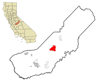
Raisin City is a census-designated place (CDP) in Fresno County, California, United States. The population was 380 at the 2010 census, up from 165 at the 2000 census. Raisin City is located 13 miles (21 km) south-southwest of downtown Fresno, at an elevation of 236 feet.

Redlands, Colorado CDP in State of Colorado, United States

Redlands is a census-designated place (CDP) in Mesa County, Colorado, United States. The population was 8,685 at the 2010 census. It is an unincorporated community comprising the area between the cities of Grand Junction and Fruita.

Heathrow, Florida CDP in Florida, United States

Heathrow is a census-designated place and an unincorporated suburban community in Seminole County, Florida, United States. Heathrow is on the I-4 Corridor in Central Florida, 19 miles northeast of Orlando and 38 miles southwest of Daytona Beach. Heathrow comprises a master-planned, private gated residential community of approximately 2,200 homes, and the Heathrow International Business Center, an office park. Heathrow was founded in 1985 by Jeno Paulucci, a food business entrepreneur. The area had been a source of celery used in making his Chun King Foods American Chinese style food. The population was 4,068 at the 2000 census. Heathrow is home to the national headquarters of the American Automobile Association (AAA).

Arnold, Minnesota Census-designated place in Minnesota, US

Arnold is a former census-designated place (CDP), which was located in Rice Lake, Saint Louis County, Minnesota, United States. The population was 2,960 at the 2010 census. The census-designated place of Arnold was located entirely within the former Rice Lake Township, adjacent to the north side of the city of Duluth. Rice Lake Township was incorporated as the city of Rice Lake on October 22, 2015, thus rendering the census-designated place of Arnold to no longer exist.

Rocky Boys Agency, Montana CDP in Montana, United States

Rocky Boy's Agency is a census-designated place (CDP) in Hill County, Montana, United States. The population was 355 at the 2010 census. The settlement developed around the US Indian agency for the Rocky Boy's Indian Reservation.

Wye, Montana CDP in Montana, United States

Wye is a census-designated place (CDP) in Missoula County, Montana, United States. It is part of the Missoula, Montana Metropolitan Statistical Area. The population was 511 at the 2010 census, an increase from its population of 381 in 2000. Wye is named for the "y"-shaped DeSmet Junction where US 93 and MT 200 met former US 10.

Monmouth Junction, New Jersey Census-designated place in New Jersey, United States

Monmouth Junction is an unincorporated community and census designated place (CDP) located within South Brunswick Township, in Middlesex County, New Jersey, United States. As of the 2010 United States Census, the CDP's population was 2,887.

Fairdale, Pennsylvania Census-designated place in Pennsylvania, United States

Fairdale is a community and census-designated place (CDP) in Greene County, Pennsylvania, United States. The population was 2,059 at the 2010 census.

Brady, Washington Census-designated place in Washington, United States

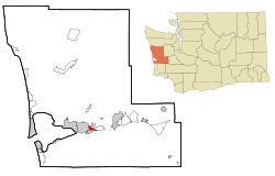
Brady is a census-designated place (CDP) in Grays Harbor County, Washington, United States. The population was 676 at the 2010 census.

Central Park, Washington CDP in Washington, United States

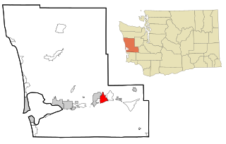
Central Park is a census-designated place (CDP) in Grays Harbor County, Washington, United States. The population was 2,685 at the 2010 census.

Chehalis Village, Washington Former CDP in Washington, United States

Chehalis Village is a former census-designated place (CDP) in Grays Harbor County, Washington, United States. The population was 346 at the 2000 census. The area was no longer listed as a CDP for the 2010 census.

Markham, Washington CDP in Washington, United States

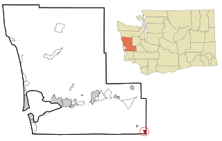
Markham is a census-designated place (CDP) in Grays Harbor County, Washington, United States. The population was 111 at the 2010 census.

Montesano, Washington City in Washington, United States

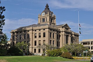
Montesano is a city in Grays Harbor County, Washington, United States. The population was 3,976 at the 2010 census. It is the county seat of Grays Harbor County.

Westport, Washington City in Washington, United States

Westport is a city in Grays Harbor County, Washington, United States. The city's population was 2,099 at the 2010 census. It is located on a peninsula on the south side of the entrance to Grays Harbor from the Pacific Ocean.

Fords Prairie, Washington CDP in Washington, United States

Fords Prairie is a census-designated place (CDP) in Lewis County, Washington, United States. The population was 1,959 at the 2010 census.

Skokomish, Washington CDP in Washington, United States

Skokomish is a census-designated place (CDP) in Mason County, Washington, United States. The population was 617 at the 2010 census. The town is the headquarters of the Skokomish Indian Tribe.

Grand Mound, Washington CDP in Washington, United States

Grand Mound is a community and census-designated place (CDP) in Thurston County, Washington, United States. It was named and founded by Jotham Weeks Judson, father of Phoebe Judson, in 1851. The population was 2,981 at the 2010 census. This area uses the 98579 and 98531 zip codes, which also includes Rochester and Gate.

Yosemite Lakes Park, California Census-designated place in California, United States

Yosemite Lakes Park is an unincorporated community in Madera County, California. It lies at an elevation of 1230 feet. As a census-designated place (CDP) it is known as Yosemite Lakes. It is part of the Madera–Chowchilla Metropolitan Statistical Area. The population was 4,952 at the 2010 census, up from 4,160 at the 2000 census.

References

  1. 1 2 "American FactFinder". United States Census Bureau. Archived from the original on 2020-02-12. Retrieved 2008-01-31.
  2. "Junction City". Geographic Names Information System . United States Geological Survey.
  3. 1 2 "Geographic Identifiers: 2010 Demographic Profile Data (G001): Junction City CDP, Washington". American Factfinder. U.S. Census Bureau. Retrieved March 30, 2017.[ dead link ]
  4. "US Gazetteer files: 2010, 2000, and 1990". United States Census Bureau. 2011-02-12. Retrieved 2011-04-23.