
Sumter County is a county located in the U.S. state of South Carolina. As of the 2020 census, the population was 105,556. In a 2018 census estimate, the population was 106,512. Its county seat is Sumter.

Georgetown County is a county located in the U.S. state of South Carolina. As of the 2020 census, the population was 63,404. Its county seat is Georgetown. The county was founded in 1769. It is named for George III of the United Kingdom.

Clarendon County is a county located below the fall line in the Coastal Plain region of U.S. state of South Carolina. As of 2020 census, its population was 31,144. Its county seat is Manning.
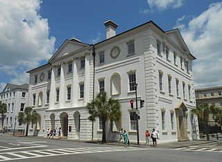
Charleston County is located in the U.S. state of South Carolina along the Atlantic coast. As of the 2020 census, its population was 408,235, making it the third most populous county in South Carolina. Its county seat is Charleston. The county was created in 1800 by an act of the South Carolina State Legislature.

Aiken is the largest city in, and the county seat of, Aiken County, in western South Carolina. It is one of the two largest cities of the Central Savannah River Area. Founded in 1835, Aiken was named after William Aiken, the president of the South Carolina Railroad. It became part of Aiken County when the county was formed in 1871 from parts of Orangeburg, Lexington, Edgefield, and Barnwell counties.
Stateburg is a census-designated place (CDP) in the High Hills of Santee in Sumter County, South Carolina, United States. The population was 1,380 at the 2010 census. It is included in the Sumter, South Carolina Metropolitan Statistical Area. Stateburg is located within the larger Stateburg Historic District.

Sumter is a city in and the county seat of Sumter County, South Carolina, United States. Known as the Sumter Metropolitan Statistical Area, the namesake county adjoins Clarendon and Lee to form the core of Sumter-Lee-Clarendon Tri-county area of South Carolina that includes three counties straddling the border of the Sandhills, Pee Dee, and Lowcountry regions. The population was 43,463 at the 2020 census.

Thomas Sumter was a soldier in the Colony of Virginia militia; a brigadier general in the South Carolina militia during the American Revolution, a planter, and a politician. After the United States gained independence, he was elected to the United States House of Representatives and to the United States Senate, where he served from 1801 to 1810, when he retired. Sumter was nicknamed the "Fighting Gamecock" for his fierce fighting style against British soldiers after they burned down his house during the Revolution.

U.S. Route 15 is a 791.71 mi (1,274.13 km)-long United States highway, designated along South Carolina, North Carolina, Virginia, Maryland, Pennsylvania, and New York. The route is signed north–south, from U.S. Route 17 Alternate in Walterboro, South Carolina to NY 17 in Corning, New York.

The Francis Marion National Forest is located north of Charleston, South Carolina. It is named for revolutionary war hero Francis Marion, who was known to the British as the Swamp Fox. It lies entirely within the Middle Atlantic coastal forests ecoregion. The park is also entirely in the Subtropical coniferous forest.

Interstate 95 (I-95) is a major Interstate Highway, running along the East Coast of the United States from Florida to Maine. In South Carolina, I-95 runs approximately parallel to the Atlantic Ocean shore although about 50 miles (80 km) inland, from Hardeeville in the south to Dillon in the northeast. The route runs through the cities of Florence and Walterboro.

The Stateburg Historic District is a historic district in Stateburg, in the High Hills of Santee area near Sumter, South Carolina in the United States. It includes two National Historic Landmarks, Borough House Plantation and the Church of the Holy Cross, and at least eight contributing properties within its boundaries. On February 24, 1971, it was added to the National Register of Historic Places. The historic district extends north and east of the town of Stateburg as far north as Meeting House Road and as far east as South Carolina Highway 441, covering an area of 5,066 acres (20.50 km2).
Singleton's Graveyard is an historic plantation cemetery located off SC 261 in the High Hills of Santee, 6 miles south of Wedgefield, South Carolina. On May 13, 1976, it was added to the National Register of Historic Places.

Wedgefield is an unincorporated community in the High Hills of Santee area in western Sumter County, South Carolina, United States. Wedgefield is also a Census Designated Place (CDP). Wedgefield was so named because its location was likened to a "wedge" into the High Hills of Santee. In the 18th and 19th centuries it was the location of many plantations, notably those of the Singleton family, which produced First Lady of the United States, Angelica Singleton Van Buren. Today the plantations are gone except for their cemeteries and Wedgefield is today noted as the location of a state park, a state forest and other recreational places. When the railroad came through in the 19th century, the commercial center of Wedgefield developed at the intersection of the railroad, Kings Highway and Wedgefield Road. It has its own post office with the Zip Code of 29168.
The High Hills of Santee, sometimes known as the High Hills of the Santee, is a long, narrow hilly region in the western part of Sumter County, South Carolina. It has been called "one of the state's most famous areas". The High Hills of Santee region lies north of the Santee River and east of the Wateree River, one of the two rivers that join to form the Santee. It extends north almost to the Kershaw county line and northeasterly to include the former summer resort town of Bradford Springs. Since 1902 the town has been included in Lee County.

Pinewood Depot is an historic railway station located at the junction of East Avenue and Clarke Street in the town of Pinewood, at the southern entrance of the High Hills of Santee, South Carolina. It is the only railroad station left in Sumter County, but is not longer used by CSX, the current owner of the railroad right-of-way. On June 10, 1997, it was added to the National Register of Historic Places.
Stewart Cleveland Cureton, also known as S. C. Cureton, was an American clergyman and civil rights activist.

Poinsett State Park is located in Sumter County in the U.S. state of South Carolina. The park is best known for its botanical oddities, combining the flora of the Blue Ridge Mountains foothills and Piedmont of Upstate South Carolina, the xeric Sandhills and the Atlantic coastal plain. In Poinsett State Park one can see mountain laurels draped with Spanish moss. The park, which has been called "weird and beautiful", is named after amateur botanist and South Carolina native Joel Roberts Poinsett, the first American ambassador to Mexico and popularizer of the poinsettia. There is a $3 charge for admission to Poinsett State Park and there are small fees for overnight camping and cabin rentals. The park is surrounded by the Manchester State Forest, and both provide access to the Palmetto Trail, linked hiking and mountain bike trails, and Manchester State Forest offers equestrian trails.

South Carolina Highway 120 (SC 120) is a 17.390-mile (27.986 km) state highway in the U.S. state of South Carolina. The highway connects Pinewood and Sumter.
