Pinewood, South Carolina | |
|---|---|
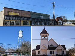 Scenes in Pinewood | |
 Location of Pinewood, South Carolina | |
| Coordinates: 33°44′23″N80°27′43″W / 33.73972°N 80.46194°W [1] | |
| Country | United States |
| State | South Carolina |
| County | Sumter |
| Area | |
• Total | 1.07 sq mi (2.77 km2) |
| • Land | 1.07 sq mi (2.77 km2) |
| • Water | 0 sq mi (0.00 km2) |
| Elevation | 190 ft (58 m) |
| Population | |
• Total | 503 |
| • Density | 469.7/sq mi (181.35/km2) |
| Time zone | UTC-5 (Eastern (EST)) |
| • Summer (DST) | UTC-4 (EDT) |
| ZIP code | 29125 |
| Area codes | 803 and 839 |
| FIPS code | 45-57085 [4] |
| GNIS feature ID | 2407126 [1] |
Pinewood is a town located on South Carolina Highway 261 at the southern entrance to the High Hills of Santee in Sumter County, South Carolina, United States. The population was 538 at the 2010 census. It is included in the Sumter, South Carolina Metropolitan Statistical Area.
