Mandailing Natal Regency

Last updated
Mandailing Natal Regency
(Kabupaten Mandailing Natal)
Mandailing-natal.jpg
Motto(s): 
Madina yang Madani
("A Civilized Regency")
Lokasi Sumatera Utara Kabupaten Mandailing Natal.svg
Country Indonesia
ProvinceNorth Sumatra
Regency seat Panyabungan
Government
  RegentDahlan Hasan Nasution
  Vice RegentMuhammad Jafar Sukhairi Nasution
  Chairman of Council of RepresentativesErwin Efendi Lubis (Gerindra)
  Vice Chairmen of Council of RepresentativesHarminsyah Batubara (Partai Demokrat) and Erwin Efendi Nasution (Golkar)
Area
  Total6,620.7 km2 (2,556.3 sq mi)
Population
 (mid 2023 estimate) [1]
  Total496,975
  Density75/km2 (190/sq mi)
Time zone UTC+7 (WIB)
Website www.madina.go.id

Mandailing Natal, a.k.a. Madina, is a regency in North Sumatra Province of Indonesia. It covers an area of 6,620.70 square kilometres and it had a population of 403,894 people at the 2010 census [2] and 472,886 at the 2020 Census; [3] the official estimate as at mid 2023 was 496,975 (comprising 247,811 males and 249,164 females). [1] The capital lies at Panyabungan. The Regency was formerly a part of South Tapanuli Regency until it was created as a separate regency on 23 November 1998. It is the southernmost regency in North Sumatra, and the largest regency by land area in the province, with Langkat Regency second to it.

Contents

Geography

The regency is divided in two by the Bukit Barisan mountains. The portion to the west of the mountains drains to the west coast of Sumatra, and comprises the districts of Batahan, Sinunukan, Batang Natal, Lingga Bayu, Ranto Baek, Natal and Muara Batang Gadis; it covers an area of 4,037 km2, and had a population of 179,270 in mid 2023. [4] The portion to the east of the mountains comprises the remaining districts of the Regency, all of which drain towards the north; it covers an area of 2,583.7 km2 and had a population of 317,705 in mid 2023.
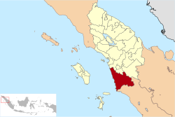
Administration

At the 2010 Census, the regency was divided into eighteen districts (kecamatan). Subsequently, five additional districts (indicated by asterisks in the table below) have been created by the division of existing districts. The twenty-three districts are tabulated below with their areas and their population at the 2010 Census [2] and the 2020 Census, [3] together with the official estimates as at mid 2023. [1] The table also includes the locations of the district administrative centres, the number of administrative villages in each district (totaling 377 rural desa and 27 urban kelurahan), and its post code.

Kode
Wilayah
Name of
District
(kecamatan)
Area
in
km2
Pop'n
Census
2010
Pop'n
Census
2020
Pop'n
Estimate
mid 2023
Admin
centre
No.
of
villages
Post
code
12.13.15Batahan497.0717,52422,50924,189Pasar Batahan18 (a)22988
12.13.22Sinunukan *172.6415,37521,52723,720Sinunukan III1422986
12.13.13Batang Natal651.5122,57525,33326,177Muara Soma31 (a)22983
12.13.14Lingga Bayu192.6822,45327,57629,251Simpang Gambir19 (b)22982
12.13.18Ranto Baek *152.7211,25914,08515,021Manisak1722984
12.13.08Kotanopan325.1526,26427,87128,441Pasar Kotanopan36 (b)22994
12.13.11Ulu Pungkut295.194,2504,6744,802Huta Godang13 (a)22999
12.13.10Tambangan158.6011,47110,91311,266Laru Lombang20 (a)22996
12.13.09Lembah
Sorik Marapi
34.7315,60510,96811,326Pasar Maga9 (a)22993
12.13.20Puncak
Sorik Marapi *
55.547,9548,9759,289Sibanggor1122995
12.13.12Muara Sipongi135.709,67012,52813,208Pasar
Muara Sipongi
16 (a)22998
12.13.21Pakantan *93.602,1462,2222,281Pakantan822997
12.13.01Panyabungan Kota259.7777,44990,04994,013Panyabungan39 (c)22915
-22919
12.13.04Panyabungan
Selatan (South
Panyabungan)
87.609,41010,32310,597Tano Bato11 (a)22952
12.13.05Panyabungan
Barat (West
Panyabungan)
87.228,91110,67711,245Longat10 (a)22911
12.13.02Panyabungan
Utara (North
Panyabungan)
63.7319,99122,57323,367Mompang12 (a)22979
12.13.03Panyabungan
Timur (East
Panyabungan)
397.8712,30714,21414,811Gunung Baringin15 (a)22912
12.13.19Huta Bargot *116.215,7158,7489,335Bangun Sejati1222978
12.13.16Natal935.3727,29233,89736,074Pasar Natal30 (b)22987
12.13.17Muara
Batang Gadis
1,435.0215,41622,32224,838Singkuang1422989
12.13.06Siabu345.3647,36453,28655,102Siabu28 (b)22976
12.13.07Bukit Malintang68.7410,89412,77113,365Bukit Malintang1122977
12.13.23Naga Juang *58.693,6504,8455,257Banua Simanosor722975
Totals6,620.70404,945472,886496,975Panyabungan404

Notes: (a) including 1 kelurahan. (b) including 2 kelurahan. (c) comprising 9 kelurahan and 30 desa.

National Park

Sorik Marapi District Highland without Batang Gadis National Park Psm tanpa hutan lindung.jpg
Sorik Marapi District Highland without Batang Gadis National Park
Sorik Marapi District Highland with Batang Gadis National Park Psm dan hutan lindung.jpg
Sorik Marapi District Highland with Batang Gadis National Park
see Batang Gadis National Park 

Related Research Articles

<span class="mw-page-title-main">Karo Regency</span> Regency in North Sumatra, Indonesia

Karo Regency is a landlocked regency of North Sumatra Province of Indonesia, situated in the Barisan Mountains. The regency, which was established on 7 November 1956, covers an area of 2,127.25 square kilometres (821.34 sq mi) and according to the 2010 census it had a population of 350,479, increasing to 404,998 at the 2020 Census; the official estimate as at mid-2023 was 420,799, comprising 208,600 males and 212,200 females. 60.99% of the regency is forested. Its regency seat is the town of Kabanjahe. The Batak Karo language is spoken in the regency, as well as the Indonesian language. It borders Southeast Aceh Regency in Aceh to the west, Deli Serdang Regency and Langkat Regency to the north, Dairi Regency and Toba Samosir Regency to the south, and Deli Serdang Regency and Simalungun Regency to the east.

<span class="mw-page-title-main">Pelalawan Regency</span> Regency in Riau, Indonesia

Pelalawan is a regency (kabupaten) of Riau Province, Indonesia. It is located on the island of Sumatra. The regency was created on 4 October 1999 as a result of the division of Kampar Regency, of which it was previously the eastern 43%. It now has an area of 13,408.72 km2 and had a population of 301,829 at the 2010 Census and 390,046 at the 2020 Census; the official estimate as at mid 2023 was 415,469. The administrative centre is in the town of Pangkalan Kerinci.

<span class="mw-page-title-main">Indragiri Hilir Regency</span> Regency in Riau, Indonesia

Indragiri Hilir is the most eastern regency (kabupaten) of Riau Province, Indonesia. It is located on the island of Sumatra. The regency has an area of 13,136.14 km2 and had a population of 661,779 at the 2010 census and 654,909 at the 2020 Census; the official estimate as at mid 2023 was 695,571. The administrative centre of the regency is the town of Tembilahan.

<span class="mw-page-title-main">Batanghari Regency</span> Regency in Jambi, Indonesia

Batanghari is a regency of Jambi Province in Sumatra, Indonesia. It originally covered a wider area, but on 4 October 1999 this was split between a new Muaro Jambi Regency in the east and a reduced Batang Hari Regency in the west, which now covers an area of 5,804.83 km2. It had a population of 241,334 at the 2010 census and 301,700 at the 2020 census; the official estimate as at mid 2023 was 312,279. The administrative capital is the town of Muara Bulian(Bulian Estuary or Bulian Delta).

<span class="mw-page-title-main">Mojokerto Regency</span> Regency of Indonesia

Mojokerto Regency is a regency in East Java Province of Indonesia. It is part of the Surabaya metropolitan area which comprises Gresik Regency, Bangkalan Regency, Mojokerto Regency, Mojokerto City, Surabaya City, Sidoarjo Regency, and Lamongan Regency. The Regency covers an area of 969.36 km2. The population of the Regency was 908,004 in 2000, but had risen to 1,025,443 at the 2010 Census and to 1,119,209 at the 2020 Census; the official estimate as of mid-2022 was 1,133,584, and the total for mid-2023 was 1,145,400. Many of them earn their living as small farmers and craftsmen.

<span class="mw-page-title-main">South Labuhanbatu Regency</span> Regency in North Sumatra, Indonesia

South Labuhanbatu Regency is a regency of North Sumatra Province of Indonesia, created on 21 July 2008 by being carved out of the southern districts of the existing Labuhanbatu Regency. The new South Labuhanbatu Regency covers an area of 3,596 square kilometres and according to the 2010 census it had a population of 277,673, which rose to 314,094 at the 2020 Census; the official estimate as at mid 2023 was 330,797. Its administrative headquarters are at the town of Kotapinang.

<span class="mw-page-title-main">Serdang Bedagai Regency</span> Regency in North Sumatra, Indonesia

Serdang Bedagai Regency is a regency on the east coast of North Sumatra Province of Indonesia, facing Malaysia, with 95 km of coastline and covering an area of 1,900.22 square kilometres, divided into seventeen districts (kecamatan), in turn subdivided into 243 villages. Its administrative centre is the town of Sei Rampah. The regency surrounds the independent city of Tebing Tinggi, and also contains a district (kecamatan) by the same name. The name “Serdang Bedagai” was derived from the two Sultanates which formerly existed in the Region; they were Serdang Sultanate and Padang Bedagai Sultanate. The population was 592,922 at the 2010 Census, while the 2020 Census produced a total of 657,490; the official estimate as at mid 2023 was 682,918.

<span class="mw-page-title-main">South Tapanuli Regency</span> Regency in North Sumatra, Indonesia

South Tapanuli is a regency in North Sumatra, Indonesia. Its seat is the town of Sipirok. This regency was originally very large and contained thousands of towns and villages, including the city of Padang Sidempuan. The areas that have separated from South Tapanuli Regency are the new regencies of Mandailing Natal, Padang Lawas Utara, and Padang Lawas, all lying to the south-east of the residual South Tapanuli Regency, plus the city (kota) of Padang Sidempuan. After the division, the regency seat moved from Padang Sidempuan to Sipirok.

<span class="mw-page-title-main">North Tapanuli Regency</span> Regency in North Sumatra, Indonesia

North Tapanuli Regency is a landlocked regency in North Sumatra province, Sumatra, Indonesia. Its capital is Tarutung. The regency covers an area of 3,793.71 square kilometres and it had a population of 278,897 at the 2010 Census and 312,758 at the 2020 Census; the official estimate as of mid-2023 was 323,102.

<span class="mw-page-title-main">Central Bangka Regency</span> Regency in Bangka Belitung Islands, Indonesia

Central Bangka Regency is a regency (kabupaten) of the Bangka Belitung Islands Province, Indonesia. It covers an area of 2,155.77 km2 and had a population of 161,075 at the 2010 Census, rising to 198,946 at the 2020 Census; the official estimate as at mid 2022 was 205,510 - comprising 106,340 males and 99,170 females. The town of Koba is its regency seat.

<span class="mw-page-title-main">Pinrang Regency</span> Regency in South Sulawesi, Indonesia

Pinrang Regency is one of the twenty-one regencies in South Sulawesi Province of Indonesia. Pinrang town in Watang Sawitto District is the administrative capital of Pinrang Regency. The regency is situated in the northwest of the South Sulawesi peninsula, and covers a land area of 1,896.57 km2. It had a population of 351,161 at the 2010 Census and 403,994 at the 2020 Census; the official estimate as at mid 2023 was 417,932.

<span class="mw-page-title-main">Dompu</span> Town in Lesser Sunda Islands, Indonesia

Dompu is a town and the administrative centre of the Dompu Regency, located in the eastern part of the island of Sumbawa, in central Indonesia's province of West Nusa Tenggara. It is the third largest town on the island of Sumbawa, with a district population of 49,854 at the 2010 Census, which by the 2020 Census had grown to 54,987; the official estimate as at mid 2023 was 57,680. It is connected by provincial road to Bima and Sape.

<span class="mw-page-title-main">Bungo Regency</span> Regency in Indonesia

Bungo Regency is a regency (kabupaten) of Jambi Province in Sumatra, Indonesia. It was created on 4 October 1999 by the division of the former Bungo Tebo Regency into a new Tebo Regency in the west and this Bungo Regency in the east. The Bungo Regency covers an area of 4,659 km2. As at the 2010 census, the regency had a population of 303,135 and 362,363 at the 2020 census; the official estimate as at mid 2023 was 376,382 - comprising 191,594 males and 184,788 females. The administrative capital is the town of Muara Bungo.

<span class="mw-page-title-main">East Tanjung Jabung Regency</span> Regency in Jambi, Indonesia

East Tanjung Jabung Regency is a regency of Jambi Province, Indonesia. It is located on the island of Sumatra. The regency was created on 4 October 1999 by the division of the then Tanjung Jabung Regency into eastern and western halves. It now has an area of 5,087.07 km2 and had a population of 205,272 at the 2010 census and 229,813 at the 2020 census; the official estimate as at mid 2023 was 236,727. The regency's administrative capital lies at the town of Muara Sabak, a riverine port near the mouth of the Berbak River.

<span class="mw-page-title-main">Kaur Regency</span> Regency in Bengkulu, Indonesia

Kaur is the most southern regency of Bengkulu Province, Indonesia, on the west coast of the island of Sumatra. It was created on 25 February 2003 from what were formerly the southeastern districts of the South Bengkulu Regency. It has an area of 2,365.00 km2 and had a population of 107,899 at the 2010 Census and 126,551 at the 2020 Census; the official estimate as at mid 2023 was 131,063 - comprising 67,389 males and 63,674 females. The regency seat is at the town of Bintuhan.

<span class="mw-page-title-main">Ogan Ilir Regency</span> Regency in South Sumatra

Ogan Ilir Regency is a regency of South Sumatra Province, Indonesia. It takes its name from the main river which stream that area, Ogan River. And the name Ilir means downstream. Indralaya is the regency seat. The regency borders Palembang City and Muara Enim Regency to the north, Ogan Komering Ilir Regency to the east, Ogan Komering Ilir Regency, and East Ogan Komering Ulu Regency to the south, and Muara Enim Regency to the west.

<span class="mw-page-title-main">South Minahasa Regency</span> Regency in North Sulawesi, Indonesia

South Minahasa Regency is a regency in North Sulawesi, Indonesia. Its capital is the town of Amurang. It was originally part of the Minahasa Regency until it was established as a separate regency on 25 February 2003. In turn, nearly four years later, a new Southeast Minahasa Regency was established as a separate regency from part of the South Minahasa Regency on 2 January 2007. The residual Regency now covers an area of 1,456.74 km2, and had a population of 195,553 at the 2010 Census; this had risen to 236,463 at the 2020 Census; the official estimate as at mid 2023 was 244,590.

<span class="mw-page-title-main">Southeast Minahasa Regency</span> Regency in North Sulawesi, Indonesia

Southeast Minahasa Regency is a regency in North Sulawesi, Indonesia. It covers a land area of 730.63 km2, and had a population of 100,443 at the 2010 Census; this had risen to 116,323 at the 2020 Census, and the official estimate as at mid 2023 was 118,946. It was established as a separate regency from the south-eastern part of the South Minahasa Regency on 2 January 2007. Its administrative centre is at the town of Ratahan.

<span class="mw-page-title-main">Tuban Regency</span> Regency of Indonesia

Tuban Regency is a regency in the East Java province of Indonesia. The Dutch name of the regency is 'Toeban'. It covers a land area of 1,839.94 sq. km, and had a population of 1,118,464 at the 2010 Census and 1,198,012 at the 2020 Census; the official estimate as of mid-2023 was 1,258,368. The administrative centre is the coastal town of Tuban.

<span class="mw-page-title-main">Sekayu, Indonesia</span>

Sekayu is a town and district which serves as the administrative centre of Musi Banyuasin Regency within South Sumatra Province, Sumatra, Indonesia. The district's population was 78,637 at the 2010 Census and 91,120 at the 2020 Census; the official estimate as at mid 2023 was 99,589. The district comprises 14 small towns and villages, of which 4 are kelurahan and ten are desa as follows:

References

  1. 1 2 3 Badan Pusat Statistik, Jakarta, 28 February 2024, Kabupaten Mandailing Natal Dalam Angka 2024 (Katalog-BPS 1102001.1213)
  2. 1 2 Biro Pusat Statistik, Jakarta, 2011.
  3. 1 2 Badan Pusat Statistik, Jakarta, 2021.
  4. Badan Pusat Statistik, Jakarta, 2023, Kabupaten Mandailing Natal Dalam Angka 2023 (Katalog-BPS 1102001.1213)

0°47′02″N99°15′18″E / 0.7838°N 99.2549°E / 0.7838; 99.2549