Dairi Regency

Last updated

Dairi Regency
Kabupaten Dairi, Sumatra Utara (01).jpg
Regent's office of Dairi Regency
Dairi Regency Emblem.png
Lokasi Sumatra Utara Kabupaten Dairi.svg
Country Indonesia
ProvinceNorth Sumatra
Regency seat Sidikalang
Government
  RegentEddy Keleng Ate Berutu
  Vice RegentJimmy Andrea Lukita Sihombing
  Chairman of Council of RepresentativesSabam Sibarani (Golkar)
  Vice Chairmen of Council of RepresentativesAlvensius Tondang (PDI-P) and Wanseptember Situmorang (Partai Demokrat)
Area
  Total1,927.80 km2 (744.33 sq mi)
Population
 (mid 2023 estimate) [1]
  Total324,747
  Density170/km2 (440/sq mi)
Time zone UTC+7 (WIB)
Website www.dairikab.go.id

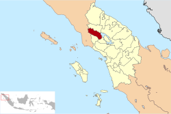
Dairi Regency is an inland regency on the western shore of Lake Toba in North Sumatra Province of Indonesia. The regency was created on 23 September 1964 from what were previously the north-western districts of North Tapanuli Regency; however the southern districts of this new regency were in turn split off on 25 February 2003 to form the new Pakpak Bharat Regency. The reduced regency covers an area of 1,927.80 square kilometres (744.33 sq mi) and it had a population of 269,848 people at the 2010 Census [2] and 308,764 at the 2020 Census; [3] the official estimate as at mid 2023 was 324,747 - comprising 162,928 males and 161,819 females. [1] Its administrative seat is at the town of Sidikalang.

Contents

Geography and climate

Welcome gate to Dairi Regency Welcome gate to Dairi Regency - Gapura Kabupaten Dairi (Dairi-Karo; Lae Pondom) (02).jpg
Welcome gate to Dairi Regency

Dairi is mostly hills and mountains, averaging 700 to 1,250 metres (2,300 to 4,100 ft) above sea level. It has a tropical rainforest climate, with the heaviest rainfall between September and May. [4]

Demographics

Population pyramid for Dairi as of 2008; males are in blue and females are in red Dairi Population Pyramid.png
Population pyramid for Dairi as of 2008; males are in blue and females are in red

A 2008 estimate by the Dairi government put Dairi's population at 271,983, with a sex ratio of 99.43. Of the population, 39.96% is under the age of 14. [5] At the 2010 Census the population was 269,848, [2] at the 2020 Census it was 308,764 [3] and for mid 2023 it was estimated as 324,747. [1]

Bordering territories

The Dairi Regency is bordered to the north by Karo Regency, to the east by Samosir Regency and Lake Toba, to the south by Pakpak Bharat Regency, and to the west by Aceh Province (Southeast Aceh Regency and the City of Subulussalam).

Administrative districts

Dairi Regency is divided into fifteen districts (kecamatan), tabulated below with their areas and their populations at the 2010 Census [2] and the 2020 Census, [3] together with the official estimates as at mid 2023. [1] The table also includes the locations of the district administrative centres, the number of administrative villages in each district (totaling 161 rural desa and 8 urban kelurahan), and its post code.

Kode
Wilayah
Name of
District
(kecamatan)
Area
in
km2
Pop'n
Census
2010
Pop'n
Census
2020
Pop'n
Estim.
mid 2023
Admin
centre
No.
of
villages
Post
code
12.11.01Sidikalang70.6748,64653,43356,498Sidikalang11 (a)22211
-22219
12.11.13Berampu40.857,9089,0319,396Berampu522251
12.11.15Sitinjo53.1511,23514,42915,211Sitinjo4 (b)22219
12.11.10Parbuluan235.4020,63725,23627,203Sigalingging1122282
12.11.02Sumbul192.5839,36545,60647,224Sumbul19 (c)22284
12.11.14Silahisabungan75.624,4715,2425,811Silalahi522280
12.11.05Silima Pungga-Pungga88.3512,65114,44815,318Parongil16 (d)22262
12.11.11Lae Parira42.7513,56714,52615,442Lae Parira922281
12.11.04Siempat Nempu60.1517,97920,24121,091Buntu Raja1322261
12.11.07Siempat Nempu Hulu
(Upper Siempat Nempu)
93.9317,66320,18320,993Silumboyah1222254
12.11.08Siempat Nempu Hilir
(Lower Siempat Nempu)
105.6210,42311,74612,346Sopobutar1022263
12.11.03Tigalingga197.0021,44424,42825,333Tigalingga1422252
12.11.12Gunung
Sitember
77.009,09010,71411,081Gunung
Sitember
822250
12.11.09Pegagan Hilir
(Lower Pegagan)
155.3314,74016,74017,933Tiga Baru1322283
12.11.06Tanah Pinem439.4020,23422,76123,867Kuta Buluh1922253
Totals1,927.80269,848308,764324,747Sidikalang169

Notes: (a) comprising 5 kelurahan (Batang Beruh, Bintang Hulu, Kuta Gambir, Sidiangkat and Sidikalang Kota) and 6 desa.
(b) including the kelurahan of Panji Dabutar. (c) including the kelurahan of Pegagan Julu I. (d) including the kelurahan of Parongil.

Coat of arms

The coat of arms of Dairi has many connotations. Indonesia's date of independence, 17 August 1945, is indicated by the 17-budded cotton plant on the left side, 8 rattan branches in the center, and 45 seeds of rice on a stalk to the right. The shield in the centre is divided into five, four parts indicating different cash crops important to the area (benzoin resin, coffee, tobacco and patchouli), while the fifth shows a traditional Pakpak Batak house; the house signifies protection. The five point star in the top center signifies the Pancasila-respecting habits of the Dairi people, while the mountains represent tranquility and the chains represent gotong royong , or cooperating and collaborating. The central sharpened bamboo spear represents the Dairi people's struggle for independence. [6]

History

An early Dutch settlement in Dairi COLLECTIE TROPENMUSEUM Kolonistenwoning Dairi kolonisatie Sumatra's Westkust TMnr 10001419.jpg
An early Dutch settlement in Dairi

Prior to the arrival of the Dutch East India Company, the people of what is now Dairi lived in traditional adat -regulated communities, with unelected local leaders. After the arrival of the Dutch they established an ethnic-Dutch controleur to be in charge of the Dairi onder afdeling, as well as a native Indonesian demang, or lieutenant. When the Japanese occupied Indonesia beginning in 1942, the Dairi area was also occupied; during this time, local youths were used as forced labour to build the 65 kilometres (40 mi) long Sidikalang road and the Dutch were removed. [7]

After Indonesia's independence, the residents attempted to build a foundation for a new government. However, after the Dutch army recaptured nearby East Sumatra in 1947, they chose a new leader for the Dairi area. Another leader was chosen in 1949; later that year, after the Netherlands and Indonesia signed an agreement for Indonesian independence [7]

Economy

Farming is a large business in Dairi. Major crops in Dairi are coffee, both robusta and arabica, corn, and potatoes. Approximately 6,770 tonnes of robusta coffee are produced every year, in addition to 2,639 tonnes of arabica; corn fields take up 63% of suitable farming land. [8] Other minor trades are damar collecting, fish farming, and rattan. [9]

Since 1997, Dairi Prima Mineral have operated the Dairi mine near the Sopokomil hamlet of Longkotan [id] village [10] in the Silima Pungga-Pungga [id] subdistrict of the regency. [11] [12]

Related Research Articles

<span class="mw-page-title-main">Jambi</span> Province of Indonesia

Jambi is a province of Indonesia. It is located on the east coast of central Sumatra and stretches to the Barisan Mountains in the west. Its capital and largest city is also called Jambi. It is bordered by the provinces of Riau to the north, West Sumatra to the west, Bengkulu to the southwest, South Sumatra to the south, and shares a maritime border with the Riau Islands to the east and the Pacific Ocean to the east. The province has a land area of 49,026.58 km2, and a sea area of 3,274.95 km2. It had a population of 3,092,265 according to the 2010 census and 3,548,228 according to the 2020 census; the official estimate of population as of mid-2022 was 3,631,136.

<span class="mw-page-title-main">Deli Serdang Regency</span> Regency in North Sumatra, Indonesia

Deli Serdang is a regency in the Indonesian province of North Sumatra. It surrounds the city of Medan, and also borders the city of Binjai, which is effectively a bedroom community for Medan. The entire regency lies within the Medan metropolitan area. It occupies an area of 2,497.72 sq.km. The capital of the district is Lubuk Pakam, which is located approximately 30 km east of Medan. The national census of 2000 recorded 1,573,987 people, but by 2010 the regency's population increased by 13.76% to 1,790,431, and at the 2020 Census the total was 1,931,441. The official estimate as at mid 2022 was 1,953,986. Kualanamu International Airport is located in this regency.

<span class="mw-page-title-main">Karo Regency</span> Regency in North Sumatra, Indonesia

Karo Regency is a landlocked regency of North Sumatra Province of Indonesia, situated in the Barisan Mountains. The regency, which was established on 7 November 1956, covers an area of 2,127.25 square kilometres (821.34 sq mi) and according to the 2010 census it had a population of 350,479, increasing to 404,998 at the 2020 Census; the official estimate as at mid-2023 was 420,799, comprising 208,600 males and 212,200 females. 60.99% of the regency is forested. Its regency seat is the town of Kabanjahe. The Batak Karo language is spoken in the regency, as well as the Indonesian language. It borders Southeast Aceh Regency in Aceh to the west, Deli Serdang Regency and Langkat Regency to the north, Dairi Regency and Toba Samosir Regency to the south, and Deli Serdang Regency and Simalungun Regency to the east.

<span class="mw-page-title-main">Pelalawan Regency</span> Regency in Riau, Indonesia

Pelalawan is a regency (kabupaten) of Riau Province, Indonesia. It is located on the island of Sumatra. The regency was created on 4 October 1999 as a result of the division of Kampar Regency, of which it was previously the eastern 43%. It now has an area of 13,408.72 km² and had a population of 301,829 at the 2010 Census and 390,046 at the 2020 Census; the official estimate as at mid 2022 was 410,988. The administrative centre is in the town of Pangkalan Kerinci.

<span class="mw-page-title-main">Indragiri Hulu Regency</span> Regency in Riau, Indonesia

Indragiri Hulu is a landlocked regency (kabupaten) of Riau, Indonesia. It is located on the island of Sumatra. The original regency was split in two on 4 October 1999, with the western half being created as a separate Kuantan Singingi Regency. The regency now has an area of 8,198.71 km2 and had a population of 363,442 at the 2010 census, 408,704 at the 2015 census and 444,548 at the 2020 census; the official estimate as at mid 2022 was 464,076. The administrative seat of the regency is located at the town of Rengat.

<span class="mw-page-title-main">Kuantan Singingi Regency</span> Regency in Riau, Indonesia

Kuantan Singingi is a regency (kabupaten) of Riau, Indonesia. It is located on the island of Sumatra. The regency was created on 4 October 1999 from what had been the western half of Indragiri Hulu Regency. It has an area of 7,656.03 km² and had a population of 292,116 at the 2010 Census and 334,943 at the 2020 Census; the official estimate as at mid 2022 was 345,850. The seat of the regency is the town of Teluk Kuantan.

<span class="mw-page-title-main">Rokan Hilir Regency</span> Regency in Riau, Indonesia

Rokan Hilir is a regency (kabupaten) of Riau Province, on Sumatra island, Indonesia. It was formed on 4 October 1999 from districts which had previously been the northwestern part of Bengkalis Regency. It occupies the lower part of the catchment area of the Rokan River, and has an area of 8,851.59 km2. It had a population of 553,216 at the 2010 census and 637,161 at the 2020 census; the official estimate as at mid 2022 was 638,407. The administrative centre of the Rokan Hilir Regency is located at the town of Bagansiapiapi.

<span class="mw-page-title-main">North Bengkulu Regency</span> Regency in Bengkulu, Indonesia

North Bengkulu is a regency of Bengkulu Province, Indonesia, on the island of Sumatra. It originally covered much of the northern part of Bengkulu Province, but on 25 February 2003 the most northwesterly districts were split off to form a separate Mukomuko Regency, and on 24 June 2008 the most southeastern districts were likewise split off to create a new Central Bengkulu Regency. The residual regency now covers an area of 4,424.59 km2, and it had a population of 257,675 at the 2010 Census and 296,523 at the 2020 Census; the official estimate as at mid 2022 was 302,833. The administrative centre is at the town of Arga Makmur.

<span class="mw-page-title-main">Humbang Hasundutan Regency</span> Regency in North Sumatra, Indonesia

Humbang Hasundutan Regency is a landlocked regency in North Sumatra province of Indonesia. In the east of the regency, Baktiraja District stretches along a short part of the southern shore of Lake Toba in North Sumatra. The regency covers an area of 2,502.71 km2, and it had a population of 171,650 at the 2010 census</ref> and 197,751 at the 2020 census; the official estimate as at mid 2022 was 202,299. Its seat is the town of Dolok Sanggul. To the north is Samosir Regency and Pakpak Bharat Regency, to the east is North Tapanuli Regency, and to the west and south is Central Tapanuli Regency, and beyond the latter the Indian Ocean.

<span class="mw-page-title-main">Labuhanbatu Regency</span> Regency in North Sumatra, Indonesia

Labuhanbatu Regency, alternatively written in space as Labuhan Batu Regency, is a regency of North Sumatra Province in Indonesia. Its administrative seat is Rantau Prapat. An original regency of the province, it had an area of 9,703 km2 as at early 2008, prior to the separation out of its southern and its north-western districts respectively to create the new South Labuhanbatu and North Labuhanbatu Regencies on 21 July 2008.

<span class="mw-page-title-main">South Labuhanbatu Regency</span> Regency in North Sumatra, Indonesia

South Labuhanbatu Regency is a regency of North Sumatra Province of Indonesia, created on 21 July 2008 by being carved out of the southern districts of the existing Labuhanbatu Regency. The new South Labuhanbatu Regency covers an area of 3,596 square kilometres and according to the 2010 census it had a population of 277,673, which rose to 314,094 at the 2020 Census; the official estimate as at mid 2023 was 330,797. Its administrative headquarters are at the town of Kotapinang.

<span class="mw-page-title-main">North Labuhanbatu Regency</span> Regency in North Sumatra, Indonesia

North Labuhanbatu Regency is a regency of North Sumatra, Indonesia, created on 21 July 2008 by being carved out of the north-western districts of the existing Labuhanbatu Regency, which until 2008 covered an area of 9,703 square kilometres and had a population of 840,382 according to the 2000 census. 60.99% of the regency is forested. The new North Labuhanbatu Regency covers 3,545.8 square kilometres and had a population of 331,660 at the 2010 Census, rising to 381,994 at the 2020 Census; the official estimate as at mid 2023 was 401,863 . The Kualuh River is located in this regency. The administrative centre of the regency is at the town of Aek Kanopan.

<span class="mw-page-title-main">Mandailing Natal Regency</span> Regency in North Sumatra, Indonesia

Mandailing Natal, abbreviated as Madina, is a regency in North Sumatra Province of Indonesia. It covers an area of 6,620.70 square kilometres and it had a population of 403,894 people at the 2010 census and 472,886 at the 2020 Census; the official estimate as at mid 2023 was 496,975. The capital lies at Panyabungan. The Regency was formerly a part of South Tapanuli Regency until it was created as a separate regency on 23 November 1998. It is the southernmost regency in North Sumatra, and the largest regency by land area in the province, with Langkat Regency second to it.

<span class="mw-page-title-main">Pakpak Bharat Regency</span> Regency in North Sumatra, Indonesia

Pakpak Bharat Regency is a landlocked regency in North Sumatra, Indonesia. It was created on 25 February 2003 from the southern districts of Dairi Regency. The regency covers an area of 1,218.3 square kilometres and it had a population of 40,481 at the 2010 census and 52,351 at the 2020 Census; the official estimate as at mid 2022 was 54,609. Its seat is the town of Salak. It is the least populated regency in North Sumatra. Its population is roughly the same as Greenland, the island with the lowest population density in the world.

<span class="mw-page-title-main">Central Tapanuli Regency</span> Regency in North Sumatra, Indonesia

Central Tapanuli Regency is a regency in North Sumatra province, Sumatra, Indonesia. The seat of regency government is at Pandan. The regency covers an area of 2,194.98 km2 and consists of a long extent of land along the western coast of North Sumatra, together with offshore islands of which the largest is Mursala Island; it had a population of 311,232 at the 2010 census and 365,177 at the 2020 Census; the official estimate as at mid 2023 was 386,895. The regency surrounds on the landward side the city of Sibolga, which is administratively separate from the regency.

<span class="mw-page-title-main">North Tapanuli Regency</span> Regency in North Sumatra, Indonesia

North Tapanuli Regency is a landlocked regency in North Sumatra province, Sumatra, Indonesia. Its capital is Tarutung. The regency covers an area of 3,793.71 square kilometres and it had a population of 278,897 at the 2010 Census and 312,758 at the 2020 Census; the official estimate as of mid-2023 was 323,102.

<span class="mw-page-title-main">Bungo Regency</span> Regency in Indonesia

Bungo Regency is a regency (kabupaten) of Jambi Province in Sumatra, Indonesia. It was created on 4 October 1999 by the division of the former Bungo Tebo Regency into a new Tebo Regency and this Bungo Regency. The regency covers an area of 4,659 km2. As at the 2010 census, the regency had a population of 303,135 and 362,363 at the 2020 census; the official estimate as at mid 2022 was 373,344. The administrative capital is the town of Muara Bungo.

<span class="mw-page-title-main">Ogan Komering Ilir Regency</span> Regency in South Sumatra

Ogan Komering Ilir Regency is a regency of South Sumatra Province, Indonesia. It takes its name from the Ogan River and the Komering River, which are the two main rivers that drain the area. The name Ilir means downstream. The administrative centre is the town of Kayu Agung. The regency borders Banyuasin Regency to the northwest, Bangka Strait, and the Java Sea to the east, Lampung Province to the south, and Palembang city, Ogan Ilir Regency, and East Ogan Komering Ulu Regency to the west.

<span class="mw-page-title-main">Central Lampung Regency</span> Regency in Lampung, Indonesia

Central Lampung Regency is a regency of the province of Lampung, on Sumatra, Indonesia. On 20 April 1999, two areas were separated from the original regency - the southeastern portion was split off to form a separate East Lampung Regency, while the town of Metro was created as an independent city. The reduced regency has an area of 4,545.50 km2 and had a population of 1,170,048 people at the 2010 census and 1,460,045 at the 2020 census; the official estimate as at mid 2022 was 1,500,002. The regency seat is the town of Gunung Sugih.

<span class="mw-page-title-main">Bone Regency</span> Regency in South Sulawesi, Indonesia

Bone Regency is a regency of South Sulawesi, Indonesia. Originally the seat of the Bone state, it joined Indonesia in 1950. The regency covers an area of 4,559.00 km2 and had a population of 717,682 at the 2010 census and 801,775 at the 2020 census the official estimate as at mid 2022 was 813,188. Its main products are seaweed, rice, and fish. The principal town is Watampone, which comprises the three districts of Tanete Riattang Barat, Tanete Riattang and Tanete Riattang Timur within the regency.

References

  1. 1 2 3 4 Badan Pusat Statistik, Jakarta, 28 February 2024, Kabupaten Dairi Dalam Angka 2024 (Katalog-BPS 1102001.1211)
  2. 1 2 3 Biro Pusat Statistik, Jakarta, 2011.
  3. 1 2 3 Badan Pusat Statistik, Jakarta, 2021.
  4. Dairi Government, Geografi.
  5. Dairi Government, Demografi.
  6. Dairi Government, Lambang.
  7. 1 2 Dairi Government, History.
  8. North Sumatra, Dairi.
  9. Dairi Government, Sosiologi.
  10. Niranjan, Ajit; Nugraha, Rizki (6 February 2021). "Proposed Indonesian zinc mine 'almost certain' to collapse". DW News . Archived from the original on 19 August 2022. Retrieved 10 April 2023.
  11. "RESOURCES AND RESERVES, DAIRI ZINC PROJECT" (PDF). 2012. Archived (PDF) from the original on 7 February 2020. Retrieved 10 July 2013.
  12. Simangunsong, Tonggo (12 January 2023). "Indonesian government accused of putting lives at risk with zinc mine permit". The Guardian . ISSN   0261-3077. Archived from the original on 22 March 2023. Retrieved 10 April 2023.
Bibliography

3°00′00″N99°10′00″E / 3°N 99.1667°E / 3; 99.1667