Provincial Trunk Highway 1 is Manitoba's section of the Trans-Canada Highway. It is a heavily used, 4-lane divided highway, with the exception of a short 18 km section in the southeastern corner of the province. It is the main link between southern Manitoba's largest cities, and also serves as the province's main transportation link to the neighbouring provinces of Saskatchewan and Ontario. The highway is the only major east-west divided highway in Manitoba, and carries a large majority of east-west traffic within and through the province. It has full freeway status sections at Portage la Prairie and Winnipeg. The total distance of the Trans-Canada Highway in Manitoba is approximately 490 km (300 mi).
Provincial Trunk Highway 59 is a major provincial highway in the Canadian province of Manitoba. It runs from the Lancaster-Tolstoi Border Crossing, through the city of Winnipeg, north to 8th Avenue in Victoria Beach on Lake Winnipeg.
Provincial Trunk Highway 75 is a major highway in the Canadian province of Manitoba. It is the main link between the city of Winnipeg and the United States border, where it connects with Interstate 29/U.S. Route 81.
Provincial Trunk Highway 16 (PTH 16) is a provincial highway in the Canadian province of Manitoba. It is the Manitoba section of the Yellowhead Highway, and also the Trans-Canada Highway Yellowhead section. The main purpose of this highway is to connect Winnipeg with other Canadian cities such as Saskatoon and Edmonton. The highway runs from Bloom at an intersection with the Trans-Canada Highway and Provincial Road 305 ten kilometres (6.2 mi) west of Portage la Prairie to the Saskatchewan boundary sixteen kilometres (9.9 mi) west of Russell, where it continues as Saskatchewan Highway 16.
Provincial Trunk Highway 4 is a provincial highway in the Canadian province of Manitoba. The highway connects the city of Selkirk to PTH 59, the main route to Grand Beach and cottage country on the east side of Lake Winnipeg.

Provincial Trunk Highway 2 is a 315-kilometre (196-mile) highway in the Canadian province of Manitoba. It runs from Highway 13 at the Manitoba-Saskatchewan border to Winnipeg's Perimeter Highway near Oak Bluff.
Provincial Trunk Highway 15 is a provincial highway in the Canadian province of Manitoba. It runs from Winnipeg's Perimeter Highway east to Elma where it ends at PTH 11. PTH 15 and the portion of Route 115 east of PTH 59 are collectively known as Dugald Road.

Provincial Trunk Highway 3 (PTH 3) is a major provincial highway located in the Canadian province of Manitoba. It runs from the Saskatchewan boundary to the southwest city limits of Winnipeg, where it continues as Winnipeg Route 155. Prior before to the implementation of Winnipeg's City Route System, it extended to Pembina Highway.
Provincial Trunk Highway 11 (PTH 11) is a provincial primary highway located in the Eastman Region of the Canadian province of Manitoba. It runs from an intersection with PTH 59 near Victoria Beach to an intersection with PTH 1.
Provincial Trunk Highway 52 is a provincial highway in the Canadian province of Manitoba. It runs east from PTH 59, through the city of Steinbach, to La Broquerie where it ends at its junction with PR 210 and PR 302. It is a two-lane highway, except from Mitchell to the eastern edge of Steinbach, where it is a divided, four-lane road.
Provincial Trunk Highway 5 is a provincial primary highway located in the Canadian province of Manitoba.

Provincial Trunk Highway 10 is a provincial primary highway located in the Canadian province of Manitoba.

Provincial Trunk Highway 12 is a provincial primary highway located in the Canadian province of Manitoba. Lying entirely in the Eastman Region, it runs from the U.S. border to a dead end in Grand Beach. PTH 12 forms the Manitoba section of MOM's Way, a tourist route from Thunder Bay to Winnipeg. PTH 12 is primarily a two-lane highway except for two four-lane stretch between Steinbach and PTH 1 and a ten-kilometre concurrency with PTH 44.
Provincial Trunk Highway 44 is an east-west provincial highway in the Eastman Region of the Canadian province of Manitoba.
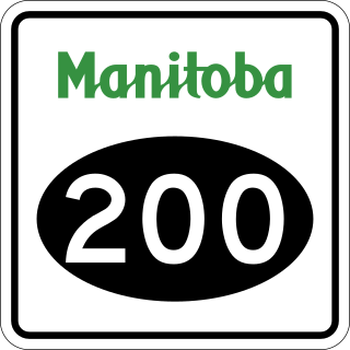
Provincial Road 200 is a provincial road in Manitoba. It runs from the Perimeter Highway at Winnipeg to the border town of Emerson, ending at Manitoba Highway (PTH) 75 at Emerson, near the Canada–United States border.
Provincial Trunk Highway 22 is a short north-south provincial highway in the Canadian province of Manitoba. It runs from PTH 23 near Elgin to PTH 2 and PR 250 in Souris. This highway is the main access road to the renowned Souris Swinging Bridge.
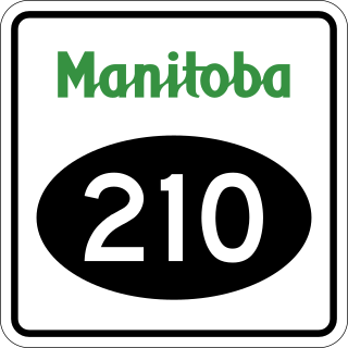
Provincial Road 210 is a 117.2-kilometre-long (72.8 mi) provincial road in the Eastman Region of southeastern Manitoba, Canada. It serves to connect the towns and communities of Woodridge, Marchand, La Broquerie, Ste. Anne, Landmark, Linden, Île-des-Chênes, and St, Adolphe with PTH 12, PTH 59, and PTH 75.

Provincial Road 207 is a 56.7-kilometre-long (35.2 mi) provincial road in the Eastman Region of Manitoba, Canada. Much of PR 207 follows the historic Old Dawson Trail.

Provincial Road 248 is a north-south provincial road in the Pembina Valley and Central Plains regions of the Canadian province of Manitoba.

Provincial Road 246 is a 36.0-kilometre-long (22.4 mi) provincial road in both the Pembina Valley and Eastman regions of the Canadian province of Manitoba. It runs from PR 200 near Ste. Agathe to PTH 75 at St. Jean Baptiste.
