Maxbass, North Dakota

Last updated

Maxbass, North Dakota
Maxbass Rural Fire District - Maxbass, North Dakota 5-23-2008.jpg
Maxbass Rural Fire District
ND Bottineau County Maxbass.svg
Location of Maxbass, North Dakota
Coordinates: 48°43′21″N101°08′33″W / 48.72250°N 101.14250°W / 48.72250; -101.14250
CountryUnited States
State North Dakota
County Bottineau
Founded1905
Area
[1]
  Total0.16 sq mi (0.42 km2)
  Land0.16 sq mi (0.42 km2)
  Water0.00 sq mi (0.00 km2)
Elevation
[2]
1,506 ft (459 m)
Population
 (2020)
  Total89
  Density546.01/sq mi (210.27/km2)
Time zone UTC-6 (CST)
  Summer (DST) UTC-5 (CDT)
ZIP code
58760
Area code 701
FIPS code 38-51420
GNIS feature ID1036154 [2]

Maxbass is a city in Bottineau County, North Dakota, United States. The population was 89 at the 2020 census. [3] Maxbass was founded in 1905.

Contents

History

The city was named after Max Bass who figured prominently in the Great Northern Railway's immigration and land settlement activities for many years before and after 1900. Bass was born in Austria in 1853 and served as land commissioner Dakota Territory from 1885 to 1901. In March 1891, he was appointed General Immigration Agent for the Great Northern Railway with headquarters in Chicago and remained with the railroad until his death in 1909. [4] [5]

Geography

According to the United States Census Bureau, the city has a total area of 0.17 square miles (0.44 km2), all land. [6]

Demographics

Historical population
CensusPop.Note
1910 240
1920 147−38.7%
1930 21747.6%
1940 215−0.9%
1950 25920.5%
1960 218−15.8%
1970 174−20.2%
1980 141−19.0%
1990 123−12.8%
2000 91−26.0%
2010 84−7.7%
2020 896.0%
2021 (est.)87 [7] −2.2%
U.S. Decennial Census [8]
2020 Census [3]

2010 census

As of the census of 2010, there were 84 people, 43 households, and 20 families living in the city. The population density was 494.1 inhabitants per square mile (190.8/km2). There were 61 housing units at an average density of 358.8 per square mile (138.5/km2). The racial makeup of the city was 89.3% White, 1.2% Native American, 1.2% from other races, and 8.3% from two or more races. Hispanic or Latino of any race were 1.2% of the population.

There were 43 households, of which 18.6% had children under the age of 18 living with them, 32.6% were married couples living together, 11.6% had a female householder with no husband present, 2.3% had a male householder with no wife present, and 53.5% were non-families. 46.5% of all households were made up of individuals, and 18.6% had someone living alone who was 65 years of age or older. The average household size was 1.95 and the average family size was 2.70.

The median age in the city was 41 years. 20.2% of residents were under the age of 18; 8.4% were between the ages of 18 and 24; 27.3% were from 25 to 44; 28.6% were from 45 to 64; and 15.5% were 65 years of age or older. The gender makeup of the city was 59.5% male and 40.5% female.

2000 census

As of the census of 2000, there were 91 people, 45 households, and 25 families living in the city. The population density was 554.2 inhabitants per square mile (214.0/km2). There were 70 housing units at an average density of 426.3 per square mile (164.6/km2). The racial makeup of the city was 96.70% White and 3.30% Native American.

There were 45 households, out of which 17.8% had children under the age of 18 living with them, 46.7% were married couples living together, 2.2% had a female householder with no husband present, and 44.4% were non-families. 42.2% of all households were made up of individuals, and 22.2% had someone living alone who was 65 years of age or older. The average household size was 2.02 and the average family size was 2.76.

In the city, the population was spread out, with 20.9% under the age of 18, 5.5% from 18 to 24, 26.4% from 25 to 44, 26.4% from 45 to 64, and 20.9% who were 65 years of age or older. The median age was 44 years. For every 100 females, there were 97.8 males. For every 100 females age 18 and over, there were 100.0 males.

The median income for a household in the city was $36,250, and the median income for a family was $37,500. Males had a median income of $23,750 versus $22,083 for females. The per capita income for the city was $22,129. There were no families and 2.4% of the population living below the poverty line, including no under eighteens and 9.5% of those over 64.

Related Research Articles

<span class="mw-page-title-main">Warwick, North Dakota</span> City in North Dakota, United States

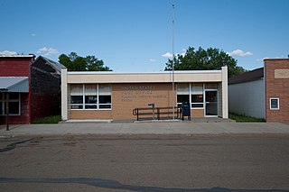
Warwick is a city in Benson County, North Dakota, United States. The population was 55 at the 2020 census. Warwick was founded in 1907.

<span class="mw-page-title-main">Lignite, North Dakota</span> City in North Dakota, United States

Lignite is a city in Burke County, North Dakota, United States. The population was 141 at the 2020 census. Lignite was founded in 1907 and was named for the quantities of lignite, a low-grade coal, present in the area.

<span class="mw-page-title-main">Alice, North Dakota</span> City in North Dakota, United States

Alice is a city in Cass County, North Dakota, United States. The population was 41 at the 2020 census.

<span class="mw-page-title-main">Gardner, North Dakota</span> City in North Dakota, United States

Gardner is a city in Cass County, North Dakota, United States. The population was 129 at the 2020 census.

<span class="mw-page-title-main">Alsen, North Dakota</span> City in North Dakota, United States

Alsen is a city in Cavalier County, North Dakota, United States. The population was 32 at the 2020 census. Alsen was founded in 1905.

<span class="mw-page-title-main">New Rockford, North Dakota</span> City in North Dakota, United States

New Rockford is a city in Eddy County, North Dakota, United States. It is the county seat of Eddy County. The population was 1,361 at the 2020 census. New Rockford was founded in 1883.

<span class="mw-page-title-main">McHenry, North Dakota</span> City in North Dakota, United States

McHenry is a city in Foster County, North Dakota, United States. The population was 64 at the 2020 census. McHenry was founded in 1899.

<span class="mw-page-title-main">Wishek, North Dakota</span> City in North Dakota, United States

Wishek is a city in McIntosh County, North Dakota, United States. The population was 864 at the 2020 census.

<span class="mw-page-title-main">Flasher, North Dakota</span> City in North Dakota, United States

Flasher is a city in Morton County, North Dakota, United States. It is part of the "Bismarck, ND Metropolitan Statistical Area" or "Bismarck-Mandan". The population was 217 at the 2020 census. Flasher was founded in 1902.

<span class="mw-page-title-main">Balta, North Dakota</span> City in North Dakota, United States

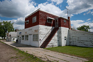
Balta is a city in Pierce County, North Dakota, United States. The population was 66 at the 2020 census. Balta was founded in 1912, and is known for its duck hunting.

<span class="mw-page-title-main">Martin, North Dakota</span> City in North Dakota, United States

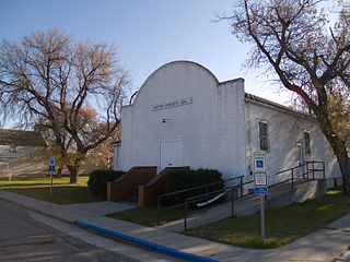
Martin is a city in Sheridan County, North Dakota, United States. The population was 63 at the 2020 census.

<span class="mw-page-title-main">Bowdon, North Dakota</span> City in North Dakota, United States

Bowdon is a city in Wells County, North Dakota, United States. The population was 137 at the 2020 census.

<span class="mw-page-title-main">Newell, South Dakota</span> City in South Dakota, United States

Newell is a city in Butte County, South Dakota, United States. The population was 584 at the 2020 census.

<span class="mw-page-title-main">Florence, South Dakota</span> Town in South Dakota, United States

Florence is a town in northwestern Codington County, South Dakota, United States. It is part of the Watertown, South Dakota Micropolitan Statistical Area. The population was 337 at the 2020 census.

<span class="mw-page-title-main">Bowdle, South Dakota</span> City in South Dakota, United States

Bowdle ( is a city in Edmunds County, South Dakota, United States. The population was 470 at the 2020 census.

<span class="mw-page-title-main">Estelline, South Dakota</span> City in South Dakota, United States

Estelline is a city in Hamlin County, South Dakota, United States. It is part of the Watertown, South Dakota Micropolitan Statistical Area. The population was 749 at the 2020 census.

<span class="mw-page-title-main">Parkston, South Dakota</span> City in South Dakota, United States

Parkston is a city in Hutchinson County, South Dakota, United States. The population was 1,567 at the 2020 census.

<span class="mw-page-title-main">Murdo, South Dakota</span> City in South Dakota, United States

Murdo is a city in and county seat of Jones County, South Dakota, United States. The population was 475 at the 2020 census.

<span class="mw-page-title-main">Whitewood, South Dakota</span> City in South Dakota, United States

Whitewood is a city in Lawrence County, South Dakota, United States. The population was 879 at the 2020 census.

<span class="mw-page-title-main">Crooks, South Dakota</span> City in South Dakota, United States

Crooks is a city in Minnehaha County, South Dakota, United States and is a suburb of Sioux Falls. The population was 1,362 at the 2020 census. Crooks was named New Hope until 1904. The town's present name honors W. A. Crooks, a local politician.

References

  1. "ArcGIS REST Services Directory". United States Census Bureau. Retrieved September 20, 2022.
  2. 1 2 U.S. Geological Survey Geographic Names Information System: Maxbass, North Dakota
  3. 1 2 "Explore Census Data". United States Census Bureau . Retrieved January 28, 2022.
    • Wick, Douglas A. (1988). North Dakota Place Names. Hedemarken Collectibles. ISBN   0-9620968-0-6.
  4. Williams, Mary Ann (Barnes) (1966). Origins of North Dakota place names. Bismarck, North Dakota: Bismarck tribune, 1966. p. 36. OCLC   431626.
  5. "US Gazetteer files 2010". United States Census Bureau. Archived from the original on January 25, 2012. Retrieved June 14, 2012.
  6. "City and Town Population Totals: 2020-2021". United States Census Bureau. July 21, 2022. Retrieved July 21, 2022.
  7. United States Census Bureau. "Census of Population and Housing" . Retrieved June 17, 2014.