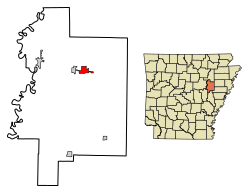
McCrory, Arkansas

Last updated

McCrory, Arkansas
McCrory, AR 003.jpg
Motto: 
The Heart of Woodruff County
Woodruff County Arkansas Incorporated and Unincorporated areas McCrory Highlighted 0542500.svg
Location of McCrory in Woodruff County, Arkansas.
Coordinates: 35°15′28″N91°11′48″W / 35.25778°N 91.19667°W / 35.25778; -91.19667
Country United States
State Arkansas
County Woodruff
Government
  MayorDoyle W. Fowler
Area
[1]
  Total2.37 sq mi (6.13 km2)
  Land2.37 sq mi (6.13 km2)
  Water0.00 sq mi (0.00 km2)
Elevation
[2]
210 ft (64 m)
Population
 (2020)
  Total1,583
  Density668.50/sq mi (258.11/km2)
Time zone UTC-6 (Central (CST))
  Summer (DST) UTC-5 (CDT)
ZIP code
72101
Area code 870
FIPS code 05-42500
GNIS feature ID0058141 [2]
Website cityofmccrory.com

McCrory is a city in Woodruff County, Arkansas, United States. The population was 1,583 at the 2020 census.

Contents

The McCrory Commercial Historic District, the McCrory Waterworks, and the Dr. John William Morris Clinic are all listed on the National Register of Historic Places listings in Woodruff County, Arkansas.

Geography

McCrory is located at 35°15′28″N91°11′48″W / 35.25778°N 91.19667°W / 35.25778; -91.19667 (35.257914, -91.196738). [3]

According to the United States Census Bureau, the city has a total area of 2.4 square miles (6.2 km2), all land.

Demographics

Historical population
CensusPop.Note
1890 299
1900 225−24.7%
1910 637183.1%
1920 6877.8%
1930 92434.5%
1940 1,0109.3%
1950 1,11510.4%
1960 1,053−5.6%
1970 1,37830.9%
1980 1,94240.9%
1990 1,9711.5%
2000 1,850−6.1%
2010 1,729−6.5%
2020 1,583−8.4%
U.S. Decennial Census [4]

2020 census

McCrory Racial Composition
RaceNum.Perc.
White 1,24478.58%
Black or African American 22714.34%
Asian 80.51%
Other/Mixed 885.56%
Hispanic or Latino 161.01%

As of the 2020 United States Census, there were 1,583 people, 741 households, and 500 families residing in the city.

Education

McCrory provides public education from the McCrory School District including the McCrory High School.

Related Research Articles

<span class="mw-page-title-main">Woodruff County, Arkansas</span> County in Arkansas, United States

Woodruff County is located in the Arkansas Delta in the U.S. state of Arkansas. The county is named for William E. Woodruff, founder of the state's first newspaper, the Arkansas Gazette. Created as Arkansas's 54th county in 1862, Woodruff County is home to one incorporated town and four incorporated cities, including Augusta, the county seat. The county is also the site of numerous unincorporated communities and ghost towns. Occupying only 587 square miles (152,000 ha), Woodruff County is the 13th smallest county in Arkansas. As of the 2020 Census, the county's population was 6,269. Based on population, the county is the second-smallest county of the 75 in Arkansas. Located in the Arkansas Delta, the county is largely flat with fertile soils. Historically covered in forest, bayous and swamps, the area was cleared for agriculture by early settlers. It is drained by the Cache River and the White River. Along the Cache River, the Cache River National Wildlife Refuge (NWR) runs north–south across the county, preserving bottomland forest, sloughs and wildlife habitat.

<span class="mw-page-title-main">Pulaski County, Arkansas</span> County in Arkansas, United States

Pulaski County is a county in the U.S. state of Arkansas. With a population of 399,125 as of the 2020 United States Census, it is the most populous county in Arkansas. The county is included in the Little Rock–North Little Rock–Conway metropolitan area. Its county seat is Little Rock, which is also Arkansas's capital and largest city.

<span class="mw-page-title-main">Lake Village, Arkansas</span> City in Arkansas, United States

Lake Village is a city in and the county seat of Chicot County, Arkansas, United States. The population was 2,575 at the 2010 census. It is located in the Arkansas Delta. Lake Village is named for its location on Lake Chicot, an oxbow lake formed by the Mississippi River.

<span class="mw-page-title-main">Sunset, Arkansas</span> Town in Arkansas, United States

Sunset is a town in Crittenden County, Arkansas, United States. The population was 198 at the 2010 census.

<span class="mw-page-title-main">Tillar, Arkansas</span> Town in Arkansas, United States

Tillar is a town in Desha and Drew counties in the U.S. state of Arkansas. The population was 225 at the 2010 census. The area west of it was known as Tillar Station. Frank Tillar Memorial Methodist Episcopal Church, South is listed on the National Register of Historic Places.

<span class="mw-page-title-main">Batesville, Arkansas</span> City in Arkansas, United States

Batesville is the county seat and largest city of Independence County, Arkansas, United States, 80 miles (183 km) northeast of Little Rock, the state capital. According to the 2010 Census, the population of the city was 10,268. The city serves as a regional manufacturing and distribution hub for the Ozark Mountain region and Northeast Arkansas.

<span class="mw-page-title-main">Melbourne, Arkansas</span> City in Arkansas, United States

Melbourne is a city and county seat of Izard County, Arkansas, United States. The population was 1,848 at the 2010 census. It is home to the main campus of Ozarka College.

<span class="mw-page-title-main">Wabbaseka, Arkansas</span> Town in Arkansas, United States

Wabbaseka is a town in Dunnington Township, Jefferson County, Arkansas, United States. Its population was 255 at the 2010 U.S. census. It is included in the Pine Bluff, Arkansas Metropolitan Statistical Area.

<span class="mw-page-title-main">Strawberry, Arkansas</span> Town in Arkansas, United States

Strawberry is a town in Lawrence County, Arkansas, United States. The population was 302 at the 2010 census.

<span class="mw-page-title-main">Grady, Arkansas</span> City in Arkansas, United States

Grady is a city in Lincoln County, Arkansas, United States. The population was 305 at the 2020 census, down from 449 at the 2010 census. It is included in the Pine Bluff, Arkansas Metropolitan Statistical Area.

<span class="mw-page-title-main">Austin, Arkansas</span> City in Arkansas, United States

Austin is a city in Lonoke County, Arkansas, United States. The population was 2,038 as of the 2010 census and an estimated 3,693 as of 2018. It is part of the Little Rock–North Little Rock–Conway Metropolitan Statistical Area.

<span class="mw-page-title-main">Mansfield, Arkansas</span> City in Arkansas, United States

Mansfield is a city in Scott and Sebastian counties Arkansas, United States. The Sebastian County portion of the city is part of the Fort Smith, Arkansas-Oklahoma Metropolitan Statistical Area. As of the 2010 Census, the population was 1,139. The population was 1,097 at the 2000 census.

<span class="mw-page-title-main">Waldron, Arkansas</span> City in Arkansas, United States

Waldron is a city in Scott County, Arkansas, United States. Its population was 3,386 at the 2020 census. The city is the county seat of Scott County.

<span class="mw-page-title-main">Forrest City, Arkansas</span> City in Arkansas, United States

Forrest City is a city in St. Francis County, Arkansas, United States, and the county seat. It was named for General Nathan Bedford Forrest, a notable Confederate war hero. Shortly after the end of the Civil War, he had a construction crew camped here, who were completing a railroad between Memphis and Little Rock.

<span class="mw-page-title-main">Bald Knob, Arkansas</span> City in Arkansas, United States

Bald Knob is a city in White County, Arkansas, United States. The population was 2,897 at the 2010 census. Located at the intersection of two of the state's natural regions, Bald Knob is often promoted as "where the Ozarks meet the Delta". Bald Knob is known for its yearly Home Fest held during Mother's Day weekend. It was once known as the leading strawberry producer in the world in the 1950s. Bald Knob was established in 1881.

<span class="mw-page-title-main">Kensett, Arkansas</span> City in Arkansas, United States

Kensett is a city in White County, Arkansas, United States. Located adjacent to the east side of Searcy, the city is the hometown of noted legislator Wilbur D. Mills, who was influential throughout the 1960s and 1970s in the United States House of Representatives.

<span class="mw-page-title-main">Augusta, Arkansas</span> City in Arkansas, United States

Augusta is a city in Woodruff County, Arkansas, United States, located on the east bank of the White River. The population was 2,199 at the 2010 census. The city is the county seat of Woodruff County.

<span class="mw-page-title-main">Hunter, Arkansas</span> Town in Arkansas, United States

Hunter is a town in southeast Woodruff County, Arkansas, United States. The population was 152 at the 2000 census.

<span class="mw-page-title-main">Patterson, Arkansas</span> City in Arkansas, United States

Patterson is a city in Woodruff County, Arkansas, United States. The population was 452 at the 2010 census.

<span class="mw-page-title-main">Southside, Independence County, Arkansas</span> City in Arkansas, United States

Southside is an incorporated city located in Independence County, Arkansas, United States.

References

  1. "2020 U.S. Gazetteer Files". United States Census Bureau. Retrieved October 29, 2021.
  2. 1 2 U.S. Geological Survey Geographic Names Information System: McCrory, Arkansas
  3. "US Gazetteer files: 2010, 2000, and 1990". United States Census Bureau. February 12, 2011. Retrieved April 23, 2011.
  4. "Census of Population and Housing". Census.gov. Retrieved June 4, 2015.